Kinnell, Killin, Perthshire

Stone Circle:  OS Grid Reference – NN 57699 32805

Also Known as:

  1. Killin P1/3 (Thom)

Getting Here

Kinnell stone circle, with Mheall Clachach rising

At the pub by the bridge which crosses the Falls of Dochart (aptly called the ‘Falls of Dochart Inn’), walk downstream following the dirt-track which runs parallel with a section of the river for a good 5-600 yards.  In the field that appears on your right, watch out for the rise of the stones as you approach the large gates which take you into the ground of Kinnell House.  You can climb over the gate just into the field and go straight to the stones.

Archaeology & History

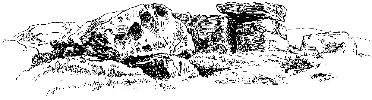
Found on the field called Kinnell Park in the grounds of Kinnell House, less than a mile out of Killin, this is a well-preserved site consisting of six stones. It appears to have been described first of all by Thomas Pennant in 1772, in the same breath as the megalithic remains at Lawers on the other side of Loch Tay.  Pennant wrote:

“In going through Laurs observe a Druidical circle; less complete indeed than one, that should have been mentioned before, at Kinnel, a little southwest of Killin; which consists of six vast stones, placed equidistant from each other.”

Coles’ 1910 plan of Kinnell
Thom’s geometric plan

It would seem that the site has changed little since Pennant’s visit.  Sitting on a reasonably level grassy plain, the hills rise and surround the small ring of stones, with the lower horizons running along the south.  Due west (equinox) we have the large pyramidal hill of Meall Clachach; whilst to the north are the legendary hills of Creag na Cailleach and Ben Lawers, each with their own rich mythic archaeological legacies.  Legendary stones and wells are also close by, some with rites still enacted by old local people keeping truly ancient traditions alive.

The first detailed archaeological survey of the Kinnell site was done by Fred Coles and published in 1910.  It has yet to be superseded.  Mr Coles wrote:

“Taking the Stones in the usual order…I here give their dimensions and characteristics: Stone A, 6 feet 3 inches high, springs from an oblong base which girths 11 feet 4 inches, to a rough irregular top; Stone B leans forward towards the centre of the Circle, and measures along its sloping back 6 feet 9 inches, the present height from the ground to its upper edge being 4 feet. It is of smooth garnetiferous schist, and free from the deep fissures and rifts so common in these Stones. Stone C, a very rectangular but narrow block of schist, has a 15 Feet-girth at the base of 9 feet, but tapers up from both ends to a pyramidal summit, 5 feet 4 inches above ground. Its inner face is over 6 feet in breadth. Stone D, 4 feet 6 inches high, is a broad, flat-topped, very massive block, measuring 9 feet 5 inches round the base, but near the middle of its height 11 feet 2 inches. Stone E, the shortest of the group, is only 4 feet high, has a rough, uneven top, and a basal girth of 8 feet 11 inches. Stone F, the tallest, measures 6 feet 4 inches in height, but in girth only 7 feet 3 inches. It is very rough, vertically fissured in many places, and full of white quartz veins.

“Neat, well-defined, and comparatively small as this Circle is, it is to be noticed that the positions of the Stones do not conform to perfect regularity as points on the circumference. On working out the plan, the measurements prove that a diameter of 29 feet exactly bisects three of the erect Stones, B, C, and F, but leaves the other two untouched. The interspaces of the settings are not all quite equal, a space of 14 feet 8 inches dividing the centres respectively of F and A, A and B, F and E, and E and T); but between D and C it is 13 feet 8 inches, and between 0 and B I S feet 5 inches. Yet, the Stones stand proportionally near enough to each other to give one a satisfying impression that these six megaliths represent the group in its completeness, and that there were no smaller blocks between any two of them. The space enclosed by these stones is quite smooth and level, bearing no indication of having at any time been disturbed.”

Many years later, the late great Alexander Thom came here and, with his geometric perspective, gave a more precise ground-plan and lay-out.  Thom (1980) defined the site as a “Type B flattened circle, or possible ellipse,” with a perimeter of 35 megalithic yards and diameter of 11.8 MY.  Aubrey Burl’s commentary described Kinnell as:

“Six stones of schist stand evenly spaced on the circumference of an ellipse 32ft 7in x 27ft 5in (9.9 x 8.4m) in diameter.  The stones are graded in height towards the SW where the two tallest are over 6ft (1.8m) high.”

One of the upright stones was said by Hugh MacMillan (1884) to have had cup-markings on it in the 19th century, when he told of the circle possessing “some seven or eight tall massive stones, with a few faint cup-marks on one of them.”  But these appear to have faded, or were cut into the one of the missing stones.

Folklore

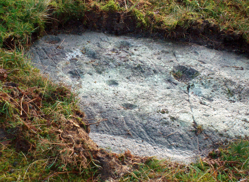
Close to the Kinnell circle could once be found a curious large boulder, covered in moss, but with a large cavity in which water gathered.  Local lore ascribed the rock to actually be a well, as it was known as ‘The Well of the Whooping-Cough’, or Fuaran na Druidh Chasad, measuring some eight feet long and five feet high. Local people visited the site to be cured of the said disease, but Hugh MacMillan also suggested that the miraculous well-in-the-stone was connected with ancient rituals once enacted at the Kinnell circle, saying:

” it is a reasonable supposition that the Fountain of the Whooping-Cough may have had some connection in ancient times with this prehistoric structure in its immediate neighbourhood…”

He may have been right!

References:

  1. Burl, Aubrey, A Guide to the Stone Circles of Britain, Ireland and Brittany, New Haven & London 1995.
  2. Coles, Fred R., “Report on Stone Circles Surveyed in Perthshire (Aberfeldy District),” in Proceedings of the Society of Antiquaries, Scotland, volume 44, 1910.
  3. Fraser, Duncan, Highland Perthshire, Standard Press: Montrose 1973.
  4. Gillies, William A., In Famed Breadalbane, Munro Press: Perth 1938.
  5. McKerracher, Archie, Perthshire in History and Legend, John Donald: Edinburgh 1988.
  6. MacMillan, Hugh, ‘Notice of Two Boulders having Rain-Filled Cavities on the Shores of Loch Tay, Formerly Associated with the Cure of Disease,’ in Proceedings of the Society of Antiquaries of Scotland 18, 1884.
  7. Pennant, Thomas, A Tour in Scotland, 1772 – Part 2, Benjamin White: London 1776.
  8. Royal Commission on the Ancient & Historical Monuments of Scotland, Archaeological Sites and Monuments of Stirling District, Central Region, Society of Antiquaries of Scotland 1979.
  9. Thom, A., Thom, A.S. & Burl, H.A.W., Megalithic Rings, BAR: Oxford 1980.
  10. Wheater, Hilary, Killin to Glencoe, Appin Publications: Aberfeldy 1982.

© Paul Bennett, The Northern Antiquarian 


Corrycharmaig (1), Glen Lochay, Killin, Perthshire

Cup-Marked Stone:  OS Grid Reference – NN 52794 35503

Also Known as:

  1. Allt Coire Charmaig
  2. Canmore ID 24163

Getting Here

Corrycharmaig 1 stone

Go thru Killin and, just past the Bridge of Lochay hotel, take the tiny road on your left.  Go down here for 3 miles till you pass the gorgeous Stag Cottage (with its superb cup-and-rings in the field across the road) for another 300 yards, until you see Duncroisk Farmhouse set back on your right.  On the other side of the road, go thru the giant deer-gates (close ‘em behind you) to the river-bridge and across it.  Walk along the track till you reach the turning to Corrycharmaig House on the right (over the stream), but here, go up into the field thru the gate.  Walk up the hill ahead of you with its trees on the left, walking up onto the grassy level, over the deer-fence, then up again to the rounded knoll another 100 yards up.  You’re here!

Archaeology & History

On my first visit to this stone, in overcast and wet conditions — the easternmost of at least four separate carved rock faces along the same geological ridge — I only noticed a handful of cup-marks etched onto the northeastern section of the stone. But I was sure there were supposed to be more.  And when I returned home to check up, found that Ron Morris (1981) said there were “40 widely scattered cups of which, however, 29 well-defined cups are in a compact group, of which 6 are in a line.”  Much more than what I saw! And when I checked further, it was evident that even more cup-marks were once visible on the rock.  In the very first description of this carved stone, E.A. Cormack (1952) told:

“On the easterly area there are about 70 small cups, roughly one inch in diameter, in groups of ten to twelve. Most are on the flatter rock surface, but some are on the steeper slope facing south, which also bears the marks of deep glacial scorings.”

A sample of cups on ‘Corrycharmaig 1’

So on our visit here again a few weeks ago when we stayed at Corrycharmaig house*, a couple more visits allowed a slightly better investigation, albeit in even wetter and cloudier conditions than our first visit!  And the more we looked, the more we could see; and it was plainly evident that a number of cup-marks had become receptacles for moss-growth!  We counted at least 40 cup-markings on this ‘Corrycharmaig 1’ stone, but it seemed pretty obvious that beneath the grasses and vegetation, more carvings would be found.

Walking SSE along the same rocky ridge brings you to the other rock faces of Corrycharmaig (2), (3) and (4) — all with their own carvings.  Corrycharmaig 2 possessing the only known complete cup-and-ring on the ridge.  More carvings remain hidden nearby…

References:

  1. Cormack, E.A., “Cross-Markings and Cup-Markings at Duncroisk, Glen Lochay,” in Proceedings of the Society of Antiquaries, Scotland, volume 84, 1952.
  2. Morris, Ronald W.B., The Prehistoric Rock Art of Southern Scotland, BAR 86: Oxford 1981.
  3. Royal Commission on the Ancient & Historical Monuments of Scotland, Archaeological Sites and Monuments of Stirling District, Central Region, Society of Antiquaries of Scotland 1979.

© Paul Bennett, The Northern Antiquarian


Corrycharmaig (4), Glen Lochay, Killin, Perthshire

Cup-Marked Stone:  OS Grid Reference – NN 52768 35504

Getting Here

‘Corrycharmaig 4’ cup-marked stone

Follow the same directions to get to the Corrycharmaig 3 carving; and just a yard or two to the right of the far western edge of the rock, you’ll see another smaller slightly sloping rock, closer to the fencing, with faint cup-markings.  That’s the one! (note that the 10-figure grid reference given here might need adjusting slightly)

Archaeology & History

This small slightly sloping piece of exposed rock is on the western extremity of the Corrycharmaig cluster of carvings, but is a distinctly separate piece of rock from the Corrycharmaig 3 stone (though part of the same outcrop).  The stone itself has two sections to it, with a natural crack in the rock defining eastern and western section — both of which possess cup-marks.

The easternmost section of the stone has seven cup-marks, some of which were only recently uncovered.  A large single cup-mark sits near the middle of this portion of the rock; this is probably what Mr Cormack (1952) was talking about when he told that, “further west (of the Corrycharmaig 3 carving, PB) is one isolated larger cup of 4-inch diameter.”  On the western side of the stone, we find just two or three cup-marks, though one large cup-marking here would seem to be Nature’s handiwork.

It is highly likely that beneath the excessive vegetational growth around this carving and others along this ridge, other sections of prehistoric carvings remain to be found.

References:

  1. Cormack, E.A., “Cross-Markings and Cup-Markings at Duncroisk, Glen Lochay,” in Proceedings of the Society of Antiquaries, Scotland, volume 84, 1952.
  2. Morris, Ronald W.B., The Prehistoric Rock Art of Southern Scotland, BAR 86: Oxford 1981.
  3. Royal Commission on the Ancient & Historical Monuments of Scotland, Archaeological Sites and Monuments of Stirling District, Central Region, Society of Antiquaries of Scotland 1979.

© Paul Bennnett, The Northern Antiquarian


Pule Hill, Marsden, West Yorkshire

Tumulus:  OS Grid Reference – SE 0322 1039

Getting Here

Pule Hill, from the west

From Marsden itself, take the A62 road west and where the road bends round, the large hill rising on your left is where you’re heading.  There’s a parking spot near the bottom of the highest part of the hill.  From here, walk right to the top, up whichever route you feel comfortable with. At the very top is an intrusive modern monolith (dedicated to somebody-or-other, which the fella wouldn’t approve of if he really loved these hills*).  About 10 yards east of the stone is a small grassy mound with a bittova dip in the middle.  That’s it!

Archaeology & History

This is a little-known prehistoric site, whose remains sit upon a very well-known and impressive hill on the western edges of Marsden.  Described in Roy Brook’s (1968) excellent survey on the history of Huddersfield as “the most important site” from the Bronze Age in this region, it seems curious that the attention given to it has been relatively sparse and scattered.  The tops and edges of the hill have been cut into and worked upon by the uncaring spade of industrialism (of which there is much evidence), aswell as much of the peat being used for fuel over countless centuries — some of which appears to have been cut close to the all-but-lost remains of this once-important burial site.

The first description of the hill itself seems to be in 1426, where it was named in the Ramsden Documents, “past’ voc’ le Pole.” (Smith 1961)  It wasn’t until appearing as Puil Hill on the 1771 Greenwood map that the title we know of it today began to take form.  Local people would alternately call it both Pule and Pole Hill.  But its name is somewhat curious, as the word appears to derive from the variant Celtic and old English words, peol, pul and pol,

“meaning a pool or marsh, especially one that was dry in the summer.  Pole Moor therefore means Pool or Marsh Moor…and Pule Hill = the hill in the marsh.” (Dyson 1944)

Remains of mound looking NW
Small mound at left-centre

However, in Smith’s English Place-Name Elements, he gives an additional piece of word-lore which seems equally tenable, saying the word may be “possibly also ‘a creek'”, which could be applied to the water-courses immediately below the west side of the hill.  We might never know for sure.  But the archaeological remains on top of Pule Hill have a more certain history about them…

The burial site first appears to have been mentioned in a short article by Henry Fishwick (1897), who wrote:

“Whilst searching for…flints on the summit of Pule Hill a few weeks ago a discovery was made which is of considerable antiquarian interest.  On the highest point of the hill, and from 12 to 18 inches below the surface, were found two human skeletons lying on their sides almost directly east and west, the knees of both being drawn up.  Near to them were two small circular urns measuring 4¾ inches high, 5 inches across the top, and 6 inches in diameter at the widest part, the base being 3 inches across.  These are made of native clay very slightly burnt, and are ornamented with short lines (apparently cut with some sharp instrument) which forms a rough herring-bone pattern.  On the centre band are four ears or small handles which are pierced so as to admit a small cord.  The urns contained animal matter and a few calcined human bones.

“Since the discovery of these two urns another has been exhumed from the same place.  It measures 3½ inches in height and 7 inches in diameter at the widest part, which is just below the rim of the mouth.  Its ornamentation is similar to the others, but quite so elaborately executed; the base is made with four feet or claws.  On one side of the urn is an ear or handle pierced with a small hole in the direction of a double-groove, in which it is placed; there is a second double-groove near the bottom.  When found this urn only contained sand.  Fragments of a fourth urn were discovered on the same spot… The discoverers of these were Mr G. Marsden and Mr F. Fell.”

As a consequence of this, a couple of years later members of the Yorkshire Archaeology Society took it upon themselves to have a closer look at the place — and they weren’t to be disappointed.  They cut a large trench across the top of the site from east to west, digging down until they hit the bedrock of the very hill; then dug an equal trench as much as 30 yards to the north, and on the southern side to the edge of the hill near where it drops.  They came across,

“In three places were found distinct cavities…driven into the rock to a depth of about eighteen inches, the dimensions of which…averaged three feet long by two feet wide.”

Drawings of urns & bowls (Manby 1969)
Mr Petch’s old photos of the bowls & urns

Within these rock cavities they found small portions of bone, charcoal and flint.  It was also found that the urns which were described earlier by Mr Fishwick, had been found laid on their sides “at the places where the cavities were subsequently discovered.”  Inside the urns, the remains of various human bones were discovered and reported on by Mr Boyd Dawkins: a craniologist of some repute in his time.

The discoveries were remarked upon a few years later — albeit briefly — in D.F.E. Sykes (1906) excellent history work of the area, where he told us that it was one of his esteemed friends, “George Marsden of Marsden…who was fortunate enough in August, 1896, to find” the ancient remains.  But perhaps the most eloquent description of the Pule Hill remains was done by James Petch (1924) of the once-fine Tolson Museum archaeology bunch in Huddersfield (still open to the public and very helpful indeed).  Mr Petch wrote:

“Several Bronze Age interments have been found in the locality. Of these the most important is that discovered on the summit of Pule Hill and excavated in 1896 by the late Mr. George Marsden. The finding of an arrowhead led to digging and four urns containing burnt human remains, and so-called “incense cup” were uncovered and removed (Figures 24, above, and 25, below) . In 1899 the site was again opened up for further examination. It was then noted that the urns had been set in cavities dug into the rock to a depth of about 18 inches. The type of the urn fixes the interment as belonging to the Bronze Age, and characteristic of such interments are the rock-cavities. The site is however somewhat exceptional in that no trace was found of the mound which was usually heaped over an interment. As the site is very exposed, the mound may have been weathered away, leaving no traces visible to-day. Along with the urns were found an arrowhead, one or two scrapers, a disc, a few pygmies and a number of flakes and chippings. It is important to note that these flints are mostly the relics of a Mas d’Azil Tardenois workshop which existed long before the interment was made on the summit of Pule Hill, and that they have no necessary connection with the Bronze Age burial…

“Owing to the generosity of the late Mr. George Marsden, the discoverer, and his family, the urns are now in the Museum. They form one of the most striking exhibits in the Prehistoric section. They are illustrated in Figures 24 and 25, above.

“The smallest of the group (Figure 24, 1 and 2, above) belongs to the type known as “incense-cups,” this name being the result of a somewhat fanciful attempt to account for the perforations the examples always show. It is quite evident and widely recognized now that this explanation – that they were in fact censers – is unsatisfactory, and that the use of this peculiar type of vessel is a problem as yet unsolved. Nos. 3 and 4 and Fig 25, 1 and 2 (above), are styled “food vessels,” such as may have been their ordinary use.

“No. 3 is ornamented with slight indentations, and without lugs; it has two strongly marked beads around the mouth, with a distinct groove between them. No. 4 has two slight lugs opposite to one another, which appear to have been pinched up from the body of the vessel; they were perforated but the holes have been broken out. Fig. 25, Nos 1 and 2 (above), is the best of the series, it is ornamented with small cone-shaped indentations and shows several unusual features; the width is great in proportion to the height; the lugs are not opposite and were attached to the vessel after it was made; the one on the left is seen to be perforated, and the position of the second is above the figure 2 in the illustration. The four feet were attached in a similar manner, and are not solid with the body of the vessel. All the vessels are hand made and show no indication of the potter’s wheel.”

Ceremonial bowl from the site (J. Petch 1924)

The site has subsequently been listed in a number of archaeology works, but there’s been no additional information of any worth added.  Manby (1969) noted that of the four vessels from this prehistoric ‘cemetery’, one bowl was of a type more commonly found in East Yorkshire — though whether we should give importance to that single similarity, is questionable.

One thing of considerable note that seems to have been overlooked by the archaeological fraternity (perhaps not too surprising!) is the position of these burial deposits in the landscape.  To those people who’ve visited this hill, the superb 360° view is instantly notable and would have been of considerable importance in the placement and nature of this site.  The hill itself was probably sacred (in the animistic sense of things) and is ideal for shamanistic magickal practices.  The communion this peak has with other impressive landscape forms nearby – such as the legendary West Nab — would also have been important.

For heathens and explorers amongst you, this is a truly impressive place indeed…

References:

  1. Abraham, John Harris, Hidden Prehistory around the North West, Kindle 2012.
  2. Barnes, Bernard, Man and the Changing Landscape, Eaton: Merseyside 1982.
  3. Brook, Roy, The Story of Huddersfield, MacGibbon & Kee: London 1968.
  4. Clark, E. Kitson, “Excavation at Pule Hill, near Marsden,” in Yorkshire Archaeological Journal, volume 16, 1902.
  5. Cowling, Eric T., Rombald’s Way, William Walker: Otley 1946.
  6. Dyson, Taylor, Place Names and Surnames – Their Origin and Meaning, with Speicla Reference to the West Riding of Yorkshire, Alfred Jubb: Huddersfield 1944.
  7. Elgee, Frank & Harriet, The Archaeology of Yorkshire, Methuen: London 1933.
  8. Faull, M.L. & Moorhouse, S.A. (eds.), West Yorkshire: An Archaeological Guide to AD 1500 – volume 1, WYMCC: Wakefield 1981.
  9. Fishwick, Henry, “Sepulchral Urns on Pule Hill, Yorkshire,” in Proceedings of the Society of Antiquaries, volume 16, 1897.
  10. Manby, T.G., “Bronze Age Pottery from Pule Hill, Marsden,” in Yorkshire Archaeological Journal, volume 42, part 167, 1969.
  11. Petch, James A., Early Man in the District of Huddersfield, Tolson Memorial Museum: Huddersfield 1924.
  12. Smith, A.H., The Place-Names of the West Riding of Yorkshire – volume 2, Cambridge University Press 1961.
  13. Sykes, D.F.E., The History of the Colne Valley, F. Walker: Slaithwaite 1906.
  14. Watson, Geoffrey G., Early Man in the Halifax District, HSS: Halifax 1952.

Acknowledgements:  Huge thanks to Ben Blackshaw, for guiding us to this and other sites in the region!

* To be honest, I think it’s about time that these increasing pieces of modern detritus that keep appearing in our hills, dedicated to whoever, should be removed to more appropriate venues, off the hills, keeping our diminishing wilderness protected from them in ways that real lovers of the hills deem necessary. Such modern impositions are encroaching more and more and intruding upon the places where they simply don’t belong.  I’ve come across many hill walkers who find them unnecessary and intrusive on the natural environment, so they should be discouraged.  There is a small minority of sanctimonious individuals who seems to think it good to put their clutter onto the landscape, or want to turn our hills into parks – but these personal touches should be kept in parks, instead of adding personal touches where they’re not needed. Or even better, put such money into things like schools, hospitals or communal green energy devices. People would much prefer to be remembered by giving the grant-money to the well-being of others, instead of being stuck on a stone on a hill (and if not, well they definitely don’t belong to be remembered in the hills!).  What if everyone wanted to do this?!  Or is it only for the ‘special’ people.  Please – keep such things off our hills!

© Paul Bennett, The Northern Antiquarian


Lippersley Pike, Denton Moor, North Yorkshire

Cairn:  OS Grid Reference – SE 14335 52478

Getting Here

Follow the directions to reach the Lippersley Pike cup-marked stone, then keep walking westwards, but go up the slope immediately on your right (north) and walk upwards along the path to the notable stone structure at the top-end of the ridge a coupla hundred yards ahead.  Once there, you’re standing on it!

Archaeology & History

Lippersley Pike & shooter’s butt

A little known site with some excellent 360° views all round, reaching as far west as Pendle Hill, north past Simon’s Seat, and east onto the far reaches of the North York Moors.  The landscape here is truly superb!  And humans have been here since, it would seem, mesolithic periods at least, if Cowling’s finds are owt to go by! For although he described the much denuded tomb that we can still see under the herbage and recently-built shelter, there was also, “on the northern slope…a small occupation immediately below the summit on the northern side.”  We found remains of it on our visit here the other day.  But of the tomb itself — which Mr Cowling thought was neolithic in age — he wrote:

“The highest point of Lippersley Pike, on Denton Moor, is crowned by a stone cairn 1083 feet above sea level, and overlooks, on the northern side, a small site which appears to have been occupied by the ‘Broad Blade’ people, for there occur several pieces of patinated flint, along with scrapers and worked blades.”

Aerial view of Lippersley Pike

Cowling then describes a number of flints and other prehistoric working utensils that he found all round here.  The remains of the cairn measure some 25 feet east-west and 23 feet north-south.  There has been no excavation here, although the fella’s who dug out much of the stone to build the shooter’s butt on its top may have found summat, but have kept it quiet!

The cairn is an ancient marker along the boundary line marking the townships of Denton and Great Timble and was visited in perambulation walks in previous centuries.  Grainge (1871) describes the extensive perambulation in his Knaresborough Forest work.  ‘Lippersley’ itself first appears in records from 1576, although A.H. Smith (1963:5) does not suggest an etymology.  The place is worth visiting as a good starting point to explore the other little-known prehistoric remains on these moors, including the Crow Well settlement, the Heligar Pike tomb, etc, etc.

References:

  1. Cowling, E.T., Rombald’s Way: A Prehistory of Mid-Wharfedale, William Walker: Otley 1946.
  2. Grainge, William, The History and Topography of Harrogate and the Forest of Knaresborough, John Russell Smith: London 1871.
  3. Grainge, William, The History and Topography of the Townships of Little Timble, Great Timble and the Hamlet of Snowden, William Walker: Otley 1895.
  4. Smith, A.H., The Place-Names of the West Riding of Yorkshire – volume 5, Cambridge University Press 1963.

© Paul Bennett, The Northern Antiquarian


Corrycharmaig (3), Glen Lochay, Killin, Perthshire

Cup-Marked Stone:  OS Grid Reference – NN 52774 35504

Also Known as:

  1. Allt Coire Charmaig

Getting Here

Corrycharmaig 3 stone, with Meall Dhuin Croisg rising…

Go thru Killin and, just past the Bridge of Lochay hotel, take the tiny road on your left.  Go down here for 3 miles till you pass the gorgeous Stag Cottage (with its superb cup-and-rings in the field across the road) for another 300 yards, until you see Duncroisk Farmhouse set back on your right.  On the other side of the road, go thru the giant deer-gates (close ’em behind you) to the river-bridge and across it.  Walk along the track till you reach the turning to Corrycharmaig House on the right (over the stream), but here, go up into the field thru the gate.  Walk up the hill ahead of you with its trees on the left, walking up onto the grassy level, then up again to the rounded knoll another 100 yards up.  You’re here!

Archaeology & History

This is the most visually impressive of the set of four cup-marked rocks along this ridge — although if you visit here when the light is poor, or the sky’s overcast, you’ll be lucky if you can actually see much of the material.  For example, I counted 38 cups on this particular stone on a day when the sky was bright, but upon checking later, found that Mr Morris (1981) described there being, “40 widely scattered cups of which, however, 29 well-defined cups are in a compact group of which 6 are in line.”  Whereas more recently the Canmore website told there to be,

Corrycharmaig-3 carving
Close-up of line of cups

“At least 48 cupmarks are visible on the most westerly exposure. The cupmarks range in size from 25mm in diameter and 5mm in depth to 100mm in diameter and 40mm in depth.  A straight line of six cupmarks arranged close together is orientated running from NW to SE.”

This line of six cups is very distinct and stands out as the most notable aspect on this carving, probably because it gives a sense of ‘order’ or linearity, whereas the rest of the carving (as with oh so many of them, thankfully) possess that non-linear feature of scattered cups and lines, dissolving reason and ego, and eliciting the natural meditative state, if one so cares to allow. On our most recent visit here, our eyes and fingers traced what appeared to be the faint remains of a carved line running along the bottom edge of the row of cups and then bending around the bottom cup in the same line — a little bit like the carved lines which run around the edges of the row of cups on Ilkley Moor’s Idol Stone.  You can just make this ‘line’ out in the photo, below.

Cup-mark and flint
Clusters of cups and faint line

On one visit to the site when we’d stayed with the late great Lindsay Campbell of Stag Cottage, other sections of this carving were visible that we’d previously missed, highlighting at least 45 cup-marks that we counted.  Several of the cups had been exposed by animals (sheep or deer – we couldn’t tell) cutting into the soaking wet earth and in carefully checking a couple of cups whose edges were exposed, found a small worked flint within one of the cups!  I looked at it, held it, puzzled over it, then laid it back where we’d found it.  You can see it in the photo here, on the right.

This carving obviously grows on you with time.  And like its carved companions of Corrycharmaig (1), (2) and (4) both left and right of here, the stone rests within a natural theatre of dreams, eliciting — if only in a slight way — the non-focal perspective necessary to receive the carvings as its executor knew…

References:

  1. Cormack, E.A., “Cross-Markings and Cup-Markings at Duncroisk, Glen Lochay,” in Proceedings of the Society of Antiquaries, Scotland, volume 84, 1952.
  2. Morris, Ronald W.B., The Prehistoric Rock Art of Southern Scotland, BAR 86: Oxford 1981.
  3. Royal Commission on the Ancient & Historical Monuments of Scotland, Archaeological Sites and Monuments of Stirling District, Central Region, Society of Antiquaries of Scotland 1979.

© Paul Bennett, The Northern Antiquarian


Yarnbury Henge, Grassington, North Yorkshire

Henge:  OS Grid Reference – SE 01405 65413

Getting Here

Yarnbury henge from the air

In Grassington, go up the main street and keep going uphill, out of town.  You’re on Moor Road now and it keeps going northeast for about a mile, where the small copse of trees grows just before Yarnbury House.  However, on the other side of the road (right) two field before you reach the house, you’ll notice a slightly raised elevation in the field, close to the wall.  A footpath runs right past it, so you shouldn’t have too much trouble finding it!

Archaeology & History

This is a fine, roughly circular neolithic monument, sat not-quite-on-the-heights, but still possessing damn good views all round (except immediately west), begging the question, ‘what on earth are you and why were you built here?’  Answers to which, we don’t really know.  But ascertaining its geomantic nature wouldn’t be too difficult for local people who have spent years visiting the site.  John Dixon (1990) mentioned how, in the winter months,

“the sun falls behind Pendle (Hill) providing it with a sky-red backdrop.  In my own view the site is related to the presence of Pendle…and may have been the major factor in the location of the monument.”

He may be right!  It has been suggested by one archaeologist (King et al, 1995) that the site was “most probably a wood henge” with upright rings of wooden posts that were built onto the central platform — but until we get a full dig here, we’re not gonna know.

N-NE section of henge
SW section of the henge

Found close to an extensive amount of other prehistoric remains in the area (dating from the neolithic to Iron Age), this henge monument is notable for its size, as it’s only a little fella!  It’s like a mini-version of the Castle Dykes henge near Aysgarth, 14 miles to the north!  First mentioned as a ‘disc barrow’ in 1929, J. Barrett (1963) added the Yarnbury Henge to the archaeological registers 32 years later, citing it as a “circular platform 60-63 ft diameter, surrounded by a ditch 20ft wide (crest to crest) and an outer bank.”  A couple of years later D.P. Dymond (1965) described the henge in slightly more detail, telling:

“At Yarnbury, just over one mile north-east of Grassington there is an earthwork 116ft in diameter overall, consisting of a ditch with external bank.  On surface inspection the earthwork appeared to have the characteristics of a henge monument.  An excavation carried out in July 1964 , by an archaeological summer school based on Grantley Hall, proved this thesis.  There was no trace of an internal mound and the entrance to the southeast was obviously  original.  No traces were found of any sort of internal structure, and a square pit in the centre of the circle had been caused by an excavation earlier this century.  The ditch was rock-cut and the bank of simple dump construction.  No dating evidence was found… With its single entrance the Yarnbury henge falls into Atkinson’s Class 1.”

SW area of the henge

In recent years it seems that some damage has been done by digging into the east and southeastern sections of the henge.  Summat we hope doesn’t get any worse.  In the field on the other side of the road we found traces of prehistoric enclosure walling (along with a curious, large, almost cursiform shadow, 44 yards across and running 110 yards NE), typical of the extensive settlement remains found less than a mile away at Lea Green and High Close Pasture, Grassington.  It’s an impressive area, well worth checking out!

References:

  1. Barrett, J., “Grassington, W.R.,” in Yorkshire Archaeological Journal, part 161, 1963.
  2. Beck, Howard, Yorkshire’s Roots, Sigma: Wilmslow 1996.
  3. Dixon, John & Phillip, Journeys through Brigantia – volume 2: Walks in Ribblesdale, Malhamdale and Central Wharfedale, Aussteiger Publishing: Barnoldswick 1990.
  4. Dymond, D.P., “Grassington, W.R.,” in Yorkshire Archaeological Journal, part 163, 1965.
  5. Harding, A.F., Henge Monuments and Related Sites of Great Britain, BAR 175: Oxford 1987.
  6. Harding, Jan, The Henge Monuments of the British Isles, Tempus: Stroud 2003.
  7. King, Alan, et al, Early Grassington, Yorkshire Archaeological Society 1995.
  8. Wainwright, G.J., “A Review of Henge Monuments in the Light of Recent Research,” Proceedings of the Prehistoric Society, volume 35, 1969.

© Paul Bennett, The Northern Antiquarian


Alcomden Stones, Stanbury Moor, West Yorkshire

Legendary Rocks: OS Grid Reference – SD 97313 35737

Also Known as:

  1. Oakenden Stones

Getting Here

The ‘druidic’ Alcomden Stones

Takes a bitta getting to this spot, but it’s worth the effort!  Make a day of it and walk up here via the little-known Cuckoo Stones monoliths.  From here the walk gets steeper!  Follow the footpath from the standing stones, uphill, to the legendary Wuthering Heights building of Bronte-fame a half-mile ahead of you.  Then walk immediately up the slope at the side of the derelict house higher onto the moor (there’s no real footpath to follow) until the moorland levels out.  From here, look west and walk that way for a few hundred yards where you’ll be seeing a large rock outcrop ahead of you.  That’s where you’re heading! (if you reach the triangulation pillar, take the small path from there along the top of the moor towards this large rock outcrop)

Archaeology & History

Alcomden’s Altar Stone

To those of you who like a bitta wilderness, or healthy normal people I suppose, this is a stunning place!  Even though there’s little by way of archaeology here — save the usual expectations of a few flints and arrowheads — its geomancy, its position in the landscape, makes it excel as a once important ritual site for our ancestors in not-so-distant centuries.  Although local tradition gave these great rocks a prehistoric pedigree, the archaeological record doesn’t say as much — but that doesn’t really mean much up here.  We’ve found a singular Bronze Age cairn on the level at Middle Moor Flat 400 yards northwest (not in the record books), some prehistoric walling on the flat east of here (not in the record books), so a lot more attention is needed hereby to see what more may be hiding in this rocky heathland area.

The main feature amidst this extensive scattering of rocks is the large rocking stone, said to weigh six- or seven-tons, resting upon other glacial deposits.  The rock itself can be made to rock very slightly.  It was described in Lewis’ Topographical Dictionary as a

“cromlech, an evident druidical remain, (which) consists of one flat stone, weight about six tons, placed horizontally upon two huge upright blocks.”

But the placement here was done by Nature and not humans — making it much more important to our ancestors.  This was a site for solace, for ritual and to commune with the gods themselves.  A few visits to this place show this quite clearly — unless you’re unable to relax that is! It’s a place I wanna spend more time working with, as the mythic history around these stones feels strong, despite their absence from written records.

The ‘altar’ resting on rocks
Alcomden’s “altar”

The druidic sentiments espoused by Lewis were all but echoed by our otherwise sober historian, J. Horsfall Turner, in his history of Haworth (1879), where he describes the Alcomden Stones as “the remains of a Druid’s Altar.”  On top of the main ‘altar stone’ are what could be ascribed as worn cup-markings, but it seems they’re Nature’s handiwork once again; though this wouldn’t deny them as having some significance to our ancestors.  A number of other boulders amidst this mass of rocks also have what seem like cup-markings, but none of them can be said with any certainty to have been carved by people.  Indeed, the entirety of this legendary rock outcrop seems to have been created solely by the spirits of Nature.

One view of Earth, from Alcomden
View of Earth, from Alcomden

It was first described as ‘Alconley’ in 1371, then in the 1379 Poll Tax returns as ‘Halcom’, the etymology of which is difficult.  Al- is a cliff or rock, many of which occur here; den is certainly a valley, over which we look to the northeast (to Ponden Kirk, 500 yards away); but the central element of ‘com‘ is the greatest puzzle.  Blakeborough (1911) tells of the old Yorkshire word ‘con’ — found in the 1371 spelling — meaning “to scan, or observe critically,” which one can certainly apply here in a topographical sense, i.e., “observation stones above a valley.”  It’s simple, succinct, and makes sense!

Folklore

As Elizabeth Southwart (1923) rightly said,

“Our forefathers, instinct and imagination more highly developed than knowledge, peopled their woods with fairies and their valleys with ghosts.  On the high, wind-swept spaces they built their altars to Unknown Gods.”

Turner's 1913 drawing
Turner’s 1913 drawing

And such she thought was done at this “heap of rocks called Oakenden Stones.”  It seems likely, as this place is superb for ritual magick and meditative systems.  But all we have are the repeats of numerous old historians, from Whiteley Turner (1913) and his namesake J. Horsfall, to James Whalley, J.W. Parker and more, who recorded what the old locals said: that is was a place of the druids.  There may be a grain of truth in it somewhere…

References:

  1. Bennett, Paul, The Old Stones of Elmet, Capall Bann: Milverton 2001.
  2. Blakeborough, Richard, Wit, Character, Folklore and Customs of the North Riding of Yorkshire, W. Rapp: Saltburn 1911.
  3. Parker, J.W., Guide to the Bronte Country, J.W. Parker: Haworth n.d. (c.1971)
  4. Southwart, Elizabeth, Bronte Moors and Villages: From Thornton to Haworth, John Lane Bodley Head: London 1923.
  5. Turner, J. Horsfall, Haworth, Past and Present, Hendon Mill: Nelson 1879.
  6. Turner, Whiteley, A Spring-Time Saunter round and about Bronte Lane, Halifax Courier 1913.

© Paul Bennett, The Northern Antiquarian


Black Knoll Cross, Morton Moor, West Yorkshire

Cross:  OS Grid Reference – SE 1034 4465

Also Known as:

  1. Black Knowle Cross

Getting Here

Black Knoll on 1851 map

Get up to the Twin Towers right at the top of Ilkley Moor (Whetstone Gate), then walk east along the footpath, past the towers for about another 100 yards, looking out on the other side of the wall until it meets with some other walling running downhill onto Morton Moor.  Follow this walling into the heather for a few hundred yards.  Where it starts dropping down the slope towards the small valley, stop!  From here, follow the ridge of moorland along to your left (east) and keep going till you’re looking down into the little valley proper.  Along the top of this ridge if you keep your eyes peeled, you’ll find the stone cross base sitting alone, quietly…

Archaeology & History

This old relic, way off any path in the middle of the moor, has little said of it.  Whilst its base is still visible — standing on a geological prominence and fault line — and appears to taken the position of an older standing stone, christianised centuries ago, the site is but a shadow of its former self.  When standing upright may centuries back, the “cross” was visible from many directions. We discovered this for ourselves about 20 years back, when Graeme Chappell and I sought for and located this all-but-forgotten monument.  When we found the stone base, what seemed like the old stone cross lay by its side, so we repositioned it back into position on July 15, 1991.  However, in the intervening years some vandal has been up there and knocked it out of position, seemingly pushing it downhill somewhere.  When we visited the remains of the cross-base yesterday (i.e., Dave, Michala Potts and I) this could no longer be located.  A few feet in front of the base however, was another piece of worked masonry which, it would seem, may have once been part of the same monument.

Cross-base, looking north
Close-up of cross-base

Years ago, after Graeme and I had resurrected the “cross” onto its base, I went to visit the Bradup stone circle a few weeks later and found, to my surprise, the upright stone in position right on the skyline a mile to the northeast, standing out like a sore thumb!  This obviously explained its curious position, seemingly in the middle of nowhere upon a little hill.  This old cross, it would seem, was stuck here to replace the siting of what seems like a chunky 3½-foot long standing stone, lying prostrate in the heather about 10 yards west of the cross base.

Stuart Feather (1960) seems to be the only fella I can find who described this lost relic, thinking it may have had some relationship with a lost road that passed in the valley below here, as evidenced by the old milestone which Gyrus and I resurrected more than 10 years back.  Thankfully (amazingly!) it still stands in situ!

If you aint really into old stone crosses, I’d still recommended having a wander over to this spot, if only for the excellent views and quietude; and…if you’re the wandering type, there are some other, previously undiscovered monuments not too far away, awaiting description…

References:

  1. Bennett, Paul, The Old Stones of Elmet, Capall Bann: Chieveley 2001.
  2. Feather, Stewart, “A Cross Base on Rombald’s Moor,” in Bradford Antiquary, May 1960.
  3. Feather, Stewart, “Crosses near Keighley,” in Cartwright Hall Archaeology Group Bulletin 5:6, 1960.

© Paul BennettThe Northern Antiquarian


Almscliffe Crags, North Rigton, North Yorkshire

Legendary Rocks:  OS Grid Reference – SE 2681 4900

Also Known as:

  1. Ormscliffe Crags

Getting Here

This is an outstanding site visible for miles around in just about every direction – so getting here is easy! If you’re coming from Harrogate, south down the A658, turn right and go thru North Rigton.  Ask a local.  If you’re coming north up the A658 from the Leeds or Bradford area, do exactly the same! (either way, you’ll see the crags rising up from some distance away)

Archaeology & History

Almscliffe Crags – looking east

This giant outcrop of rock rises out from the meadowlands here like a miniature volcano, visible for many miles all round.  The history and legends surrounding the aged edifice are prodigious and the view from its tops on a fine day is one to be remembered.   It is likely, although there is little corroborative historical evidence, that is was an “omphalos”, or navel centre of the universe for the local people many centuries ago.  A great cutting runs through its centre and “runs from nearly north to south, and forms the boundary between the townships of Rigton and Stainburn, so that a portion of the rock is in each township.”  On the respective sides of this division are carved the letters “T.F.” and “E.L.”, being the initials of the families who owned the land here in olden days, Thomas Fawkes [of the legendary Guy Fawkes’ family] and Edwin Lascelles, of the ancient Harewood family.

Although Almscliffe Crags have been described in a great many local history books, it almost beggars belief to find it omitted from all the ancient mystery or “sacred sites” books ever written.  Curious…  Such lesser sites as Alderley Edge, the Cow and Calf rocks, Kilburn’s White Horse, Twelve Apostles stone circle, and many more, whilst having their respective virtues, don’t touch this place for ritual or sacred intent.

First described in the early 13th century records of Fountains Abbey, A.H. Smith (1961) thought the name of Almscliffe itself originally came from a hypothetical lady’s name, which seems an all-too-easy proclamation to make, instead of the humble option of  “I don’t know”!  But Smith wasn’t the only one to throw some curious ideas up about the etymology of Almscliffe.  Said by some local etymologists to derive from the Celtic Al-, a rock or cliff, and mias, an altar, there are other attempts to bring its rocky form into a consensus meaning.  The anglo-saxon Ael or El, being fire, and messe, or mass; and the Scandinavian Ormcliff, being the “cliff of the serpent”.  In Jones’ History of Harewood (1859), he tells

“it to have derived its name from the distribution of almes, at certain times, agreeably to the tenor of legacies left to the chapel which stood there in the sixteenth century, and was at that time dedicated to the Virgin Mary.”

It’s difficult to say which one tells its true title.  Many a druidic tale has also been carved into its form.  Such is the nature of this site that Grainge (1871) wrote how,

“it would not be difficult to show, with the exception of the artificial temple or circle of stones, this place possesses all the accessories of that ancient worship as…typical of the worship of the sun.”

Simpson’s 1879 drawing of the Almscliffe ‘cromlech’

A remark that was even echoed by one of Yorkshire’s finest and most sober historians, Harry Speight. (1903)  Grainge also pointed out that in his day there were three standing stones by the great Crags, one fallen, but “two of these rocks yet stand upright.”  A few years later we find that the ranting christian writer,  Henry T. Simpson (1879), described similar megalithic remains here, though his description was of a “cromlech.” (illustrated here)  I can find no trace, nor further references to these relics; but think it reasonable to suggest that, perhaps, Simpson’s cromlech and Grainge’s standing stones may have been one and the same monument.

In the field 100 yards immediately north of the Crags (the one with the two rocks in it) there used to be seen the remains of some primitive early walling, suggestive of a small, early settlement site.  Very little can be seen of these remains today and, as far as I’m aware, no archaeological survey was ever done of them. In all honesty, it’s highly probable that a number of other important prehistoric sites were once in evidence at varying distances around Almscliffe Crags…

Folklore

The creation myth of Almscliffe tells that, long long ago, the great giant Rombald — whose main place of residence tended to be Ilkley Moor — was having a fight with the devil upon his homeland heath.  As is common in the myths of giants, the ‘devil’ picked up a great boulder and threw it at Rombald, but it missed and fell just short of the village of North Rigton, creating Almscliffe Crags. A variation of this tale tells that it was Rombald and his wife having the argument and she threw the stones to create the place.  Several sites have been named as the place where the mythological argument occurred: the Cow and Calf rocks, the Great Skirtful and Little Skirtful of Stones all cited in the folktales of our Yorkshire peasants.  Another variation of the tale tells that the devil was simply carrying some stones (as devils and giants are renowned to do in the folk-tales of the world) and he accidentally dropped them where the Crags now stand.  Such rock-throwing tales are, once more, symptomatic of cailleach tales more commonly found in Ireland and Scotland.

There are a great many cup-markings on the top surface of these Crags, most of which seem natural, but it is not unreasonable to think that, perhaps, some may have been carved by human hands? (not sure misself)  Eric Cowling (1946) sincerely believed the antiquity of some carvings here.  One of them particularly, three feet across and eighteen inches deep, though seemingly natural, has for several centuries been known as  the “Wart Well.”  Its name is attributed to folklore that is more commonly found in Ireland and the Scottish highlands; that is, should you have a wart, prick it with a pin until a drop or two of blood drips into the water that gathers in the stone bowl, then dip your hand in afterwards.  The wart is sure to vanish.  Another method to achieve the same end is to merely wash the skin affliction in the water, and it will soon fade. (Interestingly, an old psychotherapist friend, afflicted with the damned things, did just this and they promptly vanished.)

A more minor creation myth tells that the stone bowls we see on top of the Crags here – including the Wart Well – was actually made when the giant Rombald stepped from his home onto the Crags and left his footprint embedded in the rock face.  He was said to have made it in just one step, from the Giant Skirtful of Stones prehistoric cairn [where one legend reputes him buried].

Faerie folk were also long held to live here.  On the northwest side of the Crags is the entrance to a small cave that was always known as the Faerie’s Parlour, as it was said to be an entrance to their supernatural world.  In times past, many people have scrambled down into the cave, but never reached their Otherworldly paradise.  William Grainge (1871) wrote how the little people “were all powerful on this hill and exchanged their imps for children of the farmers round about.”  This is typical of old changeling lore!  In outlying villages surrounding the Crags there is a particular excess of faerie and old heathen lore.

One very curious-sounding tale tells how a goose was sent down the hole and, after some considerable time, re-emerged 3½ miles away out from a well near Harewood Bridge.  The goose is one of the many symbols of the sun and one of its primary symbolic attributes is that of winter.  Interestingly perhaps, as the rock art writer Graeme Chappell has pointed out, the underground journey of the goose from Almscliffe to Harewood Bridge coincides closely with the rising of sun on morning of the winter solstice.  This tale may simply be a folk remnant — and an archaic one at that — of just that event: ritualising winter solstice from these Crags.  In Norse lore, shamans tell of geese carrying the great god Wotan across the skies at the coming of the Yule period.

Another ritual date that was celebrated here was Beltane, or May 1.  Not only do we find many of the outlying villages possessed their own maypoles, but in 1879 Mr Simpson of Adel reported seeing Beltane fires atop of these rocks.  Other meetings were made here as the Crags are spliced in half by the local boundary line, and perambulation records show that people came here during the ‘beating of the bounds’, as they used to be called.  This boundary perambulation moot ingredient is what strongly implies the site to have had ritual importance.  And the fact that a mass of folktales emerge from here adds to this.  Then of course we have the physical situation of the Crags at the heart of the mid-Wharfedale landscape.  All these ingredients combined, strongly suggest the site would have been, not just the ritual meeting place of tribal elders in pre-christian times, but an omphalos: it rises majestically from the land and all monuments gaze towards its giant form.  Important giant prehistoric monuments from the hills miles away tell of myths that come and go from this proud mass of stone.  Although we have other omphali just over the extended horizons from Almscliffe, this is where the World began in the creation myths of ancient times in mid-Wharfedale, at the heart of the ancient kingdom of Elmet.

But there is still more lore to be told of these rocks…

The centre piece of the Crags is known as the Altar Rocks.  Upon its western side is carved the “figure of a large tree, which we take to be the monogram of the Celtic Jupiter,” says Grainge.  This assumption is derived from an eighteenth century writer who, said Speight (1903), told that “Almnus and Alumnus are titles of Jupiter, to whom this high altar was dedicated.”

The highest part of the Crags, to the west, is known as Lover’s Leap where, in 1766, a daughter of a respectable Rigton farmer of the name Royston, having been disappointed in love, decided to kill herself.  She jumped, so legend reputes, from a point some sixty feet above ground, but a strong wind blowing at the time caught hold of her dress and carried her through the air until she landed safely in an adjoining field with naught but a sprained thumb!  The said lady realised the stupidity of her ways and was said to have lived out a long and fine life.

In recent years earthlights (UFOs) have been seen floating above and around the great outcrop.  It is likely that these were the same things which, in days of olde, the people would call the faerie.  I highly recommend visiting the place!

References:

  1. Bennett, Paul, The Old Stones of Elmet, Capall Bann: Milverton 2001.
  2. Bogg, Edmund, From Eden Vale to the Plains of York, James Miles: Leeds 1895.
  3. Bogg, Edmund, Higher Wharfeland, James Miles: Leeds 1904
  4. Cowling, E.T., Rombald’s Way, William Walker: Otley 1946.
  5. Eliade, Mircea, Patterns in Comparative Religion, Sheed & Ward: London 1958.
  6. Grainge, William, History & Topography of Harrogate and the Forest of Knaresborough, J.R. Smith: London 1871.
  7. Jones, John, The History and Antiquities of Harewood, Simpkin Marshall: London 1859.
  8. Simpson, William, Archaeologia Adelensis, W.H. Allen: London 1879.
  9. Smith, A.H., The Place-Names of the West Riding of Yorkshire – volume 5, Cambridge University Press 1961.
  10. Speight, Harry, Kirkby Overblow and District, Elliott Stock: London 1904.

© Paul Bennett, The Northern Antiquarian