Thistle Brig, Stanley, Perthshire

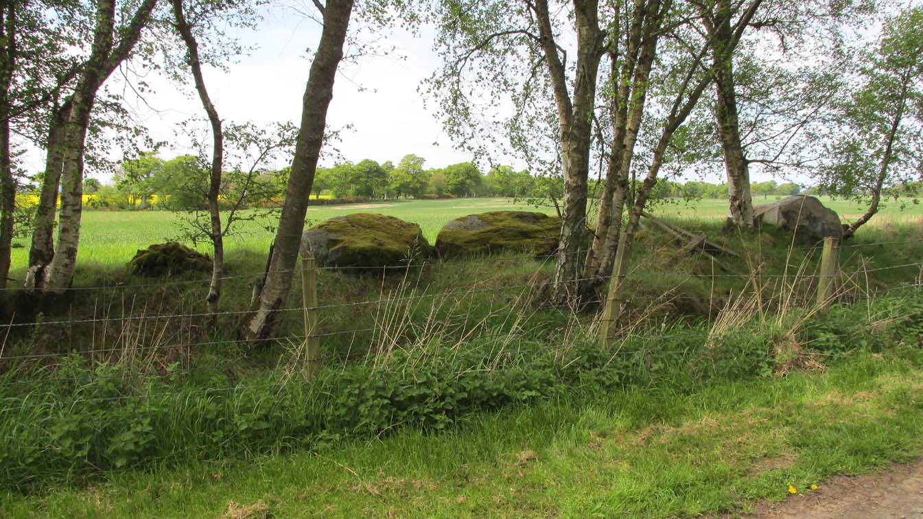
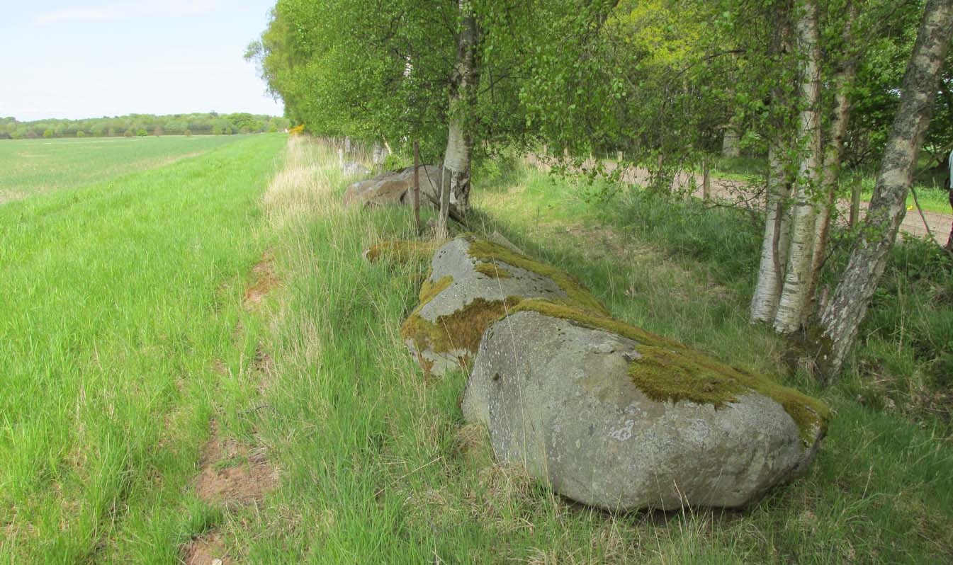
Legendary Rock: OS Grid Reference – NO 10842 32040

Getting Here

The easiest way to see the site is to stop at the car park at Craighall on the B9099 south of Stanley, and follow the path to the river.  The remains of the Brig will be seen on the other side of the Tay from the riverside walk.

Archaeology & History

The Thistle Brig was described in the nineteenth century Ordnance Survey Name Book as:-

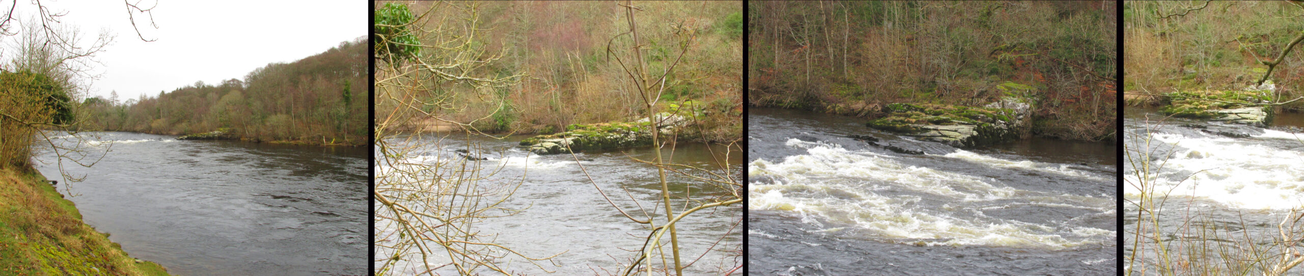
‘A remarkable spot in the River Tay, when the breadth of the river becomes suddenly narrow by the protrusion of a bed of trap rock which crosses it at this place.’

Thistle Brig & the quarries for its hard stone on the 1901 25 in OS-map

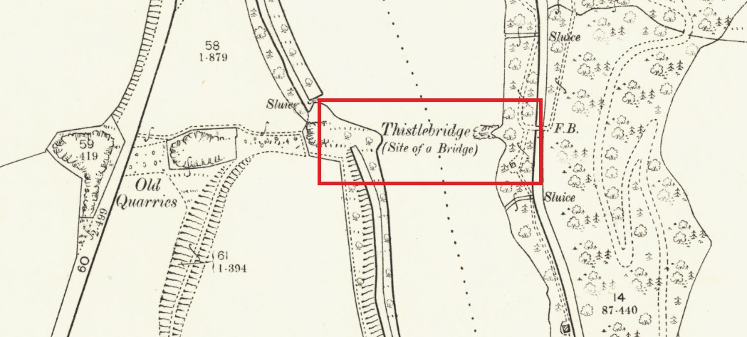
According to local historian Alexander Scott, the Thistle Brig formed a convenient place to ford the Tay until  much of it was blasted away by explosives some time in the mid-nineteenth century in order to improve the flow of the river.  Old maps imply that an actual bridge may have spanned the Tay hereabouts at some time in the past.  The seemingly little known folklore of this site relates to an invasion by the Danes in the early mediaeval period. Elsewhere there are similar stories, so the truth or otherwise depends on where you are in Scotland, but this one may have more validity as the tale seems to give its name to the place!

The name ‘Thistle Bridge’ has been applied on old postcards to a stone footbridge over a side channel or lade between the road and the River Tay to the south of the Brig, and is not the subject of this profile.

The remains of the Thistle Brig – a hard basalt dyke on the east bank of the River Tay

Folklore

Alexander Scott, writing of the Brig:-

“…tradition holds that here the thistle received the distinction  of becoming the national emblem of Scotland.  In one of the many invasions the country suffered from foreign armies, the Danes, on one occasion, having landed on the east coast sacked the town of Montrose and continued on their march across the country, burning and pillaging as they went.  While crossing the Tay at this ford at night, the incident occurred of one of the leading soldiers arriving on the opposite side suddenly coming in contact with a thistle with his bare leg, which caused him to emit a shreik of pain.

“The noise was heard by the Scots, who had been encamped nearby, and the alarm thus given was the means of securing a victory over their enemies. The thistle was thereafter honoured as the national badge.”

Reference:

  1. Scott, Alexander, St Martins and Cambusmichael, A Parochial Retrospect, Munro & Scott 1911.

Link:

  1. Ordnance Survey Name Book

© Paul T Hornby 2021

Witches Stone, St. Martin’s, Perthshire

‘Standing Stone’:  OS Grid Reference – NO 15927 31609

Also Known as:

  1. Canmore ID 28628

Getting Here

The Witches Stone of MacBeth

Going north-eastish from the city of Perth, take either the A93 or A94, turning west along the A93 a mile south of Guildtown, or east at Balbeggie on the A94, until you reach St. Martin’s hamlet and park up just below the church opposite the old cottages. Walk up the track below the cottages (not the one above them!) for ⅘-mile (1.35km) [past the ruined Cupar Stone Circle], and where the land has levelled out and in the huge flat field on your left, you’ll eventually reach a gate and see the odd-looking ‘rock’ about 250 yards away in the middle.

Archaeology & History

A fungal morel turned to stone

In a quiet and little-known parish that was once littered with about a dozen stone circles, there remains a most curious and fascinating stone which, in earlier days, was to be seen on the open moorlands at this spot.  The area was then forested and then the agriculturalists came with their farming and destroyed the forests, leaving the old stone as it presently stands, isolated, above the hamlet of St. Martin’s to the south.  Although it was described in the 19th century as being “four feet high”, it stands barely three feet tall, is very curiously-shaped—just like a morel mushroom from some angles—and in the middle of an extensive piece of flatland where the crops barely grow.

Witches Stone on 1866 map

Witches Stone, looking west

The stone was highlighted on the first OS-map of the parish in 1866, showing it in the woodland plantation of Eastmuir.  It may have been some sort of northern outlier related to the now-destroyed stone circle of Cupar 400 yards south; and if this was the case, its position in the landscape relative to the circle would give the Witches Stone an airt (virtue ascribed to cardinal directions) in the cycle of the year that relates to darkness and death. (Perhaps oddly—perhaps not—the name of parish St. Martin’s relates to that dark period in the calendar, as St. Martin’s day in the old calendar was Samhain or Halloween: old New Year’s Day, when the spirits of the dead moved across both land and skies.)

It was erroneously described by the Canmore lads as being little more than “a glacial erratic”, but the stone here is quite earthfast; and their idea that “its peculiar shape has probably been caused by wind erosion”, is also somewhat dubious considering the shape of other monoliths and megalithic rings in the region.  The stone has an appearance similar to some Bull Stones, where the animal was chained to rocks such as this and then baited by dogs, although I can find no such lore here. Indeed, the history and archaeology of the stone seems all but silent.  Its folklore however, would have the Shakespearian romanciers amongst you flocking to the place…

Deep grooves atop of the stone

The top of the stone has some very distinct and deep-cut lines running across it at angles, and has the appearance of being cut into at some time in the dim and distant past.  By whom, and for what reason, we cannot say.

Folklore

William Richie (1845) told us that in the 11th Century when Scotland was having to deal with the english disease of stealing land and spreading its violence, King MacBeth—whose castle stood within this parish at Cairnbeddie (NO 1498 3082)—took that advice of two witches, and that

“they met him one night at a place still called ‘the Witch Stane’ (where a remarkable stone still stands), about a mile from his old residence, and warned him to beware, ‘Till Birnam forest come to Dunsinane.’”

The 1860 Name Book told us that,

“The Moor where the witches met, which is in St. Martins Parish is yet pointed out by the country people, and there is a stone still preserved, which is called the Witches Stone.”

References:

  1. Scott, Aleander, St. Martin’s and Cambusmichael, Perth 1911.
  2. Richie, William, “St. Martins and Cambusmichael,” in New Statistical Account of Scotland – volume 10: Perthshire, William Blackwood: Edinburgh 1845.

Acknowledgements:  Huge thanks to Prof Paul Hornby for showing me this site. Cheers matey!

© Paul BennettThe Northern Antiquarian


Cupar Stone Circle, St. Martin’s, Perthshire

Stone Circle (ruins):  OS Grid Reference – NO 15958 31227

Also Known as:

  1. Canmore ID 28632

Getting Here

The stone circle on 1867 map

Follow the same directions as if you’re visiting the Witches Stone of St. Martin’s.  On the way up the long dirt-track, just where the track has levelled out above the slope, keep your eyes peeled on the left (west) for a line of large long boulders on the other side of the barbed-wire fence, laid down, just at the edge of the field.  That’s what’s left of the place!

Archaeology & History

This site is in a sad state of affairs and no discernible ‘stone circle’ of any form can be seen here.  The stones that constituted the megalithic ring were uprooted and dumped at the side of the huge field sometime in the latter-half of the 20th century.  The site is shown clearly on the early OS-maps but at some point in more recent years, the land-owner here (I presume) uprooted the stones and dumped them at the field-side, where they remain. Not good.

Cupar Stones from the track

One of the stones here bore the curious name ‘Cupar’, which probably relates to it being a place where criminal trials were held, or justice dispensed. (Grant 1952)  Traditions such as this were enacted at other megalithic rings and ancient sites in earlier times.

The first mention of the circle I can find is in the old Name Book of 1865, which informs us:

“Three large boulders set up edgeways, and part of a circular earthen bank.  There is no local tradition regarding the stones but the Rev Park believes them to be the remains of a Druidical Temple. The name Cupar Stone is not well known locally but still appears on the estate map.”

Cupar Stones at field-edge

It originally stood on the edge of the large flat plateau, just at the point where the land slopes down to the south, with the curious Witches Stone of MacBeth on the same level plateau just over 400 yards to the north.  This small monolith may have been a deliberate outlier from the ring, perhaps relating to the calendrical airt of death (the direction ‘north’ commonly denotes Death in pre-christian cultural cosmologies).  But we know little else about the ring.  In Margaret Stewart’s (1965) notes about the site, she indicated that some of the stones were still standing when she saw them, saying how the “largest remaining stones are to the south and west.”  They’re not anymore!

Postulating it as a possible ‘four-poster’ stone circle (a dubious one, he said), Aubrey Burl (1988) told us:

“In the south corner of a partly cleared wood…there are three large stones, two of them fallen. They are in a roughly straight line running NNE-SSW.  Nearby is a fourth prostrate stone in a boundary wall.  Stewart (1965:21) suggested that they had once formed a ring approximately 24ft 6in (7.5m) in diameter. Different opinions have been that if there had been a circle, it was probably larger.”

In light of the near-complete destruction of the Cupar stone circle, I feel that note should be made of a somewhat worrying trend, not only here, but many other prehistoric sites in the country.  In the site profile Canmore has given the Cupar stone circle, its destruction and vandalism has been termed “agricultural improvement”, as if to sound ‘acceptable’ and that it’s OK to destroy stone circles – which it plainly is not!  If you or I were to do such a thing, we’d be arrested!  We need to make sure that, as individuals and organizations, we treat what some term “agricultural improvement” for what it is: vandalism (usually by rich tory land-owners who give back-handers, or similar things, to make sure the official paperwork looks OK).  I know a lot of archaeologists agree with this too, but cannot speak out for fear of losing their jobs.

References:

  1. Barnatt, John, Stone Circles of Britain (2 volumes), BAR: Oxford 1989.
  2. Burl, Aubrey,  The Stone Circles of the British Isles, Yale: London 1976.
  3. Burl, Aubrey, Four Posters: Bronze Age Stone Circles of Western Europe, BAR 195: Oxford 1988.
  4. Burl, Aubrey, The Stone Circles of Britain, Ireland and Brittany, Yale University Press 2000.
  5. Grant, William & Murison, David D., The Scottish National Dictionary – volume 3, SNDA: Edinburgh 1952.
  6. Royal Commission on the Ancient & Historical Monuments Scotland, South-east Perth: An Archaeological Landscape. RCHAMS: Edinburgh 1994.
  7. Stewart, Margaret E.C., “Excavation of a Circle of Standing Stones at Sandy Road, Scone, Perthshire“, in Transactions & Proceedings Perthshire Society Natural Science, volume 11, 1965.

© Paul BennettThe Northern Antiquarian


Higher Town Bay, St. Martin’s, Scilly Isles

Cist:  OS Grid Reference – SV 934 153

Also Known as:

  1. Monument no.303793

Archaeology & History

The remains of this old tomb were first noted by Mr Alexander Gibson, whose photograph of the site is here reproduced.  Thought by Paul Ashbee (1974) to date from between the Iron Age and Romano-British period, the site was first described in O.G.S. Crawford’s (1928) essay in Antiquity journal.  It was just one of several such sites in relative proximity to each other and which, due to them being so close to the sea, have been all-but washed over by Nature’s advance.  Mr Crawford told that this,

“cist on the shore…is on St. Martin’s, between Crethus Hill and English Island Point, about 20 yards from the edge of the rushy bank, and at approximately high water-mark.  It is oriented north and south and is 3 feet long by 2 (feet) wide.  It has now no capstone.  The cist when found was full of coarse, gravelly sand and stones, which were cleared out; amongst this were parts of leg bones (the joint-ends missing) and smaller fragments; then a piece of a human jaw, without teeth, and finally the skull.  The facial portion was missing.  The skull fell to pieces on removal but it and all the other pieces were preserved and the cist filled in again.”

In the same article, Crawford notes that,

“nearby, to the west, were two or three other cists of the same type, and many years ago yet others were observed, both round this bay and at Lawrence’s, to the west of Crethus Hill.”

References:

  1. Ashbee, Paul, Ancient Scilly, David & Charles: Newton Abbot 1974.
  2. Crawford, O.G.S., “Stone Cists,” in Antiquity Journal, volume 2, no.8, December 1928.
  3. Weatherhill, Craig, Cornovia, Halsgrove 2009.

Links:

  1. Pastscape Notes on Monument no.303793

© Paul Bennett, The Northern Antiquarian