Holy Ash Well, Bradford, West Yorkshire

Holy Well (destroyed):  OS Grid Reference SE 15942 34208

Also Known as:

  1. Ash Well
  2. Holy Well Ash Well
  3. Pin Well

Archaeology & History

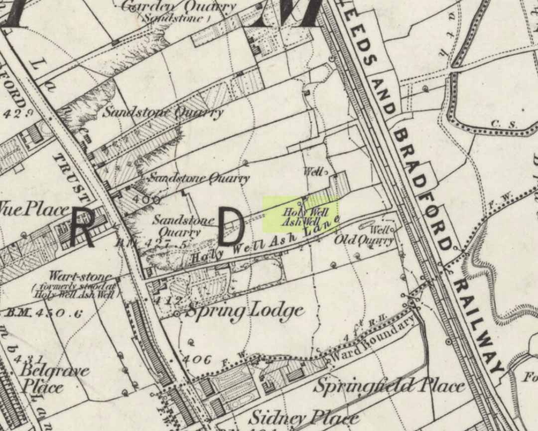
Holy Well Ash on 1852 map

Either right next to, or perhaps now beneath Bradford City’s Valley Parade football ground, was once a very important sacred well site.  Known as the Holy Ash Well and variants thereof, this healing spring was of considerable renown to people all around Bradford district in bygone days.  The site was illustrated on the 1852 OS map, and there was also a sacred stone adjacent to the well known as the Wart or Pin Stone, which had some animistic healing properties related the waters.

The old well was described by local historian Abraham Holroyd (1873) who said that:

“In Manningham Lane there is a fine well, in old deeds called Hellywell, i.e., holy well, in a field now called Halliwell Ash, now a stone quarry… Near this is the ancient Pin Stone.”

A few years later, in Robert Charles Hope’s (1893) monumental study, he described how,

“This holy well, not far from Manningham Lane, probably derived its name from having at some time been dedicated to some saint.  The inhabitants of Bradford were wont in ancient times to resort on Sundays to these wells as a common place of meeting, to drink of the waters and partake of their preternatural virtues.”

Which was another was of saying that he didn’t really know too much about the place!

The Bradford historian William Preston (1933) described this site in one of his early essays, where he informed us that local people knew the accompanying rock hereby as the Ash Stone, due to its proximity and ritual relationship to a great old ash tree (Fraxinus excelsior) that grew next to the well.  The mythic history of this particular tree should not be understated: it was a Creation deity par excellence in northern and Viking myths, but whatever old tales and power might once have been had here, in Bradford, they’ve long since been forgotten.  But it was the industrial historian William Cudworth (1896) who told the most of this all-but forgotten site, saying:

“On the sloping ground between Belle Vue and the Midland Railway there once existed a spring of water, supposed to have preternatural virtues. The name it bore within present recollection is probably a corruption of Holy-well. The holy wells of England as elsewhere had not all the same virtues attached to them. Some were blessed if used for baptisms, to others were attributed curative properties, especially for sore or weak eyes, while others were supposed to possess mystical powers, insomuch as any article dipped in them became charms or safeguards against witchery.  Any traditions associated with the spring at Halliwell (or Holywell) Ash are lost, but certainly in the early part of the present century the place was a favourite resort of the townspeople on Sundays.

“The derivation of the name is doubtful. In the survey of 1638 a close called ” Helliwell Ash” is mentioned as containing 2a. 3r. 26p., but without any indication as to its locality. The spelling of the name is of little moment.  Mr. James, in his “History of Bradford,” states that he had seen the place referred to in old deeds as “Helly-well.” By his will, dated May, 1685, Thomas Lister, of Manningham, devised to his two daughters, Juliana Lambrecht and Elizabeth Stapleton, equal shares in two closes of land called “Holywell Ash” and ” Delf Close,” besides other lands in Manningham. In the will disposing of the possessions of Juliana Lambrecht, her moiety of “Holywell Esh” was bequeathed to Francis Stapleton, her nephew.  In due course the lands in question were inherited by Francis Sharp Bridges, and have latterly belonged to Sir Francis Sharp Powell, M.P., in whose writings the form of spelling is given as ” Halliwell Ash.”

“Upon the ground in question there used to be a fine well of water issuing out of the higher ground, to which tradition assigned healing virtues. Might not the name of “holy” come from this circumstance?  Sufficient importance attaches to the tradition, however, to have led the farmers of the recent ordnance plan of Manningham to preserve the name, although the widening of the Midland Railway below Thorncliffe Terrace has almost obliterated the site.”

A more recent updated overview of the site was written by one of my old school-mates, Dave Pendleton (1997), who said of the place:

“Prior to 1886 the only feature of any real note in the Valley Parade environs was a holy well that emerged near the corner of the football grounds Midland Road and Bradford End stands; hence the road Holywell Ash Lane. Today the site of the well is covered by the football pitch.

Only the road name survives as a reminder of what was apparently one of the district’s foremost attractions. On Sundays and holidays people would gather to take the waters and leave pins, coins, rags and food as offerings to the spirit that resided in the waters.

Accounts suggest that the well was covered and had a great ash tree standing over it (hence ‘holy ash’). There was also a standing stone called the wart stone of unknown antiquity. The stone had a carved depression that collected water. It was believed that the water was a miraculous cure for warts. Indeed, as early as 1638 the Holy Well had been credited with healing powers.

The well suffered a decline in popularity during the late nineteenth century and its keepers resorted to importing sulphur water from Harrogate, which they sold for a half penny per cup. The well disappeared under the Valley Parade pitch during the summer of 1886 and the wart stone was moved to the top of Holywell Ash Lane – which then ran straight up to Manningham Lane. The stone was still there as late as 1911 but thereafter it seems to have disappeared into the mists of time.”

A night-club adjacent to the Valley Parade football ground—called Bibby’s—was said to have had an old well in its cellar, which the owner of the place, Mr Pearl Gladstone Minott, said was ‘haunted’.

Unfortunately I’ve not been able to find any old photos or drawings of this lost holy well – though I imagine that some local, somewhere must be able to help us out with this one.  Surely there’s more of this site hidden away somewhere….?

References:

  1. Bennett, Paul, The Old Stones of Elmet, Capall Bann: Milverton 2001.
  2. Cudworth, William, Manningham, Heaton and Allerton, W. Cudworth: Bradford 1896.
  3. Holroyd, Abraham, Collecteana Bradfordiana, Saltaire 1873.
  4. Hope, R.C., The Legendary Lore of the Holy Wells of England, Elliot Stock: London 1893.
  5. Pendleton, David & Dewhirst, John, Along the Midland Road, Bradford City AFC 1997.
  6. Preston, W.E., ‘Some Bradford Holy Wells’, in Bradford Antiquary, volume 7, 1933.

© Paul Bennett, The Northern Antiquarian 

St. Helen’s Well, Holbeck, Leeds, West Yorkshire

Holy Well (destroyed):  OS Grid Reference – SE 295 329

Archaeology & History

In the Holbeck area of Leeds, one of the three spa wells was previously patronised to this mythical saint, whose wells profuse in this part of the world.  St. Helen’s Well (later becoming the Holbeck Spa Well) was found at the appropriately named St. Helens Bridge.  Ralph Thoresby (1715) wrote of the place: a supposed medicinal holy well, it previously had a chapel by it, of which no trace is seen today. John Mayhall (1860) also mentioned this “medicinal well,” but told little more. It was Andrea Smith (1982), more than a century later, who wrote the most about the place:

“In connection with the well by St.Helen’s Bridge, Holbeck, (Thoresby) refers to “another ancient fabrik called St. Helen’s,” but there is a difficulty in deciding exactly what he means by ancient; it is taken here as meaning more than two hundred years old. This suggests, then, that by St. Helen’s Bridge there was once a well and chapel which gave rise to the dedication and which was probably a Medieval foundation, considering the popularity of St. Helen at that time.”

Both of these sites have long since disappeared. The well eventually became known as a local Spa Well, and was found to possess a high sulphur content.

References:

  1. Mayhall, John, The Annals of Yorkshire, Joseph Johnson: Leeds 1860.
  2. Smith, Andrea, ‘Holy Wells Around Leeds, Bradford & Pontefract,’ in Wakefield Historical Journal 9, 1982.
  3. Thoresby, Ralph, Ducatus Leodiensis: or the Topography of the Ancient and Populous Town and Parish of Leedes, Robinson & Holdsworth: Leeds 1816.

© Paul Bennett, The Northern Antiquarian


Fenny Shaw Cup-Mark, Bingley Moor, West Yorkshire

Cup-Marked Stone:  OS Grid Reference – SE 11271 43565

Also Known as:

  1. Carving no.112 (Boughey & Vickerman)

Getting Here

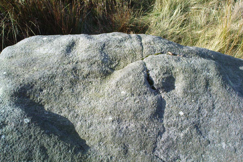
Close-up of 'cup-mark'
Close-up of ‘cup-mark’
Fenny Shaw Cup-Marked Stone

Follow the same directions to reach the Big Rock carving.  From here walk less than 100 yards up the slope, veering to your left and where you reach the rushes (Juncus grasses), walk up and keep your eyes peeled for the singular upright rock.  Or as ‘Redkiteyorks’ said, go “up the slope 82.4 metres, 54.5 degrees(True) from IAG108 (Big Rock).” It aint hard to find really…

Archaeology & History

Another stone mainly for the purists amongst you.  Little has been written on this possible carving.  Boughey & Vickerman (2003) said simply:

“Large rough rock. Two possible cups on top and one further possible cup on W vertical face. Doubtful”.

References:

  1. Boughey, K.J.S. & Vickerman, E.A., Prehistoric Rock Art of the West Riding, WYAS: Leeds 2003.
  2. Hedges, John (ed.), The Carved Rocks of Rombald’s Moor, WYMCC: Wakefield 1986.

© Paul Bennett, The Northern Antiquarian

Bull Stone, Guiseley, West Yorkshire

Standing Stone/s:  OS Grid Reference – SE 20675 43469

Also Known as:

  1. Boon Stones
  2. Boul Stones
  3. Bull Stone of Otley Chevin

Getting Here

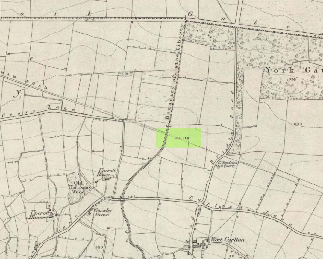
Bull Stone as ‘Pillar’, 1851 map

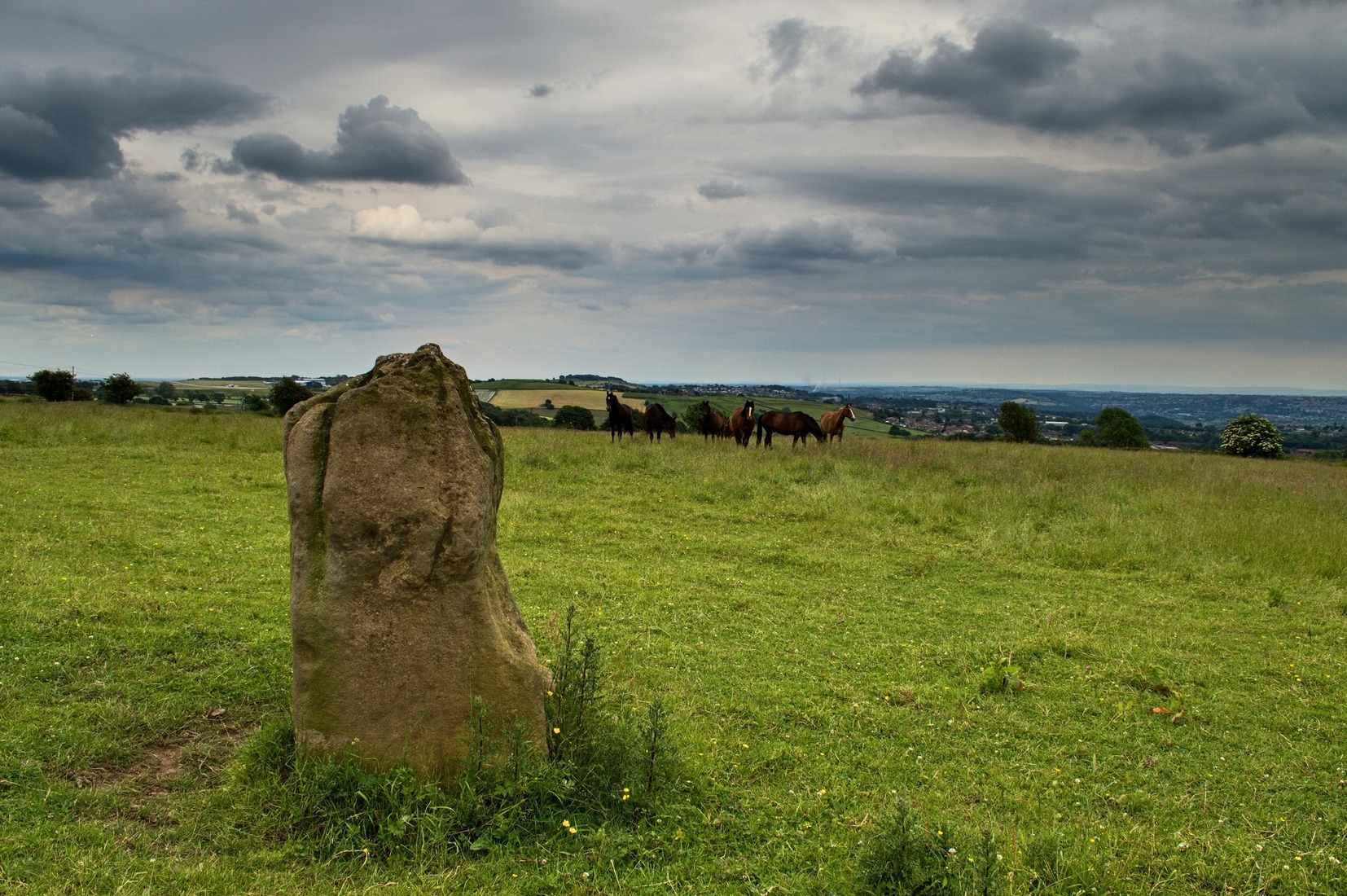
Worth checking this if you aint seen it before! Head up to the back (south-side) of Otley Chevin (where the cup-and-ring Knotties Stone lies sleeping), following the road there and park up near/at the Royalty pub.  Take the footpath behind the pub which crosses the fields and once into the second field, head diagonally down to the far-left corner.  From here, look over the wall — you can’t really miss it!

Archaeology & History

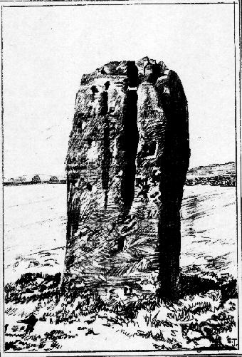
An intriguing site for various reasons.  All we have left to see of any value nowadays is this nigh-on 6-foot tall thick monolith, standing alone in the field halfway between West Carlton and Otley Chevin.  Completely missed in local archaeological surveys, the place was mentioned briefly by Slater (1880); though it appears to have been first described in detail by Eric Cowling (1946), who suspected the stone may have Roman origins (though didn’t seem too convinced!), saying that:

“near the ground the section is almost oblong, with sides three-feet six-inches by one-foot ten-inches; two feet from top, the section is almost circular.”

Sid Jackson’s 1956 sketch
Photo by James Elkington

The fact that the stone stands very close to the line of an all-but forgotten Roman road that runs right past it added weight to this thought (the road runs towards a Roman settlement a mile east of here near Yeadon).  But this standing stone is unlikely to be Roman.  More recent evidence seems to indicate a relationship with a now-lost giant cairn about 100 yards to the south.  The only remains we have of this place are scatterings of many small loose stones nearby.  And it seems a very distinct possibility that the extra standing stones that were once hereby, stood in a line.

The very first reference I’ve found about this site also indicates that there was more than one stone here in the past!  In 1720 this site was known as the ‘Boon Stones’; and the plural was still being used by the time the 1840 Tithe Awards called them the ‘Boul Stones.’  Initially it was thought that both words were plural for “bulls” — as A.H. Smith (1962) propounds in his otherwise superb survey — but this is questionable. (see Folklore)

Folklore

A piece of folklore that seems to have been described first by Philemon Slater (1880) relates to the pastime of bull-baiting here, that is –

“fastening bulls to it when they were baited by dogs, a custom…still known to the Carlton farmers” (North Yorkshire).

Cowling (1946) told that he heard the stone was said to be lucky as well as being a source of fertility.  This ‘fertility’ motif may relate to the meaning of the stone’s early name, the Boon Stones.  Both boon and boul are all-but obsolete northern dialect words.  ‘Boul’ is interesting in its association with a prominent folklore character, as it was used as a contemptuous term “for an old man.”  Now whether we can relate this boul to the notion of the ‘Old Man’ in British folklore, i.e., the devil, or satan — as with the lost standing stone of The Old Man of Snowden, north of Otley — is difficult to say.

More interestingly perhaps is the word ‘boon’, as it is an old dialect word for “a band of reapers, shearers, or turf-cutters.”  This band of reapers ordinarily consisted of five or six people and would collect the harvest at old harvest times.  And as the early description talks of Boon Stones, this plurality would make sense.  One curious, though not unsurprising folklore relic relating to these boons was described at another megalithic site (now gone) by John Brand (1908), where in the parish of Mousewald in Dumfries,

“The inhabitants can now laugh at the superstition and credulity of their ancestors, who, it is said, could swallow down the absurd nonsense of ‘a boon of shearers,’ i.e., reapers being turned into large grey stones on account of their kemping, i.e., striving.”

Standing stones with the folklore of them being men or women turned to stone is common all over the world.  If we accept the dialect word ‘boon’ as the first name of this old stone, there may once have been some harvest-time events occurred here long ago (and this is quite likely).  Equally however, we must also take on the possibility that this Bull Stone has always been a loner and that its name came from the now obsolete Yorkshire word, a bull-steann, meaning a stone used for sharpening tools, or a whetstone.

Take your pick!

References:

  1. Bennett, Paul, The Old Stones of Elmet, Capall Bann: Milverton 2001.
  2. Brand, John, Observations on the Popular Antiquities of Great Britain – volume 2, George Bell: London 1908.
  3. Cowling, Eric T., Rombald’s Way, William Walker: Otley 1946.
  4. Jackson, Sidney, ‘The Bull Stone,’ in Cartwright Hall Archaeology Group Bulletin, 2:5, 1956.
  5. Smith, A.H., English Place-Name Elements – 2 volumes, Cambridge University Press 1956.
  6. Smith, A.H., The Place-Names of the West Riding of Yorkshire – volume 7, Cambridge University Press 1962.
  7. Slater, Philemon, The History of the Ancient Parish of Guiseley, William Walker: Otley 1880.

© Paul Bennett, The Northern Antiquarian 

Baildon Moor (151), West Yorkshire

Cup-Marked Stone:  OS Grid Reference – SE 13736 40227

Also Known as:

  1. Baildon carving no.23 (Hedges)

Getting Here

As with many of the other Baildon Moor carvings, get up to Dobrudden caravan park and walk into the grasses immedietaly northeast onto the Dobrudden necropolis plain for 100 yards or so. It’s not far from the track and one of the many bell-pits is very close by.  Look around!

Archaeology & History

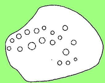
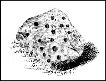
A lovely little carving (sad aren’t I…?), first recorded and illustrated in Glossop’s (1888) famous essay on the ancient sites of Baildon Moor.  He described there being 18 cups etched onto this rock — a fact echoed a few decades later in Mr Baildon’s (1913) magnum opus.  The modern surveys thankfully still count 18 cups here.

Mr Baildon’s 1913 image
Glossop’s 1888 drawing

This is another one of the Baildon Moor carved stones included in Mr Holmes’ (1997) astronomical survey, where he thought the cup-markings here represented stellar maps and other prehistoric astronomical events. A damn good investigative notion, but it sadly aint true.  However, those self-same ‘central design’ curves found at a large proportion of other carvings on and around Baildon Moor are plain here for all to see…

References:

  1. Baildon, W. Paley, Baildon and the Baildons (parts 1-15), St. Catherines Press: Adelphi 1913-26.
  2. Boughey, K.J.S. & Vickerman, E.A., Prehistoric Rock Art of the West Riding, WYAS: Leeds 2003.
  3. Colls, J.N.M., ‘Letter upon some Early Remains Discovered in Yorkshire,’ in Archaeologia, 31, 1846.
  4. Cowling, Eric T., Rombald’s Way, William Walker: Otley 1946.
  5. Cudworth, William, ‘Baildon Moor & its Antiquities,’ in Bradford Antiquary 3, 1900.
  6. Glossop, William, ‘Ancient British Remains on Baildon Moor,’ in Bradford Antiquary No.1, 1888.
  7. Hedges, John (ed.), The Carved Rocks of Rombald’s Moor, WYMCC: Wakefield 1986.
  8. Holmes, Gordon, 2000 BC – A Neolithic Solstice Odyssey, SASRG 1997.

© Paul Bennett, The Northern Antiquarian

Baildon Moor (158), West Yorkshire

Cup-Marked Stone:  OS Grid Reference – SE 13781 40259

Also Known as:

  1. Baildon Stone 29 (Hedges)

Getting Here

Takes a bitta finding this one, mainly cos it’s only a small stone – but worth the walkabout. It’s on the Low Plain, north of Dobrudden, about 10 yards down the path from the caravan park.

Archaeology & History

W.P. Baildon’s 1913 drawing

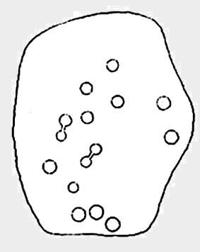
As with other stones on this roughland plain, it was first recorded and drawn by the local historian W. Paley Baildon (1913), who counted at least 15 cups here, with one complete cup-and-ring.  Some of the cups have very distinct half-rings upon them; whilst others are connected by faint lines (as his drawing clearly shows).  The later surveys of Hedges (1986), and Boughey & Vickerman (2003) counted 17 cups on this stone.  This was another of the carvings which local astronomer Gordon Holmes (1997) thought may have been based on the constellation of Cassiopeia (like the nearby Cassiopeia Stone, found on the same moorland plain).

References:

  1. Baildon, W. Paley, Baildon and the Baildons (parts 1-15), St. Catherines: Adelphi 1913-26.
  2. Boughey, Keith & Vickerman, E.A., Prehistoric Rock Art of the West Riding, WYAS 2003.
  3. Glossop, William, ‘Ancient British Remains on Baildon Moor,’ in Bradford Antiquary, 1888.
  4. Hedges, John (ed.), The Carved Rocks on Rombalds Moor, WYMCC: Wakefield 1986.
  5. Holmes, Gordon T., 2000 BC – A Neolithic Solstice Odyssey, SASRG Press 1997.

© Paul Bennett, The Northern Antiquarian

Baildon Moor (160), West Yorkshire

Cup-Marked Stone:  OS Grid Reference – SE 13787 40274

Also Known as:

  1. Carving no.33 (Hedges)

Getting Here

W.P. Baildon’s sketch

Best way to find this is to get up to the Dobrudden caravan site on the edge of Baildon Hill, near the cinder-dump, then follow the same directions as for the Baildon Moor carving no.171.  It’s on the same plain amidst the grasses – but you’re gonna have to zigzag about for a while before you find it!

Archaeology & History

A simple plain cup-marked stone which Boughey & Vickerman (2003) reckoned to have 14 of the little babies etched on its surface.  Ninety years earlier, the reliable Mr W.P. Baildon (1913) — who seems to have been the first person to describe this carving — showed there to be 15 cups when he came here.

This was one of the many carved rocks that astronomer Gordon Holmes (1997) looked at in his attempt to give a celestial explanation for the designs.  I’m not too sure misself…

References:

  1. Boughey, Keith & Vickerman, E.A., Prehistoric Rock Art of the West Riding, WYAS 2003.
  2. Hedges, John (ed.), The Carved Rocks on Rombalds Moor, WYMCC: Wakefield 1986.
  3. Holmes, Gordon T., 2000 BC – A Neolithic Solstice Odyssey, SASRG Press 1997.

© Paul Bennett, The Northern Antiquarian

Acrehowe Circle, Baildon Moor, West Yorkshire

Ring Cairn:  OS Grid Reference – SE 14245 40686

Also Known as:

  1. Coll’s Burial Mound
  2. Rerehowe

Getting Here

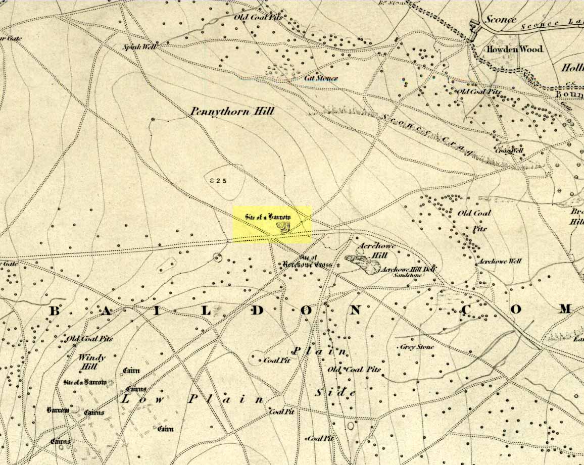
Acrehowe site on 1852 map

Go up through Baildon centre and head onto the moors. Crossing the cattle-grid, a coupla hundred yards further up, turn left. Past the small reservoirs on your left, another 100 yards or so and you reach the brow of the hill.  As you begin going down the road, there’s a small car-park right by the roadside.  The curious remains of the earthworks at the side of the old circle are discernible in the grassland right to its side.

Archaeology & History

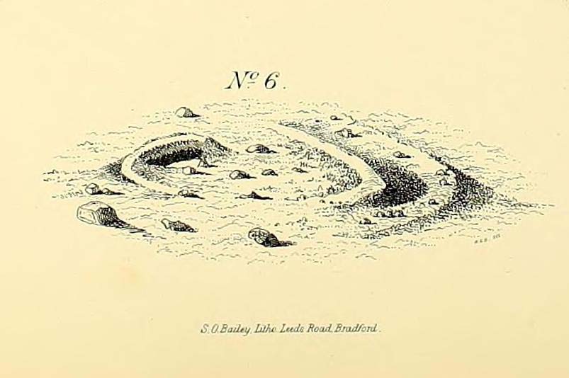
Illustrated on the 6-inch OS-map of 1852 as “Site of a Barrow” (similar to how it appears in the image drawn here by Mr. C.N.M. Colls) a short distance below Pennythorn Hill top, there are still considerable traces of the earthworks surrounding the east and southern sides of what was once some form of ring cairn or tumulus that was once at this prominent place in the landscape.

Aerial view of siteThe site was first explored by Mr Colls in 1843 (his results were reported a few years later), who found a loose double-ring of stones, fifty feet across, surrounded by a shallow trench which was most notable on the south and east sides. Two urns were also uncovered near the centre of the ring, nearly two feet down, containing the cremated remains of people.  A few years later, the Leeds historian James Wardell (1869) told a most fascinating note about what happened during their excavation, saying:

“This…examination was attended by a circumstance not soon to be forgotten by the persons engaged therein (on the excavation). They had almost reached the place where the broken urn and bones were deposited when, at once, such a fearful storm of thunder, lightning and rain came on, that they were not only considerably alarmed, but driven from the Common to seek shelter in the village.”

Colls’ 1846 sketch

We hear this sorta thing at many of our ancient places!

Colls 1846 plan

One anonymous writer in 1955 described the site as a ‘stone circle’, and a number of subsequent archaeologists copied this without question; but in all probability this site was more typical of an old cairn circle or ring-cairn, similar in size and design to the Roms Law circle two miles north of here.  However, the earthworks at its side give the impression of some sort of exaggerated hengiform enclosure.

The place-name element howe strongly indicates a burial site and is a suffix found at many prehistoric tombs across northern England.  The prefix ‘acre’ may relate to “a plot of arable or cultivated land, a measure of land (an acre) which a yoke of oxen could plough in a day” (Smith 1956), or may be a corrupted form of the Old English word, ‘acen’, relating to oak trees.  Early literary examples of the place-name would enable a clearer understanding of the prefix element here.

References:

  1. Anonymous, Colls’ Burial Mound Stone Circle, Baildon Moor, Museum Leaflets: Bradford 1955.
  2. Baildon, W. Paley, Baildon and the Baildons (parts 1-15), St. Catherines: Adelphi 1913-26.
  3. Barnes, Bernard, Man and the Changing Landscape, Eaton: Merseyside 1982.
  4. Bennett, Paul, The Old Stones of Elmet, Capall Bann: Milverton 2001.
  5. Colls, J.N.M., ‘Letter upon some Early Remains Discovered in Yorkshire,’ in Archaeologia, 31, 1846.
  6. Collyer, Robert & Turner, J.H., Ilkley: Ancient and Modern, William Walker: Otley 1885.
  7. Smith, A.H., English Place-Name Elements – volume 1, Cambridge University Press 1956.
  8. Wardell, James, Historical Notes of Ilkley, Rombald’s Moor, Baildon Common, and other Matters of the British and Roman Periods, Joseph Dodgson: Leeds 1869. (2nd edition 1881)

© Paul Bennett, The Northern Antiquarian


Cassiopeia Stone, Baildon Moor, West Yorkshire

Cup-and-Ring Stone:  OS Grid Reference – SE 13771 40235

Also Known as:

  1. Carving no.28 (Hedges)
  2. Carving no.156 (Boughey & Vickerman)

Getting Here

If you wanna find this carving, you’ll find it near several others on the Low Plain, 40 yards east of the footpath north of Dobrudden Farm.  Look around in the tribbly grass!

Archaeology & History

This was first described and illustrated in a short article by William Glossop in the Bradford Antiquary in 1888, and reproduced by W. Paley Baildon (1913) – who drew his own impression of the carving. Tis one of my favourites from this moor. Dunno why – I just like it.

W.P. Baildon’s accurate 1913 drawing
Cowling’s 1946 drawing

Local astronomer and writer Gordon Holmes (1997) posited the theory that a part of this carving represented the constellation of Cassiopeia — hence its title!  He told of finding the same pattern of cups at four other carvings on the moors and assigned astronomical meanings to them.  He may be right, though I doubt it to be honest.  Having looked and looked at the many carvings here, and many other places, the star-reflection hypothesis doesn’t tend to work (as the heavenly bodies have moved somewhat since the days when the cups were first carved).  Along with this, when I was young I used to think cup-and-rings did have an astronomical basis — only to find, after constant analysis, that the theory didn’t work.

There are perhaps 20 cup-markings here, with various linking-lines and curves between and around the cups.  Perhaps the most accurate of the early drawings was Mr Paley Baildon’s 1913 image, where he highlighted the faint surrounding ring enclosing the 4 or 5 cups near the bottom of the stone.

References:

  1. Boughey, Keith & Vickerman, E.A., Prehistoric Rock Art of the West Riding, WYAS 2003.
  2. Cowling, Eric T., Rombald’s Way, William Walker: Otley 1946.
  3. Glossop, William, “Ancient British Remains on Baildon Moor,” in Bradford Antiquary, 1888.
  4. Hedges, John (ed.), The Carved Rocks on Rombalds Moor, WYMCC: Wakefield 1986.
  5. Holmes, Gordon T., 2000 BC – A Neolithic Odyssey, SASRG Press 1997.

© Paul Bennett, The Northern Antiquarian


Enclosure Stone, Bingley Moor, West Yorkshire

Cup-and-Ring Stone:  OS Grid Reference – SE 10983 43368

Also Known as:

  1. Carving no.99 (Boughey & Vickerman)

Getting Here

Enclosure Carving, Stanbury Hill

From East Morton village, take the moorland road, east, and up the steep hill.  Where the road levels out there’s a left turn where a trackway leads onto the moor.  Go up here & keep walking till you hit a moorland ‘footpath’ signpost.  Stop here and walk due west (your left) onto the gently sloping rise and into the mass of the Stanbury Hill enclosure system.  Keep walking for 200 yards or so, where the land begins to slope down to the end of the spur; and just 50 yards before it drops down to the stream below you’ll find a cluster of carved rocks like the Lunar Stone, the Teaspoon Rock, Spotted Stone, etc, all scattered about.  Near these, you’ll find this one!

Archaeology & History

Not to be confused with the carving of the same name on the northern side of these moors (near the Green Crag Slack enclosure), this carved rock gets its name specifically from looking like a lay-out plan of some settlement or enclosure.  It’s unlikely that this title or description has anything to do with the carving, but its the impression it gave me when I first saw it!  But then once you look at the carving from another angle it takes on a different impression.

Enclosure Carving from above

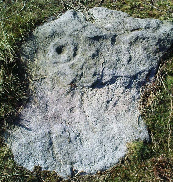
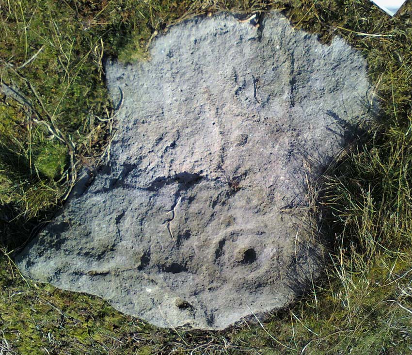
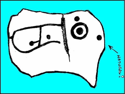
First thought to have been found by Stuart Feather in 1978, it is one of many carvings that occur in what seems to be an extensive prehistoric enclosure or settlement.  There’s a complete cup-and-ring near the western end of the rock, with another distinct cup-marking by its side, and what looks to be a natural cup at the top-end of the stone.  But it was the other section of the carving on the central and eastern side which intrigued me: a curious ‘enclosure’ of lines, with a cup-marking in each section.  Cutting between the cup-and-ring and the enclosure lines is a natural long crack or fissure running roughly north-south through the rock.  It seemed to me (though I could be wrong) that a line had been pecked running along this natural crack — although in Boughey & Vickerman’s (2003) drawing they don’t highlight this.  It also seemed that the carved lines from ‘enclosure’ linked up to the pecked line that was carved along the natural fissure in the rock (as illustrated in my crap drawing!).

Shit drawing of CR99

As with the Lunar Stone nearby: it appears that either this stone was carved at different periods; or else for a long period of time much of the stone was exposed to the elements, whilst a section of it remained covered.  For the distinct cup-and-ring on the western-end is more worn, with more eroded evidence of pecking, than the extended lines on the eastern end of the rock.  I need to go back here and get some better images — and certainly do a much better drawing!

References:

  1. Boughey, Keith & Vickerman, E.A., Prehistoric Rock Art of the West Riding, WYAS 2003.
  2. Hedges, John (ed.), The Carved Rocks on Rombalds Moor, WYMCC: Wakefield 1986.

© Paul Bennett, The Northern Antiquarian