Castle Stead, Cullingworth, West Yorkshire

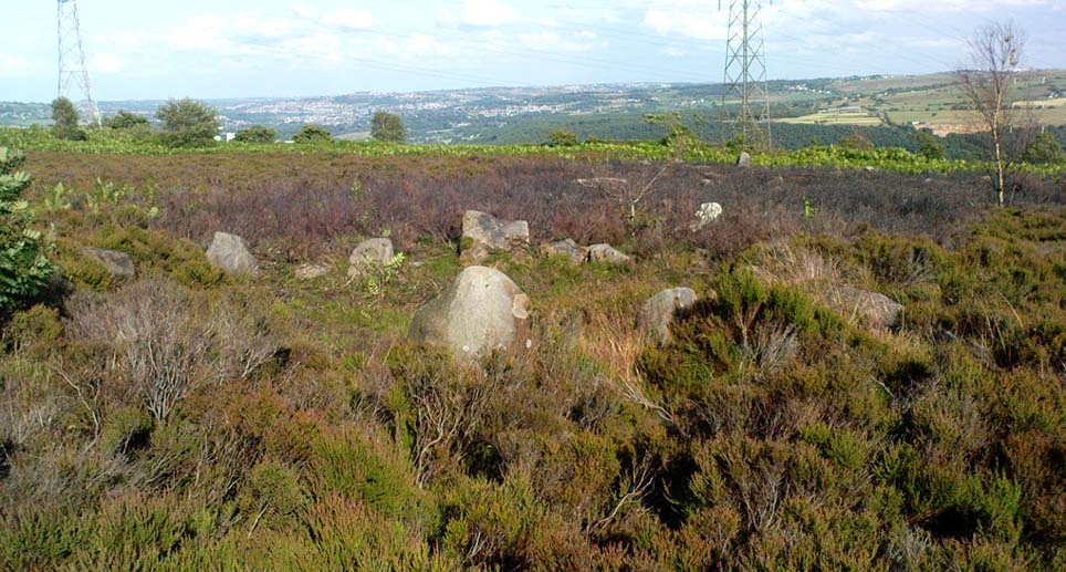
Earthworks:  OS Grid Reference – SE 067 354

Getting Here

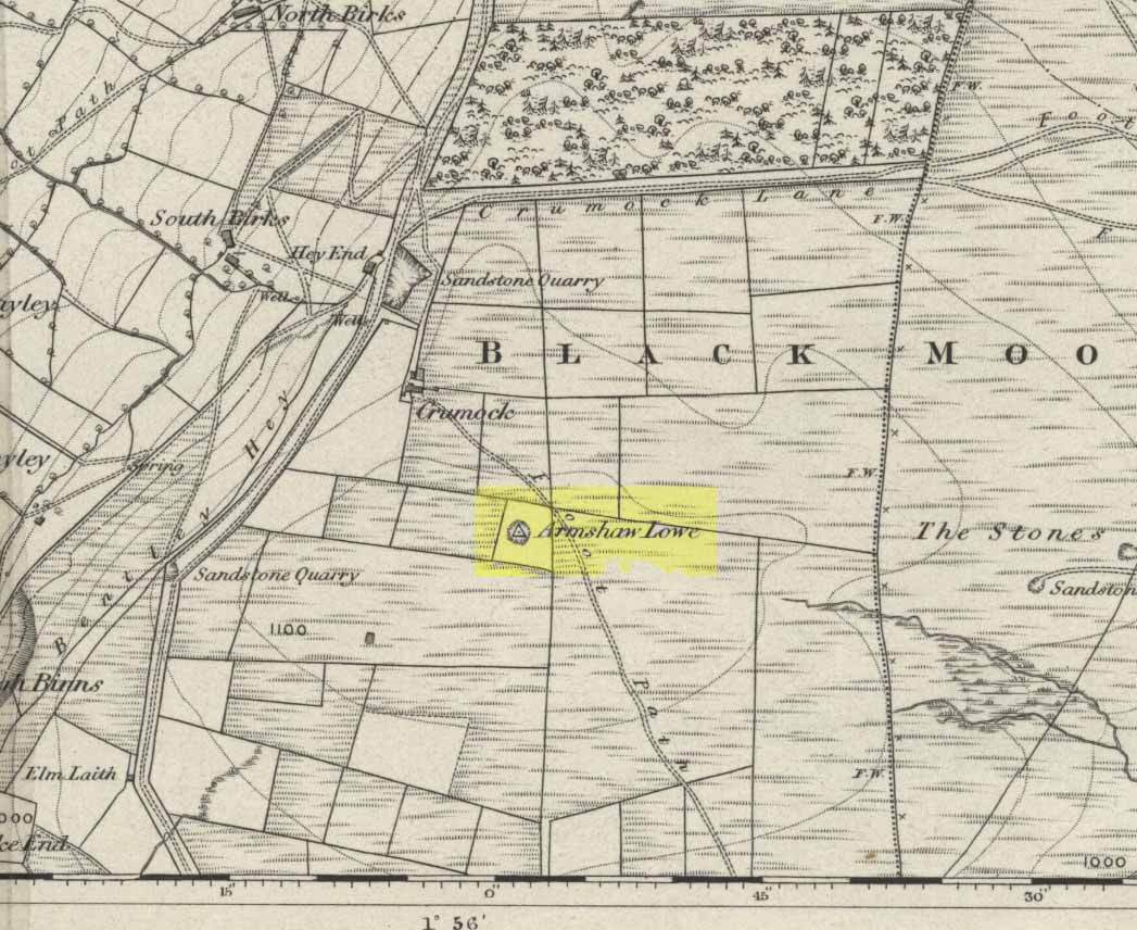
C.F. Forshaw (1908) told us that “this Castlestead…lies on the high ground between Cullingworth and Denholme, about 300 yards east of the point where te Cullingworth Road meets the Halifax-Keighley Road in Manywells Height, and over looks Buck Park Woods and the beck flowing down a deep ravine to enter the head of Hewenden Reservoir.  A little to the north lies Moat Hill Farm…and the ancient burial place therewith associated.”  Very little remains of the site can be seen.

Archaeology & History

C.F. Forshaw's 1908 plan of this Castle Stead site
C.F. Forshaw’s 1908 plan of this Castle Stead site

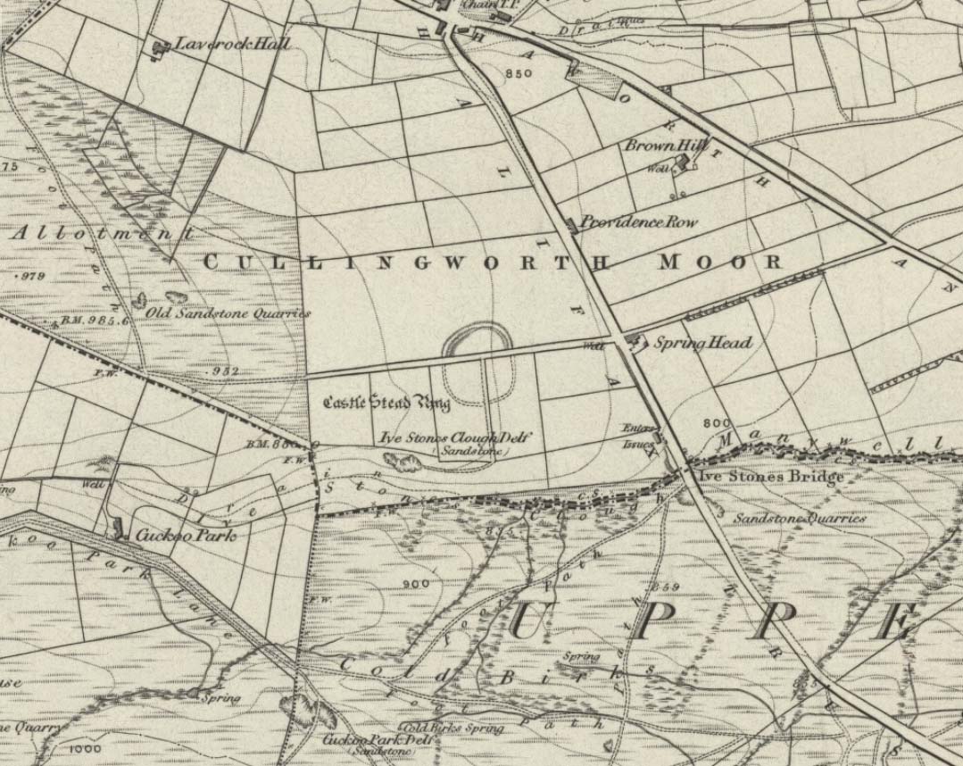
Just over a mile southeast of the site of (virtually) the same name — the Castlestead Ring — this here Castle Stead site had me thinking that both sites were one and the same (poor research on my behalf I’m afraid).  At the moment, the archaeological period of when this site was constructed remains unknown.  Thought by Forshaw (1908) to be “almost certainly a hitherto unknown Roman entrenchment,” the very slight remains left here could be Iron Age or Romano-British.  In his lengthy article on the remains that could be seen here more than 100 years ago, Mr Forshaw told us:

“Several fields hereabouts bear the name Castlestead and one of these contains the entrenchment, which almost coincides within its area… The reason for the selection of this site is clear, for on no side is it commanded by higher ground: whilst one face has a natural fortification of a rock scar  impassable at most points and easily accessible at none.  Here very little art would make the position impregnable in primitive warfare, and it is noticeable that the most suitable part of the verge has been selected, and almost the whole of the scar has been included.  It is, however, only right to state that stone has been quarried here within living memory and this may have altered the ground considerably, and may account for several features mentioned hereafter.

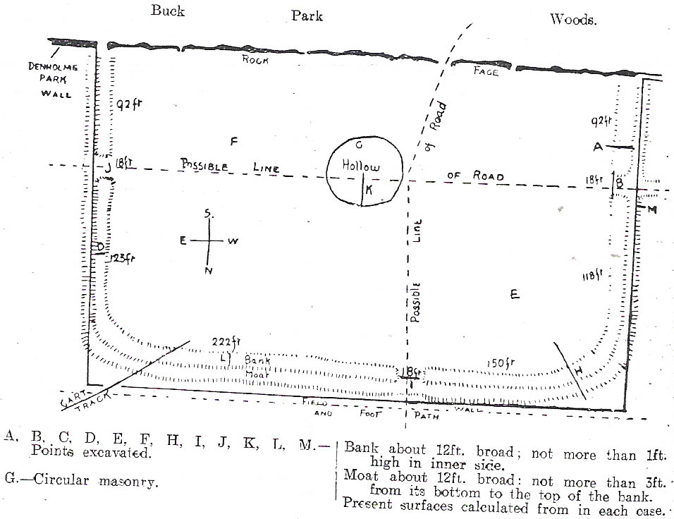
“The accompanying plan (above) will make the outline of the fortification clear, and from it one can readily recognise the usual Roman form.  The moat and bank, the quadrangular shape with rounded corners and the entrances on three sides (and possibly on the fourth also) are characteristic.  The unusual point is the selection of a natural fortification for one (the south) side.

“The question at once arises: was this a permanent stone fort?  Clearly not, for the bank has been cut across at four places (A, D, H & L) and not only was no stone found — beyond such odds and ends as may be seen in any field — but the deeper, undisturbed layers of silt showed no signs of a trench in which foundations might have stood.  It is noticeable that there are more stones on the crown of the bank than elsewhere.  This I take to be the remains of what was thrown up in the bank.  The field has been cultivated many years, so that the bank has been much reduced in height and the moat filled up.

“The original height of the bank is difficult to guess, but the moat was about three feet deeper than at present at the point H, and from the amount of soil removed we may imagine the bank about five feet higher than it is now, and solid at that; this makes a total outside slope of about 10 feet, a very formidable obstacle to surmount in the face of opposition, especially is strengthened by a stockade, such as was possibly present.The remains of the bank are capped with a layer of some six inches of bluish, silty clay.  This was evidently placed there deliberately, and is in accordance with Roman work as seen elsewhere (e.g., at Castleshaw, near Oldham).  There is also some slight evidence that, as at Castleshaw, the moat was once faced with irregular pieces of flat stone.  The moat was some 18 feet across at the top, six feet at the bottom and five feet deep.  The east and west sides were probably less strongly entrenched.  Certainly the moat was much less, for rock lies only just below the sod, halfway along the western side.  When the southern face is examined there are more signs of stonework, however, for where the rock is deficient the gap is filled with the remains of a dry wall which has some peculiar characteristics.  In places the lower part of this wall is formed of roughly-shaped oblong blocks of large size (one has a face of 57 x 17 inches), arranged in definite tiers.  This is not like an ordinary field fence, and differs even more from the ancient wall marked (probably erroneously) as Denholme Park Wall on the Ordnance map, which it continues: so it is conceivable that it may be Roman work.  There is now little or no sign of a bank along the rocks bounding the southern side of the camp, but it is probable that something once existed to give cover to the defenders, and we may well imagine a low dry wall continuous with the fragments just described: and it is rather noticeable that there are more squared stones in the walls of this field than in others in the neighbourhood.

“There are no traces of buildings within the lines so far as the present investigations go, nor signs of prolonged occupation at the site.  I have dug at the points indicated (on the map above) and came upon rock or disturbed silt in each case.  The circular shallow hollow in the centre seems natural.  It is to be remarked that the average depth of surface soil in this field is unusual, more than one foot in fact.”

Mr Forshaw then goes on to ask a series of questions, followed by his own particular answers and theory relating to the nature of these earthworks.  Hopefully you won’t mind if I cite his ideas in full, despite him thinking that the remains here are of Roman origin (remains of which I don’t really wanna include on TNA).  He continued:

“Was this camp on the course of a Roman road?  One can only say that no definite road exists at the entrances now, but there seems some ground for thinking that a surface was prepared…at the western entrance for two reasons:

1. Just to the north the rock is covered with made soil only; but in the entrance itself irregular stones are packed in a level, solid manner, giving a strong impression of artificiality.  At the southern verge of the entrance this layer ends abruptly in a line at right angles to the bank, and here it is based not on rock, but on natural silt.

2. A slight hollow runs straight westward from it for some twenty yards through the next field. This may represent a destroyed road.”

Mr Forshaw then makes a few attempts to justify this idea, including notices of footpaths and linear features near the site, aswell as citing earlier historical sources that describe Roman roads — but the ones cited are some considerable distance from this site.  In summing up, he notes how no Roman finds were made here — nor indeed any finds from earlier periods — but he opted for the site being a temporary Roman outpost.  The more recent opinions of this place are that it was of late Iron Age or Romano-British origin.

References:

  1. Cudworth, William, Round about Bradford, Thomas Brear: Bradford 1876.
  2. Forshaw, C.F., ‘Castlestead, near Cullingworth,’ in Yorkshire Notes and Queries – volume 4, H.C. Derwent: Bradford 1908.
  3. Hindley, Reg, Oxenhope: The Making of a Pennine Community, Amadeus: Cleckheaton 2004.
  4. James, John, The History and Topography of Bradford, Longmans: London 1876.
  5. Keighley, J.J., ‘The Prehistoric Period,’ in Faull & Moorhouse’s, West Yorkshire: An Archaeological Survey to AD 1500 – volume 1, WYMCC: Wakefield 1981.
  6. Varley, Raymond, “The Excavation of Castle Stead at Manywells Height, near Cullingworth, West Yorkshire,” in Transactions of the Hunter Archaeological Society, volume 19, 1997.

© Paul Bennett, The Northern Antiquarian 


Harden Moor Cairnfield, Bingley, West Yorkshire

Cairns:  OS Grid Reference – SE 0757 3869

Getting Here

Overgrown cairn, looking north

Follow the same directions to reach the Harden Moor circle.  From here, walk down the footpath at its side down the slope for 100 yards and take the first little footpath on your left for 25 yards, then left again for 25 yards, watching for a small footpath on your right.  Walk on here for another 100 yards or so, keeping your eyes peeled for the image in the photo just off-path on your left, almost overgrown with heather. 

Archaeology & History

This is just one of several cairns in and around this area (I’ll probably add more and give ’em their own titles and profiles as time goes by), but it’s in a pretty good state of preservation.  Nothing specific has previously been written about it, though it seems to have been recorded and given the National Monument number of 31489, with the comment “Cairn 330m north of Woodhead, Harden Moor.” (anyone able to confirm or correct this for me?)

It’s a good, seemingly undisturbed tomb, very overgrown on its north and eastern sides.  Three pretty large upright stones, a couple of feet high, remain in position with an infill of smaller stones and overgrowth (apart from removing a little vegetation from the edges to see it clearer, we didn’t try disturbing it when we found it).  It gives the impression of being a tomb for just one, perhaps two people and is more structured than the simple pile-of-stone cairns on the moors north of here above Ilkley and Bingley.  Indeed, the upright stones initially gave the impression of it once being a small cromlech of sorts!  Other cairns exist close by, but until we get heather-burning done up here, they’re difficult to find – or at least get any decent images of them!

© Paul Bennett, The Northern Antiquarian


Castlestead Ring, Cullingworth, West Yorkshire

Earthworks:  OS Grid References – SE 0514 3627

Also Known as:

  1. Blood Dykes

Getting Here

The complete Castlestead Ring on 1852 map

Dead easy this one!  On the Keighley-Halifax A629 road, about 500 yards south past Flappit Spring (public house), there’s a small road to your right.  Walk on here for 200 yards and look in the field to your right.  If the grass is long you might struggle to see it, but gerrin the field and it runs right up against the wall.  Y’ can’t miss it really!  You can park up a coupla hundred yards down the A629 main road, by the old quarry, and walk back to get here.

Archaeology & History

Although I’ve earlier described this as “nowt much to look at,” the more I come here, the more I like the place (sad aren’t !!?).  The hard-core  archaeology folks amidst you should like it aswell.  Not to be confused with the site of the same name a mile to the south of here, this large earthwork was shown on the 1852 OS-map as a complete ring, which is also confirmed in old folklore; and a survey done by Bradford University in the late 1970s indicated a complete circle was once in evidence.  To view this for yourself: if you type the OS grid-reference into Google maps, you’ll see from the aerial image that a complete ring was indeed here at sometime in the not-too-distant past.

Bend in the ditch on northern side of the ring
Harry Speight’s 1898 drawing

Today however – indeed, since William Keighley described it 1858 – there’s only a shallow, semi-circular ditch to be seen in the fields.  But despite this, its remains have brought it to the literary attention of about a dozen writers – though we still don’t know exactly what it was!  The best conjecture is by the archaeologist Bernard Barnes (1982), who thinks it best to describe as a enclosure or earthwork dating from the Bronze Age.  Eighty feet across and covering more than 1.5 acres, an excavation of the site in 1911 found nothing to explain its status.

One of the first descriptions of this site comes from the pen of the industrial Bradford historian, John James in 1876 (though Hearne, Leland and Richardson describe it in brief much earlier). Talking of the sparsity of prehistoric remains in the region (ancient history wasn’t his forte!), he said, “I know of no British remains in the parish that are not equivocal, unless a small earth-work lying to the westward of Cullingworth may be considered of that class.”

Indeed it is! He continued:

“It is situated on a gentle slope, about two hundred yards from a place called Flappit Springs, on the right-hand side of the road leading thence to Halifax. The form has been circular. (my italics) The greater part of it to the south has been destroyed by the plough. I took several measurements of that part which remains, but have mislaid the memoranda I then made; I however estimate the diameter to have been about 50 yards. The ditch to the westward is very perfect. It is about two yards deep and three wide; with the earth thrown up in the form of a rampart on the inner side. The remain is less perfect to the eastward.”

James then speculates on the nature of the site, thinking it to be “one of a line of forts erected by the Brigantes…to prevent the inroads of the Sistuntii.” Intriguing idea!

A few years later when William Cudworth (1876) visited the site, he described:

“At present there only remains about one-fourth part of a circle representing the appearance of a considerable earthwork or rampart. The remainder has been cut away by the construction of the road leading to the allotments.”

Echoing Mr James’ sentiments, Cudworth also suggested “it may have been an enclosure to guard their cattle, while in summer they grazed on the vast slope on which it stands.”  Y’ never know…

NW section showing bank and ditch
Exposed stonework of inner embankment

A visit to the place on October 21 2007, found not only a profusion of mushrooms scattering the field (varying species of Amanita, Lycoperdon, Panaeolina, Psilocybes, etc), and the remnants of two old stone buildings 20 yards of the NE side, but a distinctive ‘entrance’ on the northern side of the ring, which gave the slight impression of it being a possible henge monument. It’s certainly big enough! All traces of the southern-side of the ring however, have been ploughed out.

The views from here are quite excellent, nearly all the way round. You’re knocking-on a 1000 feet above sea level and the high hills of Baildon, Ilkley, Ogden Moor and the Oxenhope windmills are your mark-points. There’s one odd thing to think about aswell: if this is a prehistoric site, it’s pretty much an isolated one according to the archaeo-catalogue – and as we know only too well, that aint the rule of things. We’ve got adjacent moorlands south and west of here, very close by. Likelihood is, there’s undiscovered stuff to be foraged for hereabouts…

Folklore

An old folk-name given to this ring is the Blood Dykes, which is supposed to relate to the place being the site of a great battle.

References:

  1. Barnes, Bernard, Man and the Changing Landscape, Eaton: Merseyside 1982.
  2. Bennett, Paul, The Old Stones of Elmet, Capall Bann: Milverton 2001.
  3. Cudworth, William, Round about Bradford, Thomas Brear: Bradford 1876.
  4. Elgee, Frank & Harriett, The Archaeology of Yorkshire, Methuen: London 1933.
  5. Forshaw, C.F., ‘Castlestead, near Cullingworth,’ in Yorkshire Notes and Queries – volume 4, H.C. Derwent: Bradford 1908.
  6. James, John, The History and Topography of Bradford, Longmans: London 1876.
  7. Keighley, J.J., ‘The Prehistoric Period,’ in Faull & Moorhouse’s, West Yorkshire: An Archaeological Survey to AD 1500 – volume 1, WYMCC: Wakefield 1981.
  8. Keighley, William, Keighley, Past and Present, Arthur Hall: Keighley 1858.
  9. Speight, Harry, Chronicles and Stories of Bingley and District, Elliott Stock: London 1898.

© Paul Bennett, The Northern Antiquarian


Harden Moor Stone Row, Bingley, West Yorkshire

Standing Stones (lost):  OS Grid Reference – SE 07 38

Getting Here

This site hasn’t been located. However, if it hasn’t been destroyed by the quarrying on the SW side of the moor, remains of it should still be found amidst the heather and would be a good discovery for any enthusiast.

Archaeology & History

The first notes I found about this place were those by archaeologist Sydney Jackson in 1956, who wrote:

“It would be interesting to know what Dr Richard Richardson, of Bierley Hall, Bradford meant when, writing about 1709, he said that Mr Benjamin Ferrand show him a ‘skirt of stones’ on Harden Moor, near to a row of stones placed in a line nigh two hundred paces in length some two feet above the heath, others hidden beneath it.” (my italics)

The undoubted man-made nature of this row of stones was emphasized by Dr Richardson when he wrote,

“That these stones were placed here by design, no person can doubt; but for what I end cannot conjecture, having never seen anything of this kind before.”

The great Yorkshire historian Harry Speight (1898) also came across the same antiquarian notes many years before and speculated how,

“it may be inferred from this that it had been a double row of stones, like the avenue of Maiden Castle in Swaledale.”

The ‘skirt of stones’ that were described here may be the well-preserved Harden Moor Circle.  However in recently finding the short essay of Peter Craik (1907) of Keighley, this idea may need re-assessing, as Craik clearly shows in his survey of the the nearby Catstones Ring earthwork, what he described as the “remains of a cairn” on the northern edge of that ring, giving us a different location for this lost stone row.

However, another potential position for our lost stone row that needs exploring is the one described by Butler Wood following an exploratory visit here with the Bradford historian, William E. Preston, at the beginning of the 20th century.  Mr Wood (1905) told of them both coming across some sort of earth-and-stone line “half-a-mile north of” the Catstones Ring, telling:

“Mr W.E. Preston and myself traced a short time ago on Harden Moor, remains of an entrenchment for a distance of 80 or 90 yards.  It faces south, and lies near Spring Head Heights.  The wall consisting of boulder and earth rising three feet above the soil, but there is no trace of a ditch.”

This is obviously half the length described by Richardson and Ferrand in 1709, but nearly two centuries separate the two accounts (the position of Mr Woods’ line is roughly SE 072 387; whilst that nearer to the Catstones Ring would be nearer SE 069 383).

I’ve searched the tops of this moorland a number of times hoping to locate this seemingly important megalithic stone row, obviously without success.  Further searches on the moor are needed after the heather’s been burnt back.

References:

  1. Craik, Peter, “Catstones Ring,” in C.F. Forshaw’s Yorkshire Notes & Queries, volume 3 (H.C. Derwent: Bradford 1907).
  2. Jackson, Sidney, “Harden Circle Found,” in Cartwright Hall Archaeology Group Bulletin, 2:1, July 1956.
  3. Speight, Harry, Chronicles and Stories of Old Bingley, Elliott Stock: London 1898.
  4. Wood, Butler, ‘Prehistoric Antiquities of the Bradford District,’ in Bradford Antiquary, volume 2, 1905.

© Paul Bennett, The Northern Antiquarian


Harden Moor Circle, Bingley, West Yorkshire

Ring Cairn:  OS Grid Reference – SE 07496 38675

Getting Here

Harden Moor circle01
Harden Moor Circle, looking SE

From Harden, go up Moor Edge High Side (terraced row) till you reach the top. Follow the path thru’ the woods on the left side of the stream till you bend back on yourself and go uphill till you reach the moor edge. Keep walking for about 500 yards and keep an eye out to your immediate left.  The other route is from the Guide Inn pub: cross the road and go up the dirt-track on the moor-edge till you reach a crossing of the tracks where a footpath takes you straight onto the moor (south). Walk on here, heading to the highest point where the path eventually drops down the slope, SE. As you drop down, watch out for the birch tree, cos the circle’s to be found shortly after that, on your right, hidden in the heather!

Archaeology & History

This aint a bad little site hidden away on the small remains of Harden Moor, but is more of a ‘ring cairn’ than an authentic stone circle (a designation given it by previous archaeologists).  An early description of it was by Bradford historian Butler Wood (1905), who also mentioned there being the remains of around 20 small burials nearby.  When the great Sidney Jackson (1956; 1959) and his team of devoted Bradford amateurs got round to excavating here, he found “four or five Bronze Age urns” associated with the circle.  His measurements of the site found it to be 24 feet across, and although the stones are buried into the peat with none of them reaching higher than 3 feet tall, it’s a quietly impressive little monument this one.  About 20 upright stones make up the main part of the ring.

I’ve visited the place often over the last year or so since a section of the heather has been burnt away on the southern edges of the circle.  This has made visible a very distinct surrounding raised embankment of packing stones about a yard wide and nearly two-feet high, particularly on the southern and eastern sides of the circle, giving the site a notable similarity in appearance and structure to the Roms Law circle (or Grubstones Ring) on Ilkley Moor a few miles to the north.

There is also the possibility that this ring of stones was the site described by local historian William Keighley (1858) in his brief outline of the antiquities of the region, where he wrote:

“On Harden Moor, about two miles south of Keighley, we meet with an interesting plot of ground where was to be seen in the early days of many aged persons yet living, a cairn or ‘skirt of stones,’* which appears to have given name to the place, now designated Cat or Scat-stones. This was no doubt the grave of some noted but long-forgotten warrior.

* The Cairn was called Skirtstones by the country people in allusion to the custom of carrying a stone in the skirt to add to the Cairn.”

However, a site called the ‘Cat stones’ is to be found on the nearby hill about 500 yards southeast – and this mention of a cairn could be the same one which a Mr Peter Craik (1907) of Keighley mentioned in his brief survey of the said Catstones Ring at the turn of the 20th century.  We just can’t be sure at the moment.  There are still a number of lost sites, inaccuracies and questions relating to the prehistoric archaeology of Harden Moor (as the case of the megalithic Harden Moor Stone Row illustrates).

Section of the inner ring

The general lack of an accurate archaeological survey of this region is best exemplified by the archaeologist J.J. Keighley’s (1981) remark relating specifically to the Harden Moor Circle, when he erroneously told that, “there are now no remains of the stone circle on this site” — oh wot an indicator that he spent too much time with paperwork!  For, as we can see, albeit hidden somewhat by an excessive growth of heather, the ring is in quite good condition.

It would be good to have a more up-to-date set of excavations and investigations here.  In the event that much of the heather covering this small moorland is burnt back, more accurate evaluations could be forthcoming. But until then…..

References:

  1. Bennett, Paul, The Old Stones of Elmet, Capall Bann: Milverton 2001.
  2. Craik, Peter, “Catstones Ring,” in C.F. Forshaw’s Yorkshire Notes & Queries, volume 3 (H.C. Derwent: Bradford 1907).
  3. Faull, M.L & Moorhouse, S.A. (eds.), West Yorkshire: An Archaeological Survey to AD 1500 – volume 1, WYMCC: Wakefield 1981.
  4. Jackson, Sidney, “Harden Moor Circle,” in Cartwright Hall Archaeology Group Bulletin, 1:18, June 1956.
  5. Jackson, Sidney, “Harden Circle Found,” in Cartwright Hall Archaeology Group Bulletin, 2:1, July 1956.
  6. Jackson, Sidney, “Bronze Age Urn found on Harden Moor,” in Cartwright Hall Archaeology Group Bulletin, no.7, 1959.
  7. Keighley, J.J., “The Prehistoric Period,” in Faull & Moorhouse, WYMCC: Wakefield 1981.
  8. Keighley, William, Keighley Past and Present, Arthur Hall: London 1858.
  9. Wood, Butler, ‘Prehistoric Antiquities of the Bradford District,’ in Bradford Antiquary, volume 2, 1905.

© Paul Bennett, The Northern Antiquarian


Armshaw Lowe, Oxenhope, West Yorkshire

Tumulus?:  OS Grid Reference – SE 04422 35130

Getting Here

Armshaw Lowe on 1852 map

Go along the B6141 from Denholme to Oxenhope, turning right just by the bend which drops into Oxenhope, and head along the small road to Upwood Park camping site. Just before here is the Grange Park Animal sanctuary.  Ask there to walk onto the field behind, where you’ll see a rise in the land, as you can see on the rather poor photo I took from the east-side.

Archaeology & History

Although ascribed on early OS-maps as a tumulus (and still shown as an antiquity on the modern ones), this site appears to be simply the end-point along a geological ridge, starting a few hundred yards east of here, consisting of an upsurge of rocks covered in earth and nothing more. A survey of the place done by Bellamy in 1970 (Yorkshire Archaeological Journal, 42:6, 1970) seems to indicate the same. To those who want to test the theory, start by exploring it from Cullingworth Moor and walk along the ridge itself. It seems pretty clear.

Armshaw Lowe - looking west
Armshaw Lowe – the small mound in centre of photo

The “antiquarian” element to the site seems to originate in its positioning in the landscape. Armshaw Lowe is on the topmost point of the hills hereabouts, with 360-degree views all round, commanding excellent sights all round. But it’s perhaps the word ‘lowe’ that might be the important bit here, as in old english it can mean an old moot or meeting spot — which it may well have been for local tribes.  It is may be this element that gives Armshaw Lowe its lingering antiquarian status.

Check it out for yourselves and see what y’ think. I went up here to see an old burial mound, but found only a decent geological feature atop of local hills. But me ‘n’ the archaeologists might be wrong…

References:

  1. Gomme, G.L., Primitive Folk-Moots; or Open-Air Assemblies in Britain, Sampson Low: London 1880.

© Paul Bennett, The Northern Antiquarian