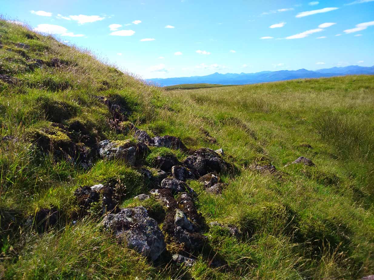
This long-lost holy well was located on the southeast side of the town. It was highlighted on the first OS-map in 1849, but its waters were disrupted shortly after this. Daniel Conway (1882) told that,
“It flowed where there was a quarry used for the harbour works. The writer of this notice heard from two men, John Mulholland and Owen Graham, dwelling at Portpatrick in 1860, that they had seen on the rock beside the well what tradition said was the impression of the knees and left hand of St. Patrick.”
When the holy wells writer E.M.H. M’Kerlie (1916) came to visit this site, it was “no longer to be seen.” He wrote:
“The water which issued from a rock on the south side of the village is now diverted by means of pipes into another course.”
Royal Commission Ancient & Historical Monuments of Scotland,Inventory of Monuments and Constructions in Galloway – County of Wigtown, HMSO: Edinburgh 1912.
Walker, J. Russel, “‘Holy Wells’ in Scotland,” in Proceedings of the Society of Antiquaries of Scotland, vol.17 (New Series, volume 5), 1883.
Cup-Marked Stone (destroyed): OS Grid Reference – NX 0010 5411
Archaeology & History
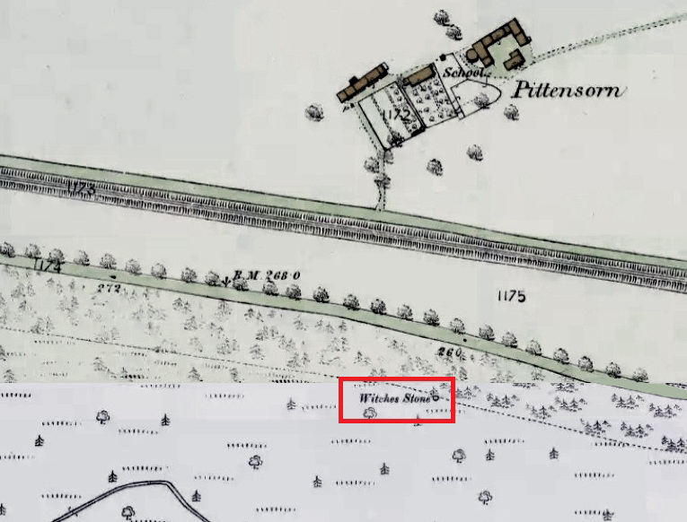
Very little is known about this long-lost carving, whose primary information comes from the folklore records. Apparently it was found on a rock a short distance south of the destroyed St. Patrick’s Well and the two sites seem to have had a traditional relationship with each other. The carving had a foot-shaped motif on the rock, and a number of other cup-markings; but I can find no account as to whether the ‘foot’ carving possessed ‘toes’, as seen on the impressive Cochno Stone, north of Glasgow. It may have been little more that the petroglyphic ‘feet’ seen on the recently discovered and aptly-named Footprint Stone, or those on the newly rediscovered Witches Stone; but we cannot discount it being larger, like the Footprint Stone of Dunadd. If we could locate an early sketch of the stone, all would be revealed! Sadly, as E.M.H. M’Kerlie (1916) told us,
“this rock was blasted at the time when the government essayed to make the harbour one of great importance”,
several years after the nearby holy well had been re-routed. Fucking idiots! Any further info on this site would be most welcome.
Folklore
The local story that was told about St. Patrick creating these carvings seems to have been described first of all by Andrew Agnew (1864), who wrote:
“Once, when about to revisit his native land, he crossed the Channel at a stride, leaving the mark of his foot distinctly impressed on one of the rocks of the harbour; unfortunately, in making a new jetty, this interesting memento was destroyed.”
(The mention of the jetty would seem to imply that the carving was closer to the sea than the grid-reference cited above.) In another tale, St. Patrick rested his hand onto the same rock and the marks of his hand and fingers were left there. This folklore motif is found across the world. It relates to cosmological creation myths of indigenous spirits and deities in the tribes and cultures who narrate it. In this instance, the myth of St Patrick replaced a much earlier mythic tale of another giant or deity, whose name we have lost. Unless, of course, such petroglyphs were still being carved in Galloway by local people in the 4th-5th centuries.
A further tale of St Patrick, at Portpatrick, replaced a quite obvious shamanistic tale. When he journeyed back from Ireland to Galloway, Agnew again told us:
“Having preached to an assembly on the borders of Ayrshire, the barbarous people seized him, and, amidst shouts of savage glee, struck his head from his body in Glenapp. The good man submitted meekly to the operation; but no sooner was it over than he picked up his own head, and, passing through the crowd, walked back to Portpatrick, but finding no boat ready to sail he boldly breasted the waves and swam across to the opposite shore, where he safely arrived (according to the unanimous testimony of Irishmen innumerable), holding his head between his teeth!”
Legends such this are found in shamanistic pantheons worldwide. Shamans primary renown is their ability to travel and recover from the Lands of the Dead, always journeying into impossible and inhospitable arenas, with tales of being dismembered, beheaded, dying, and returning to life to help the tribe with whatever it was that required such a task (usually a healing function). This story of St Patrick – and many other saints – are mere glosses onto the earlier animistic stories, then abridged as being better, more spiritually mature, more egocentric. But their roots are essentially animistic.
Royal Commission Ancient & Historical Monuments of Scotland,Inventory of Monuments and Constructions in Galloway – County of Wigtown, HMSO: Edinburgh 1912.
Walker, J. Russel, “‘Holy Wells’ in Scotland,” in Proceedings of the Society of Antiquaries of Scotland, vol.17 (New Series, volume 5), 1883.
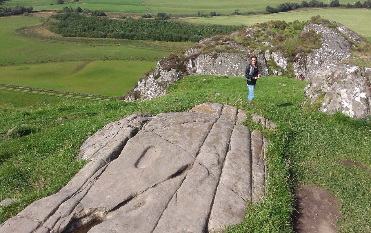
From Lochgilphead, take the A816 road north for several miles (towards the megalithic paradise of Kilmartin), keeping your eyes peeled for the road-signs saying “Dunadd.” Turn left and park-up a few hundred yards down. Go through the gate and walk up Dunadd. Just before the flattened plateau at the top, a length of smooth stone is accompanied to its side by the deep cup-and-ring of the Dunadd Basin. Three or four yards away, you’ll see the long ‘footprint’.
Archaeology & History
Near the top of Dunadd’s Iron Age ‘fortress’ and overlooking the megalithic paradise of the Kilmartin valley, several man-made carvings are in evidence very close to each other, all with seemingly differing mythic content. This one—the footprint—stands out; but it’s not alone! Faint etchings of at least one other ‘foot’ is clearly visible. The first literary account of it was by Ardrishaig historian R.J. Mapleton (1860), who told,
“There is on the top of Dunadd a mark that strikes me as interesting; it is like a large axe-head, or a rough outline of a foot. My impression is that it may have been the spot on which the chief would place his foot when succeeding to the headship of his tribe. The footmark was always considered among the people here as a mould for an axe-head, and I was rather laughed at for suggesting an inaugurating stone.”
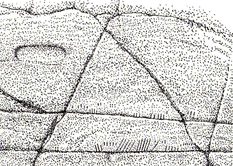
Dunadd Footprint (after Royal Commission 1988)F.W.K. Thomas’ 1879 sketch
Be that as it may, a few years later the carving had caught the attention of the Scottish Society of Antiquaries. In his article exploring the potential for ritual inaugurations at Dunadd, Captain F.W.L. Thomas (1879) explored, not only the footprint, but the mythic functions of this symbol, looking at parallels with petroglyphs elsewhere in the world where the ‘foot’ was known to be a ritual inauguration symbol (amongst other things). He gave us the first real detailed account of the carving:
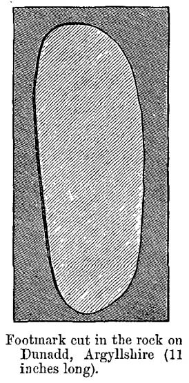
“About 10 or 12 feet below, and to the northward of the highest point, the living rock is smooth, flat and bear of sward, and in it is engraved an impression of a footmark, not of a naked foot, but such as would be made when the foot is clothed by a thick stocking or cuaran… The engravure is for the right foot; and it exactly fitted my right boot. The footmark is sunk half-an-inch deep, with perpendicular sides, the surface is smoothed or polished, and the outline is regular… It has probably been sheltered by the turf until recently. The footmark is 11 inches long, nearly 4½ inches broad where broadest, and 3½ inches across at the heel. When a person stands with his foot in the depression, he looks a little easterly of north.”
A century or so later when the Royal Commission (1988) boys got here, they found not one, but two ‘feet’ carved into the rock! A few feet away, near to the carved boar,
“At the south end of the main rock surface there is the lightly-pecked outline of a shod right foot. 0.24m long and 0.1m in maximum width, with a pronounced taper to the heel. There are further peck marks within the outline, and a sunken footmark was intended but not completed. This print is on almost the same alignment as the more prominent footprint some 2m to the north, which measures 0.27m from NNE to SSW, by 0.1m in maximum width and 25mm in depth. It is somewhat broader at the heel than the incomplete mark, and its sides are straighter.”
Close-up of the carving
They then emphasize how we’re unable to date the footprints, although point out how such carvings are “found in Britain from the Iron Age onwards.” But footprints have be found on other petroglyphs in Scotland (much less in England) and date between the neolithic and Bronze Age periods—but whether Dunadd’s example goes that far back, we cannot say. Extensive excavations occurred at Dunadd between 1980-81 and most of the finds were Iron Age and early medieval in nature (this carving and the cup-and-ring barely got a mention in Lane & Campbell’s [2000] extensive summation). But we may be looking at an evolutionary developmental relationship in symbolism and form, if the traditions of the place have any substance. This is something I’ll return to when writing of the Boar Carving, just a few feet away…
Folklore
The legends behind this seemingly insignificant mark near the top of Dunadd ostensibly echo and relate to the huge cup-and-ring of Dunadd Basin four yards away. I can only repeat what I said in that site profile.
R.J. Mapleton (1860) said that Dunadd was known by local people to be a meeting place of witches and the hill of the fairies, whose amblings in this wondrous landscape are legion. Legends and history intermingle upon and around Dunadd. Separating one from the other can be troublesome as Irish and Scottish Kings, their families and the druids were here. One such character was the ever-present Ossian. Mapleton told:
“From these ancient tales we turn to a much later period of romance, when Finn and his companions had developed into extraordinary and magical proportions; a story is current that when Ossian abode at Dunadd, he was on a day hunting by Lochfyneside; a stag, which his dogs had brought to bay, charged him; Ossian turned and fled. On coming to the hill above Kilmichael village, he leapt clean across the valley to the top of Rudal hill, and a second spring brought him to the top of Dunadd. But on landing on Dunadd he fell on his knee, and stretched out his hands to prevent himself from falling backwards. ‘The mark of a right foot is still pointed out on Rudal hill, and that of the left is quite visible on Dunadd, with impressions of the knee and fingers.’”
As Mr Thomas (1879) clarified:
“The footmark is that of the right foot, and the adjacent rock-basin is the fabulous impression of a knee.”
References:
Bord, Janet, Footprints in Stone, Heart of Albion Press 2004.
Campbell, Marion, Mid-Argyll: An Archaeological Guide, Dolphin Press: Glenrothes 1984.
Campbell, M. & Sanderman, M., “Mid-Argyll: An Archaeological Survey,” in Proceedings of the Society Antiquaries, Scotland, volume 95, 1962.
Craw, J.H. “Excavations at Dunadd and other Sites,” in Proceedings of the Society Antiquaries, Scotland, volume 64, 1930.
Lane, Alan & Campbell, Ewan, Dunadd: An Early Dalriadic Capital, Oxbow: Oxford 2000.
Mapleton, R.J., Handbook for Ardrishaig Crinan Loch Awe and Pass of Brandir, n.p. 1860.
Morris, Ronald W.B., The Prehistoric Rock Art of Argyll, Dolphin Press: Poole 1977.
Royal Commission on the Ancient & Historical Monuments of Scotland, Argyll – Volume 6: Mid-Argyll and Cowal, HMSO: Edinburgh 1988.
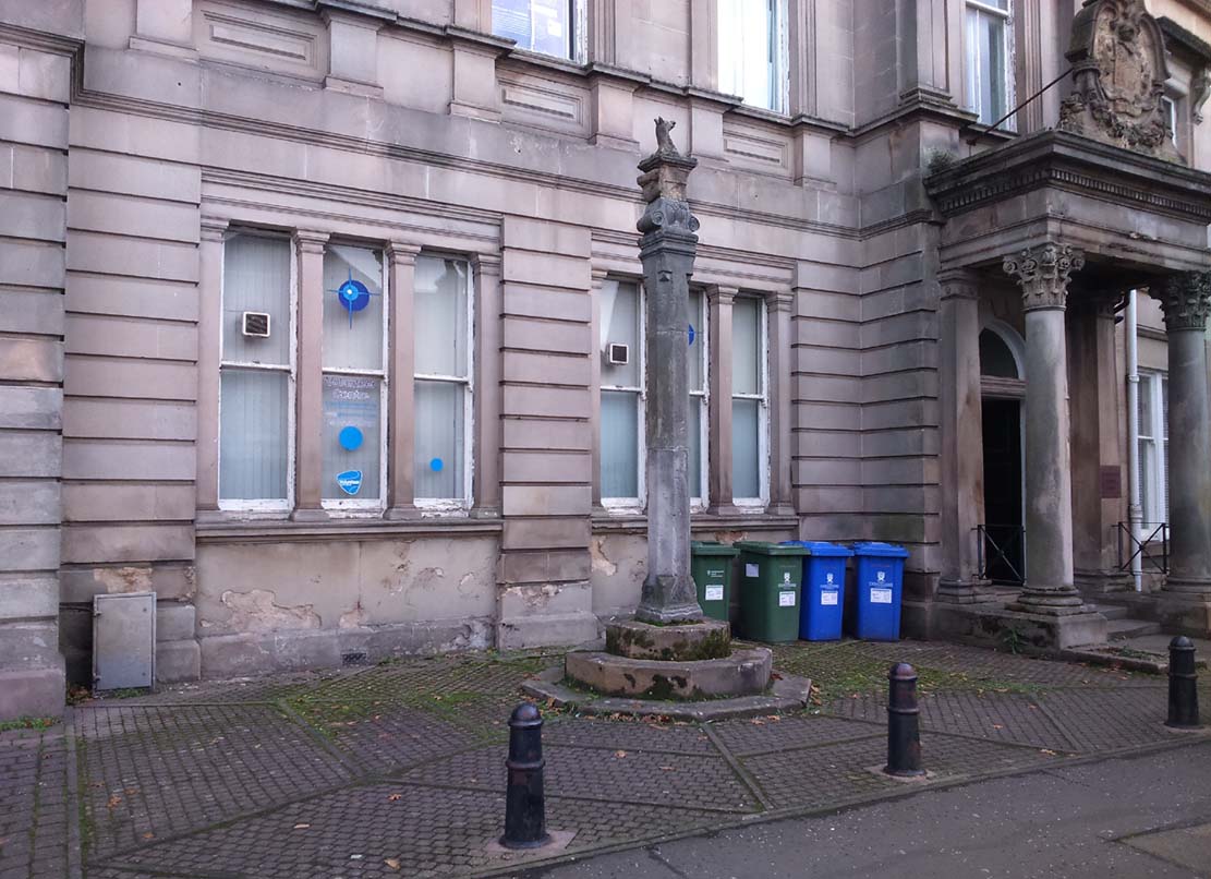
Get into the small town of Alloa, where the buses stand at Shillinghill. From here walk southwest down Mill Street, which runs into Bank Street. Keep your eyes peeled on your right-hand side, where outside one of the old municipal buildings you’ll see it standing upright.
Archaeology & History
Although now standing against the old buildings halfway down Bank Street, Alloa’s Mercat or Burgh Cross was initially set up at the crossroads 162 yards (148m) away, where Mar Street meets Mill Street and Bank Street. It was moved to its present position sometime in the 1880s and knowledge of its early history is scant.
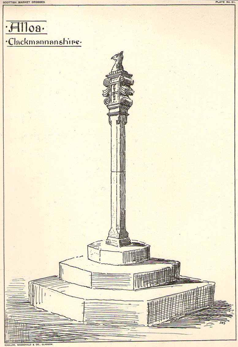
Standing some ten feet high, the monument was described in John Small’s (1900) rare magnum opus, in which he detailed the architectural features of the monument, telling us that,
John Small’s sketch
“The shaft, which rests on a base and three steps, is of the usual square section, with splayed angles, stoped at top and bottom, the top stop being rather peculiar.
The head of the Cross is composed of an oblong stone set upright, characteristic of the late type seen in Keikleour and Kinrossie. The oblong is ornamented at the sides with debased volutes and acanthus leaves, the whole crowned by a wreath from which rises a griffin’s head, part of the supporters of the Arms of the Lords of the Manor, Lord Mar and Kellie.”
References:
Anonymous, The Alloa Illustrated Family Almanac, MacGregor & Steedman: Alloa 1887.
Mair, Craig, Mercat Cross and Tolbooth, John Donald: Edinburgh 1988.
Royal Commission on the Ancient & Historical Monuments, Scotland, Inventory of Monuments and Constructions in the Counties of Fife, Kinross and Clackmannan, HMSO: Edinburgh 1933.
Small, John W., Scottish Market Crosses, Eneas Mackay: Stirling 1900.
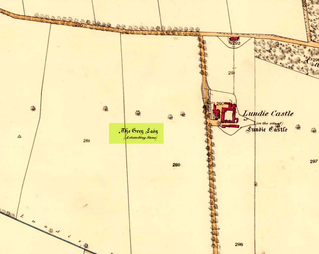
The site of the stone is on the top of a ridge due west of Lundie Castle and is best approached from the minor road between Lundie and Denhead, but at the time of my site visit a steel gate had been erected across the field just before the site of the stone together with a large festoon of electric fencing, which I did not cross.
Archaeology & History
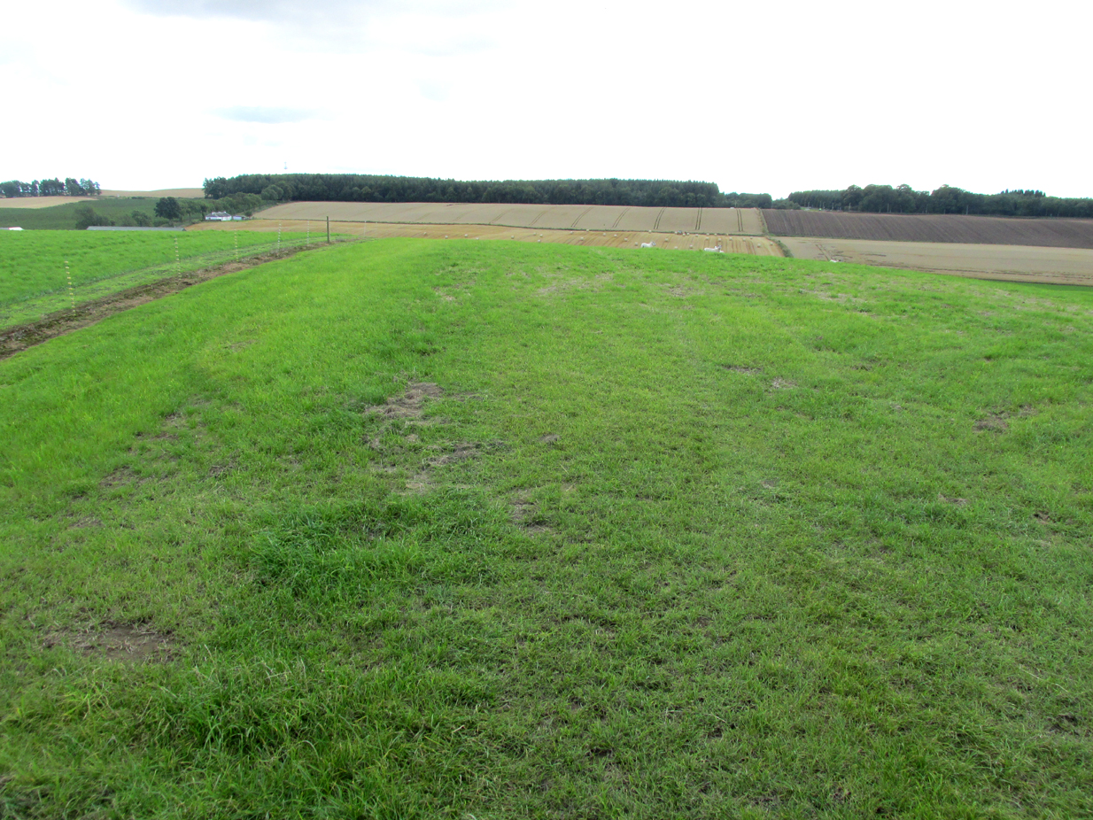
The Grey Lady stood on the near grassy horizon
The Ordnance Survey name book describes the stone, the informants being Mr. Pattullo junior and Mr. Bett of Pitermo:
“This name is applied to a Standing Stone a little to the west of Lundie Castle. It is about 4 feet high, between two & three broad & rather a Kidney Shape. …Some think of druidical origin, but young Pattullo intends to blast it shortly“.
The rough grass probably marks where she stood.
And indeed it seems the feckless youth did have his wicked way with The Grey Lady, who had been a landmark for millennia, for she sadly no longer exists. In view of the folklore attaching to the stone, it may be worth speculating whether the kidney shape denoted a lunar symbolism for the stone.
Folklore
The OS name book states:
“The ladies of Lundie Castle have romance connected with it – that a white lady is to be seen walking round it on a certain night of every new moon.”
Reference:
Ordnance Survey Name Book; Forfarshire (Angus) volume 66 (1857-61)
Park up at Murthly village, follow the farm road west, opposite the Kinclaven junction up to the cross roads, and turn right and go past Douglasfield Farm, following the road as it bends to the left; then through the metal gates and walk on until you come to an earth bridge over the ditch to your left. Cross the bridge and the low-lying Witches Stone is about 30 yards on to your left by the drainage ditch.
Archaeology & History
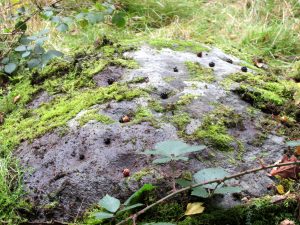
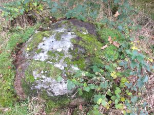
Not recorded on the Canmore online database, the Witches Stone is a low-lying, domed, earthfast rock bearing at least 12 cup marks. One cup mark has been drilled at some time in the past. Did the land owner do this as a preliminary to blowing it up with gunpowder? There is an interesting story relating to the origin of the cup marks, and it seems the name of the rock and its folklore may point to its ritual significance having passed down through oral tradition from the Bronze Age to historical times.
Folklore
The mid-nineteenth century Ordnance Survey Name Book has the following record, attested by Sir W.D. Stewart, Mr. T. Cameron & Mr. J. Cameron:-
Close-up of cupsBlackberries in cupmarks
“A small rock nearly level with the ordinary ground surface, underneath which it is traditionally held that a large sum of money is buried. In order to test the truth of this tradition, it is said that some years ago a man commenced to excavate the soil around the rock in order, if possible, to secure the hidden treasure, while so employed, a small dog suddenly appeared on the top of the rock and desired the man to desist, assuring him at the same time that the reputed treasure was really there, but it was never intended that the eye of mortal should behold it. There are some marks on the rock which the superstitious tell you are the prints of this very sagacious dog’s paws.”
Along the A81 road from Port of Menteith to Aberfoyle, watch out for the small road in the trees running at an angle sharply uphill, nearly opposite Portend, up to Coldon and higher. Keep going, bearing right past Mondowie and stopping at the dirt-track 100 yards or so further up on the left. Walk up this dirt-track for ⅔ mile, and just before reaching the planted forestry, turn right along another dirt-track. Less than 200 yards along there’s a large sycamore tree, and about 20 yards below it (south) are several open flat rock surfaces. This is the most westerly of them.
Archaeology & History
…and again
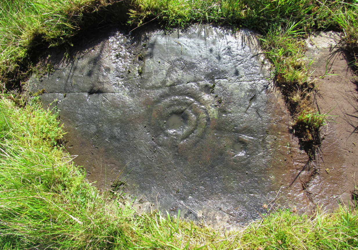
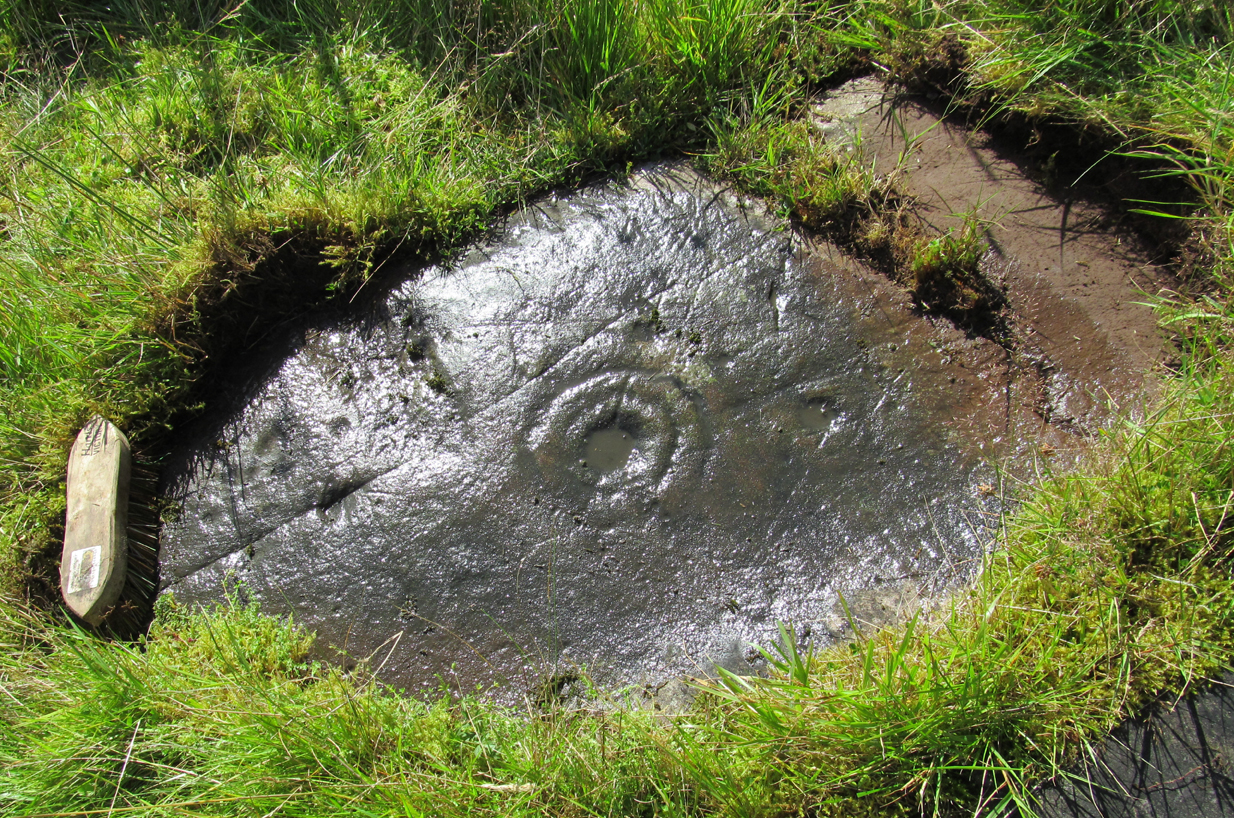
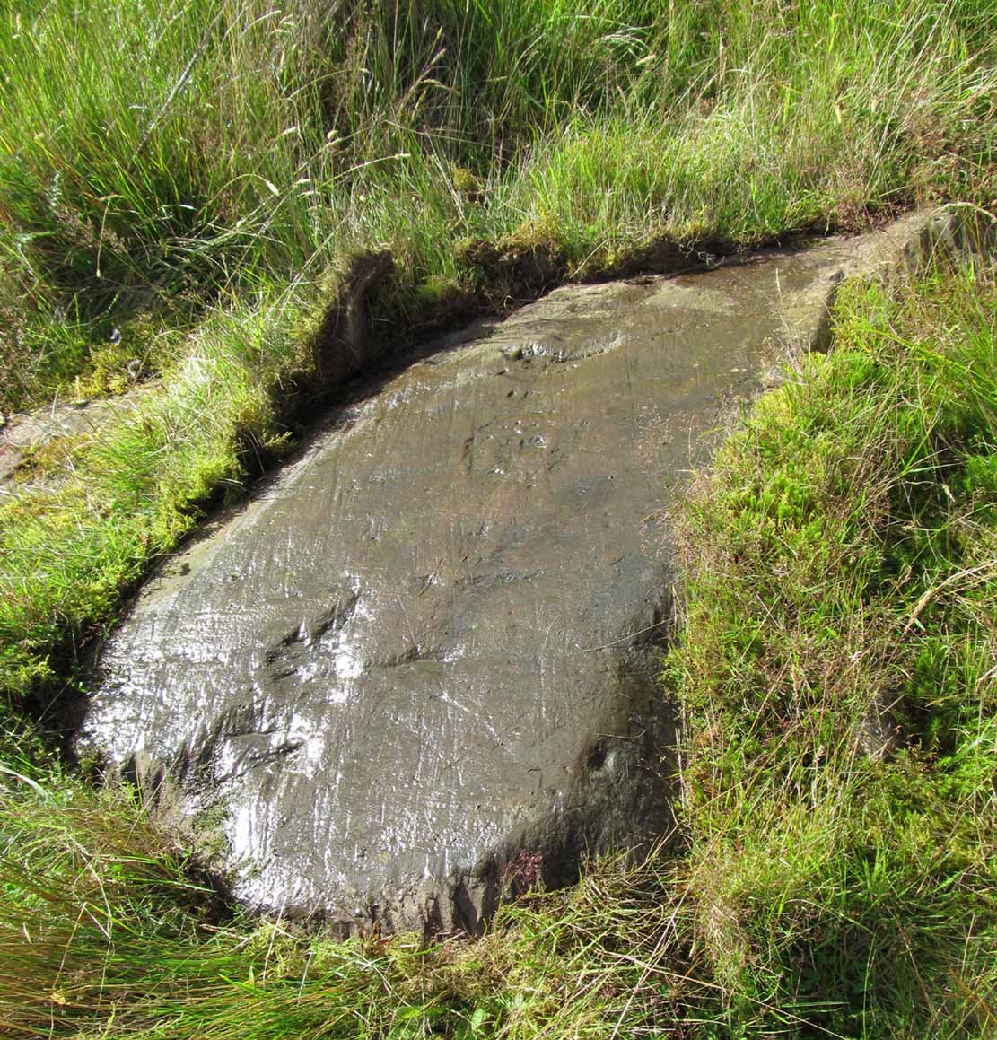
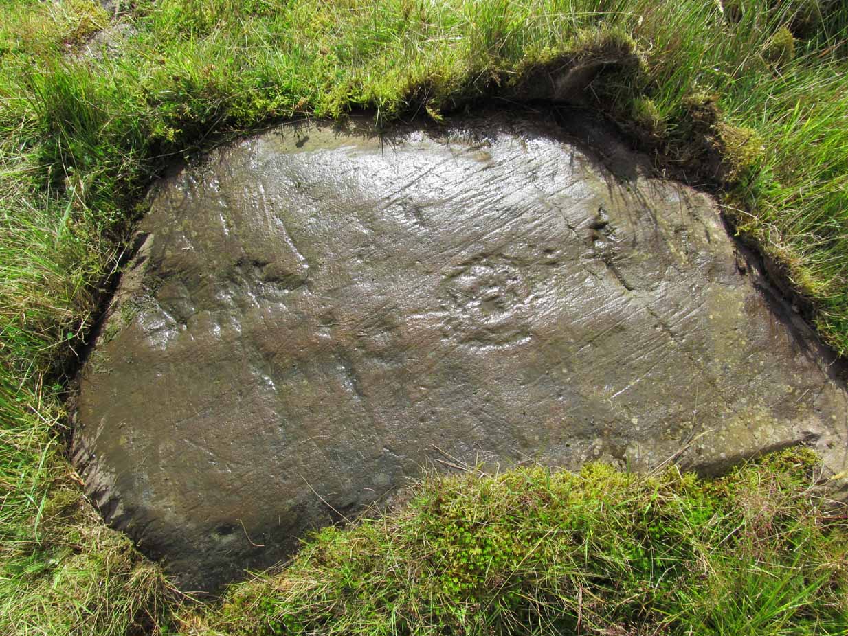
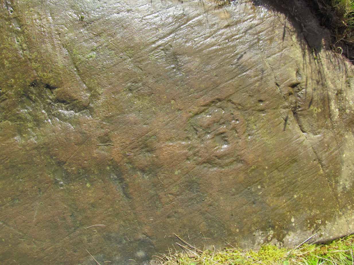
On this small smooth rock surface we find an almost archetypal cup-and-ring stone, whose design consists of a double cup-and-ring and a faint cup-and-ring. The double-ring has several seemingly natural small fissures in the rock running at various angles into the central cup from the outside; and there are two faint ones running from the double-rings outwards to the cup-mark in the single-ring, framing the central cupmark in the middle. It may have been that these scratches on the rock gave rise to the position of the cupmark in this petroglyph. It’s difficult to see whether or not the single cup-and-ring was ever completed.
Canmore’s description of this petroglyph tells simply: “The larger of the two is 180mm in diameter and has two rings around a cup that is 70mm in diameter and 15mm deep. The smaller has one ring around a cup.”
Once you’ve seen this, have a look at the Over Glenny (6) carving, about 10 yards east of here.
Along the A81 road from Port of Menteith to Aberfoyle, watch out for the small road in the trees running at an angle sharply uphill, nearly opposite Portend, up to Coldon and higher. Keep going, bearing right past Mondowie and stopping at the dirt-track 100 yards or so further up on the left (and ignore the english fuckers up here who might say “you’re not allowed to park here”, as Scottish government regulation allows you to do so unless you block the road). Walk up this dirt-track for ⅔ mile, and just before reaching the planted forestry, turn right along another dirt-track. Less than 200 yards along there’s a large sycamore tree, and about 20 yards below it (south) is the carving you’re looking for.
Archaeology & History
It’s difficult keeping up with the carvings in this region to the north of the Lake of Menteith, as we find new unrecorded ones on every visit, maintaining the tradition of fellow rock art students Maarten van Hoek, Kaledon Naddair, George Currie, Jan Broewer and the rest—and we know that there’s more of them hidden away. This one doesn’t seem to be in the Canmore listings, but I put that down to the fact that they’ve got a grid-reference wrong somewhere, as it’s pretty plain to see. Although, to be honest, in the rather vague descriptions of other adjacent carvings (Over Glenny 5 and 7), this carving is in-between them, so you’d expect it to be listed. Anyway, that aside…
Looking down at the ringsClose-up of faint rings
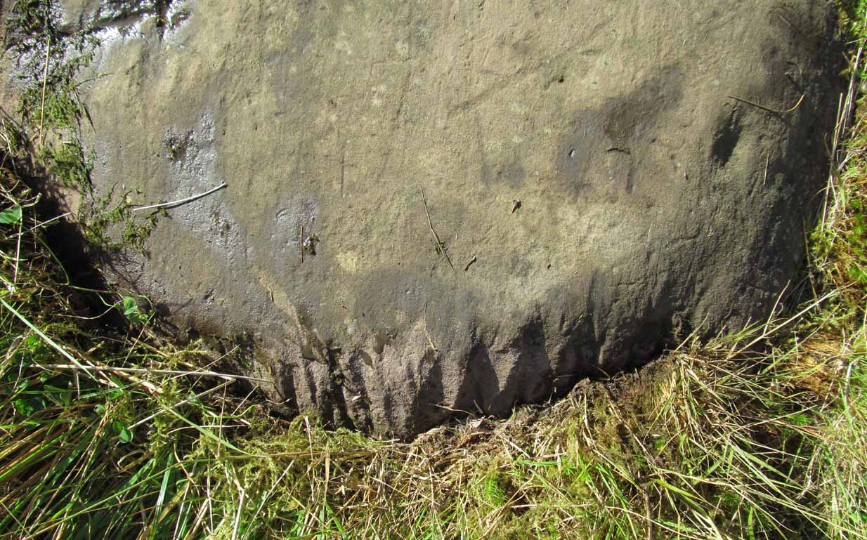
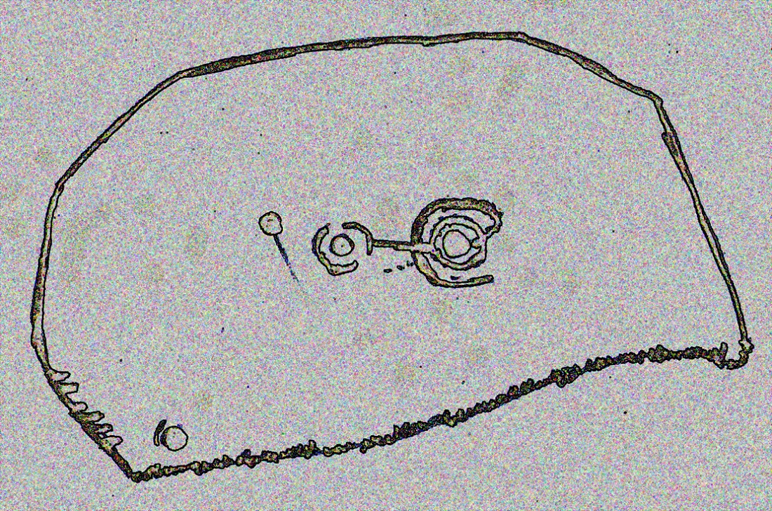
This long flat exposed rock surface has two primary cup-and-rings upon it: one cup with a double-ring, and the other standard cup-and-ring; there are also two single cup-markings on the stone: one near the middle of the rock and the other on its lower-right side. The main element is the double-cup-and-ring, which appears to be incomplete—not only in terms of its design, but also, as you can see in the photos, seems unfinished. From the central double-ring, a faint carved line runs out from the centre and into the other faint, incomplete, single cup-and-ring.
Series of metal-sharpening groovesArty-farty sketch of the design
At the bottom of the stone (as with several others hereby) a curious set of deep scars have been cut into the edge of the rock. They’re unmistakable when you see them. They have probably been created by metal artifacts being sharpened along the bottom of the rock—many many times by the look of it. These deep cuts reminded me of the more famous Polisher Stone, down Avebury-way. They may be explained by the fact that, several centuries ago, a battle occurred here and some of the men gathered in the area before the attack. It would seem as if this and the other cup-and-ring stones were used to sharpen their blades before going into battle. Whether this was done because of some local lore which imbued these stones with some sort of magick, we do not know. Folklore here seems curiously scarce (english incomers destroyed local traditions, as writers were telling us in the 19th century), apart from the well-known one of the area being rife with fairies: Robert Kirk’s famous The Secret Commonwealth of Elves, Fauns and Faeries (1691) was written three miles west of here, at Aberfoyle.
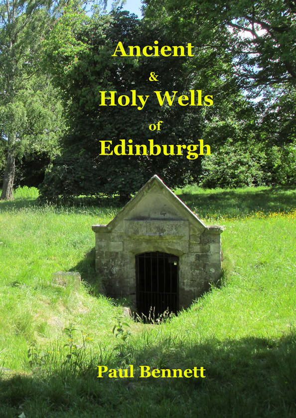
This is the first detailed guide ever written on the holy wells and healing springs in and around the ancient city of Edinburgh, Scotland. Written in a simple A-Z gazetteer style, nearly 70 individual sites are described, each with their grid-reference location, history, folklore and medicinal properties where known. Although a number them have long since fallen prey to the expanse of Industrialism, many sites can still be visited by the modern historian, pilgrim, christian, pagan or tourist.
The book opens with two introductory chapters: the first explores the origin and nature of holy wells and what they meant to local people in earlier centuries; and the next is a comparative overview of water cults worldwide. It is an invaluable guide for any student or tourist who wants to look beneath the modern history of the city and get a taste of the more archaic customs that once belonged here…
The quickest way here is still a long one. From Gargunnock village, take the road west towards the A811, turning left just before the bend down to the main road, and up through what looks like private estate gates. Walk all the way along this road as if you’re visiting the Leckie broch and its carvings, but keep going, until it becomes a track. Continue into the woods, uphill and out the other side until you have the Gargunnock cliffs rising a few hundred yards ahead of you. On your right a few yards up is a long straight length of walling running to the first set of cliffs. Go up it and up the next rise and the next. When you’re on top of the moors, look for the highest spot close by. You can’t miss it!
Archaeology & History
Cairn-edge, looking NW
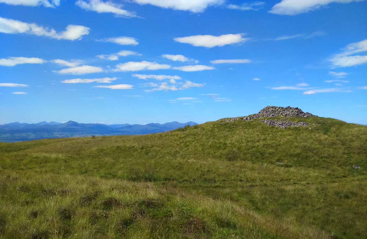
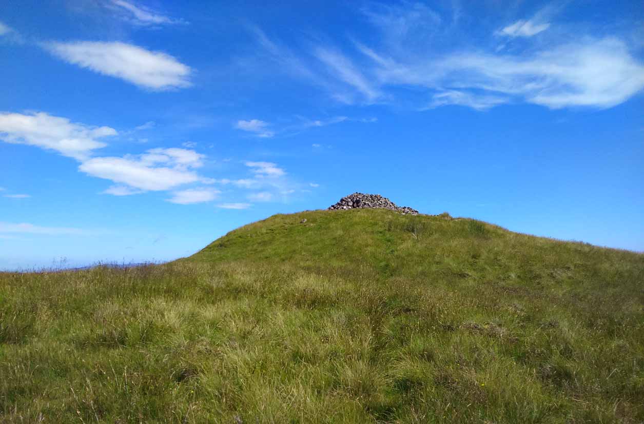
Nearly 1600 feet above sea level, this seemingly isolated giant cairn sits on the highest point of the Gargunnock Hills, giving a truly fantastic 360º view, looking across a diameter of perhaps 100 miles on a clear day—which is what I was greeted with when I visited. Giant cairns scatter hilltops all across the British Isles, many of them peopled with creation myths of giants, devils and thoroughly animistic creatures! But I can find no such tales here… Equal lackings are in the archaeological texts which, it seems, only catalogued the site in recent years.
Caerlatheron, looking SE
The name of the site is intriguing. The element caer is a fort, but no such ‘fort’ seems to be here. But we’ll come back to that shortly. The element latheron and its variants apparently relates to a mire or swamp (Watson 1926), whose existence to the immediate south and west is considerable (a small loch was once hereby, but its size has decreased over the last 150 years), and it is very boggy across the tops here. When I visited, it was a scorching day (I was fucked by the time I got here!), but in many places the ground was very dangerous to walk over. It was superb! So it seems that the place-name indicates Caerlatheron was ‘the fort by the swamp’. It works perfectly, except that this is listed as a cairn – and it’s a large one at that!
Note the overgrown raised embankment (lower centre)
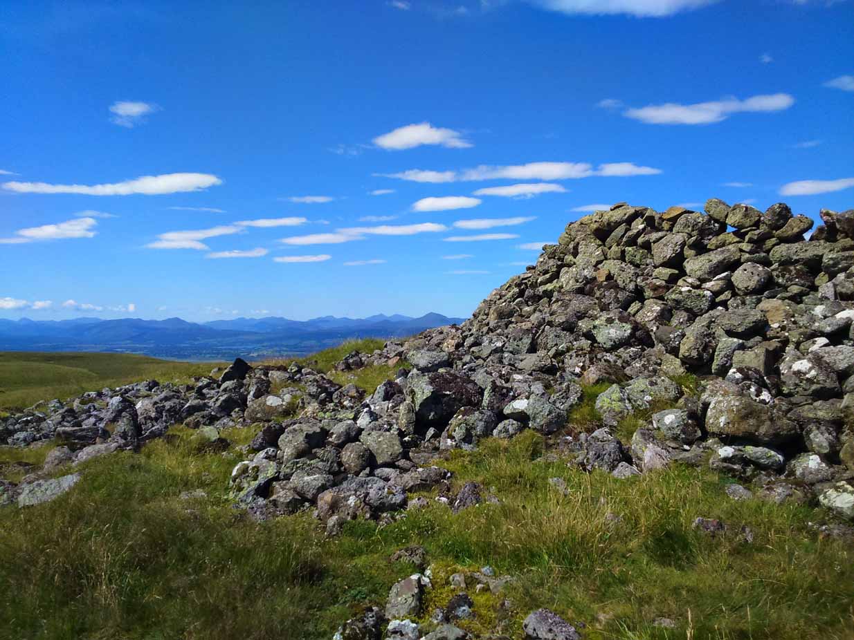
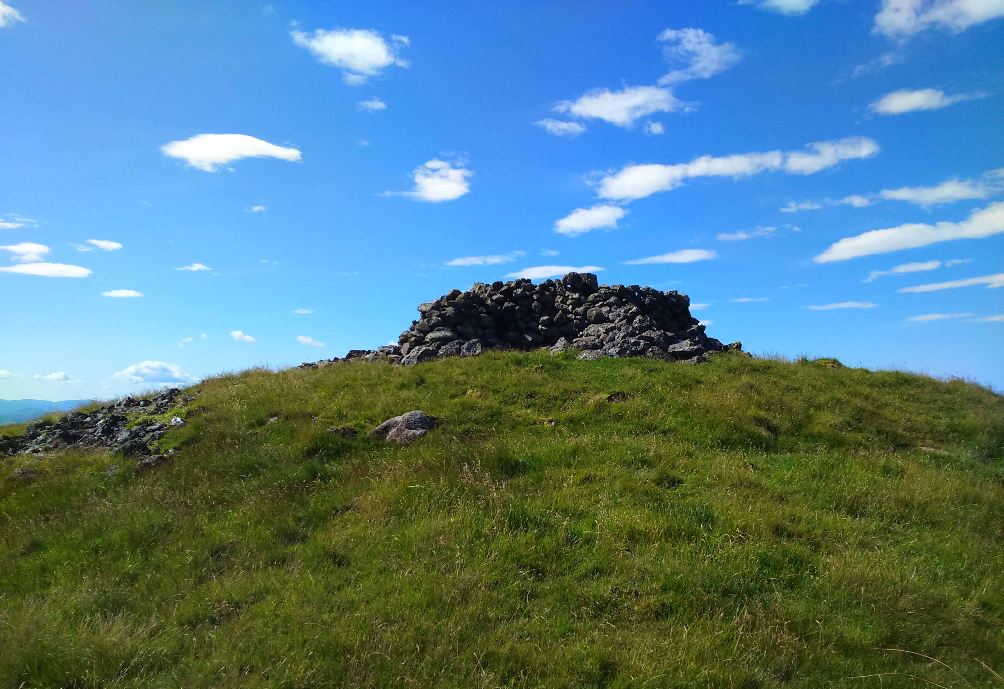
The cairn sites on top of a large mound. This mound seems to be artificial and is between 10-12 feet high. The cairn and mass of rocks on top of the mound (within which is a triangulation pillar) is itself 4-5 feet high—although much of this relates to Ordnance Survey and walkers piling up many of the loose stones to create an enclosure or wind-break to protect any traveller up here in stormy weather. The cairn-pile is 20 yards across at the top, and as you walk around it you become aware that this appears to be slightly raised on top of its parent mound with an evident ’embankment’, particularly on the eastern side. As you follow this round, you lose sight of it completely on the southern edges, which is covered by the extended cairn-mass; but some of it seems in evidence on the northwest and northern side. A number of stones marking this out would seeeem to be in evidence. A few larger flat stones on the south and western top of the cairn might suggest that it was once a chambered cairn – but this is highly speculative. The late great Audrey Henshall never got here; and I don’t know whether the great local archaeologist, Miss Christian MacLagan, ever got her fingers here either, so we don’t have their expertise to help us out.
Caerlatheron, looking ECairn-mass of the huge mound
The mound upon which the ‘cairn’ sits is also intriguing. When walking round and around the bottom of it, you note the unmistakable substantial mass of overgrown rocks, particularly around from the northwest, to north, to northeast, both on the slopes and at the bottom, seeming to imply that the entire mound is artificial. I kept walking up and down and around it, to see if these had simply fallen from the top, but wasn’t 100% sure and wished there was a geologist at hand to tell me, one way or the other. In truth, the shape of the mound from the bottom, from most angles, reminded me of an overgrown broch and not a cairn. And there are a few brochs nearby—the closest of which is just at the bottom of the hill from here: the Leckie broch (I aint done the site profile for it yet, soz….). It was only when I got home and looked for the meaning of Caerlatheron that the ‘broch’ idea came back to me with a little more fortitude, perhaps making sense of it as a ‘fortified structure by the bogs and swamps’. Perhaps… Without an excavation, we may never know for sure.
Singular cairn, 350yd NNW
About 350 yards northwest, across truly dodgy swampy ground (walk up here at night and it’ll probably be the last thing you ever do!) is another small singular cairn, made up of quite large rocks, with a few smaller ones filling it up. It looks to be either a shepherd’s cairn, or one for his sheepdog perhaps, a few centuries old. I can find nothing about it in any local history or record-books.
The place is well worth visiting—but it’s a full day out and you’ll be knackered when you get back. However, from here Nature grants us a stunning view of these tiny parts of Her body. It’s well worth the effort!
References:
Watson, W.J., Celtic Placenames of Scotland, William Blackwood 1926.




 This is the first detailed guide ever written on the holy wells and healing springs in and around the ancient city of Edinburgh, Scotland. Written in a simple A-Z gazetteer style, nearly 70 individual sites are described, each with their grid-reference location, history, folklore and medicinal properties where known. Although a number them have long since fallen prey to the expanse of Industrialism, many sites can still be visited by the modern historian, pilgrim, christian, pagan or tourist.