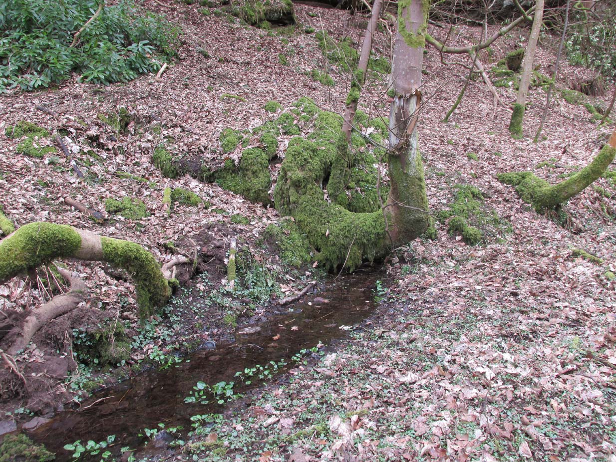
From Gargunnock village, take the road west towards Leckie, and then just before the right-angled bend in the road down towards the A811, bear sharp left, and then immediate right below the farmhouse along what looks like a private road taking you onto the Watson House mansion. About 500 yards along, with trees either side of you, look down the small steep slope where a small burn (stream) is visible. Get down there and, where the waters bend away changing direction to head north, look carefully for a small spring of water emerging, just a few yards south of the stream itself, beneath a young tree.
Archaeology & History
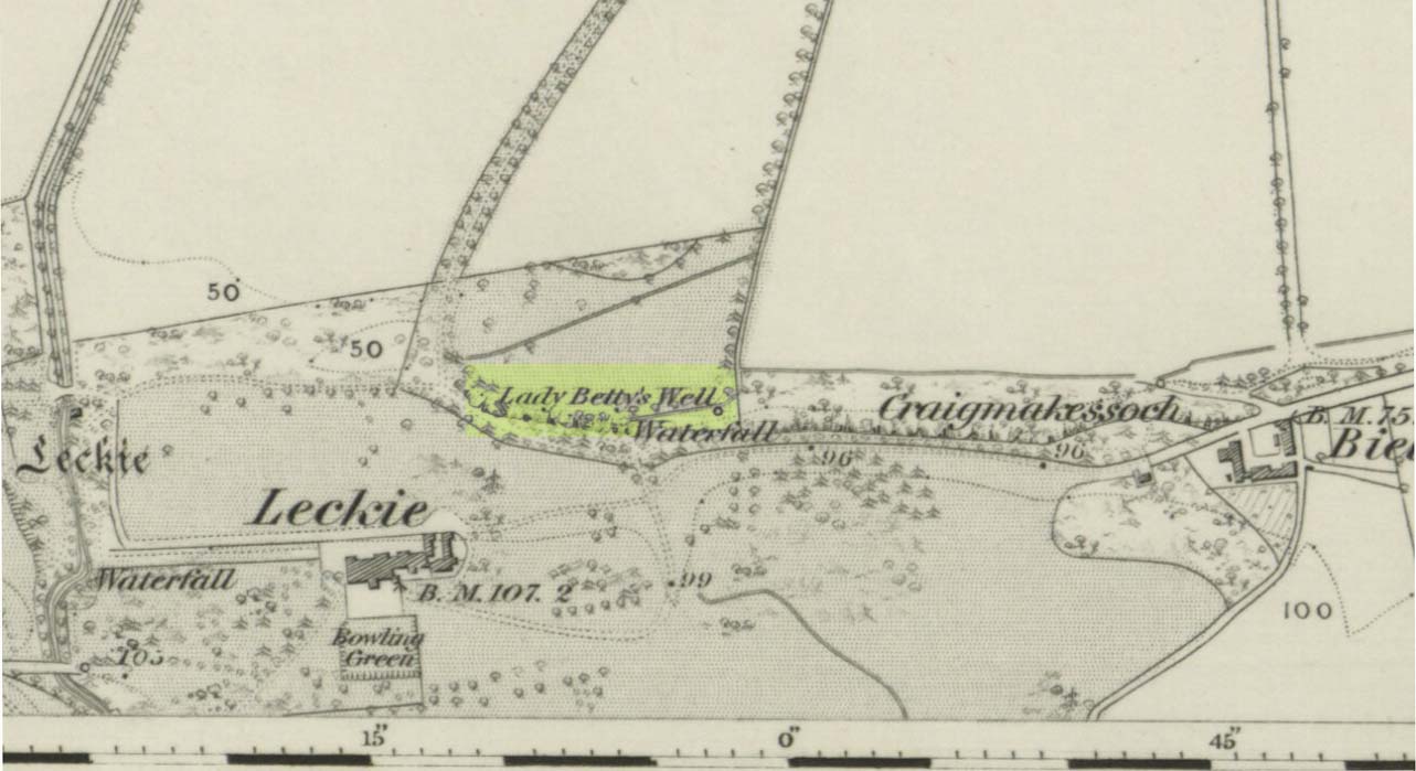
Lady Bettys Well on 1860 map
This all-but-forgotten water source is, thankfully, still running with clear waters below the wooded slopes. It is highlighted on the first OS-map of the region in 1860, 50-60 yards east of a small but once-picturesque waterfall (now spoiled by a mass of industrial waste, dumped hereby). Little seems to be known about its mythic history and, quite possibly, may have had something to do with our old cailleach. May have…. I say this purely in relation to what was said about the site by the Ordnance Survey lads at the end of the 1850s when they visited the site and enquired as to its name and nature. They told:
“A Small Spring issuing from under a rock like the mouth of a drain having no appearance of a Well. It took its name (Betty) from an old woman who lived adjacent some two hundred years ago; there is no tradition or Antiquity connected with it – nothing more nor less than an Old woman’s well, but is well known in the neighbourhood by the name. Situated at the base of Craigmakessoch and about 10 chains north west of Leckie house.”
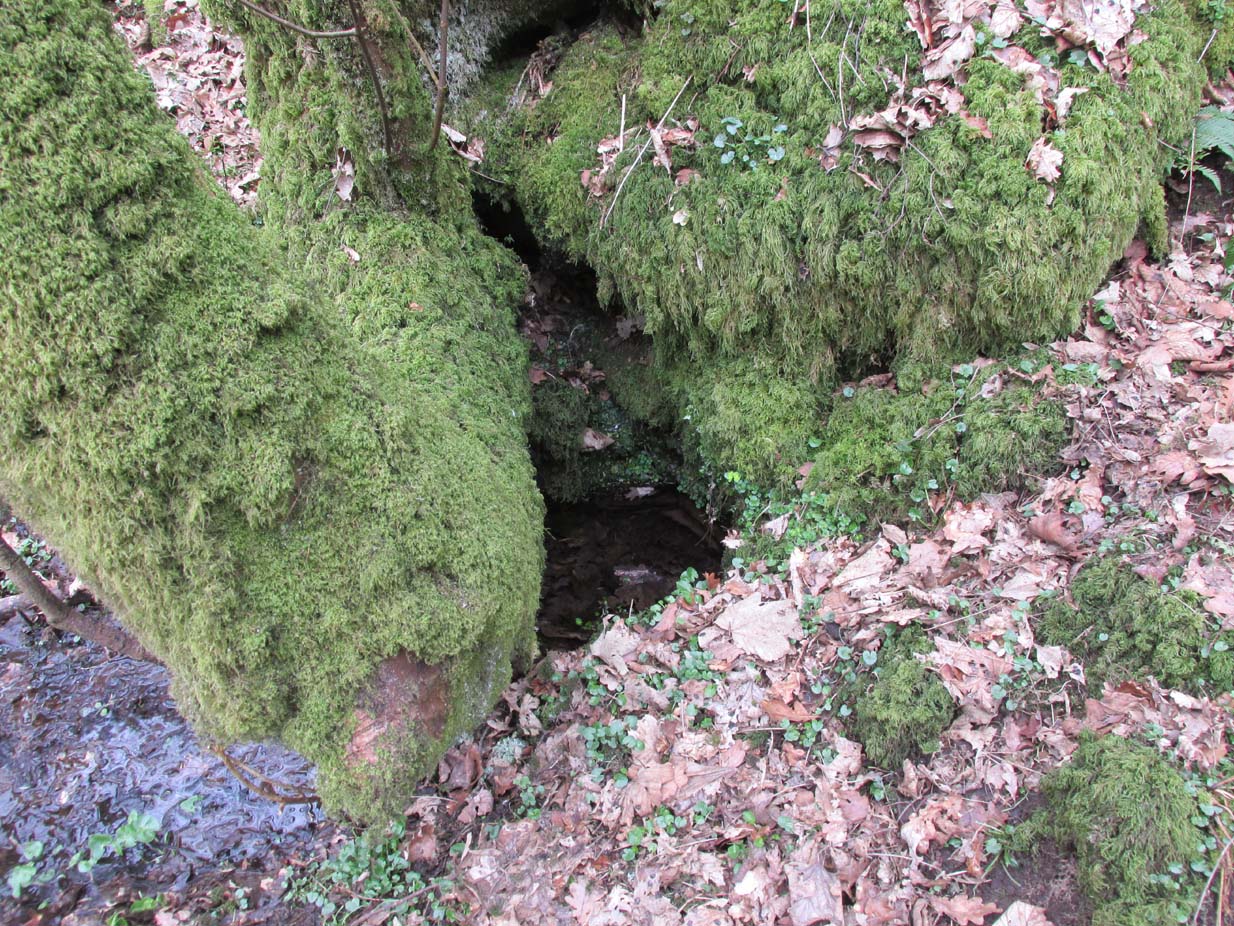
Water emerging by the roots
Although ‘Betty’ is obviously a shortening of Elizabeth, it’s the Old Woman’s bit that brings up the cailleach element, which may or may not be valid. The small crag beneath which the spring still rises is known as ‘Craigmakessoch’, which Prof Paul Hornby thought might derive from a forgotten attribution to the little-known St. Makessog or Kessog. (are there any local folk who can clarify things?)
Were it not for the pollution due to the dumping here (in an otherwise beautiful place), it looks like the waters would still be drinkable – but we all decided to give it a miss…
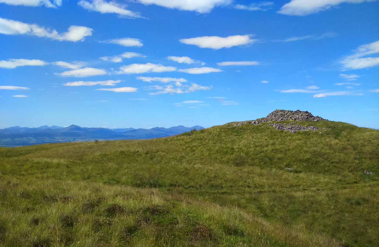
The quickest way here is still a long one. From Gargunnock village, take the road west towards the A811, turning left just before the bend down to the main road, and up through what looks like private estate gates. Walk all the way along this road as if you’re visiting the Leckie broch and its carvings, but keep going, until it becomes a track. Continue into the woods, uphill and out the other side until you have the Gargunnock cliffs rising a few hundred yards ahead of you. On your right a few yards up is a long straight length of walling running to the first set of cliffs. Go up it and up the next rise and the next. When you’re on top of the moors, look for the highest spot close by. You can’t miss it!
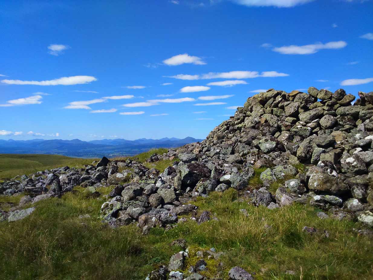
Archaeology & History
Cairn-edge, looking NW
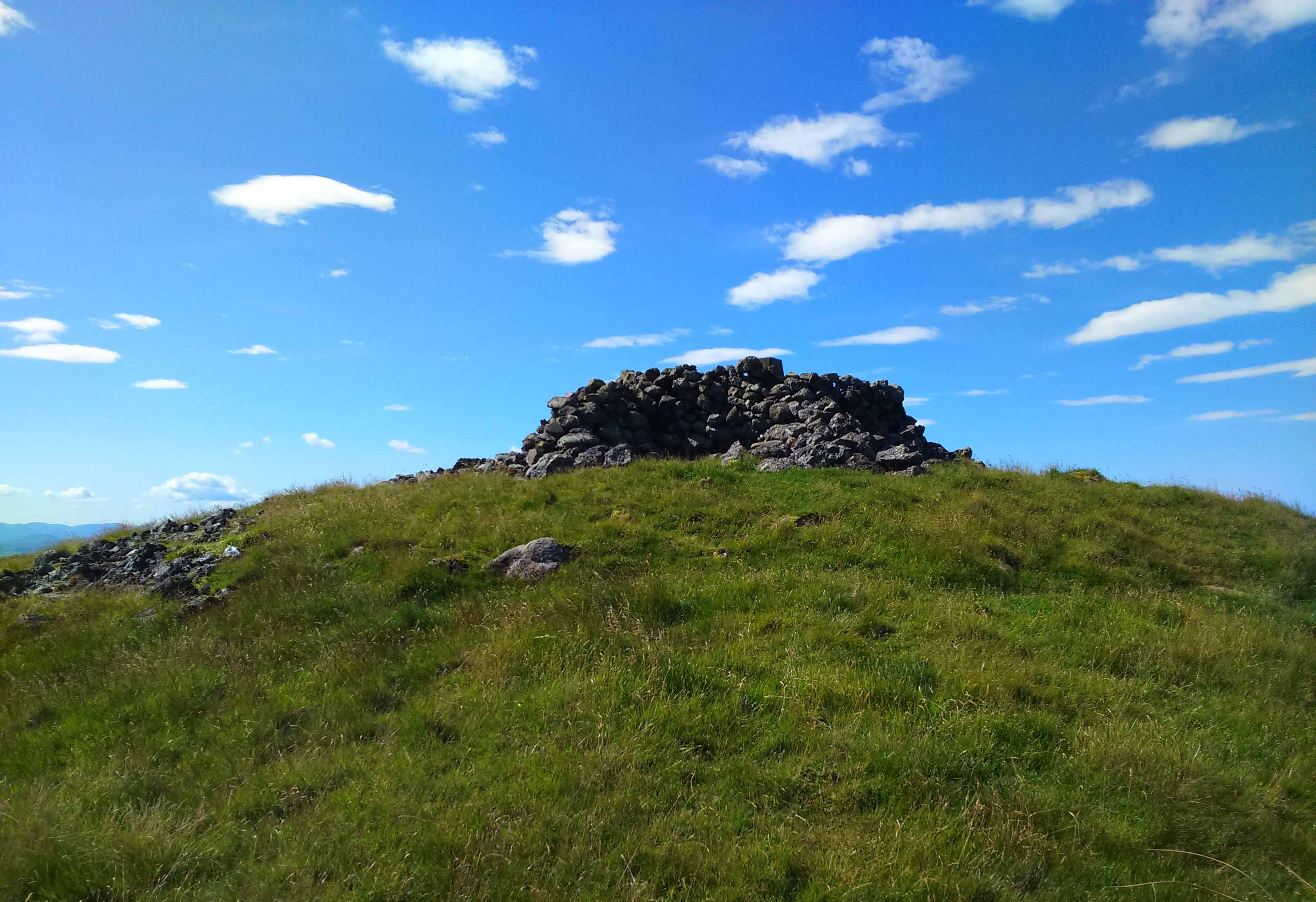
Nearly 1600 feet above sea level, this seemingly isolated giant cairn sits on the highest point of the Gargunnock Hills, giving a truly fantastic 360º view, looking across a diameter of perhaps 100 miles on a clear day—which is what I was greeted with when I visited. Giant cairns scatter hilltops all across the British Isles, many of them peopled with creation myths of giants, devils and thoroughly animistic creatures! But I can find no such tales here… Equal lackings are in the archaeological texts which, it seems, only catalogued the site in recent years.
Caerlatheron, looking SE
The name of the site is intriguing. The element caer is a fort, but no such ‘fort’ seems to be here. But we’ll come back to that shortly. The element latheron and its variants apparently relates to a mire or swamp (Watson 1926), whose existence to the immediate south and west is considerable (a small loch was once hereby, but its size has decreased over the last 150 years), and it is very boggy across the tops here. When I visited, it was a scorching day (I was fucked by the time I got here!), but in many places the ground was very dangerous to walk over. It was superb! So it seems that the place-name indicates Caerlatheron was ‘the fort by the swamp’. It works perfectly, except that this is listed as a cairn – and it’s a large one at that!
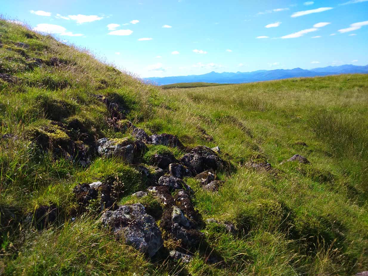
Note the overgrown raised embankment (lower centre)
The cairn sites on top of a large mound. This mound seems to be artificial and is between 10-12 feet high. The cairn and mass of rocks on top of the mound (within which is a triangulation pillar) is itself 4-5 feet high—although much of this relates to Ordnance Survey and walkers piling up many of the loose stones to create an enclosure or wind-break to protect any traveller up here in stormy weather. The cairn-pile is 20 yards across at the top, and as you walk around it you become aware that this appears to be slightly raised on top of its parent mound with an evident ’embankment’, particularly on the eastern side. As you follow this round, you lose sight of it completely on the southern edges, which is covered by the extended cairn-mass; but some of it seems in evidence on the northwest and northern side. A number of stones marking this out would seeeem to be in evidence. A few larger flat stones on the south and western top of the cairn might suggest that it was once a chambered cairn – but this is highly speculative. The late great Audrey Henshall never got here; and I don’t know whether the great local archaeologist, Miss Christian MacLagan, ever got her fingers here either, so we don’t have their expertise to help us out.
Caerlatheron, looking ECairn-mass of the huge mound
The mound upon which the ‘cairn’ sits is also intriguing. When walking round and around the bottom of it, you note the unmistakable substantial mass of overgrown rocks, particularly around from the northwest, to north, to northeast, both on the slopes and at the bottom, seeming to imply that the entire mound is artificial. I kept walking up and down and around it, to see if these had simply fallen from the top, but wasn’t 100% sure and wished there was a geologist at hand to tell me, one way or the other. In truth, the shape of the mound from the bottom, from most angles, reminded me of an overgrown broch and not a cairn. And there are a few brochs nearby—the closest of which is just at the bottom of the hill from here: the Leckie broch (I aint done the site profile for it yet, soz….). It was only when I got home and looked for the meaning of Caerlatheron that the ‘broch’ idea came back to me with a little more fortitude, perhaps making sense of it as a ‘fortified structure by the bogs and swamps’. Perhaps… Without an excavation, we may never know for sure.
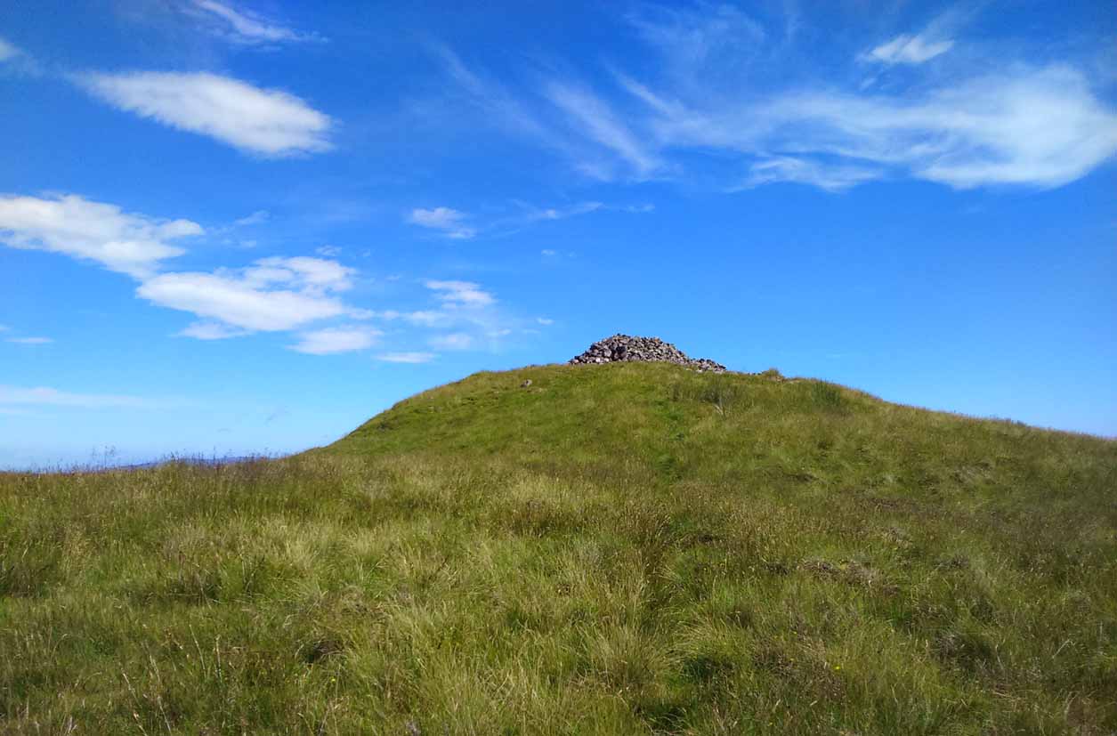
Singular cairn, 350yd NNW
About 350 yards northwest, across truly dodgy swampy ground (walk up here at night and it’ll probably be the last thing you ever do!) is another small singular cairn, made up of quite large rocks, with a few smaller ones filling it up. It looks to be either a shepherd’s cairn, or one for his sheepdog perhaps, a few centuries old. I can find nothing about it in any local history or record-books.
The place is well worth visiting—but it’s a full day out and you’ll be knackered when you get back. However, from here Nature grants us a stunning view of these tiny parts of Her body. It’s well worth the effort!
References:
Watson, W.J., Celtic Placenames of Scotland, William Blackwood 1926.
Take the A811 road between Stirling and Kippen and go up into Gargunnock, From the village centre, go along the Leckie Road (not the Main Street!) for half-a-mile, then turn left up the tiny road. ¾-mile (1.15km) along, a small bridge crosses the Leckie Burn (a.k.a. St Colm’s Burn). From here, walk up the footpath into the woods for 100 yards or so and cross the waters. When you see the large overgrown rocky rise of the Leckie Broch covered in pesky rhododendrons, walk up its left-side where (presently) a clearing has been made and the carved rocks stand out.
Archaeology & History
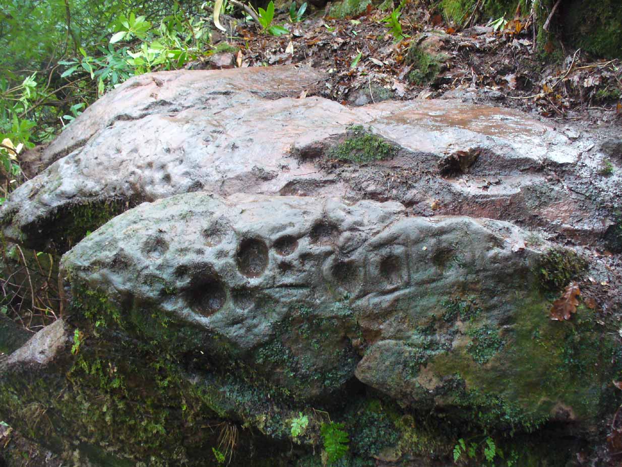
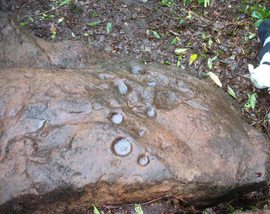
A very curious design here! Possibly carved at the same time as the Leckie broch to which it is attached—possibly not—we have here a curious amalgam of Nature’s incisions and human design, culminating in cup-and-rings and cups-and-squares no less! When we came to visit it a few days ago, Lisa Samsonowicz found the stone hiding away, buried beneath a thin layer of natural cover. The rest of the team thereafter enabled a much clearer pictures of the carving.
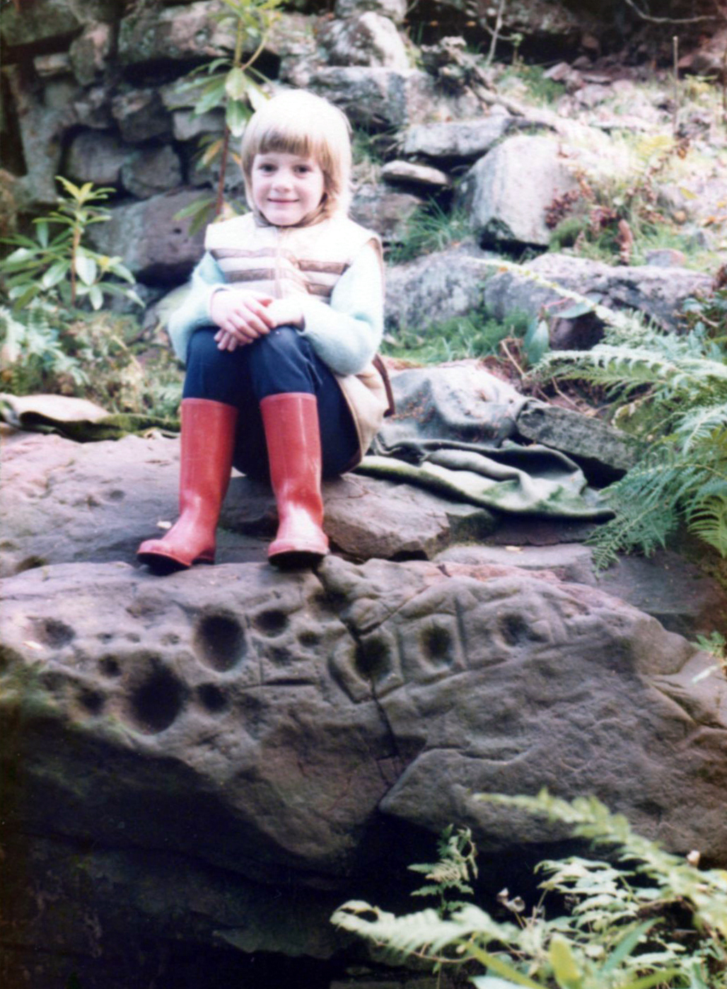
Star motif & other cupsYoung Allison on the new find (photo courtesy John McLaren)
We’re not quite sure who first rediscovered the carving. In an early photo of the site taken in the late ’70s or early ’80s, a young Allison McLaren sits highlighting the design. But she wasn’t the fortunate lass who discovered it! One account describes a local woman, Lady Younger of Leckie House, who was out walking her dog, accidentally dislodging some of the rocky debris of the Iron Age broch and unearthing the petroglyphs, thereafter taking Allison along to see it. The other account tells of it being noticed for the first time during an excavation of the broch by Euan MacKie and his team. Whichever it was, Prof Mackie (1970) was certainly the first person to write about it. He told:
“Part of the sandstone face of the northern end of the promontory on which stands the Leckie dun is covered with well preserved cup-marks, presumably much older than the dun. They were discovered when rubble and soil fallen from the dun was removed. Some of the cup-marks stand alone and some are surrounded by what appear to be incised rectangles in a ladder pattern. There are other, less clear markings.”
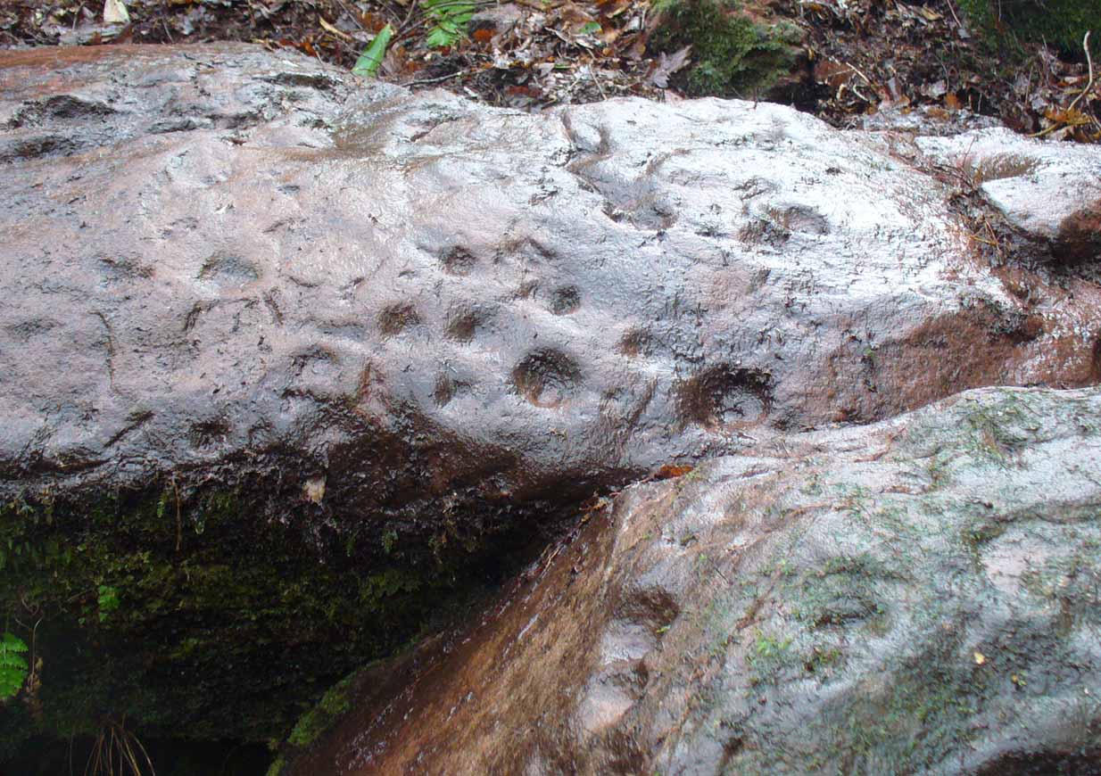
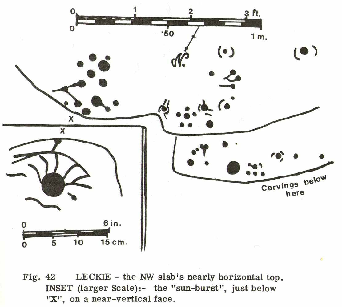
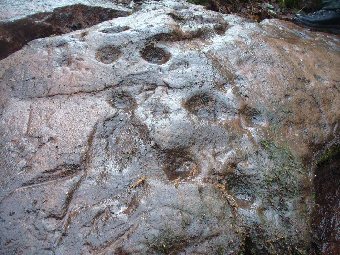
Ron Morris’ 1981 sketchSmall & large cupmarks
There then followed a series of written accounts, small and large, about the Leckie broch—but little else was said of the carvings. It wasn’t until Ronald Morris (1981) came to see them a few years later that they gained a slightly lengthier description. He described how the petroglyph was,
“carved over about 3m (yds) at heights of 1-2m (yds) on faces now sloping mostly 0-90º NW, with 3 cups-and-one-near-hexagonal-ring up to 12cm (4½in) diameter, a ‘sun-burst’ and other grooves, and at least 40 cups up to 12cm (4½in) diameter and up to 8cm (3in) deep. On a vertical E-facing slab there are also many grooves, some of which connect lines of cups. Some grooves resemble a ‘sea-horse’, an ‘axe’, etc. All except the cups are probably incised, but some may be natural.”
Large cupmarks on sloping faceLooking down the spine of 2 rocks
The entire design in fact covers two separate sections of rock. On the vertical face of one stone is a curious conjoined cup-and-rectangle, attached to a cup-and-square, attached to a traditional cup-and-ring. A cluster of other cups, large and small, are immediately left of this odd geometric pattern. The ‘cups’ within this section of the petroglyph are quite deep and, it would seem, were geological in nature but have been touched-up by human hands. Immediately below this rectangle-square-circle sequence, faint carved lines run a little further down the face of the rock. They were difficult to see clearly and require subsequent visits to enable a more complete picture. Along the top of this section of rock are several cups, one or two of them seeming to have faint rings around them. (at the very bottom of this vertical carved face, at ground level, a small section of man-made walling is visible, which was no doubt a section of the huge broch)
Above the top of this vertical carved face is a gap between this and a second, larger earthfast stone. This has a series of cups, some with faint rings around them, but most of them are just cups, both shallow and deep, running down the slope of the rock. A notable ‘star’ of five cups surrounding a single-cup stands out on this section. Some of them seem to have been geophysical in nature, but again have been touched-up and added to.
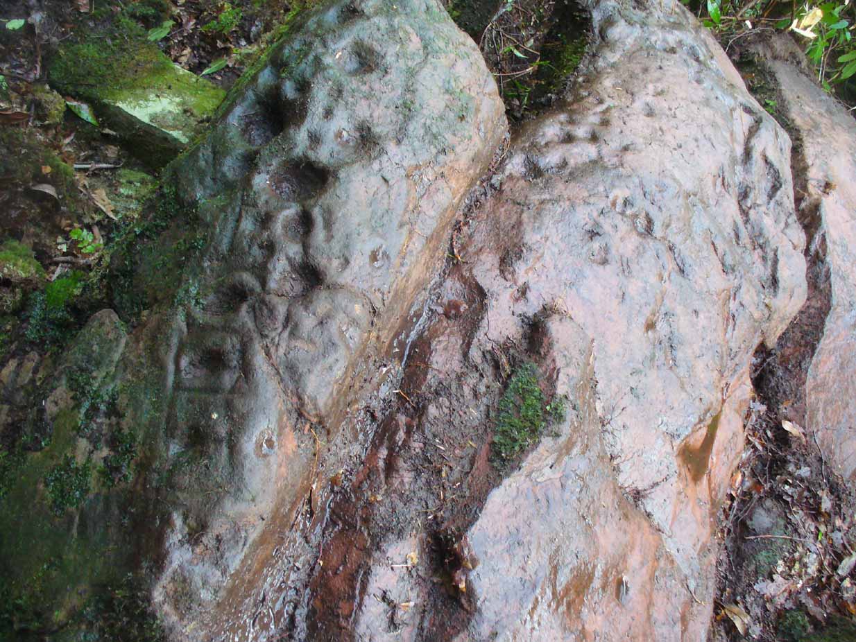
Cluster of curious peck-marks
Slightly higher still, on another third section of rock, a curious cluster of weird ‘pecks’, almost in a square pattern, with a possible cup-mark close to the edge of the stone is clearly visible. The edge of this rock seems to have been quarried and the markings here may just be mason marks preceding the breaking of the stone in the Iron Age.
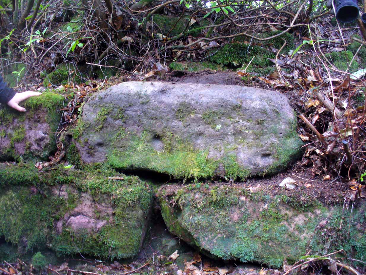
Walk around to the south-side of the broch and there, in the walling, on a vertical stone face, is the small cup-marked Leckie 1 carving.
One final note of concern: the carving (and the broch) have become overrun with rhododendrons, to the point where they are severely damaging the monuments here. They need to be curtailed before further archaeological destruction occurs. Help!
Acknowledgements: Immense thanks to Lisa Samsonowicz, Fraser Harrick, Nina Harris, Frank Mercer and Paul Hornby for all their work, enabling a clear picture of the site. And a huge thanks to John McLaren of the Gargunnock Village History site for allowing us to include the early photo of the carving here – thanks John! 🙂
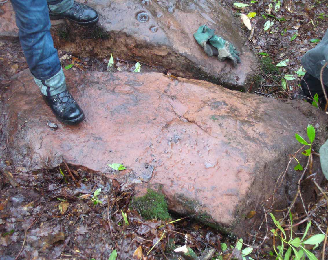
Take the A811 road between Stirling and Kippen and go up into Gargunnock, From the village centre, go along the Leckie Road (not the Main Street!) for half-a-mile, then turn left up the tiny road. ¾-mile (1.15km) along, a small bridge crosses the Leckie Burn (a.k.a. St Colm’s Burn). Walk up the footpath into the woods for 100 yards or so and cross the waters. When you see the large overgrown rocky rise of the Leckie Broch covered in pesky rhododendrons, walk up its left-side and, as it levels out, note the walling on your left. It’s just a few yards along.
Archaeology & History
This cup-marked stone is only for the mad petroglyphic puritans amongst you! Rediscovered by Nina Harris on February 5, 2017, it can be seen when you look at the main southern wall of this rhododendron-infested broch, near the middle of one of the large cut-and-squared stones built into the upright face. The carving has at least two cup-markings on its vertical face—which are clearly visible on the photo. One is quite deep, whilst the other is quite faint. At either end of the stone are what may have been two other cups that were started but never finished, or just natural-occurring holes in the stone (I’m more of the opinion that they’re just natural, but would love to be wrong!). A possible third cup-mark can be seen along the top-edge of the stone.
There is no mention of this carving in Dr Mackie’s various writings on the Leckie Broch, which he excavated in the 1970s; only the recognised cup-and-ring stone (Leckie 02) on its northeast edge. The intriguing element (which can also be applied to the Leckie-2 carving) is that the Leckie Broch was constructed in the 1st century AD—and these cup-markings were probably carved around that time, much later than many others. It is likely that other unrecorded carvings will be hiding away nearby.
References:
MacKie, Euan, “The Leckie Broch, Stirlingshire,”, in Glasgow Archaeological Journal, volume 9, 1982.
This little-known holy well on the northeastern edges of the Touch Hills is another part of our ancient heritage that may well have been lost. All that now remains are the literary remnants telling of this once important site, around which local socio-religious elements occurred from time to time. When the local historian J.S. Fleming (1898) wrote about the site, it had already disappeared, and was himself fortunate to recover information relating to its former existence. He told:
“My attention has been drawn to an article which appeared in the Stirling Journal of 31st October, 1834, describing what is claimed to be a Holy Well dedicated to Saint Corbet, or probably Saint Cuthbert. The well was situated in Touch Glen, not far from Gilmour’s Lynn, and was, even at that time, reduced to a spring one foot deep and three or four feet in circumference, surrounded by boggy ground. The writer states that there were people then alive who had resorted to this Well in their younger days. Its virtues were restricted to one hour in the year, and that the hour of sunrise on the first Sabbath of May; the supposition being that by drinking of its waters at the Well by the adventurous pilgrims to such a wild and lonely spot at early sunrise, the devotee was assured of the preservation of his life during that year. We have never come across this Saint’s name, but Saint Cuthbert had an altar in the Rude Kirk (High Church of Stirling) and, as for the Well, from its diminishing condition in 1834, its site no doubt has long been obliterated.”
It is possible that some remnant of the waters here can still be found, or are known about, by dedicated local practitioners—but without their aid, this sacred site may be forever lost…
Folklore
In Thomas Frost’s (1899) essay on the holy wells of Scotland, he echoed what Mr Fleming had told, saying:
“Of St. Corbet’s Well, on the top of the Touch Hills…it was formerly believed that whoever drank its water before sunrise on the first Sunday in May was sure of another year of life, and crowds of persons resorted to the spot at that time, in the hope of thereby prolonging their lives.”
This restorative folklore element, implicit in the nature of water itself, was obviously related to the cycles of renewal in the social activity of our peasant ancestors, as found in every culture all over the world. (Eliade 1959; 1989)
One account relating to the disappearance of St. Corbet’s Well told that it fell back to Earth as the spirit of the site was insulted by profane practices. Janet & Colin Bord (1985) told that:
“This theme, of real or imagined insult to the well causing it to lose its power, move its location, or cease flowing altogether, is widespread. St. Corbet’s Well on the Touch Hills (Stirling) was said to preserve for a year anyone who drank from it on the first Sunday in May, before sunrise, and it was visited by great crowds at the height of its popularity. But the drinking of spirits became more popular than the drinking of well water, so St. Corbet withdrew the valuable qualities of the water, then eventually the water itself stopped flowing.”
References:
Andrews, William (ed.), Bygone Church Life in Scotland, W. Andrews: London 1899.
Bord, Janet & Colin, Sacred Waters, Granada: London 1985.
Eliade, Mircea, The Sacred and the Profane: The Nature of Religion, Harcourt, Brace & World: New York 1959.
Eliade, Mircea, The Myth of the Eternal Return, Arkana: London 1989.
Fleming, J.S., Old Nooks of Stirling, Delineated and Described, Munro & Jamieson: Stirling 1898.
Frost, Thomas, “Saints and Holy Wells,” in Bygone Church Life in Scotland (W. Andrews: Hull 1899).