Go up the B822 road from Fintry for literally 2.5 miles (about 500 yards below the small copse of trees that almost hide Balafark Farm above you) and at a very small ‘parking’ spot are 2 farm-gates. Go through the lower of the two and head downhill, crossing the small burn and up the other side for just over 100 yards where you’ll meet a very low, old and very overgrown wall. Keep your eyes peeled for it! Walk left along this wall, uphill, for another 100 yards till you meet a a dried-up dyke that runs downhill. 10-15 yards down this, a small stone greets you…
Archaeology & History
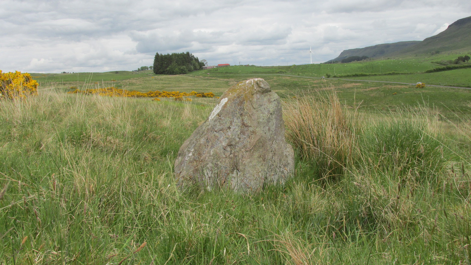
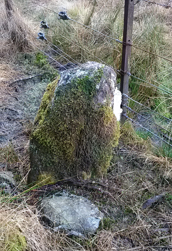
It’s difficult to call this a ‘standing stone’ and, as far as I’m concerned, is even more troublesome to cite it as a legitimate prehistoric monument. Nevertheless it is shown on the modern OS-maps as such and was listed by the Royal Commission (1963:1) lads in their standing stones inventory. But it’s really pushing it to be honest! They told us:
“This stone stands about 180 yds NW of a gate which opens off the Fintry-Kippen road, 340 yds N of its crossing of the Lernock Burn. It is triangular in profile and wedge-shaped in section, measuring 3’3″ both in height and breadth along its base, by 1’7″ in greatest thickness. It may well have been a boundary stone as it is near the corner of some ground which is enclosed by a turf dyke and has been cultivated.”
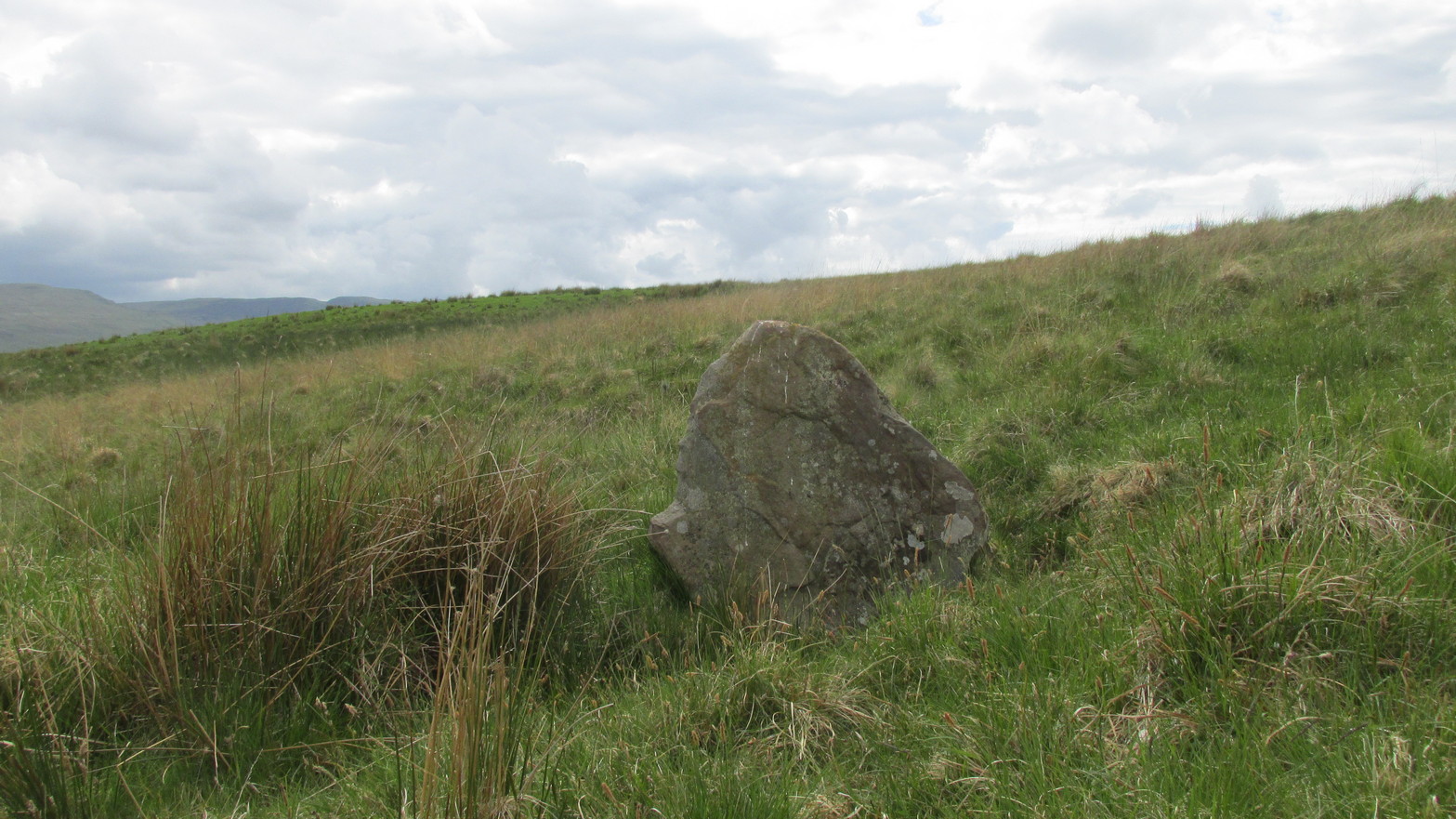
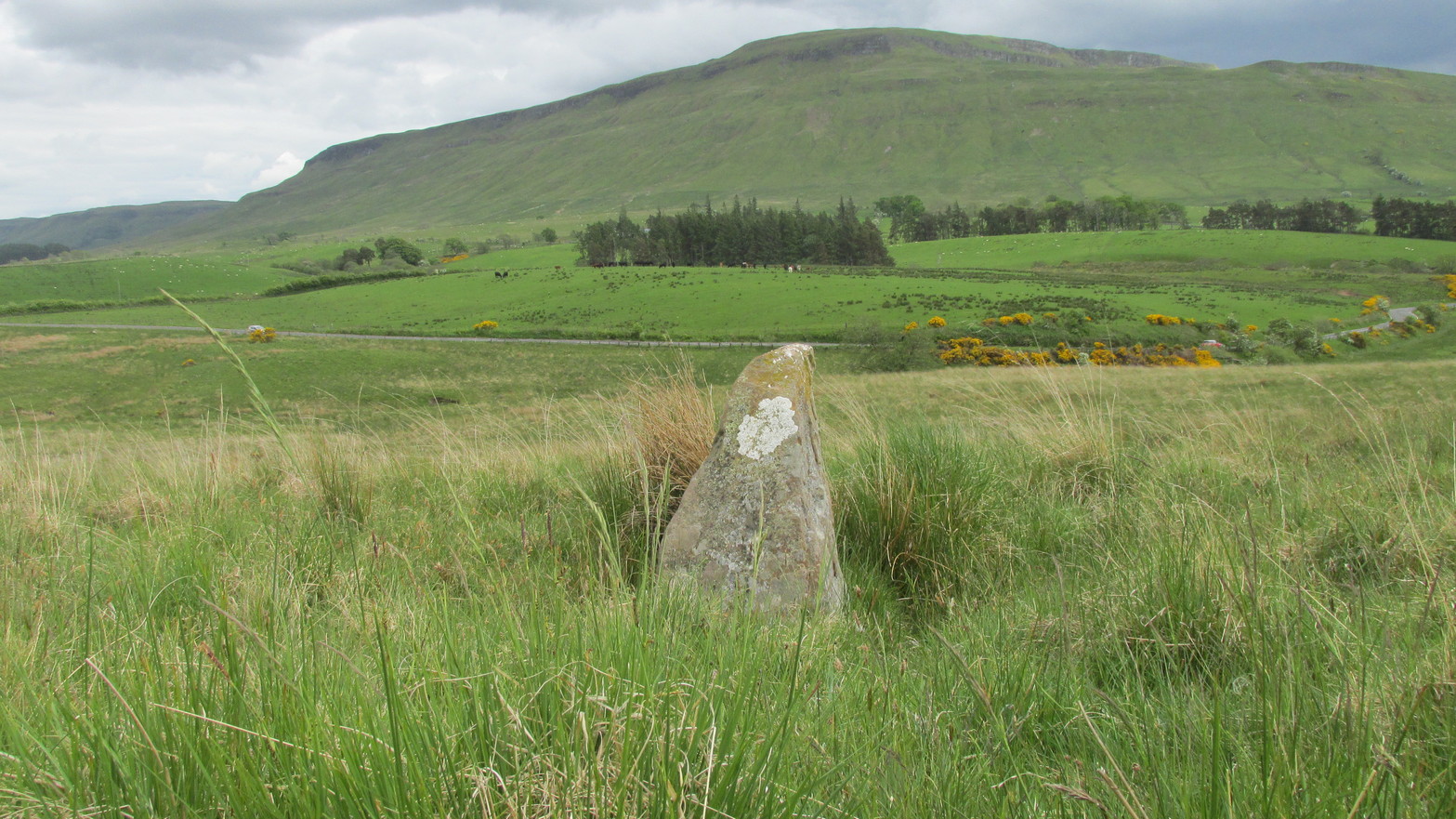
Looking southwestLooking up to the ancient cairn of Stronend
In truth, if we call this a standing stone, then there are hundreds of others that I’ve come across over the years—frobbling off-path across huge swathes of moorland—that must also be added to our prehistoric inventories, as the height of this isolated rock is echoed in countless others which are off the archaeological listings. One such stone ‘stands’ 100 yards northeast of here—although there are many others with much greater potential. …I think the only thing that may sway this as being a possible prehistoric upright is the fact that the top of the stone appears to have been broken off, albeit a few hundred years ago if the weathering is owt to go by. But a cursory look for any broken top-piece found nothing.
References:
Royal Commission on the Ancient & Historical Monuments Scotland, Stirling – volume 1, HMSO: Edinburgh 1963.
Take the same route as if you’re visiting the small Carlin Stone (a few hundred yards further along): along the B822 road between Kippen and Fintry, stop at Balafark farm and cross the road above the farm to take the track into the forest. 1km along, note the small green track, off the main central track, slightly up on the rise on your right, which bends round and then goes (eventually) to the other side of the forest. Once you reach the gate at its edge, walk left 285 yards (261m) along the fence.
Archaeology & History
The Wife and the Carlin on the 1865 OS-map
Described in the Ordnance Survey’s (1870) Book of Reference (volume 47) as “a flat rock on the boundary between Perth and Stirling,” the rock is certainly not flat—and any geographical relationship it had with Perth has long since gone. Instead, the stone in question here is an upright one—although it’s not much more than two feet tall. However, on the other side of the present-day fence there is a small flat stone in the ground; but it is the moss-covered upright that is our ‘Wife with the Bratty Plaid.’ A smaller curious-looking quartz-lined stone also lies next to this old Wife…
The Wife, looking east
The Wife, looking west
Marked on the ancient boundary line, this small but sturdy standing stone probably has a prehistoric pedigree, although we cannot be certain without an excavation. It is shown on the earliest OS-maps from the 1860s, but we have no notifications from any literary sources telling the tale behind the stone’s fascinating name: meaning simply, the ‘wife wearing the tartan shawl.’ When Marion Woolley and I came here the other day, we tried to see if a simulacrum of such a figure was hiding in the moss-covered upright—but unlike the notable simulacrum at MacBeth’s Stone, we struggled somewhat here. It was possible, from certain angles (if we didn’t stand on our heads and poke each other in the eyes!) to see this ‘wife in a shawl’, but twas a struggle…
There’s every likelihood that whatever the old tale once was about this petrified ancestral stone, it would have had some mythic relationship with the Old Wife known as the Carlin, or cailleach, a few hundred yards to the west, at the Carlin Stone. As yet however, their histories remain hidden in the sleep of the Earth…
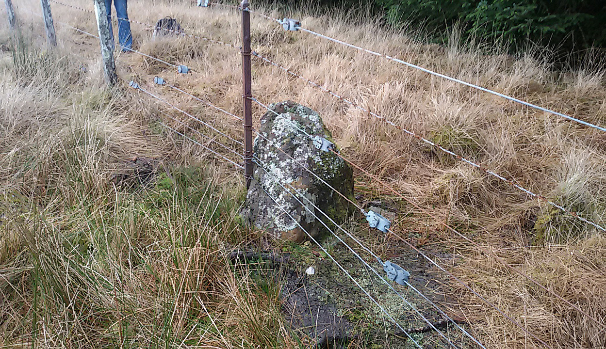
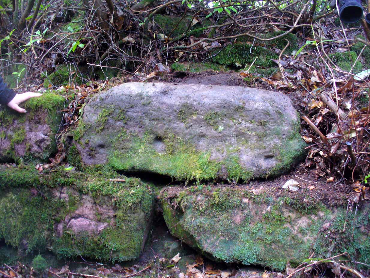
Take the B822 road between Kippen and Fintry, stopping at Balafark farm. On the other side of the road, above the farm, take the track into the forest. Naathen…. 1120 yards (1.02km) along, note the small green track, off the main central track, slightly up on the rise on your right. It bends round and then goes (eventually) straight to the edge of the forest. Once you reach the edge, go left all along the fence until it meets the large gate 800 yards WSW. 20 yards past the gate, a small stone is along the fence-line. This is the Carlin!
Archaeology & History
Carling Stone, looking east
Found along the same boundary line as another stone with similar mythic virtues (called the ‘Wife with the Bratty Plaid’), when Marion Grace Woolley and I visited the site earlier, we found only a small upright, barely a foot tall, right in line with the ancient boundary along a newly made fence. Thankfully, whoever built the fence, understood the nature of the stone, and left it in the ground where it belongs. We know not for sure exactly how old this stone might be, but it its name and position suggest very old – probably prehistoric.
The Carlin is another word for the Cailleach: the prima mater or great Earth goddess in Irish, Scottish and northern English animistic traditions. Her virtues are immense, representing the cycles of the natural world, a creation giant, healer and a whole host of other elements inherent to the natural world. Although She tends to be represented as the Winter hag, the Cailleach changes Her faces and attributes as the cloaks of the seasons go by, annually, cyclically, year after year after year. She’s as much the cloak of the Winter as She is the fertility of Spring, the warmth of the Summer and the fruits of Autumn.
Carling Stone, looking west
Whatever traditions there might have been at this small Carlin Stone are now long forgotten it seems. We find no bodach (Her husband) in immediate attendance. However, the existence of the small standing stone called the ‘Wife with the Bratty Plaid,’ several hundred yards to the east along the same ancient boundary line, implies there would have been a traditional perambulation along this boundary, and during such annual ritual walks, tales or words may have been said here. Does anyone know more…?
The quickest way here is still a long one. From Gargunnock village, take the road west towards the A811, turning left just before the bend down to the main road, and up through what looks like private estate gates. Walk all the way along this road as if you’re visiting the Leckie broch and its carvings, but keep going, until it becomes a track. Continue into the woods, uphill and out the other side until you have the Gargunnock cliffs rising a few hundred yards ahead of you. On your right a few yards up is a long straight length of walling running to the first set of cliffs. Go up it and up the next rise and the next. When you’re on top of the moors, look for the highest spot close by. You can’t miss it!
Archaeology & History
Cairn-edge, looking NW
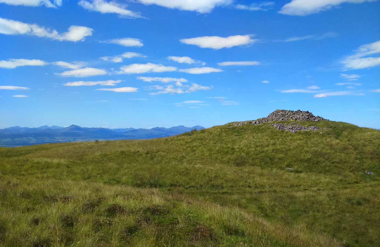
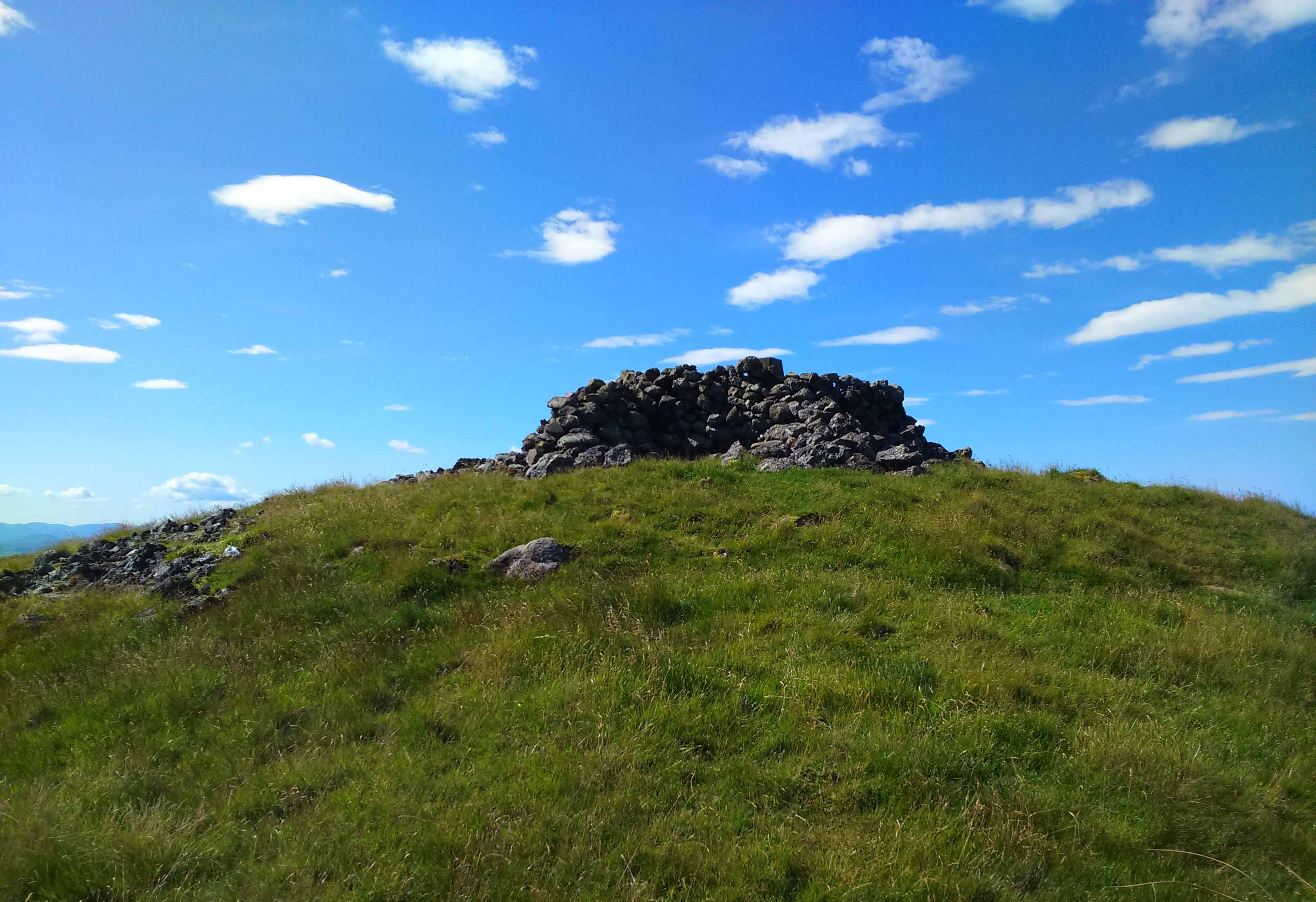
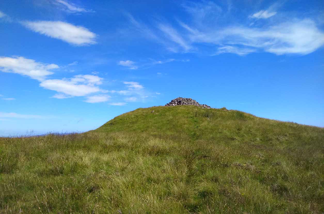
Nearly 1600 feet above sea level, this seemingly isolated giant cairn sits on the highest point of the Gargunnock Hills, giving a truly fantastic 360º view, looking across a diameter of perhaps 100 miles on a clear day—which is what I was greeted with when I visited. Giant cairns scatter hilltops all across the British Isles, many of them peopled with creation myths of giants, devils and thoroughly animistic creatures! But I can find no such tales here… Equal lackings are in the archaeological texts which, it seems, only catalogued the site in recent years.
Caerlatheron, looking SE
The name of the site is intriguing. The element caer is a fort, but no such ‘fort’ seems to be here. But we’ll come back to that shortly. The element latheron and its variants apparently relates to a mire or swamp (Watson 1926), whose existence to the immediate south and west is considerable (a small loch was once hereby, but its size has decreased over the last 150 years), and it is very boggy across the tops here. When I visited, it was a scorching day (I was fucked by the time I got here!), but in many places the ground was very dangerous to walk over. It was superb! So it seems that the place-name indicates Caerlatheron was ‘the fort by the swamp’. It works perfectly, except that this is listed as a cairn – and it’s a large one at that!
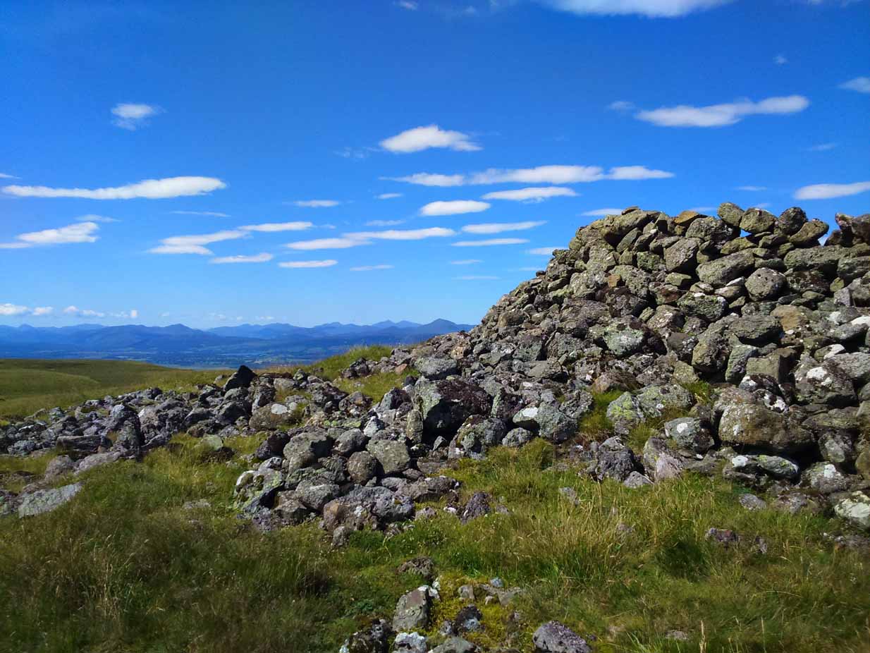
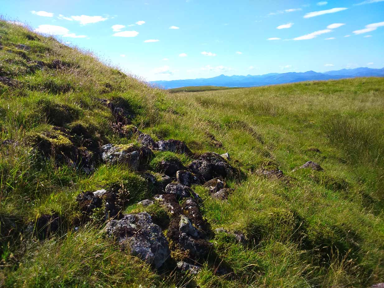
Note the overgrown raised embankment (lower centre)
The cairn sites on top of a large mound. This mound seems to be artificial and is between 10-12 feet high. The cairn and mass of rocks on top of the mound (within which is a triangulation pillar) is itself 4-5 feet high—although much of this relates to Ordnance Survey and walkers piling up many of the loose stones to create an enclosure or wind-break to protect any traveller up here in stormy weather. The cairn-pile is 20 yards across at the top, and as you walk around it you become aware that this appears to be slightly raised on top of its parent mound with an evident ’embankment’, particularly on the eastern side. As you follow this round, you lose sight of it completely on the southern edges, which is covered by the extended cairn-mass; but some of it seems in evidence on the northwest and northern side. A number of stones marking this out would seeeem to be in evidence. A few larger flat stones on the south and western top of the cairn might suggest that it was once a chambered cairn – but this is highly speculative. The late great Audrey Henshall never got here; and I don’t know whether the great local archaeologist, Miss Christian MacLagan, ever got her fingers here either, so we don’t have their expertise to help us out.
Caerlatheron, looking ECairn-mass of the huge mound
The mound upon which the ‘cairn’ sits is also intriguing. When walking round and around the bottom of it, you note the unmistakable substantial mass of overgrown rocks, particularly around from the northwest, to north, to northeast, both on the slopes and at the bottom, seeming to imply that the entire mound is artificial. I kept walking up and down and around it, to see if these had simply fallen from the top, but wasn’t 100% sure and wished there was a geologist at hand to tell me, one way or the other. In truth, the shape of the mound from the bottom, from most angles, reminded me of an overgrown broch and not a cairn. And there are a few brochs nearby—the closest of which is just at the bottom of the hill from here: the Leckie broch (I aint done the site profile for it yet, soz….). It was only when I got home and looked for the meaning of Caerlatheron that the ‘broch’ idea came back to me with a little more fortitude, perhaps making sense of it as a ‘fortified structure by the bogs and swamps’. Perhaps… Without an excavation, we may never know for sure.
Singular cairn, 350yd NNW
About 350 yards northwest, across truly dodgy swampy ground (walk up here at night and it’ll probably be the last thing you ever do!) is another small singular cairn, made up of quite large rocks, with a few smaller ones filling it up. It looks to be either a shepherd’s cairn, or one for his sheepdog perhaps, a few centuries old. I can find nothing about it in any local history or record-books.
The place is well worth visiting—but it’s a full day out and you’ll be knackered when you get back. However, from here Nature grants us a stunning view of these tiny parts of Her body. It’s well worth the effort!
References:
Watson, W.J., Celtic Placenames of Scotland, William Blackwood 1926.
Take the A811 road between Stirling and Kippen and go up into Gargunnock, From the village centre, go along the Leckie Road (not the Main Street!) for half-a-mile, then turn left up the tiny road. ¾-mile (1.15km) along, a small bridge crosses the Leckie Burn (a.k.a. St Colm’s Burn). From here, walk up the footpath into the woods for 100 yards or so and cross the waters. When you see the large overgrown rocky rise of the Leckie Broch covered in pesky rhododendrons, walk up its left-side where (presently) a clearing has been made and the carved rocks stand out.
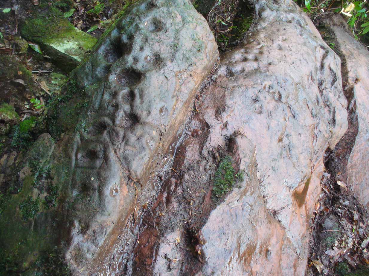
Archaeology & History
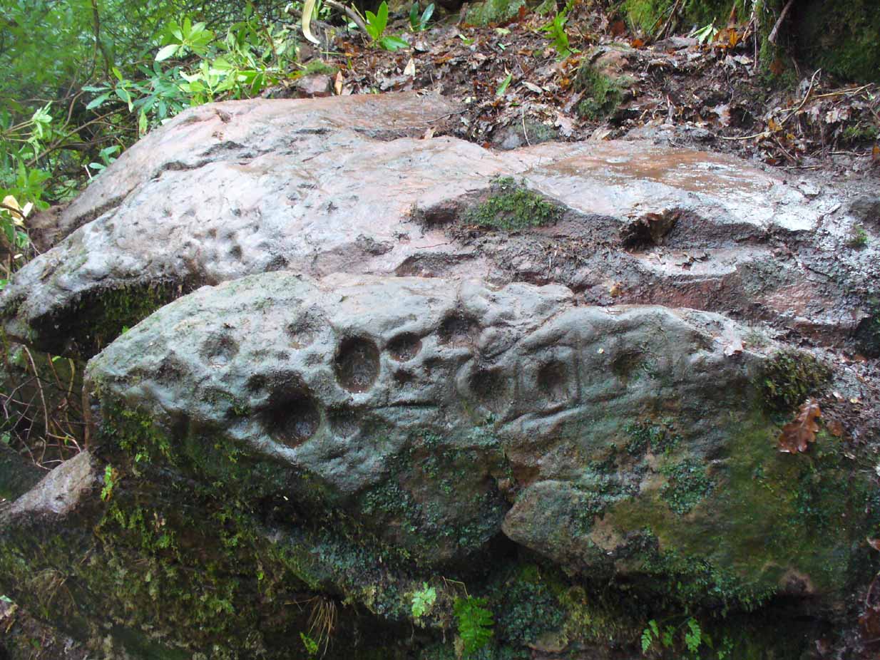
A very curious design here! Possibly carved at the same time as the Leckie broch to which it is attached—possibly not—we have here a curious amalgam of Nature’s incisions and human design, culminating in cup-and-rings and cups-and-squares no less! When we came to visit it a few days ago, Lisa Samsonowicz found the stone hiding away, buried beneath a thin layer of natural cover. The rest of the team thereafter enabled a much clearer pictures of the carving.
Star motif & other cupsYoung Allison on the new find (photo courtesy John McLaren)
We’re not quite sure who first rediscovered the carving. In an early photo of the site taken in the late ’70s or early ’80s, a young Allison McLaren sits highlighting the design. But she wasn’t the fortunate lass who discovered it! One account describes a local woman, Lady Younger of Leckie House, who was out walking her dog, accidentally dislodging some of the rocky debris of the Iron Age broch and unearthing the petroglyphs, thereafter taking Allison along to see it. The other account tells of it being noticed for the first time during an excavation of the broch by Euan MacKie and his team. Whichever it was, Prof Mackie (1970) was certainly the first person to write about it. He told:
“Part of the sandstone face of the northern end of the promontory on which stands the Leckie dun is covered with well preserved cup-marks, presumably much older than the dun. They were discovered when rubble and soil fallen from the dun was removed. Some of the cup-marks stand alone and some are surrounded by what appear to be incised rectangles in a ladder pattern. There are other, less clear markings.”
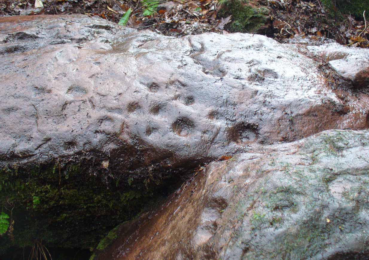
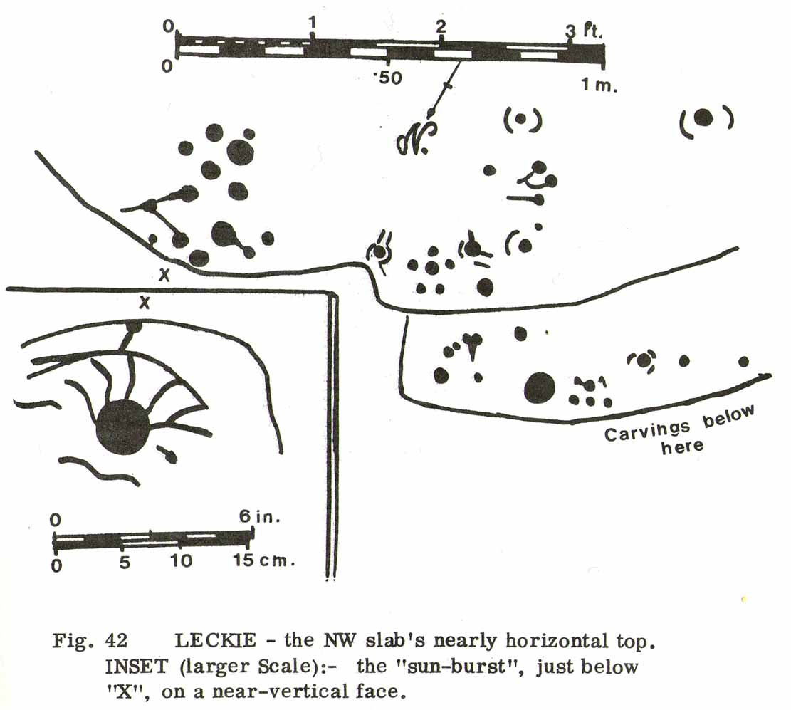
Ron Morris’ 1981 sketchSmall & large cupmarks
There then followed a series of written accounts, small and large, about the Leckie broch—but little else was said of the carvings. It wasn’t until Ronald Morris (1981) came to see them a few years later that they gained a slightly lengthier description. He described how the petroglyph was,
“carved over about 3m (yds) at heights of 1-2m (yds) on faces now sloping mostly 0-90º NW, with 3 cups-and-one-near-hexagonal-ring up to 12cm (4½in) diameter, a ‘sun-burst’ and other grooves, and at least 40 cups up to 12cm (4½in) diameter and up to 8cm (3in) deep. On a vertical E-facing slab there are also many grooves, some of which connect lines of cups. Some grooves resemble a ‘sea-horse’, an ‘axe’, etc. All except the cups are probably incised, but some may be natural.”
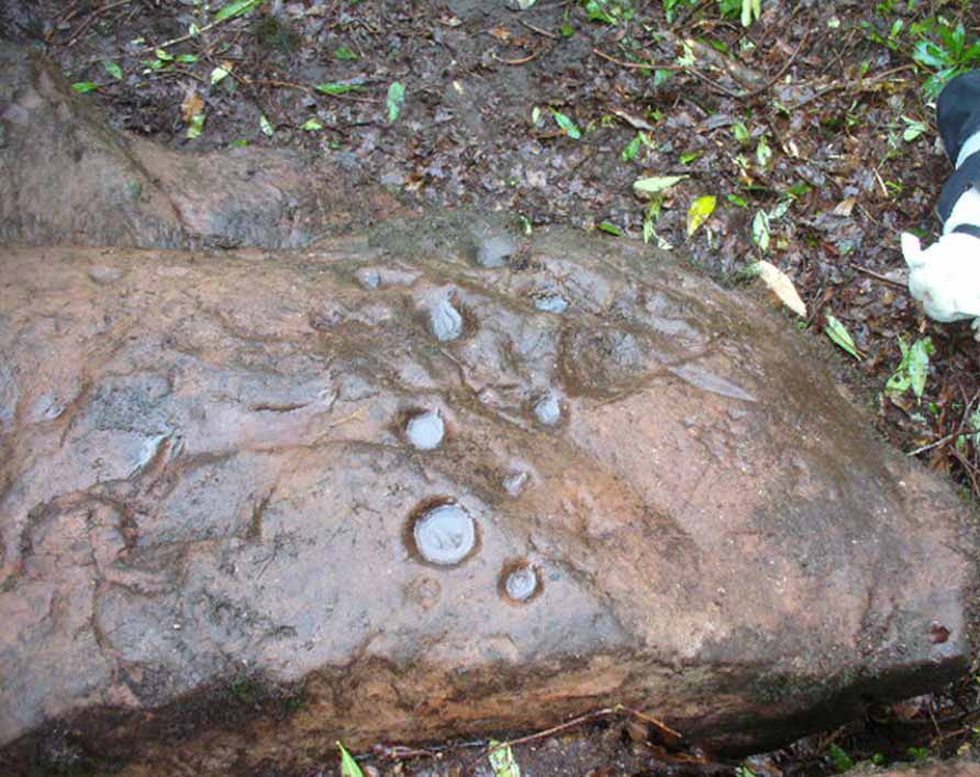
Large cupmarks on sloping faceLooking down the spine of 2 rocks
The entire design in fact covers two separate sections of rock. On the vertical face of one stone is a curious conjoined cup-and-rectangle, attached to a cup-and-square, attached to a traditional cup-and-ring. A cluster of other cups, large and small, are immediately left of this odd geometric pattern. The ‘cups’ within this section of the petroglyph are quite deep and, it would seem, were geological in nature but have been touched-up by human hands. Immediately below this rectangle-square-circle sequence, faint carved lines run a little further down the face of the rock. They were difficult to see clearly and require subsequent visits to enable a more complete picture. Along the top of this section of rock are several cups, one or two of them seeming to have faint rings around them. (at the very bottom of this vertical carved face, at ground level, a small section of man-made walling is visible, which was no doubt a section of the huge broch)
Above the top of this vertical carved face is a gap between this and a second, larger earthfast stone. This has a series of cups, some with faint rings around them, but most of them are just cups, both shallow and deep, running down the slope of the rock. A notable ‘star’ of five cups surrounding a single-cup stands out on this section. Some of them seem to have been geophysical in nature, but again have been touched-up and added to.
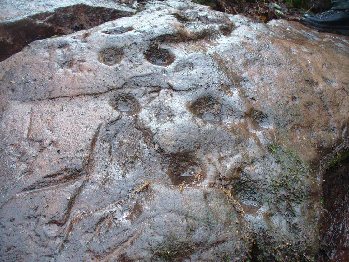
Cluster of curious peck-marks
Slightly higher still, on another third section of rock, a curious cluster of weird ‘pecks’, almost in a square pattern, with a possible cup-mark close to the edge of the stone is clearly visible. The edge of this rock seems to have been quarried and the markings here may just be mason marks preceding the breaking of the stone in the Iron Age.
Walk around to the south-side of the broch and there, in the walling, on a vertical stone face, is the small cup-marked Leckie 1 carving.
One final note of concern: the carving (and the broch) have become overrun with rhododendrons, to the point where they are severely damaging the monuments here. They need to be curtailed before further archaeological destruction occurs. Help!
Acknowledgements: Immense thanks to Lisa Samsonowicz, Fraser Harrick, Nina Harris, Frank Mercer and Paul Hornby for all their work, enabling a clear picture of the site. And a huge thanks to John McLaren of the Gargunnock Village History site for allowing us to include the early photo of the carving here – thanks John! 🙂
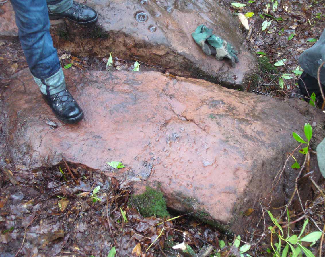
Take the A811 road between Stirling and Kippen and go up into Gargunnock, From the village centre, go along the Leckie Road (not the Main Street!) for half-a-mile, then turn left up the tiny road. ¾-mile (1.15km) along, a small bridge crosses the Leckie Burn (a.k.a. St Colm’s Burn). Walk up the footpath into the woods for 100 yards or so and cross the waters. When you see the large overgrown rocky rise of the Leckie Broch covered in pesky rhododendrons, walk up its left-side and, as it levels out, note the walling on your left. It’s just a few yards along.
Archaeology & History
This cup-marked stone is only for the mad petroglyphic puritans amongst you! Rediscovered by Nina Harris on February 5, 2017, it can be seen when you look at the main southern wall of this rhododendron-infested broch, near the middle of one of the large cut-and-squared stones built into the upright face. The carving has at least two cup-markings on its vertical face—which are clearly visible on the photo. One is quite deep, whilst the other is quite faint. At either end of the stone are what may have been two other cups that were started but never finished, or just natural-occurring holes in the stone (I’m more of the opinion that they’re just natural, but would love to be wrong!). A possible third cup-mark can be seen along the top-edge of the stone.
There is no mention of this carving in Dr Mackie’s various writings on the Leckie Broch, which he excavated in the 1970s; only the recognised cup-and-ring stone (Leckie 02) on its northeast edge. The intriguing element (which can also be applied to the Leckie-2 carving) is that the Leckie Broch was constructed in the 1st century AD—and these cup-markings were probably carved around that time, much later than many others. It is likely that other unrecorded carvings will be hiding away nearby.
References:
MacKie, Euan, “The Leckie Broch, Stirlingshire,”, in Glasgow Archaeological Journal, volume 9, 1982.