Standing Stones: OS Grid Reference – NT 0953 2398
Also Known as:
- Canmore ID 48527
- Menzion Farm

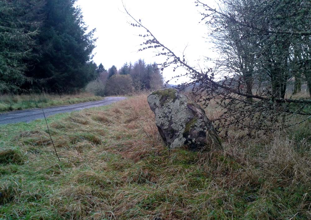
The small Giant’s Stone
Take the long long A701 road betwixt Moffat and Penicuik, and in the middle, somewhere, keeps your eyes attentive to the Tweedsmuir hamlet, across the small bridge almost lost in the expanse of old hills. Once over the bridge, park up by the edge of the forest. Walk along the small road that follows the riverside – and after a few hundred yards you’ll see, either side of the small road, three stones. Our “giant” is the tallest of the smallests here, right by forestside.
Archaeology & History
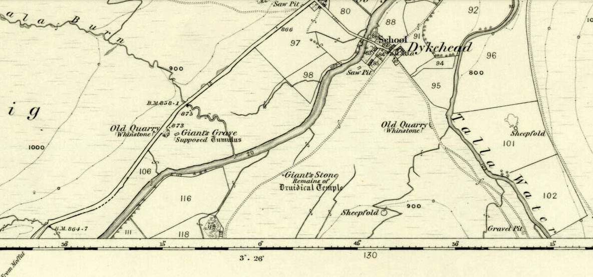
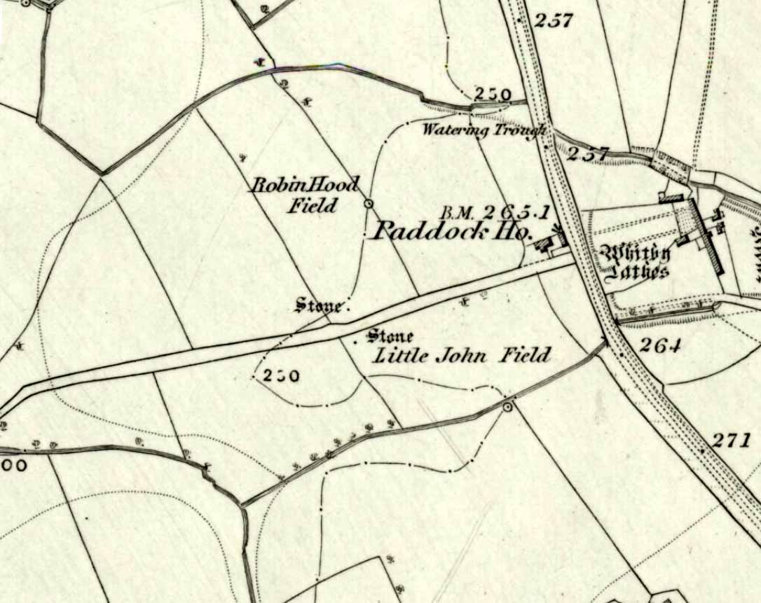
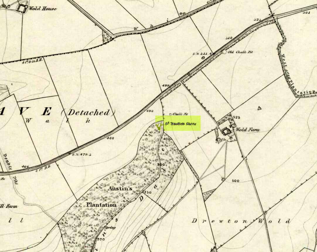
Giant’s Stone & Grave on 1865 OS-map
Hiding away in the Back-of-Beyond, amidst a small cluster of other small megalithic remains, sleeps this quiet standing stone and its companions – three of them altogether, almost lost to anyone but old locals, whose tongues have sadly all but died. Very little has been written about the place in any archaeology tomes and the earliest mention of the site seems to have been in the Second Statistical Account of 1845, when the surveyors told:
“Close by the road leading from the church to Menzion House, there are the remains of a Druidical temple or Pictish court of justice. Only one stone is left of a number similar in appearance and size which stood together, and which have been removed for the purpose of dike-building, &c. It is called the Standing Stone, and is five feet above the surface of the earth.”
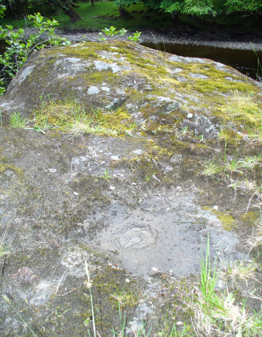
Stone 2, across the road
More than a century later, the Royal Commission (1967) lads got round to checking the place out, but there seems to be some slight confusion as to what they recorded and the situation as it stands today. The present Royal Commission lads reports the existence of what they call the Menzion Stones: quite separate standing stones—although ‘fallen’—just a short distance from the Giant’s Stone (Canmore ID 48561), citing them as described in the Peeblesshire (1967) survey which, oddly, neither includes nor names the Giant’s Stone which is only yards away. It seems safe to assume that the respective Royal Commission inspectors have made erroneous judgements here, brought about due to the repositioning of the original Giant’s Stone when the Forestry Commission afflicted the place and, it seems, damaged the site. It’s difficult to say with any certainty—but there are definitely some official errors in the description of this site. Anyway, if we assume that the ‘Menzion’ standing stones in the Peeblesshire Inventory were actually the Giant’s Stone and its companions, this is how they reported it following a visit here in 1956:
“A quarter of a mile NE of Menzion farmhouse, the road to Tweedsmuir passes between two standing stones. The more northerly stone, situated 10 yds W of the roadway measures about 2 ft. 3 in square at ground level and stands to a height of 2 ft 6 in. The other stone is 25 yds SE of the first and 12 yds E of the roadway. It, too, is almost square on plan, measuring about 2 ft 2 in along each side at ground level, and stands to a height of 2 ft.”
Even more peculiar is that today we have three standing stones at this spot! Like those at Perthshire’s Tigh nam Bodach, perhaps the metamorphosized spirit of the site is reproducing!
Folklore
In the very same Second Statistical Account (1845) was recounted the folklore of the largest stone, which had obviously been told them by local folk. Twas said that,
“From behind it, a person of diminutive stature, known by the name of Little John, discharged an arrow at the head of a freebooter of formidable dimension who greatly annoyed the peaceful inhabitants, and who, though on the opposite side of the Tweed, was unable to elude the deadly stroke.”
Folklorists Janet & Colin Bord narrated a variation on the above story, telling that,
“This stone and the two nearby mark the place where Jack the Giant Killer despatched his last victim. Jack hid behind the Giant’s Stone to shoot, but unfortunately the mortally wounded giant managed to get a punch in and Jack was himself killed. The stone now acts as his gravestone.”

All three stones together
Invariably, references to “giants” in folklore—be it in mountains or standing stones—indicates early Creation Myth stories that tell about the origin of the given site. In the case of this standing stone and its companions, and the related Giant’s Grave tomb 320 yards WNW across the River Tweed, it would seem to indicate a folk memory of the hero-figure or giant who was buried here thousands of years ago, and whose spirit inhabits the stone. This motif is widespread and very archaic.
References:
- Bord, Janet & Colin, Atlas of Magical Britain, Sidgwick & Jackson: London 1990.
- Eliade, Mircea, A History of Religious Ideas – volume 1, University of Chicago Press 1978.
- Johnson, Walter, Folk Memory, Oxford University Press 1908.
- Maclagan, David, Creation Myths, Thames & Hudson: London 1977.
- Roberts, Anthony, Sowers of Thunder, Rider: London 1978.
- Royal Commission on the Ancient & Historical Monuments, Scotland, Peeblesshire – volume 1, Aberdeen University Press 1967.
© Paul Bennett, The Northern Antiquarian