From Durness take the road east for a couple of miles till you see the signpost which takes you on the left-hand side of the road, down to the coast. You can’t miss it!
Archaeology & History
Findings here allege to take the history of the place into the mesolithic period, but we don’t know this for sure. An excavation here by a Mr Donald Macdonald of Sangobeg in 1904 uncovered the presence of several small bone pins, which seem consistent with Mesolithic finds elsewhere. When archaeo-excavations were done here in 1982, human remains going back to at least Iron Age were found in the simple deposit of many shells. A further analysis by the Glasgow Archaeology Unit in 1996 was prevented of some excavation by (get this!) those screwy Health & Safety regulations. Here’s a definite case for an independent group to undertake work here, as we could ignore such preventative measures (and if we drown it’s our fault!). Smoo Cave’s primary function is pretty obvious: it would have been used for both shelter and ritual.
Folklore
The folklore here tells of magick and occultism and possible remnants of rites of passage lore. For herein, many centuries ago, a powerful land-owner called Lord Reay — reputed as a master in the black arts — battled with the devil in the Smoo Cave.
The devil was keeping watch on Lord Reay following a previous dispute between the two of them, and espied him as he entered the cave. As Alexander Polson told it, the cave
“consists of three caverns, one within the other. Lord Reay had got as far as the second, and his dog, which had gone on in advance, returned howling and hairless. By this, Lord Reay knew that Satan was there before him, and bravely waited the attack, which was soon made, and his lordship fought lustily. Happily at the opportune moment a cock crew. This frightened the devil and his attendant witches, but Lord Reay stood between them and the exit. In their fright they blew holes through the roof of the cave, and this is the origin of the two openings through which the Smoo burns fall.”
Pitch black cave; protective spirit animal; encountering one’s psychological nemesis; unconscious battles with Underworld forces; rebirth of the sun at cock-crowing time; the conquering of the dark forces and renewal of Lord Reay. These are typical hallmarks probably signifying folk-remnants of shamanism and rites of passage, for which this cave may once have been used.
References:
Polson, Alexander, Scottish Witchcraft Lore, W. Alexander: Inverness 1932.
From Threshfield, go up Skirethorns Lane for about 1/2 mile, where the lane takes a sharp right. Continue uphill for nearly 2 miles to a metal gate. Go through the gate, where you’ll see a pair of curious standing stones ahead of you, but instead walk about 250 yards along the line of the old field wall running to the west. You’ll see on the modern OS-map that a ‘cairn’ is shown: this is where you’re heading!
Archaeology & History
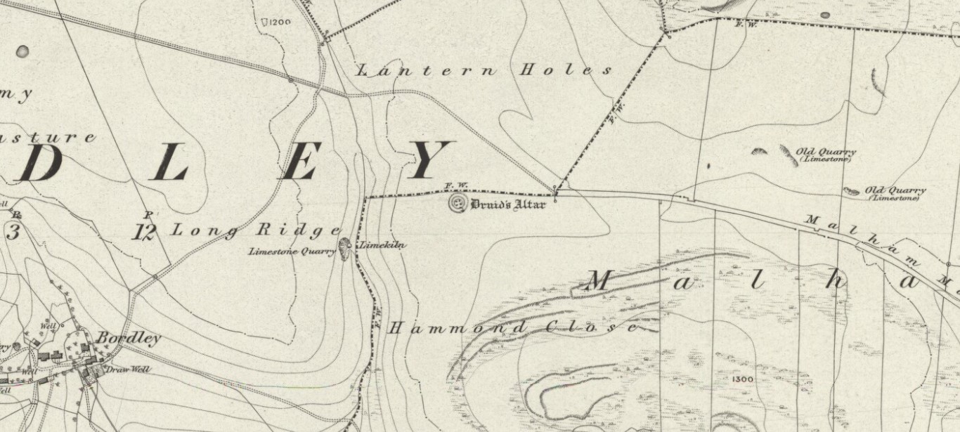
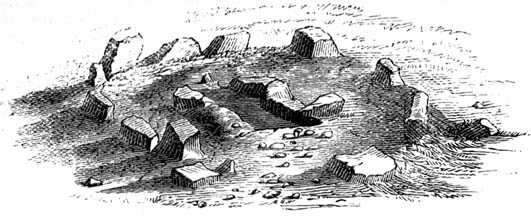
First highlighted on the 1852 OS-map of Bordley and district, this is a lovely site in a beautiful setting, surrounded by a veritable mass of other prehistoric remains at all quarters, including the large settlement of Hammond Close immediately south, the little-known settlement at Kealcup to the west, the Lantern Holes settlement up the hill immediately north, some standing stones due east, and much more. Although it was described in Aubrey Burl’s Four Posters (1988) as just such a type of megalithic relic (a “four-poster stone circle”), an earlier description of the site from the mighty pen of Harry Speight (1892) told of a much more complete ring of stones, with trilithon to boot. He wrote:
“This prehistoric relic consists of a round stone and earthen mound, about 150 feet in circumference and 3 feet high, and was formerly surrounded by a circle of upright stones, only three of which are now left standing. On one side was a large flat stone resting upon two others, and known as the Druid’s Altar. On the adjoining land an ancient iron spear-head was found some years ago, and fragments of rudely-fashioned pottery have also from time to time turned up in the same neighbourhood.”
Edmund Bogg’s (1904) description following his own visit a few years later described this “remains of Druidical sacrifice” as consisting of,
“a mound some four feet high, and fifty yards round the outer rim. In the centre are two upright stones about four feet in length; and others nearly buried in the mound. Numerous stones from this circle have been used in building the adjoining walls.”
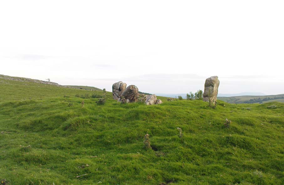
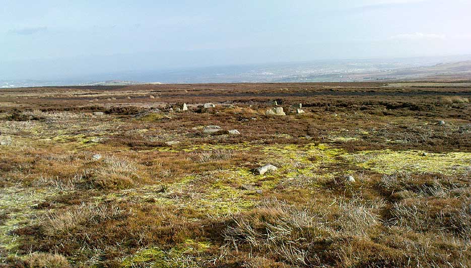
Bordley Circle, looking SEBordley Hill, looking south to Pendle Hill
A decade later another writer (Lewis 1914) merely copied what Speight and Bogg had recited previously. And whatever the modern books might tell of its status, I think we can safely assert that this was originally a much more substantial monument than the humble four-poster stone circle that meets our eye nowadays. Our megalithic magus, Aubrey Burl (1988), wrote the following on Bordley’s druidical stones:
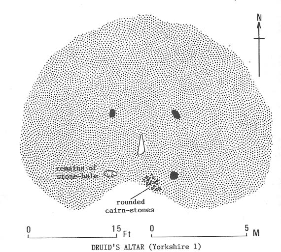
“On a circular mound 41ft (12.5m) across and 3ft (1m) high, three stones of local limestone form the corners of a rectangle 11ft 6in (3.5m) square, from which the SW stone is missing. At its corner is ‘a stump, possibly the base of a prostrate stone,’ 5ft 10in (1.8m) long, now lying near the centre. The tallest stone, 3ft 7in (1.1m) high is at the south-east. The sides of the square are close to the cardinal points. Between the SW and SE stones is a scatter of round cairnstones… Characteristically, the 4-Poster stands at the edge of a terrace from which the lands falls steeply to the west.”
Plan of the Druid’s Altar (after Burl, 1988)
The Druid’s Altar seems to have originally been a large prehistoric tomb, perhaps even a chambered cairn. Its situation in the landscape where it holds a circle of many outlying hills to attention, almost in the centre of them all, was evidently of some importance. The only geographical ‘opening’ from here is to the south, where a long open valley widens to capture the grandeur of Pendle Hill, many miles away. This would not have been insignificant.
We must also draw attention to what may be a secondary tumulus of similar size and form to the mound that the Druid’s Altar sits upon only some 25 yards to the west of the “circle”. The shape and form of this second mound is similar to that of our Druid’s Circle — though to date, it seems that no archaeologist has paid attention to this secondary feature. It measures some 21 yards (east-west) x 19 yards (north-south) in diameter and has the appearance of a tumulus or buried cairn. The mound may be of a purely geological nature, but this cannot safely be asserted until the attention of the spade has been brought here.
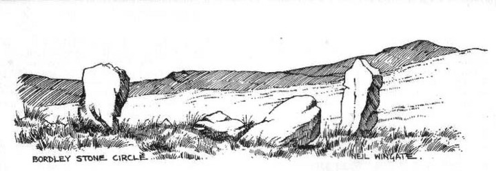
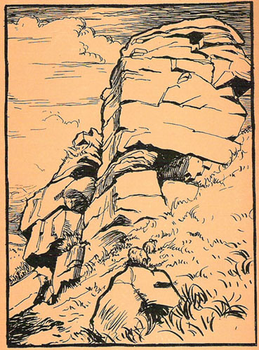
Druid’s Altar, Bordley (drawing by Neil Wingate, 1976)
Folklore
Although we have nothing directly associated with the circle, the surrounding hills here have long been known as the abode of faerie-folk. Threshfield — in whose parish this circle lies — is renowned for it. There have been accounts of curious light phenomena here too. Modern alignment lore tells the site to be related to the peaked tomb above Seaty Hill, equinox west of here.
References:
Bogg, Edmund, Higher Wharfeland, James Miles: Otley 1904.
Burl, Aubrey, Four Posters: Bronze Age Stone Circles of Western Europe, BAR 195: Oxford 1988.
Feather, S.W. & Manby, T.G., ‘Prehistoric Chambered Tombs of the Pennines,’ in Yorkshire Archaeological Journal, Vol 42, 1970.
Lewis, A.L., ‘Standing Stones and Stone Circles in Yorkshire,’ in Man, no.83, 1914.
Raistrick, Arthur, ‘The Bronze Age in West Yorkshire,’ in Yorkshire Archaeological Journal, Vol 29, 1929.
Speight, Harry, The Craven and Northwest Yorkshire Highlands, Elliott Stock: London 1892.
Wingate, Neil, Grassington and Wharfedale, Grassington 1977.
Follow the same directions as to reach the Tree of Life Stone carving. From here walk 7 or 8 yards east. You can’t miss it!
Archaeology & History
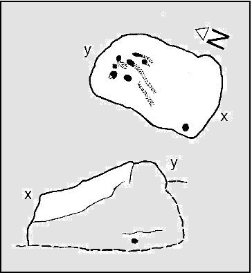
Coped Stone carving (after Boughey & Vickerman)
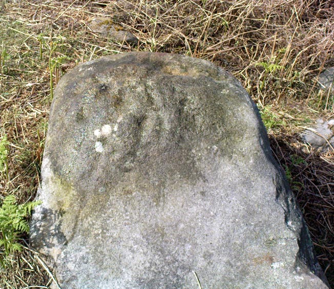
About 20 feet away from the more renowned Tree of Life Stone — and seemingly linked to it by a small stretch of ancient walling that runs between the respective stones — is this rather large boulder close to the walling with at least seven cup-marks on it. A number of vague lines run down and around the edges of some of the cups, but they can be somewhat hard to see if the light conditions aint right (I don’t recommend trying to suss it out on dark grey overcast days — unless you’ve got awesome eyes!). Immediately next to this rock is a large collection of small stones, looking to be the remains of some man-made construction from time past. The nature of this pile of rocks has yet to be ascertained, but it would be reasonable to assume that it was at one point earlier a much larger pile that has been plundered for use to make the drystone walls hereby. Less than 10 yards below this and the Tree of Life Stone carving is a line of ancient walling, at least Iron Age in nature, possibly earlier, running for some distance east-west up and across the moorland.
Cup-marks near top of the stone
The carving was described for the first time, albeit very briefly, by Eric Cowling (1937) in his lengthier description of the Tree of Life Stone, saying how “a small coped stone to the east has several scattered cups” on its surface — meaning this old thing! Boughey & Vickerman’s (2003) survey (2003) describe it as a “medium-sized, upstanding, worn rock. Seven or eight possible cups, mostly at the top of S face, but one at its bottom of E face.”
…And the poor old fella has had nowt else said of it until now! I reckon this carving will only be of interest to the most serious of meditators or hardened rock-art freaks!
References:
Boughey, Keith & Vickerman, E.A., Prehistoric Rock Art of the West Riding, WYAS 2003.
Cowling, Eric T., “Cup and Ring Markings to the North of Otley,” in Yorkshire Archaeological Journal, part 131, 33:3, 1937.
Cowling, Eric T., Rombald’s Way: A Prehistory of Mid-Wharfedale, William Walker: Otley 1946.
A beautiful place found along the roadside towards Seil Island, on the B844 a few miles south of Oban. When you get near the south end of the loch right by the road, have a gander! If the waters are low you can sometimes see the ghostly island appear above the waves…
Archaeology & History
You’re lucky to see anything here – as the crannog has all but submerged. This old artificial island could once be clearly seen less than 400 yards south of Duachy farmhouse, near the southwestern edge of the loch. It measured roughly 10 yards by 8 yards, was built of stones, seemingly “with a boat-slip on the west side and a ‘square place’ on the east as if for a landing stage.” All trace of the causeway linking it to the shore has apparently vanished. But if you do stop here, check out the Duachy Standing Stones on the hillside behind you!
References:
Royal Commission on the Ancient & Historical Monuments of Scotland, Argyll – volume 2: Lorn, HMSO: Edinburgh 1974.#
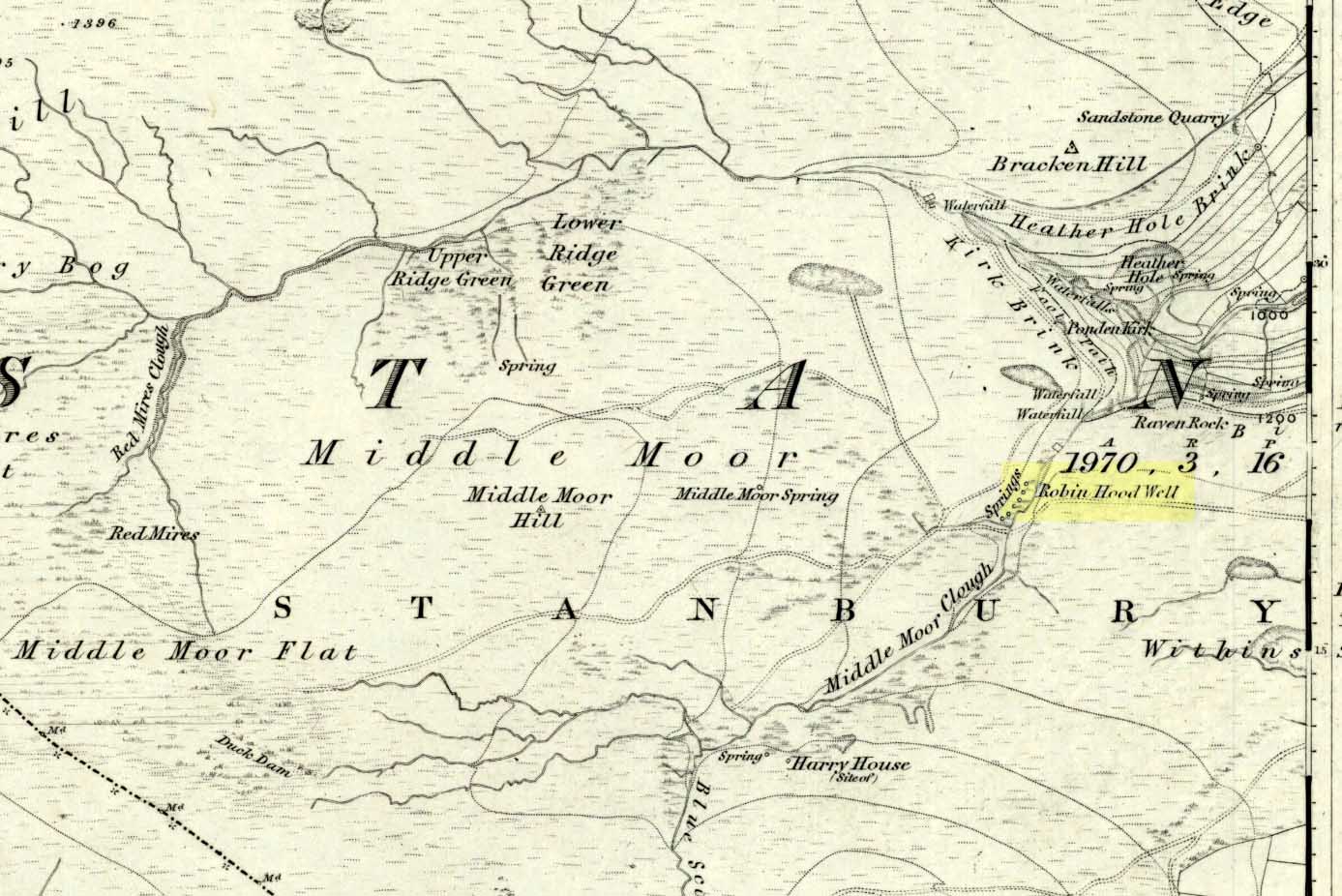
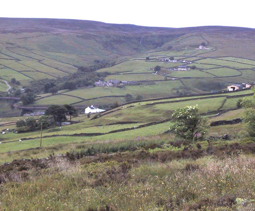
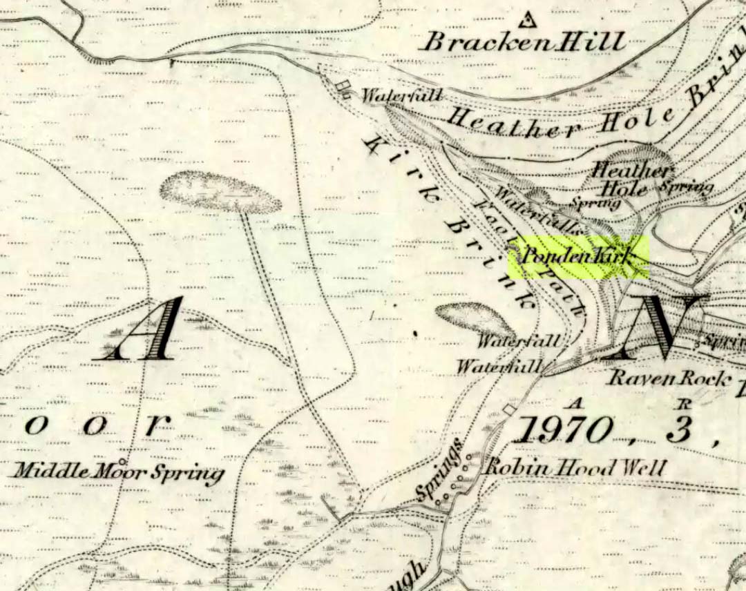
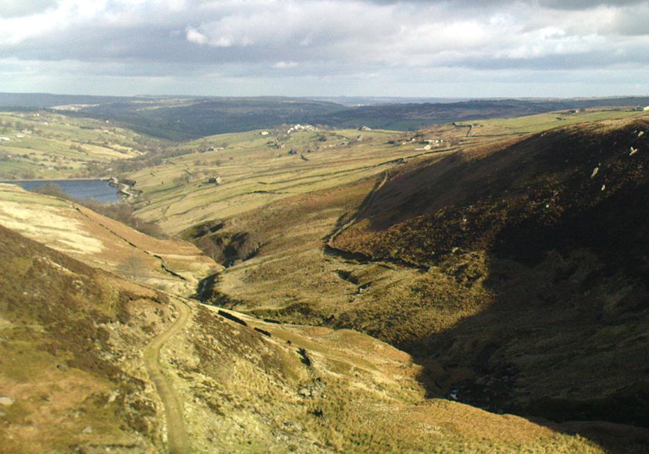
Follow the same directions to get to the nearby Ponden Kirk and, once on top of the rocks, overlooking the valley, walk on the footpath to your right. It bends round and follows the stream up onto the moors. About 100 yards along, walk up the heathery slope to the right and you’ll find several boggy watering holes on the top of the ridge. In looking at the first OS-map of the area in 1853, it seems that the northernmost of six boggy springs is the Robin Hood’s Well – although we don’t know this for certain. It’s one of them though!
Archaeology & History
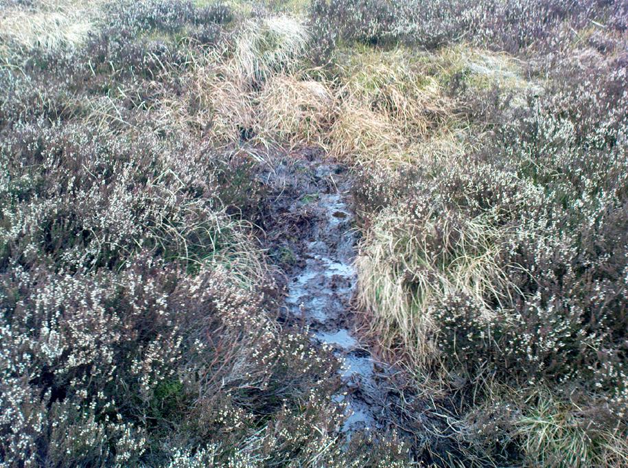
Robin Hood’s Spring, above Ponden Kirk
There’s little to see here really: it’s little more than a small boggy spring of water emerging from the edge of the ridge, as the photo shows. Curiously, descriptions of the site (and its neighbouring compatriots, Will Scarlett’s Well and Little John’s Well) are sparse aswell. It was noted by the Ordnance Survey lads in 1848 and subsequently posted on the first OS-map of the area in 1851. Both Horsfall Turner (1879) and Johnnie Gray (1891) mention the site passing, saying nothing of the place. However, several years after Gray’s work, Halliwell Sutcliffe (1899) ventured here and gave us the first real description of the place, telling:
“Half-hidden underground, and fringed with fern and bog-weed, lie the three wells which go by the names of Robin Hood, Little John and Will Scarlett. One may stop to ask how they came by their birth-names, to wonder why a man should have troubled to fashion them in this out-of-the-way spot; but neither speculation nor questioning of the moor folk brings one nearer to an answer.”
Folklore
Halliwell Sutcliffe’s scruffy quick sketch, circa 1898
Apart from this site being a spot where the legendary outlaw stopped and drank in ages past, the healing attributes of these waters have long since been forgotten. Considering the proximity of the Ponden Kirk and its legendary association with fertility and marriage rites, I’d guess that such lore wold have centred around Beltane, or Mayday; and Robin Hood is very well known in folklore to have close associations with the same period. So — and I’m guessing here — it’s likely that whatever might have occurred at this well, would have taken place around Beltane aswell.
References:
Gray, Johnnie, Through Airedale from Goole to Malham, Walker & Laycock: Leeds 1891.
Sutcliffe, Halliwell, By Moor and Fell in West Yorkshire, T. Fisher Unwin: London 1899.
Turner, J. Horsfall, Haworth, Past and Present, Hendon Mill: Nelson 1879.
Various ways to get here, but the 2 most common are: (1) from Brunthwaite village, above Silsden, following the road uphill for a mile, then turning right (west) onto the moorland dirt-track to Doubler Stones Farm. Just before here there’s a footpath uphill (north) for 200 yards to the stones. (2) follow the Millenium Way footpath south up Addingham Moorside, onto Addingham High Moor. Keep going on the same path another 500 yards and they’ll appear ahead of you.
Archaeology & History
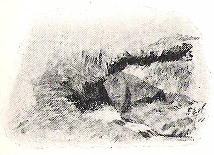
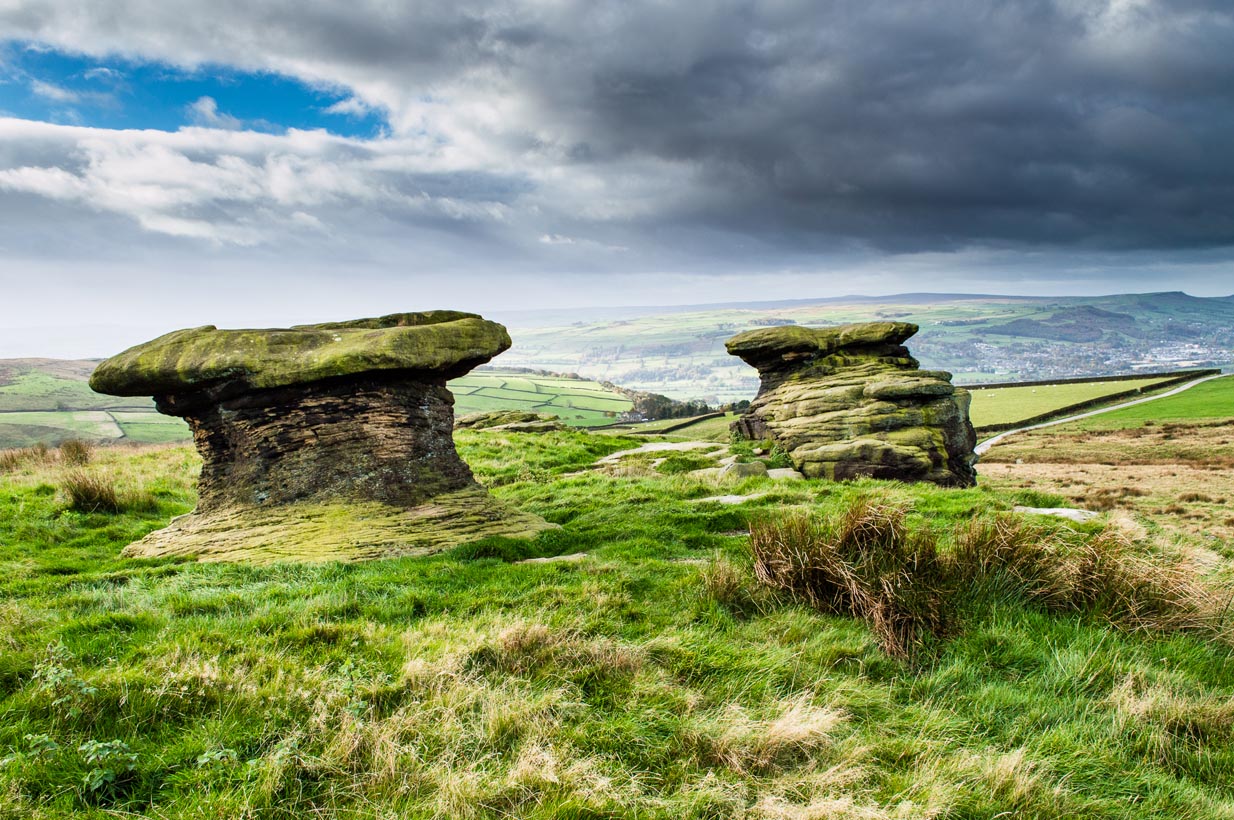
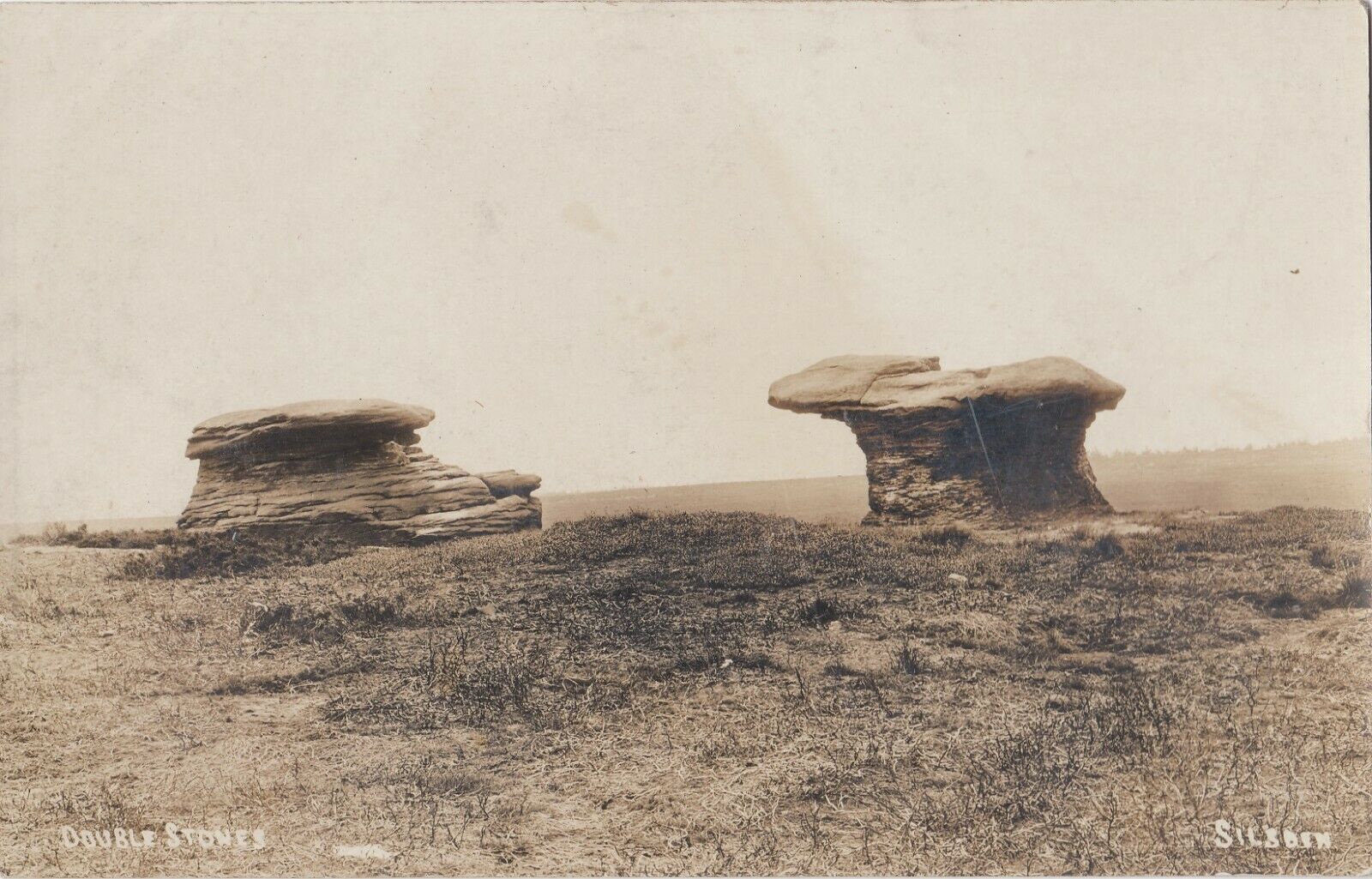
First described as the ‘Doublestones’ in the local Addingham parish records of 1786, these great mushroom-shaped rocks were later brought to the attention of archaeologists by J. Romilly Allen in 1879 and they greatly intrigued numerous Victorian antiquarians, who puzzled as much about their exotic forms as the cup-marks on their tops! Allen wrote of them:
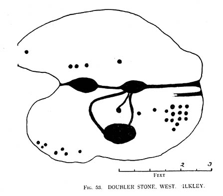
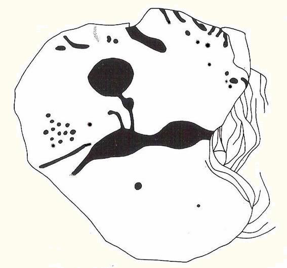
Cowling’s old drawingHedges (1986) sketch of the design
“These rocks are by far the most remarkable freaks of Nature to be seen in the district. They occupy a prominent position, perched on the extremity of a rocky knoll which juts out into the valley; and as seen from below, with their weird forms standing out clear and sharp against the background of blue sky, they present so extraordinary an appearance that they would at once attract the attention of even the most unobservant. In general outline they resemble gigantic toadstools; and I presume that they are called Doubler Stones from the fact of their shapes being almost identical. They may be appropriately described as Nature’s Twins. The upper surface of the cap of one of these stones has three large basin-shaped cavities in it. Two of these lie along the central axis of the stone, and measure respectively 1ft 3in by 2ft 9in deep, and 1ft 9in by 1ft 3in by 9in deep. They are united by a deep groove, a continuation of which runs out over the edge of the stone at each end. There is another basin lying to the west side of the two central ones, with one of which it is connected by grooves. It measures 2ft by 1ft 9in and is 9in deep. There is no direct evidence that these basins are artificial; but it is quite possible that they may have been so originally, and have been enlarged by natural agencies. But in addition to the basins, are twenty-six cup-markings of distinctly artificial origin. They vary in diameter from 2 to 4 in. One group of cups appears to be arranged in parallel rows.”
Doubler Stones, c.1890
Although the writer thought there were no artificial cup-markings on the other Doubler Stone (the one on the left in the photo), John Hedges (1986) and Boughey & Vickerman (2003) cite there to be at least two cup-markings on this rock. Other writers have given different numbers for the respective cup-marks thought to be on these rocks down the years.
If you’re into prehistoric rock-art, check this place out. If you’re a geologist and aint been here, you’ll be even more impressed!
Folklore
Approaching the Doublers (photo – James Elkington)
In Nicholas Size’s Haunted Moor (1934) he described the Doubler Stones as being the abode of ghosts and a place of sacrificial rites in ancient days. While in Guy Ragland Phillips’ Brigantia, we find that the word ‘doubler’ itself “is a large shallow dish, bowl or plate” – which we find on top of the greater one of these two well-worn-weirdoes. As well as being haunted, there is some other little-known, though not unexpected folklore here, which told these old stones to be the meeting place of witches in previous centuries.
In addition to this, we are told that the witches of Fewston valley to the west used to meet up with the more famous Pendle witches at these stones. One historian proclaimed that this notion was spurious, as it would be too far for the Pendle witches to walk – which says more about the historian in question than the people of previous centuries. The distance from Pendle to the Doublers can be traversed in a day and is an ideal meeting spot, away from the prying eyes of a wrathful Church, that sought war against the animistic practices of our ancestors.
References:
Allen, J. Romilly, ‘The Prehistoric Rock Sculptures of Ilkley,’ in Journal of the British Archaeological Association, volume 35, 1879.
Allen, J. Romilly, ‘Notice of Sculptured Rocks near Ilkley,’ ibid, volume 38, 1882.
Bennett, Paul, The Old Stones of Elmet, Capall Bann: Chieveley 2001.
Boughey & Vickerman, Prehistoric Rock Art of the West Riding, West Yorkshire Archaeology Service 2003.
Cowling, Eric T., Rombald’s Way, William Walker: Otley 1946.
Hedges, John, The Carved Rocks on Rombalds Moor, WYMCC: Wakefield 1986.
Jennings, Hargrave, Archaic Rock Inscriptions, A. Reader: London 1891.
Phillips, Guy Ragland, Brigantia: A Mysteriography, RKP: London 1976.
Size, Nicholas, The Haunted Moor, William Walker: Otley 1934.
We were up here again the other week: wind, hail and snow blowing like hell, thankfully keeping the place to ourselves! To get here, head up Cow Pasture Road from the train station and up to the Cow & Calf Hotel near the famous rocks. Go past it a 100 yards or so and then look uphill onto the moors ahead of you. You’ll see a great over-hanging rock on the slope above you which looks as though its may fall down at any moment. That’s the Pancake Stone! Either walk up the steep path to get there quickly, or the longer route by taking the sloping diagonal path that runs eastwards until you’re on the same level.
Archaeology & History
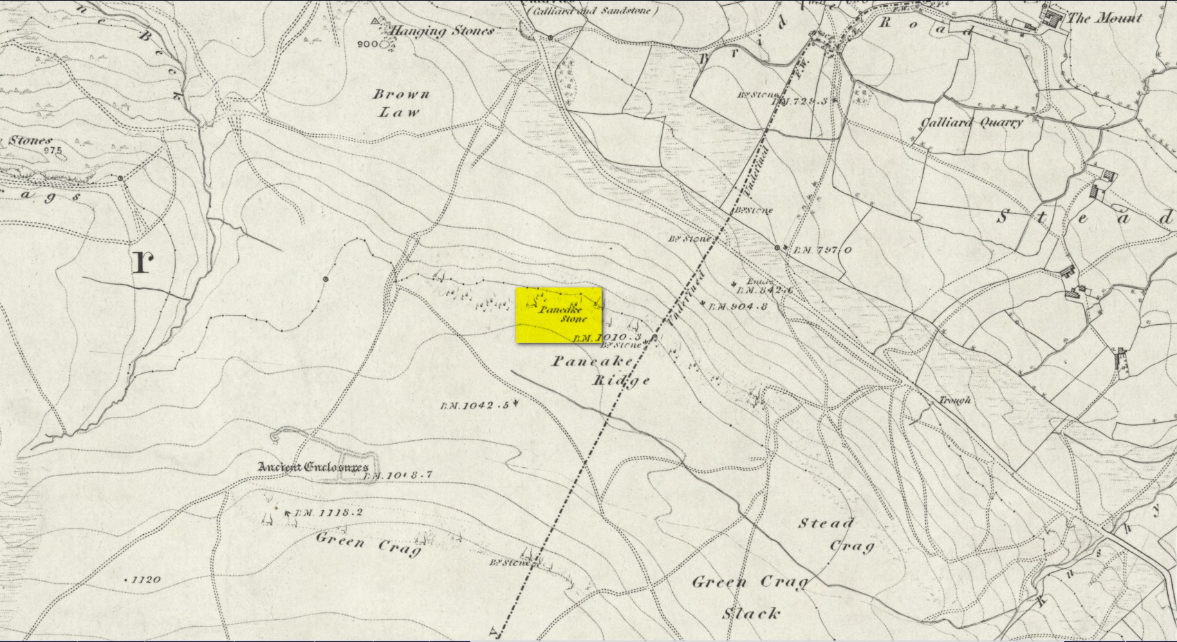
Site shown on 1851 map
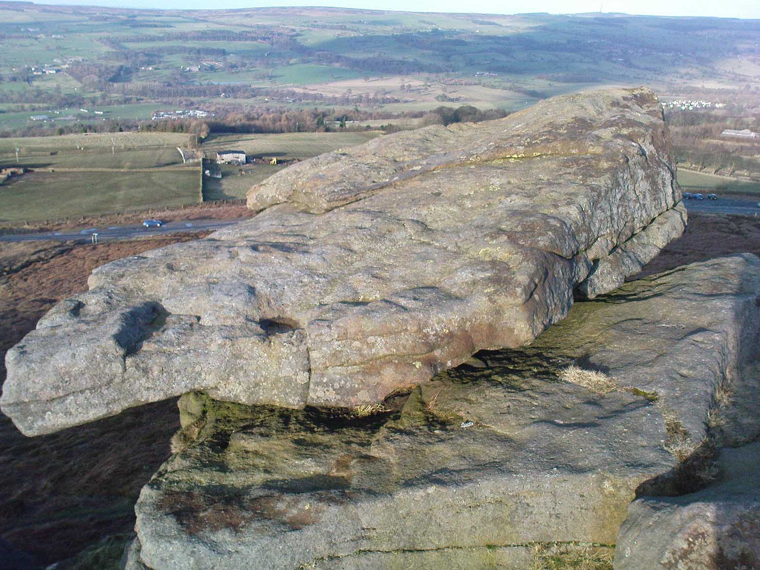
Highlighted on the first Ordnance Survey map of the region in 1851, this prehistoric carved stone had been known as the Pancake Stone by local people long before any antiquarians gave it their literary attention to the place. It would have had tales told of it, no doubt, but they were never written down. It’s an impressive, some would say precarious piece of rock: an elongated thin wedge of stone resting gently on the cliff edge, much like a rocking stone to be honest, seemingly hanging onto the edge of the geological ridge awaiting its fall down the slope; but that’s not gonna happen for many more centuries yet.
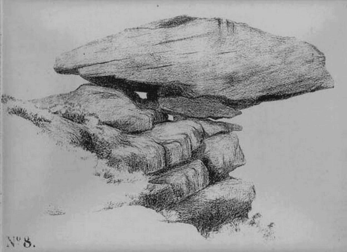
J. Thornton Dale’s 1879 drawingJ. Thornton Dale’s 1879 drawing
Much has been written about the petroglyph on the this wedge of stone, which covers much of its surface. Although a Mr J. Thornton Dale did a fine series of quite accurate drawings of this stone (and others on the moors) between 1878 and 1880, the first literary description of the Pancake rock carving appears to have been by the renowned J. Romilly Allen in 1882 (who evidently visited the stone on a cloudy or overcast day), saying that:
“On its upper surface are several cup-markings much obliterated by the actions of the weather, but some of them sufficiently distinct to prove their origin artificial, and to show that this rock was noticed in ancient times, and very possibly considered an object either of worship or superstition.”
Close-up of CnRsLooking across the stone
This latter assumption is highly probable. Strong animistic notions (moreso than usual) would be very evident here. Its position on the land with its outward focus from here towards other notable points in the landscape (Almscliffe Crags is one obvious focus); as well as looking at the rock itself from other viewpoints, give the stone considerable ritual importance. Sections of the moorland plain behind it—known as Green Crag—was the Land of the Dead in ancient times, and it is more than likely that death rites would have been enacted here — though we may never know what form they took.
Dale’s 1879 sketch
The stone has what seems to be at least 54 cup-markings on its upper face, with numerous grooves meandering and connecting other points. In J. Thornton Dale’s 1879 drawing of the upper surface, you will note that a couple of the rings he included have all-but faded away and are not included in the more recent surveys. Of the primary design, rock art students Boughey & Vickerman (2003) described there being “six complete and five partial rings” amidst the morass, but much of the design is very worn and, originally, there was probably a bit more to it all. The rock upon which the main Pancake Stone rests also has some worn cup-marks etched on its surface, a couple of which can be made out in the top photo.
Folklore
Good old Nicholas Size (1934) added this site to his list as a place where he had visions of the old christian cult, upon whose bare face were enacted blood rites and sacrifice. One Beltane Eve when he decided to amble up onto the moor edge, he could see a strange glow coming from behind the rock. He continues:
“Then suddenly I noticed there was a figure dancing upon it. The figure seemed to swirl round and round with floating draperies, grey or white, and I can only say that it looked very uncanny. Stupidly, I wondered that anybody could be such a fool as to dance in the darkness upon that precarious footing…”
But such activities on these moors, at certain times of the year, have been enacted for many centuries. It’s just kept quiet and, as more modern pagans (as they like to call ’emselves) keep coming up here and to other places, so the original folk move to their older and increasingly more secluded spots… In the latter half of the 20th century the site was used as a focus by chaos magickians, shortly after the inception of that Current.
References:
Allen, J. Romilly, ‘The Prehistoric Rock Sculptures of Ilkley,’ in Journal of the British Archaeological Association, volume 35, 1879.
Allen, J. Romilly, ‘Notice of Sculptured Rocks near Ilkley, with some Remarks on Rocking Stones,’ in Journal of the British Archaeological Association, volume 38, 1882.
Boughey, Keith & Vickerman, E.A., Prehistoric Rock Art of the West Riding, West Yorkshire Archaeology Service 2003.
Cowling, Eric T., Rombald’s Way, William Walker: Otley 1946.
Hedges, John, The Carved Rocks on Rombalds Moor, WYMCC: Wakefield 1986.
Jennings, Hargrave, Archaic Rock Inscriptions, A. Reader: London 1891.
Size, Nicholas, The Haunted Moor, William Walker: Otley 1934.
Speight, Harry, Upper Wharfedale, Elliott Stock: London 1900.
Go west through Stanbury village towards Lancashire for a mile till you reach the end of Ponden Reservoir. Where the water ends, follow the small track up to, and past, Whitestone Farm, till you reach the stream. Follow the valley up…
Archaeology & History
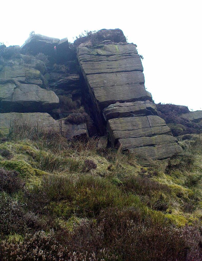
As the great Yorkshire historian J. Horsfall Turner (1879) told, “Ponden Kirk consists of a ledge of high rocks, dry in summer, but forming a stupendous cataract after heavy rain. It was here that Mrs Nicholls (Currer Bell) caught a severe cold shortly before her death.” The site is a fine one – not to be attempted from the base by unfit doods, unless you’re really serious about your climbing! But to those of us who like clambering up rocks and wholesome scenery, walk to the site via the stream (Ponden Clough Beck) and get to the cleft in the rock face. Tis a truly fine place!
Ponden Kirk from below
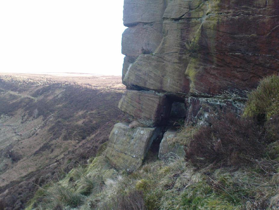
In 1913, one writer posited the notion that the opening in the rocks through which local folk crawl (see Folklore, below) “is seemingly artificial” – which aint quite true, sadly.
Once on the tops above the Kirk, you’ve one helluva decent view, be it raining or sunny. On the far northeastern horizon arises the great omphalos of Almscliffe Crags; and next to that is the elongated top of Baildon Hill; and a little further northeast is Otley Chevin. It would be good to visit here on a few of the old heathen days and watch the sunrise, just to see if there are any intriguing solar observations to be made! (take a tent though – or p’raps, if you’re like us, don’t bother, but you’ll be bloody cold for the night!) The only potential sunrises of heathen significance appear to be midsummer and Beltane….
Ponden Kirk on 1851 map
For me at least, one of the things which gives this site an intriguing form of sanctity is the fact that the Kirk itself forms the head at the end of the valley. It is a very fine ritual site and would obviously have had much more to be said of it than just the heathen marriage rites which are left today. The forces of wind and rain scream from its height, and in the valley beneath the chime of the gentlest echoes resonate, giving an altogether different ‘spirit’ amidst the same land. Those old cherubs of ‘male’ and ‘female’ spirit commune potently here – no doubt being the ingredients which gave form to the marriage customs… Those of you into feng-shui (the real stuff, not the modern bollox) and genius loci should spend time with the water and rocks here and you’ll see what I mean. Archaeologists amongst you, if you dare, should amble aimlessly here for sometime…for many hours, a few times, and give yourselves a notion of the ‘ritual landscapes’ you like to write about from the safety of your textbooks, to get a bittova better notion of what ‘experiencing the land’ is actually about.
Ponden Kirk’s opening
This rocky outcrop was also said to be the place that Emily Bronte used in her Wuthering Heights novel as the place called Penistone Crags. A couple of other local writers have also added this legendary place in their tales aswell.
Folklore
Alleged by Elizabeth Southwart (1923) “to be of druidical origin,” the first literary note of this great rock outcrop appears to come from the reverend James Whalley (1869) of Todmorden, who in his romantic amblings over the moorlands here, told that if any gentleman wants to get married,
“he must by all means pay a visit to Ponden Kirk… Here ‘they marry single ones!’ Any lady or gentleman who can successfully ‘go through one part of the rock’ (which is quite possible) is declared to all intents and purposes duly married according to the forms and ceremonies of Ponden Kirk.”
The view from the top
His wording here seems to imply that the event of passing through the rocky opening, is in itself a confirmation of the ceremony of marriage, not needing the blessing of some strange christian rites. If so, this tradition would be a very ancient one indeed, making the stone the witness to the marriage event. This would be a rite witnessed by the stones themselves: a universal heathen attribute found in most of the ancient traditional cultures. But this curious unwritten history was to be echoed a decade later by that great Yorkshire historian, J. Horsfall Turner (1879), who told us that,
“at Ponden Kirk, as at Ripon Minster, a curious wedding ceremony is frequently observed. It consists in dragging one’s-self through a crevice in the rock, the successful performance of which betokens a speedy nuptial… The place is now frequently called ‘Wuthering Heights. Apart from the association of such names as Crimlesworth and Oakden (see the Alcomden Stones), fancy easily ascribes a druidical settlement at the Kirk.”
A not unreasonable assumption – though nothing of this nature, of yet, has been found.
That other great Yorkshire writer, Harry Speight — aka Johnnie Gray (1891) — echoed the same folklore telling how,
“The natives of these parts have a saying, ‘Let’s go to Ponden Kirk where they wed odd ‘uns,’ which has its origin in an old custom of passing through an enormous boulder… The belief is that if you pass through it, you will never die single. No one knows how the rock acquired its name, but the Saxon kirk suggests a temple of worship, possibly extending back to the druidical times.”
Ponden Kirk – by T. MacKenzie, c.1923
A few years later, Mr Whiteley Turner came here and he too affirmed the old wedding rites, also telling that “according to tradition, maidens (some say bachelors too) who successfully creep through the aperture will be married within the year.” This bit of info also shows that the rocks also had oracular properties – a function known at countless other sites.
The proximity of Robin’s Hood Well, just a couple of hundred yards away, beckons for association with the Ponden Kirk – which it obviously had… But that’s a tale to be told elsewhere…
Get to the Twelve Apostles stone circle, then walk just 100 yards down the main footpath south, towards Bingley, and watch out for a small footpath immediately to your left. Walk on here and head for the rocky outcrop a half-mile ahead of you. Once past the outcrop, take the first footpath right and walk down for another 100 yards. Stop! – and walk into the heather. The circle’s about 50 yards away! You can of course come from the Menston side of the moor, following the same directions for the Great Skirtful of Stones, but keep walking on for another 200 yards, towards the rocky outcrop again, turning left down the path for 100 yards, before stopping and walking 50 yards into the heath again!
Archaeology & History
Roms Law circle
This is one of my favourite sites on these moors. I’m not 100% sure why – but there’s always been something a bit odd about the place. And I don’t quite know what I mean, exactly, when I say “odd.” There’s just something about it… But it’s probably just me. Though I assume that me sleeping rough here numerous times in the past might have summat to do with it, playing with the lizards, and of course…the sheep… AHEM!!! Soz about that – let’s just get back to what’s known about the place!
Grubstones is an intriguing place and, I recommend, recovers its original name of Roms or Rums Law. It was described as such in the earliest records and only seems to have acquired the title ‘Grubstones’ following the Ordnance Survey assessment in the 1850s. The name derives from two compound words, rum, ‘room, space, an open space, a clearing’; and hlaw, a ‘tumulus, or hill’ – literally meaning here the ‘clearing or place of the dead,’ or variations thereof. But an additional variant on the word law also needs consideration here, as it can also be used to mean a ‘moot or meeting place’; and considering that local folklore, aswell as local boundary records tell of this site being one of the gathering places, here is the distinct possibility of it possessing another meaning: literally, ‘a meeting place of the dead’, or variations on this theme.
The present title of Grubstones was a mistranslation of local dialect by the Ordnance Survey recorders, misconstruing the guttural speaking of Rum stones as ‘grub stones.’ If you wanna try it yourself, talk in old Yorkshire tone, then imagine some Oxford or London dood coming along and asking us the name of the ring of stones! It works – believe me….
The site has little visual appeal, almost always overgrown with heather, but its history is considerable for such a small and insignificant-looking site. First described in land records of 1273 CE, Roms Law was one of the sites listed in the local boundary perambulations records which was enacted each year on Rogation Day (movable feast day in Spring). However in 1733 there was a local boundary dispute which, despite the evidence of written history, proclaimed the Roms Law circle to be beyond the manor of Hawksworth, in which it had always resided. But the boundary was changed – and local people thenceforth made their way to the Great Skirtful of Stones on their annual ritual walk: a giant cairn several hundred yards east to which, archaeologically, there is some considerable relationship. For at the northern edge of the Roms Law circle is the denuded remnants of a prehistoric trackway in parts marked out with fallen standing stones and which leads to the very edge of the great cairn. This trackway or avenue, like that at Avebury (though not as big), consists of “male” and “female” stones and begins – as far as modern observations can tell – several hundred yards to the west, close to a peculiar morass of rocks and a seeming man-made embankment (which I can’t make head or tail of it!). From here it goes past Roms Law and continues east towards the Great Skirtful, until it veers slightly round the southern side of the huge old tomb, then keeps going eastwards again into the remnants of a prehistoric graveyard close by.
In my opinion, it is very likely that this trackway was an avenue along which our ancestors carried their dead. Equally probable, the Roms Law Circle was where the body of the deceased was rested, or a ritual of some form occurred, before taken on its way to wherever. It seems very probable that this avenue had a ceremonial aspect of some form attached to it. However, due to the lack of decent archaeological attention, this assertion is difficult to prove.
A previously unrecognised small single tomb is in evidence to the immediate southeast (5 yards) of the circle. There is also another previously unrecognised prehistoric trackway that runs up along the eastern side of the circle, roughly north-south, making its way here from Hawksworth Moor to the south. The old legend that Roms Law was a meeting place may relate to it being a site where the dead were rested, along with it being an important point along the old boundary line. Records tell us that the chant, “This is Rumbles Law” occurred here at the end of the perambulation – which, after the boundary change, was uttered at the Great Skirtful. This continued till at least 1901.
Northern section of the Ring
Modern archaeological analysis of the site is undecided as regards the actual nature of Roms Law. Ordnance Survey maps show it as an “enclosure” (which is vague); Faull & Moorhouse’s survey (1981) erroneously tell us it had no funerary nature, contrary to Eric Cowling’s (1946) report of finding bones and ashes from the small hole in near the centre of the ring, aswell as the 1880 drawing of the site in Collyer & Turner’s survey (above). And we find the single cairn on the south-eastern edge of the ring indicating burial rites of sorts definitely occurred here. Described variously by previous archaeologists as a stone circle, a ring cairn, cairn circle, an enclosure, aswell as “a rubble-fill wall of a circular house” (by some anonymous member of the West Yorkshire Archaeology Service, who didn’t respond to my queries about this curious assumption), the real nature of Roms Law leans more to a cairn circle site. A fine example of a cup-and-ring stone — the Comet Stone — was found very close to the circle, somewhere along the Grubstones Ridge more than a hundred years ago, and it may have had some relevance to Roms Law.
This denuded ring of stones is a place that has to be seen quite blatantly in a much wider context, with other outlying sites having considerable relationship to it. Simple as! (If you wanna know more about this, check out my short work, Roms Law, due out shortly!)
Describing the status and dimensions here, our great Yorkshire historian Arthur Raistrick (1929) told that:
“The larger stones still standing number about twenty, but the spaces between them are filled with stones of many intermediate sizes, so that one could with only considerable detail of size, etc, number the original peristalith.”
…Meaning that we’re unsure exactly how many stones stood in the ring when it was first built! Although a little wider, the Roms Law is similar in form to the newly discovered ‘Hazell Circle‘ not far from here. The site has changed little since Raistrick’s survey, though some halfwits nicked some of the stones on the southwestern edge of the site in the 1960s to build a stupid effing grouse-butt, from which to shoot the birds up here! (would the local council or local archaeologist have been consulted about such destruction by building the grouse-butt here? – anyone know?) Thankfully, this has all but disappeared and the moorland has taken it back to Earth.
There is still a lot more to be told of Roms Law and its relationship with a number of uncatalogued sites scattered hereby. Although it’s only a small scruffy-looking thing (a bit like misself!), its archaeology and mythic history is very rich indeed. “Watch This Space” – as they say!
Folklore
Alleged to be haunted, this site has been used by authentic ritual magickians in bygone years. It was described by Collyer & Turner (1885) “to have been a Council or Moot Assembly place” — and we find this confirmed to a great extent via the township perambulation records. Considerable evidence points to an early masonic group convening here in medieval times and we are certain from historical records that members of the legendary Grand Lodge of All England (said to be ordained in the tenth century by King Athelstan) met here, or at the adjacent Great Skirtful of Stones giant cairn 400 yards east.
The boundary perambulations which occurred here on Rogation Day relate to events just before or around Beltane, Mayday. Elizabeth Wright (1913) said of this date:
“These days are marked in the popular mind by the ancient and well-known custom of beating the parish bounds, whence arose the now obsolete name of Gang-days, and the name Rammalation-day, i.e., perambulation-day, for Rogation-Monday. The practice is also called Processioning and Possessioning… The reason why this perambulation of the parish boundaries takes place at Rogationtide seems to be that originally it was a purely religious observance, a procession of priest and people through the fields to pray for a fruitful Spring-time and harvest. In the course of time the secular object of familiarizing the growing generation with their parish landmarks gained the upper hand, but the date remained as testimony to the primary devotional character of the custom.”
And the calling of, “This is Rumbles Law” maintained this ancient custom when it used to be uttered here.
Not too hard to find really. On the far western edge of the King’s Park golf course, head for the highest point where the small cliffs drop down. From here, walk down the footpath on the slight slope south, just below where the small copse of trees are, and you’ll see the singular small flat stone in the grasses near the footpath you’re walking along. If you can’t find it – look around!
Archaeology & History
A little-known but fascinating isolated carving, first described by David Morris at the sixth meeting of the Stirling Natural History and Archaeological Society in 1901. It is found on the western edge of the town, above the rocky edges not far from the pond of St. Thomas’ Well on the far edge of the golf course. Morris’ finding was written up in their fine journal, where he wrote:
“In the King’s Park, about 50 yards east of the cliff where a seat overlooks the Douglas Terrace sand quarry, there is a smooth surface of rock showing through the turf, measuring two-and-half feet by one-and-half feet… On it is a cup-shaped hollow, outside the rim of which is a well-marked hollowed ring, beyond which is another faintly marked, concentric circular groove. The cup-mark measures one-and-a-half inches across; the inner rim of the first circle is 4 inches, and the outer rim is 6 inches in diameter. The outer circle, if complete, would be 9 inches in diameter. The depth of the central hollow is half-an-inch, and of the inner groove fully one-quarter of an inch. The markings are plainly artificial…”
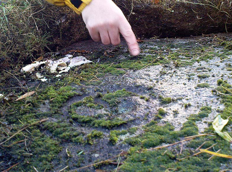
King’s Park CR – central design, pointing to northernmost cup
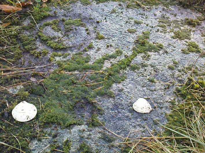
In good sunlight, it is obvious that the carving is a fine example of a double-ringed cup-and-ring carving – though the outer ring may not be complete. The Scottish Royal Commission lads told that “this rock outcrop bears three cup marks” – one of which has the rings surrounding it. In the first photo here, the southernmost cup-marking is highlighted in the centre of the two shells which were on the rock when we arrived.
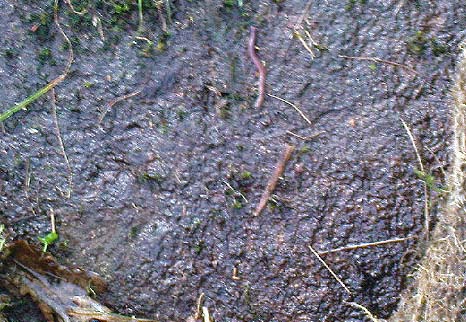
However, there’s definitely more to this carving than previous investigations have outlined. It seems that the northernmost cup-mark has a ring and a possible outer-ring. There is also a distinctive linear carving, which at first seems like a primitive triangle, just below the southernmost cup – as we’ve tried illustrating here in the photo which Mikki Potts took. It’s faint, but once you see it, it’s obvious that it’s there. Other faint lines of similar nature also seem apparent near the northernmost cup-marking, but we will have to wait for rubbings and further visits in better light to ascertain the full image on this rock. Well worth checking out if you like your rock art! (can any of you Scottish rock-art fanatics have a closer look at this? – take a rubbing of it and see what other aspects are on this design)
Faint linear carvings on southern end of the rock
One other thing which seemed apparent when we were here: this site has all the geomantic hallmarks of accompanying a burial at some time in the ancient past. Its isolation here is unusual and the carving is only 50 yards from the highest point hereabouts, where you have 360-degree views all round, typifying the position of many prehistoric tombs.* Does anyone know about such features, or have records of any field-name surveys taken, which might confirm or deny this thought? Twouldst be good to know!
References:
Feachem, Richard, Prehistoric Scotland, Batsford: London 1963.
Morris, David B., “Cup and Ring Marked Rock Surface in King’s Park,” in Stirling Natural History & Archaeology Society Transactions, 1900-1901.
Morris, Ronald W.B., The Prehistoric Rock Art of Southern Scotland, BAR 86, Oxford 1981.
Royal Commission on the Ancient and Historical Monuments of Scotland, Stirlingshire – 2 volumes, HMSO: Edinburgh 1963.
Royal Commission on the Ancient & Historical Monuments of Scotland, Archaeological Sites and Monuments of Stirling District, Central Region, Society of Antiquaries of Scotland 1979.
* Since writing the above, thanks the correspondence of Paddybhoy, we’ve learned that there definitely were prehistoric tombs close by; one being just at the bottom of the ridge below the carving, on Douglas Terrace. Records describe several other prehistoric tombs nearby at Birkhill House, the Birkhill Sandpit and Coneypark Nursery. However, I still think it most probable that there were other tombs and more rock art, probably along the edges of King Park, aswell as the Cambusbarron plain. These need locating.