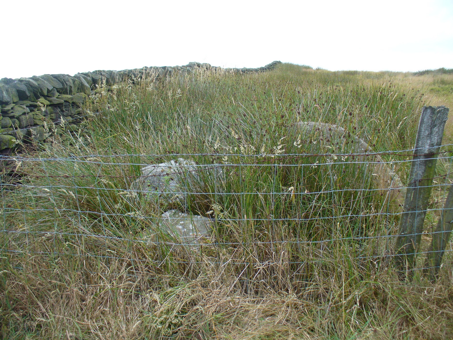
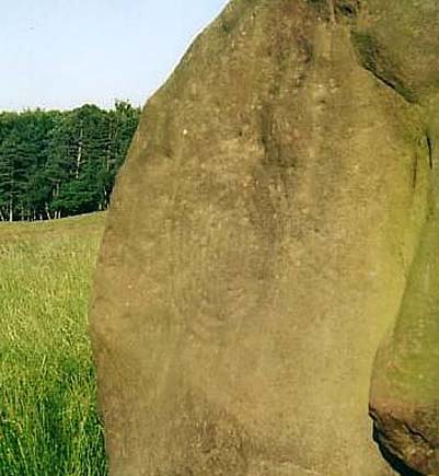
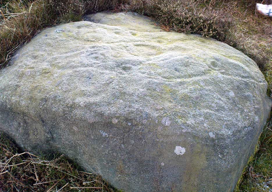
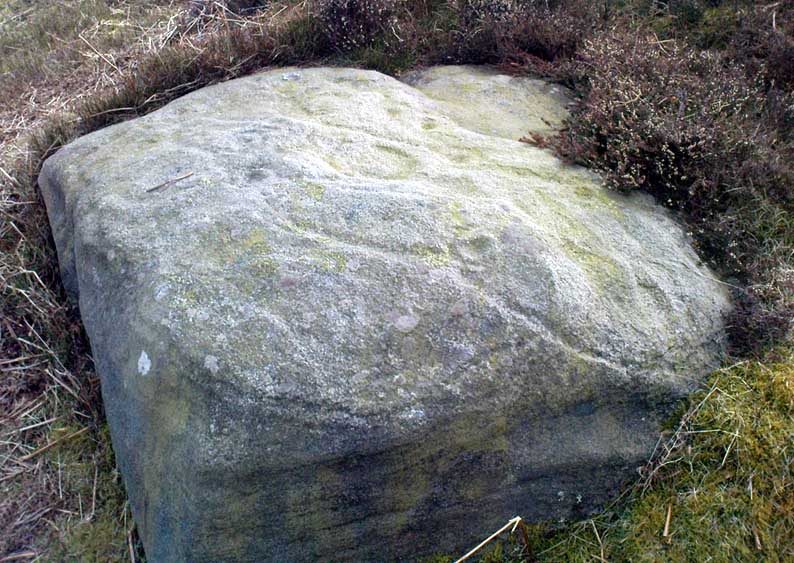
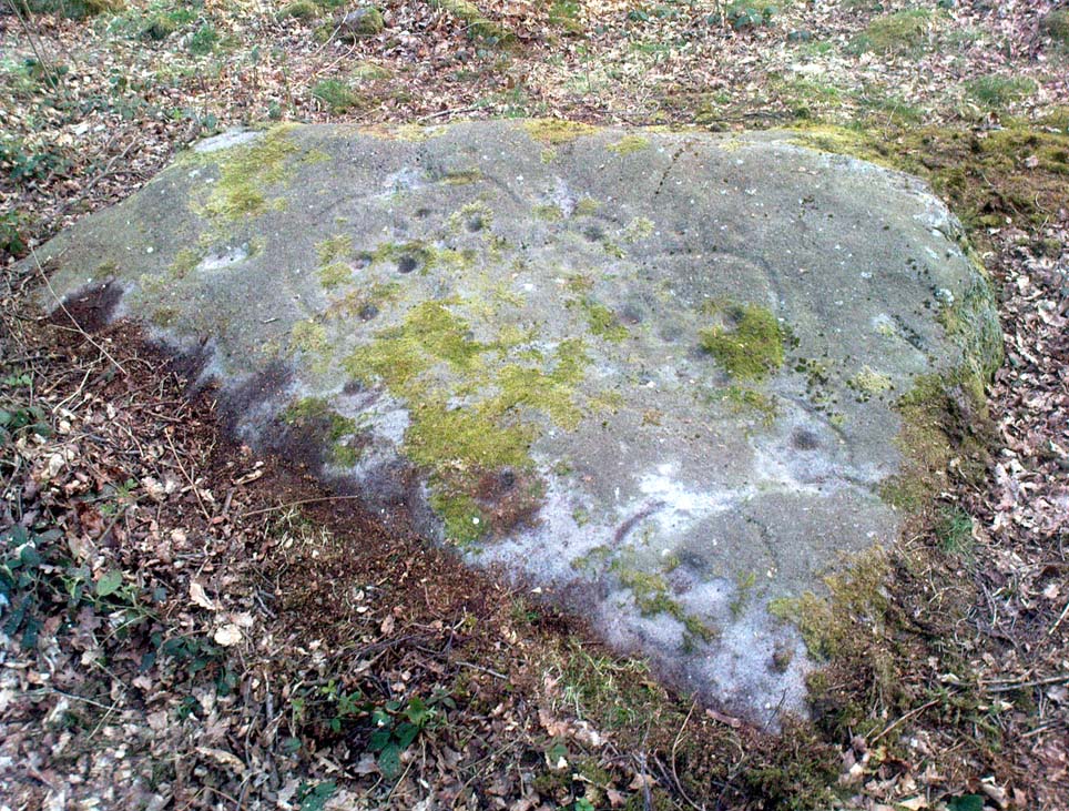
The best and easist way to get here is to drive west past Dick Hudson’s pub along the moor road for about a mile till you reach the left turn of Heights Lane. Stop here! (if you’re now going downhill to East Morton, you’ve gone past it) On the opposite side of the road is a gate and a footpath onto the moor at the spot called Fenny Shaw Low Well (small copse of woods adjacent to your right). Walk a quarter-mile up the path, bearing left where the path diverges (ignoring the ‘Private’ sign) and head for the derelict building. Less than 100 yards before it, notice the large boulder to your right, on the slope – that’s it!
Archaeology & History
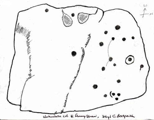
Old inaccurate drawing, c.1982
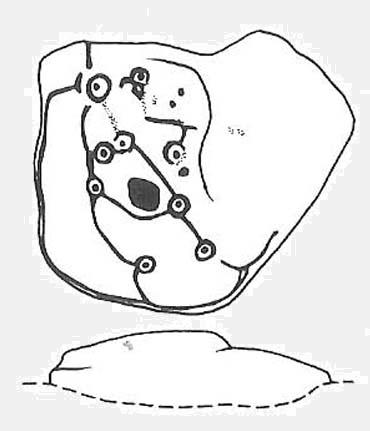
I first came across this on one of my countless ambles on these moors as a teenager. It was a cold, windy day as I recall – hence the reason for my sketch of the stone being a bit vague! The bit of paper on which I drew it, was included in one of my unpublished hand-written booklets. A few years later an image of the carving appeared in Mr Hedge’s (1986) fine collection, in much better detail than my scratty little pic!
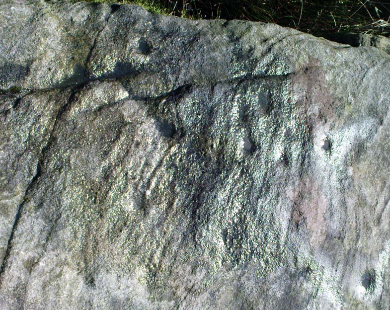
Some cup-marks highlighted
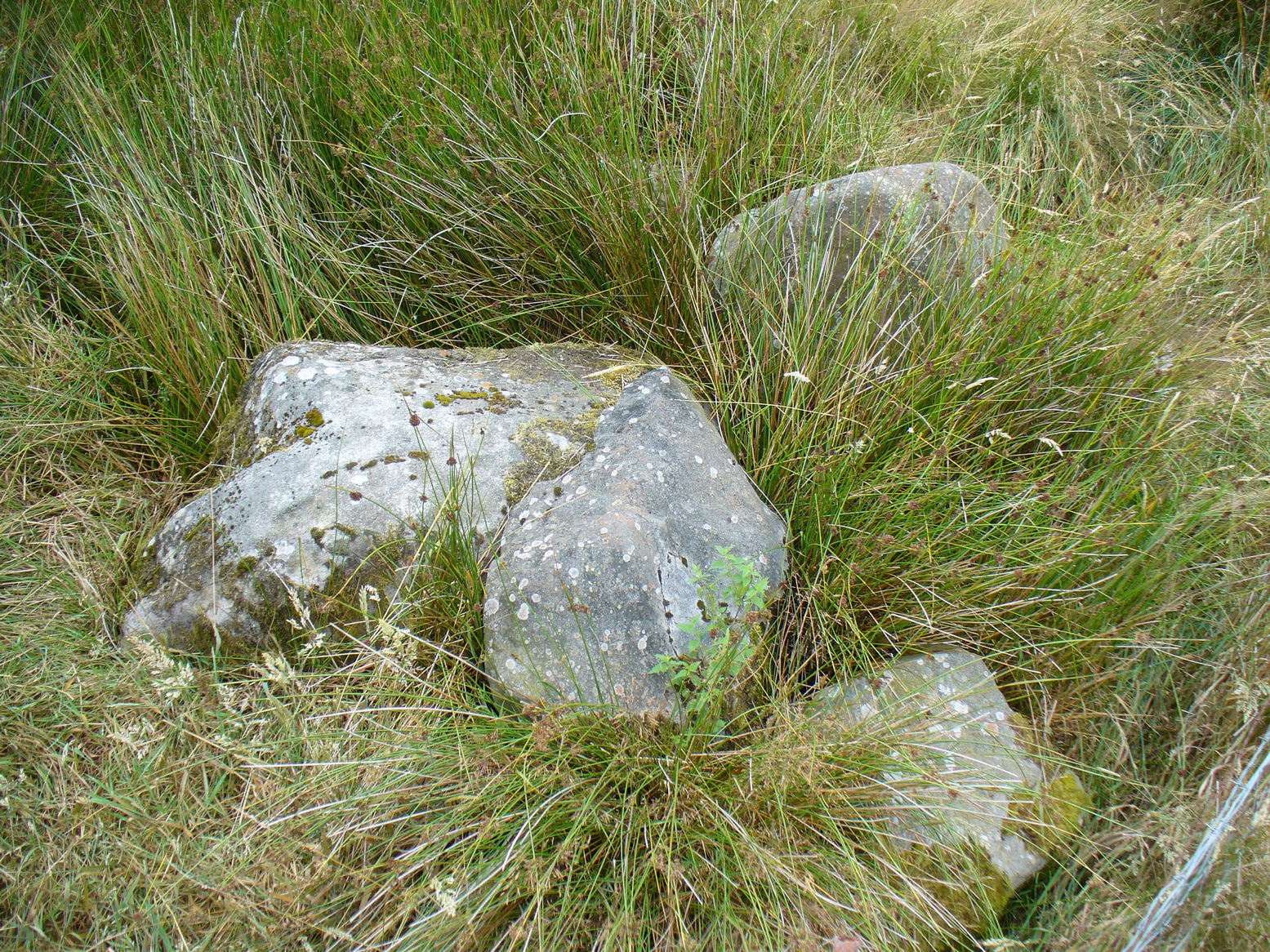
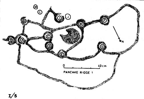
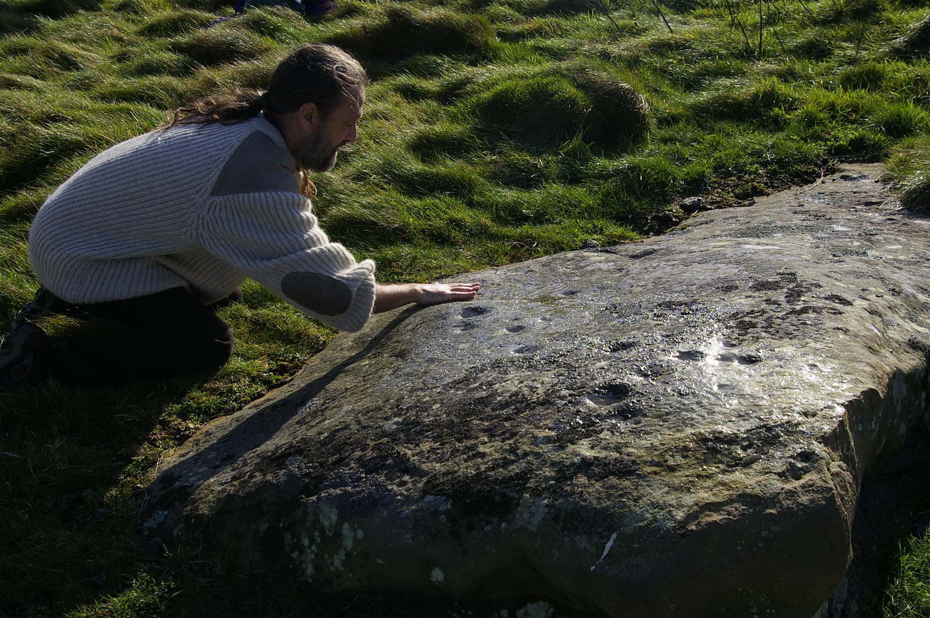
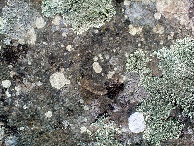
It’s a ‘big rock’ and stands out on the slope here. There’s at least one complete cup-and-ring which is visible on the northern edge of the rock and there are between 17 and 30 other cups scattered across its surface, which has been greatly eroded by our timely forces of wind, rain, ice and snow.
Hedges’ 1986 sketch
In ambling around looking at the other stones in the vicinity, along with finding the small Littlestone cup-marked rock further up the slope, we also found, just below the faded old Big Stone, another quite large rock upon which, quite recently, someone has decided to etch four complete cup-and-ring symbols. These appear to have been done either to,
i) assess degrees and speed of erosion on rock carvings;
or,
ii) pure artistry.
Whichever it may be (and there’s been various cries of “vandalism” when such carvings have been etched by some folk on otherwise virgin rock over the years), let it be known that the Big Stone’s partner was etched c.2008-9. Does anyone out there know who did this ‘new’ carving?
References:
Boughey, K.J.S. & Vickerman, E.A., Prehistoric Rock Art of the West Riding, WYAS: Leeds 2003.
Hedges, John (ed.), The Carved Rocks of Rombald’s Moor, WYMCC: Wakefield 1986.
Stone Circle (destroyed): OS Grid Reference – SE 0898 4393
Also known as:
Bradup Bridge
Brass Castle
Kirkstones Circle
Archaeology & History
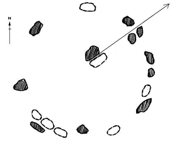
Lay-out of the site, c.1929 (after Raistrick)
Not far from the little-known site of Beacon Hill, this once important megalithic ring was described by Arthur Raistrick in 1929 as “the finest stone circle” in West Yorkshire. Sadly however, the complete destruction of the place in recent years has now left us with nothing to go by (you would think such actions were illegal, but we’ll come to that shortly).
The site measured thirty feet across and, until only a few years back, had a distinct embankment surrounding it. In 1885 Robert Collyer described 18 stones here; but in Raistrick’s (1929) survey only 12 were visible. He told:
“The circle is situated on the west side of the Keighley to Ilkley road, in the rough pasture called ‘Brass Castle’…immediately south and west of Bradup Bridge. The circle is approximately 30 feet diameter, but has been very damaged at some period since 1885. At that date 18 stones were standing, but now only 12 remain, though there are large unfilled holes on the sites from which the other stones have been removed. There are slight traces of a bank, but the most notable feature is the large size of the stones (millstone grit from the neighbouring escarpment) of which the circle has been made. There are some traces of a double circle, but it is not possible to be sure of this now. It seems certain that the stones were removed from this circle to repair the neighbouring Bradup Bridge, an act of vandalism always to be deplored… There is no appearance of this circle having been used for interment, nor any record extant of exploration.”
When Eric Cowling (1946) visited the site in the 1930s, his notes indicate that it was much as Raistrick had described a few years prior, telling:
“This circle is situated at the west side of the Keighley-Ilkley road near Bradup Bridge on the Airedale side of Rombalds Moor, near the crest. Only twelve stones remain standing; these are large and apparently obtained from the nearby escarpment (Kirkstones, PB); holes mark the site of stones removed. The ring is thirty feet in diameter with some traces of a circular bank; the position of some stones suggests that the circle may have been continuous. I have heard this place referred to as ‘Kirkstones’ and ‘Brass Castle’, both suggestive names.”
A newspaper account of the site in 1960 reported that 12 stones were still in situ and that “there are large holes from which the other stones have been removed.” This fact was echoed by a local walker, Ken Pickles, who knew the site well and said:
“I first walked this moor in 1945,” he says. “In the late 1960s there were definitely 12 there. It was a perfect stone circle. It offends me that children should be denied things like this.”
As if to affirm the status and number of stones again, when archaeologist Ian Longworth (1965) wrote about it he told that,
“Twelve stones remain in this badly damaged circle, which measures about 30 feet across. The stones are of local millstone grit. Several seem to have been removed from the site to repair Bradup Bridge.”
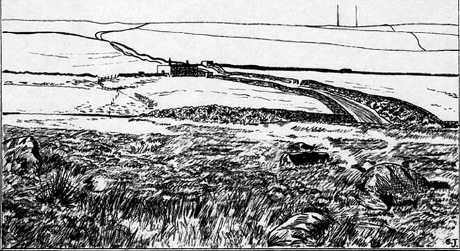
Sid Jackson’s old drawing
By 1995 only one stone was in situ, but a very distinct, albeit low circular embankment was still in evidence. I sat here quite a few times when I was young, munching mi sarnies, having a rest, alone and with friends (once in the company of holy wells author Edna Whelan and fellow rock art researcher and author Graeme Chappell) before journeying back home. It looked that at least one other stone was buried just beneath the grassy surface on the northeastern side of the banking.
Bradup is included in the respective archaeological magnum opuses of both Burl (2000) and Barnatt (1989); where the latter visited the site in the 1980s and thought it may have been “the last vestiges of a cairn.”
Arthur Raistrick’s (1929) plan shows that at least two stones stood near the centre of the circle, which may have related to a solstice sunrise alignment with the old standing stone at nearby Black Knoll hill on Morton Moor (replaced at an unknown date in the past by a stone cross). And when Mr Raistrick told this to be the best stone circle in the region, he knew what he talking about! He had surveyed many other prehistoric remains and was the leading archaeological authority in the region at the time. Today, we have no such professional authority in the region who is worthy of such an accolade. The sorry series of events that led to the destruction of Bradup’s stone circle took a little time to emerge, but after a series of emails to various departments several years ago, the culpability seemed to spread across several people, each of whom made simple mistakes; but these were mistakes that have led directly to Bradup’s demise. I hope some of you will forgive me telling its story…
Bradup stones removed & dumped near wallBradup stone remains dumped in a pile
I first received an email from a colleague in 2002 asking whether or not I was aware of what seemed to be the final destruction of the Bradup stone circle, as the land-owner from Upwood Farm had been over the field and uprooted some buried stones — plus the last visible upright in the ring — and moved them into a pile at the top southern-end of the field in which the circle previously stood. So a small bunch of us went over to have a look and, much to our horror, found the report to be true. The field itself had been completely levelled and the circular embankment flattened, with the upright stone and any buried ones dragged and dropped into the pile of stones that obviously constituted the megalithic structure we’d sat within and visited so many times down the years up against the wall at the top of the field. Someone — the land-owner it seemed — quite recently in early 2002, had destroyed the Bradup stone circle.
How the hell had this happened…!? So, I contacted those who were supposed to look after the welfare of such monuments.
In 2006, Pippa Pemberton was the person working for English Heritage who had the stately title of ‘Field Monument Warden for West Yorkshire’ and elsewhere — and it was Pippa who told the sorry tale, albeit through the well-disguised erudition of avoiding blame to anyone. Amongst several allegedly ‘professional’ archaeologists who I emailed, it was one to Neil Redfern that was responded to, eventually. As you’ll read below, my email asks how this stone circle had been destroyed, with the lengthy ‘explanation’ giving the official reasoning:
Bradup Stone Circle Destroyed
From: Paul Bennett Sent: 10 March 2006 14:05 To: REDFERN, Neil Subject: Stone circle destroyed nr Ilkley
Hello there!
I sent you an email quite a long time ago (below) concerning the complete destruction of Bradup stone circle on Ilkley Moor, for which I have heard nothing since. I wonder, out of respect, if you could either let me know the circumstances surrounding my query, or perhaps pass me on to the relevant person:
“Out of interest (and on the same moorland region) I wonder if you could let me know who it was from English Heritage who de-scheduled a site once known as the Bradup stone circle (also known as Kirk Stones) after a visit to the place a few years ago? (SE 0897 4393) The incorrect site/location was examined and the real stone circle, close by, was subsequently destroyed by the adjacent land-owner. Evidence of the destruction is still there at the top of the field in the form of a few oddly-piled small boulders.
“I think it important that whoever de-scheduled this site should be taken to task for their error. (I don’t mean sack the poor soul, although it’s evident that some re-training is probably in order.) or perhaps the land-owner taken to task for the destruction of the site.
“I would be interested to hear what you, or one of your fellow workers, think about what’s happened here.
Best wishes – Paul Bennett”
Sometime later, I received the following response:
“Dear Paul
Your email was passed on to me by Neil Redfern, as I am currently the person dealing with scheduled monuments in West Yorkshire. Please accept my apologies for the delay in responding to you – we have been working with Heritage Action on this issue, and it was accidentally assumed that you were associated with that organisation too.
In response to your query I have copied an extract from a recent letter I sent to Heritage Action about Bradup, outlining the history of the case and the justification for its descheduling. I hope that this text answers your concerns. For your information, should you require any further assistance with this case, I recommend that you return to me quickly as I am due to start maternity leave at Easter and we do not yet know who will be dealing with this casework in my absence.
With best wishes
Pippa Pemberton,
English Heritage Yorkshire Region, Field Monument Warden – West Yorkshire & Districts of Scarborough & Ryedale.
Scheduling and location of the Bradup site
Scheduled Monuments are currently provided statutory protection under the 1979 Ancient Monuments and Archaeological Areas Act, which replaced earlier legislation and is itself currently under review by the government (DCMS) in their Heritage Protection Review. Scheduled Monuments are a land-based designation, which means that they are fixed in space, with defined boundaries within which specific protection applies. The legally protected location of a Scheduled Monument is recorded on maps and described in associated documentation. Together these documents provide the legal record of the site and are the basis on which protection is applied.
Our records show that a site at Bradup was scheduled as a stone circle in 1933 at grid reference SE 0895 4391, based on information provided by a partial survey of the site made by Dr A Raistrick in 1920 and on reports recorded in 1885. This site was known by the name of Bradup Stone Circle. The location of this site is shown on the map attached to this email.
Subsequently the Ordnance Survey visited the site in 1961, when R Emsley undertook a measured survey of the locations of the stones and hollows included within the scheduled site. However he noted that the stones appeared, by that stage, to be haphazard in their distribution and he appears to have been unconvinced by the description of the site as a stone circle. On the basis of this visit by Emsley, the Bradup stone circle was marked on the 6” Ordnance Survey map, with the location given by Emsley as SE 0895 4392. In addition, Emsley noted that the unscheduled site known as ‘Kirkstones’ was located nearby at SE 0907 4479, but did not describe this site. We have no information on file about this site.
Visits were then made to the scheduled Bradup site by two Royal Commission / English Heritage Field Monument Wardens in 1981 and 1985, with the purpose of monitoring the management of the site. Both of these officers found the site difficult to distinguish, noting stones in a rough pasture field.
Subsequently, it appears that several other locations have been claimed for the Bradup Stone Circle across several fields in the locality, including SE 0897 4393 (Paul Bennett). This latter would place the circle within the adjacent improved pasture field and outside the previously scheduled area.
Descheduling the site
During 1994, a visit made to the site at SE 0895 4391 under the English Heritage Monuments Protection Programme (MPP) noted that the site described by Raistrick does not correspond with the remains then visible. According to this MPP officer, the spatial relationships between the stones and stone holes differed from those Raistrick recorded whilst he also appeared to have omitted others. In their opinion, the scheduled site was not a stone circle, but “a haphazard group of rocks … situated on a hillside which has been quarried and has naturally occurring gritstone boulders. The site itself consists of a random collection of boulders and small holes left by stone quarrying on a slight rise and has a roughly rectangular hollow in the centre which may be an excavation.” “The site is lacking in any of the other features normally associated with stone circles … Whether the extra stones represented by the stone holes are taken into account or not there are no grounds for considering this site to be a stone circle or any other type of prehistoric monument. It is therefore recommended for descheduling”.
Subsequently the recommendation for descheduling would have passed by the officer to the Monuments Protection team, who would have passed it to the relevant Inspector of Ancient Monuments for their consideration and approval. It would then have been passed to a committee of archaeological advisors for their consideration and approval before finally being submitted to the Department of Environment (now DCMS) for their approval and action.
Review visit to the descheduled Bradup site
In response to Heritage Action’s concerns, a site visit was undertaken to the descheduled site by several members of English Heritage’s Heritage Protection team in November 2005. At SE 0895 4391 they observed a number of exposed stones in a rough pasture field, some earthfast, and also hollows that may represent removed stones. The team could not relate the remains at this location to either Raistrick’s description or the Ordnance Survey drawing and concluded that the remains at this location had been mis-attributed (comprising natural boulders and quarrying) and that descheduling was the appropriate action. If a stone circle had been located in the nearby improved pasture field, which was never protected by scheduling, then any remains have been removed. “Either way [they conclude], de-scheduling was the correct action, and unless evidence is produced that demonstrates surviving prehistoric remains no further action should be undertaken”.
Conclusion
In conclusion then, the site afforded legal protection between 1933 and 1995 as a Scheduled Monument was located in the rough pasture field at SE 0895 4391. Since the 1970s several successive archaeologists have been unable to locate the remains of a stone circle in this location, leading to an interpretation of mis-attribution and the descheduling of this site; an interpretation that has recently been upheld by the Heritage Protection team. There has been no landscape change in this area subsequent to descheduling, with the land-use remaining as rough pasture and the previously protected stones and hollows remaining in place.
Other accounts place a potential stone circle in a nearby field. This potential site was never subject to any legal protection as a designated Scheduled Monument, and any potential surface remains have been removed by the farmer, within his legal rights, during its conversion to improved pasture.”
In this reply, notice the remark describing the position of the circle: “Our records show that a site at Bradup was scheduled as a stone circle in 1933 at grid reference SE 0895 4391, based on information provided by a partial survey of the site made by Dr A Raistrick in 1920 and on reports recorded in 1885.” This is either deliberate misinformation, or bad record-keeping, as neither Robert Collyer’s 1885 reference, nor Arthur Raistrick’s 1929 account cites such a grid-reference. It is possible that when the Ordnance Survey lad, R. Emsley, visited here in 1961, that he looked at the wrong dubious ‘ring’ of low stones over the fence into the heather. Somehow he, or his subsequent record-keepers, mistook what Raistrick said were the “most notable feature (are) the large size of the stones”, for the small earthfast rocks over the fence. This is very poor when you consider that the 1970s 1:10,000 OS-map of this area clearly shows the circle to be in the field, indicating that the Ordnance Survey fella had been, seen and recorded it correctly.
One final element on this “grid-reference” error: I have in front of me the List of Scheduled Monuments in the Bradford District (“The Schedule is currently not available on” their website cos the people who get paid to do such a thing can’t be arsed), dated from the 1990s. The “Bradup stone circle near Bradup Bridge, Morton” is cited as being at “SE 0900 4400” and not the OS grid reference described in the explanation about the site’s destruction. Funny that innit…?
There’s much more that I could say in response to this excuse for de-scheduling and allowing the destruction of Bradup stone circle, but I’m hoping that people can see for themselves that ‘excuses’ are the order of the day in this report. Simply put: the Bradup stone circle was destroyed due to the ineptitude of ‘authorities’ mistaking several natural earthfast rocks at the grid-reference they give (if indeed even that’s the right one for it!) for the real prehistoric circle in the adjacent field. In short, they fucked up – and the email above is their attempt at an excuse to cover up their mistakes. We all know how they cover each others backs when they screw up. If you or I did this, we’d be in court.
Folklore
Also known as the Brass Castle and the Kirkstones (indicating it as a place of worship), Cowling (1946) told how “local lore suggests that the place is haunted.” The name Kirkstones derives from the rock outcrop 800 yards north of here, where the stones which made this site may have come from. A dowsing survey found there to be water beneath the circle, but this wasn’t mapped.
Various ways to get here, but I suppose the easist is by walking along the path just above the woods from the main A61 road, where there’s the junction turn-off to Wike. You have to walk perhaps 1000 yards until eventually, a couple of hundred yards up the slope to your left (south) you’ll see the boulder stuck in the field. You’re there!
Archaeology & History
The Grey Stone, Harewood
Described first by Cowling & Hartley in 1960, this multiple-ringed carving gives the distinct impression that it aint quite as old as our more traditional cup-and-rings on the moors west and north of here – but I s’ppose we’ll never know for sure. There isn’t a central cup to this concentric-ringed carving, which is quite unusual, and which is why I get the impression that it’s from a later archaeological period. However, saying that, there are several other faint cup-markings on the southwest and east-faces of the boulder (which I forgot to photograph when I was there – idiot that I am!). Boughey and Vickerman (2003) illustrate as many as 18 other cup-marks on the rock surface – which they list as stone 399 in their survey.
Although there seems to be no folklore attached to this isolated carving, rock-art authority Graeme Chappell noted how “the midwinter full moon set behind Almscliffe Crags at its extreme northerly setting point in Bronze Age times” from this Grey Stone.
The archaeologist S.A. Moorhouse (1981) also pointed out how some of the many Grey Stones (which usually means ‘a boundary stone’, sometimes very ancient ones) found in northern England, derive their name from the old word har, which “can also mean ‘grey, hoar,’ used to describe natural boulders, possibly with cup-and-ring markings” – just as we have here!
References:
Bennett, Paul, The Old Stones of Elmet, Capall Bann: Milverton 2001.
Boughey, Keith & Vickerman, E.A., Prehistoric Rock Art of the West Riding, WYAS: Wakefield 2003.
Cowling, E.T. & Hartley, C.E., ‘A Ring-Marked Rock: The Grey Stone,’ in YAJ 1960.
Moorhouse, S.A., ‘Boundaries,’ in Faull & Moorhouse’s West Yorkshire: An Archaeological Survey, volume 2, 1981.
Best visited in winter and spring – thereafter the vegetation can hide it a little – but even then, it’s not too hard to find. Start from the Cow & Calf Hotel and walk across the road onto the moor, and head over as if you’re gonna walk above the Cow & Calf Rocks, onto the moorland proper. When you’ve gone a few hundred yards, walk up the slope (there are several footpaths – you can take your choice). Once on the ridge on top of the moor proper, you’ll see the Haystack Rock: it’s on the same ridge, right near where the moor drops down the slope about 250 yards west of here, just about next to the footpath that runs along the edge. Look around!
Archaeology & History
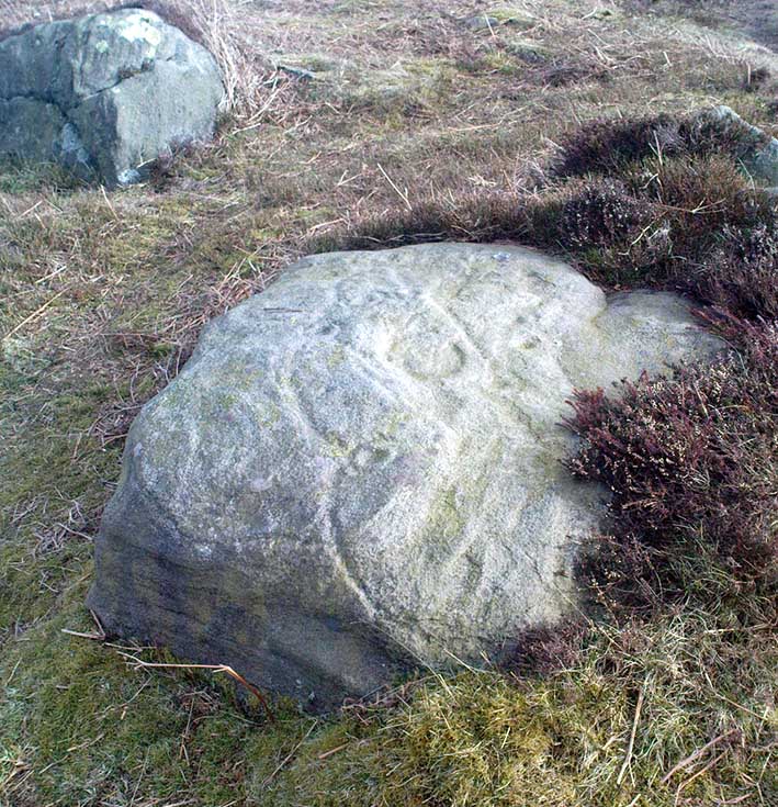
Unlike some folk who’ve seen this old stone, I find this carving superb. Its one of my favourites up here! Its alternative name – the Planet Stone – perhaps lends you to expect something more, but this is down to the astronomer who thought this was some type of heavenly image (which is most unlikely). I prefer to call it the ‘Map Stone’ because the correlates this carving has with indigenous aboriginal cup-and-rings is impressive and — to Aborigines anyway — would have all the hallmarks of a map. But not a ‘map’ in the traditional sense of modern humans. The incidence of cups and rings linked by curvaceous lines, typifies routes between water-holes or settlement spots made by ancestral beings — which is just what we find at this carving here. These ancestral beings need to be seen in a quite mythic sense: they may be creation deities (giants, gods, etc), animal spirits, the routes of shaman spirits, or other expressions of homo-religiosus.
Map Stone (note the carved line along the very edge of the rock)…and again from another angle
In the Map Stone here, we see that the very edge of the rock (fig.2 & 3) is ‘encircled’, perhaps (and I say perhaps) symbolic of the edge of the world. The lines and rings upon the top of the rock may symbolize journeys to and from important places. Another impression I get of this carving, with the “map” idea, is that the large pecked diamond-shaped ‘cup’ near the middle of the carving is a large body of water around which the archaic routeways passed. The next time anyone visits this stone, have a look at it with this idea in mind. Its simple, straightforward and makes sense (mind you – that doesn’t mean to say it’s right!).
The first account I’ve found of this comes from the pen of J. Romilly Allen (1882), where this stone “measuring 5ft 3in by 5ft, and 1ft 9in high” was described thus:
“On its upper surface, which is nearly horizontal, are carved thirteen cups, varying in diameter from 2 to 2½ in, eleven of which are surrounded by rings. There is also an elaborate arrangement of connecting grooves.”
Although we can only work our nine cup-and-rings here today, Mr Allen seemed suitably impressed with this old carving. Stan Beckensall (1999) seemed to have a good feel of this design too, describing it thus:
“Two thirds of the surface of this earthfast sandstone have been used in a design that partly encloses the marked part of the rock with long curvilinear grooves along its edge, and the inner grooves link single rings around cups. The effect is one of inter-connection and fluidity.”
Hedges 1986 sketch
The Map Stone was also looked at to examine the potential for Alexander Thom’s proposal of a megalithic inch: a unit of measure speculated to have been used in neolithic and Bronze Age times for the carving of cup-and-ring stones. Using nine other carvings on these moor as samples, Alan Davies (1983, 1988) explored this hypothesis and gave the idea his approval. However the selectivity of his data, not only in the carvings chosen, throws considerable doubt on the idea. Unfortunately the idea doesn’t hold water. The ‘geometry’ in the size of cup-and-rings relates more to the biometrics of the human hand and not early scientific geometry, sadly….
References:
Allen, J.R., ‘Prehistoric Rock Sculptures of Ilkley,’ in Journal British Arch. Assoc., 35, 1879.
Allen, J.R., ‘Notice of Sculptured Rocks near Ilkley, with some Remarks on Rocking Stones,’ in Journal British Arch. Assoc., 38, 1882.
Allen, J.R., ‘Cup and Ring Sculptures on Ilkley Moor,’ in Reliquary Illus. Archaeology, 2, 1896.
Beckensall, Stan, British Prehistoric Rock Art, Tempus: Stroud 1999.
Boughey, K.J.S. & Vickerman, E.A., Prehistoric Rock Art of the West Riding, WYAS: Exeter 2003.
Collyer, Robert & Turner, J.H., Ilkley: Ancient and Modern, William Walker: Otley 1885.
Cowling, E.T., Rombald’s Way, William Walker: Otley 1946.
Davis, Alan, ‘The Metrology of Cup & Ring Carvings near Ilkley in Yorkshire,’ Science Journal 25, 1983.
Davies, Alan, ‘The Metrology of Cup and Ring Carvings,’ in Ruggles, C., Records in Stone, Cambridge 1988.
Hedges, John, The Carved Rocks on Rombald’s Moor, WYMCC: Wakefield 1986.
Alan Davies’ image of the carving – with carved ‘lake’ near centre
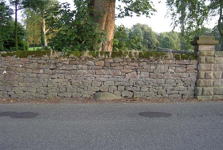
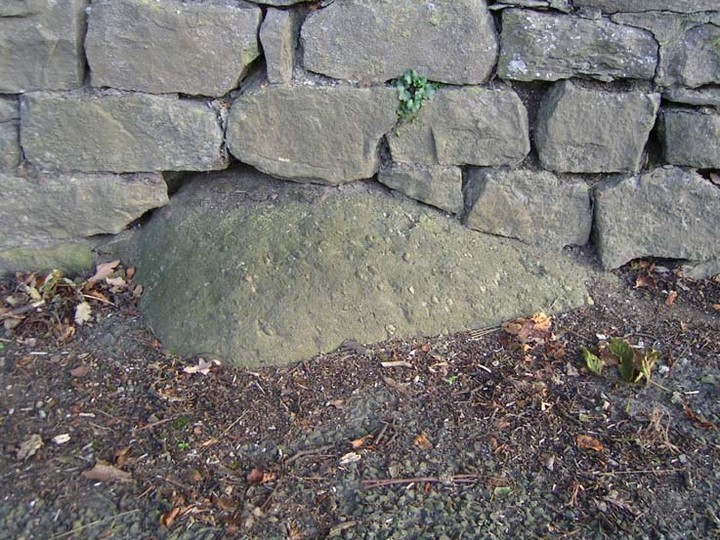
The best way to locate this is probably by starting from the pub opposite the old church of St. Leonard and heading west along the village road, past three large gate-entrances, until reaching the conspicuous milestone by the road junction. On the other side of the road, just before the gate entrance to Downham Hall, edged into the base of the wall, we find this ‘ere The Great Stone.
Archaeology & History
The Great Stone, Downham
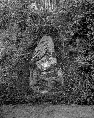
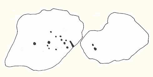
What a truly beautiful little village we find in Downham, nestled quietly and with age at the northern edge of Pendle hill. It’s tucked away, off any main road so maintaining its sense of age and almost reclusive nature. There is hidden history a-plenty scattering the landscape here, but tales of our Great Stone — thought by some as an old monolith; remains of a Roman milestone by others; whilst some just denote it as nowt but a small stone — is what brought me here. It’s name betrayed my expectation (I always hope for too much it seems…), but the small pock-marked stone has been embedded in its present position for at least 150 years, as the growth of soil and tree behind it shows. Archaeo-historians say little of it (reputations y’ know!) until something substantial is found; but thankfully we came upon the lovely couple who are Lord and Lady Clitheroe of Downham Hall, who told us more…
Folklore
“There are a couple of humourous legends told of the Great Stone,” Lord Downham began… But to a (sometimes) courteous megalithomaniac like myself, the tales rang the all-too-familiar bell.
Close-up of the Great Stone
The original position of the stone, though not known for certain, was some short distance away either across the road, or further along in a nearby field. When it was moved – Lord Downham said around 1830 – the remains of a body were found beneath it; but another source told in fact that it marked “the final resting place of two legionaries who died on the nearby Roman road during trouble with the Brigantes.” (An old Roman road is nearby) But apparently this old stone also moves. When the church bell strikes midnight the stone is said to turn itself around upside-down. Where have we heard that before!?
The site is described in Clifford Byrne’s (1974) unpublished manuscript on the crosses of Lancashire, where he cites it as being the remains of a cross pedestal, but adds that “if ever a cross stood by the village green, no memory of seems now to exist.” But Mr Byrne also described the all-too-familiar heathen folk tales, saying:
“A local man told the writer that the object is called Downham Stone and that it turns over every night at midnight. We read elsewhere that the boulder is called “the great stone of Downham” and that it turns at the stroke of midnight by the church clock.”
References:
Byrne, Clifford H., “A Survey of the Ancient Wayside Crosses in North East Lancashire,” unpublished manuscript, 1974.
Lofthouse, Jessica, Three Rivers, Robert Hale: London 1946.
Lofthouse, North Country Folklore, Robert Hale: London 1976.
Winterbottom, Vera, The Devil in Lancashire, Cloister: Stockport 1963.
Stone Circle (destroyed): OS Grid Reference – SD 664 655
Archaeology & History
I have found no archaeological references whatsoever to this site (though to be honest, the Lancashire archaeological fraternity are pretty poor when it comes to finding and recording sites). The place has its existence preserved in the aptly-named Ringstones Lane and the farmhouse, Ringstones.
Michala Potts found several records of the place in the 17th century, and the site is shown on the 1844 OS-map with the same name, but we have been unable to ascertain when/if any standing stones were here. The place may well have been a burial-site of some sort, as found at other Ringstone place-names in Lancashire. But we can clearly see on aerial imagery that there is a large, distinct, circular outline in the heavily ploughed fields about 100 yards north of the farm. There is what may be the remains of a second circle above this, but the outline is faint; but it appears that an enclosure of some sort, ovoid in shape and a couple of hundred feet across, was also evident in the same field where the more distinct circular outline is seen.
My favourite outline however, is a large linear mark on the ground stretching for several hundred yards running roughly north-south, starting in the field between Aikengill and Ringstones and going dead straight, bypassing the circle and crossing Ringstones Lane, where it seems to disappear and is no longer visible. The curious ‘ground line’ is roughly 100 feet across. Cursus anyone!?
In September, 1928, the old ley-hunter Alfred Watkins was out on one of his many rambles when he “saw a tall stone almost buried in the bank at this crossroads,” appropriately known as Picts Cross, about a mile south of Sellack — so he called it the ‘Picts Cross Stone.’ He also said, “It was Pricker’s and Prick’s Cross in 18th century maps, and Pig’s Cross in the 1832 Ord. Map. Now ‘pig’ is the present Welsh word for “a peak, a point, a pike.””
And a lovely pointy old stone it looks in his old photo! The monolith is in the hedgerow along the old boundary line.
References:
Watkins, Alfred, The Old Standing Crosses of Herefordshire, Simpkin Marshall: London 1930.
Loadsa ways to get to this little outcrop, which the Boughey & Vickerman survey (2003) says comprises of five different carvings (CRs 33-37). I’m not so sure misself. When Stuart Feather first found these in the 1950s, he only thought three stones were carved, which I think is the more accurate.
Most folk would probably prefer to walk down the slope from Holden Gate down the footpath past Jaytail Farm, then dropping down to the very bottom of the fields (south) where you’ll see a small knoll with a cluster of rocks just in front of the tree-line. But I wandered up thru the ‘Private’ (ahem!) woodland, wet-thru in the pouring rain, and clambered over the wall right to the very spot (the old dowser’s ‘seek-and-find-rock-art’ nose worked again!).
Archaeology & History
High Carr Cup-Marked Stone – from Hedge’s Carved Rocks on Rombald’s Moor
Listed in John Hedge’s (1986) survey as carvings 1-5, I’d say there’s one “definite” carving here, but the others – comprising simply of cups – are a little dubious. The main carving has at least six definite cup-markings, found on the rock at the highest point of the knoll at the bottom of the field. The drawing in Hedge’s survey shows as many as 12 cups on this stone, but I’m not totally convinced. Another stone right next to the main one has, perhaps, a cup-marking or two on it – but again, these may be natural.
Of the other alleged carvings, it was difficult to work out as they were literally covered in tons of cow-shit. It seems this rock-outcrop is the local bovine toilet! A lovely secluded place though, with plenty of wildlife to see. Next stop from here: the great Holden waterfalls!
References:
Boughey, K. & Vickerman, E.A., Prehistoric Rock Art of the West Riding, WYMCC: Wakefield 2003.
Feather, S., ‘Three Bronze Age Rock Carvings near Keighley,’ in CHAGB 4:3, 1959.
Hedges, John D., The Carved Rocks on Rombald’s Moor, WYMCC: Wakefield 1986.
We were fortunate and taken here by the renowned local megalith authority, Pete Glastonbury – but without Pete’s help you might be ambling here and there for quite a while. It’s on the eastern side of The Ridgeway, down the slope past the stone known as The Polisher, across the flatland sea of many rocks until it begins rising again a few hundred yards east. Where a long straight embankment rises up a few feet (a boundary line), the rock’s just a few yards above it. Walk back and forth around here and you’ll eventually find it!
Archaeology & History
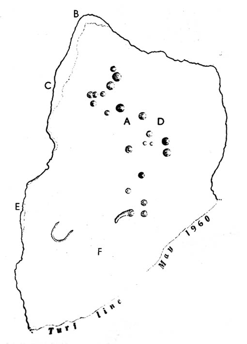
Lacaille’s 1962 sketch of the carving
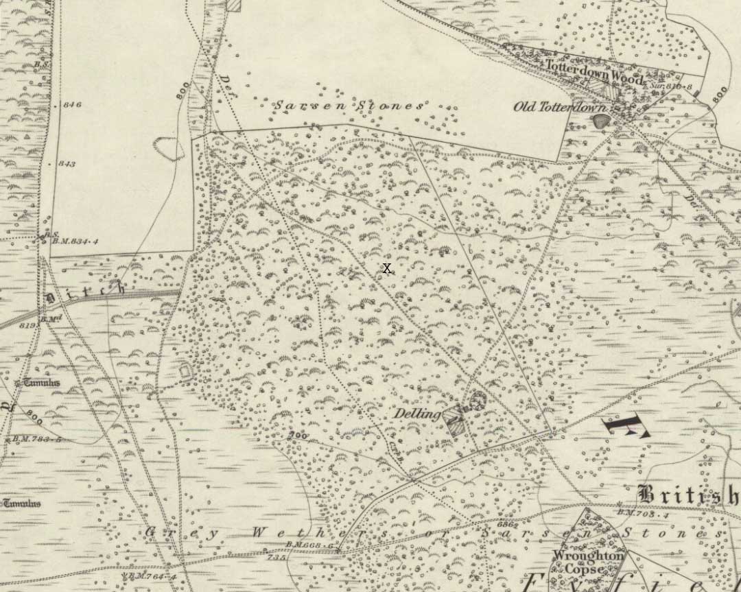
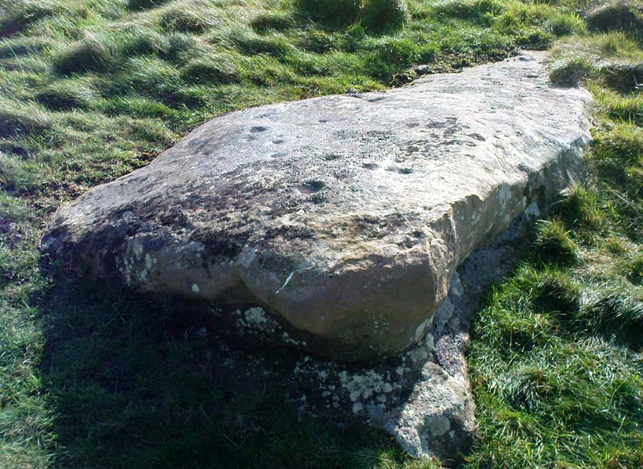
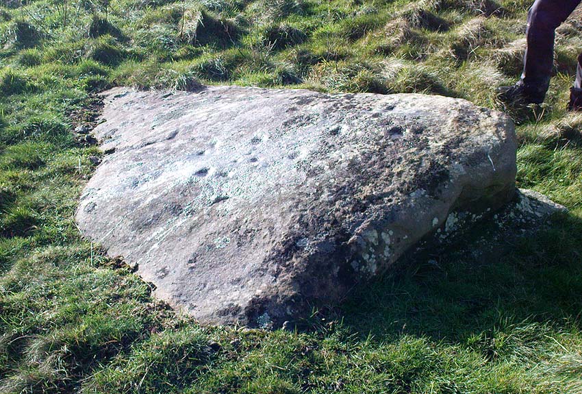
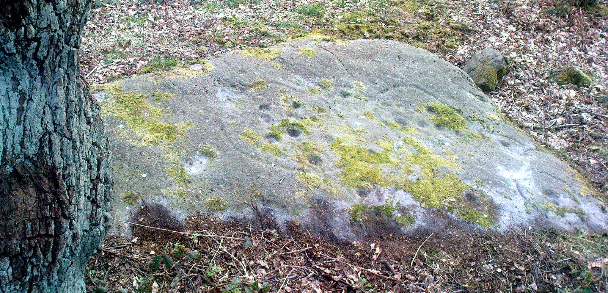
Archaeologist A.D. Lacaille (1962) appears to have been the first person to have written about this little-known site, describing it as being “between the south-western corner of Totterdown Wood and Delling Cottage.” Here is what he described as, “a cluster of unmistakably artificial and mostly well-preserved cup-markings on the smooth south-easterly sloping surface of a recumbent sarsen.”
And from the photos accompanying Lacaille’s article, it obviously looked a decent carving as well — and so it has transpired. Lacaille (1963) briefly mentioned the carving again a year later in his lengthier essay on the nearby Polisher Stone up the slope a few hundred yards away. But then Wiltshire’s only known cup-marked stone was all-but ignored by archaeologists and left in the literary wilderness until, years later when rock art became a fad in such circles, regional archaeologists Pete Fowler & Ian Blackwell (1998) described the carving as “a cluster of several round depressions…each about two inches across”; though incorrectly ascribed it as the “southernmost example” of cup-marked stones outside of Cornwall.¹ Another rock-art student known as Mr Hobson, following his excursion to the site with the regional authority Pete Glastonbury, wrote:
“The cups themselves are very smoothed out, and fit the bill from the drawing. The horseshoe is very evident, as is the ‘slug’ mark, possibly a half-finished groove from one of the cups near the horseshoe. There are also some angular, yet serpentine (?) grooves at turf level on the south side of the stone. These look like they might be enhanced natural marks in places.”
The rock itself isn’t in its original position, having been moved from another point very close by (probably only yards away). It is sited on the edge of an old boundary line — which made me wonder whether the ‘U’- or ‘C’-shaped ingredient in the carving was a later addition, perhaps of one of the old land-owners hereabouts. The cups however, seem typical of the thousands that we find in northern Britain.
The isolation of this carving is rather anomalous. Others should be in the area but archaeo-records are silent (though the majority of Wessex archaeologists are academically illiterate when it comes to identifying such carvings). The carving may simply be the product of nomadic northerners, showing what their tribes do ‘up North’, so to speak. However, considering the tough nature of southern sarsen stones, it’d have taken ages to etch just this one stone. You can visualise it quite easily: southern tribal folk looking on, somewhat perplexed, as a northern traveller tried to convey what they etch on their stones in the northern lands, only to struggle like hell with cup-marks they’d do with ease on the softer rocks of their homelands. Wessex tribes-folk may have watched, seen the trouble their traveller had over such inane and (perhaps) meaningless carvings, and didn’t see the mythic point s/he was trying to convey…
Curious ‘U’ or ‘C’-shaped feature
Or maybe not!
The lesson with rock-art tends to be simple: where there’s one carving, others are nearby. The rule aint 100% of course — but when we were here the other day I was wanting to dart here, there and everywhere to check the many thousands of outcrop rocks that scatter this entire area. Us rock-art nuts tend to do things like that. It’s a madness that afflicts…
There were one or two stones with ‘possible’ single cup-markings on them, but I wasn’t going to start adding them to any catalogues. They were far too questionable. I was wanting something a bit more decent than that. And then, when Mikki, June, Pete, Geoff and I got to the collapsed long barrow known as the Devil’s Den a few hundred yards further down this rock-strewn sea of a valley, there was something with a bit more potential that we came across…
Folklore
In recent years this cup-marked stone has already attracted imaginative notions, with little foundation. Archaeologists Fowler & Blackwell (1998), in their otherwise fine book, think this carving was related to goddess worship, describing how,
“On Dillion Down…the Great Mother’s help was permanently invoked by patiently indenting a special stone with symbols of her potency.”
Adding that this “was a new idea brought in from the North, and Fyfield was the only place to have such a stone.” Weird! I could’ve sworn there were plenty of other rocks between here and there!
References:
Fowler, Peter J., Landscape Plotted and Pieced: Landscape History and Local Archaeology in Fyfield and Overton, Society of Antiquaries London 2000.
Fowler, Peter & Blackwell, Ian, The Landscape of Lettice Sweetapple, Tempus: Stroud 1998.
Lacaille, A.D., ‘A Cup-Marked Sarsen near Marlborough, Wiltshire,’ in Archaeological Newsletter 7:6, 1962.
¹ Along with the cup-markings atop of Devil’s Den a few hundred yards to the south, across in Somerset we had the Pool Farm example; there are a number of examples in Dorset, including the Badbury Rings carving; plus others in Devon, etc.
To get here, start from Bingley centre, go through Myrtle Park, across the river bridge and turn right at the dirt-track. Walk on & go over the old bridge/ford of Harden Beck, keeping with the track until the next set of buildings and be aware of a footpath left here. Take this and cross the golf-course, bearing SE until you reach the edge of Cottingley Woods. Take the distinct footpath into the trees & walk up the vivid moss-coloured path until you reach the level at the top where the woods become more deciduous. Here, turn left for 100 yards into the bit of woodland which has been fenced-off and walk about. You’ll find it!
Archaeology & History
Cottingley Woods Fairy Stone
This is a truly superb cup-and-ring stone which anyone into the subject must take a look at! It was first found by the old forester here, Ronald Bennett, in 1966 — ten years before the rock art student Keith Boughey (2005) mistakenly reported it to have been found “by Valerie Parkinson…in 1976.” Everything about it’s excellent — but I think the setting in woodland is what really brings it out.
The first published account and photograph of this superb carved stone seems to have been in Joe Cooper’s (1982) precursory essay on the Cottingley Fairies in an article he wrote for The Unexplained magazine in the 1980s. A few years later I included the stone in a short article on local folklore (Bennett 1988), then again much later in The Old Stones of Elmet (2001). It was curiously omitted from Boughey & Vickerman’s (2003) survey, as were the other carvings that are found very close by. Not sure why… But of the small cluster here (I’ll add the others later), this carving stands out as the best of the bunch by far! Its name has nothing to do with the Cottingley Fairy folk down town: it simply originates from my own teenage thoughts and the true ambience of the setting. Check it out!
Joe Cooper’s 1982 photoFairy Stone carving
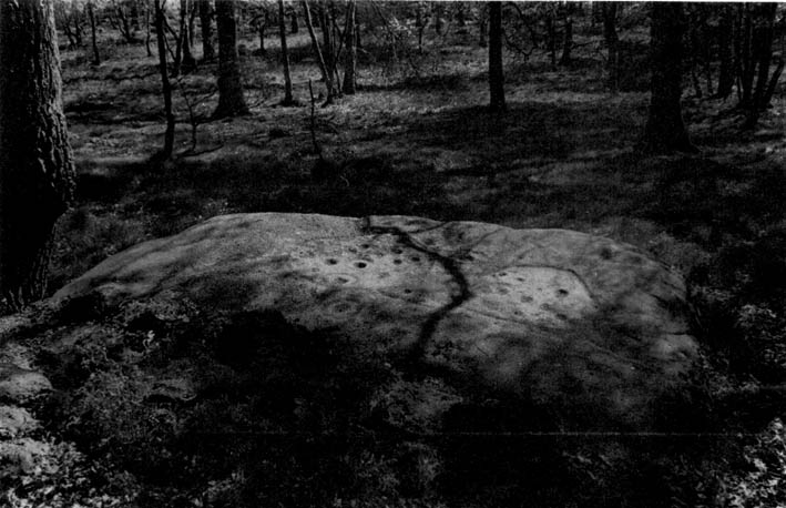
The rock is typical millstone grit and its carved upper surface measures roughly 3 yards east-west and 2 yards north-south, sloping gently into the ground. As the photo shows, this is an elaborate design seemingly centred around two large and another smaller circular form, each enclosing a number of internal cups, ring and lines. The next time we’re over there, we’ll try get some clearly images and make a detailed drawing of the old fella! In the event that you visit here, check out the other three carvings close to this primary design — and try work out which one of the three was carved by the scouts in more modern times! Another simple cup-marked stone was recently found in the undergrowth a short distant east of this group.
Sketch of the design in 1981
Recently the carving was given attention with what’s known as photogrammetry software: this enables a more complete image of the 3-dimensional nature of objects scrutinized. In the resulting photos (which I’m unable to reproduce here due to copyright restrictions), a previously unseen long carved line was detected that runs across the middle of the larger of the two enclosing rings. Hopefully in the coming months, those with the software (can’t remember whether it’s English Heritage or Pennine Prospects who won’t allow it) might allow us to reproduce one or two of their images to enable the rest of the world to see what their images have uncovered. After all, considering that we peasants brought this carving to their attention, you’d at least hope they could repay the finds. Some of these larger organizations, despite what they may say, simply don’t swing both ways!
Folklore
In an early edition of my old Fortean archaeology rag of the 1980s, I narrated the tale of one Anne Freeman, who was walking through the woods here. When she reached the top of the woods, near some stones she heard a loud chattering and allegedly saw two tiny figures barely one-foot tall wearing red outfits and green hats in “medieval peasant dress”. Andy Roberts (1992) later repeated the tale and illustrated the carving in his Yorkshire folklore work.
In the 1960s, the old ranger Ronnie Bennett (no relative of mine) who first found these carvings, also reported that he saw little people here: “not one, but three,” as he said. Not fairies with wings, but more gnome-like.
References:
Bennett, Paul, Of Cups and Rings and Things, unpublished: Shipley 1981.
Bennett, Paul, ‘Tales of Yorkshire Faeries,’ in Earth 9, 1988.
Bennett, Paul, The Old Stones of Elmet, Capall Bann: Milverton 2001.
Boughey, Keith, “A Group of Four Cup-and-Ring-Marked Rocks at Black Hills, Cottingley Woods,” in Prehistory Research Section Bulletin, no.42, 2005.
Cooper, Joe, ‘Cottingley: At Last the Truth,’ in The Unexplained 117, 1982
Roberts, Andy, Ghosts and Legends of Yorkshire, Jarrold 1992.