This curiously-named and long lost well would almost have us believe that the Greek poet and philosopher himself was a-wandering in this neck of the woods. But that sadly wasn’t the case. It seems to have been mentioned just once in Looe’s early Town Books:
“In 1621 that part of West Looe Down which lieth on the West part of the Homer Well, was let to rent, for two crops, at 6s.8d. per acre”
In Courtney & Couch’s (1880) Cornish dialect work, the word homer is said to mean “homeward”; this is also echoed in Wright’s (1905) magnum opus. It seems to imply that it was a drinking well used by folk traveling the short distance from Looe village, across the river and onto or over West Looe Down towards their cottage or farmhouse; akin to a refreshing resting place halfway home, so to speak. Sometimes the word homeward can be taken to simply mean “at home,” in which case it would suggest that the Well was simply next to someone’s house. We may never know…
References:
Bond, Thomas, Topographical and Historical Sketches of the Boroughs of East and West Looe, J. Nichols: London 1823.
Courtney M.A. & Couch, T.Q., Glossary of Words of Use in Cornwall, English Dialect Society: London 1880.
Wright, Joseph, English Dialect Dictionary – volume 3, Henry Frowde: London 1905.
Follow the same directions as if you’re going to the Black Burn (2) carving (which you’ll obviously be looking at if you’re checking this one out!); and from there, walk two or three steps southwards down the slope – and you’re just about stood on it!
Archaeology & History
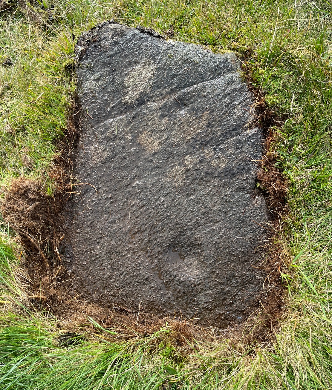
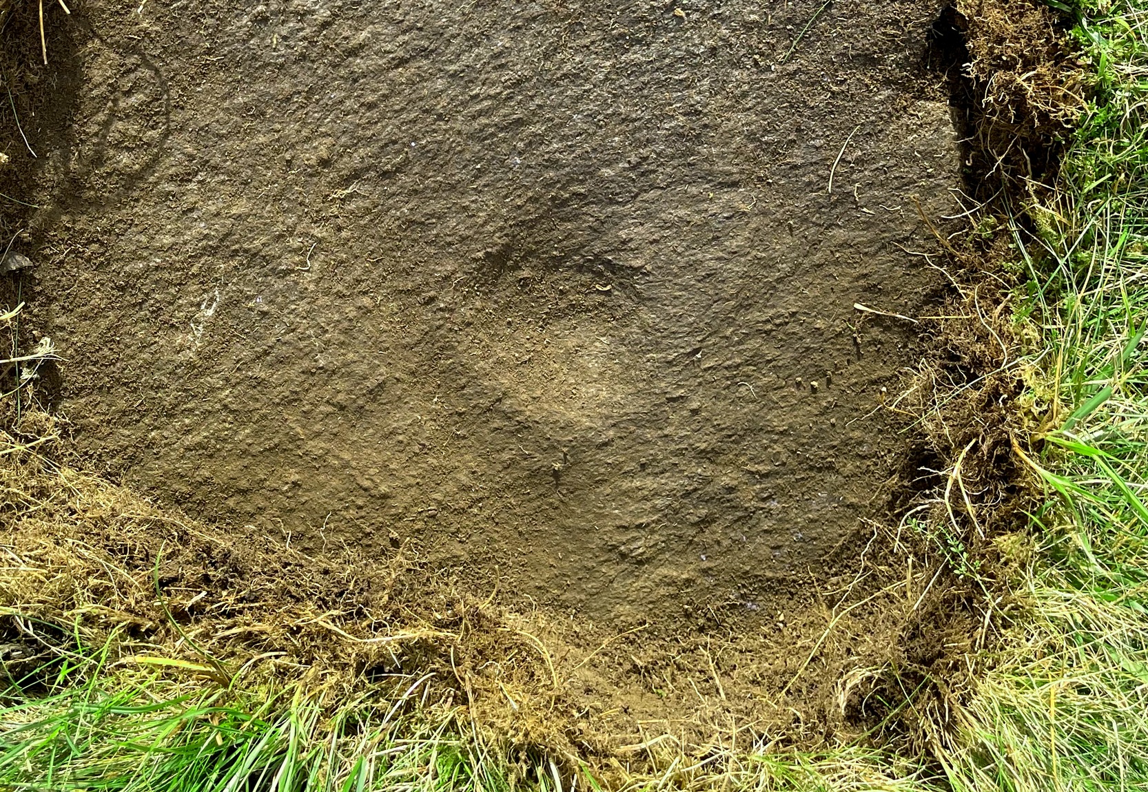
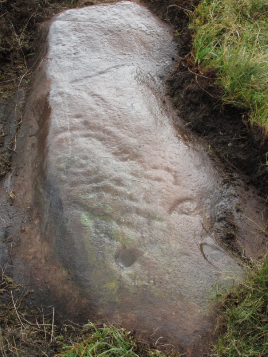
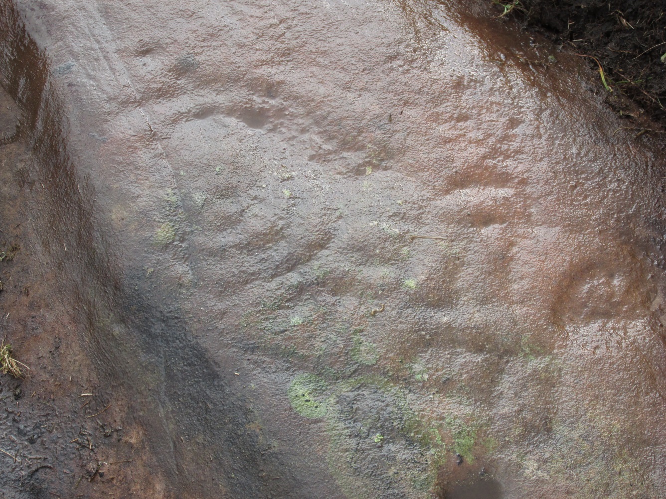
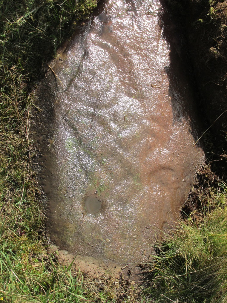
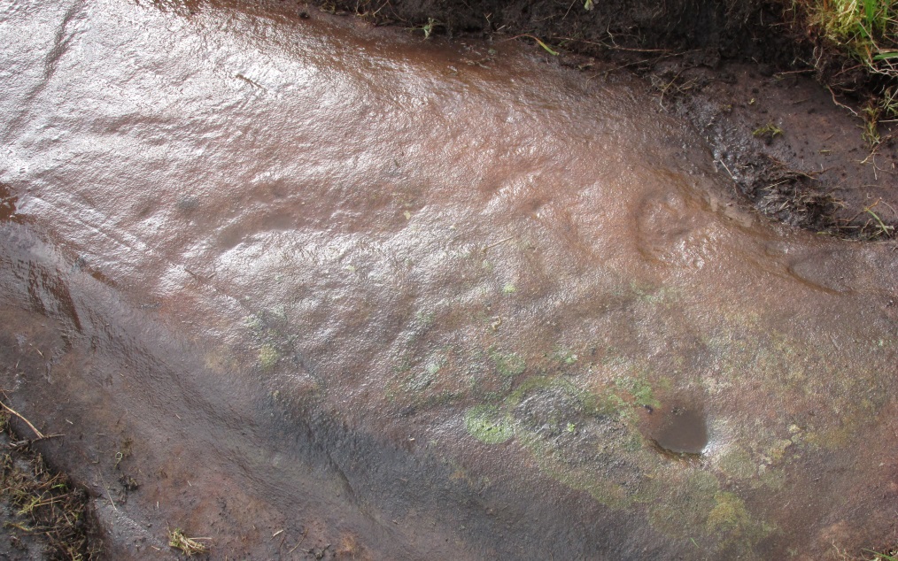
This, at first sight, seems little more than two cup-marks: one rather small, and the other somewhat larger than usual. I walked round it, crouched down and fondled it, poured water on it and heightened the carving… and noticed what seemed to be a carved arc around the western side of the large cup. But I couldn’t make my mind up whether this was natural or not. And then as laid down and looked across the stone, it seemed as if a very faint triangle completely enclosed the large cup! I crawled round it at ground level and the shape appeared and disappeared as the light altered. So I took a few more photos and wondered whether or not the shape would become obvious in them. And it did!
An eye in the triangle?Cup and faint triangle, or a trick of the mind?
It’s unusual – and I’m still not sure whether it’s natural or not. The carving needs more attention, in better daylight. Or perhaps the computer-tech kids might have a look at it and see if this really is an eye-in-the-triangle style design we’ve got here. It would be damn good! Anyhow, the carving was first mentioned by George Currie (2005), who told of it being two metres south of the Black Burn (2) cup-and-ring and, plainly, that it “has two cups: 60 x 15mm and 25 x 8mm.” It overlooks the urisk-haunted Urlar Burn, a creature known in some places for having milk and other offerings poured into cup-marks to appease it and gain good fortune.
References:
Currie, George, “Perthshire: Black Burn (Dull Parish) – Cup and Ring Marked Rocks”, in Discovery & Excavation Scotland, volume 6 (new series), 2005.
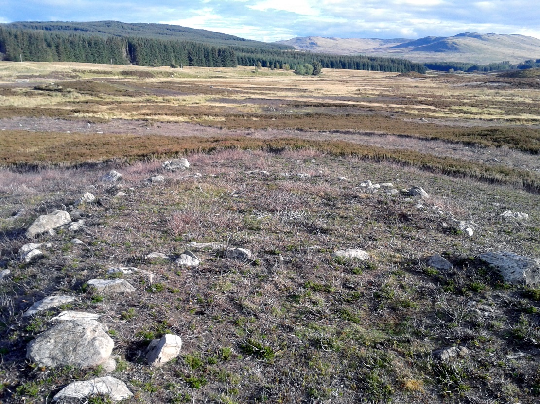
Take the A826 Crieff Road uphill for 275 yards then turn right up the Urlar Road. It’s a long uphill walk from here, up the private road, through and past Urlar Farm and along the track, making sure to go right where the track splits, keeping to the west-side of the burn. (don’t cross over it!) From here, the fields open up ahead of you into the distant hills. Keep along the track until, after a few hundred yards a small copse of trees is on your right. Walk past the bottom of this and then walk immediately up to the top of the large rounded knoll, or Tom, on your right. Once at the top, look for the triangular stone on its southwestern edge.
Archaeology & History
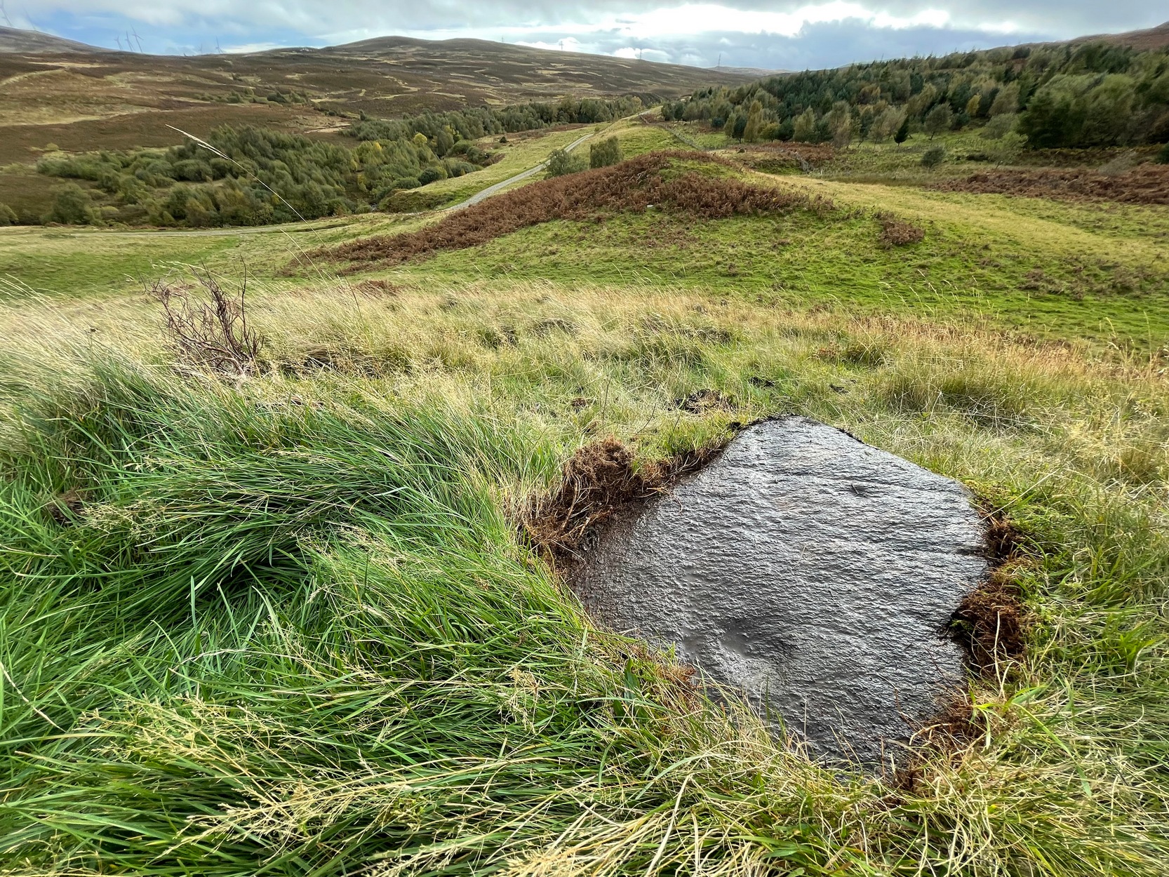
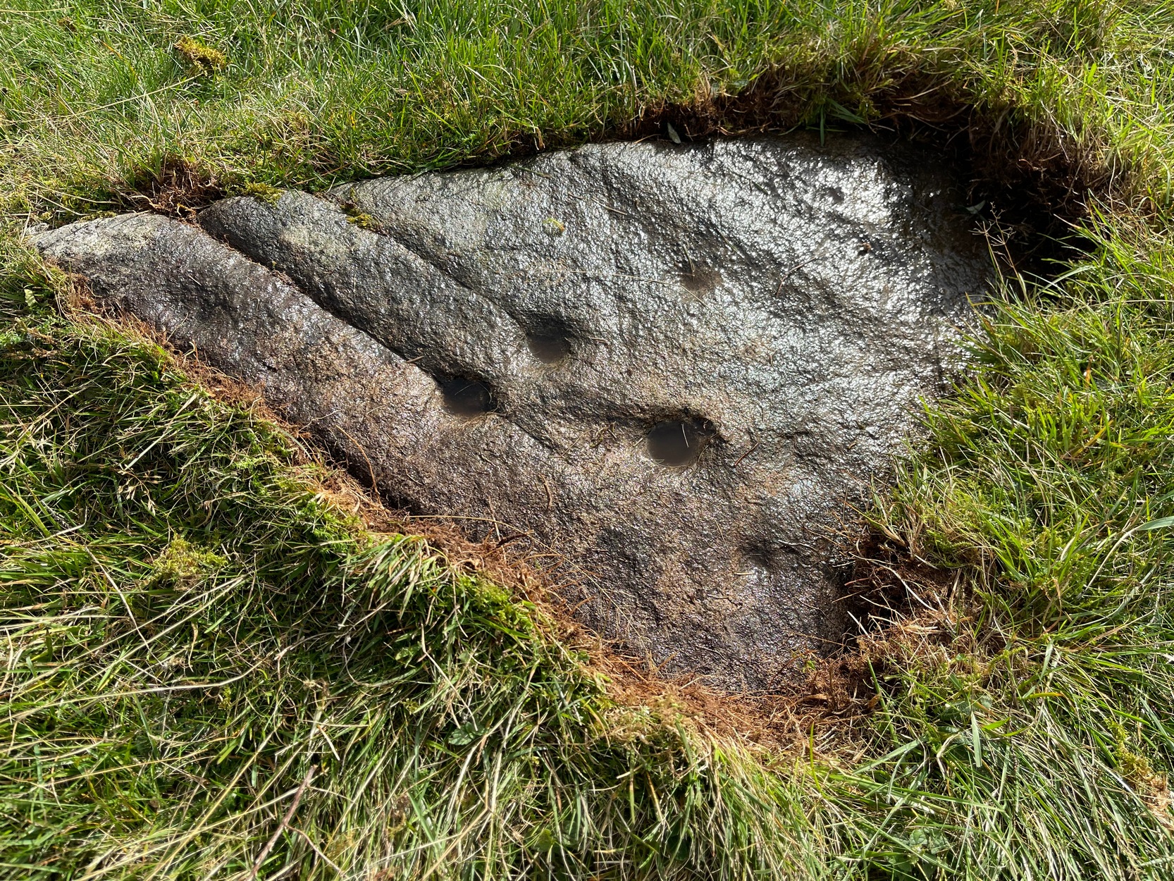
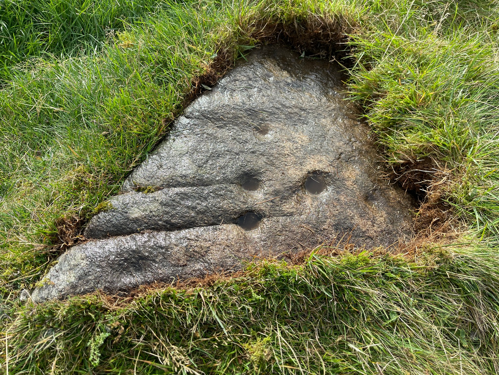
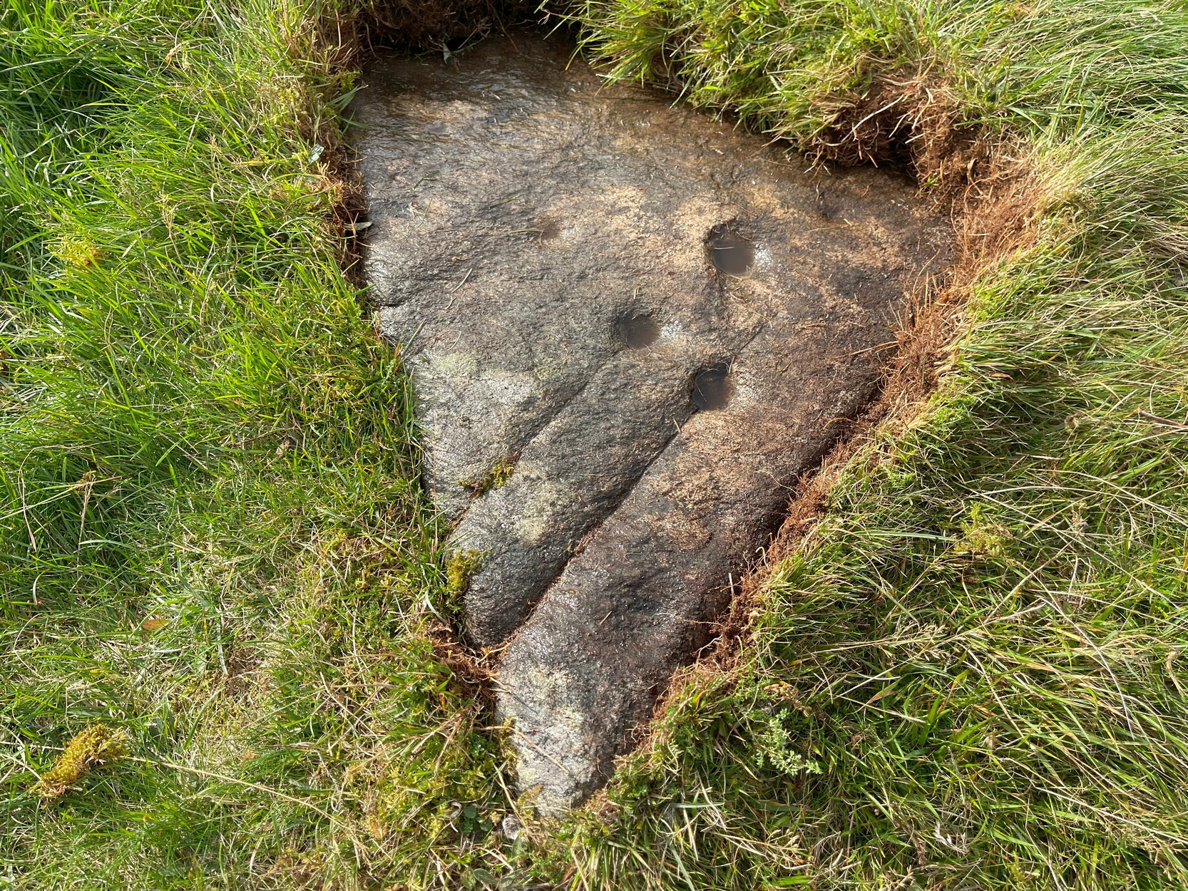
Upon this rounded tom, beloved of faerie folk and overlooking the urisk-haunted Urlar Burn, is this small flat triangular-shaped stone, embedded in the ground, possessing an unusual set of seven, possibly eight cup-markings (not five as Currie [2005] initially described) of varying depths and age, carved into straight geological fissures in the rock which, I hasten to add, were probably intended as part of the original design. Such elements are not unusual in carvings in other parts of the world, tending to relate to some spirit or ancestral ingredient. Whether that was important here, we might never know.
Black Burn (2) carvingBlack Burn (2) carving
But in addition to the cups on their geological cracks, a large faint wonky incomplete ring has been carved around the centre-most cup-mark, seemingly stopping where it meets the natural crack. You can just make it out in the photos. One side of this ring may continue onto the top of the longer crack, but it was difficult to see in the cloudy daylight and another visit is necessary.
The carving was first described by George Currie (2005), who told, in his usual minimalist manner:
“On W side of large knoll, triangular-shaped rock, 0.7 x 0.7m, flush with ground; five cups, largest being 50 x 20mm and smallest, 25 x 8mm.”
Two or three yards away, just slightly down the slope to your south, is another cup-marked stone: the Black Burn (3) carving.
References:
Currie, George, “Perthshire: Black Burn (Dull Parish) – Cup and Ring Marked Rocks”, in Discovery & Excavation Scotland, volume 6 (new series), 2005.
Acknowledgements:Huge thanks for use of the Ordnance Survey map in this site profile, reproduced with the kind permission of the National Library of Scotland.
The location of what was, in all likelihood, a small Bronze Age burial on the edge of old Shotley Bridge (as it was in the mid-19th century) remains a mystery. It’s likely that the position of the site is now beneath someone’s house in the town. Its existence was thankfully recorded in correspondence between a “Mr. John Dixon, of the Engineer’s Office, Consett Ironworks,” and the great John Collingwood Bruce. Dixon’s letter dated October 13, 1856, told:
“I take the liberty of informing you of the discovery of a coffin, of some description or other, in a field near ShotleyBridge. I have visited the place and enclose a sketch² made on the spot as it appeared when I saw it. Some workmen were excavating sand and came upon it about a foot beneath the surface. The only remains that we can ascertain to have been in it, are a few pieces of bone, barely recognizable as such, and now in the hands of Dr.Renton. I have not yet seen them. He tells me that one fragment resembles a portion of a skull, but that they are in such small pieces it is difficult to say what they are. I shall endeavour to get a piece — as, if the surface remains, I apprehend we shall be able to say whether they are human or not. Possibly it may never have been a human coffin —though from the paved bottom and the appearance of great age the stones possess, and also the bearing NW and SE, I am inclined to think it must be one. The dry situation — a sloping hillside — would tend to preserve the remains of bones. I cannot hear of any urns, or the fragments of any, having been found in it. They may, if ever there were any, have been destroyed. The coffin may have been opened before, and rifled — say hundreds of years ago. It seems unaccountably short — as I believe the older ones are generally distinguished by their great size; but it may have been, and probably was, merely a receptacle for burnt remains, either in urns or not. The paving I mentioned had all disappeared when I saw it. As it consisted of small stones, they had doubtfully been carried away. Not being an antiquarian, or skilled in antiquarian lore, I cannot do more than form an idea about it, but shall be glad to hear your opinion at any time you may find it convenient.”
In a second letter, replying to Mr Bruce’s enquiries, Dixon added that a piece of flint had been found amongst the debris which, he thought,
“might possibly turn out to be part of an ancient weapon; and if so, might lead to some solution of the question.”
As Dr. Bruce pointed out: many ancient British graves were not uncommonly as short as three feet. In so called “rude times it would seem that a grave was made much shorter than the body—which was doubled up, and thrust in.” It was his opinion that the grave here was prehistoric. We have to agree with him. But where exactly was this place? Does anyone know…?
References:
Anon., “Discovery at Shotley Bridge,” in Proceedings Society of Antiquaries Newcastle-upon-Tyne, volume 1, no.22, 1856.
Take the A675 road to Bolton from Abbey Village, going up the track opposite Piccadily farmhouse until you reach the ruins in the woods. The site can also be reached by going south down the Tockholes Road car park following the sign for Hollinshead Hall on your right.
Archaeology & History
Hollinshead Hall
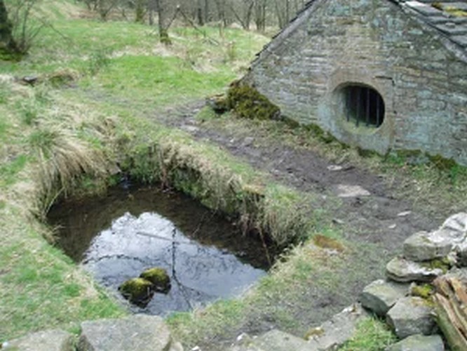
Associated with Hollinshead Hall, which is now a ruin, the well is made of the same sandstone rubble as the hall with a stone slate roof. The building a single cell is built into a slope from which the spring arises and is encapsulated by it. Either side a high walls creating a sort of forecourt with side benches with inward-facing chamfered piers with ball finials at the ends. The well house itself is quite an attractive building and is certainly not thrown up, having a symmetrical facade with chamfered unglazed widows which are fitted with spear-headed iron bars and clearly the building has never been glazed. The gable end has a large oval opening with a matching one at the rear. In the centre is a heavy board door with a chamfered doorway. This doorway unfortunately is locked baring any entrance to the well house.
Peering in through the windows one can see how strong the vaulted roof is, adorned by a pendent ball in its centre. The spring’s water flows from a crudely carved lion’s head, either side of a reredo of Ionic colonnettes, with a sunken stone tank beneath or each side a rectangular recess which enclose rectangular pools. There is a diamond-paved floor with a central gutter draining from this well or trough at centre of rear wall.
Local tradition accounts that there was a site here from Medieval times and indeed, that the name Hollinshead was derived from a version of holy well although O.E hol, for hollow is more likely although there is a Halliwell Fold Farm nearby being derived from O.E halig for healing. The pool with steps down above the well house may be the original well of course. The discovery of a hoard of medieval coins in 1970s would support the date and perhaps they were an offering.
Folklore
Abram’s Blackburn (1877) is perhaps the first to state that the water was curative. However, anonymous quote in Nightingales History of Tockholes describes the well as:
“Here no less than five different springs of water, after uniting together and passing through a very old carved stone representing a lion’s head, flow into a well. To this Well pilgrimages were formerly made and the water which is of a peculiar quality, is remarkable as an efficacious remedy for ophthalmic complaints.”
Another tradition is that the site was a resting place for pilgrims to Whalley Abbey and that the trough was used as baptistery, however, this would be more likely to be the spring above the well house. It is probably a spring house, a structure built over a natural source of water for the storage of dairy products and other foods that needed to be kept fresh.
Reculsancy was very prevalent in Lancashire and the well house does the bear the coat of arms of the Radcliffes. It would suggest why the structure is so ornate and suggest a 1600s date—although many authorities suggest an 18th century origin. The site would be a secret baptistery and its design as a dairy would also help as well as being still function, certainly the presence of benches suggest this functionality. It appears to be too close to the house to be a garden folly such as a grotto! The suggestion of stained glass in the windows suggests something more significant discovered during the present stone roof’s construction. Indeed, the choice of the lion’s head is possibly that of the ‘Lion of Judah’, meaning Jesus providing rich and valuable water, although this is a common motif on many drinking fountains of course! Interesting, Cramshaw (1994) tells us that the site was in the 1980s the site of a well dressing, although what type is unclear and no other author has mentioned it as far as I am aware. Perhaps we shall never know the real origin of this delightful building.
Take the A822 road south out of Crieff and less than half a mile down, in a field on the east side of the road is the giant solitary standing stone of Dargill. On the opposite side of the road from here (roughly) is a small country lane. Go along here and past the third field on your left, park up. Look down the fields for a coupla hundred yards and you’ll see the standing stone. Make your way there by following the field-edges.
Archaeology & History
Concraig stone, near Crieff
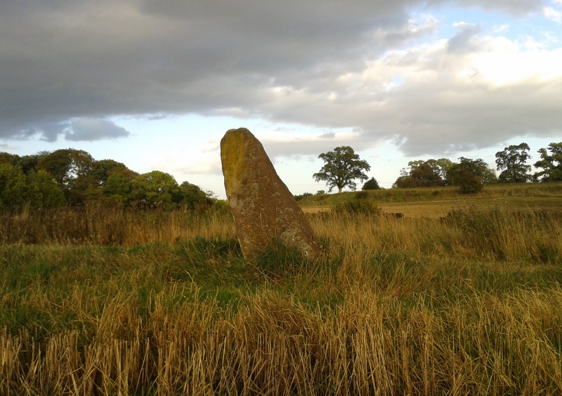
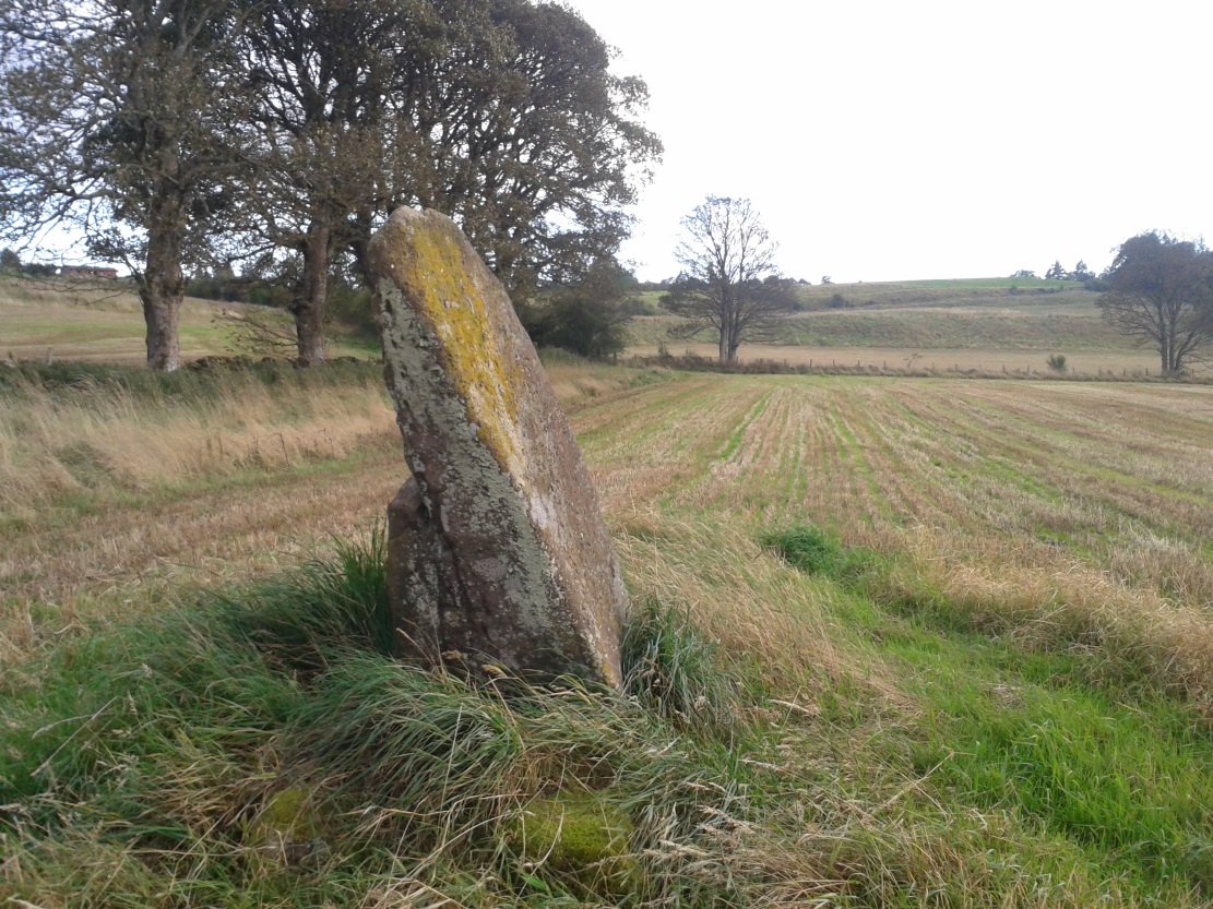
Closer to the larger town of Crieff than it is to the village of Muthill, this seven-foot tall standing stone, leaning at an angle to the north and with a small scatter of stones around its base, stands alone near the side of the field, feeling as if others once lived close by. It’s set within a distinctly nurturing landscape, enclosed all round instead of shouting out to the hills, with that nourishing female quality, less commonly found than those stones on the high open moors. The only real ‘opening’ into a wider landscape here was mentioned by the local writer Andrew Finlayson (2010), “to the distant east.” Whether this possessed any astronomical-calendrical importance hasn’t yet been explored.
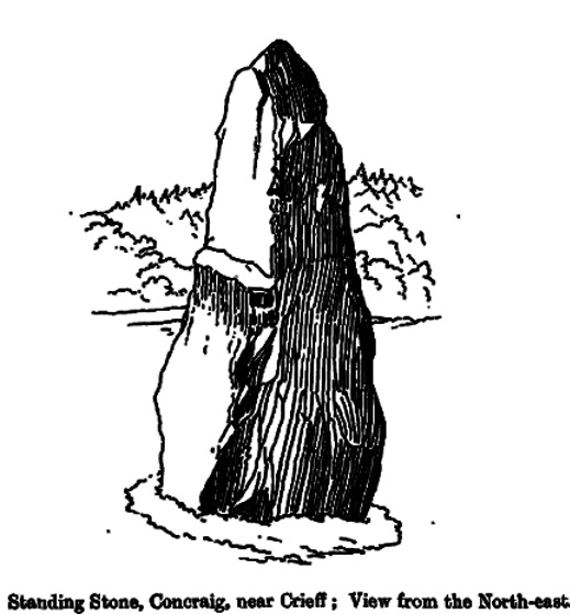
Concraig, looking southFred Coles 1911 sketch
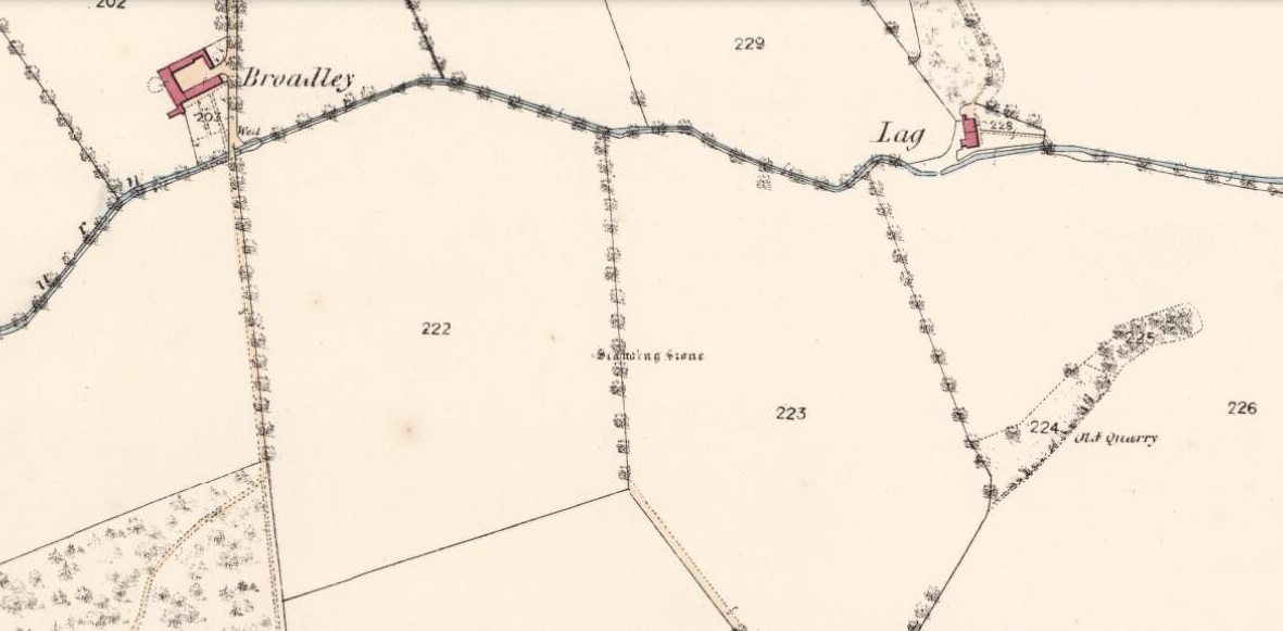
The stone was first highlighted on the 1863 Ordnance Survey map—and described in their Name Book as “a large upright Stone adjacent to and South-east of Broadley about 8 feet high and traditionally said to be either the remains of a Druidical Temple or in some way associated with the Druidical period”—but since then it hasn’t fared very well in antiquarian tomes. Fred Coles (1911), as usual, noted it in one of his Perthshire surveys, but could find very little information from local people about the place, simply telling us that,
“in an open field about 300 yards to the north-west of Concraig, there stands this irregularly four-sided block of conglomerate schist… The stone measures 9 feet 3 inches round the base and stands 7 feet 3 inches in height. About halfway up its eastern face it has been broken so as to leave a very distinct ledge.”
What appears to be cup-markings on the southern-face of the stone are just Nature’s handiwork.
Take the same directions to reach the giant Carn Ban prehistoric tomb. Follow the track past the tomb further onto the moorland until you reach a small wooden bridge over the small burn. From here, walk straight north off-path onto the moor for 100 yards and a small rise in the land, with several cairns just below it, is the site in question.
Archaeology & History
Hut circle are hut circles – right? Well, usually that’s the case. We find them attached to, or within, or outlying prehistoric enclosures and can date from anywhere between the neolithic and Iron Age periods. With the site we’re looking at here, on the outer western side of Glen Cochill’s southernmost giant enclosure, there’s something amiss….or maybe that should be, “something rather peculiar.”
Mr Hornby, hut-sideShamans Lodge walling
Paul Hornby found it a few weeks ago during an exploration of the region’s prehistory. We went in search of, and found, the giant Carn Ban close by, but noticed curious archaeological undulations ebbing in and out of the heathlands: cairns, walls, hut circles, settlements, more cairns—and then this!
Consisting of two slightly larger-than-average ovals of walled stone, probably Bronze Age in date, the first impression was of a remarkably well-preserved site (and that it is!), seemingly of an elongated stretch of walling, with a central wall that split it into two halves. Each ‘hut circle’ was found to be between six and seven yards across, with the two conjoined architectural features giving an overall NW-SE length of 14 yards. But the more we looked at this, the more obvious it became that this was originally one single hut circle—the lower southeastern one—with an additional one that was added and attached onto the northwestern side at a later date, probably several centuries later.
Lower earlier hut circle, with upper later hut circle attached
Walking around the structure we found that the very well-preserved walls—about 2 feet wide in places and rising a foot or so above the compacted peat—had been built onto a raised platform of earth. This was no ordinary hut circle! The ground beneath it seems to have been raised and supported and on the southern side in particular it is notable that other building stones are compacted into the peat. There may even be the remains of a secondary outer wall on this southern edge, where it seems that the entrance was made.
Small group of cairns 15 yards away
Here’s the curious bit: immediately outside the northwestern and southern walls are small prehistoric tombs, or cairns. Not just one or two, but more than a dozen of them, all constructed within 20 yards of this curiously raised double hut circle. Literally, a small prehistoric house of some form was raised in the centre of a prehistoric graveyard—and it doesn’t end here.
Of at least three giant enclosures in this region, and what looks like a very well-preserved prehistoric tribal hall or meeting place, there are upwards of a hundred tombs scattered nearby. Two cairn circles were also found about 100 yards to the north, one of which was damaged by a military road a few centuries ago.
Close-up of walling
I give this double-roomed abode the somewhat provocative title of the Shaman’s Lodge because of its setting: surrounded by tombs, the ‘house’ would seem to have been a deliberate setting erected in the Land of the Dead here. I hope you can forgive my imaginative mind seeing this as a structure where, perhaps, a medicine woman would give rites to the dead, either for those being buried in the small graves, or rites relating to the giant White Cairn of the ancestors close by. Shamans of one form or another occur in every culture on Earth and have been traced throughout all early cultures. If no such individuals ever existed within the British Isles, someone needs to paint one helluva good reason as to why they believe such a thing….
When the heather grows back here, the site will disappear again beneath the vegetation. It is unlikely to re-appear for quite sometime, so I recommend that anyone wanting to have a look at this does so pretty quick before our Earth covers it once again….
References:
Stewart, Margaret E.C., “Strath Tay in the Second Millenium BC – A Field Survey”, in Proceedings Society Antiquaries Scotland, volume 92, 1961
Acknowledgements: Huge thanks again to Paul Hornby for his assistance with site inspection, and additional use of his photos.
Take the same directions to locate the cup-and-ring stone of Ballochraggan 12. There are several rocks adjacent. The one immediately next to it, to the northeast, is the one you’re looking for. Be gentle and careful if you’re gonna look at it — deadly serious, be very careful indeed!
Archaeology & History
One of the most intriguing and most fascinating of all the prehistoric carvings I’ve yet to discover. Not that this was all my own work. If it hadn’t been for Paul Hornby, we might have simply walked past it as being little more than a single cup-marked stone—and in this area, single cup-marks tend to be little more than geological in nature.
After we’d looked over several of the registered carvings close by, I did my usual meandering back and forth, stroking stones and seeing if there were any carvings that had been missed by previous surveyors. And in walking past a small piece of smooth rock, a singular cupmark seemed to stand out. I walked past it, shouting across to my colleague.
“It looks like we’ve got a single cup-mark here Paul,” I said, “with possible half-ring.” Thankfully Mr Hornby gave it his better attention.
Mask Stone, with faint ‘urn’Close-up of features
The sun was still out and shining across the smooth rock surface, which tends to mean that you’re not seeing any carving on the stone quite as good as it actually is. Thankfully however, the sun was beginning to get lower and, when this happens, if we wet the rock, any carvings that might be there stand out much better. And this little fella just seemed to get better and more curious the more attention Paul gave it!
The first thing that became obvious were a series of faint carved lines above the single cup-mark. Initially these didn’t seem to merit much attention (straight lines on rock are usually more the product of geophysical action than that of humans), but as the rock got wetter, Paul saw something very distinct indeed.
“There’s a face on it!” he exclaimed. And indeed there was. A Rorschach response no doubt, but it was still very much like a face. This looked for all the world akin to the stylised olde English gentry sort of countenance, as in old cartoons. It was quite ‘distinct’, as such characters themselves insist on being! Yet around this initial face, more lines seemed to be emerging as the stone gave up more and more of its hidden story.
Standing back from an initial investigation, the carving was seen to consist of a triple-ring, but without the traditional ‘cup’ in its centre. Instead, the centre was marked simply by a small ‘dot’—perhaps, originally, being a small conglomerate hole formed as a result of another tiny harder fragment of stone falling away from its larger mass. But a ‘dot’ it was. The other carved ‘lines’ however, immediately below and attached to the triple-ring, gave us something almost unique—and another strong Rorschach response. As the photos clearly show, we have a distinct second ‘face’ made up of the same lines but in a quite different form. This ‘face’ has all the attributes we usually associate with pictures of mythical spirits, demons, or a mask—hence the name!
Paul took a series of fine photos, hoping that he could catch the image that our eyes could clearly see. And thankfully, his digital camera brought the image to life even better than our eyes did! The ‘mask’ is comprised of carved lozenge forms, akin to the more decorative ones we find at Kilmartin, and more especially around Newgrange, Ireland. We sat and talked about this: wondering and working out routes that we’d take over mountains and moors, from Ireland, to Kilmartin, then onto Ballochraggan, etching the same designs onto the rocks hereby and attaching similar mythic notions to them: of shamanism and kingship; underworlds and journeys—paradigms lost and certainly misunderstood in the non-polysemia of many modern academics.
Lozenges and rings
…The stone here was still slightly covered over and, beneath the loose grasses, another feature emerged of another petroglyphic rarity. At the topmost western side of the rock a straight line ran across the surface, seemingly marked by the hand of man, with a curious little line almost doubling back on itself for just an inch or so, and then feeling to run down the stone, towards the concentric rings and the face below. When we stood back and took the photos, this line and its tracer took on a form that I’ve only seen echoed in one of the Netherlargie tombs at Kilmartin, Argyll, 44.4 miles (73km) to the west. It is very distinct.
The beaker, rings & ‘face’
Spuriously ascribed as being ‘axe’ carvings (oh how archaeologists love this Rorschach projection), the Netherlargie North tomb cover-stone in Kilmartin has a series of burial ‘urns’ or beakers carved onto the rock, amidst a scattered collection of cup markings. (Beckensall 2005:73-4; Bradley 1983:92-3; Royal Commission 1971:68-70; Twohig 1972, etc) Here too at Ballochraggan we find another such symbol, but just a singular example, much larger and more clearly a beaker or urn, as are traditionally found within many old neolithic and Bronze Age tombs; although no tomb is immediately apparent at this Ballochraggan carving.
The entire carving is very faint indeed (you can’t even see it when you’re looking directly at it unless conditions are good) showing that it remained open to the elements for thousands of years. Other adjacent carvings lack the erosion that we find on this one, even on those which, as archaeologist Lisa Samson said, is “softer sandstone rock than this one”—implying that it’s one of the older carvings in this incredible cluster.
References:
Beckensall, Stan, The Prehistoric Rock Art of Kilmartin, Kilmartin Trust: Kilmartin 2005.
Bradley, Richard, Altering the Earth, Society of Antiquaries Scotland: Edinburgh 1993.
Royal Commission on the Ancient & Historical Monuments of Scotland, Argyll – volume 6: Mid-Argyll and Cowal, HMSO: Edinburgh 1971.
Twohig, Elizabeth Shee, The Megalithic Art of Western Europe, Clarendon: Oxford 1981.
Acknowledgments: Huge thanks again to Mr Paul Hornby for his considerable help with this site, and for use of his photos.
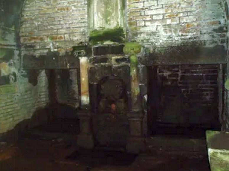
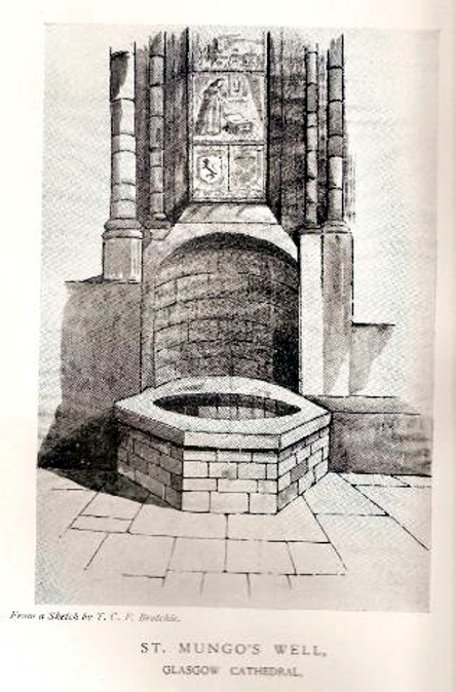
Not to be confused with the sacred well of the same name found along Gallowgate a short distance to the south, the waters of this ancient well have sadly fallen back to Earth. The structure built above it, however, is thankfully still preserved inside the Cathedral, as visitors will see.
Folklore and history accounts tell its dedication to be very early – and the tale behind the erection of the cathedral is closely associated with the waters themselves. Indeed, if the folklore is accepted, we find merely a transference of early animistic ideas about the death of an ancestor placed onto this early Saint, with a simple association in the formula of: tomb, holy site and architectural form. It could almost be Bronze Age in nature!
The lengthiest (and best) description of St Mungo’s Well was by Mr Brotchie (1920) in a lecture he gave on the city’s holy wells in April 1920, which was thankfully transcribed by the local history society. He told us:
“It seems to me that Glasgow in a very particular degree is a case that illustrates emphatically the existence of the early cult of the sacred fountain (sketch attached)… How came it to be there? In itself it represents the very beginning of Glasgow. It was to the little spring on the hillside overlooking the Molendinar that there came the earliest of christian missionaries, Ninian. All that we know of Ninian is from the account of Jocelin, the monk of Furness, who tells us that “ane holy man Ninian cam to Gleschu or Glasgow in the third century”, and made his cell on the banks of the Molendinar. When Kentigern or Mungo came to Glasgow in the sixth century, he made his settlement near a certain cemetery, which had long before been consecrated by St. Ninian, and which at the time when Jocelin wrote (twelfth century), was “encircled by a delicious density of overshadowing trees.” The crypt of the Cathedral—in reality an under church of extraordinary beauty of design and magnificence of mason work—is the shrine of St. Mungo, who is buried there, and the whole design of the lower church shows that the architect who in 1230 planned the building…built his scheme up with the idea of providing a shrine for the saint’s tomb and his holy well.
“The well is in the lower eastern corner of the church just opposite to the chapter house. John Hardying, the chronicler, who visited Scotland in 1413, states that St. Mungo’s shrine was then the centre of the life of Glasgow. In 1475 James III, on account of his great devotion to St. Kentigern, granted three stones of wax yearly for the lights at the tomb of the saint in the cathedral, near his holy well.
“St. Mungo adopted this well from the pagans of the district and changed its purpose from evil to good. Beside it he erected in 560 his little wattle hut where he died. He was buried inside it, and when the great cathedral was built the holy well was included within its walls…
“St. Mungo’s Well was a place of pilgrimage to the early christian fathers, and we find it described as “an idolatrous well” in 1614. In 1579 we have a public statute prohibiting pilgrimages to wells, and in 1629 the Privy Council denounced these pilgrimages in the strongest terms, it being declared that for the purpose of “restraining the superstitious resort of pilgrimage to chapels and wells, which is so frequent and common in this kingdom, to the great offence of God, scandall of the kirk, and disgrace of his majesties government,” that commissioners cause diligent search in “all such pairts and places where this idolatrous superstition is used, and to take and apprehend all such persons of whatever rank and qualitie whom thay sall apprehend going on pilgrimage to chapels and wells.” That decree was issued under the Dora of 1629. But all in vain. The custom of visiting chapels and wells had become a habit – and habits, as we all know, though easily formed are difficult to break. The wells continued to be visited by stealth if need be.”
Along the A84 road between Doune and Callander, take the tiny country lane up to your right to Drumloist (if you’re coming from Doune) or up the tiny unmarked road past Keltie Bridge on your left (if you’re coming from Callander). Uphill for several miles, you eventually emerge from the trees and are on the top of the tiny road. Once here, keep your eyes peeled for Drumloist farm. Best thing to do is walk up the track and ask at the farm. The fella there is a superb old Highlander who’ll point you to the place on the hill above.
Archaeology & History
A site that was never explored by that giant of chambered tomb research, Audrey Henshall. A pity, as it has a lot of potential and seems to have a lot more to say about itself than the meagre findings reported by the Scottish Royal Commission doods.
Curious fairy mound to rearOne of two main chambers
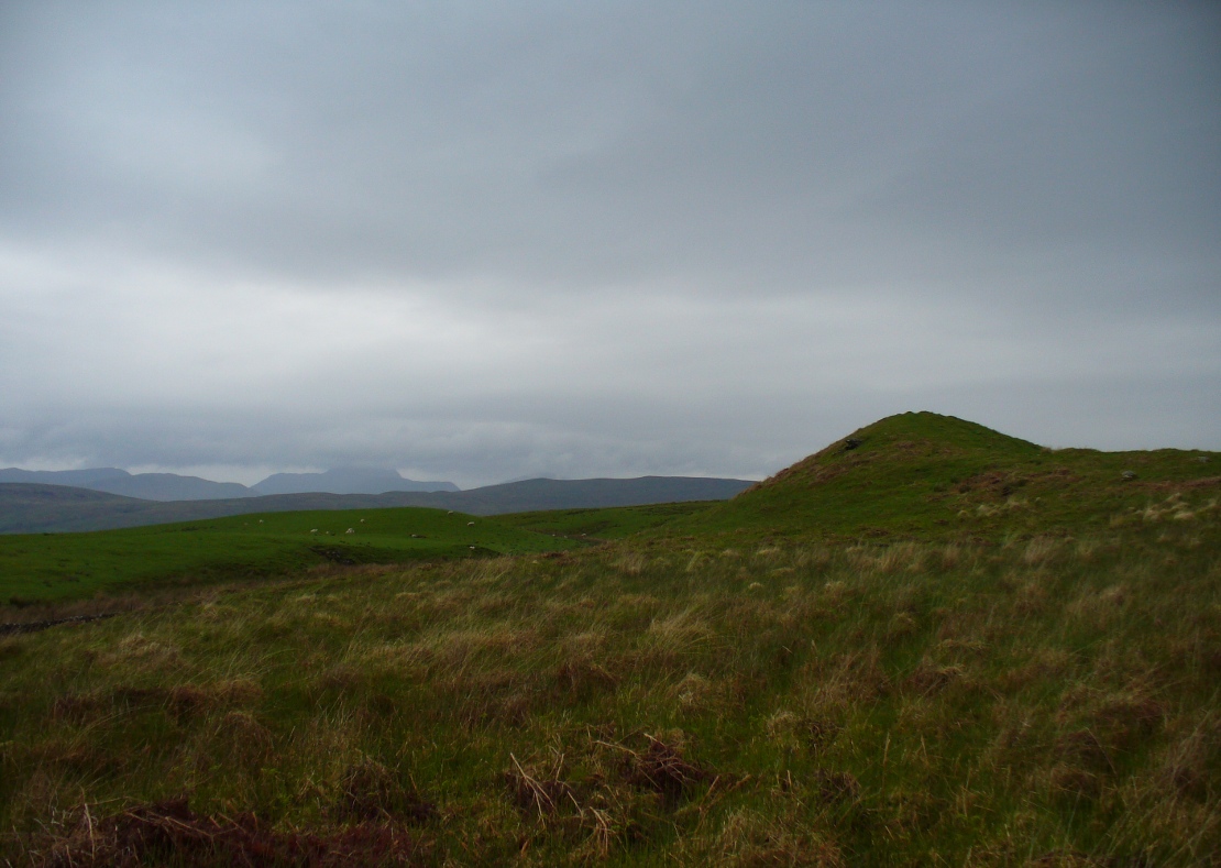
Although there’s a very notable “fairy hill” eminence close by which strongly draws your attention, the actual hillock upon which this chambered tomb was constructed is in front of this, closer to the farm. A couple of rows of ancient walling—Iron Age by the look o’things—run up the hillside, with one of them running into the eastern sides of the huge mound which this tomb plays a part in. The mound itself is about a hundred feet across, although seems to have been damaged over the centuries. Although it is probably neolithic in origin, sections of the monument seem to have been altered and re-used for other purposes, giving it that distinctly multi-period look.
The farmer informed us how some of the stones from the mound had been robbed and used in some of the walling in the past. He also told us how there are so many other archaeological features upon the moors above here that remain to be “officially” recorded, despite the efforts of some who swept the region for remains a few decades ago.
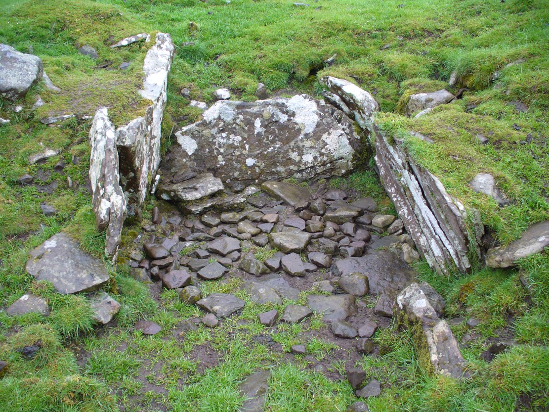
Looking into the main cistNature’s faded cup&ring
The main prehistoric section of the tomb that can be seen are the two opened cists, or stone-lined graves, to the top north-western edges of the mound. They align together, NE to SW, with a gap of about three yards between the two open tombs. The more northerly of the two is much more overgrown; whilst the southwestern grave comprises of three large flat upright stones, forming a traditional ‘box’ with smaller flat stones lining the floor. But these two separate tombs (if indeed they were originally separated) point directly to the large, very prominent “fairy mound” about 100 yards north-east, on the north side of the Drumloist Burn. The alignment seems very deliberate.
Walking over the boggy ground to the (unnamed) fairy mound, a natural ‘platform’ of rocks sticks out on its south-easterly side, and upon this are what I initially thought were two cup-markings, with the more easterly one of the two seeming to have a carved arc along its edge; but subsequent visits here at different times of day has shown that they are Nature’s handiwork. Anyhow, looking from this mound, back across to the Ballachraggan tomb, the open flat landscape heading south-west is held where the sunset falls. Sadly on the day we visited, Nature greeted us with grey cloud and the drizzle of light rain all afternoon, so we couldn’t make out if there was something, far away, which the tomb was truly aligned with… A damn good site though!