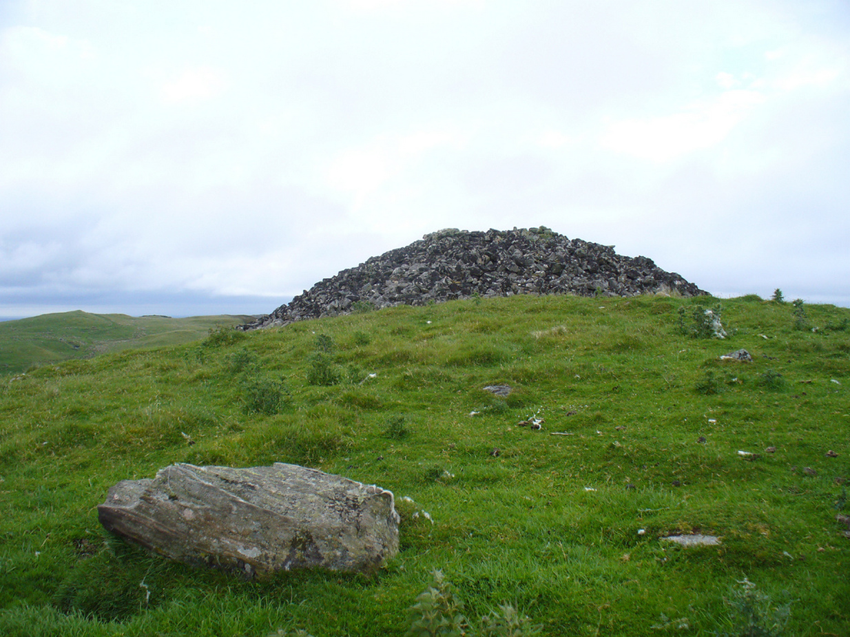
A mile east of Bettyhill on the A836 road, watch for the large piles of rocks up on the hill on your left (north). Turn left on the tiny road past the first house for 150 yards and then on the track past the sheep-fanks through the gate and up the small hill. The cairn is the smallest of the pile of rocks in front of you.
Archaeology & History
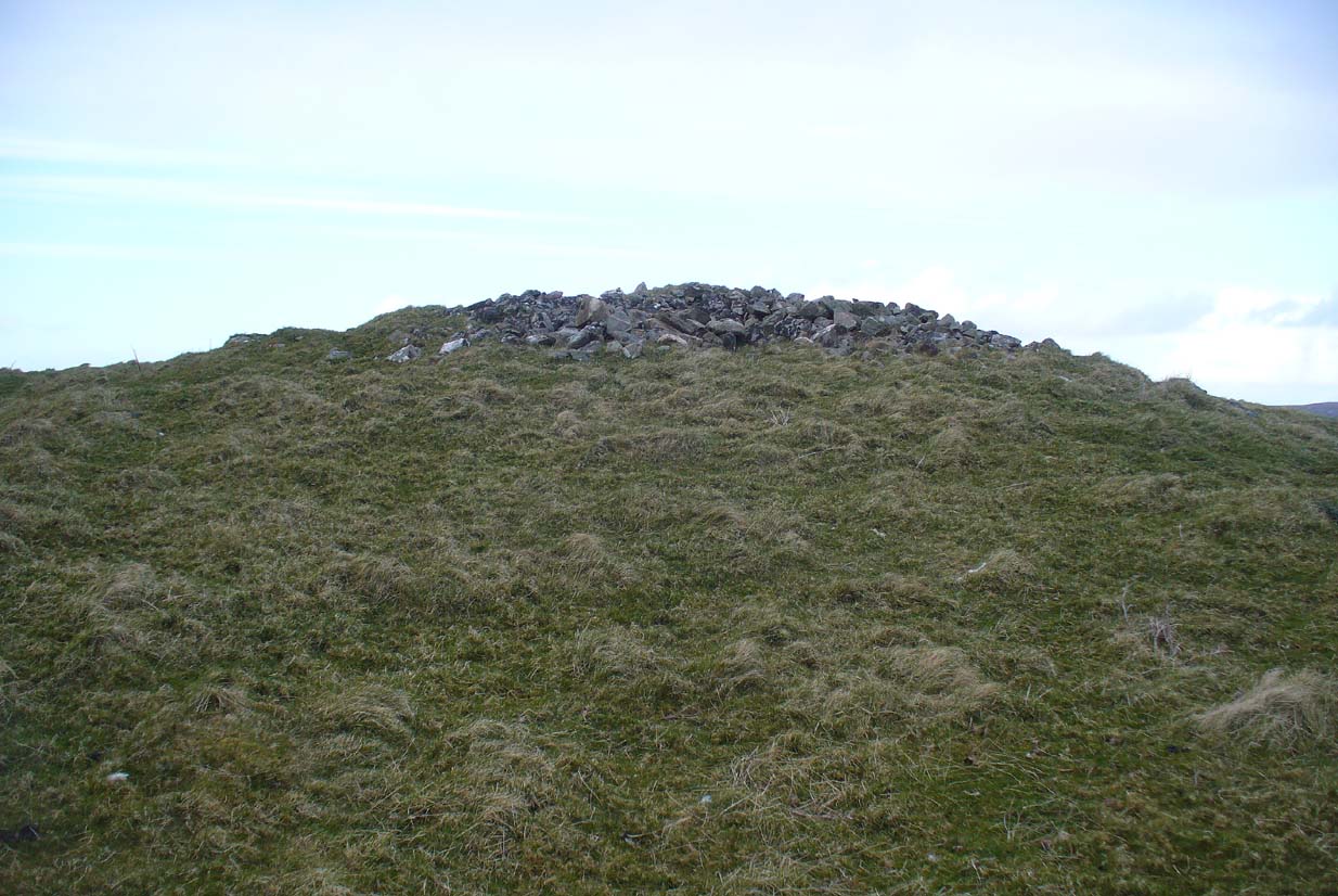
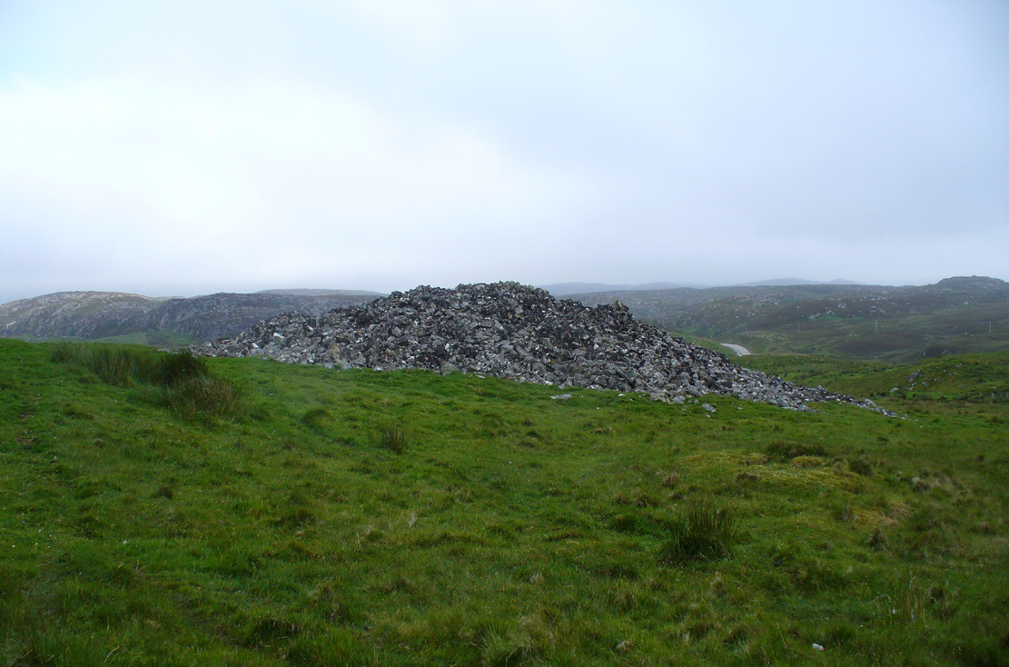
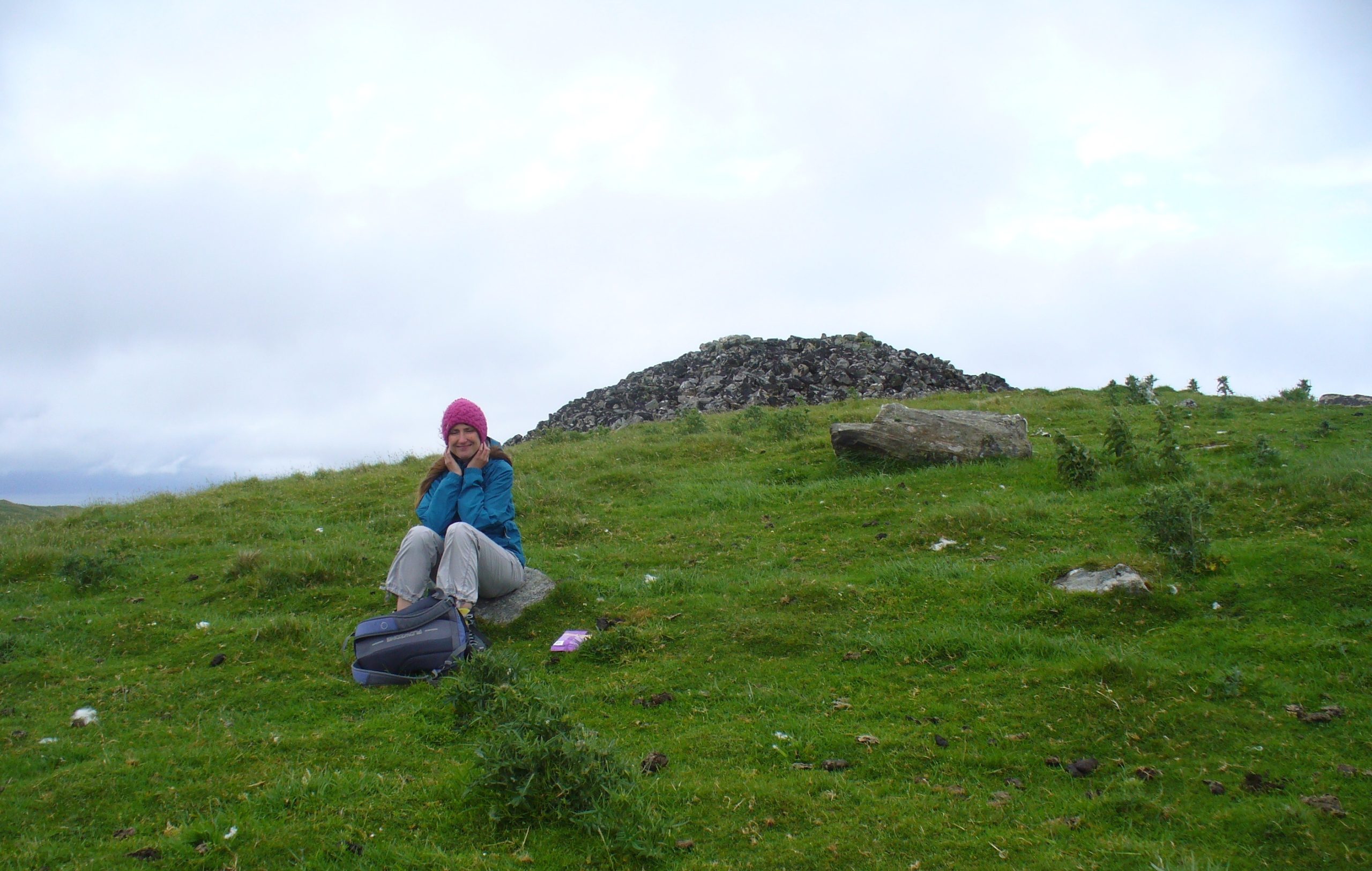
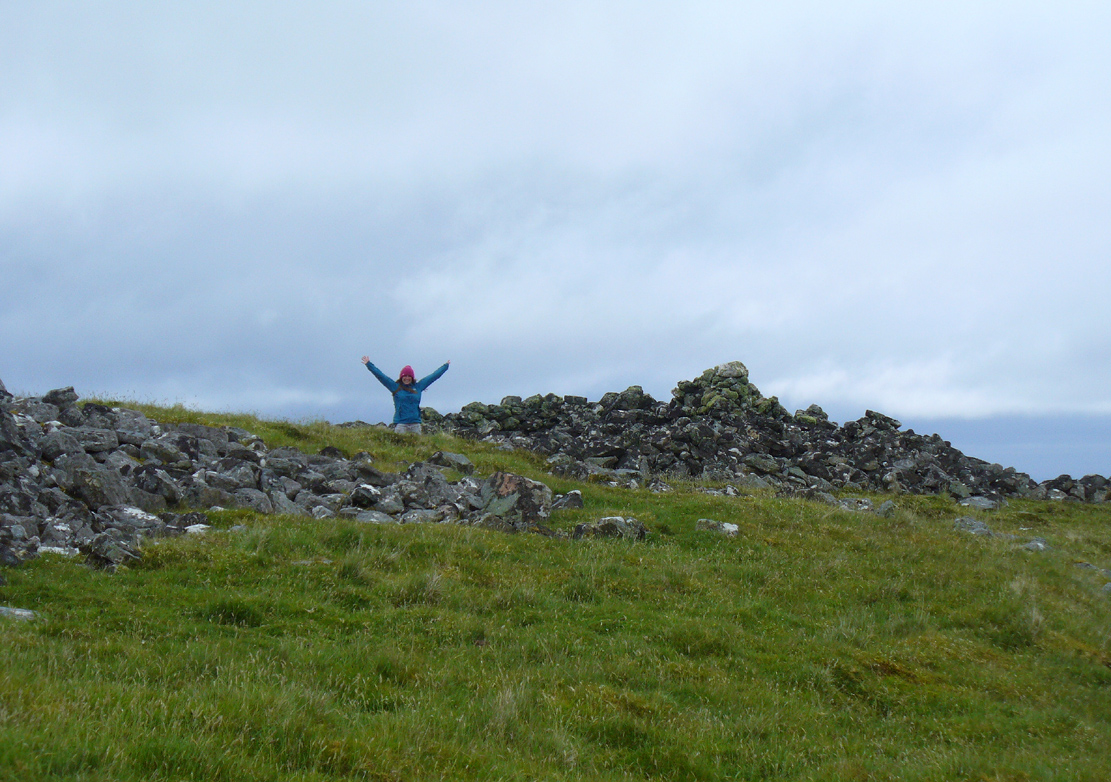
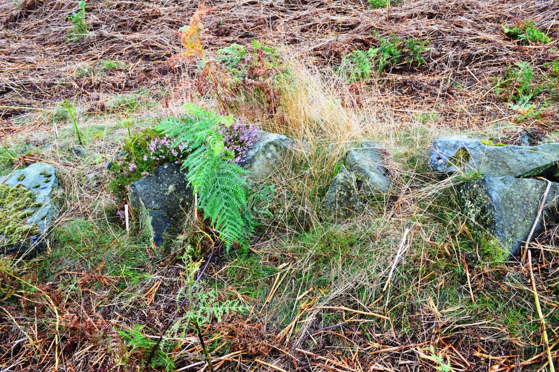
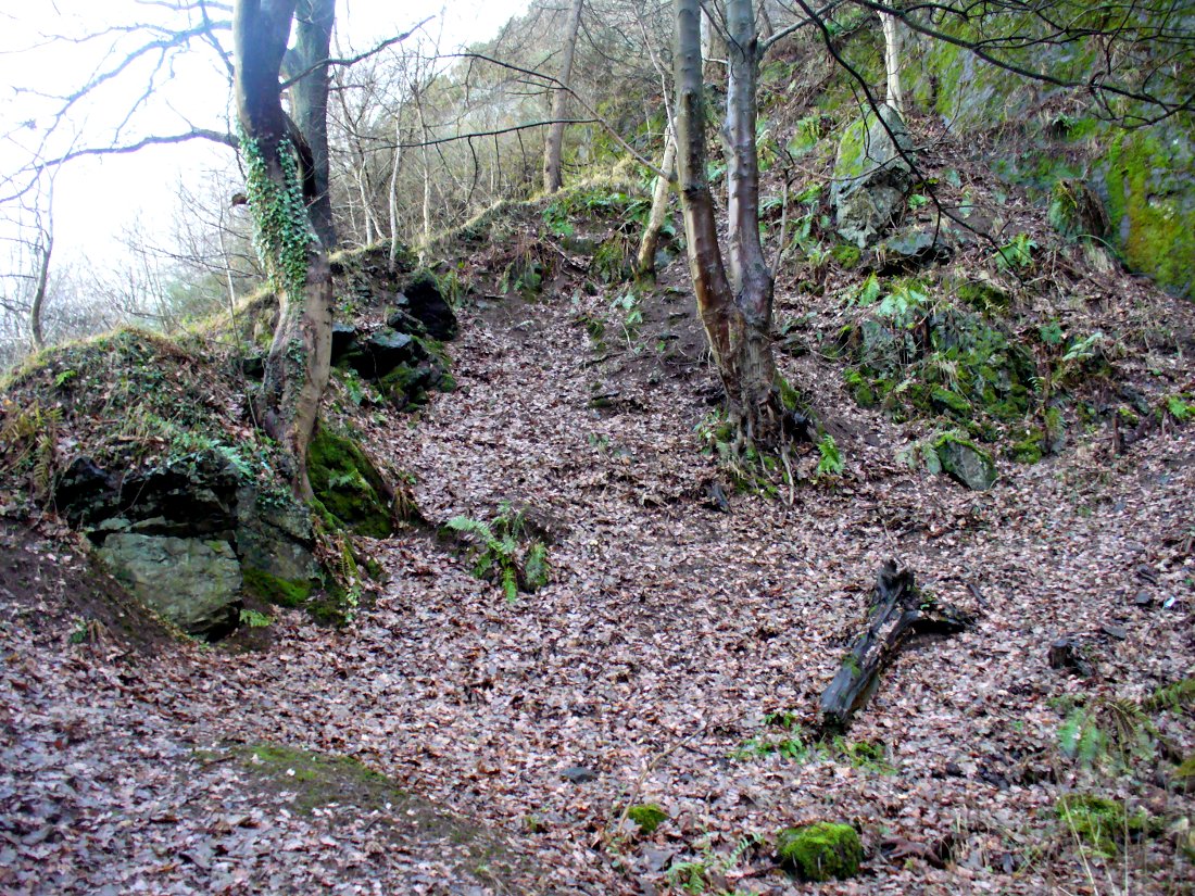
Of the four giant cairns clustered here at Fiscary, a mile east of Bettyhill, this one has received the least attention. It is found amidst a massive cluster of archaeological remains running from the 19th century all the way back into the neolithic period. Quite impressive!
Sitting on top of the cairn the view is impressive: looking 360º with the Orkney islands s to the northeast, Durness and the rising mountains west and southwest, and endless craggy moorlands peppered with lochans driving in all directions to the south countless miles away. This panorama of wilderness is something to behold…
Looking west out to sea
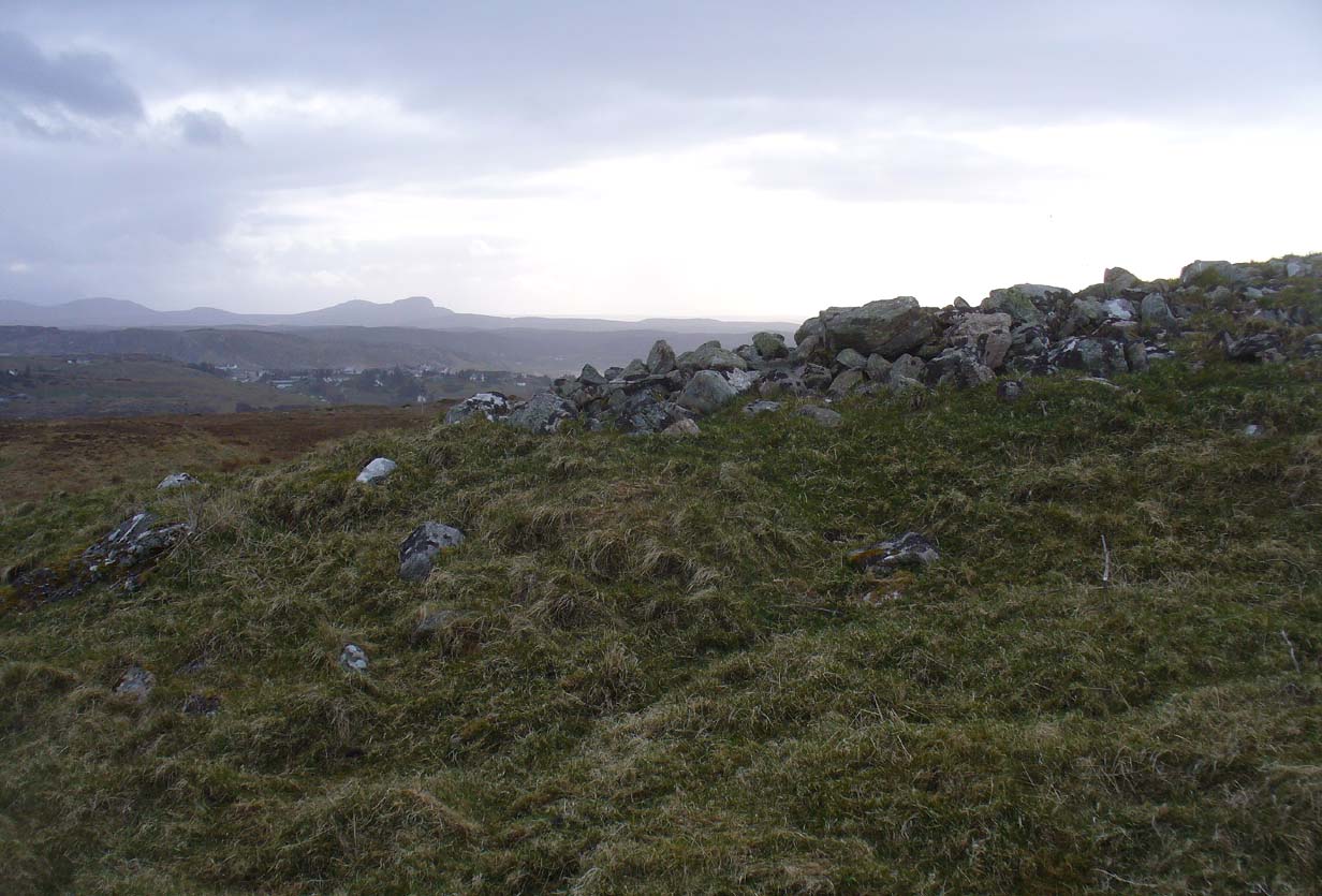
Looking southwest
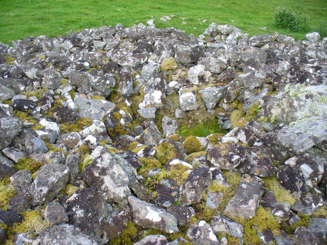
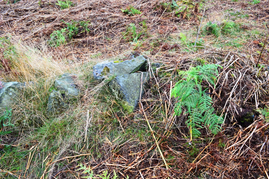
The tomb itself, with the acceptable scatter of fallen rocks to the edges, is nearly 50 yards in circumference, measuring more than 12 yards east-west and nearly 14 yards north-south, with the Earth covering the older rocks to the edges with more and more vegetation as the years pass. It stands about 5-6 feet high with the typical internal mass of thousands of stones making up the cairn. No known excavations have ever been made here.
In the otherwise superb Royal Commission (1911) survey of Sutherland, they only had scant information to say about this tomb, telling that,
“The fourth cairn…measures 28′ to 30′ in diameter and is about 6′ high. There are no signs of chambers visible and the cairn has been a good deal dilapidated.”
Even when R.J. Mercer (1981) came to give this area greater attention, he passed by the Fiscary 4 cairn with equal brevity, noting simply its dimensions, elevation above sea level and the fact that it is a “circular cairn on crest of hill.”
The tombs of Fiscary 1, 2 and 3 are very close by some beginning some 257 yards (235m) to the east. I cannot recommend this entire complex highly enough!
References:
Henshall, Audrey S., The Chambered Cairns of Sutherland, Edinburgh University Press 1995.
Mercer, R.J. & Howell, J.M., Archaeological Field Survey in Northern Scotland – volume 2, University of Edinburgh 1981.
o’ Reilly, Kevin & Crockford, Ashley, What to See Around Bettyhill, privately printed 2009.
Royal Commission on Ancient & Historical Monuments, Scotland, Second report and inventory of monuments and constructions in the county of Sutherland. HMSO: Edinburgh 1911.
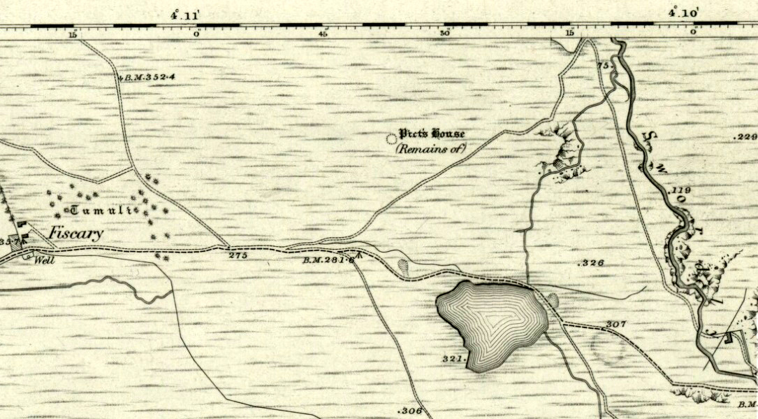
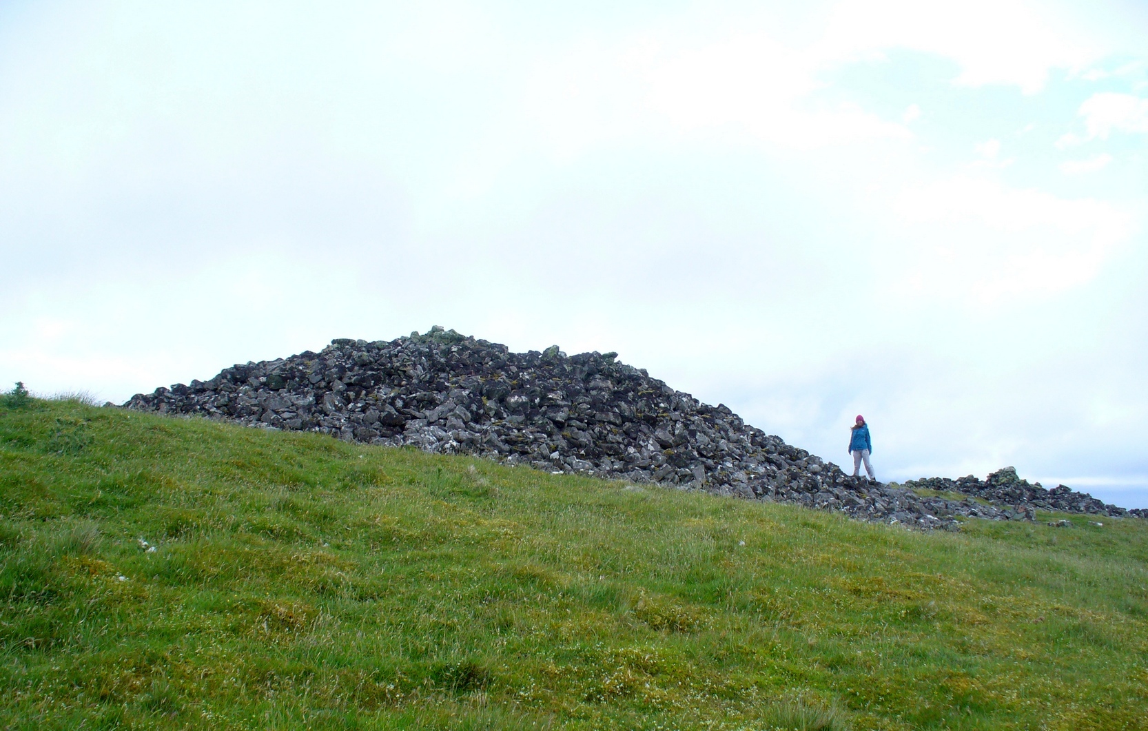
Along the A836 road from Bettyhill to Thurso, a mile east of the village keep your eyes peeled to your left (or to the right if you’re coming the other way!), looking north, and you’ll see some very large piles of stones a few hundred yards away. Go through the gate onto the rough grasslands and the first one you reach is the cairn in question. Y’ can’t miss it!
Archaeology & History
On 1878 OS-map as Picts House
Close to the Fiscary 1 and Fiscary 2 tombs, this is the third and southernmost of the three giant cairns on this moorland hillside and is the second largest of the trio. Curiously it was the only one highlighted by the Ordnance Survey lads in their cartographic analysis here in 1873—they somehow missed the others—when they told it to be a ‘Pictish House’, or broch. A few years later when the Royal Commission (1911) fellas got their noses up here, they said that this,
“which is the most easterly, is circular in form, is about 68ft in diameter, and 15ft 6in to the apex, on which a small pile of stones has recently been erected. The cairn does not appear to have been excavated, but the stones in several places have been pulled out, probably in attempts to discover the chambers or in pursuit of rabbits.”
Looking into its centre
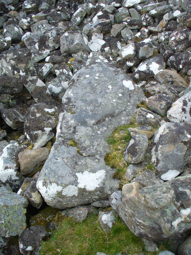
Long stone at southern edge
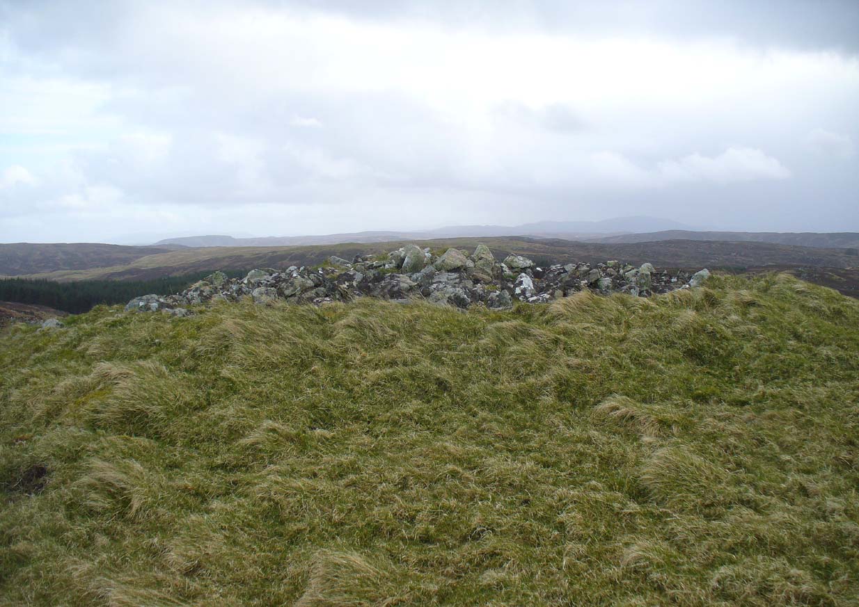
Considering the size of this giant cairn and its close association with is neighbours 150 yards northwest, I’m surprised at the lack of attention it’s been given. Within the collapse of stones on its southern-side we find an elongated stone which seems to have stood upright at some point in the past, either at the very edge of the cairn, or just inside it. It may even have been a covering stone to a collapsed entrance, but without an excavation we’re not gonna know for certain.
The fact that this cairn is on the slopes south of the crowning cairns of Fiscary 1 and Fiscary 2 implies that this was built some centuries later than them. Also notable here is that the view to the north is blocked and we are instead only looking across a panorama east, south and west.
Folklore
Looking across into the east
Local tradition told that this was a Pict’s house, or broch (it may well have been) and is shown as such on the first Ordnance Survey account of the region in 1878. Otta Swire (1963) told that this landscape was once peopled by giants who made the land and played a part in the creation of some of the giant tombs around here. One time local school-teacher at Bettyhill, Alan Temperley (1977) also told us how the fairy folk lived close to the giant tombs of Fiscary.
References:
Gourley, Robert, Sutherland: An Archaeological Guide, Birlinn: Edinburgh 1996.
Henshall, Audrey S., The Chambered Tombs of Scotland – volume 1, Edinburgh University Press 1963.
Henshall, Audrey S., “The Distant Past,” in The Sutherland Book (edited by Donald Omand), Northern Times: Golspie 1991.
Henshall, Audrey S., The Chambered Cairns of Sutherland, Edinburgh University Press 1995.
o’ Reilly, Kevin & Crockford, Ashley, What to See Around Bettyhill, privately printed 2009.
Royal Commission on Ancient & Historical Monuments, Scotland, Second report and inventory of monuments and constructions in the county of Sutherland. HMSO: Edinburgh 1911.
Sutherland, George, Folk-lore Gleanings and Character Sketches from the Far North, John o’ Groats Journal: Wick 1937.
Temperley, Alan, Tales of the North Coast, Research Publishing Company: London 1977.
Acknowledgments: HUGE thanks to Aisha Domleo and for getting me up here.
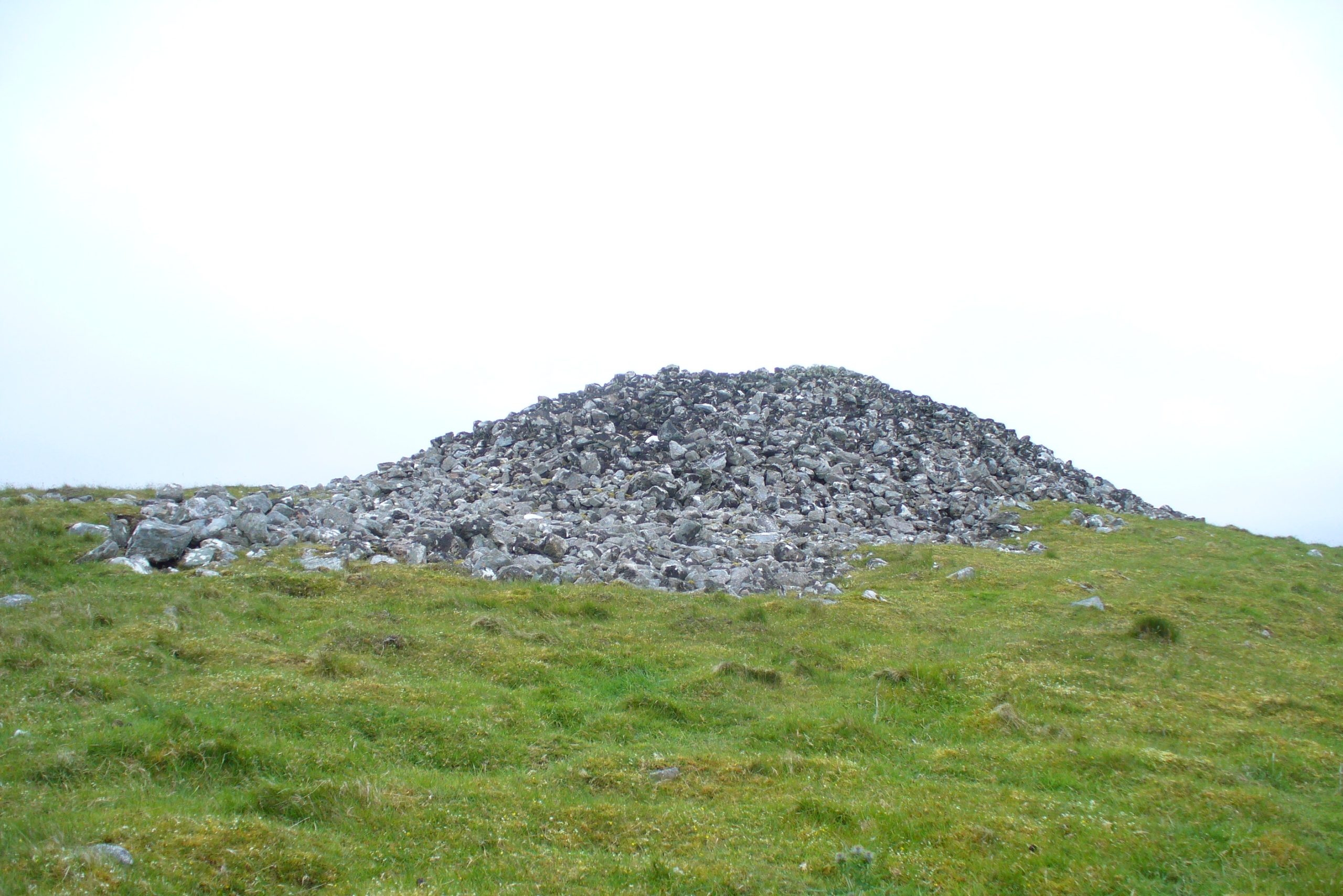
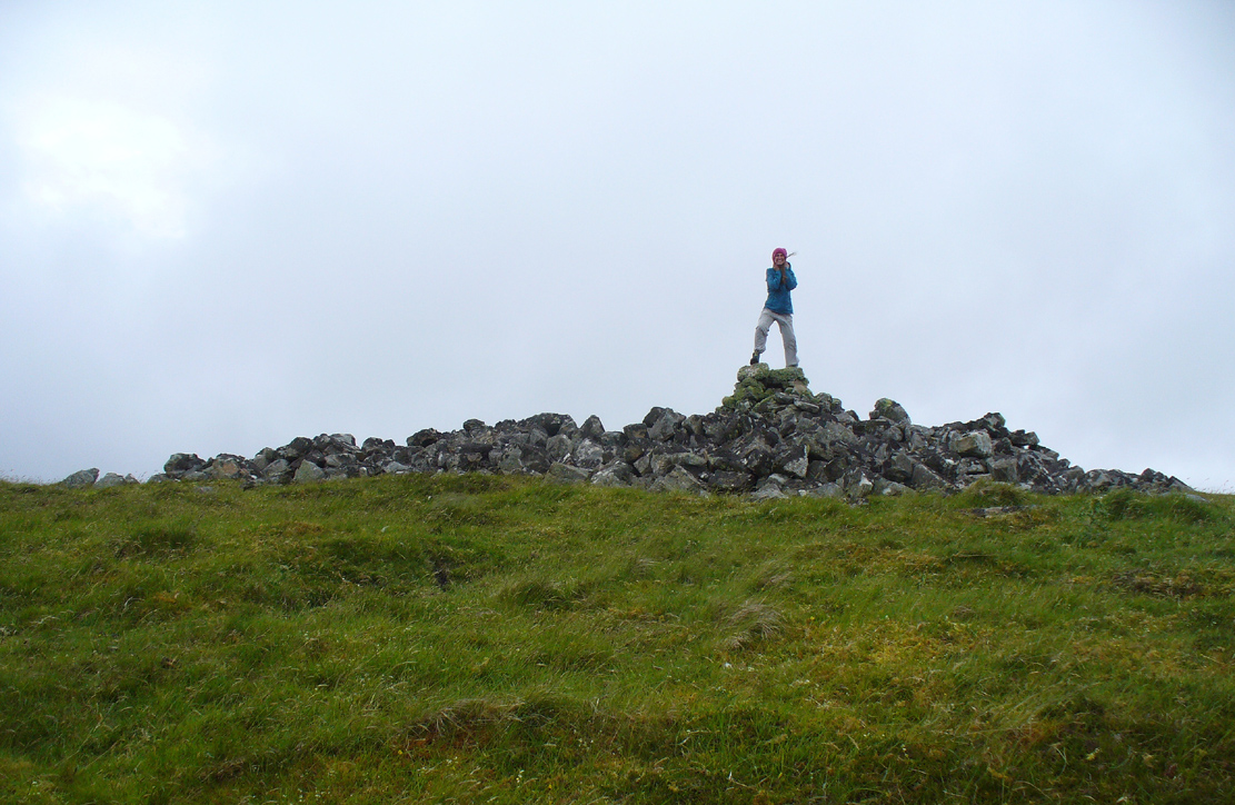
A mile east of Bettyhill along the A836 road, watch out for the large piles of rocks up on the hill on your left (north). Go through the gate, past the Fiscary 3 cairn and 150 yards northwest you’ll reach the crowning cairn on the hilltop itself – the Fiscary 2 cairn.
Archaeology & History
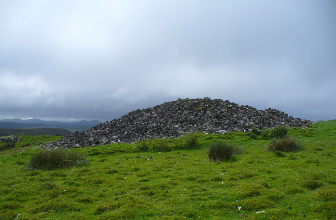
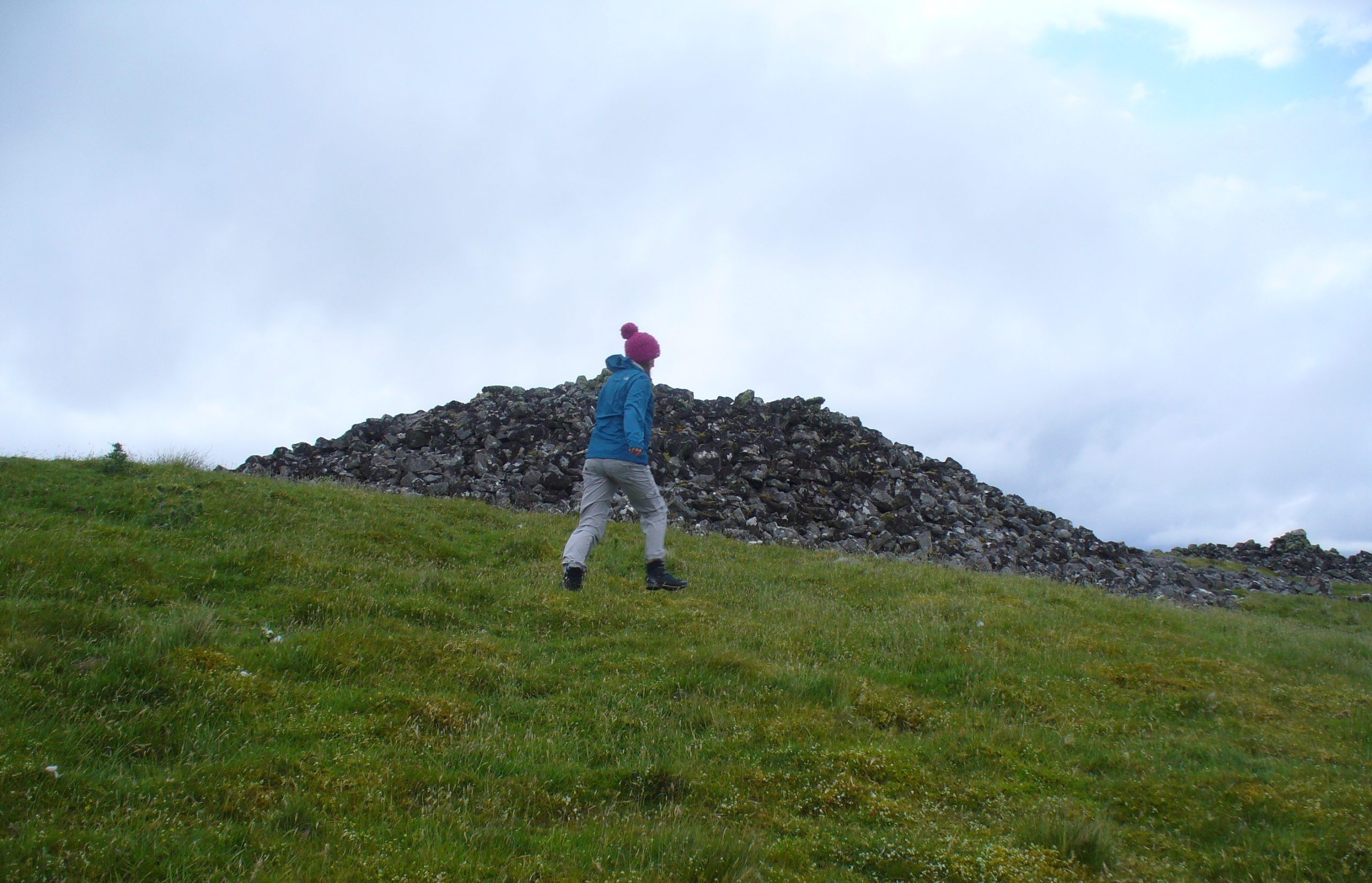
Fiscary 2 cairn, looking NW
The second of the three giant chambered cairns on this moorland hillside is the largest (only just!) of them all. Positioned right on top of the small hill, this great mass of rocks stands out from the roadside a quarter-mile to the south quite blatantly, yet it somehow evaded the eyes of the early Ordnance Survey lads in their visit here in 1873 (though the nearby Fiscary 3 cairn was plotted). Odd…
Aish by the side o’ the cairn
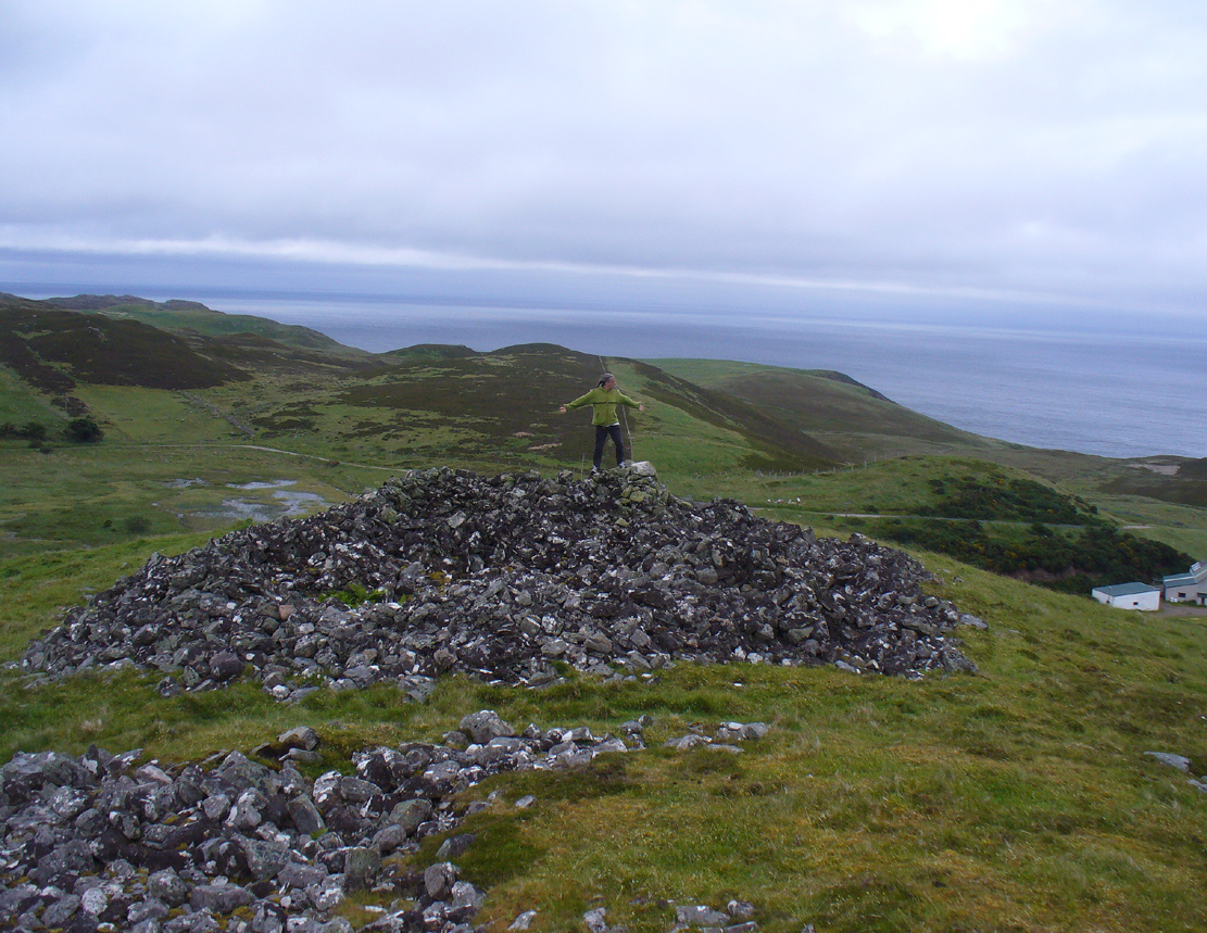
When I came here with Aisha and her clan a few weeks ago Nature was blasting us with full gales and so half her bunch returned after a short while, leaving us to get thrown about in the winds! Even just trying to stand upright on this and its associated tomb proved difficult. But despite this and the low grey clouds—typical of northern Scottish weather—it was obvious that the views from here would be superb, seeing far into the distance with a 360º view. I have little doubt that other important prehistoric sites would be speaking with this giant neolithic cairn, but there is nothing in the archaeology accounts to help us on such matters.
The giant tomb is almost linked to its companion—Fiscary 1—by a low scatter of rocks running between them, with only a yard or two separating their disturbed masses. Several archaeology students have posited that the two seemingly separate sites were, many thousands of years ago, perhaps one elongated chambered tomb, just like the ones found nearby at the Coille na borgie and Long Skelpick cairns; but it seems unlikely in this case…
Fiscary (2) on 1908 mapFiscary (2), looking SE
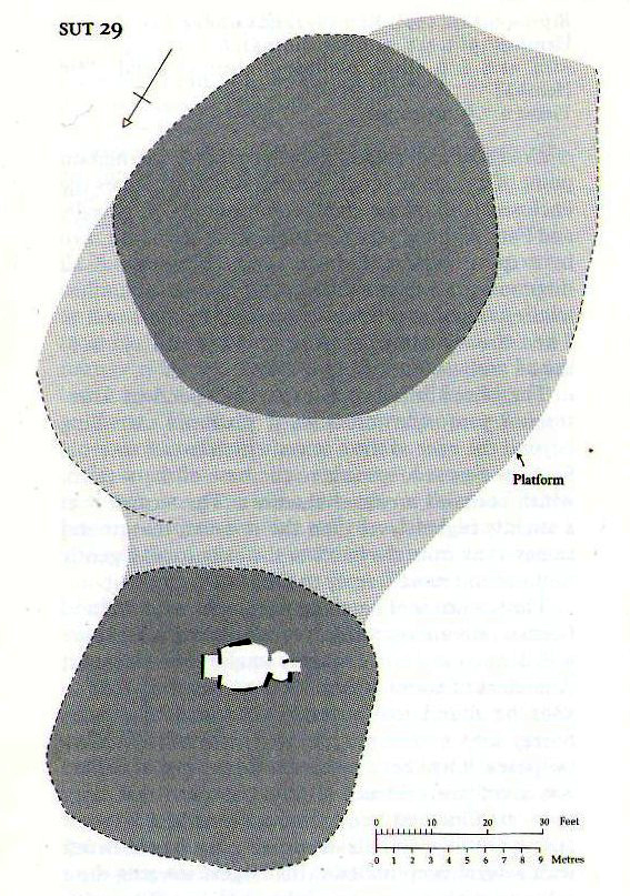
Although Adam Gunn (1893) mentioned the “four large cairns” at Fiscally (the fourth and smallest is 262 yards to the west), the first real description I can find of the place comes from an article by a local man called Cathel Kerr (1892) who told us it was “about 220 feet in circumference, and 15 or 16 in height”; but most of his article dealt with his excavation into the adjacent Fiscary 1 tomb, which he noticed was connected by a stone platform that ran between the two sites. This was the first mention of such a connecting platform—and a curious feature it is indeed. When the Royal Commission lads came here in May 1909 they also noted this connecting platform. They found that the cairn itself,
“does not appear to have been excavated. It is circular with a diameter of about 52ft and is some 10ft high to the top of the modern pile of stones on its apex. It presents a peculiar feature. At the north end is clearly visible a broad platform of stones extending to a distance of 25ft from the base of the cairn and, though largely overgrown with turf, traceable by the outline of stones almost entirely around it. This platform has been described as a neck connecting the two cairns (Fiscary 1 and 2, PB), but in reality it stops 7ft distant from the adjacent cairn.”
In strong gales at Fiscary 2Henshall’s plan of Fiscary 1 & 2
Indeed, this “platform” seems to have been either deliberately constructed with the hilltop cairn positioned on top of it, or has been set around the tomb. It’s difficult to say with any certainty without further excavation.
The great Audrey Henshall (1963; 1995) wrote extensively about this ancient monument in her works, finalizing her site entry in The Chambered Cairns of Sutherland (1995). After describing in some detail the obvious archaeological association this site has with Fiscary 1, she gave us a detailed description on this one and wrote:
“The larger south cairn (Fiscary 2, PB) is bare, steep-sided, and has been little disturbed. The diameters are between 19.5 to 21.5m, and the height is 5.5m measured from the NW. The edge is clear for about half of the circuit. The surrounding platform is quite low and is partly covered with peat and deep heather which in places obscure the edge. The platform varies in width from 4.8 to 7.3m. On the SE side the cairn edge is clear and there is no sign of the platform. It appears on the NE side where it is largely free of heather, and the cairn material merges into its stones. This part of the platform is edged by a rough kerb which fades away westwards into the spread of stones which links the two cairns. In the area between the cairns the stones are mainly covered by peat on which grow turf and heather. The spread of stones appears to be thin, but on the NW side of the cairn, where there is evidently a drop in ground level, breaks in the peat cover show that here the stone spread has considerable depth. Round the W side the platform is heather-covered, and along the SW part, where the hill drops away steeply, there is a rough kerb at a lower level than elsewhere, within which the surface of the platform rises to the base of the cairn. The S end of the platform, which here is bare stones, seems to turn sharply towards the S edge of the cairn, though the actual edge of the platform is indefinite.”
The likelihood is that this cairn is the oldest of the cluster of three found here, most likely constructed in the neolithic period. Its position in the landscape would indicate that the site would have been built to commemorate the spirit of a local tribal elder, a King or Queen. It’s a superb site and I’ll be visiting it again very soon indeed!
Folklore
Bouncy elven sprite flies by
The folklorist Otta Swire (1963) told that this region was once peopled by giants who created the landscape itself around here (a common attribute of giants the world over), and they also played a part in the creation of this and other giant tombs in the area. The one time local school-teacher at Bettyhill, Alan Temperley (1977), also told us that the fairy folk lived close to the giant tombs of Fiscary.
References:
Gourley, Robert, Sutherland: An Archaeological Guide, Birlinn: Edinburgh 1996.
Gunn, Adam & Mackay, John, Sutherland and the Reay Country, John Mackay: Glasgow 1893.
Henshall, Audrey S., The Chambered Tombs of Scotland – volume 1, Edinburgh University Press 1963.
Henshall, Audrey S., “The Distant Past,” in The Sutherland Book (edited by Donald Omand), Northern Times: Golspie 1991.
Henshall, Audrey S., The Chambered Cairns of Sutherland, Edinburgh University Press 1995.
o’ Reilly, Kevin & Crockford, Ashley, What to See Around Bettyhill, privately printed 2009.
Sutherland, George, Folk-lore Gleanings and Character Sketches from the Far North, John o’ Groats Journal: Wick 1937.
Temperley, Alan, Tales of the North Coast, Research Publishing Company: London 1977.
Acknowledgments: To the beautiful Aisha Domleo, for her images, bounce, spirit and madness – as well as getting me up to see this cluster of sites. And a Huge thanks for use of the Ordnance Survey map in this site profile, reproduced with the kind permission of theNational Library of Scotland.
A mile east of Bettyhill on the A836 road, watch for the large piles of rocks up on the hill on your left (north). Go through the gate, past the Fiscary 3 cairn and 150 yards northwest you’ll reach the crowning cairn of Fiscary 2 on the hilltop itself. Fiscary 1 is just a few yards in front of you.
Archaeology & History
Although this is the smallest of the Fiscary cairns, it is the one that has had been investigated more than the others in this cluster—and you can tell as it’s been dug into. However, saying that, when Aisha and me were here a few weeks ago, the wind was blowing with such strength that we could give it little more than a cursory overview, as we were both getting blown about like a pair o’ puffters in the gale that was raging in from the sea! Twas quite overwhelming…
Fiscary 1 to the rear
One of the first things you notice is how this cairn is inextricably linked, both physically and otherwise, to its close partner on the hilltop only yards away: the Fiscary 2 cairn. Fiscary 2 reaches outwards towards where we now stand—slightly below the larger tomb immediately north (the airt of Death itself): almost as if an ancient Queen and Her King were resting still hand-in-hand in their respective burial sites.
Aisha on top!
…And although such romance may seem nothing more than that, recall that we are probably looking at two giant archaic monuments whose birth emerged in the neolithic: when time was measured by night, not day; when the Moon was Prima Mater’s aide and portender; and patriarchy had yet to be borne…. Giant hilltop cairns were the places of our ancient shaman-kings, queens and tribal elders, whose integral relationship with the cycles of the world to which we are (still) bound, were culturally very different in some fundamental ways, before rites of passage were disposed of…. But I’m moving away from the modern history of the Fiscary tomb…. Soz!
Around the time when some of the indigenous northerners up here were seeing the fading lights of their animistic cosmology disappear into the emergence of ‘history’, when the traditional tales were ebbing, Fiscary 1 was at least being written about—albeit in a detached way, as a museum piece, a piece of architecture. It’s the way things have become. The tomb was excavated by a local man called Cathel Kerr in the latter half of the 19th century, although he reported that it had already been dug into a few years earlier. Kerr told that some of the stones had been taken by an unnamed local for building purposes (not good!). “It had been opened from the top” he said—continuing:
“and there was abundant evidence around the cairn, that large slabs of stone had been removed from the interior. A little observation showed that there was the appearance of an internal chamber… The…cairn is about 150 feet in circumference and about 9 or 10 feet in height, and between it and (Fiscary 2) there is what seems to me to be a neck of stones joining the two cairns… Most of the neck joining the two cairns is covered over with turf, but a very slight observation reveals the fact that underneath it the mass of stones is continuous. The apparent depth of stones is from 3 to 4 feet. It is most unlikely that this neck could have been formed by stones falling from the top of the cairns.
“The chamber, when opened, proved to be tripartite. The entrance is from the west or northwest side, between two upright stones, with a large heavy slab thrown across them. The passage is only 3 or 4 feet long, and about 3 feet high, and nearly the same in width. This leads into a small chamber measuring about 6 feet by 3 feet. In front of it, on the north side, a large upright slab projects, and helps to form part of the end of the inner chamber and a division between the two on the south side. In all likelihood the stone corresponding to that one has been removed, so that there is nothing to mark the division between the chambers on that side. The larger chamber measures 6 feet 4 inches by 7 feet 9 inches. The sides are made up of large upright slabs and masonry, built up between the slabs. The corners are all rounded and there is the appearance of vaulting by the stones overlapping one another. The height of this chamber at present is about 5 feet. The end of the chamber is made up by two upright stones, with nearly 2 feet of an entrance between them, leading into the innermost chamber. This chamber is a very irregular oblong; indeed the ends are rounded. On an average it is 5 feet 9 inches long, by 33 inches wide, and 3 or 4 feet in height. It had the appearance of being covered over with slabs, some of which stood on edge inside; but of this I am not very sure, as the roofing of all the chambers has been interfered with.
“Inside there lay on the floor a large quantity of broken stones and black earth. Underneath there was what seemed a mixture of ashes and earth, with numerous pieces of charred wood, but no charred bones as far as I could see. Underneath that layer there was ordinary gravel. I found some fragments of bones on the innermost part, and some in the larger chamber. They do not appear to me to be of very great antiquity. A small vitrified mass was found on the floor.”
When the Royal Commission (1911) lads turned up to see the site in 1909 they reported—in a rather exaggerated manner—that the cairn “is now completely destroyed” and then in the next sentence said,
“The chamber is half filled-up with debris and only two or three large slabs remain, the others having disappeared. Its diameter has been about 46ft, and its height 4ft to 5ft.”
If the Royal Commission believe that’s an example of something being “completely destroyed”, they should turn their eyes and attention to sites like the Nixon’s Station cairn on top of Ilkley Moor which, when I was young, was larger than any of the Fiscary cairns; but somehow under the watchful eyes of the regional archaeologists in the 1980s and ’90s, was levelled to the ground – i.e., properly destroyed!
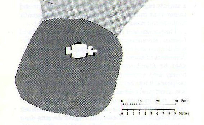
Audrey Henshall’s ground plan
In more recent years the cairn has received the honourable attention of the great Audrey Henshall (1963; 1995) who, in her updated site profile of Fiscary 1, told us not much more about the site than her predecessor Kerr. Contextualizing the place with its partner Fiscary 2 and the platform upon which it rests, she wrote:
“The paired cairns appear to be independent structures 8.5m apart, though a platform extending beyond the base of the south cairn, which has no internal features exposed, spreads to the base of the north cairn, which contains a ruined chamber… The north cairn is of bare angular stones with turf and heather only encroaching over the edges. Its limits are well-defined and give a roughly square plan with short diameters of 16.5m… Kerr exposed the roofless tripartite chamber, and most of the structure which he recorded was visible in 1955 (Henshall 1963). Less could be seen in 1992 as the chamber had been largely filled by loose stones…”
Much like the situation as it is today. More recently a small pile of stones has been added to the top of the cairn, from whence the view is excellent to the north, east and west. The larger Fiscary 2 cairn blocks the view directly south.
Folklore
Otta Swire (1963) not only told that this landscape was once peopled by giants who made the land and played a part in the creation of some of the giant tombs around here. The one time local school-teacher at Bettyhill, Alan Temperley (1977), also told us that the fairy folk lived close to the giant tombs of Fiscary.
References:
Eliade, Mircea, The Myth of the Eternal Return, RKP: London 1955.
Gourley, Robert, Sutherland: An Archaeological Guide, Birlinn: Edinburgh 1996.
Gunn, Adam & Mackay, John, Sutherland and the Reay Country, John Mackay: Glasgow 1893.
Henshall, Audrey S., The Chambered Tombs of Scotland – volume 1, Edinburgh University Press 1963.
Henshall, Audrey S., “The Distant Past,” in The Sutherland Book (edited by Donald Omand), Northern Times: Golspie 1991.
Henshall, Audrey S., The Chambered Cairns of Sutherland, Edinburgh University Press 1995.
o’ Reilly, Kevin & Crockford, Ashley, What to See Around Bettyhill, privately printed 2009.
Royal Commission on Ancient & Historical Monuments, Scotland, Second report and inventory of monuments and constructions in the county of Sutherland. HMSO: Edinburgh 1911.
Sutherland, George, Folk-lore Gleanings and Character Sketches from the Far North, John o’ Groats Journal: Wick 1937.
Temperley, Alan, Tales of the North Coast, Research Publishing Company: London 1977.
Acknowledgments: Huge thanks to beautiful Aisha Domleo again, for help with some of the photos – and adding your elegant spirit and energy to the place – as well as getting me up here in the first place!
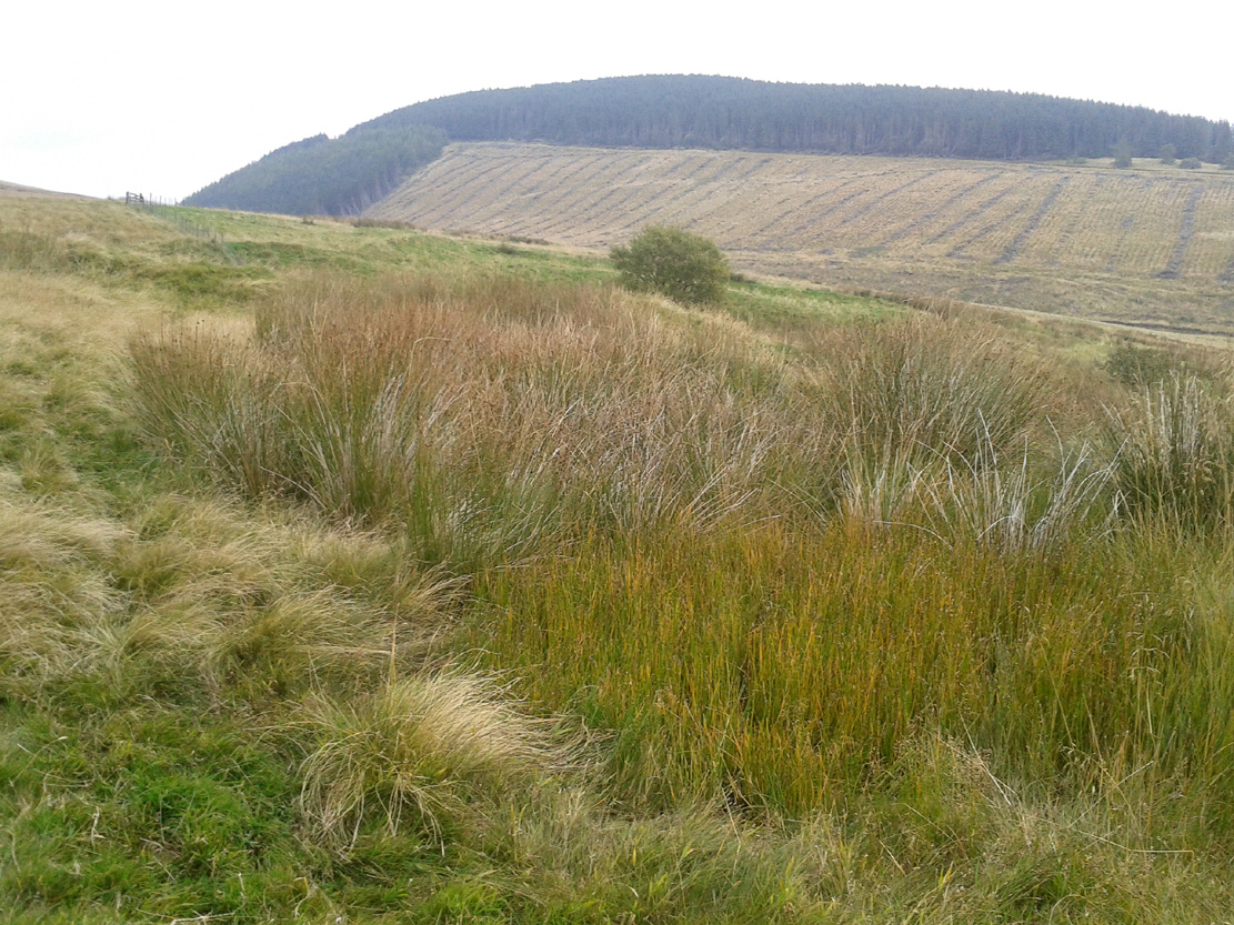
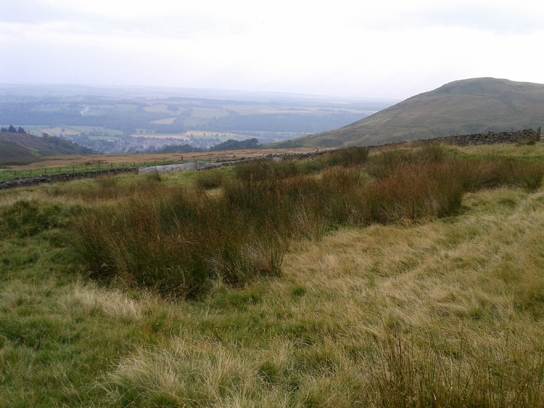
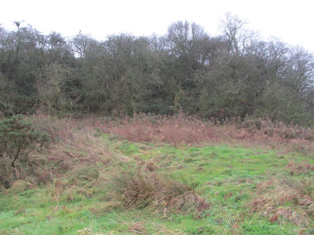
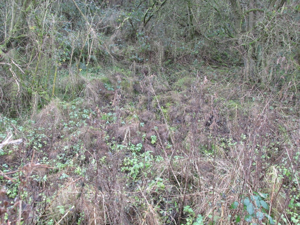
Take the long uphill road to Castle Campbell and park up at the top. From here, bear to your right and walk up the footpath onto the hills. A few hundred yards along you’ll reach a gate and you have the choice of continuing along the path, or dropping down into the small glen and up the other side, towards the ruins of an old settlement called Craiginnin, whose walls you can see from here. Head there, keeping to the path that leads you to it, going through the first couple of gates and out the other side. Just above the burn, some very overgrown walling is evident (possibly Iron Age in nature), where excessive Juncus reeds are growing. Amidst this is a boggy pool. Unless the boggy-land across the burn is the place in question, this is probably the spot!
Archaeology & History
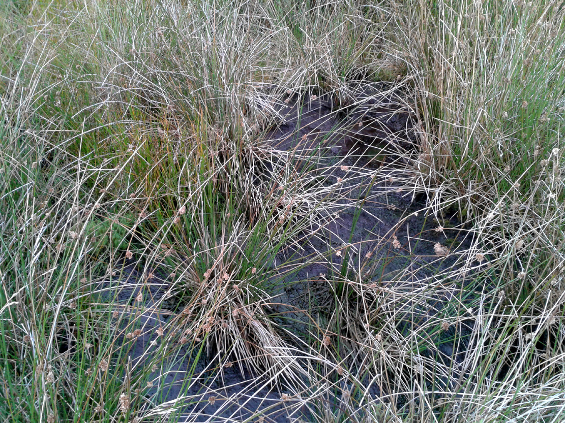
The boggy waters of the well
There’s very little to see here today other than a murky boggy pool, indicating it hasn’t been used for a long time; although when we visited the place there were several animal tracks into the edge of the pool, indicating that they still drink here. This implies it has/had some medicinal virtues, but even I wasn’t going to try drinking this! If there was ever a stone trough here, it too has gone (probably nabbed by a farmer in bygone years) and there seems to be no archaeocentric reference to the place. The well was described in place-name and folklore accounts, where its waters were used by the people living at this settlement to clean and prepare the butter made by the farmer.
Folklore
The hills, glens and burns of the Ochil range were well-known haunts of fairy folk—and Craiginnan was no exception. In an early article in the Scottish Journal of Topography, a pseudonymous “J.C.” of “13 Dalrymple Place” (who was it?) told of several dying traditions and, amidst it all, the story behind the Butter Well above Castle Campbell:
“The meadow of Craiginnan, in the vicinity of these hills, was (and still is) famous for the quantities of hay it yearly produces. Nearly seventy years ago, David Wright rented the farm of Craiginnan. His servants on cutting the grass of the meadow, were in the custom of leaving it to the management of the fairies. These aerial beings came from Blackford, Gleneagles, Buckieburn, etc., and assembling on the summit of the Saddlehill descended to their work among the hay. From morning till evening they toiled assiduously. After spreading it out before the sun, they put it into coils, then into ricks, when it was conveyed into the adjacent farm-yard, where they built it into stacks. This kindness of the fairies David Wright never forgot to repay, for, when the sheep-shearing came round, he always gave them a few of the best fleeces of his flock. He flourished wonderfully, but finding his health daily declining, and seeing death would soon overtake him, he imparted to his eldest son the secret of his success and told him ever to be in friendship with the “gude neebors.”
“The old man died and was succeeded by his son, who was at once hard, grasping and inhospitable. The kind advices and injunctions given him by his father were either forgotten or unattended to. Hay-making came round, but young Wright, instead of allowing the “green-goons” to perform what they had so long done (thinking thereby to save a few fleeces), ordered his servants to the work. Things went on very pleasantly the first day, but on going next morning to resume their labour, what was their surprise to find the hay scattered in every direction. Morning after morning this was continued, until the hay was unfit for use. In revenge for this, he destroyed the whole of their rings, ploughed up their green knolls, and committed a thousand other offences. He had soon reason, however, to repent of these ongoings.
“One day the dairymaid having completed the operation of churning, carried the butter, as was her wont, to the butter well on the east side of the house, to undergo the process of washing, preparatory to its being sent away to the market. No sooner had she thrown it into the well, than a small hand was laid upon it, and in a second the bright golden treasure disappeared beneath the crystal waters! The servant tried to snatch it; but alas! it was lost—irrecoverably lost forever! and as she left the place a voice said:
“Your butter’s away’
To feat our band
In the fairy ha’.”
“The horses, cows and sheep sickened and died; and to complete all, Wright, on returning from a Glendevon market, night overtook him in the wild pass of Glenqueich. He wandered here and there, and at last sunk into a “well-e’e”, in which he perished. After his death the farmhouse went gradually to demolition and its bare walls are now only to be seen.”
Butter Well site, looking west
The place-name ‘Craiginnan’ is thought to derive from the somewhat banal “crags by the anvil-shaped land”, which is grasping at some desperate straws if you ask me! But it’s also been suggested by Angus Watson (1995) to possibly derive from the “Gaelic Creag Ingheann, maiden crag”, which would acquaint it with the nearby Maiden’s Well and Maiden’s Castle a mile northeast of here—both of which are possessed of their own fairy-lore. Makes a lot more sense too!
References:
“J.C.”, “Rhymes and Superstitions of Clackmannanshire,” in Scottish Journal of Topography, Antiquities & Traditions, volume 2, Jul 1, 1848.
Simpkins, John Ewart, County Folklore – volume VII: Examples of Printed Folk-Lore Concerning Fife, with some Notes on Clackmannan and Kinross-Shires, Folk-Lore Society: London 1914. p.312
Watson, Angus, The Ochils: Placenames, History, Tradition, PKDC: Perth 1995.
Sacred Well (lost): OS Grid Reference – NA 100 000
Also Known as:
Well of Eternal Youth
Folklore
An old story told in previous centuries by the indigenous folk of Hirta (St. Kilda) described a long-lost well that was thought to be an abode of the little people, known as the Well of Eternal Youth. Not to be confused with the Well of Virtues near the Amazon’s House less than a mile west, the rough whereabouts of this site is cited by J. Sands (1878) in the folklore section of his otherwise historical account on these faraway Atlantic islands. He wrote:
“Once on a time an old fellow, in going up Connagher with a sheep on his back, observed a Well which he had never seen or heard of before. The water looked like cream, and was so tempting, that he knelt down and took a hearty drink. To his surprise all the infirmities of age immediately left him, and all the vigour and activity of youth returned. He laid down the sheep to mark the spot, and ran down the hill to tell his neighbours. But when he came up again neither sheep nor well were to be found, nor has any one been able to find the Tobair na h-oige to this day. Some say that if he had left a small bit of iron at the well—a brog with a tacket in it would have done quite well—the fairies would have been unable to take back their gift.”
Explorations of old maps and texts has failed to show with certainty where this legendary well may have been (the grid-ref is an approximation), but it was reported in Mrs Banks’ Scottish Calendar Customs (1937) to have been “issuing out of the face of a rock on the north-side of the east bay…only accesible by the inhabitants, no stranger daring to climb the steep rock.” Some of us would try!
References:
Banks, M. MacLeod, British Calendar Customs: Scotland – volume 2, Folklore Society: London 1937.
Of all the ancient wells in the city of Glasgow, this has to be one of the most intriguing! Descriptions of it are few and far between, but it is the name of the site which is of interest, to folklorists and occult historians alike. For the word ‘Bogle’ is another term for a ‘boggart’ or goblin of some sort! The well is mentioned in Andy MacGeorge’s (1880) excellent study in his description of ancient wells in the city. Citing notes from the 17th century, amidst many sites,
“Another was Bogle’s Well, in regard to which there is a minute of the town council “that Bogillis Well should be assayed for bringing and convoying the water of the same to the Hie street according to the right the town hes thereof,” and the magistrates are recommended to arrange for having this done “by conduits of led.””
…Obviously in the days when they were clueless about lead-poisoning! The word ‘bogillis’ is the early plural form of the bogle, or bogill (Grant 1941:201). But where exactly was this old well? Are there any other records hiding away to help us locate its original position? It seems to have been one in a cluster of legendary and holy wells in a very small area scattered between Glasgow’s cathedral, down the High Street and to the northern banks of the River Clyde… (the grid-reference given for this site is an approximation)
In a less esoteric fashion, the occult historian Jan Silver suggested that the name of the Well may relate to the family name, ‘Bogle’. This could indeed be the real story behind the well’s name.
Folklore
Traditionally ascribed in the lower counties of England to be an evil malicious sprite, in more northern counties and in Scotland the creature was said by Katherine Briggs (1979) to be a more “virtuous creature”, akin to the helpful brownies or urisks of country lore. This was said to be the case in William Henderson’s (1868) Folklore of the Northern Counties. Whether this well was haunted or the home of a bogle, we do not know as the folklore of this site appears to be lost; so I appeal to any students who might be able to enlighten us further on the place. The Forteans amongst you might have a cluster of ‘hauntings’ hereby, perhaps….
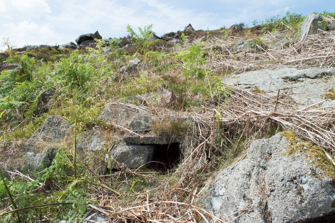
Fairy Mine, Bingley Moor (photo by James Elkington)
This is a strange one. A really strange one….. The site would not have even been written about had it not been for James Elkington pushing me to make its existence visible to a wide audience. As with many sites that I’ve rediscovered, this is one of many that I never seem to write about, for various reasons…although I did do a short piece on it (Bennett 2001) many years back in a little earth mysteries mag, but kept the location quiet. But now, James has got me to change my mind about it. If anyone can throw any light onto what they think this site might be, feel free to let us know. With the exception of its early history, this is its story…
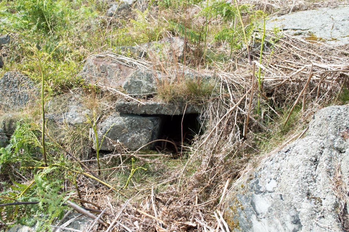
Close-up of the entrance (photo by James Elkington)
One weekend in the early Spring of 1977, Jon Tilleard and I made our weekly wander onto the southern edges of Rombalds Moor, doing little as usual apart from maybe seeking out the curious cup-and-ring stones and other ancient remains, along with walking through the obligatory bogs and wetlands, getting filthy and wet through as healthy kids do at that age. After making our way to Horncliffe Well (generally our first point of call most weeks), we decided to head straight west, off-path as always, and eventually sat ourselves down for something to eat near Wicking Crags on Bingley Moor.
As we packed up again, readying ourselves to walk further onto the moor, John stood upright. In doing so, he dislodged a stone by his feet—right where I was still sitting on the ground!
“Watch out!” he exclaimed loudly—and I quickly rolled forward to get out of the way of the impending stone. Thankfully it wasn’t too big. But then as I turned round to see what had happened, I saw John stood on the small rocky rise he’d been sitting upon—and right beneath his feet, the stone that he’d dislodged had been hiding a very curious secret indeed…
As the photos show, a small opening led into the Earth right underneath where Jon had been sitting. The stone he’d accidentally kicked away had covered and sealed a previously unrecorded entrance. Now, after however many centuries it had been closed and secret, he’d uncovered it again. For us two fourteen-year-old lads gazing into this passageway, our imaginations started running riot!
“What the hell izzit!?”—we must have exclaimed a dozen times or more to each other! To this day, we still don’t know.
I’m not sure how long we stayed here after we’d first found it, but before we left we made sure that the covering stone which had sealed the entrance was propped back upright, securely, so that no one else could find it. The site was quite a way off-path, at the head of a very large boggy area where—to this day—people very rarely walk (in all my years of walking these moors, I’ve yet to see another human walking in this area).
In looking into the tunnel for the very first time, the ground on the outside was of course covered by the usual moorland vegetation; but an inch behind where the stone had sealed this tunnel, the floor was grey dust, all the way in. There were no animal tracks, neither mice nor others, no droppings, no nothing (which we thought was rather unusual). No plants of any form were evident. This ‘door’ had been closed for a very long time it seemed. …Today if you visit the site, ferns and other small plants have encroached several feet into the tunnel.
The entrance itself is about 14 inches across, and from the ground to the top covering stone the entrance is less than 12 inches high, showing quite clearly that no humans can walk in or out of it. Which added to the puzzle: what the hell is it? And why was it sealed with a covering stone? But the more we looked (it became our regular port of call each time we were on the moors) the more obvious it became that a huge amount of work had gone into creating this antiquarian oddity.
As Winter came and cleared all the vegetation surrounding the site, we got an increasingly clear picture of it. But this wasn’t before we tried to get inside! Jon and I failed, but our torches showed that it went in for perhaps 10 feet or so and then appeared to be stop, blocked by another stone. Thankfully I had a younger brother, Phil, who was seven-year old at the time—so we took him up to have a look at the place. We figured that only a small person could get inside the tunnel, but we didn’t tell him this (nor my parents!) until we arrived.
With torch in hand, Phil slithered into the entrance and, eventually, his little feet disappeared into the ground. He didn’t seem too happy about it as I remember—but I was his big brother! (cruel – cruel – cruel!) Shouting back down to us as he slithered further and further in, when he reached the blocking stone in the tunnel he exclaimed—”You can go round it!”
“What!? Really!?”
We were excited.
“Keep going Phil,” we urged. But he wouldn’t.
“I’m scared Paul,” he said. “I won’t be able to get back out”—or something along those lines. And he was probably right.
But he managed to get his young tiny body slightly round the blocking stone that he’d reached and shone the torch-light down the extended tunnel. He told that the it just kept going into the hill still further, keeping the same size and dimensions and straightness for about the same distance again—but then it started to curve very slightly, bending to the left (northwest) until it disappeared underneath the entire hillside, stretching out of sight. It seemed from his description, subsequently, that the tunnel went on for another 50 feet at least.
Once he was safely back out, he reiterated how far in it seemed to go. We walked up the hill under which it had been built and Phil bimbled to roughly where he thought the tunnel was as he saw it with the torchlight. Standing on the hilltop, this was obviously an extraordinary feat as there are thousands of tons of rock and earth covering it! Curiously, years later, a dowser who visited the place walked the same route that Phil had described when he went inside it (we told the dowser nothing of Phil’s venture until afterwards).
Denuded walling leading to entrance (photo by James Elkington)Low walling leading to the ‘Mine’ (photo by James Elkington)
When all the moorland vegetation has died back, you can clearly see how the tunnel has been built upon by a large mass of earth and rocks, some of them loose. All round it is an extended collapse of what seems to be quarried stone tumbling down the hillside. At the top of the hill are the remains of old walling and at least two walled structures—although they appear to be post-medieval in nature, not prehistoric. At the entrance itself is evidence of continued walling of some form. It seems as if a wider man-made chamber of some sort may once have stood here, right in front of the present-day entrance. Even if this proves not to be the case, there is very clear evidence that the tunnel which goes into the hillside was once longer, as low walling continues outside away from the entrance, bending away some 50 yards to the southeast, before ending with no indication of additional structural remains. This walled structure swerving out from the entrance is equally perplexing.
The closest prehistoric feature is an unrecorded cairn and petroglyph a few hundred yards away. As far as I’m concerned, this tiny little entrance into the ground isn’t prehistoric. But I’m nonetheless still very intrigued by it, not least because of a few very strange things that subsequently occurred here after we’d discovered it.
Whoever did this, went to a helluva lot of trouble and immense effort to build it. And for what? …Since being opened nearly 40 years ago, very few people have been to see this curious entrance into the Earth. I’ve kept its location hidden. But amongst the visitors has been an archaeologist, a historian, antiquarian authors, occultists and friends. None have been able to say what this site might be. From souterrains to mine-shafts, probably the best suggestion so far was by Mr Paul Hornby who suggested it might have been some sort of kiln, as there seems evidence of fire against one of the stones. But there are anomalies with the site that don’t quite fit the glove of a normal kiln. The extended collapsed ‘tunnel’ which reaches way out, past the entrance which Jon broke in the 1970s, doesn’t make sense; nor the fact that the tunnel goes way into the natural hillside. Indeed, many things here don’t make sense, simply—I presume—because we haven’t asked the right question yet.
But one thing seems obvious: there may be something at the end of this tunnel, deep inside the hill, which someone many centuries ago, for some odd reason, wanted to keep hidden for a long long time. What’s at the end of this tunnel? And if it’s valuable treasure deep in there—it is NOT going to some museum which then, in later years, will be sold off cheaply to some wealthy dood when the museum runs out of money. It should be kept within the safe holdings of The Northern Antiquarian. If this becomes an issue, whatever lies at the end will simply be re-buried elsewhere.
Fortean History
On that fine Spring morning when we first discovered this “mine shaft for little people” as we called it, before we went on our way, we placed the stone that Jon had dislodged that had covered the entrance back into position so that no one could see the opening leading into the ground and under the hill. It was firm and secure when we left—we made sure of it.
The following Sunday morning we made our way back up past Horncliffe Well again and onto this little mine-shaft to sit and have summat to eat. The rocky arena here made it difficult to locate, even though we knew where it was. But when we eventually did find it again, the covering-stone was missing. In fact it had been rolled a good 5 yards away from the entrance. This was odd, we thought—considering that no one even knew of its existence. We wondered if an animal had taken up residence inside, but there were no tracks or remains consistent with this initial idea. We puzzled about it, ate our food, and said our au revoirs. Before we left, we repositioned the covering stone again to block the entrance. This time we made it a little more secure than previously.
The following Sunday morning we visited the site again—and the covering stone had been removed, again! So we replaced it, securely, and visited the place a week later—and the same thing had happened again. This occurred time after time, month after month, year after year. Every single time we covered the entrance, something came and removed it. Yet no one ever comes on this section of the moorland—and even if they did, the site is very difficult to locate. Until now, the site has never been added to any archaeology or history records anywhere—so no one knew of its existence (in asking two of the moorland rangers who’ve worked here over the decades, neither of them knew what we were talking about).
When Andrew Hammond and I left school at 18 (in 1981), we decided as a ritual to bring our school books onto the moor and burn them as the sun was setting in the northwest. We sat near the little mine-shaft and sang our songs of joys at being out of school at last—and as the darkness began to fall over the moor, we replaced the entrance-stone again. Within 30 minutes Nature had cast pitch black across the moor and we fell asleep.
Awaking at sunrise the following day, we wandered down the slope to the little mine-shaft where we’d repositioned the stone only hours previously. It had been moved again, several yards away from the entrance. No animal could have moved it. Whatever it was, it kept doing it every time we repositioned the covering stone. No animal tracks, droppings, or any evidence whatsoever of Nature’s creatures being responsible for the constant removal of the covering stone has ever been found. The constant removal of the covering stone remains a complete mystery.
When a dowser came and tried tracing the underground route of the tunnel in the early 1990s, his rods took him to the top of the rocky hill above, then led him in a small curve to the northwest for more than 100 yards before stopping.
Note:
In the event that archaeologists ever get round to excavating or assessing this site, I would appreciate being contacted before anything is done and would love to be involved in any work performed at the site. I’ll be a good boy! Other remains nearby (usually covered by heather) need appraising to enable a more complete analysis, otherwise all subsequent reports would lack wider archaeocentric contextualization. Thanks, in advance. 🙂
References:
Bennett, Paul., ‘Into a Mythic Domain – a Passage into the Ilkley Underworld,’ in Northern Earth, 87, Autumn 2001.
Acknowledgements: Huge thanks to James Elkington for use of his photos to illustrate this site profile.
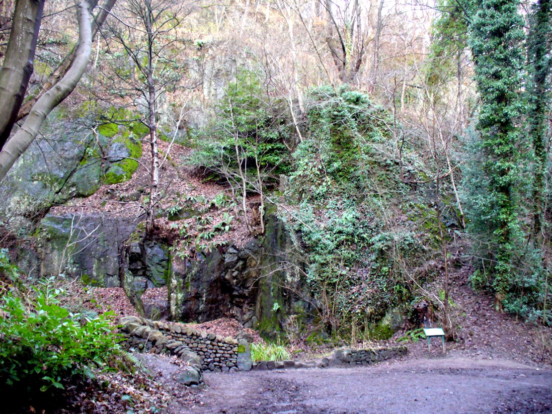
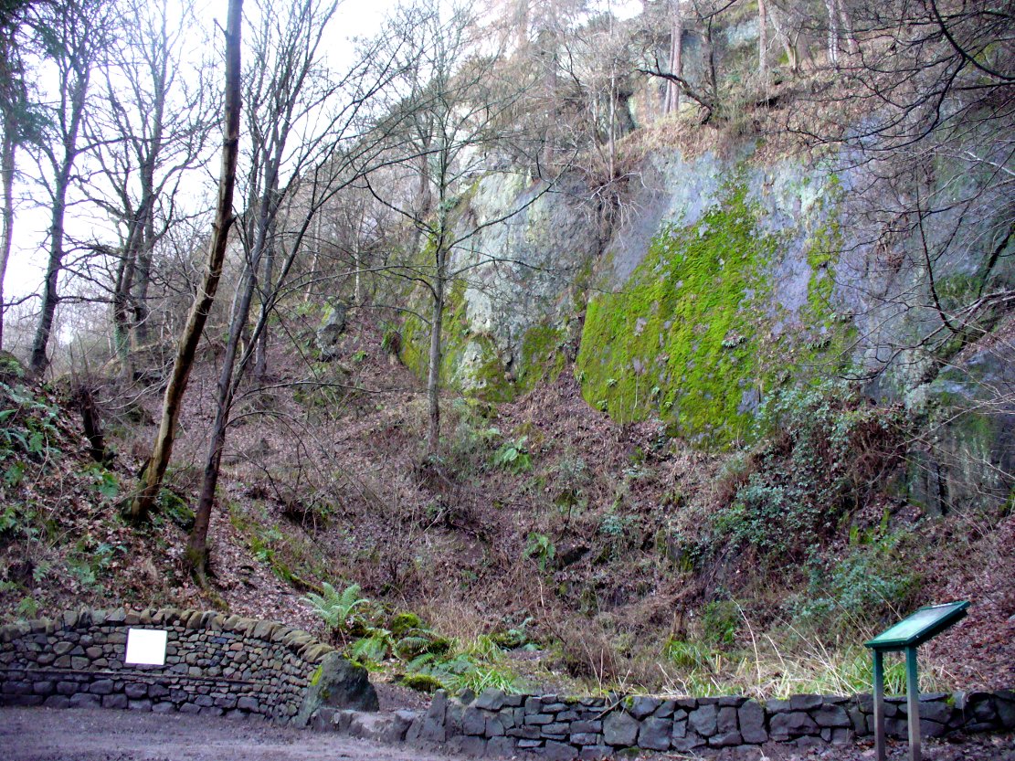
From the main street through Alva, between the Co-op and the corner shop, go up the small road at the side of the Johnstone Arms Hotel (Brook Street) and, at the small crossroads, straight across as if following the sign to the golf course. Stay along the track parallel with the Alva Burn waters and as you go into the trees a hundred yards or so along, to your left is a disused quarry, with a couple of plaques telling you its brief history. This is the spot!
Archaeology & History
This is a truly fascinating site for a number of reasons. Sadly, we can no longer see what had been here for oh so many thousands of years thanks, as usual, to the industrialists destroying the land here. Although in this case, without them we’d be unaware of its very existence. Additionally, there is a twist to the industrial’s find, which seems to have stopped further quarrying by some local people….
The tomb was somewhere in the left-middle
Listed in the relative Royal Commission accounts (1933; 1978), without comments, the tale is a simple one, but was narrated in some detail by J.G. Callander (1914) in Scotland’s prodigious Society of Antiquaries journal. During some quarrying operations over the Christmas period of 1912, James Murdoch “uncovered the remains of a human skeleton which had been buried in a natural cavity in the rock.” Three weeks later, local police officer George Donald and Dr W.L. Cunningham of Alva, accompanied Mr Callander to the site and made a detailed assessment of what had been found. He wrote:
“The quarry in which the grave was found is situated at the mouth of Alva Glen, a few yards distant from the right bank of the burn which flows through it. The body had been placed in a cavity or rock shelter in the face of the cliff, about 40 feet from the base, and about 200 feet above sea-level, and a rough, curved wall of dry-stone building, about 1 foot in thickness, had been built across the opening, which faced the east, the ends of the wall being still in situ when I visited the site. The space enclosed measured about 4 feet 6 inches from north to south, and about 5 feet from east to west. Subsequent to the burial the whole face of the rock and the walling had been covered, to a thickness of probably some 6 feet, by soil and detritus washed down from the hill face above. The greater part of the floor of the cavity was formed of clean, broken, angular stones, but the space on which the body was placed had been covered with a thin layer of soil preparatory to the burial. No charcoal or charred wood, which is so often seen in prehistoric graves, was found in this deposit. The skull lay in the north end of the grave, on its right side, facing the rock to the west, the vertebrae and ribs followed a line to the south, and the nether limbs were inclined towards the interior of the cavity. The whole face, including all the teeth and the lower jaw, was a-wanting. Apparently the body had been placed in a flexed position, half on its side and half on its back. Nothing else was found in the grave but a quantity of snail shells, probably twenty or thirty, which were nearly all broken, the few complete examples being in a very fragile condition.
“Elsewhere it has been stated that these formed a necklace, but while they were strewn out in front of the skeleton for a distance of over 3 feet, none of them showed any signs of artificial perforation. The species of Helixis is probably hortensis, the common garden snail.”
Mr Callander then included a lengthy description of the body itself, some of whose bones were fractured. He told that a certain
“Professor Bryce states that the skeleton is that of a dwarf of about 4 feet 2 inches in stature. The epiphyses are all fully united, although the line of union is visible on the surface at some points. Growth must therefore have been completed, and the person must have been, if the union of the epiphyses of the long bones had pursued its normal course, over twenty-one years of age…”
Regarding the sex of the dwarf, Mr Bryce wasn’t 100% certain, but told:
“The calvaria shows the general characters of a female skull, but it cannot be stated definitely that the individual was a woman, because the cranial characters are such as might have been present in a dwarf of the male sex. The calvaria is of moderate size, and is well formed.”
Bryce concluded as a whole that this person was in reasonably good health and, from the condition of the bones, showed “there was no evidence of the disease known as rickets.” In his final remarks he told:
“The general conclusions to which a careful examination of the skeleton leads, is that we have here to do, not with a representative of a dwarfish race, but with an individual who from premature union of the epiphyses was to a remarkable degree stunted in growth. The condition is a well-known one, and the class of dwarfs, in which this individual must be included, is well recognised.”
Probable spot of the lost tomb
The exact spot of the tomb appears to have been destroyed, or at the very least is certainly covered over and no longer visible. The section of the quarry looking east, into which the tomb was built, is all-but gone and no initial evidence prevails to show its exact location. However, it would seem from the description to have been close to the tops of the tree-line, perhaps giving a clear view to the rising sun in the east. Perhaps…
The position of this tomb, enclosed high up in the cliffs, hidden away at the entrance to the deeply cut ravine of the Alva Glen, is intriguing in that it is a rarity. Ravines like this are always peopled by olde spirits in animistic tribal traditions — and this dangerous glen with its fast waters and high falls would have been no different, especially to the Pictish people who we know were still here even after the Romans had buggered off. Is it possible that this figure was a guardian to the Glen itself, a medicine woman or shaman, whose very Glen was her home? We know from traditional accounts in many of the North American tribes that dwarves were accessories to the spirit worlds, and some were shamans. (Park 1938) In northern and central European lore, these small people are “the mysterious craftsmen-priests of early civilizations.” (Motz 1987) Whilst in Scottish lowland lore, the ‘Brown Man of the Muirs’ was a dwarfish creature described by Briggs (1979) as “a guardian spirit of wild beasts”, or watered-down shaman figure. There is more to this burial than meets the eye of dry academia…
Folklore
The Alva Glen—in addition to being beautiful and home to the Ladies Well—was long known to be one of many places in the Ochils that were peopled by the faerie folk. (Fergusson 1912) Local people still say this place is haunted by the spirit of a dangerous witch called Jenny Mutton.
It’s worth reiterating the words of Mr Callander (1914) regarding the finding and subsequent death of the man who uncovered this fascinating tomb, as some folk (then as now) think his demise was as inevitable as the man who planned on building turbines in Glen Cailleach:
“On the 24th December last, while quarrying stone for road metal in a quarry at the foot of the Ochils, at Alva, James Murdoch uncovered the remains of a human skeleton which had been buried in a natural cavity in the rock. Two days later he was killed at the same spot by the fall of a mass of overhanging rock, a tragic sequel, which not long ago would have been considered a judgement on him for disturbing the dead.”
References:
Briggs, Katherine M., A Dictionary of Fairies, Penguin: Harmondsworth 1979.
Corbett, L., et al., The Ochil Hills, Forth Naturalist & Historian 1994.
Drummond, A.L., “The Prehistory and Prehistoric Remains of the Hillfoots and Neighbouring District”, in Transactions Stirling Natural History & Antiquarian Society, volume 59, 1937.
Fergusson, R. Menzies, The Ochil Fairy Tales, David Nutt: London 1912.
Gimbutas, Marija, “Slavic Religion,” in Encyclopedia of Religion – volume 13 (editor M. Eliade), MacMillan: New York 1987.
Motz, Lotte, “Dvergar,” in Encyclopedia of Religion – volume 4 (editor M. Eliade), MacMillan: New York 1987.
Park, Willard Z., Shamanism in Western North America: A Study in Cultural Relationships, Evanston: Chicago 1938.
Royal Commission on the Ancient & Historical Monuments, Scotland, Inventory of Monuments and Constructions in the Counties of Fife, Kinross and Clackmannan, HMSO: Edinburgh 1933.
Royal Commission on the Ancient & Historical Monuments, Scotland, The Archaeological Sites and Monuments of Clackmannan District and Falkirk District, Society of Antiquaries of Scotland 1978.
The 6″ OS map of 1913 has a ‘Fairy Well’ marked on the northern edge of Preesall Hill. Travelling north through the village on the B5377, the Hill is to your right. Immediately past it is a stile, cross over this and go straight on with the hill to your right. The approximate site of the fairy well is now marked by a boggy area at the foot of the hill.
Archaeology & History
Almost a footnote in Reverend William Thornber’s 1852 paper on the Britons, Saxons and Danes in the Foreland of the Fylde, here is how this site is described by him in the quaint (to our eyes) language of the mid-nineteenth century:
“…the hill of Presal, (the ‘Pressonde’ of Domesday), with its well all but deified; and although the votaries, like those in the pool of Laconia, may not have cast into it cakes of bread-corn to Juno,* yet a bush was named ‘Beggar’s bush,’ from the circumstances of the offerings of rags and clouts being affixed to it, over which a prayer was said; for Bishop Hale ridicules a superstitious prayer for the blessing of clouts for the cure of diseases.”
In addition, the following reference was found on-line:
“…If the travellers had lingered, however, they would observe the inhabitants placing half eggshells on the edge of the Fairy Well at the foot of Preesall Hill; a practice of the local school children even at the beginning of the 20th century. Recording some of the traditions of the country areas of 19th century Wales, Sir John Rhys in his “Celtic Folklore”, mentioned how half eggshells were left out for the fairy folk to use as cooking pots in which to prepare food and brew beer for the reapers at harvest time.”
Close-up of the boggy waters
The Beggar’s Bush is long gone, but the red colour of the deposits in the adjoining ditches would indicate a chalybeate (iron-bearing) spring rather than a well, and the northern slope of the hill seems to have become an unofficial children’s play area. Curiously, at the top of the hill, next to the playground of the Fleetwood’s Charity School, there is a modern ‘beggar’s bush’, festooned with white and yellow plastic strips, in a small nature trail area…
* quoted from Borlase, in his Natural History of Cornwall (1758): “…In Laconia they cast into a pool, sacred to Juno, cakes of bread-corn; if they sunk, good was portended; if they swam, something dreadful was to ensue.”
¶ http://www.lancastrians4ever.homecall.co.uk/lancastrians4ever/precha1.htm – Believed to be an online digest of out of print Preesall history publications by Stan Jones
References:
Thornber, William, ‘Traces of the Britons, Saxons and Danes in the Foreland of the Fylde,’ in Proceedings and Papers of the Historic Society of Lancashire and Cheshire, Liverpool 1852.
Acknowledgements: – My thanks to the staff of the Local Studies Department, Borough of Blackpool Library Services for their assistance