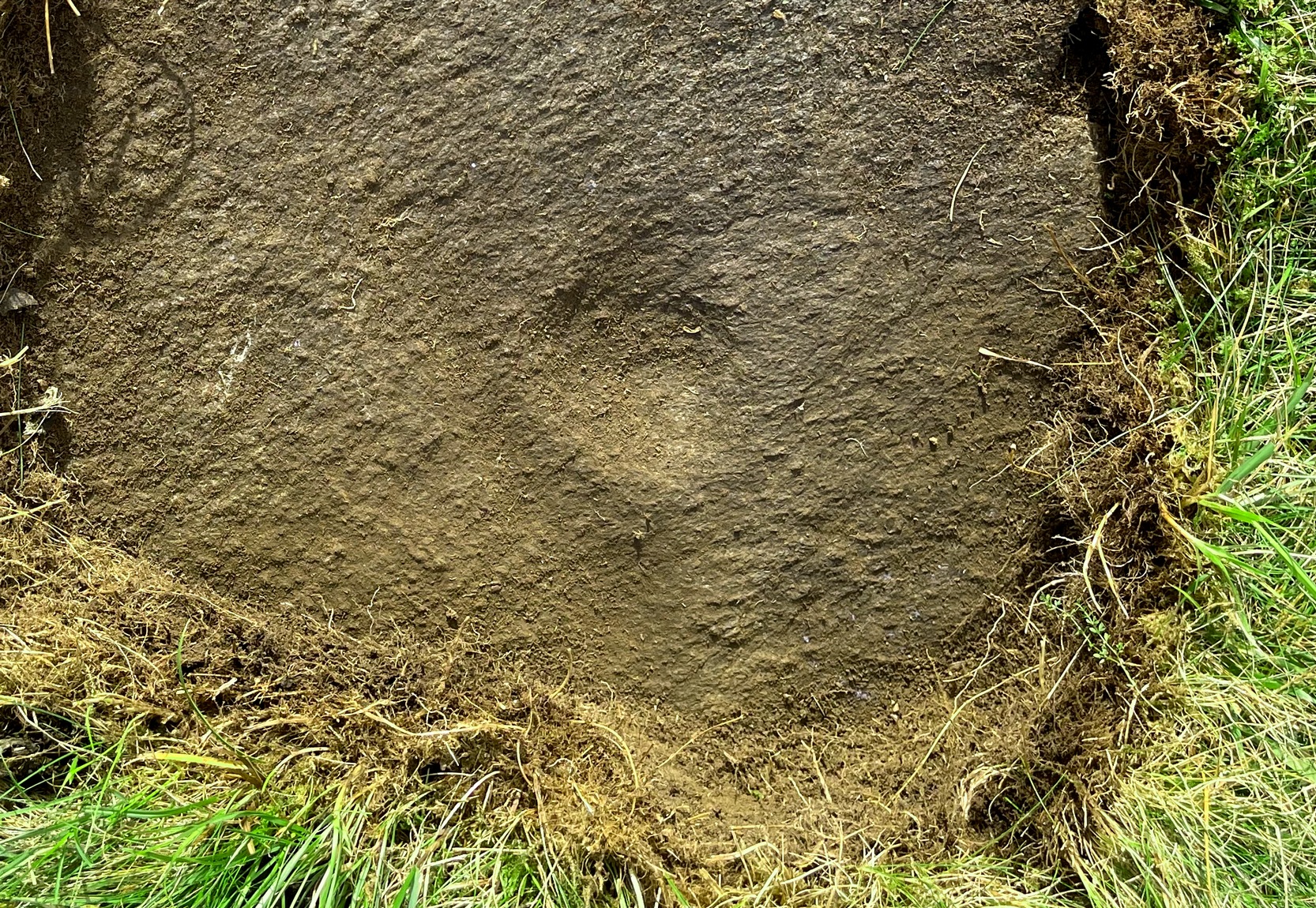
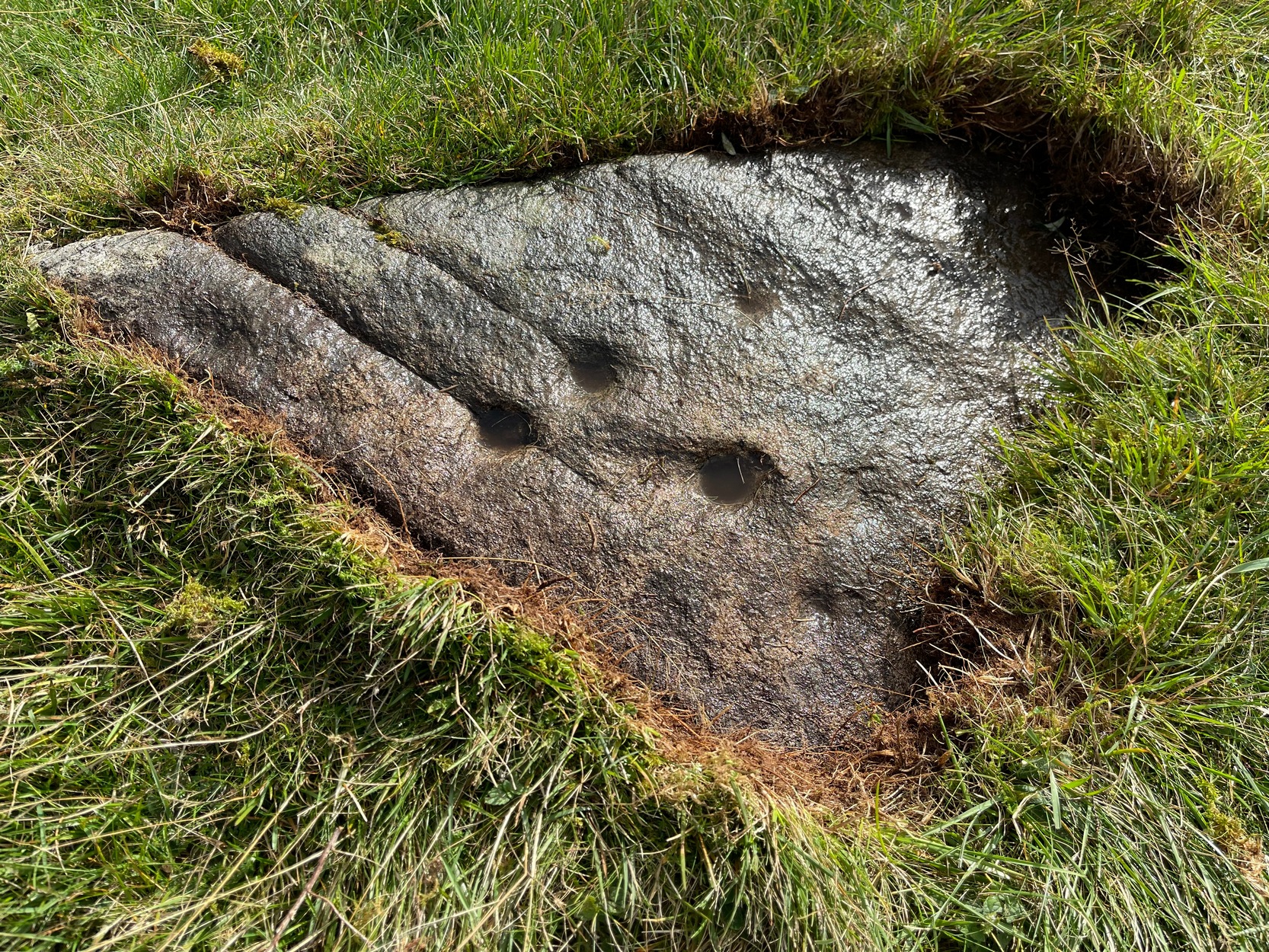
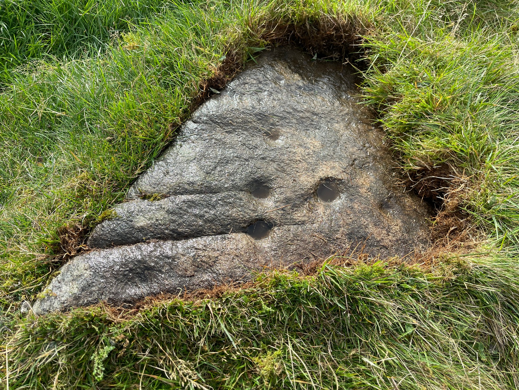
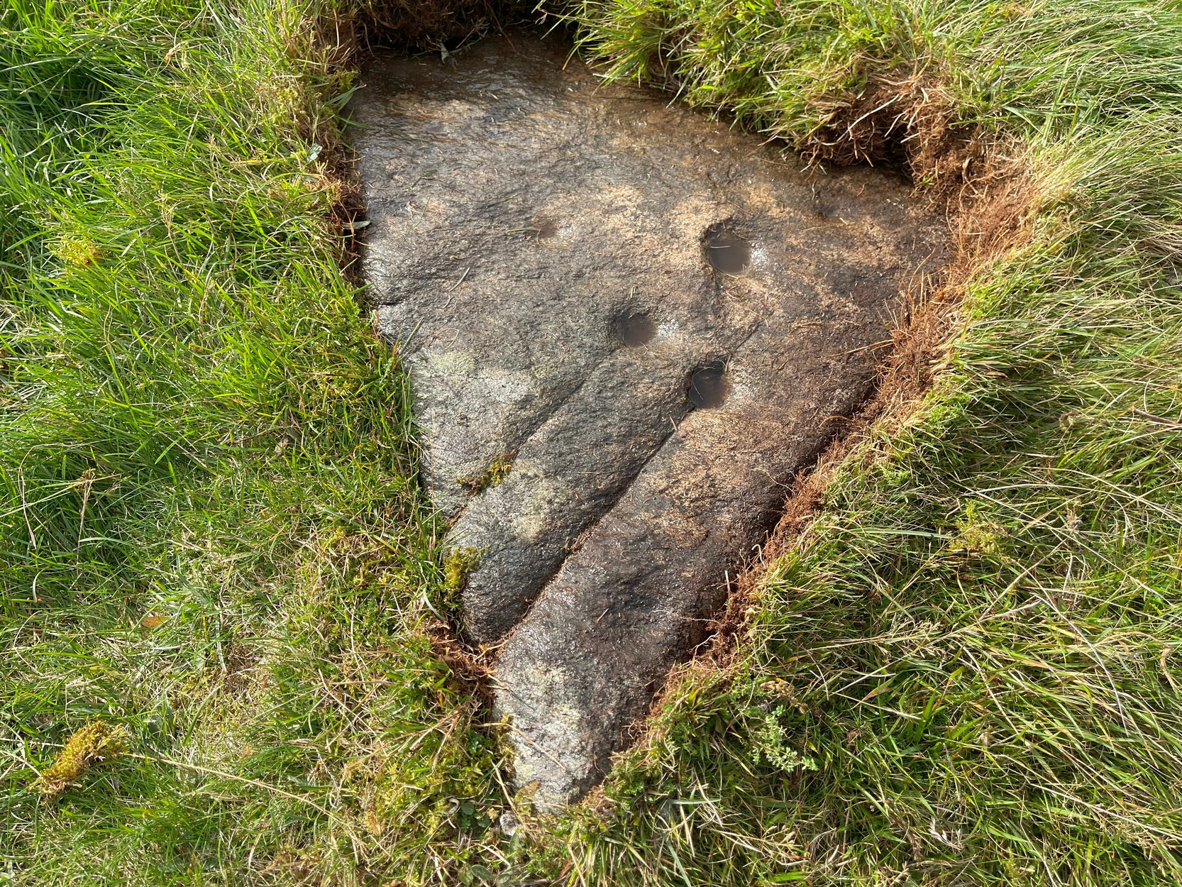
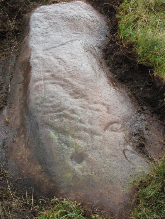
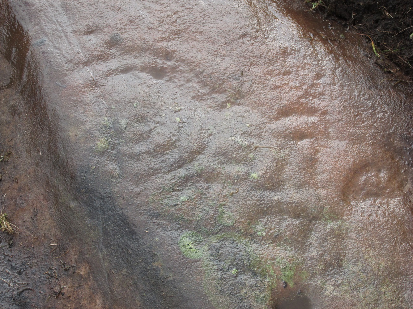
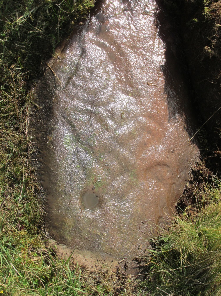
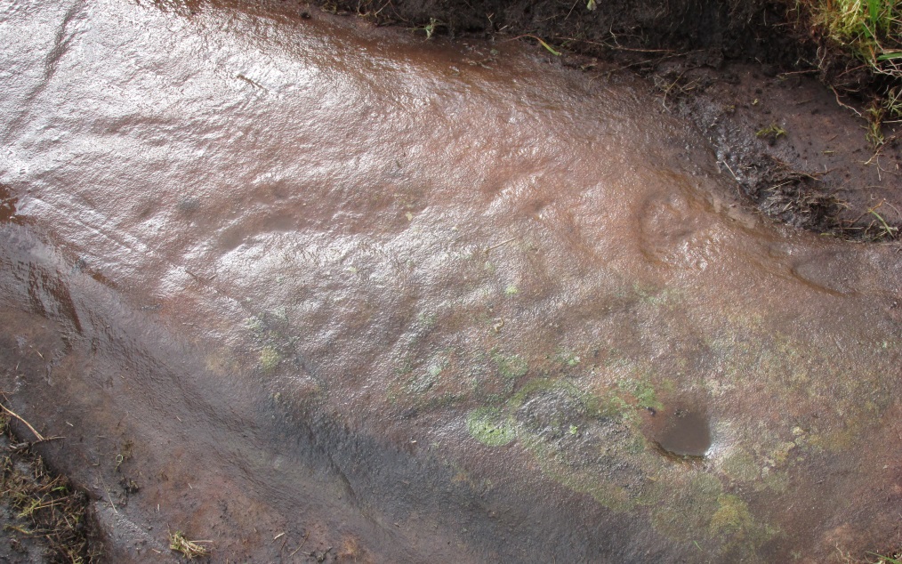
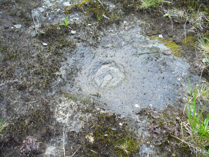
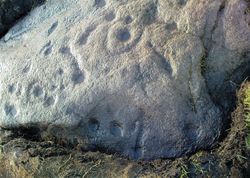
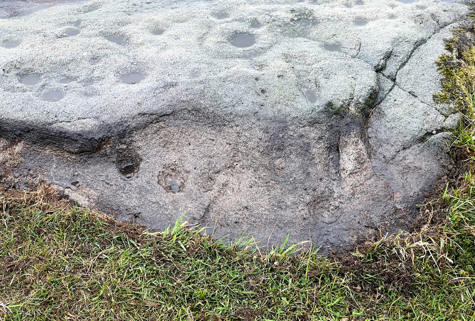
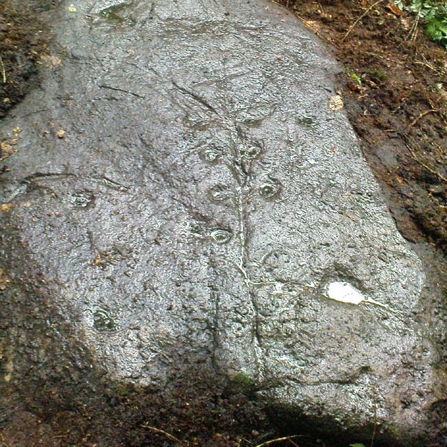
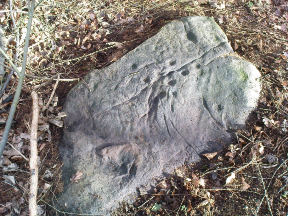
Lochan Hakel’s cup & ring (photo by Sarah MacLean)
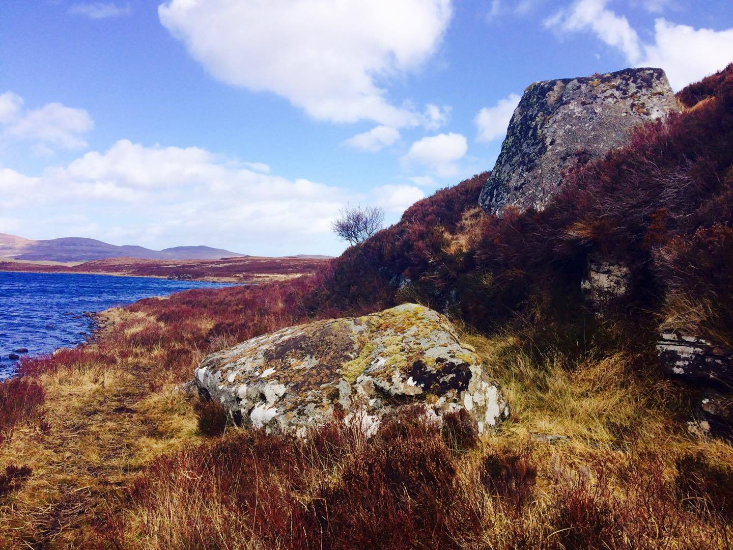
Whether you take the A836 or A838 into Tongue (through truly beautiful wilderness), make sure you go into the village itself—and then keep going, south, along the tiny country road. Nearly 2½ miles along, note the small loch of Lochan na Cuilce on your right. A few hundred yards past this, on the other side of the road (barely visible at first) is Lochan Hakel. Walk around to the south-side of the loch and, across from where the small island of Grianan lives, you’ll see this large rounded boulder by the loch-side.
Archaeology & History
Stuck in a veritably stunning middle-o’-nowhere landscape below the outstretched northern moors beneath Ben Loyal & co, there is no previous literary account of this faded petroglyph, rediscovered in early April 2017 when Sarah MacLean took us on a visit to the more renowned multiple cup-and-ringer of Lochan Hakel 2, just yards away above the moorland rise (which is unmissable from here). It’s not too special in comparison with its neighbour and many others—but try telling Sarah that!
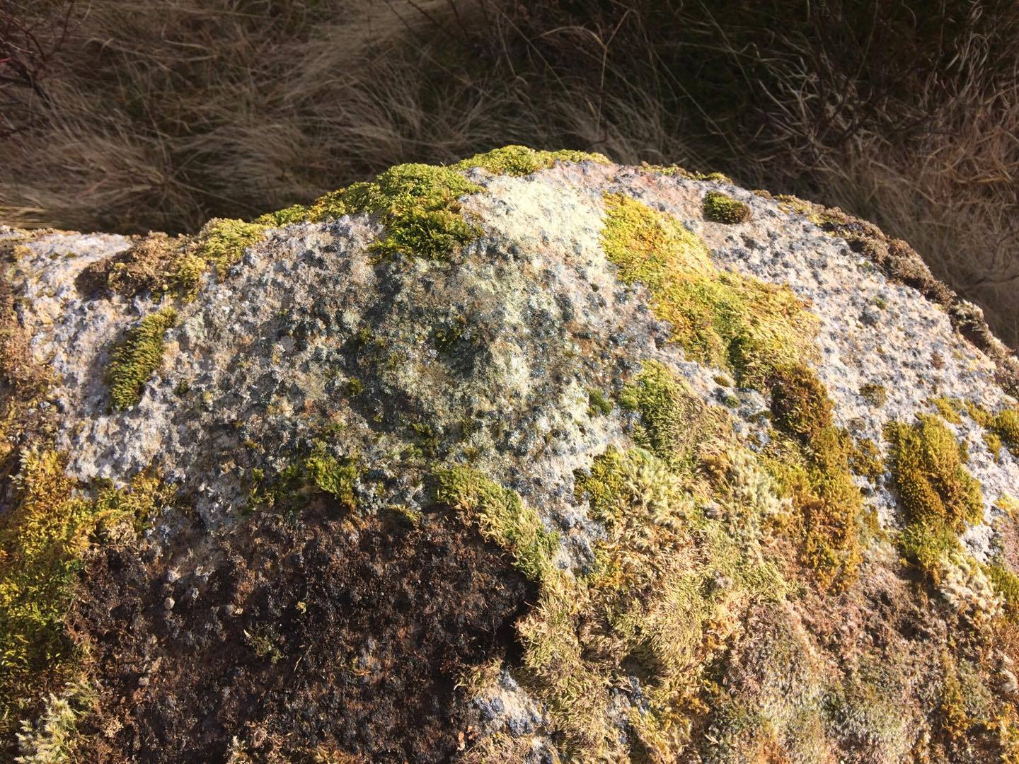
Cup & ring atop of stone (photo by Sarah MacLean)
This large rounded lichen-covered boulder has, at its height, a carved ring around a natural rise—known as a ‘boss’—at the very top of the rock. On its southern side, Sarah found a single cup-mark, along with a couple of others on the more northeasterly sloping face. At the bottom of this face is another seemingly isolated small cup-marking. There may well be other carved elements beneath the mass of ancient lichens, but we thought it best to leave them for the time being. It’s also quite likely that other unrecorded carvings exist in the area.
Acknowledgments: Huge thanks to Sarah MacLean, not only for helping to locate this carving, but for use of her photos in this site profile. Cheers Sarah! And to Donna Murray, for putting up with me whilst in the area! …Now, let’s find some more of them!
Follow the same directions as if you’re going to the Black Burn (2) carving (which you’ll obviously be looking at if you’re checking this one out!); and from there, walk two or three steps southwards down the slope – and you’re just about stood on it!
Archaeology & History
This, at first sight, seems little more than two cup-marks: one rather small, and the other somewhat larger than usual. I walked round it, crouched down and fondled it, poured water on it and heightened the carving… and noticed what seemed to be a carved arc around the western side of the large cup. But I couldn’t make my mind up whether this was natural or not. And then as laid down and looked across the stone, it seemed as if a very faint triangle completely enclosed the large cup! I crawled round it at ground level and the shape appeared and disappeared as the light altered. So I took a few more photos and wondered whether or not the shape would become obvious in them. And it did!
An eye in the triangle?Cup and faint triangle, or a trick of the mind?
It’s unusual – and I’m still not sure whether it’s natural or not. The carving needs more attention, in better daylight. Or perhaps the computer-tech kids might have a look at it and see if this really is an eye-in-the-triangle style design we’ve got here. It would be damn good! Anyhow, the carving was first mentioned by George Currie (2005), who told of it being two metres south of the Black Burn (2) cup-and-ring and, plainly, that it “has two cups: 60 x 15mm and 25 x 8mm.” It overlooks the urisk-haunted Urlar Burn, a creature known in some places for having milk and other offerings poured into cup-marks to appease it and gain good fortune.
References:
Currie, George, “Perthshire: Black Burn (Dull Parish) – Cup and Ring Marked Rocks”, in Discovery & Excavation Scotland, volume 6 (new series), 2005.
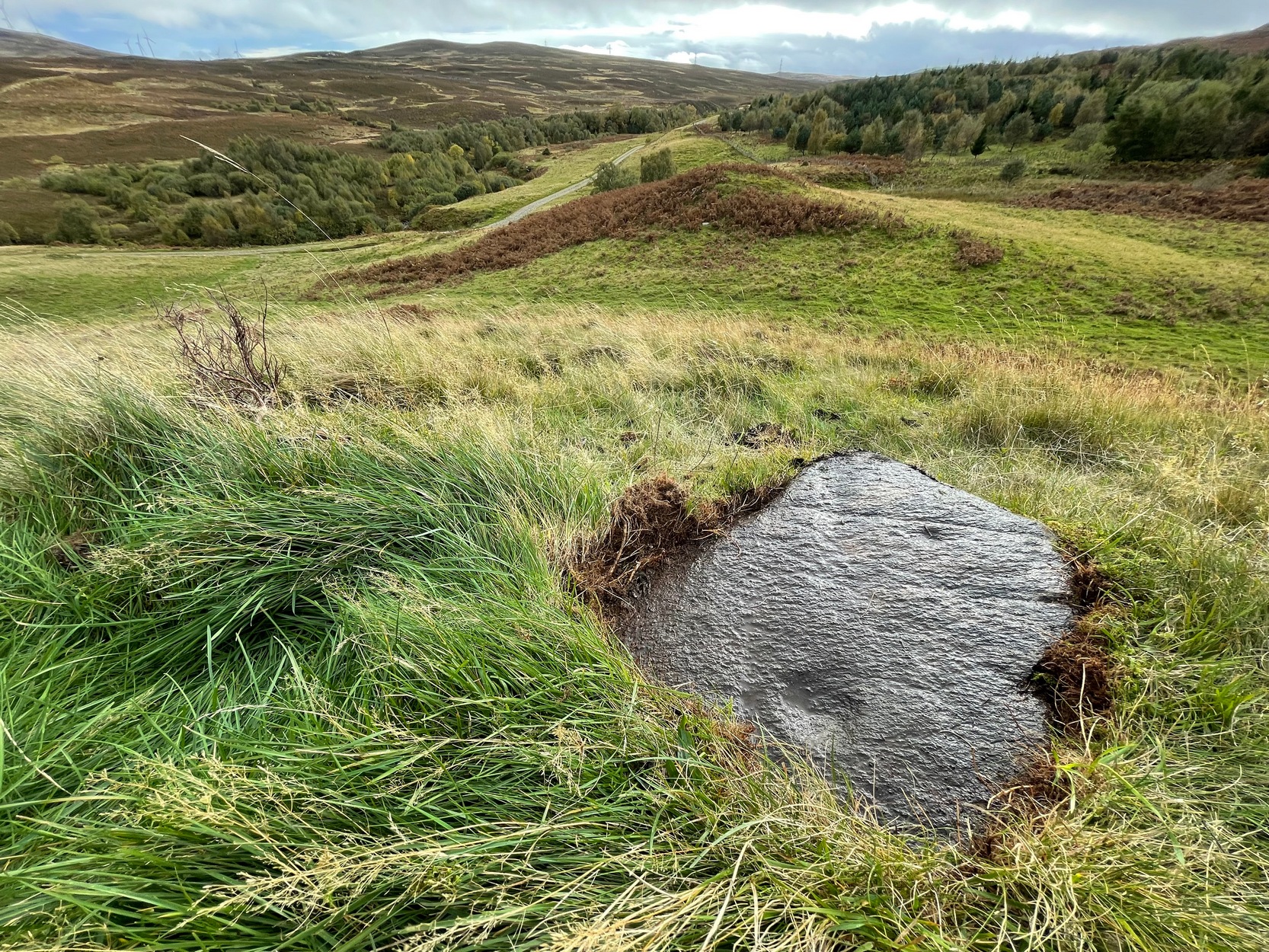
Take the A826 Crieff Road uphill for 275 yards then turn right up the Urlar Road. It’s a long uphill walk from here, up the private road, through and past Urlar Farm and along the track, making sure to go right where the track splits, keeping to the west-side of the burn. (don’t cross over it!) From here, the fields open up ahead of you into the distant hills. Keep along the track until, after a few hundred yards a small copse of trees is on your right. Walk past the bottom of this and then walk immediately up to the top of the large rounded knoll, or Tom, on your right. Once at the top, look for the triangular stone on its southwestern edge.
Archaeology & History
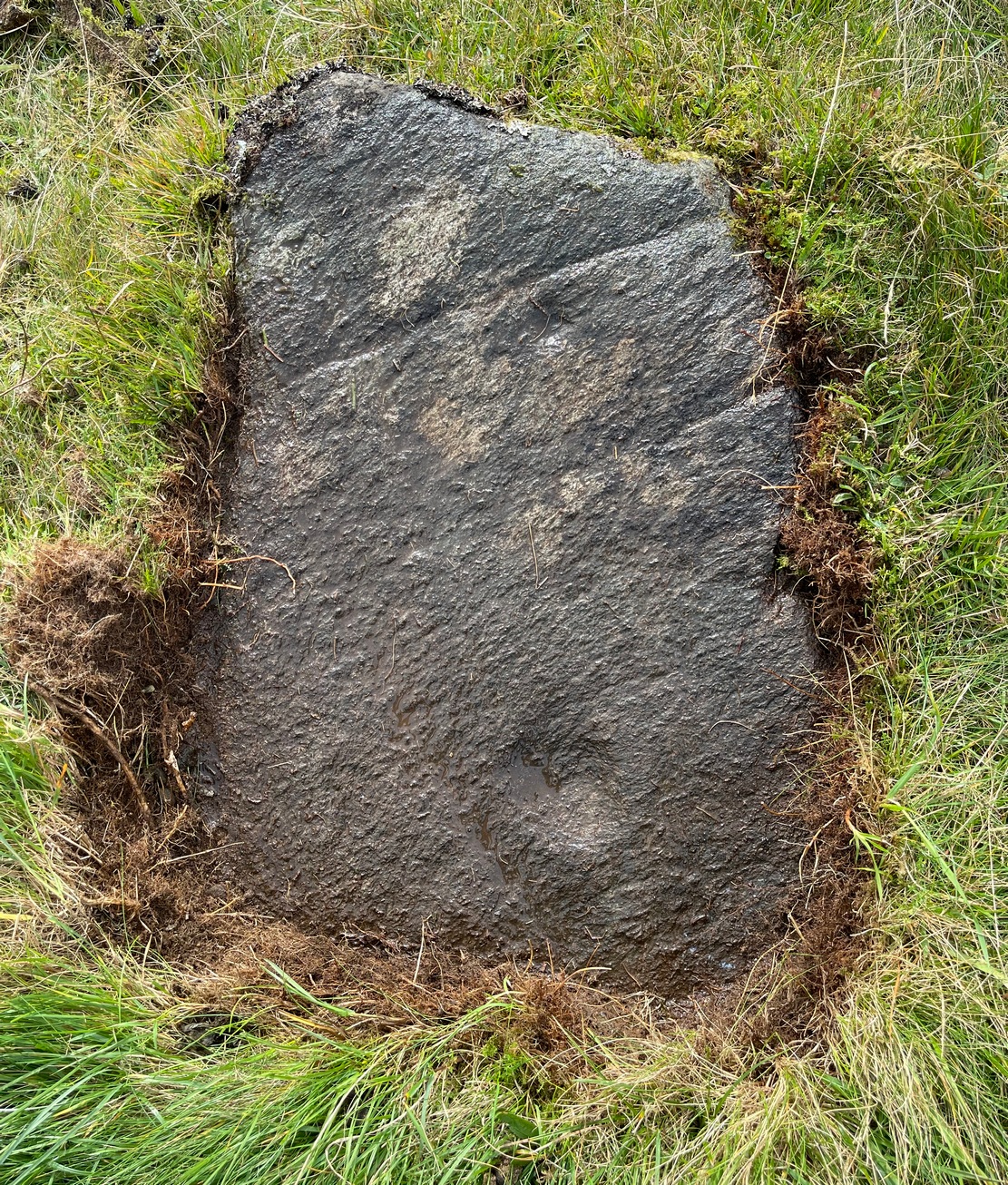
Upon this rounded tom, beloved of faerie folk and overlooking the urisk-haunted Urlar Burn, is this small flat triangular-shaped stone, embedded in the ground, possessing an unusual set of seven, possibly eight cup-markings (not five as Currie [2005] initially described) of varying depths and age, carved into straight geological fissures in the rock which, I hasten to add, were probably intended as part of the original design. Such elements are not unusual in carvings in other parts of the world, tending to relate to some spirit or ancestral ingredient. Whether that was important here, we might never know.
Black Burn (2) carvingBlack Burn (2) carving
But in addition to the cups on their geological cracks, a large faint wonky incomplete ring has been carved around the centre-most cup-mark, seemingly stopping where it meets the natural crack. You can just make it out in the photos. One side of this ring may continue onto the top of the longer crack, but it was difficult to see in the cloudy daylight and another visit is necessary.
The carving was first described by George Currie (2005), who told, in his usual minimalist manner:
“On W side of large knoll, triangular-shaped rock, 0.7 x 0.7m, flush with ground; five cups, largest being 50 x 20mm and smallest, 25 x 8mm.”
Two or three yards away, just slightly down the slope to your south, is another cup-marked stone: the Black Burn (3) carving.
References:
Currie, George, “Perthshire: Black Burn (Dull Parish) – Cup and Ring Marked Rocks”, in Discovery & Excavation Scotland, volume 6 (new series), 2005.
Acknowledgements:Huge thanks for use of the Ordnance Survey map in this site profile, reproduced with the kind permission of the National Library of Scotland.
Take the same directions to locate the cup-and-ring stone of Ballochraggan 12. There are several rocks adjacent. The one immediately next to it, to the northeast, is the one you’re looking for. Be gentle and careful if you’re gonna look at it — deadly serious, be very careful indeed!
Archaeology & History
One of the most intriguing and most fascinating of all the prehistoric carvings I’ve yet to discover. Not that this was all my own work. If it hadn’t been for Paul Hornby, we might have simply walked past it as being little more than a single cup-marked stone—and in this area, single cup-marks tend to be little more than geological in nature.
After we’d looked over several of the registered carvings close by, I did my usual meandering back and forth, stroking stones and seeing if there were any carvings that had been missed by previous surveyors. And in walking past a small piece of smooth rock, a singular cupmark seemed to stand out. I walked past it, shouting across to my colleague.
“It looks like we’ve got a single cup-mark here Paul,” I said, “with possible half-ring.” Thankfully Mr Hornby gave it his better attention.
Mask Stone, with faint ‘urn’Close-up of features
The sun was still out and shining across the smooth rock surface, which tends to mean that you’re not seeing any carving on the stone quite as good as it actually is. Thankfully however, the sun was beginning to get lower and, when this happens, if we wet the rock, any carvings that might be there stand out much better. And this little fella just seemed to get better and more curious the more attention Paul gave it!
The first thing that became obvious were a series of faint carved lines above the single cup-mark. Initially these didn’t seem to merit much attention (straight lines on rock are usually more the product of geophysical action than that of humans), but as the rock got wetter, Paul saw something very distinct indeed.
“There’s a face on it!” he exclaimed. And indeed there was. A Rorschach response no doubt, but it was still very much like a face. This looked for all the world akin to the stylised olde English gentry sort of countenance, as in old cartoons. It was quite ‘distinct’, as such characters themselves insist on being! Yet around this initial face, more lines seemed to be emerging as the stone gave up more and more of its hidden story.
Standing back from an initial investigation, the carving was seen to consist of a triple-ring, but without the traditional ‘cup’ in its centre. Instead, the centre was marked simply by a small ‘dot’—perhaps, originally, being a small conglomerate hole formed as a result of another tiny harder fragment of stone falling away from its larger mass. But a ‘dot’ it was. The other carved ‘lines’ however, immediately below and attached to the triple-ring, gave us something almost unique—and another strong Rorschach response. As the photos clearly show, we have a distinct second ‘face’ made up of the same lines but in a quite different form. This ‘face’ has all the attributes we usually associate with pictures of mythical spirits, demons, or a mask—hence the name!
Paul took a series of fine photos, hoping that he could catch the image that our eyes could clearly see. And thankfully, his digital camera brought the image to life even better than our eyes did! The ‘mask’ is comprised of carved lozenge forms, akin to the more decorative ones we find at Kilmartin, and more especially around Newgrange, Ireland. We sat and talked about this: wondering and working out routes that we’d take over mountains and moors, from Ireland, to Kilmartin, then onto Ballochraggan, etching the same designs onto the rocks hereby and attaching similar mythic notions to them: of shamanism and kingship; underworlds and journeys—paradigms lost and certainly misunderstood in the non-polysemia of many modern academics.
Lozenges and rings
…The stone here was still slightly covered over and, beneath the loose grasses, another feature emerged of another petroglyphic rarity. At the topmost western side of the rock a straight line ran across the surface, seemingly marked by the hand of man, with a curious little line almost doubling back on itself for just an inch or so, and then feeling to run down the stone, towards the concentric rings and the face below. When we stood back and took the photos, this line and its tracer took on a form that I’ve only seen echoed in one of the Netherlargie tombs at Kilmartin, Argyll, 44.4 miles (73km) to the west. It is very distinct.
The beaker, rings & ‘face’
Spuriously ascribed as being ‘axe’ carvings (oh how archaeologists love this Rorschach projection), the Netherlargie North tomb cover-stone in Kilmartin has a series of burial ‘urns’ or beakers carved onto the rock, amidst a scattered collection of cup markings. (Beckensall 2005:73-4; Bradley 1983:92-3; Royal Commission 1971:68-70; Twohig 1972, etc) Here too at Ballochraggan we find another such symbol, but just a singular example, much larger and more clearly a beaker or urn, as are traditionally found within many old neolithic and Bronze Age tombs; although no tomb is immediately apparent at this Ballochraggan carving.
The entire carving is very faint indeed (you can’t even see it when you’re looking directly at it unless conditions are good) showing that it remained open to the elements for thousands of years. Other adjacent carvings lack the erosion that we find on this one, even on those which, as archaeologist Lisa Samson said, is “softer sandstone rock than this one”—implying that it’s one of the older carvings in this incredible cluster.
References:
Beckensall, Stan, The Prehistoric Rock Art of Kilmartin, Kilmartin Trust: Kilmartin 2005.
Bradley, Richard, Altering the Earth, Society of Antiquaries Scotland: Edinburgh 1993.
Royal Commission on the Ancient & Historical Monuments of Scotland, Argyll – volume 6: Mid-Argyll and Cowal, HMSO: Edinburgh 1971.
Twohig, Elizabeth Shee, The Megalithic Art of Western Europe, Clarendon: Oxford 1981.
Acknowledgments: Huge thanks again to Mr Paul Hornby for his considerable help with this site, and for use of his photos.
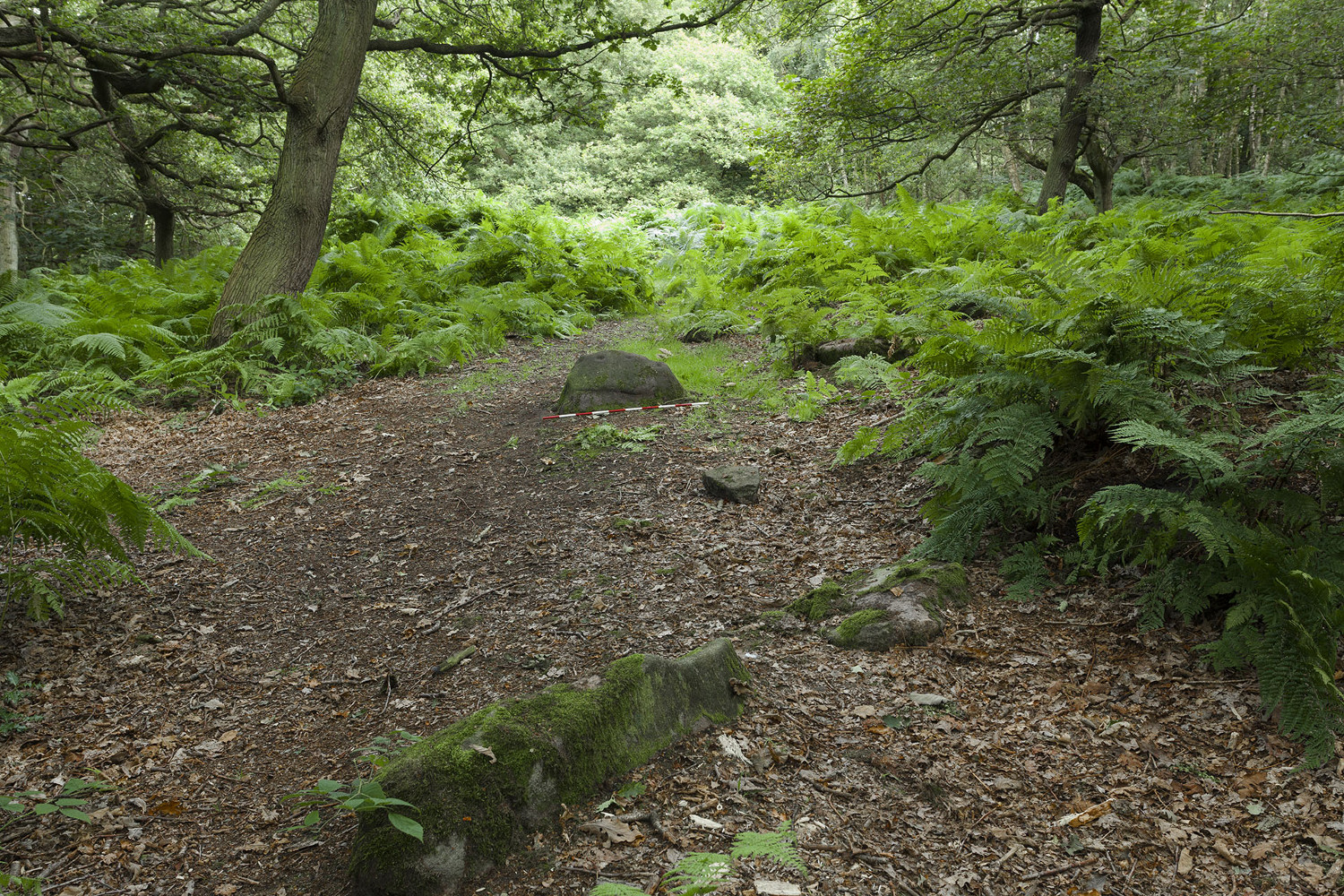
Mike Short tells: Walk ENE along Thornhill Drive (no vehicular access) to gate across road at the last house on the Drive and continue on for approx 475m where road starts to narrow slightly, becomes a little steeper and gently turns to E. Thornhill Drive is now cut into the hillside at this point with an upwards sloping bank on the S side of the path. After approx 25m further on at approx SE 20375 37950 look out on the S side of the path for a pile of boulders sitting on bedrock on top of the bank and a large rectangular tabular rock on the side of the bank. Ascend the bank and from the boulder pile the panel is approx 22m 200º(T) in the middle of an ephemeral E-W path more defined to W.
Archaeology & History
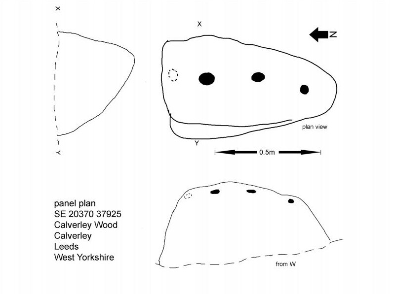
The profile (and ‘How to Get There’) for this recently discovered cup-marked stone was forwarded to me by fellow rock art explorer, Mike Short. The carving is another basic design found in Calverley Woods, between Leeds and Bradford, nearly halfway between the missing petroglyphs of West Woods 2 and Sidney Jackson’s Calverley Woods Stone. Rediscovered by Lisa Volichenko some time ago, Mike described the new carving here as follows:
Sketch of the carving (courtesy Mike Short)Cup-Marked Stone nr centre (courtesy Mike Short)
“Panel is carved on W sloping face of a sub-triangular earthfast coarse-grained sandstone boulder 0.81m X 0.50m X 0.38m, the longest axis lying almost exactly N-S. Carving consists of 3 cups, the most N of which is elliptical approx 65mm X 55mm; the central cup is elliptical approx 50mm X 40mm and the most S is circular diameter approx 40mm. On the N edge of the W face is a shallow elliptical depression thought to be of natural origin. There is an area of damage along the ‘crest’ of the boulder close to its S end.
“Carved rock is the most E of five rocks, measuring between 0.70m and 1.15m in length, in very close proximity forming an arc, 3 of which are in the footpath and one of which is resting on a large slab of rock almost completely covered by soil and vegetation.”
And so the small number of cup-marked stones in this woodland slowly grows. One wonders how many more are hidden beneath the roots of the trees—and are all of the lines and cups atop of the great Hanging Stone, a short distant away, all Nature’s handiwork…?
Acknowledgements: Huge thanks for Mike Short for the data, photos and sketch of this carving.
Troublesome to get to unless you’re reasonably fit. Probably the easiest route is to get to the Duncroisk 3 cup-and-ring stone. Keep walking along the riverside, climb over the first tall wooden fence and onwards till you reach the rocky crag reaching into the river Lochay. By whichever means possible, get yourself up and round this crag, but keep by the riverside till you get to the easier walkable rocky outcrop protruding into the river on the other side of the drop. Hereby, on one of the stones, look and you’ll find these faint cup-and-ring symbols.
Archaeology & History
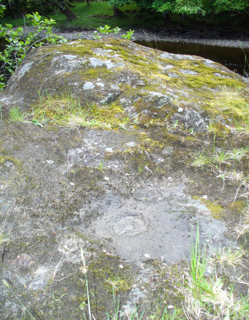
Although this carving was first described in Edward Cormack’s (1952) essay on the prehistoric carvings of the district, they have subsequently proved difficult to locate by the Royal Commission lads and other archaeologists. I’ve been here a few times looking for it and never managed to find it — until last week. When Mr Cormack first told of the design, he said:
“On a smooth rock surface just above the mouth of the small burn running into the Lochay, immediately west of the cup-marked ridge, are two cup-and-ring markings a yard apart. The rings are curiously rough edged, and do not give the same impression of weathering as those on the ridge; possibly they have been silted over shortly after being cut, and exposed again relatively recently.”
Flambeau the Cat uses the carving as his bed!
A few decades later, Ron Morris (1981) came across the carving, 10 yards “southeast of an elbow of River Lochay”, as he put it. Described as “hard to find”, he went on to give a basic outline of the design as he saw them, telling there to be “2 cups-and-one-ring, both probably complete, up to 16cm (6in) diameters, with radial grooves from cup to ring—up to 1cm deep.” Or more simply, two cup-and-rings, each with a line running from the centre to the surrounding ring.
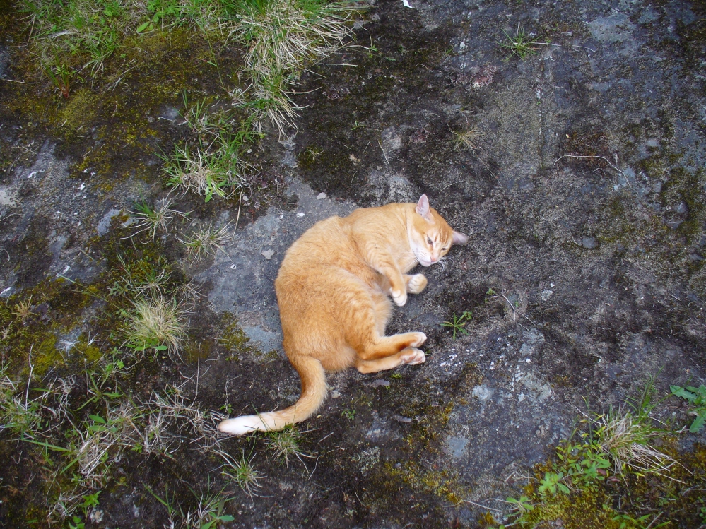
After trying to find this carving on several occasions, without success (somehow!), it was brought to my attention under the brilliant guidance of a local cat called Flambeau only last week (no lies!). In a venture down to the riverside, the great cat (in tandem with Pip the dog, who also ventures out with me to find ancient sites in this region) got to the riverside on the rock in question and began rolling about in the dust on the stone, mewing and purring away merrily! It was really brilliant to watch. Sincerely heart-warming (soz…but I can’t help it!).
Primary cup-and-ring at Duncroisk (2)
I stepped over and complimented him as he looked superb (hence the photo, above) and he just kept purring. Then, curiously, he stood up and began scratching at the dried earth on the rock, mewing away whilst doing this. Twas very odd indeed. But there, exactly where Flambeau has been scratching and rolling about, it seemed a faint cup-mark was apparent. And such it was! So I got on my knees and began cleaning away the dirt from the rock — and there, right where he’d been purring and playing, was the lost cup-and-ring carving!
Its location would suggest that the carving had some relationship with water: be that the spirit of the place, or a good site where fish can be had, or a place where someone had drowned, etc. We’ll probably never know… But it’s a beautiful spot, with the impressive Stag Cottage carvings in the adjoining field, and the newly discovered Corrycharmaig East carvings on the other side of the river — plus many others in the area.
Folklore
The River Lochay where this carving is found is named after a dedication to the Black Goddess, according to Prof. W.J. Watson. (1926) The stream by the side of the carving which runs into the River Lochay has been the place where faerie music has been heard by local people in times past.
Morris, Ronald W.B., The Prehistoric Rock Art of Southern Scotland, BAR: Oxford 1981.
Royal Commission on the Ancient & Historical Monuments of Scotland, Archaeological Sites and Monuments of Stirling District, Central Region, Society of Antiquaries of Scotland 1979.
Watson, W.J., The History of the Celtic Place-names of Scotland, Edinburgh 1926.
Probably the easiest (direction wise) is if you’re coming from Dick Hudson’s public house on the southern road surrounding Rombalds Moor. From the pub, head left (east) along Otley Road (passing Weecher reservoir) for 1.9 miles (3.1km) until you reach Reva reservoir where a track leads you to the waters. A small parking spot is on the left-side of the road. From here, go through the gate and along the footpath across the field for nearly 300 yards to the next gate; go through here and walk to your right for about 60 yards where uyou’ll reach a small straight dyke (keep your eyes peeled!) running NW (to your left): walk along here for nearly 200 yards until it hits another shallow dyke bearing right; follow this dead straight for 35 yards after which it changes direction, but you need to keep walking straight on forward for another 60 yards or so. Look around!
Archaeology & History
First photo of the carving
This carving is one in a cluster of previously unrecorded petroglyphs, uncovered in the summer of 2011 during a Northern Antiquarian bimble on the northern edge of Rombald’s Moor. The carvings were found as a bi-product of uncovering a previously undiscovered cairn circle, close to the Twelve Apostles stone circle. In assessing and exploring the newly-found circle, it was noticed that a small opening in the near horizon highlighted a rise in the landscape barely a mile away. This ‘opening’ in the land was not visible if you walked 25 yards either side of the cairn circle – but was very notable at the circle itself.
“We need to have a look at that site,” I said. “It’s position looks to have been relevant to this circle.” (or words to that effect) And a couple of weeks later we met up and walked to the place in question.
Fraggle Rock carving, looking westFraggle Rock carving, looking south
Within five minutes we came across a couple of previously unrecorded cup-marked stones, of simple design, right in line with the cairn circle. As we walked around this spot, then headed back in the direction of the circle, a cluster of small stones were noticed on the slope. One had what looked like a single cup-marking near its edge, but the rest of the rock was completely covered in vegetation. Paul Hornby and Michala Potts had, by now, already found several other previously unrecorded cup-marked stones close by; but as I carefully rolled back the vegetation at the edge of this particular rock, cups-and-rings and carved lines seemed to be covering most of its surface. It was a good one!
Face on the Fraggle Rock
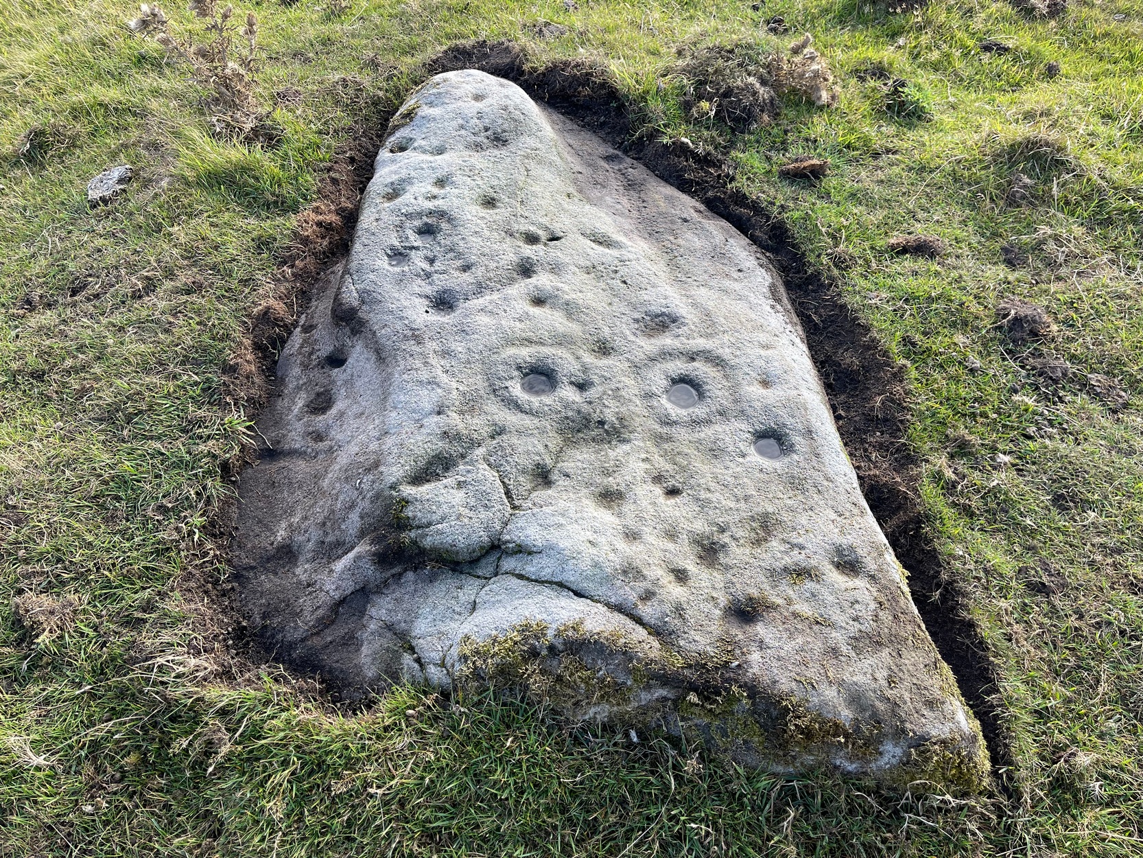
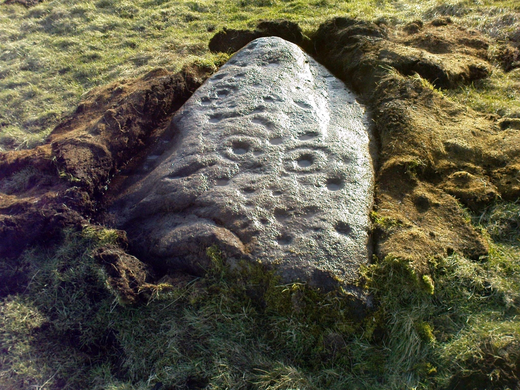
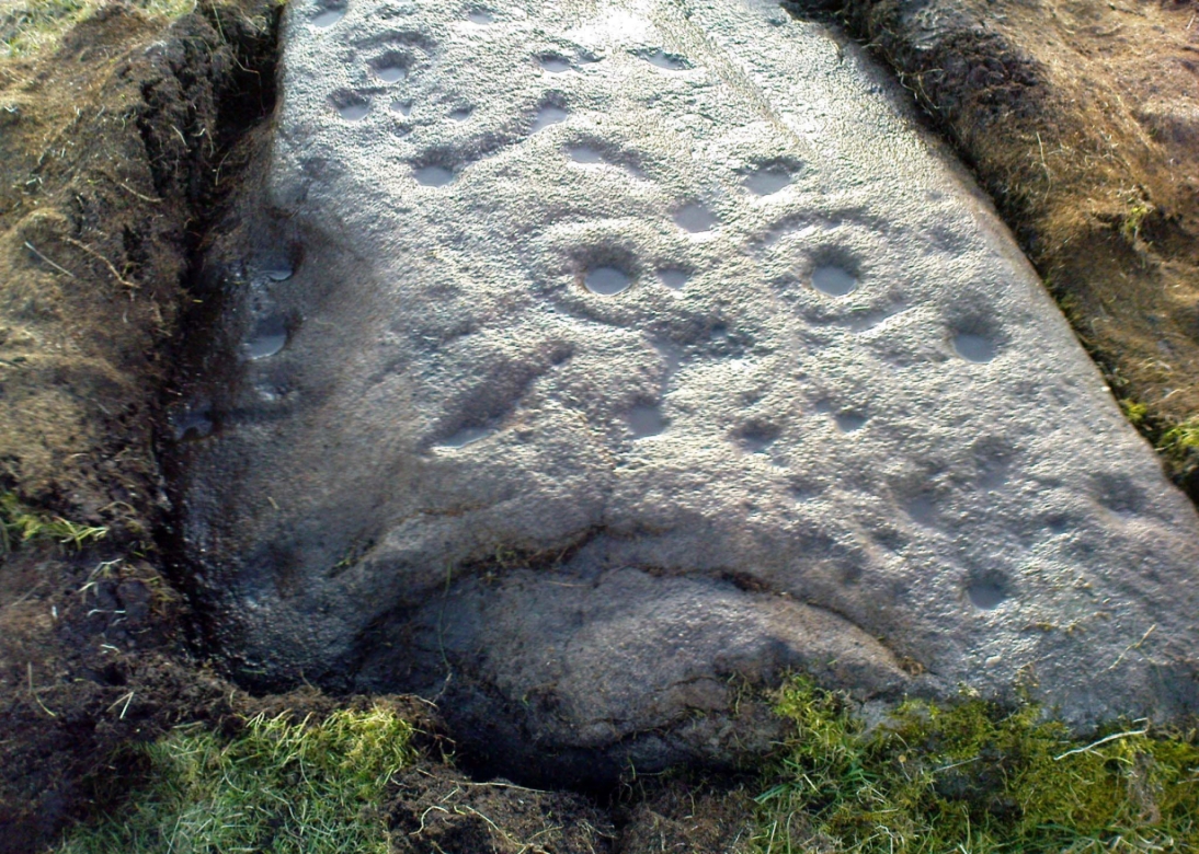
We called it the Fraggle Rock after noticing that when you look at the stone from one end, the two main cup-and-rings are likes two large eyes carved above a large natural down-turning ‘mouth’ feature, similar to some of the creatures’ faces on the muppets or the similar kid’s TV show, Fraggle Rock! (sad aren’t we!?) The photo here shows you what we mean.
The primary design consists of at least 3 cup-and-rings, 2 partial cup-and-rings, 28 cups and several carved lines along which some cup-markings are linked to others. The most notable of the carved lines is the longest (barely visible in the photos), running from a single cup-mark at the southernmost rounded end of the stone, almost straight and parallel with a natural ridge or dip along the rock, until it meets the largest of the cup-and-rings (one of the eyes on the Fraggle’s face!). Don’t ask me why, but for some reason this long faint line seemed the most perplexing element of the carving.
Eastern edge with low cupsCup-marks on rock edge
Most of the design is carved on the upper face of the stone, but a small part of the rock dips into the ground on its eastern side and a small group of cups and a single carved line, in a very good state of preservation, are etched right at the edge of the stone. Unusual. Another faint cup-and-ring is less than 100 yards west; and a fascinating cup-and-lines stone, with at least four long carved ridges running like hair from the top of the stone into the Earth, is a short distance to the north. A number of others are in this and adjacent fields.
One of the first photos, just as the mud had been cleared
This carved stone was rediscovered by Michala Potts on the rainy afternoon of August 26, 2011, on a Northern Antiquarian excursion to explore some of the cup-and-rings on Ilkley Moor. The entire stone was totally covered in soil and leaves, and Michala spent some considerable time carefully clearing the dead vegetation to unveil the carvings beneath.
Close-up of cups & scars
This carving has at least 12 cup-marks on its slightly inclined surface, with several artificial carved lines and some that are obviously geophysical in origin. (we really could do with a geologist with a cup-and-ring fetish to accompany us on some of our outings!) But the main feature of this carving — as the photos here illustrate — appears to be the natural crack that runs up through the middle of the stone, either side of which have been etched a number of cup-markings attached by small lines or ‘branches’, giving the distinct impression of a tree. Whether this was a deliberate artistic feature (a tree), or just another Rorscharch response to non-linear systems on our behalf (more probable), we’ll never know. On the moors northeast of here on the other side of the Wharfe valley, the Tree of Life Stone acquired a similar association due to its design; but this Ilkley design, sadly, aint quite as good as the one on Askwith Moor.
Tree Stone, showing modern industrial scars
There are some puzzles on this stone aswell. Other lines scar the rock which are definitely man-made, but they are of a different nature and age. The marks have been scarred by more modern metal tools, or were caused by heavy metal machinery that have rested on the rock at some time in the not-too-distant past. You can see the curved deep scratches in the photo here to the right. It seems likely that when the modern houses were built straight across and above here, this cup-marking was damaged by the workers — although they didn’t know it was here as the stone had not been catalogued by the Ilkley archaeologists. But there’s also another peculiar feature on this stone. Someone a century or two ago also carved other fainter features into the stone, seemingly lettering, on the northeast edge of the rock. They can be seen faintly on the second photo, above.
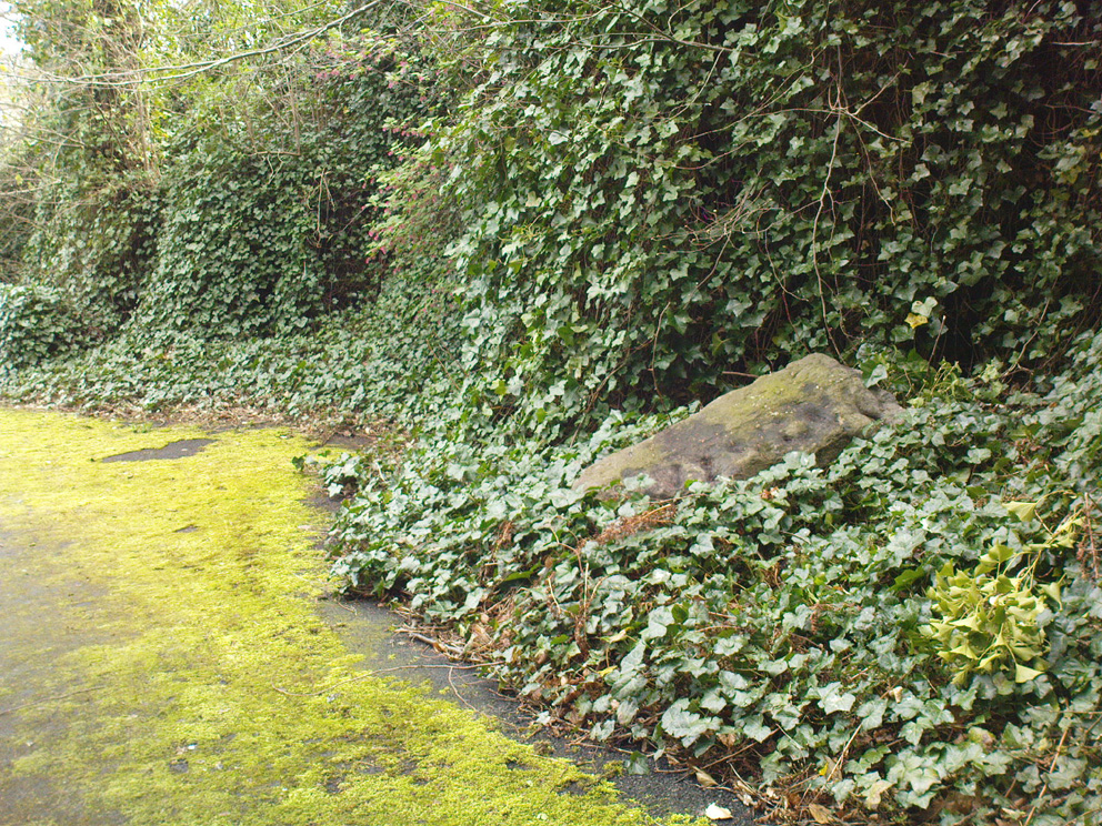
From Shipley town centre open market, take the Kirkgate road up to Saltaire, past the old town hall. On the other side of the road take the little path into the Bowling Club, in the trees (if you hit the church you’ve gone too far). Once standing in front of the bowling green itself, you need to walk along the left-side path. Two-thirds of the way down, now laid in the ivy-covered area below the old quarry face, you’ll find what you’re looking for.
Archaeology & History
I remember first seeking out this carving when I was still at school and wondering how the hell it got here – and believed it to be a fallen standing stone at the time! It seems that the stone was cut and readied for use as a gatepost instead, at some time long ago.
Close-up showing cups & linesIn its previous locale
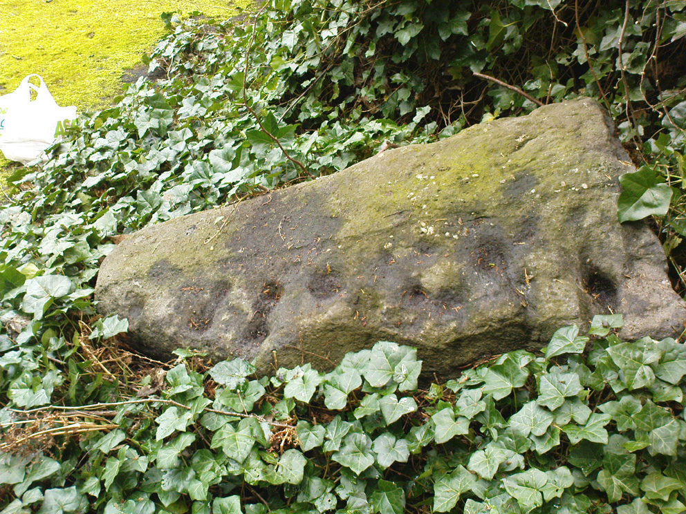
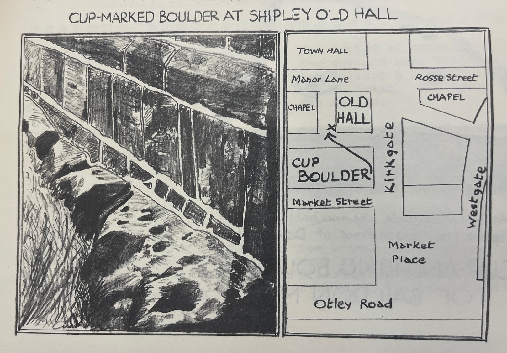
The curious cup-marked stone has travelled about a bit, somehow. Formerly at the edge of a field in the grounds of Bradford Grammar School 3 miles away (at SE 1523 3583), the fella was then built into the wall of the now-demolished Shipley Old Hall, before reaching its present resting place at the edge of the bowling green. Consisting of around 16 cup-markings with carved lines seeming to link them here and there, it was first mentioned by the late great Sydney Jackson (1955) in an early edition of the Bradford Archaeology Journal. The carving was recently included in the Boughey & Vickerman (2003) survey, where they described it as,
“Medium-sized fairly smooth grit rock with coarse line down top, probably natural, evidence of quarrying on edge. Sixteen or seventeen cups, one with a groove out has a deeper cut within it and twelve of the others are linked in pairs by short grooves. This has been interpreted as feathering for quarrying, but the grooves are across the line of likely split, rather than along it.”
And for those of you who live nearby: if you check this out, see if you can locate an earthfast boulder near here which I recall having a cluster of distinct cup-marks running on top of the rock along one side. I couldn’t find it when I looked a short while ago, it’s not in the archaeology survey lists, and it remains lost—in the heart of Shipley no less!
References:
Boughey, Keith & Vickerman, E.A., Prehistoric Rock Art of the West Riding, WYAS: Wakefield 2003.
Jackson, Sydney, “Cup-Marked Boulder, Shipley Old Hall,” in Bradford Cartwright Hall Archaeology Group Bulletin, 1:10, 1955.
Follow the same directions to find the Balfarg Stone Circle. From the A92 going north from Glenrothes, turn E onto the country lane to Star and Kennoway. 100 yards on there’s a sign for Balbirnie; turn right here and about 200 yards on, where the road bends right, the circle’s just below you). This carving is perched on its side in one of the preserved grave cists within the circle, easily visible at ground level.
Archaeology & History
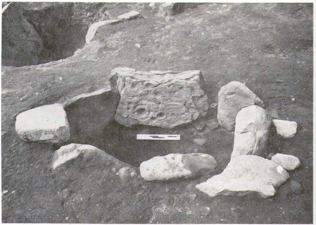
This carving (and its adjacent compatriot) was found insidethe Balbirnie stone circle when it stood in its original position more than 100 yards northwest of the place it presently occupies (at NO 2850 0304). Thankfully, when the megalithic ring was moved and reconstructed, its original status was kept, including the repositioning of this impressive small cup-and-ring stone – despite it being a copy of the original.
Early photo of the carving
Like a good number of prehistoric tombs, this small carved stone was stood on edge, facing into the stone-lined tomb (cist), obviously representative of some important element in the Land of the Ancestors: perhaps a map of the landscape therein; perhaps a personal token; perhaps indicative of the spirits of the dead; perhaps a magickal amulet for safe guidance. There are a number of ritual possibilities here, and whichever it was, we can be sure the symbols were representative of the animistic cosmology of the neolithic people living hereby, linking the living with the dead.
As you can see from the original photograph, a number of cup-marks along the edges of the stone are accompanied by two or three cup-and-rings, one of which is very faint. Some carved lines run between some facets of the carving, linking one mythic element to another. Ron Morris (1981) described the carving, simplistically, as,
“Under a cairn, within a ring of stones, one of 5 cists had, carved on the inside of a side-slab (sandstone), ¾m by ½m by ¼m (2¾ft x 1¾ft x ¾ft): 2 cups-and-one-ring—one faint and incomplete—and also 8 cups, 2 with ‘tails’. Greatest diameter of ring 12cm (5in), and carving depths up to 2cm (1in).”
References:
Burl, Aubrey, Rings of Stone, BCA: London 1979.
Morris, Ronald W.B., The Prehistoric Rock Art of Southern Scotland, BAR: Oxford 1981.