Cup-and-Ring Stone (destroyed?): OS Grid Reference – SE 314 537
Archaeology & History
The chances of this carving still being alive, so to speak, are pretty slim. It was reported by a Mr. Sullivan to the old Yorkshire petroglyph researcher Stuart Feather back in 1965, in the days when English archaeologists didn’t really give a shit about rock art. Sad but true. The carving was found in the grounds of what used to be the ICI Fibres Research Centre, in the present landscape of Hornbeam Business Park, a hundred yards or more west of Hookstone Beck. According to Feather’s report, the carving consisted of “a single-ringed cup and a groove” surrounding “two short pecked grooves and a meandering groove leading off,” all with clear signs of being pecked and carved in the old-school manner. All trace of the carving has vanished and it was probably destroyed by the Industrialists. (the grid-reference to this site is an approximation)
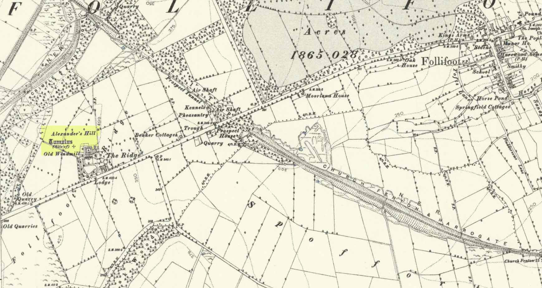
Tumulus (destroyed): OS Grid Reference – SE 3222 5211
Archaeology & History
Site of tomb on 1894 map
We are thankful that the antiquarian James Wardell (1881) gave us some details of this long lost site in his survey of prehistoric remains, otherwise information about it would certainly have been lost. Prehistoric burial mounds are rare in this part of Yorkshire, but on the rise of land behind Follifoot Ridge house could once be seen “a large barrow measuring 50 feet in diameter.” Believed by Challis and Harding (1975) to have been a late Bronze Age structure, the story of its demise was told by Wardell as follows:
“This monument of a former age…exists no longer, owing to the ignorance and cupidity of the surveyors of the highways of the township in which it was situate; by whose orders the stones, of which it was partially composed, were carted away at intervals, during a period of some five or six years, to keep in repair a neighbouring road. At the base were several very large stones, probably a kistvaen, and at the same time were found fragments of urns, bones and ‘pieces of brass’, which immediately became dispersed. Some of the latter articles came into the possession of the village smith, from whom this information was obtained, and were disposed of by him to a brass-founder as old metal, and in due time, doubtless, found their way to the foundry. From the description given of them by this person, there seems to have been amongst them some spear-heads and a palstave, but after a most diligent inquiry, there could not, as might be expected, anything whatever be recovered. I should say that from weapons of bronze being found in this huge sepulchral mound, it was not one of the most ancient kind, but has perhaps covered the remains of British warriors slain in conflict with the Roman invaders… I am indebted to Mr John Dixon of Leeds for the information relating to the demolition of this barrow, which was only obtained by him after a lengthy enquiry; and he states that on his visit to the site, it could distinctly be traced by the grass there being of a darker hue than in other parts of the field.”
A mile to the northwest, one would have been able to see the Stone Rings of Pannal, also destroyed, and the two sites may have served some geomantic relationship with each other.
References:
Challis, A.J. & Harding, D.W., Later Prehistory from the Trent to the Tyne, BAR: Oxford 1975.
Wardell, James, Historical Notes of Ilkley, Rombald’s Moor, Baildon Common, and other Matters of the British and Roman Periods, Joseph Dodgson: Leeds 1869. (2nd edition 1881).
Acknowledgements: Big thanks for being able to use the 1st edition OS-map for this site profile, Reproduced with the kind permission of the National Library of Scotland.