Going along the B6160 road from Grassington to Kettlewell and taking the little road to Arncliffe on your left just a few hundred yards past Kilnsey Crags, after ¾ of a mile keep your eyes peeled for the small parking spot on the left-side of the road, with the steep rocky stream that leads up to the Sleet Gill Cave. Walk up this steep slope, following the same directions to reach the Sleets Gill Top enclosure. From here you’ll notice a large gap in the rocky crags about 200 yards WSW that you can walk through. On the other side of this gap, along a small footpath about another 200 yards along you’ll reach a large ovoid rock. Just before this, on your right, is a long rocky rise with distinct drystone walling below it. That’s the spot!
Archaeology & History
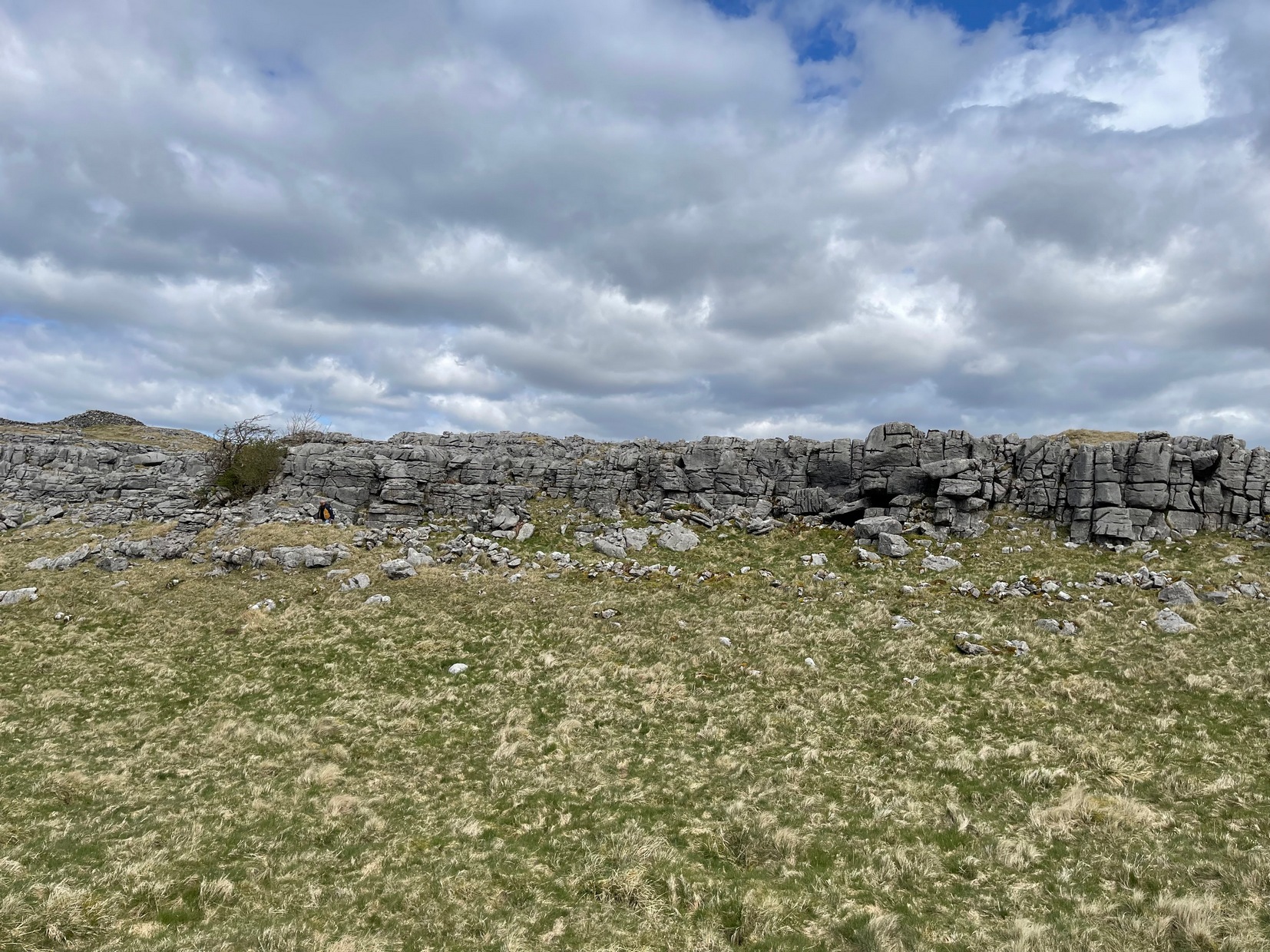
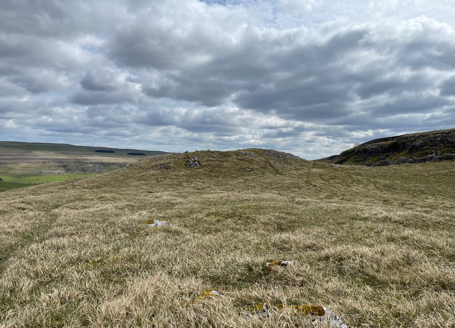
Walled section, looking S
Encircling a slightly sloping area of ground that stretches out beneath a long line of limestone crags is this notable walled enclosure running almost the full length of the rocky ridge. Measuring 40 yards (36m) in length by 10 yards (9m) across at its greatest width, this elongated rectangular enclosure has all attributes of being Iron Age in origin, much like many others in this area. However, in comparison with the others close by, this is a pretty small construction and—if used for human habitation, as is likely—would have housed only two or three families.
Western end of enclosure
Within the enclosure itself, near its western end, we find an internal line of walling that creates a single room: enough for a single family, or perhaps even where animals were kept. Only an excavation would tell us for sure.
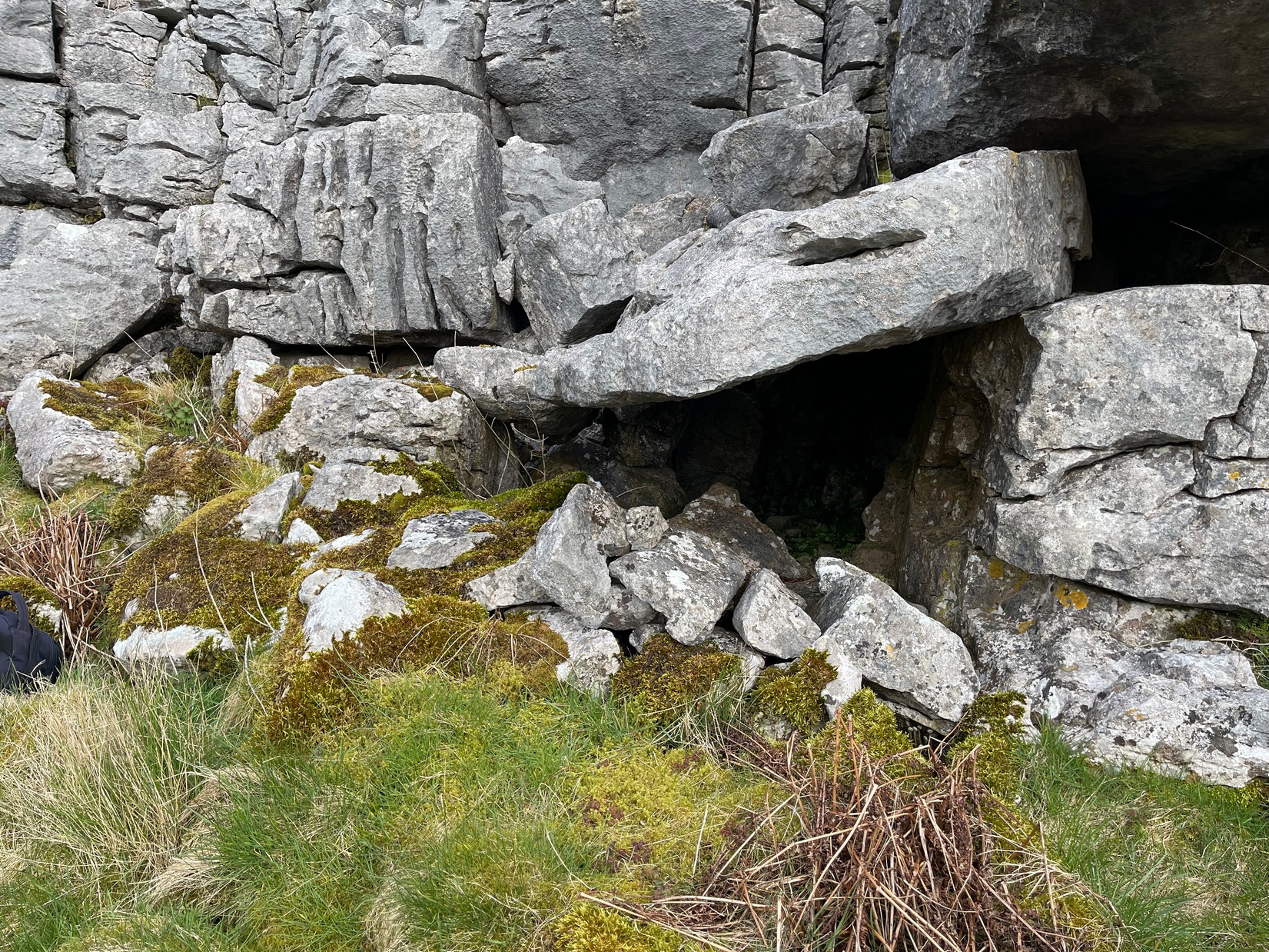
Curious stone ‘cupboard’
One notable interesting feature exists roughly halfway along the enclosure, up against the crag itself: here is small man-made stone “cupboard” of sorts, akin to some modern pantry. You’ll get an idea of it in the photo. At first I wondered if this would have been a sleeping space, but, unless it was where a shaman liked to encase him/herself inside a domestic household cave (highly improbable), it would have served a simple pragmatic function. Make up your own mind.
I liked this place. It’s surrounded by crags on almost all sides with some ancient spirit-infested rocky hills very close by, giving it a beautiful ambience. Immediately below the enclosure is what looks to be a large dried-up pool, which was probably well stocked with fish. A perfect living environment. Check it out!
Go up the B6160 road from Grassington to Kettlewell and just a few hundred yards past the famous Kilnsey Crags, take the little road to Arncliffe on your left. After ¾ of a mile, keep your eyes peeled for the small parking spot on the left-side of the road, with the steep rocky stream that leads up to the Sleet Gill Cave. Walk up to the cave, then keep going up the same steep slope to the wall/fence above. You can get over the wooden fence and keep following the wall until it just about levels out nearly 200 yards up. From here, walk 100 yards to your right where the land rises up and you’re at the edge of the walled enclosure. Look around.
Archaeology & History
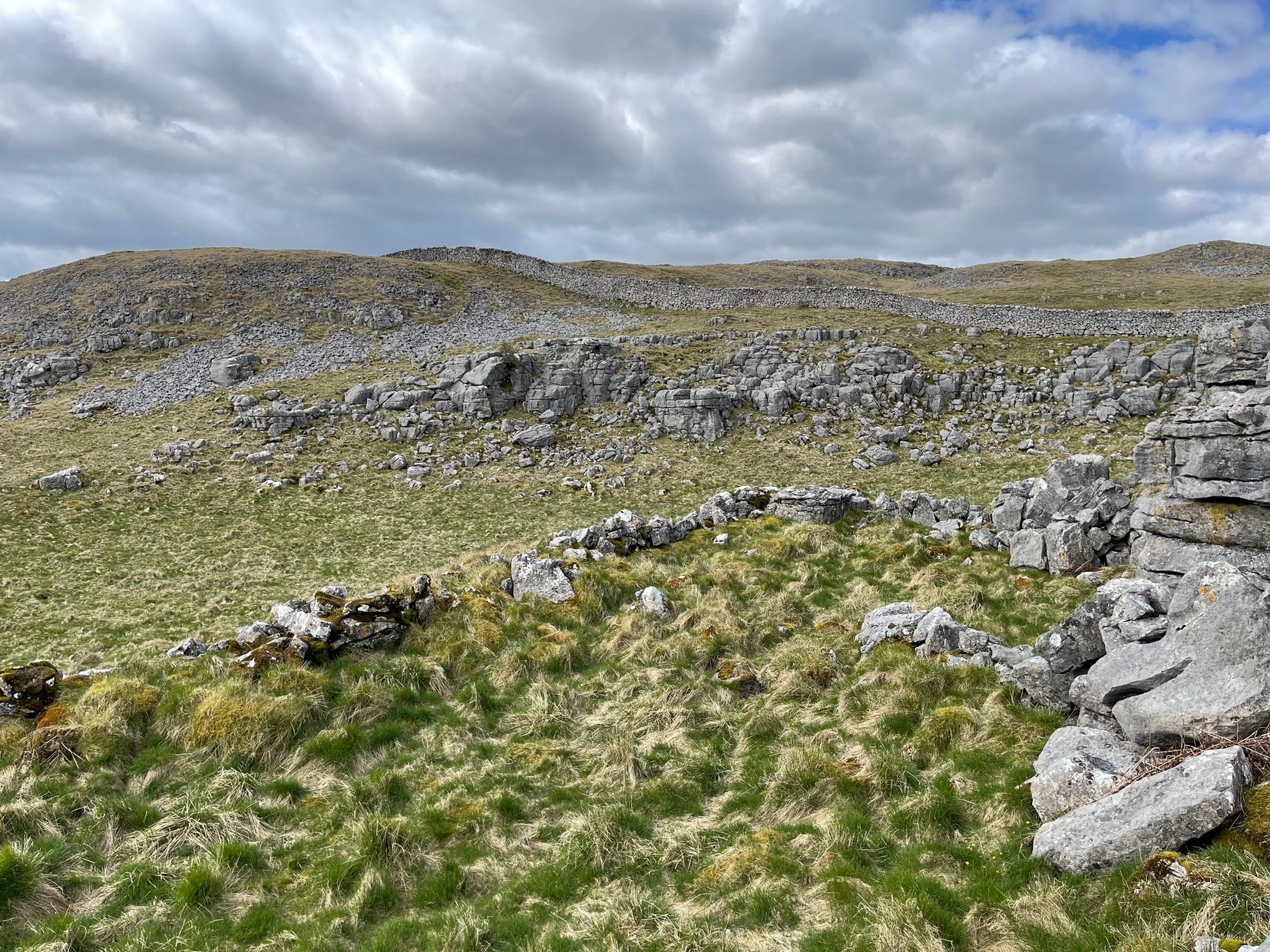
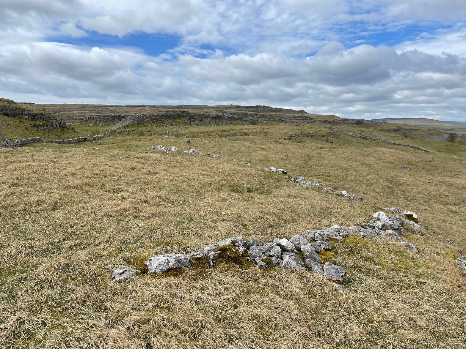
Walled section, looking W
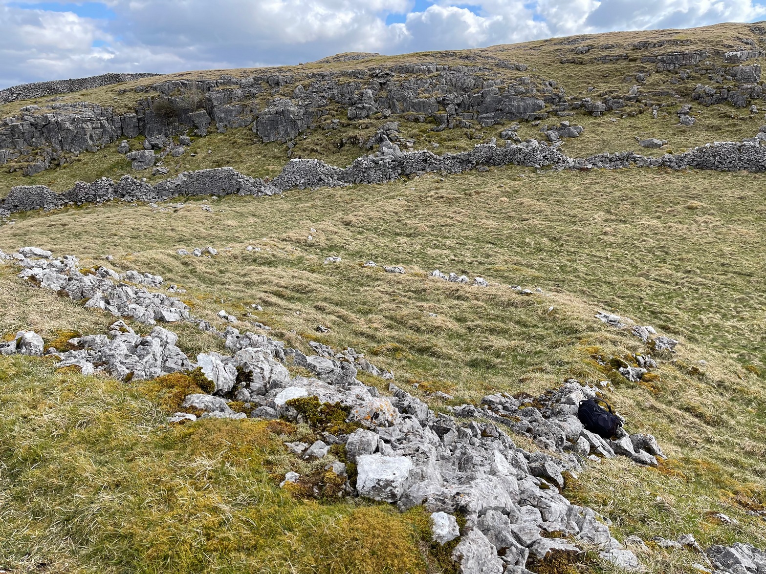
On top of a small rise in the land is this large, roughly rectangular walled enclosure measuring about 55 yards across at its longest axis (roughly WNW to ESE) and averaging 24 yards wide. The walling is pretty low down and, in some areas (mainly on its eastern edges) almost disappears beneath the vegetation—but you can still make it out – just! The southernmost edge of the enclosure is built upon a the edge of a natural rocky outcrop (typical of many enclosure and settlement sites in this neck o’ the woods) and when you stand on this section you see a very distinct rectangular enclosure, sloping down from here. This would likely have been where animals were kept as it makes no sense as a human living quarter due it being on a slope. But below this, where the land levels out, another low line of ancient walling reaches towards the high modern walls. This is one of three lines of ancient walling running, roughly parallel to the more modern walls (which themselves may have an Iron Age origin) from the main enclosure.
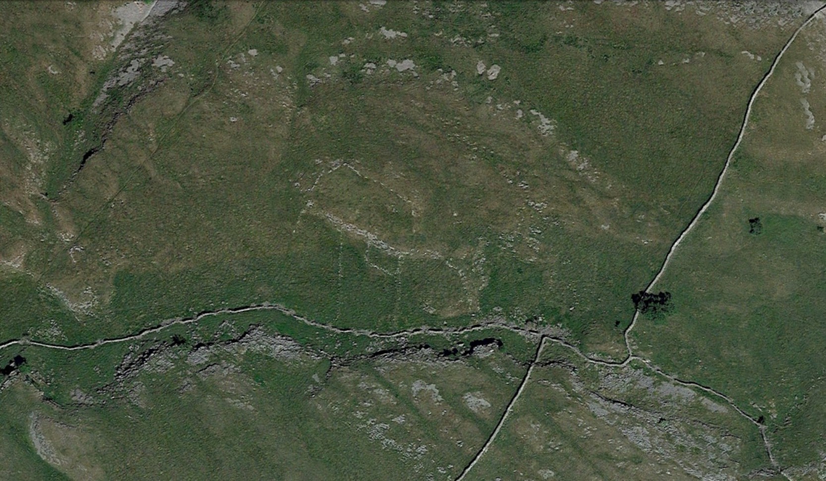
Aerial view of site
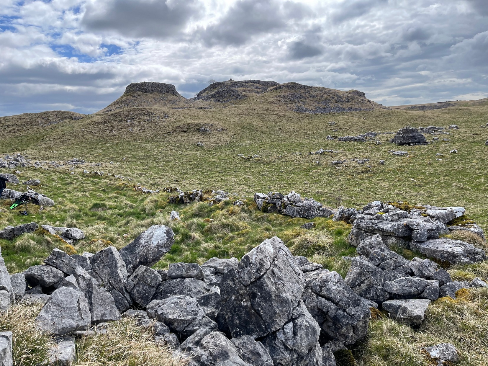
The entire structure is Iron Age in origin, but the site would have been in continual use throughout the Romano-British period and possibly even into early medieval centuries (though only an excavation would confirm that). Its basic architecture is replicated in the many other prehistoric settlements that still exist on the hills all round here (there are dozens of them). You’ll see this clearly when you visit the High Sleets enclosure less than 400 yards southwest from here.
Go up the B6160 road, heading for Kilnsey Crag. A few hundred yards past here, take the road to Arncliffe and, several hundred yards along, keep yer eyes peeled for the (usually) decent craggy dry stream bed on your left (west). Follow this upstream till you hit the large cave, continuing uphill above the crags, following the steep walling upwards to the next set of crags. Above these, another long straight line of walling continues in the same direction you’ve been walking. Follow this along until it meets up with another large line of walling, heading NE. Walk along here till this wall changes direction NE, but here you need to walk across the grasses westwards, past the large cave for another 100 yards. You’ll find it!
Archaeology & History
This is a simple but well-preserved circular monument, probably constructed in the Iron Age, just 100 yards past the incredible Douky Bottom cave (in which various prehistoric remains have been found). No excavations appear to have been made here, yet the near-perfect ring is in very good condition indeed. The monument consists of thousands of small stones – taken from the huge scree immediately behind the structure – whose uppermost visible mass overlays a much older and larger pile of stones, all of roughly the same size.
Douky Bottom ring, looking NE
The ring is less than 10 yards across and gives the impression of it being a large hut circle—which it may or may not be. Without an excavation we cannot know its function with any certainty. Other, much larger prehistoric enclosures and settlements are close by, mainly to the northeast; and you have the truly bizarre rock piles on the ghostly horizon crags, whose histories are quiet indeed…. For any antiquarians amongst you who’d like a good day out, give this region a try! It’s a truly intriguing arena with much much more hiding away than any of the archaeology records can tell you about.
Acknowledgements: Many many thanks to James Elkington for guiding us to the sites in this region.
From Threshfield, go up Skirethorns Lane for about 1/2 mile, where the lane takes a sharp right. Continue uphill for nearly 2 miles to a metal gate. Go through the gate into the fields on your left where you’ll see this pair of curious standing stones ahead of you (if you keep walking uphill in the same direction, you’ll reach the impressive Hammond Close enclosure above you).
Archaeology & History
There seem to be no references in either archaeology or geology texts about this site which, when you approach it and consider the prevalence of other prehistoric sites all round you, strongly suggests that they are either archetypal standing stones, or the remains of a collapsed cairn, with the surrounding mound removed. This is certainly the case at the Druid’s Altar or Bordley Circle visible a few hundred yards west of here, on the same grassland plain.
The stones alone, looking north
As you can see in the photos, the stones here are 4 feet tall and stand in isolation from the excess of neighbouring settlements and enclosures. A scatter of small stones—perhaps packing stones, perhaps the remains of cairn-spoil—is evident at the foot of the stones. It was initially thought that the uprights here could have been the remains of enclosure or settlement walling, as we find an excess of such remains on the hills here, but this isn’t the case. Other unrecorded prehistoric remains scatter this part of the countryside.
Follow the same directions to reach the Bordley ‘circle’ (it’s actually a much denuded burial site). Look up the hill (south) at the limestone escarpments above you, walk past the Hammond Close Stones and head up the slopes in front of you. If you get to the top of the hill without noticing the extensive prehistoric walled structures you’ve passed, then start to slowly amble here and around the tops and the slopes you’ve just walked up. They’re everywhere!
Archaeology & History
The grid reference here has to be considered as a general one. The site we’re looking at, upon the tops of this wonderful limestone-enriched hill, is quite extensive and covers much more than the simple eight-figure grid ref I’m using to direct you here. On the way up the slope from the Bordley ‘circle’ site, you’ll notice how the natural lines of limestone have been used to define lines of walling. The remains of many smaller stones have been laid into the natural rock outcrops, and others set into the earth and sectioned off smaller enclosures within the greater whole. It was obviously a huge and time-consuming exercise to create these large rocky sections, some of which appear to have actually been cut into the rock. The aerial image here shows clearly the lines as they were laid out, intruding the extensive natural bedrock covering the landscape, not just here but much further afield. Indeed, the large set of enclosures here at Hammond Field typifies dozens and dozens of other such sites in the hills north and west of here.
Enclosure walling running E-WTopmost line of walling
The trouble with this and other sites in the Upper Wharfedale region is dating them. Although we typically ascribe an Iron Age date to many of these settlements, we know that many of them were added to and maintained by peasants and farmers well into medieval times. And why not!? They’re excellent, solid and need little maintainance! The sections we’re looking at here in this particular site may have had their origins in the Bronze Age. It seems a reasonable assumption considering the existence of the Bordley circle site and several other denuded burials along the same ridge at the bottom of the slope. But the majority of the ‘enclosed’ sections running up and around this hill seem to have Iron Age and Romano-British stamps on them. It’s likely that some of the ‘enclosed’ sections would have been constructed to keep cattle in, aswell as being living quarters for people. At least one well-defined hut circle can be seen along the north-facing edge of the hill and, perhaps, even the fallen remains of a once upright standing stone.
The topmost part of the Hammond Close hill is all but surrounded by Nature’s limestone, with a large oval grassy region in the middle of it all; but on the eastern side of the hill, the natural limestone walls are lacking and so were supplemented by the work of people who built an additional protective line of walling, running north for some 45 yards from the small craggy ridge at the top, along the level, until it meets up with more natural limestone. The man-made walling is built into this aswell. Halfway along this length of north-south walling is another section, running to the east for nearly 40 yards before bending slightly for another 25 yards into yet more natural outcrop.
Partition walls on north slopeStretches of walling: from ancient to modern
I could spend the next few paragraphs describing all the walled sections visible on this hill and down its edges, but don’t wanna bore you with the small detail of it all! Aswell as that, if you climb over the eastern walls and walk a short distance across the rocky hill, you’ll start seeing other prehistoric settlement remains beneath your feet. And on the hill across directly to your north, we find more extensive remains at the very large Lantern Holes settlement, dating again from the Iron Age, if not earlier.
The ancient remains are all over the place round here! So those of you who love good outdoor wanderings, prehistoric archaeological sites and excellent views, give this place your attention! It’s well worth it!
References:
Dixon, John & Phillip, Journeys through Brigantia – volume 2: Walks in Ribblesdale, Malhamdale and Central Wharfedale, Aussteiger: Barnoldswick 1990.
From Threshfield, go up Skirethorns Lane for about 1/2 mile, where the lane takes a sharp right. Continue uphill for nearly 2 miles to a metal gate. Go through the gate, where you’ll see a pair of curious standing stones ahead of you, but instead walk about 250 yards along the line of the old field wall running to the west. You’ll see on the modern OS-map that a ‘cairn’ is shown: this is where you’re heading!
Archaeology & History
First highlighted on the 1852 OS-map of Bordley and district, this is a lovely site in a beautiful setting, surrounded by a veritable mass of other prehistoric remains at all quarters, including the large settlement of Hammond Close immediately south, the little-known settlement at Kealcup to the west, the Lantern Holes settlement up the hill immediately north, some standing stones due east, and much more. Although it was described in Aubrey Burl’s Four Posters (1988) as just such a type of megalithic relic (a “four-poster stone circle”), an earlier description of the site from the mighty pen of Harry Speight (1892) told of a much more complete ring of stones, with trilithon to boot. He wrote:
“This prehistoric relic consists of a round stone and earthen mound, about 150 feet in circumference and 3 feet high, and was formerly surrounded by a circle of upright stones, only three of which are now left standing. On one side was a large flat stone resting upon two others, and known as the Druid’s Altar. On the adjoining land an ancient iron spear-head was found some years ago, and fragments of rudely-fashioned pottery have also from time to time turned up in the same neighbourhood.”
Edmund Bogg’s (1904) description following his own visit a few years later described this “remains of Druidical sacrifice” as consisting of,
“a mound some four feet high, and fifty yards round the outer rim. In the centre are two upright stones about four feet in length; and others nearly buried in the mound. Numerous stones from this circle have been used in building the adjoining walls.”
Bordley Circle, looking SEBordley Hill, looking south to Pendle Hill
A decade later another writer (Lewis 1914) merely copied what Speight and Bogg had recited previously. And whatever the modern books might tell of its status, I think we can safely assert that this was originally a much more substantial monument than the humble four-poster stone circle that meets our eye nowadays. Our megalithic magus, Aubrey Burl (1988), wrote the following on Bordley’s druidical stones:
“On a circular mound 41ft (12.5m) across and 3ft (1m) high, three stones of local limestone form the corners of a rectangle 11ft 6in (3.5m) square, from which the SW stone is missing. At its corner is ‘a stump, possibly the base of a prostrate stone,’ 5ft 10in (1.8m) long, now lying near the centre. The tallest stone, 3ft 7in (1.1m) high is at the south-east. The sides of the square are close to the cardinal points. Between the SW and SE stones is a scatter of round cairnstones… Characteristically, the 4-Poster stands at the edge of a terrace from which the lands falls steeply to the west.”
Plan of the Druid’s Altar (after Burl, 1988)
The Druid’s Altar seems to have originally been a large prehistoric tomb, perhaps even a chambered cairn. Its situation in the landscape where it holds a circle of many outlying hills to attention, almost in the centre of them all, was evidently of some importance. The only geographical ‘opening’ from here is to the south, where a long open valley widens to capture the grandeur of Pendle Hill, many miles away. This would not have been insignificant.
We must also draw attention to what may be a secondary tumulus of similar size and form to the mound that the Druid’s Altar sits upon only some 25 yards to the west of the “circle”. The shape and form of this second mound is similar to that of our Druid’s Circle — though to date, it seems that no archaeologist has paid attention to this secondary feature. It measures some 21 yards (east-west) x 19 yards (north-south) in diameter and has the appearance of a tumulus or buried cairn. The mound may be of a purely geological nature, but this cannot safely be asserted until the attention of the spade has been brought here.
Druid’s Altar, Bordley (drawing by Neil Wingate, 1976)
Folklore
Although we have nothing directly associated with the circle, the surrounding hills here have long been known as the abode of faerie-folk. Threshfield — in whose parish this circle lies — is renowned for it. There have been accounts of curious light phenomena here too. Modern alignment lore tells the site to be related to the peaked tomb above Seaty Hill, equinox west of here.
References:
Bogg, Edmund, Higher Wharfeland, James Miles: Otley 1904.
Burl, Aubrey, Four Posters: Bronze Age Stone Circles of Western Europe, BAR 195: Oxford 1988.
Feather, S.W. & Manby, T.G., ‘Prehistoric Chambered Tombs of the Pennines,’ in Yorkshire Archaeological Journal, Vol 42, 1970.
Lewis, A.L., ‘Standing Stones and Stone Circles in Yorkshire,’ in Man, no.83, 1914.
Raistrick, Arthur, ‘The Bronze Age in West Yorkshire,’ in Yorkshire Archaeological Journal, Vol 29, 1929.
Speight, Harry, The Craven and Northwest Yorkshire Highlands, Elliott Stock: London 1892.
Wingate, Neil, Grassington and Wharfedale, Grassington 1977.