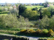
Witch Tree, Aberuthven, Perthshire

Sacred Tree:  OS Grid Reference – NN 9621 1587

Getting Here

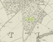
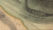
Witch Tree on 1901 OS-map

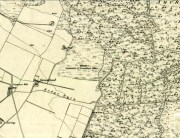
Witch Tree on 1901 OS-map

Just off the A9 between Stirling and Perth is Aberuthven village.  Down the Main Street and just south of the village, turn west along Mennieburn Road.  A half-mile on, just past Ballielands farm, you reach the woods.  Keep along the road for another half-mile, close to where the trees end and go through the gate where all the rocks are piled. Walk up to the tree-line 50 yards away and follow it along the line of the fence east, til it turns down the slope.  Naathen – over the barbed fence here, close to the corner, about 10 yards in, is the tree in question…

Archaeology & History

Witch Tree03

Looking along the fallen trunk

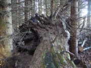
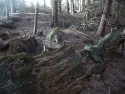
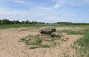
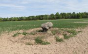
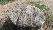
Laid down on the peaty earth, fallen perhaps fifty years ago or more, are the dying remains of this all-but forgotten Witch Tree.  To those of you who may strive to locate it—amidst the dense eye-poking branches of the surrounding Pinus monoculture—the curious feature on this dying tree are a number of old iron steps or pegs, from just above the large upturned roots.  About a dozen of them were hammered into the trunk some 100 years or more ago and, were it to stand upright again, reach perhaps 30 feet high or more.  These iron pegs give the impression of them being used to help someone climb the tree when it was upright; but their position on the trunk and the small distance between some of them shows that this was not their intention.  Their purpose on the tree is a puzzle to us (does anyone have any ideas?).

Embedded pieces or iron from roots...

Embedded iron from the roots

Embedded iron 30-40ft along

Embedded iron 30-40ft along

The fallen trunk has broken into two main sections, each with iron pegs in them.  The very top of the tree has almost completely been eaten back into the Earth.  Unfortunately too, all the bark has completely rotted away and so identifying the species of the tree is difficult (though I’m sure there are some hardcore botanists out there who’d be able to enlighten us).  The possibility that the early map-reference related to a Wych-elm (Ulmus glabra) cannot be discounted, although this would be most unusual for Ordnance officers to mistake such a tree species with a ‘witch’.  Local dialect, of course, may have been a contributing factor; but in Wilson’s (1915) detailed analysis of the regional dialect of this very area, “wych elm” for witches does not occur.  Added to this is the fact that the indigenous woodland that remains here is an almost glowing birchwood (Betula pendula) in which profusions of the shaman’s plant, Amanita muscaria, exceed.  There were no wych elms hereby.

The tree was noted by the Ordnance Survey team in 1899 and was published on their maps two years later, but we know nothing more about it.  Hence, we publish it here in the hope that someone might be able top throw some light on this historical site.

Folklore

Looking along the fallen trunk

Halfway along the fallen tree

We can find nothing specific to the tree; but all around the area there are a plethora of tales relating to witches (Hunter 1896; Reid 1899)—some with supposedly ‘factual’ written accounts (though much of them are make-believe projections of a very corrupt Church), whilst others are oral traditions with more realistic tendencies as they are rich in animistic content. One of them talks of the great mythical witch called Kate McNiven, generally of Monzie, nearly 8 miles northwest of here.  She came to possess a magickal ring which ended up being handed to the owners of Aberuthven House, not far from the Witch Tree, as their associates had tried to save her from the crazies in the Church.  This may have been one of the places where she and other witches met in bygone centuries, to avoid the psychiatric prying eyes of christendom.

Until the emergence of the Industrialists, trees possessed a truly fascinating and important history, integral to that of humans: not as ‘commodities’ in the modern depersonalized religion of Economics, but (amongst other things) as moot points—gathering places where tribal meetings, council meetings and courts were held. (Gomme 1880)  The practice occurred all over the world and trees were understood as living creatures, sacred and an integral part of society.  The Witch Tree of Aberuthven may have been just such a site—where the local farmers, peasants, wise women and village people held their traditional gatherings and rites.  It is now all but gone…

References:

  1. Gomme, Laurence, Primitive Folk-Moots, Sampson Lowe: London 1880.
  2. Hunter, John, Chronicles of Strathearn, David Philips: Crieff 1896.
  3. Reid, Alexander George, The Annals of Auchterarder and Memorials of Strathearn, Davdi Philips: Crieff 1899.
  4. Wilson, James, Lowland Scotch as Spoken in the Lower Strathearn District of Scotland, Oxford University Press 1915.

© Paul BennettThe Northern Antiquarian


MacBeth’s Stone, Belmont, Meigle, Perthshire

Standing Stone / Cup Marked Stone:  OS Grid Reference – NO 27997 43473

Also Known as:

  1. Canmore ID 30824
  2. Siward’s Stone
  3. Witches’ Stone

Getting Here

MacBeth's Stone, near Meigle

MacBeth’s Stone, near Meigle

From the centre of Meigle village, you need to go along the country lane southwest towards the village of Ardler (do not go on the B954 road).  About three-quarter of a mile (1.25km) along—past the entrance to Belmont Castle—you’ll reach a small triangle of grass on your left, and a driveway into the trees.  Walk down here, past the first house—behind which is the stone in question.  A small path takes you through the trees and round to it.  You can’t really miss it!

Archaeology & History

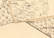
MacBeth Stone on 1st OS-map

MacBeth Stone on 1st OS-map

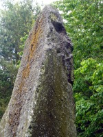
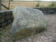
This is a magnificent site.  A giant of a stone.  Almost the effigy of a King, petrified, awaiting one day to awaken and get the people behind him!  It has that feel of awe and curiosity that some of us know very well at these less-visited, quieter megalithic places. Its title has been an interchange between the Scottish King MacBeth and the witches who played so much in his folklore, mixed into more realistic local traditions of other heathen medicine-women of olde…

The first account of this giant standing stone came from the travelling pen of Thomas Pennant (1776) who, in his meanderings to the various historical and legendary sites of Meigle district, wrote that

“In a field on the other side of the house is another monument to a hero of that day, to the memory of the brave young Seward, who fell, slain on the spot by MacBeth.  A stupendous stone marks the place; twelve feet high above ground, and eighteen feet and a half in girth in the thickest place.  The quantity below the surface of the Earth is only two feet eight inches; the weight. on accurate computation amounts to twenty tons; yet I have been assured that no stone of this species is to be found within twenty miles.”

It was visited by the Ordnance Survey lads in 1863, several years after one Thomas Wise (1855) had described the monolith in an article on the nearby hillfort of Dunsinane.  But little of any substance was said of the stone, and this is something that hasn’t changed for 150 years, despite the huge size of this erection!  Local historians make mention of it in their various travelogues, but the archaeologists haven’t really given the site the attention it deserves.  Even the Royal Commission (1994) report was scant; and apart from suggesting it to have a neolithic provenance, they merely wrote:

“Rectangular in cross-section, the stone tapers to a point some 3.6m above the ground; each of its sides is decorated with cupmarks, as many as forty occurring on the east face and twenty-four on the west.”
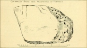
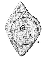
MacBeth Stone (Wise 1884)

MacBeth Stone (Wise 1884)

East face of MacBeth's Stone

East face of MacBeth’s Stone

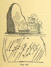
Thankfully, the fact that there are cup-markings on the stone has at least given it the attention it deserves amongst the petroglyph students.  The first account of the cup-markings seem to have come from the pen of Sir James Simpson (1867) who mentions them, albeit in passing, in his seminal work on the subject.  A few years later however, the same Thomas Wise visited MacBeth’s Stone again, and not only described the carvings, but gave us our first known illustration in his fascinating History of Paganism (1884).  He told it to be,

“A large boulder, some 12 tons in weight, situated within the policies of Belmont Castle, in Strathmore, Perthshire…is supposed to have been erected on the spot where MacBeth was slain.  Two feet above the ground this boulder has a belt of cups of different sizes, and in irregular groups.  None of these cups are surrounded by incised circles or gutters.  This boulder was probably intended for some sacred purpose, as it faces the SE.”

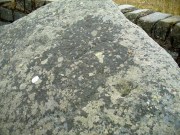
Running almost around the middle of the standing stone, on all four sides, are the great majority of the cup-markings (no rings or additional lines are visible).  They were very obviously etched into the stone after it had been erected, not before.  This is in stark contrast to the cup-and-rings found on the standing stones at Machrie, Kilmartin and elsewhere, where we know the carvings were done before the stones were stood upright.
Cup-narks on western face

Cup-narks on western face

Cups on the western face

Cups on the western face

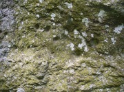
On the northern face of the stone is one possible cup-marking, and three of them are etched onto its south face; but the majority of them, forty, are on its western face, and twenty-five on its eastern side.  The great majority of them on the east and west sides occur roughly in the middle of the stone, almost like a ‘belt’ running across its body.  Those on the eastern face are difficult to discern as a thick layer of lichens covers this side, so there may be even more beneath the vegetation.

An increasingly notable element in the singular monoliths of this region, echoed again here, is that at least one side of the standing stone is smooth and flat—in the case of MacBeth’s Stone the flat face is the eastern one.  Whether this was a deliberate feature/ingredient in some of the standing stones, I do not know.  If there was such a deliberate reason, it would be good to know what it meant!

The 'face' in the top of the stone

The ‘face’ in the top of the stone

Close-up of Macbeth's face

Close-up of Macbeth’s face

Another fascinating feature at this site was noticed by Nina Harris of ‘Organic Scotland’.  Meandering around the stone in and out of the trees, she called our attention to a fascinating simulacra when looking at the upper section of the monolith on its southern side.  At first it didn’t seem clear – but then, as usual, the more you looked, the more obvious it became.  A very distinct face, seemingly male, occurs naturally at the top of the stone and it continues as you walk around to its heavily cup-marked western side.  It’s quite unmistakable!  As such, it has to be posited: was this simulacra noticed by the people who erected this stone and seen as the spirit of the rock?  Did it even constitute the reason behind its association with some ancestral figure, whose spirit endured here and was petrified?  Such a query is neither unusual nor outlandish, as every culture on Earth relates to such spirit in stones where faces like this stand out.

But whatever your opinion on such matters, when you visit this site spend some time here, quietly.  Get into the feel of the place.  And above all, see what impression you get from the stony face above the body of the stone. Tis fascinating…..

Folklore

Known locally as being a gathering place of witches, the site is still frequented by old people at certain times of the year, at night.  The stone’s association with MacBeth comes, not from the King himself (whose death occurred many miles to the north), but one of his generals.  In James Guthrie’s (1875) huge work on the folklore of this region, he told that this giant

“erect block of whinstone, of nearly twenty tons in weight…(is) said to be monumental of one of his chief officers”,

which he thought perhaps gave the tale an “air of probability about it.”  But Guthrie didn’t know that this great upright was perhaps four thousand years older than the MacBeth tradition espoused!  However, as Nick Aitchison (1999) pointed out in his singular study of the historical MacBeth,

“another MacBeth was sheriff of Scone in the late twelfth century and it is possible that he, and not MacBeth, King of Scots, is commemorated in the name.”

He may be right.  Or it the name may simply have been grafted onto the stone replacing a more archaic relationship with some long forgotten heathen elder.  We might never know for sure.

When Geoff Holder (2006) wrote about the various MacBeth sites in this area, he remarked that the folklore of the local people was all down to the pen of one Sir John Sinclair, editor of the first Statistical Account of the area—but this is a gross and probably inaccurate generalization.  Nowhere in Holder’s work (or in any of his other tomes) does he outline the foundations of local people’s innate subjective animistic relationship to their landscape and its legends; preferring instead, as many uninformed social historians do, to depersonalise the human/landscape relationships, which were part and parcel of everyday life until the coming of the Industrial Revolution.  Fundamentally differing cultural, cosmological and psychological attributes spawned many of the old myths of our land, its megaliths and other prehistoric sites.  It aint rocket science!  Sadly, increasing numbers of folklore students are taking this “easy option” of denouncement, due to educational inabilities.  It’s about time researchers started taking such misdirected students to task!

References:

  1. Aitchison, Nick, MacBeth – Man and Myth, Sutton: Stroud 1999.
  2. Coutts, Herbert, Ancient Monuments of Tayside, Dundee Museum 1970.
  3. Guthrie, James C., The Vale of Strathmore – Its Scenes and Legends, William Paterson: Edinburgh 1875.
  4. Hazlitt, W.C., Faiths and Folklore: A Dictionary, Reeves & Turner: London 1905.
  5. Holder, Geoff, The Guide to Mysterious Perthshire, History Press 2006.
  6. MacNeill, F. Marian, The Silver Bough – volume 1, William MacLellan: Glasgow 1957.
  7. MacPherson, J.G., Strathmore: Past and Present, S. Cowan: Perth 1885.
  8. Michell, John, Simulacra, Thames & Hudson: London 1979.
  9. Pennant, Thomas, A Tour in Scotland and Voyage to the Hebrides – volume 2, London 1776.
  10. Royal Commission on the Ancient & Historical Monuments of Scotland, South-East Perth: An Archaeological Landscape, HMSO: Edinburgh 1994.
  11. Simpson, James, Archaic Sculpturings of Cups, Circles, etc., Upon Stones and Rocks in Scotland, England and other Countries, Edmonston & Douglas: Edinburgh 1867.
  12. Wise, Thomas A., “Notice of Recent Excavations in the Hill Fort of Dunsinane, Perthshire,” in Proceedings Society of Antiquaries, Scotland, volume 2, 1855.
  13. Wise, Thomas A., History of Paganism in Caledonia, Trubner: London 1884.

Acknowledgements:  With huge thanks to Paul Hornby for his help getting me to this impressive monolith; and to Nina Harris, for prompting some intriguing ideas.

© Paul BennettThe Northern Antiquarian


Witches Stone, St. Martin’s, Perthshire

‘Standing Stone’:  OS Grid Reference – NO 15927 31609

Also Known as:

  1. Canmore ID 28628

Getting Here

The Witches Stone of MacBeth

Going north-eastish from the city of Perth, take either the A93 or A94, turning west along the A93 a mile south of Guildtown, or east at Balbeggie on the A94, until you reach St. Martin’s hamlet and park up just below the church opposite the old cottages. Walk up the track below the cottages (not the one above them!) for ⅘-mile (1.35km) [past the ruined Cupar Stone Circle], and where the land has levelled out and in the huge flat field on your left, you’ll eventually reach a gate and see the odd-looking ‘rock’ about 250 yards away in the middle.

Archaeology & History

A fungal morel turned to stone

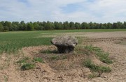
In a quiet and little-known parish that was once littered with about a dozen stone circles, there remains a most curious and fascinating stone which, in earlier days, was to be seen on the open moorlands at this spot.  The area was then forested and then the agriculturalists came with their farming and destroyed the forests, leaving the old stone as it presently stands, isolated, above the hamlet of St. Martin’s to the south.  Although it was described in the 19th century as being “four feet high”, it stands barely three feet tall, is very curiously-shaped—just like a morel mushroom from some angles—and in the middle of an extensive piece of flatland where the crops barely grow.

Witches Stone on 1866 map

Witches Stone, looking west

The stone was highlighted on the first OS-map of the parish in 1866, showing it in the woodland plantation of Eastmuir.  It may have been some sort of northern outlier related to the now-destroyed stone circle of Cupar 400 yards south; and if this was the case, its position in the landscape relative to the circle would give the Witches Stone an airt (virtue ascribed to cardinal directions) in the cycle of the year that relates to darkness and death. (Perhaps oddly—perhaps not—the name of parish St. Martin’s relates to that dark period in the calendar, as St. Martin’s day in the old calendar was Samhain or Halloween: old New Year’s Day, when the spirits of the dead moved across both land and skies.)

It was erroneously described by the Canmore lads as being little more than “a glacial erratic”, but the stone here is quite earthfast; and their idea that “its peculiar shape has probably been caused by wind erosion”, is also somewhat dubious considering the shape of other monoliths and megalithic rings in the region.  The stone has an appearance similar to some Bull Stones, where the animal was chained to rocks such as this and then baited by dogs, although I can find no such lore here. Indeed, the history and archaeology of the stone seems all but silent.  Its folklore however, would have the Shakespearian romanciers amongst you flocking to the place…

Deep grooves atop of the stone

The top of the stone has some very distinct and deep-cut lines running across it at angles, and has the appearance of being cut into at some time in the dim and distant past.  By whom, and for what reason, we cannot say.

Folklore

William Richie (1845) told us that in the 11th Century when Scotland was having to deal with the english disease of stealing land and spreading its violence, King MacBeth—whose castle stood within this parish at Cairnbeddie (NO 1498 3082)—took that advice of two witches, and that

“they met him one night at a place still called ‘the Witch Stane’ (where a remarkable stone still stands), about a mile from his old residence, and warned him to beware, ‘Till Birnam forest come to Dunsinane.’”

The 1860 Name Book told us that,

“The Moor where the witches met, which is in St. Martins Parish is yet pointed out by the country people, and there is a stone still preserved, which is called the Witches Stone.”

References:

  1. Scott, Aleander, St. Martin’s and Cambusmichael, Perth 1911.
  2. Richie, William, “St. Martins and Cambusmichael,” in New Statistical Account of Scotland – volume 10: Perthshire, William Blackwood: Edinburgh 1845.

Acknowledgements:  Huge thanks to Prof Paul Hornby for showing me this site. Cheers matey!

© Paul BennettThe Northern Antiquarian


Wells o’ Wearie, Duddingston, Edinburgh, Midlothian

Sacred Wells (destroyed):  OS Grid Reference – NT 2741 7241

Also Known as:

  1. Wells o’ Weary
  2. Well of Wery

Archaeology & History

Wells o' Wearie ponds

The Wells o’ Wearie ponds

The precise spot for these “wells” is difficult to say today with any certainty, which is unfortunate as it was a renowned spot for a variety of reasons.  The wells were apparently disrupted and fell back into the Earth when the Industrialists dug their train-line into the south-side of Arthur’s Seat.  On the early maps, we can see several ‘troughs’, ‘pumps’ and ‘wells’—one or more of which are said to be the site (and which we base the OS grid-reference on, above).

Shown on Kirkwood's 1821 map

Shown on 1821 Kirkwood map

The Wells of Wearie were one of nearly a dozen sacred and healing wells surrounding legendary Arthur’s Seat at the edge of Edinburgh, and whose waters were also said to have supernatural properties.  Shown on James Kirkwood’s 1821 map of Edinburgh (left) as the ‘Well of Wery’, this curiously named site was renowned in earlier centuries as an excellent water supply for the local people — “to cure the weary traveller” for one.  Today, all we have left of them are the small ponds immediately below the road, next to the converted railway line path, just as you come out of the long tunnel.

Folklore

In Henderson & Cowan’s (2007) fine work on Scottish fairy lore, they outline the witchcraft trial of a local woman, Janet Boyman, who was said to have performed ritual magick at the Wells of Wearie.  They told:

“Jonet Boyman of Canongate, Edinburgh, accused in 1572 of witchcraft and diabolic incantation, the first Scottish trial for which a detailed indictment has so far been found. Indeed, it is one of the richest accounts hitherto uncovered for both fairy belief and charming, suggesting an intriguing tradition which associated, in some way, the fairies with the legendary King Arthur.  At an ‘elrich well’ on the south side of Arthur’s Seat, Jonet uttered incantations and invocations of the ‘evill spreits quhome she callit upon for to come to show and declair’ what would happen to a sick man named Allan Anderson, her patient.  She allegedly first conjured ‘ane grit blast’ like a whirlwind, and thereafter appeared the shape of a man who stood on the other side of the well, and interesting hint of liminality.  She charged this conjured presence, in the name of the father, the son, King Arthur and Queen Elspeth, to cure Anderson.  She then received elaborate instructions about washing the ill man’s shirt, which were communicated to Allan’s wife.  That night the patient’s house shook in the midst of a huge and incomprehensible ruckus involving winds, horses and hammering, apparently because the man’s wife did not follow the instructions to the letter.  On the following night the house was plagued by a mighty din again, caused, this time, by a great company of women.’”

The Wells were, in earlier centuries, a site where lovers and wanderers came to relax and dream. It was a traditional gathering spot — not just for witches! — and poetry was written of them – including this by A.A. Ritchie:

“The Wells o’ Wearie — 

Sweetly shines the sun on auld Edinbro’ toun.
And mak’s her look young and cheerie;
Yet I maun awa’ to spend the afternoon
At the lanesome Wells o’ Wearie.

And you maun gang wi’ me, my winsome Mary Grieve,
There’s nought in the world to fear ye;
For I hae ask’d your minnie, and she has gien ye leave
To gang to the Wells o’ Wearie.

O the sun w-inna blink in thy bonny blue een.
Nor tinge the white brow o’ my dearie.
For I’ll shade a bower wi’ rashes lang and green,
By the lanesome Wells o’ Wearie.

But Mary, my love, beware ye dinna glower
At your form in the water sae clearly,
Or the fairy will change ye into a wee wee flower,
And you’ll grow by the Wells o’ Wearie.

Yestreen, as I wander’d there a’ alane,
I felt unco douf and drearie,
For wanting my Mary a’ around me was but pain
At the lanesome Wells o’ Wearie.

Let fortune or fame their minions deceive,
Let fate look gruesome and eerie ;
True glory and wealth are mine wi’ Mary Grieve,
When we meet by the Wells o’ Wearie.

Then gang wi’ me, my bonny Mary Grieve,
Nae danger will daur to come near ye.
For I hae ask’d your minnie, and she has gien ye leave
To gang to the Wells o’ Wearie.”

References:

  1. Baird, William, Annals of Duddingston and Portobello, Andrew Elliot: Edinburgh 1898.
  2. Bennett, Paul, Ancient and Holy Wells of Edinburgh, TNA: Alva 2017.
  3. Carrick, John D. (ed.), Whistle-Binkie, or the Piper of the Party – volume 2, David Robertson: Glasgow 1878.
  4. Colston, James, The Edinburgh and District Water Supply, Edinburgh 1890.
  5. Henderson, Lizanne & Cowan, Edward J., Scottish Fairy Belief: A History, John Donald: Edinburgh 2007.
  6. Ramsay, Alexander, On the Water Supply of Edinburgh, Neill & Co.: Edinburgh 1853.

© Paul BennettThe Northern Antiquarian


Witch’s Stane, Craigie, Ayrshire

Legendary Rock (destroyed):  OS Grid Reference – NS 4268 3231

Also Known as:

  1. Canmore ID 42851
  2. White Stane
  3. Witches’ Stone

Archaeology & History

It is difficult to assess the precise nature of this megalithic site, sadly destroyed some two hundred years ago.  The Royal Commission thinks it may have been a rocking stone, but the legend said of it indicates it to have been associated with a giant prehistoric cairn, although nothing remains nowadays.  The site was mentioned briefly in James Patterson’s (1863) huge work on the townships of Ayrshire, where he described the site as “standing upright” and “being in a field on Lodgehouse Farm,” near the village church.

“It stood on three stones, so high that a man could crawl under. It was blasted in 1819 to build houses.  The farmer’s wife, it is said, took some antipathy to it, and would not give her husband rest until he consented to have it removed.  A person of the name of Jamieson, and an assistant, were employed to blast it, which was accordingly done.  When broken up, it filled twenty-four carts.  Such was the feeling of sacrilege occasioned by the removal of the stone, that it was observed the farmer’s wife became blind, and continued so for eight years, when she died. Jamieson, who blasted it, never did well afterwards.  He drank and went to ruin.”

Serves them right!  Additional lore gained from a local lady in the 1870s has one of those all-too-familiar elements to it, speaking of something more substantive.

Folklore

When Archibald Adamson (1875) wrote his fine work on the history of Kilmarnock and district, folklore elements more typical of the Cailleach—whose legends abound in our more northern climes—seemed to have been attached to this missing site.  It is worth telling in full:

“After partaking of refreshments in the village inn, and indulging in a chat with the landlord, I retraced my steps to the highway, and in doing so got into conversation with an old lady who was very loquacious and well versed in the lore of the district. Amongst other things, she informed me that once on a time the church of Craigie had a narrow escape of being destroyed by a witch who had taken umbrage at it. It seems that the hag selected a large stone, and having placed it in her apron, flew with it in the direction of the building with the intention of dropping it upon its roof.  Her design, however, was frustrated by the breaking of her apron strings, for, upon nearing the object of her spleen, they gave way, and the stone fell with a crash that shook the earth. This accident seemingly so disheartened the carlin that she abandoned the destructive idea and allowed her burden to lie where it fell. The boulder lay in a field near the churchyard wall, and was known as “The White Stane.” It was long regarded with superstitious awe by many; but the farmer on whose ground it lay being of a practical turn of mind, looked upon  it with an eye to utility, and had it blasted for building purposes. Strange to relate, when broken up the debris filled twenty-five carts–a circumstance that would lead one to suppose that the witch must have been very muscular, and must have worn a very large apron.”

It is most likely that the witch in this legend originally set off from the Witch’s Knowe, more than 500 yards to the west of the church (and still untouched, despite the mess of the quarrying immediately adjacent).  Any further information on this missing site would be greatly appreciated.

References:

  1.  Adamson, Archibald S., Rambles round Kilmarnock, T. Stevenson: Kilmarnock 1875.
  2. Paterson, James, History of the Counties of Ayr and Wigton – volume 1, James Stillie: Edinburgh 1863.

© Paul BennettThe Northern Antiquarian


Witches Stones, Kirkton of Auchterhouse, Angus

Cup-and-Ring Stones (lost):  OS Grid Reference – NO 345 392

Also Known as:

  1. Canmore ID 31908
  2. Greenfield Knowe
  3. Greenford Knowe
  4. Sidlaw Hospital
  5. Spittal Stones

Archaeology & History

1843 map showing the 'Stone'

1843 map showing the ‘Stone’

We have no precise location for this carving, nor several of its petroglyphic relatives who lived within this arena for countless centuries until (you guessed it!) the advance of the Industrialists brought their profane ways to the region, with the usual disregard for local people and their unwritten traditions.   Which is a great pity, for there were obviously some old stories and important archaeology hereby.  Aubrey Burl (1988) for one, thought this cup-and-ring carving may have played its part in being one of the stones in a larger “four-poster” stone circle, although local history accounts tell that it was part of an impressive prehistoric tomb.

One of the Witches Stones

One of the Witches Stones

The Witches’ Stone we see illustrated here was one of at least two carvings in a cluster of stones.  The great J. Romilly Allen (1881) wrote about the it, although it seems he never visited the site himself.  Instead, his description came from that of a colleague, a Mr W. McNicoll, who told him that at the position marked on the early OS-map as a single “Stone” that was “Remains of a Druidical Altar” there were in fact

“two in number: one, an upright pointed stone, 5ft by 2ft by 3ft 6in high; ans the other lying 3ft 6in to the southwest, 7ft 6in by 5ft by 2ft 6in thick.  The latter has fifteen cups, varying from 2 to 3in in diameter; one with a single ring carved on the sloping face at the south end of the stone.  It lies horizontally and has two hollows, worn at the ends where the cups are, by the toes of persons climbing onto the top.  The ground under this stone has been partly removed and it appears to rest on two others; but the whole appears to be natural and not a cromlech or rocking stone.”

Folklore

One of the Witches Stones

One of the Witches Stones

Reference was made to this “Witches Stone” in the 1860 Object Name Book of the region, where it was said to have been part of a larger group, “considered to have been used by the Druids as a place of worship.”  This catch-all phrase of druidic relevance should be translated as “local traditional importance” where animistic rites of some sort would have occurred.  Certainly we find the usual reverence or fear in the local tale told by Mr Hutcheson (1905) which he thankfully recorded following his visit to the site:

“Here…occupying a small knoll known locally as Greenfield Knowe, towards the western end of the plateau…two upright standing stones of boulder character formed a conspicuous feature.  They were, if tradition be accepted, the survivors of a larger group.  The same tradition records that the farmer of Greenfield Farm, requiring stones for the erection of dykes, removed some of the standing stones from Greenfield Knowe.  He, however, speedily found unexpected difficulty in carrying out his intentions.  The dykers whom he had employed absolutely refused to use the stones, alleging they would thereby bring misfortune upon themselves and families, , and threatened, rather than risk such calamities, to throw up the job.

“While in this quandry the farmer, it is said, had a vision: a ghostly figure appeared to him, and in a hollow voice warned him against interference with he stones on Greenfield Knowe, and concluded by the adjuration, “Gang ower the howe t’ anither knowe.”  Needless to say, the farmer lost no time in obeying his ghostly visitor.  Next morning he carted back the stones he had removed and sought material for his dykes elsewhere.”

This is probably the same tale, slightly reformed, which the local historian W.M. Inglis (1888) described, when he told that,

“About the beginning of the present century, when a worthy old parishioner was having some repairs carried out upon his house, he removed a few of the large stones with the intention of having them built into the walls.  Throughout the night, however, an eerie feeling came over him, his conscience was on fire, he could get no rest.  Accordingly he got out of bed, yoked his horse into the cart, and like a sensible man replaced yjr sacred stones where he found them, went home, and thereafter slept the sleep of the righteous.”

…to be continued…

References:

  1. Allen, J. Romilly, “Notice of Prehistoric Remains near Tealing, in Forfarshire” in Journal of British Archaeological Association, volume 37, 1881.
  2. Burl, Aubrey, Four Posters: Bronze Age Stone Circles of Western Europe, BAR 195: Oxford 1988.
  3. Hutcheson, Alexander, “Notice of the Discovery of Stone Coffins at Auchterhouse,” in Proceedings of the Society of Antiquaries, Scotland, volume 39, 1905.
  4. Inglis, W. Mason, Annals of an Angus Parish, John Leng: Dundee 1888.

© Paul BennettThe Northern Antiquarian


Girdle Stane, Dunnichen, Angus

Cup-and-Ring Stone:  OS Grid Reference – NO 52808 49737

John Sheriff's 1995 drawing of Girdle Stane

John Sheriff’s 1995 drawing of Girdle Stane

Also Known as:

  1. Canmore ID 34662
  2. Dunnichen 1
  3. Girdlestane
  4. The Girdle Stane of Dunnichen
  5. Girdle Stone

Getting Here

From The Square in Letham village, go north up Auldbar Road and out of the village for 0.6 miles (1km).  Shortly before reaching the road junction at the top, on the left-side of the road is a recess with a stone and a small aging plaque telling you that you’ve reached the Girdle Stane.

Archaeology & History

The Girdle Stane

The Girdle Stane

This cup-and-ring stone is not in its original position.  Although we know from Ordnance Survey records in the 1860s that it was located about 130 yards north of here, close to the road junction, even that is unlikely to have been its original position—but we know not where that might have been!  It is an undoubted multi-period carving, with the earliest section being our typical neolithic or Bronze Age cup-and-ring near the centre of the stone, with several outlying cup-marks toying with our intellect as per usual!  The central cup-and-ring may have an incised line running down out of it, although this isn’t highlighted on John Sheriff’s (1995) drawing of the stone.

Girdle Stane on 1865 map

Girdle Stane on 1865 map

Surrounding the central archetype, by some distance, is a much wider carved ring that almost reaches to defines the edges of the stone itself.  This large encircling motif and other features of the petroglyph—including a large elongated “S” and marks that were probably executed by the Ordnance Survey lads at the bottom corner—were ingredients which prompted Sir James Simpson (1867) to question the veracity of the Girdle Stane’s antiquity.  He wrote:

“The so-called ‘Girdle-stone’ in the…parish of Rescobie, about four feet long and three broad, is cut on its surface with two circles, the largest of which is above two feet and a half broad, and hence does not, I believe, belong to the class which we are considering in this essay”—

More recent "S"-shaped motif

More recent “S”-shaped motif

Close-up of cups, ring and lines

Close-up of cups, ring and lines

i.e., neolithic or Bronze Age petroglyphs.  And you can see his point!  My first impression when Prof Paul Hornby and I visited the site a few days ago, after the initial “that’s a cup-and-ring in the middle”, was to proclaim: “that bit’s much more recent, maybe Pictish?”  But it probably isn’t even Pictish.  This “more recent” carved element is a distinct large elongated “S”, which may have been marked onto it when the stone was used as a township boundary marker between the local parishes.  The grand historical writer Alex Warden (1882) talks about this in his magnum opus, saying:

“At the junction of two roads, a little to the northeastward of Letham, there is a rough boulder, about five feet long by three in breadth, having on its face a circle of about thirty inches in diameter, and another smaller circle about six inches across.  It is called the Girdle Stane of Dunnichen, from the larger circle resembling the utensil called the girdle, s.c. This stone marks the boundaries between the parishes of Dunnichen and Rescobie, also between the lands of Dunnichen and Ochterlony (Balmadies).  It is probably the Grey Stone referred to in a note on the marches of Dunnichen, about 1280.”

Folklore

The folklore of the stone indicates how its origins are rooted in prehistory, despite the later additional symbols.  Alex Warden (1882) tells the all-too-familiar creation myth, usually symptomatic of giant prehistoric cairns:

“Tradition says a witch was carrying this boulder from ‘the Crafts’ of Carmylie in her apron, when the strings broke, and the stone fell where it now lies.”

Carmyllie Hill is 5 miles (8km) to the south and is a place rich in fairy-lore and vandalized prehistoric sites.

References:

  1. Coutts, Herbert, Ancient Monuments of Tayside, Dundee Museum 1970.
  2. Kidd, Scott, The Churches of the Parish of Dunnichen, David Winter: Dundee 1995.
  3. Sherriff, John, “Prehistoric rock-carving in Angus,” in Tayside & Fife Archaeological Journal, volume 1, 1995.
  4. Simpson, James, Archaic Sculpturings of Cups, Circles, etc., Upon Stones and Rocks in Scotland, England and other Countries, Edmonston & Douglas: Edinburgh 1867.
  5. Warden, Alex J., Angus or Forfarshire – volume 3, Charles Alexander: Dundee 1882.

© Paul Bennett, The Northern Antiquarian


Footprint Stone, Dunadd, Kilmichael Glassary, Argyll

Petroglyph:  OS Grid Reference – NR 83668 93579

Also Known as:

  1. Canmore ID 212008

Getting Here

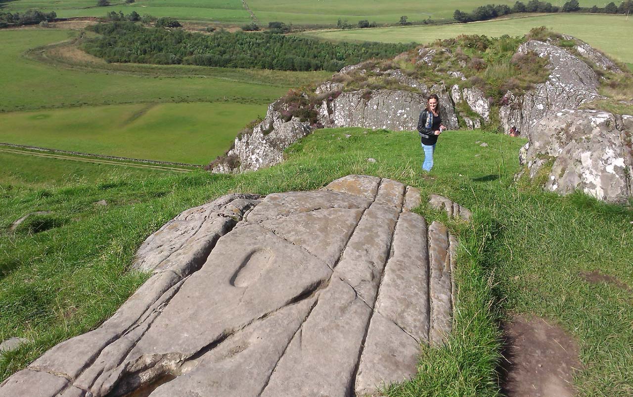
Footprint Stone in context

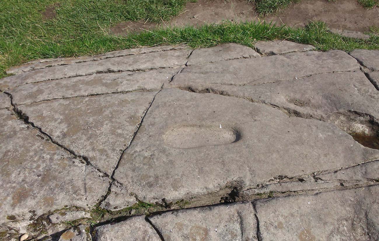
From Lochgilphead, take the A816 road north for several miles (towards the megalithic paradise of Kilmartin), keeping your eyes peeled for the road-signs saying “Dunadd.”  Turn left and park-up a few hundred yards down. Go through the gate and walk up Dunadd.  Just before the flattened plateau at the top, a length of smooth stone is accompanied to its side by the deep cup-and-ring of the Dunadd Basin.  Three or four yards away, you’ll see the long ‘footprint’.

Archaeology & History

Near the top of Dunadd’s Iron Age ‘fortress’ and overlooking the megalithic paradise of the Kilmartin valley, several man-made carvings are in evidence very close to each other, all with seemingly differing mythic content.  This one—the footprint—stands out; but it’s not alone!  Faint etchings of at least one other ‘foot’ is clearly visible.  The first literary account of it was by Ardrishaig historian R.J. Mapleton (1860), who told,

“There is on the top of Dunadd a mark that strikes me as interesting; it is like a large axe-head, or a rough outline of a foot.  My impression is that it may have been the spot on which the chief would place his foot when succeeding to the headship of his tribe. The footmark was always considered among the people here as a mould for an axe-head, and I was rather laughed at for suggesting an inaugurating stone.”

Dunadd Footprint (after Royal Commission 1988)
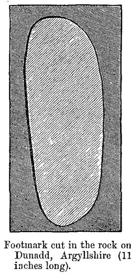
F.W.K. Thomas’ 1879 sketch

Be that as it may, a few years later the carving had caught the attention of the Scottish Society of Antiquaries.  In his article exploring the potential for ritual inaugurations at Dunadd, Captain F.W.L. Thomas (1879) explored, not only the footprint, but the mythic functions of this symbol, looking at parallels with petroglyphs elsewhere in the world where the ‘foot’ was known to be a ritual inauguration symbol (amongst other things).  He gave us the first real detailed account of the carving:

“About 10 or 12 feet below, and to the northward of the highest point, the living rock is smooth, flat and bear of sward, and in it is engraved an impression of a footmark, not of a naked foot, but such as would be made when the foot is clothed by a thick stocking or cuaran… The engravure is for the right foot; and it exactly fitted my right boot.  The footmark is sunk half-an-inch deep, with perpendicular sides, the surface is smoothed or polished, and the outline is regular… It has probably been sheltered by the turf until recently.  The footmark is 11 inches long, nearly 4½ inches broad where broadest, and 3½ inches across at the heel.  When a person stands with his foot in the depression, he looks a little easterly of north.”

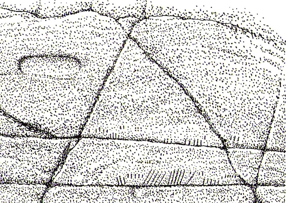
A century or so later when the Royal Commission (1988) boys got here, they found not one, but two ‘feet’ carved into the rock!  A few feet away, near to the carved boar,

“At the south end of the main rock surface there is the lightly-pecked outline of a shod right foot. 0.24m long and 0.1m in maximum width, with a pronounced taper to the heel.  There are further peck marks within the outline, and a sunken footmark was intended but not completed.  This print is on almost the same alignment as the more prominent footprint some 2m to the north, which measures 0.27m from NNE to SSW, by 0.1m in maximum width and 25mm in depth.  It is somewhat broader at the heel than the incomplete mark, and its sides are straighter.”

Close-up of the carving

They then emphasize how we’re unable to date the footprints, although point out how such carvings are “found in Britain from the Iron Age onwards.”  But footprints have be found on other petroglyphs in Scotland (much less in England) and date between the neolithic and Bronze Age periods—but whether Dunadd’s example goes that far back, we cannot say.  Extensive excavations occurred at Dunadd between 1980-81 and most of the finds were Iron Age and early medieval in nature (this carving and the cup-and-ring barely got a mention in Lane & Campbell’s [2000] extensive summation).  But we may be looking at an evolutionary developmental relationship in symbolism and form, if the traditions of the place have any substance.  This is something I’ll return to when writing of the Boar Carving, just a few feet away…

Folklore

The legends behind this seemingly insignificant mark near the top of Dunadd ostensibly echo and relate to the huge cup-and-ring of Dunadd Basin four yards away.  I can only repeat what I said in that site profile.

R.J. Mapleton (1860) said that Dunadd was known by local people to be a meeting place of witches and the hill of the fairies, whose amblings in this wondrous landscape are legion. Legends and history intermingle upon and around Dunadd.  Separating one from the other can be troublesome as Irish and Scottish Kings, their families and the druids were here.  One such character was the ever-present Ossian.  Mapleton told:

“From these ancient tales we turn to a much later period of romance, when Finn and his companions had developed into extraordinary and magical proportions; a story is current that when Ossian abode at Dunadd, he was on a day hunting by Lochfyneside; a stag, which his dogs had brought to bay, charged him; Ossian turned and fled. On coming to the hill above Kilmichael village, he leapt clean across the valley to the top of Rudal hill, and a second spring brought him to the top of Dunadd.  But on landing on Dunadd he fell on his knee, and stretched out his hands to prevent himself from falling backwards.  ‘The mark of a right foot is still pointed out on Rudal hill, and that of the left is quite visible on Dunadd, with impressions of the knee and fingers.’”

As Mr Thomas (1879) clarified:

“The footmark is that of the right foot, and the adjacent rock-basin is the fabulous impression of a knee.”

References:

  1. Bord, Janet, Footprints in Stone, Heart of Albion Press 2004.
  2. Campbell, Marion, Mid-Argyll: An Archaeological Guide, Dolphin Press: Glenrothes 1984.
  3. Campbell, M. & Sanderman, M., “Mid-Argyll: An Archaeological Survey,”  in Proceedings of the Society Antiquaries, Scotland, volume 95, 1962.
  4. Craw, J.H. “Excavations at Dunadd and other Sites,” in Proceedings of the Society Antiquaries, Scotland, volume 64, 1930.
  5. Lane, Alan & Campbell, Ewan, Dunadd: An Early Dalriadic Capital, Oxbow: Oxford 2000.
  6. Mapleton, R.J., Handbook for Ardrishaig Crinan Loch Awe and Pass of Brandir, n.p. 1860.
  7. Morris, Ronald W.B., The Prehistoric Rock Art of Argyll, Dolphin Press: Poole 1977.
  8. Royal Commission on the Ancient & Historical Monuments of Scotland, Argyll – Volume 6: Mid-Argyll and Cowal, HMSO: Edinburgh 1988.
  9. Thomas, F.W.K., “Dunadd, Glassary, Argyleshire: The Place of Inauguaration of the Dalriadic Kings,” in Proceedings of the Society Antiquaries, Scotland, volume 13, 1879.

© Paul BennettThe Northern Antiquarian 


Old Wife’s Stone, Batley, West Yorkshire

Standing Stone? (destroyed):  OS Grid Reference – SE 2428 2329

Archaeology & History

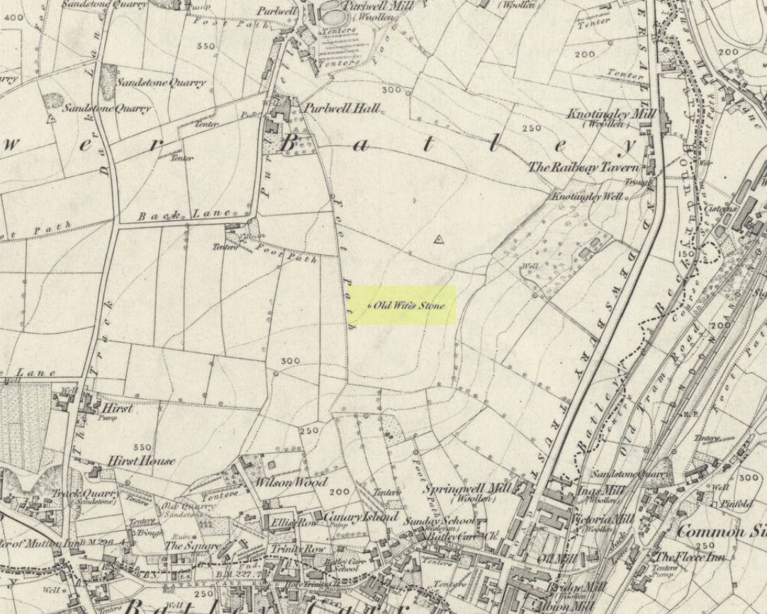
Old Wifes Stone on 1854 map

My first hint at the existence of this once valuable archaeological relic came as a result of me seeking out the history and folklore of some hitherto unknown, forgotten holy wells in the Batley and Dewsbury area.  I located the material I was looking for on the old wells, but my fortuitous discovery of this site, the Old Wife’s Stone, blew me away!

It was the place-name of ‘Carlinghow’ about one mile northwest of the grid-reference above that initially caught my attention.  From an antiquarian or occultist’s viewpoint, it’s intriguing on two counts: the first is the element ‘how‘ in Carlinghow, which can mean a variety of things, but across the Pennines tends to relate to either an ancient tribal or council meeting place, or a prehistoric burial cairn: an element that wasn’t lost in the giant archaeology survey of West Yorkshire by Faull & Moorhouse (1981).  But the first part of this place-name, ‘carling‘, was the exciting element to me; for it means ‘old woman,’ ‘old hag,’ ‘witch’ or cailleach!  The cailleach (to those who don’t know) was the prima mater: the Great Mother deity of our pre-christian British ancestors.  Meaning that Carlinghow hill was a hugely important sacred site no less—right in the heart of industrial West Yorkshire!  What is even more intriguing—or perhaps surprising—is that we have no record of such a powerful mythic creature anywhere in local folklore… Or so it first seemed…

Memory told me that no such prehistoric remains were recorded anywhere in that area—and certainly no prehistoric tombs.  I scoured through my library just to triple-check, and found the archaeological records as silent as I first thought.  Just to make sure I spent a day at the Central Library, where again I found nothing… So then I explored the region on the modern OS-maps, only to find that much of the area where the Carlinghow place-name existed was, surprisingly, still untouched by housing and similar modern pollutants. This was a great surprise to say the least.  And so to check for any potential archaeological sites which might once have been in the Carlinghow area, I turned to the large-scale 1850 OS-maps (6-inch to the mile).

This is when I came across the Old Wife’s Stone, marked in the middle of fields on the outskirts of old Batley.  There was no notice of it being a standing stone, or a simple boulder, or archaeological relic—nothing.  But its place-name compatriot of ‘Carlinghow’ was the rising hill about a mile to the northwest.  In days of olde, if Carlinghow was indeed the ‘burial tomb of the Old Woman’ or ‘meeting place of the cailleach’ (or whatever variants on the theme it may have been), it may have marked the setting sun on the longest day of the year if you had been standing at the Old Wife’s Stone – a midsummer sunset marker no less. (There are other ancient and legendary sites scattering northern England and beyond that are dedicated to the Cailleach, like the Old Woman Stone in Derbyshire, the Old Wife’s Neck in North Yorkshire, the Carlin Stone in Stirlingshire, the Old Woman Stone at Todmorden, Carlin Stone of Loch Elrig and many more.)

As if these curious ingredients weren’t enough to imply something existed in the heathen pantheon of Batley before the Industrialists swept away our indigenous history, we find echoes of the ‘Old Woman’ yet again, immediately east; this time where the animism of water and trees enfolded Her mythos in local rites and traditions, thankfully captured by the pens of several writers, and transmuted into another guise—but undeniably Her!  But that, as they say, is for another day and another site profile…

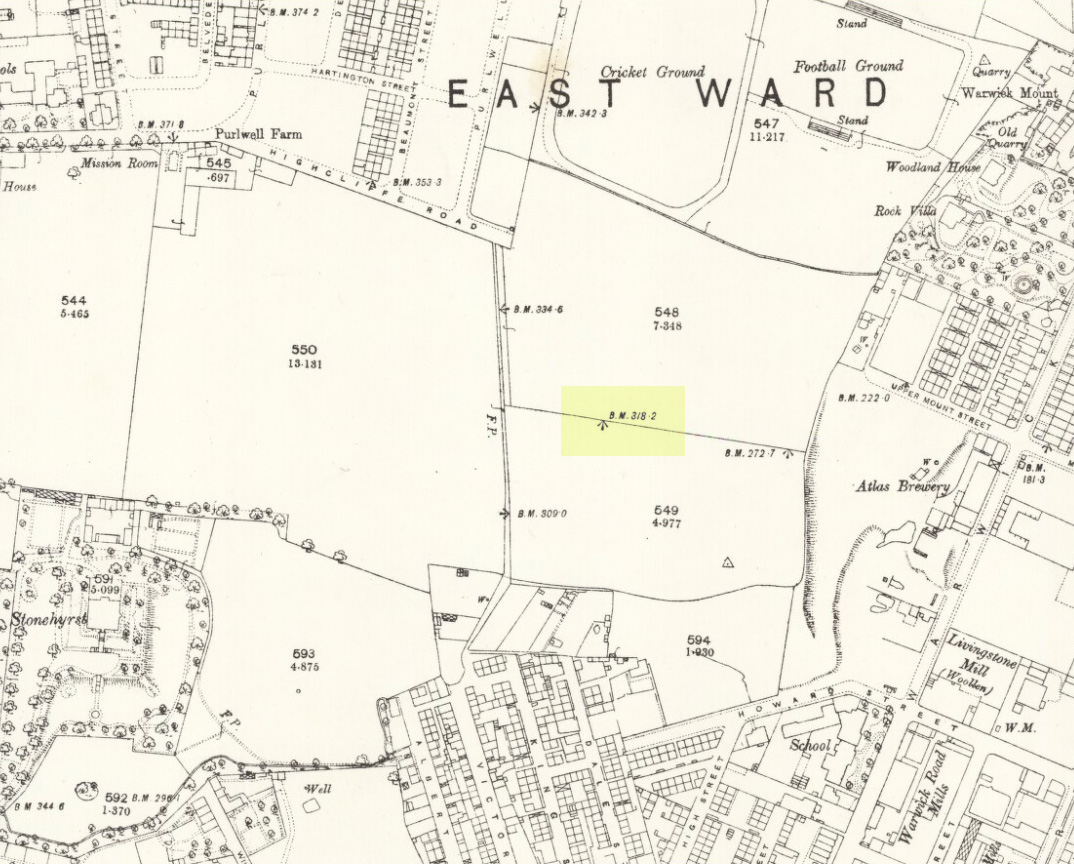
Position of stone in 1894

So is our Old Wife’s Stone (or for that matter, Carlinghow’s old tomb) still in evidence?  A school has been built where it was highlighted on the 1854 OS-map and, from the accounts of local people, seems to have long since disappeared.  The stone looks to have been incorporated into a length of walling, sometime between 1854 and 1888, and a bench-mark of “BM 318.2” carved onto it.  But when the Ordnance Survey lads re-surveyed the area in 1905, this had gone.  I have been unable to find any more information about this site and hope that, one day, a fellow antiquarian or occult historian might be able to unravel more of its forgotten mythic history.

References:

  1. Faull, M.L. & Moorhouse, S.A. (eds), West Yorkshire: An Archaeological Survey to 1500 AD – volume 1, WYMCC: Wakefield 1981.
  2. Goodall, Armitage, Place-Names of South-west Yorkshire, Cambridge University Press 1914.
  3. Keighley, J.J., ‘The Prehistoric Period’, in Faull & Moorhouse, 1981.
  4. o’ Crualaoich, Gearoid,  The Book of the Cailleach, Cork University Press 2004.
  5. Smith, A.H., English Place-Name Elements – volume 2, Cambridge University Press 1956.
  6. Smith, A.H., The Place-Names of the West Riding of Yorkshire – volume 2, Cambridge University Press 1961.
  7. Wright, Joseph, English Dialect Dictionary – volume 1, Henry Frowde: London 1898.

Acknowledgements:  Many thanks for the assistance of Simon Roadnight and Julia King in the Batley History Group.

© Paul Bennett, The Northern Antiquarian

Warlocks’ Tomb, Muckhart, Clackmannanshire

Tomb/s (lost):  OS Grid Reference – NS 9928 9865

Archaeology & History

Site of Warlock’s Tomb

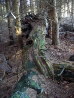
A fascinating site that was described in Johnston & Tullis (2003) local history work on the parish of Muckhart. Amidst an area bedevilled with faerie, boggarts, ghosts and historical shamanic moot sites we find more curious folklore pointing at a long forgotten site, whose age and precise nature remains a mystery.  Adjacent to the old boundary line, close to the meeting of streams, the Muckhart authors told that,

“an orchard above the old farmhouse to this day remains mainly untouched.  It was the burial site of warlocks from the parish and it is thought some may have even been burned at the Mill.  It has always been said that this ground should never be touched!  There is an ancient rubble bridge over the Hole Burn which has a Masonic Eye painted on it to ward off any unwelcome spirits.  Despite the eye, both the Farmhouse and the Millhouse have been home to many strange and ghostly manifestations.”

The folklore sounds to be a mix of archaic and medieval animistic traits: perhaps of a prehistoric cairn, visited and maintained by local people (as found throughout Britain) until the Burning Times, when christian fanatics arrived, debasing the cultural rites and murdering local innocent people.  …Perhaps not.

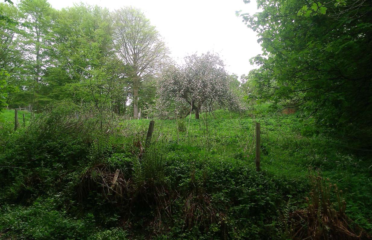
Looking down on the orchard

When Paul, Maggie and I explored the area a few days ago, we were greeted most cordially by the owner of Muckhart Mill, who knew of the folklore, but didn’t know the exact whereabout of the grave.  We couldn’t find any clues as to its exact location either.  Apart, perhaps, from the top of the hill immediately above the orchard where, alone and fenced off with an old covered (unnamed) well, a solitary Hawthorn tree stood.  We each recalled the aged relationship that Hawthorn has in witch-lore… but that’s as far as it went.  The grave remains hidden and may have been destroyed. If anyone discovers its whereabouts, please let us know so that a preservation order can be made to ensure its survival.

References:

  1. Johnston, Tom & Tullis, Ramsay (eds.), Muckhart, Clackmannanshire: An Illustrated History of the Parish, MGAS 2003.

© Paul Bennett, The Northern Antiquarian