Once located on the south side of the stream between the ‘lost’ village of Eastburn and the cottages at Battleburn, this burial mound was one of many explored by the great J.R. Mortimer (1905), who told that:
“On June 24th, 1884, it measured about 40 feet in diameter and 4½ in elevation, and had a depression in the centre, which might have been caused by a former opening. By the old inhabitants of the neighbourhood it is known — like several other similar mounds near settlements — by the name of Mill Hill. A 15-feet square was cut from the centre and the natural ground beneath was found to consist of 3 feet of clay, resting upon chalk gravel. Through this clay and into the chalk gravel beneath was a roughly-cut trench, 3½ feet deep by about 3 feet wide, running north and south the whole width of our excavation and beyond, and from about the centre of the mound a similarly roughly-formed trench was observed to run east and west…”
In the sections that Mortimer and his fellows excavated, they uncovered various intriguing deposits, including the remains of ox, goats and horses. Later deposits were also located in and around the mound, showing it had been used in more recent centuries.
Folklore
Mortimer suggested this site was once an old moot site; comparing it to a place of the same name a short distance west at Kirkburn.
References:
Mortimer, J.R., Forty Years Researches in British and Saxon Burial Mounds of East Yorkshire, A. Brown & Sons: London 1905.
Holy Well (destroyed): OS Grid Reference – SE 295 329
Archaeology & History
In the Holbeck area of Leeds, one of the three spa wells was previously patronised to this mythical saint, whose wells profuse in this part of the world. St. Helen’s Well (later becoming the Holbeck Spa Well) was found at the appropriately named St. Helens Bridge. Ralph Thoresby (1715) wrote of the place: a supposed medicinal holy well, it previously had a chapel by it, of which no trace is seen today. John Mayhall (1860) also mentioned this “medicinal well,” but told little more. It was Andrea Smith (1982), more than a century later, who wrote the most about the place:
“In connection with the well by St.Helen’s Bridge, Holbeck, (Thoresby) refers to “another ancient fabrik called St. Helen’s,” but there is a difficulty in deciding exactly what he means by ancient; it is taken here as meaning more than two hundred years old. This suggests, then, that by St. Helen’s Bridge there was once a well and chapel which gave rise to the dedication and which was probably a Medieval foundation, considering the popularity of St. Helen at that time.”
Both of these sites have long since disappeared. The well eventually became known as a local Spa Well, and was found to possess a high sulphur content.
References:
Mayhall, John, The Annals of Yorkshire, Joseph Johnson: Leeds 1860.
Smith, Andrea, ‘Holy Wells Around Leeds, Bradford & Pontefract,’ in Wakefield Historical Journal 9, 1982.
Thoresby, Ralph, Ducatus Leodiensis: or the Topography of the Ancient and Populous Town and Parish of Leedes, Robinson & Holdsworth: Leeds 1816.
The easiest way to get here if you’re coming for the first time is via the A6068 Glusburn to Cowling road. On the south side of Cowling, take the small road Old Lane, uphill on the east side of the road (very easily missed – keep your eyes peeled!) and keep going up until the road just about levels out, where there’s a muddy parking spot on your left (the giant Wainman’s pinnacle is down the path from here). Cross over the road and head up towards the giant Hitching Stone. When you reach the first fence, cross over it and follow it into the boggy heathlands to your right (west-ish). Head into the tribbly grass and keep walking for 3-400 yards till you see the large rock growing out of the Earth.
Archaeology & History
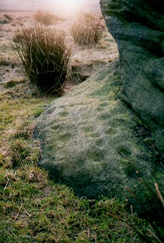
Cup-markings near ground-levelLooking from above
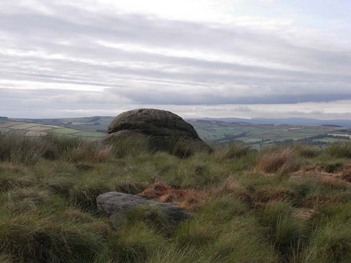
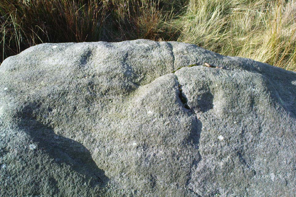
Not far from the legendary Hitching Stone is this curiously-shaped boulder sitting peacefully and alone in its landscape. It is in fact a large cup-marked boulder, previously unrecorded until being described in The Old Stones of Elmet. On top of the stone it seems that there are no definite man-made cup-markings, but there are a number of seemingly natural ones (although some could have been etched thousands of years ago and have just eroded well); instead the real cup-markings are found curiously etched at the base of this large rock, just above ground-level.
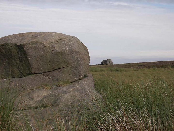
Hitching Stone on horizon
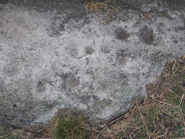
As can be seen in the photos, on its lower south-facing edge there are around 20 well-defined cups that clearly stand out. No other cup-marked stones appear to be nearby (surely there’s a few more kicking about in the area…?).
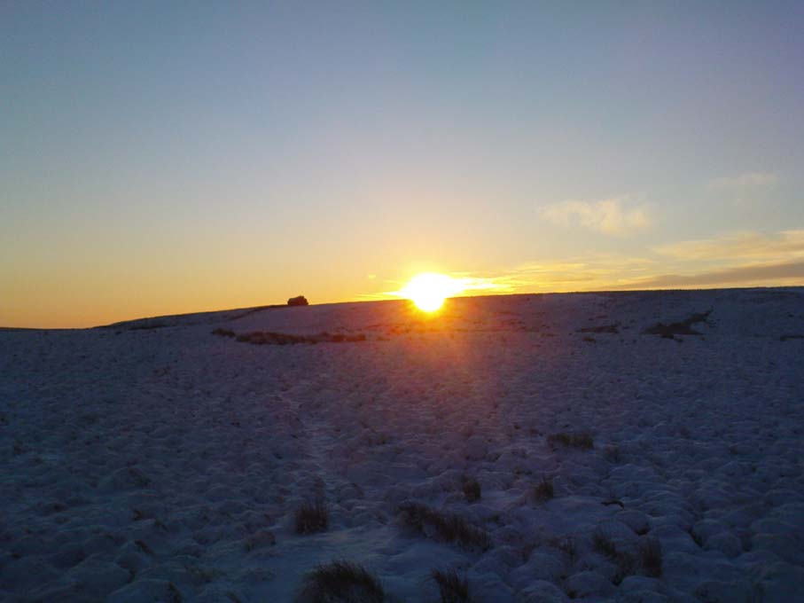
An earlier assertion I made (2001) about the nearby Hitching Stone aligning with the winter solstice sunrise from here was recently put to bed following the morning observations of myself and Dave Hazell on December 21st, 2010, when — as can be seen in the photo here — the midwinter sun emerges from the land a few degrees of arc further southeast than expected. However, I aint checked what the alignment here would have been when the cup-markings were first etched here, around 5000 years ago perhaps… Would any of you archaeo-astronomers out there know about this?
Follow the same directions to reach the Big Rock carving. From here walk less than 100 yards up the slope, veering to your left and where you reach the rushes (Juncus grasses), walk up and keep your eyes peeled for the singular upright rock. Or as ‘Redkiteyorks’ said, go “up the slope 82.4 metres, 54.5 degrees(True) from IAG108 (Big Rock).” It aint hard to find really…
Archaeology & History
Another stone mainly for the purists amongst you. Little has been written on this possible carving. Boughey & Vickerman (2003) said simply:
“Large rough rock. Two possible cups on top and one further possible cup on W vertical face. Doubtful”.
References:
Boughey, K.J.S. & Vickerman, E.A., Prehistoric Rock Art of the West Riding, WYAS: Leeds 2003.
Hedges, John (ed.), The Carved Rocks of Rombald’s Moor, WYMCC: Wakefield 1986.
Bleasdale Ring & enclosure plan (Syd Wilson, 1900)
Pretty easy to find, and a nice walk to boot! Head up to Bleasdale Church (worth a look in itself!), keep going up the path north to the aptly named Vicarage Farm. From here you’ll notice a small copse of trees on your left (east) heading to the hills. To those of you who like Predator, “it’s up there – in them trees…!”
Archaeology & History
On my first visit here in the company of John Dixon and other TNA regulars, my first impression was “this is a henge” – and noted subsequently that it’s been described as such by several writers. But the general category given to this fascinating place is a ‘timber circle.’
Bleasdale ‘henge’ circle
First discovered at the end of the 19th century and described in considerable detail by Mr Dawkins (1900), this is a gorgeous-looking monument was erected in at once a gentle and tranquil, aswell as an imposing natural setting, at the foot of Fair Snape Fell (to the northwest) and Bleasdale Fell (due southwest). These aspects of the landscape would have had obvious mythic importance to the people who built this ring amongst the trees. A condensed version of Dawkin’s material was described in J. Holden’s (1980) Story of Preston, that outlined this circle as being,
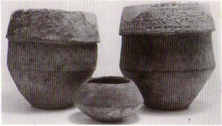
“a centre for religious worship in about 1700 BC. It was made up of a circle of timber posts which enclosed an area 45 metres in diameter. In the centre was a small mound surrounded by a ring of oak posts and a circular ditch. Inside the mound there was a grave that had in it two pottery urns filled with human bones and ashes. Examination of the contents of these urns shows that the bodies were wrapped in linen and burnt on a funeral pyre. A small ‘accessory’ cup was found inside one of the urns and this may have contained food or drink for the afterlife.”
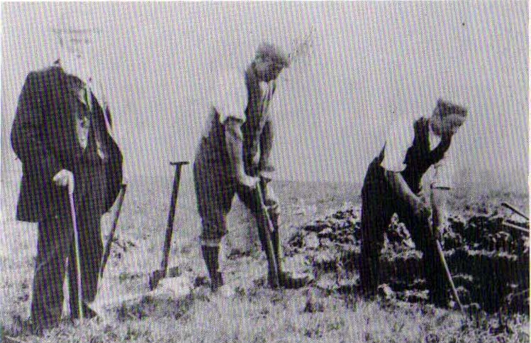
Urns from Bleasdale Ring1898 photo of Shadrach Jackson (left) & Tom Kelsall (centre) digging the site
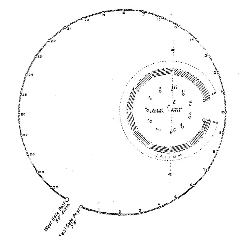
Located within a much larger circular enclosure, the internal Bleasdale ‘henge’ Ring consisted of a small circle of eleven timber posts near the edge of the ditch, and an entrance way to the east, to or from which was an avenue of further wooded posts that led to the edge of the larger enclosure. It gives the impression that this was some sort of avenue along which a ceremonial procession may have took place, strongly suggesting a ritual function. Robert Middleton (1996) told that,
“The post circle and barrow appear to respect each other (in date), whilst the enclosure may be later. The post circle has been dated to around 2200 BC, although the context and reliability of this date is unclear.”
Looking out eastwards from the middle of the internal henge-style ring and through the ‘entrance’ we find an alignment with a large notch on the skyline which, modern folklore ascribes, is where the midwinter sun rises — which is very believable, but I aint seen it proven anywhere yet.
A much greater and full excavation report of this site was written by Raymond Varley (2010), whose essay I urge fellow antiquarians to read.
References:
Dawkins, W.B., ‘On the Exploration of Prehistoric Sepulchral Remains of the Bronze Age at Bleasdale,’ in Transactions of the Lancashire & Cheshire Antiquarian Society, volume 18, 1900.
Dixon, John, Journeys through Brigantia – volume 8: Forest of Bowland, Aussteiger Publications: Barnoldswick 1992.
Edwards, Ben, “The History of Archaeology in Lancashire”, in Newman, 1996.
Gibson, Alex, Stonehenge and Timber Circles, Tempus: Stroud 1998.
Holden, Jennifer (ed.), The Story of Preston, Harris Museum: Preston n.d. (c.1980)
Middleton, Robert, “The Neolithic and Bronze Age,” in Newman, 1996.
Newman, Richard (ed.), The Archaeology of Lancashire, Lancaster University 1996.
Sever, Linda (ed.), Lancashire’s Sacred Landscape, History Press: Stroud 2010.
Stone Circle (destroyed): OS Grid Reference – NY 37 50
Archaeology & History
Listed in Burl’s (2000) magnum opus, this is another long-lost megalithic ring, whose exact location seems to have been forgotten. An early description of the site by William Whellan (1860) told us that,
“There was formerly a circle of rude stones, ten yards in diameter, near the village, supposed to have been the remains of a Druidical temple; and a little distance from it, was a tumulus, three yards high and eight in diameter.”
More than a hundred years later in Waterhouse’s (1985) fine survey, he described the circle, saying:
“It lay near the village of Dalton…near the River Caldew… An 18th century account describes it as consisting of ‘rude’ stones…set in a circle of diameter about 27m. East of the the centre of the circle were four large stones lying on top of each other. They may have been the remains of a cist, or possibly a tumbled cove, like that inside the circle-henge of Arbor Low in Derbyshire. A tumulus may have stood nearby.”
There are however some discrepancies in the descriptions between Whellan and Waterhouse. In the former, the site of Chapel Flat is talked of separately as being the abode of a hermit in the lost chapel of St. Wynemius, “in a deep and romantic part of the vale of Caldew.” The description of the stone circle immediately follows this, but is spoken of as merely being “near the village.”
Does anyone know anything further about this once important site? Did the lost hermitage on Chapel Flat actually have anything to do with the stone circle?
References:
Burl, Aubrey, The Stone Circles of Britain, Ireland and Brittany, Yale University Press 2000.
Waterhouse, John, The Stone Circles of Cumbria, Phillimore: Chichester 1985.
Whellan, William, The History and Topography of the Counties of Cumberland and Westmoreland, Comprising their Ancient and Modern History, W.Whellan: Pontefract 1860.
Near the western end of the Middle Ridge, south of Dryas Dike, it’s probably best reached following the same directions to find carving no.435, walking past it but then following the footpath down onto the moor 100 yards further down the slope. Walk along here for about 200 yards till you get to the boundary stone. You’re close!
Archaeology & History
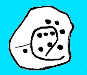
Sketch of carving 446Smiley Stone carving
First described by Stuart Feather and described by him in 1966, this small rounded stone comprises of nine or ten cup-markings with a long, enclosing line that circuitously goes around four or five of them. It’s a curious-looking design which, from one angle, gives the impression of a smiley face — hence the name (this is Boughey & Vickerman’s name for it — not mine!).
References:
Boughey, Keith & Vickerman, E.A., Prehistoric Rock Art of the West Riding, WYAS 2003.
Feather, Stuart, ‘Mid-Wharfedale Cup-and-Ring Markings – no.43 and 44: Middleton Moor, Ilkley,’ in Cartwright Hall Archaeology Group Bulletin, 11:4, 1966.
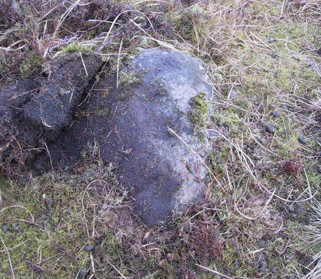
Follow the same directions to reach the Middleton Moor carvings, numbers 436 and 437, up along the footpath. This is the easiest to find as it’s right beside the footpath – as Richard Stroud’s photograph clearly shows.
Archaeology & History
Drawing of CR-435Middleton Moor CR-435
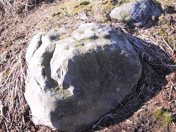
Near a cluster of other cup-and-ring marked rocks, this decent example can be found besides what may be a prehistoric trackway running roughly east-west over the Long Ridge to Foldshaw Ridge. Amazingly, this stone was never previously catalogued until Boughey & Vickerman’s survey in 2003. Just goes to show what y’ can find if y’ gerrof yer arses and look for yerselves! Comprising at least thirty cups and several lines, one faint cup-and-ring is discernible on the western edge of the stone.
If you walk westwards, back up to the hilltop from here (only a couple of hundred yards), a single upright stone which some might consider megalithic, stands right before your eyes! An excellent spot!
References:
Boughey, Keith & Vickerman, E.A., Prehistoric Rock Art of the West Riding, WYAS 2003.
Follow the same directions to get to the Middleton Moor Carving 437, along the Ridge Way footpath, and this stone is just a few yards away.
Archaeology & History
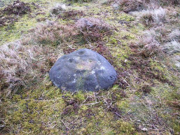
This all-but insignificant carving was first described in Boughey & Vickerman’s (2003) survey, as a “small rough grit rock sloping into turf” with what may be two faint cup-markings etched on its surface. Unless you’re a bittova rock-art fanatic, this might not be of much interest to you! (thanks to Richard Stroud for use of his photo!)
References:
Boughey, Keith & Vickerman, E.A., Prehistoric Rock Art of the West Riding, WYAS 2003.
Head for the gorgeous little hamlet of Langbar, a few miles northwest of Ilkley. Less than ½-mile before the village, keep your eyes out for the footpath bearing east onto the moors at Moor End Farm (right-hand side of road if you’ve travelled from Ilkley). Walk along the Long Ridge footpath to where the fields on your left finish and the moorland proper opens up. Hereabouts, check the stones in the heather to your right! If you amble about looking, you’ll find it!
Archaeology & History
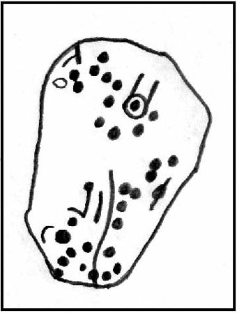
Crap drawing of CR-437
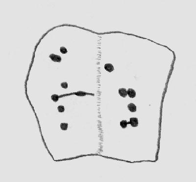
This is another one of those carvings for the purists amongst you. Less than ten yards off the footpath on Long Ridge is this medium-sized rock with several cup-marks, and lines, on both its top and vertical faces. Boughey & Vickerman (2003) think there to be at least five cups on the top, with perhaps nine on the vertical east face, though some of these are debatable. (the drawing I’ve done is from their book)
References:
Boughey, Keith & Vickerman, E.A., Prehistoric Rock Art of the West Riding, WYAS 2003.