Beamsley Beacon, Beamsley, North Yorkshire

Cairn:  OS Grid Reference – SE 09891 52435

Also Known as:

  1. Howber Hill

Getting Here

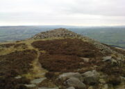
Beamsley Beacon, looking NW

If you’re coming via Ilkley, cross the bridge to Middleton and turn left, following the long winding road for several miles until you hit Langbar village.  If you’re coming via Bolton Bridge, go to Beamsley village and turn left up Lanshaw Bank until you hit Langbar village.  Whichever of the two routes you use: on the north side of Langabr village is a distinct small rough car park.  From here, cross the road where the footpath sign is and walk straight up the steep hill to Beamsley Beacon at the top.  You can’t miss it!

Archaeology & History

At the highest point on these hills, 1300 feet up, we come across this ancient prehistoric cairn.  Its position in the landscape is impressive to say the least, being visible from nearly every direction on the moorland heights for many miles around, as well as being conspicuous from the riverlands below.  A visit to the site nowadays shows it surmounted by a more recent mass of small stones turning it into a large walker’s cairn with only its compact base showing any real sign of antiquity.

Site shown on 1853 map
Western side of the cairn

Mentioned briefly in parish records from 1658 onwards, it was highlighted on the earliest OS-map as simply a Beacon hill, due to it being used for beacon fires.  We’re not certain when its beaconesque function first came about; and, it’s possible, that its beacon element could have replaced a much earlier heathen fiery function, typical of many hilltop sites up and down this and other countries.  But we do know that such fires were lit here at the beginning of the 19th century.  The great Harry Speight (1900) told that of its

“use as a prospecting-point and beacon there is no doubt.  In the Bolton Abbey registers, under date 1803, is this entry:

“Apprehensive of a French invasion, Beamsley Beacon was put in a state of repair, and four people appointed to watch it.  About — of the inhabitants of this chapelry inrolled themselves as Volunteers, the whole number of whom in Craven amounted to 1,200 Infantry and 200 Cavalry.  A Sergeant was appointed to drill the volunteers of this chapelry at Bolton.”

The beacon at this time received light from Pinhaw on Carlton Moor and sent it forward to Otley Chevin, as appears by an old chart at Wakefield, dated 1803.”
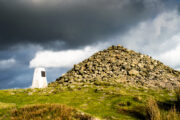
Photo by James Elkington

The beacon’s ancient name of Howber Hill is literally the Hill of Tombs, as derived from the Teutonic haugr, and Anglian how, being a burial mound; and berg is a hill, sometimes fortified.  Whilst there seems to be no evidence of ancient fortification, compacted cairn material at the base seems to confirms the -how element.  Yet despite Speight citing this etymology, he was was somewhat sceptical wondering, instead, if the site was merely a giant boundary marker—which it has been for centuries.

A short distance along the footpath to the east is the denuded old cairn known as The Old Pike.  Further east still, along the same boundary line, there was once another old tomb, long since gone…

Folklore

I’m not sure whether this should gone in the folklore section or not.  But, well, it’s here nonetheless!  In Guy Phillips’s (1976) book on the mythic history of ancient Brigantia, he describes a number of alignments, or leys (not one of those stupid energy lines, which has nowt to do with leys)—one of which crosses Beamsley Beacon.  It’s an west-east line that begins at Cockerham and from there goes,

“through Top of Blaze Moss SD 619525, Slaidburn (it is very clear here), Flambers Hill SD 877523, southern edge of Copy Hill 952523, Draughton (extremely clear), Beamsley Gibbeter and Beamsley Beacon, Heligar Pike, Scow Hall 203523, Little Almscliffe Crag, Tockwith church and on to the coast.”

I have to say that I’m sceptical of the veracity of this alignment.

References:

  1. Bogg, Edmund, Higher Wharfeland, James Miles: Leeds 1904.
  2. Cobley, Fred, On Foot through Wharfedale, William Walker: Otley 1880.
  3. Phillips, Guy Ragland, Brigantia – A Mysteriography, RKP: London 1976.
  4. Smith, A.H., English Place-Name Elements – volume 1, Cambridge University Press 1956.
  5. Smith, A.H., The Place-Names of the West Riding of Yorkshire – volume 5, Cambridge University Press 1963.
  6. Speight, Harry, Upper Wharfedale, Elliott Stock: London 1900.

Acknowledgements:  Huge thanks to James Elkington for use of his photo on this site profile.  Cheers mate. 😉

© Paul BennettThe Northern Antiquarian

The Old Pike, Beamsley, North Yorkshire

Cairn:  OS Grid Reference – SE 10226 52648

Also Known as:

  1. Howber Pike

Getting Here

T’ Old Pike on t’ 1853 map

I prefer the much longer walk to this site, from Askwith Moor carpark some 5 miles to the west, but this wouldn’t be most folks cuppa tea.  So for the lazy buggers amongst you: whether you’re coming via Ilkley (cross the bridge to Middleton and turn left, following the long winding road for several miles) or Bolton Bridge (hit Beamsley village and turn left up Lanshaw Bank), you need to get up to Langbar village. On the north side of the village is a distinct small rough carpark. From here, cross the road where the footpath sign is and walk straight up the steep hill to Beamsley Beacon at the top.  Keep walking for exactly ¼-mile where you’ll find a large heap with boulders round its edge. You’re there.

Archaeology & History

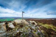
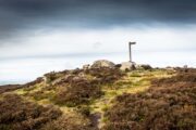
Skyline peak of T’ Old Pike (photo by James Elkington)

At the highest point of these hills where the moorlands of Langbar and Beamsley meet, is this prominent rocky pile on the same skyline as Beamsley Beacon.  The two are ancient cairns, both robbed of most of their stones, but still a good site to sit and behold the vast landscape which reaches out for miles in all directions.  And, from this highest point, looking south to the highest point across the Wharfe valley on Ilkley Moor, the remnants of another giant prehistoric cairn is visible: looking across at each other, eye to eye.

Of the two great cairns on Beamsley moor, The Old Pike is the more peculiar of the two because—unlike its partner along the ridge—several large boulders near its top give the impression of being Nature’s handiwork.  This may be the case, but Nature isn’t the lass who laid down the mass of smaller rounded stones that are mainly visible on the west and southern sides.  These have been placed there by people.  But it’s not until you step back 40 or 50 yards that you get a more distinct impression of the place.  The Old Pike rises up like a rocky nipple out of the heath, showing a very embedded overgrown man-made heap, typical of the overgrown prehistoric cairns that scatter our northern uplands.

Looking north (photo by James Elkington)
The piled heap (photo by James Elkington)

The site is included on the archaeologist’s Pastscape website, albeit citing it as a ‘possible’ cairn.  But the more we look at it, the greater the impression becomes that this old heap is man-made – certainly on its eastern and southern sides.  The rise of boulders on its west may be natural, and then ancient man placed the cairn material up and around them.  Only an excavation would tell us for sure.  But its old name of Howber Pike tells a tale before we even visit the place.  When the great Yorkshire historian Harry Speight (1900) came here he picked up on this element, telling us,

“Howber literally is the ‘Hill of Tombs’, from the Teutonic haugr and Anglian how, a burial mound, and berg also her, a hill, often fortified.”

The great place-name authority A.H. Smith (1956) not only echoes this but goes into greater etymological detail, noting that as well as haugr or how being “an artificial mound, a burial mound,” it’s a word that is particularly used in the northern counties.  He does note however, that this may not always be the case and can sometime just relate to a “a hill or hilltop resembling an artificial mound.”  However, we also find in Smith’s tome on place-name elements that the latter part of ‘Howber’ deriving from beorg, can also mean a tumulus or burial mound.  But there are cases where this has been corrupted and means, as Speight states, a fortified hill.  So at Howber Pike we seem to have the ancient name of some probable burial site.  As for its neighbour a quarter-mile west, the giant cairn of Beamsley Beacon is also known as the Howber Hill….

References:

  1. Smith, A.H., English Place-Name Elements – volume 1, Cambridge University Press 1956.
  2. Smith, A.H., The Place-Names of the West Riding of Yorkshirevolume 5, Cambridge University Press 1963.
  3. Speight, Harry, Upper Wharfedale, Elliott Stock: London 1900.

Acknowledgements:  Huge thanks to James Elkington for use of his fine photos on this site.

© Paul BennettThe Northern Antiquarian


Round Hill, Middleton Moor, North Yorkshire

Tumulus:  OS Grid Reference – SE 107 509

Also known as:

  1. Black Hill tumulus

Getting Here

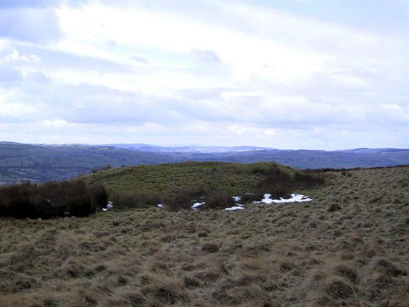
Round Hill tumulus, Middleton Moor

From Ilkley town centre, taken the road north across the River Wharfe, turning left and up the country lane towards Nesfield.  As you’re driving with the farmed fields on either side, you’ll go round a couple of swerves in the lane and reach the open moorland on your right, just past the small copse of trees on the same side.  There’s a small place to pullover on the right 100 yards on and walk up the footpath running northeast onto the moor.  Go past the disused quarry and up further till you reach the rounded hill where the tumulus stands.

Archaeology & History

On the moors north of Ilkley – as shown on OS-maps since the 1850s – on the southeastern edge of Middleton Moor, is this singular tumulus, a short distance west of some old quarrying at the curiously-named Lurgy Delf.  The small hill is easy to find and appears at the western edge of a whole host of neolithic and Bronze Age remains.  It is included as a boundary marker between Middleton and Langbar, as marked by an old stone on its southern side.  Eric Cowling (1946) described this as “a spread of stones on Round Hill” in the same context as other burial mounds and cairns in the region, also naming it as the Black Hill tumulus.  Many flints had been found all round here and it stands at the western edge of a great number of cup-and-ring stones, stretching eastwards across the moors for several miles.  To my knowledge, no excavation has taken place here.

References:

  1. Cowling, Eric T., Rombald’s Way, William Walker: Otley 1946.

© Paul Bennett, The Northern Antiquarian


Middleton Moor Carving 435, North Yorkshire

Cup-and-Ring Stone:  OS Grid Reference – SE 10771 51488

Getting Here

Follow the same directions to reach the Middleton Moor carvings, numbers 436 and 437, up along the footpath.  This is the easiest to find as it’s right beside the footpath – as Richard Stroud’s photograph clearly shows.

Archaeology & History

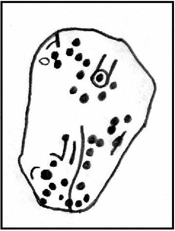
Drawing of CR-435
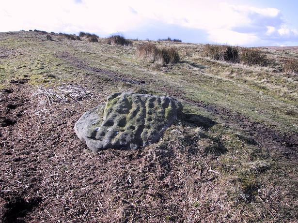
Middleton Moor CR-435

Near a cluster of other cup-and-ring marked rocks, this decent example can be found besides what may be a prehistoric trackway running roughly east-west over the Long Ridge to Foldshaw Ridge.  Amazingly, this stone was never previously catalogued until Boughey & Vickerman’s survey in 2003.  Just goes to show what y’ can find if y’ gerrof yer arses and look for yerselves! Comprising at least thirty cups and several lines, one faint cup-and-ring is discernible on the western edge of the stone.

If you walk westwards, back up to the hilltop from here (only a couple of hundred yards), a single upright stone which some might consider megalithic, stands right before your eyes! An excellent spot!

References:

  1. Boughey, Keith & Vickerman, E.A., Prehistoric Rock Art of the West Riding, WYAS 2003.

© Paul Bennett, The Northern Antiquarian

Langbar Stone, Langbar Moor, North Yorkshire

Cup-and-Ring Stone:  OS Grid Reference – SE 11180 52052

Also Known as:

  1. Carving no.41 (Feather)
  2. Carving no.459 (Boughey & Vickerman)

Getting Here

Langbar Moor carving - with extra ring
Langbar Moor carving © Richard Stroud

Various ways to get here (being in the middle of the moor n’ all).  I s’ppose the best way is to go from Langbar village, up hill to The Old Pike giant cairn, then follow the footpath on about 100 yards before dropping down the slope to your right, south (NOT the other way!).  You’ll notice some walling and an old path near the bottom of the slope SE from you – head in that direction, but before you get there, a coupla hundred yards before, stop and look around.  Good luck!

Archaeology & History

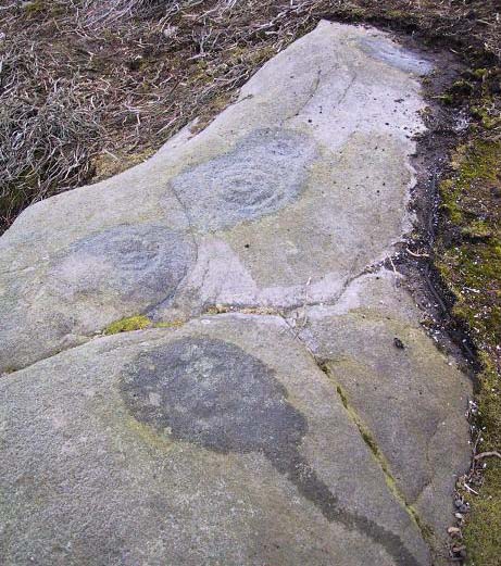
Found halfway up the southern slope beneath The Old Pike giant cairn, we find this large, flat earthfast stone, on which are the very faded remains of archetypal cup-and-ring motifs. At the top-end of the stone are slightly more pronounced cup-markings – seemingly more than is shown on the drawing, with the multiple-rings halfway along the stone. On the southeastern part of the stone, Richard Stroud found another previously unseen aspect of the carving, consisting of one large ring, with perhaps a line running out to the east. This can be seen in the water-highlighted photo.

Langbar Stone, with small single circle not noticed by archaeologists
Langbar Stone, with extra single ring not previously noted

If you visit this carving, try and get to the Middleton Moor CR-482 stone half-a-mile southwest – where I for one got the distinct impression that whoever carved that stone, also carved this one!  Barmy p’raps — but if we don’t allow subjective interface here and there, we never learn a damn thing!

Listed as stone 459 in Boughey & Vickerman’s (2003) survey, they erroneously ascribe Eric Cowling to have found it in Rombald’s Way (1946), whereas the first mention of it appears to have been by Stuart Feather in 1966 (though Cowling does mention a ‘Langbar Stone’, but illustrates another one nearby).

References:

  1. Boughey, Keith & Vickerman, E.A., Prehistoric Rock Art of the West Riding, WYAS 2003.
  2. Cowling, Eric T., Rombald’s Way, William Walker: Otley 1946.
  3. Feather, Stuart, ‘Mid-Wharfedale Cup-and-Ring Markings. No.41, Langbar Moor, Ilkley,’ in Bradford Cartwright Hall Archaeology Group Bulletin, 11, 1966.

© Paul Bennett, The Northern Antiquarian