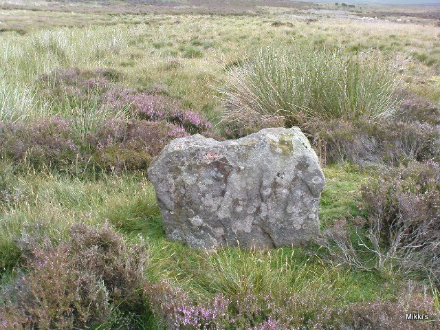
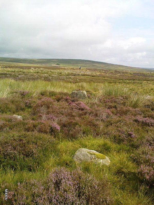
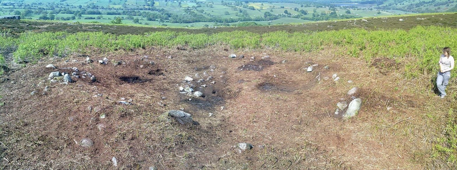
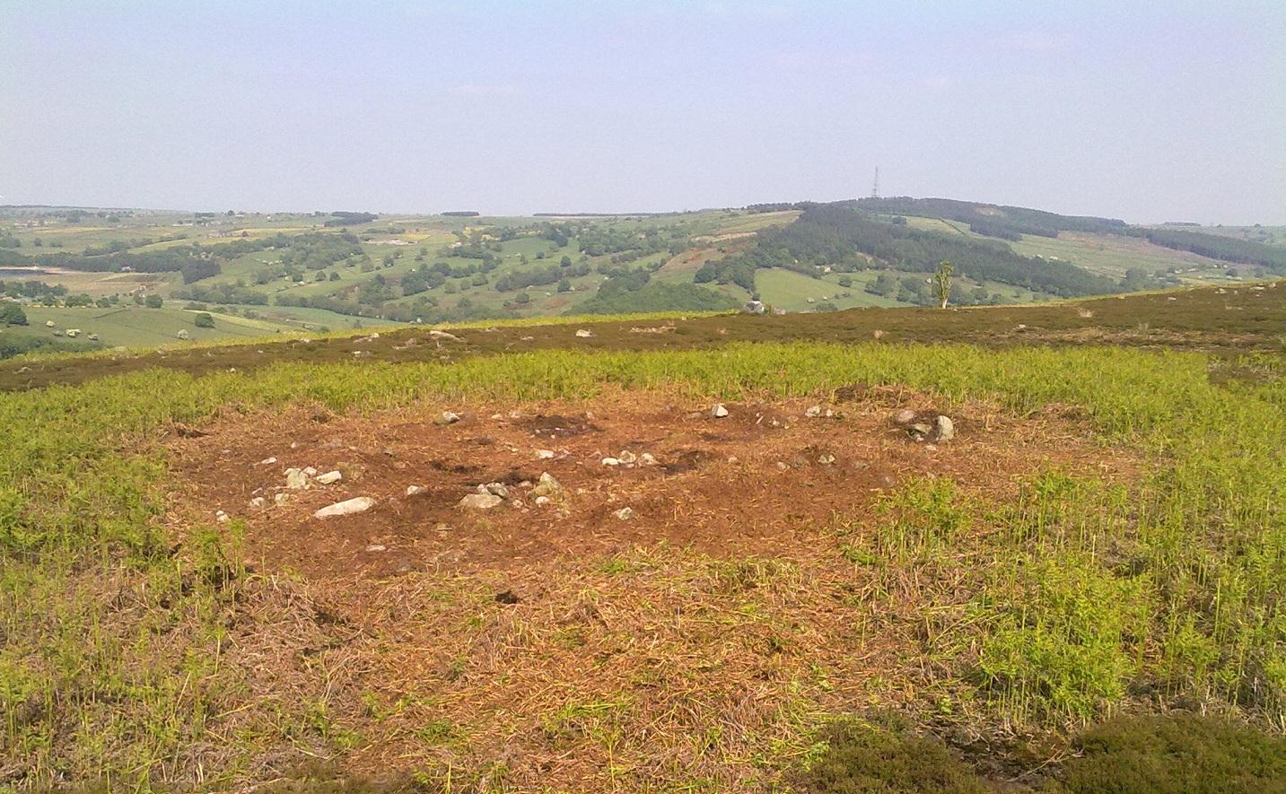
From Grassington, head east along the B6265 road for a mile or so, thru the hamlet of Hebden and, once up the hill on the other side of the village, take the track up your left and walk up until the land just about levels out and the moorland opens up on the right-hand side of the track. If you’ve got the trackway which takes you to Scar Top House on your left (where the walling breaks), head straight into the heather and walk about 150 yards NE, keeping your eyes peeled for a singular upright, less than 3ft high. Once here, check the small overgrown ring you should be stood in!
Archaeology & History
A relatively small site that can be difficult to see when the moorland heather’s in full growth — but it’s in a lovely setting, with a hidden view of the hills for nearly 360°, yet quietly hidden from prying eyes until you’re all but upon the place. Although it has a likely Bronze Age pedigree (it aint yet been excavated), it was ignored by the confines of written history until Arthur Raistrick brought it back to life in a brief note in the Yorkshire Archaeological Journal of 1965 when Mr H.G. Ramm told what he’d found, described it simply as,
“32ft in diameter, 5 stones still stand leaving spaces where other stones have been taken for walling. A large stone is flat at the centre.”
Alignment east: ring, outlier, human, hill!
And that’s that! No doubt the remarks about some stones taken from here to be used in some walling were told Raistrick by a local, but he says no more about this.
The main feature to see in this small ring is the flattish, wide upright, less than three-feet high, on the eastern side. A smaller upright stands in half-boggy Juncus grasses as you spin round towards the north, with a smaller stone laid on the ground in between. Originally it appears there were at least eight standing stones making up this circle. If you walk around it you’ll make out several of the other stones laid down. About 30 yards due east of the tallest upright in the ring is another small outlying standing stone. And, less than 100 yards northeast from this outlier, we come across the equally small, little-known stone circle of Dumpit Hill B…
References:
Burl, Aubrey, The Stone Circles of Britain, Ireland and Brittany, Yale University Press 2000.
Dixon, John & Phillip, Journeys through Brigantia: volume 2 – Walks in Ribblesdale, Malhamdale and Central Wharfedale, Aussteiger: Barnoldwick 1990.
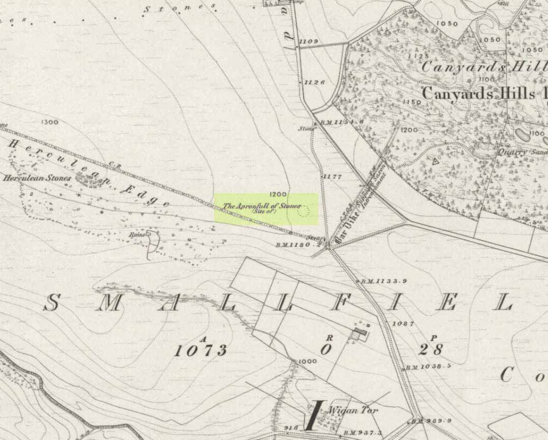
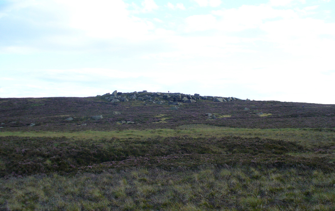
This was another example of the many giant cairns that scatter the upland moors on the Pennines, but much of it has been destroyed, with some halfwits in recent years cutting a track right through whatever remains there might have been! It was first described in John Watson’s (1776) essay on the local antiquities of Bradfield and district where, in relative conjunction with the curious Bar Dike, he told that “this is not the only curiosity on this common.” He continued: “there is on one part of it a large carnedde, called by the country people the Apron-full of Stones”, where he conjectured there laid a British tribal chief after he’d been slaughtered by the Romans. This might have been the folklore of the place, but we know such places were thousands of years earlier than the Romans.
It was later described in Joseph Hunter’s Hallamshire (1819) as a giant barrow, or ‘vast carnedde’, even then in the past tense; but some recent investigation here found “a few small stones and some lumpy turf which looked to be covering a few clumped stones.” The site requires further investigation by local people to assess the state of damage inflicted on this once great tomb.
Folklore
Said to have been the site of a local battle in ancient times; this is also another site which, as A.H. Smith (1961) tells, “is explained in folklore by tales of the devil undertaking some major building project and tripping up, only to deposit his apronful of stones” here. Does anyone out there have any more info on this place?
References:
Hunter, Joseph, Hallamshire: The History and Topography of the Parish of Sheffield in the County of York, Lackington: London 1819.
Smith, A.H., The Place-Names of the West Riding of Yorkshire, Cambridge University Press 1961-63.
Watson, John, “An Account of some Hitherto Undescribed Remains of Antiquity”, in Archaeologia, volume 5, 1776.
Takes a bitta getting to this spot, but it’s worth the effort! Make a day of it and walk up here via the little-known Cuckoo Stones monoliths. From here the walk gets steeper! Follow the footpath from the standing stones, uphill, to the legendary Wuthering Heights building of Bronte-fame a half-mile ahead of you. Then walk immediately up the slope at the side of the derelict house higher onto the moor (there’s no real footpath to follow) until the moorland levels out. From here, look west and walk that way for a few hundred yards where you’ll be seeing a large rock outcrop ahead of you. That’s where you’re heading! (if you reach the triangulation pillar, take the small path from there along the top of the moor towards this large rock outcrop)
Archaeology & History
Alcomden’s Altar Stone
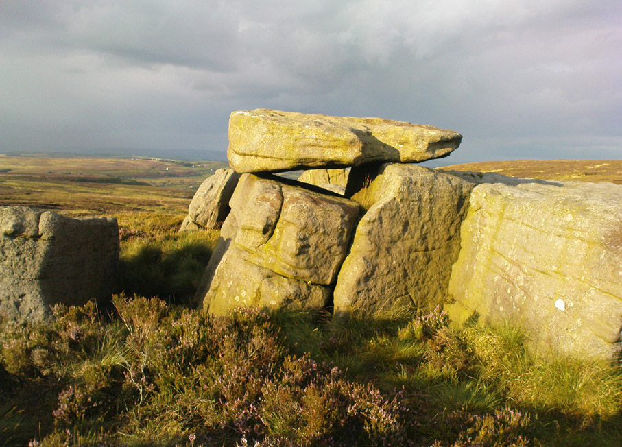
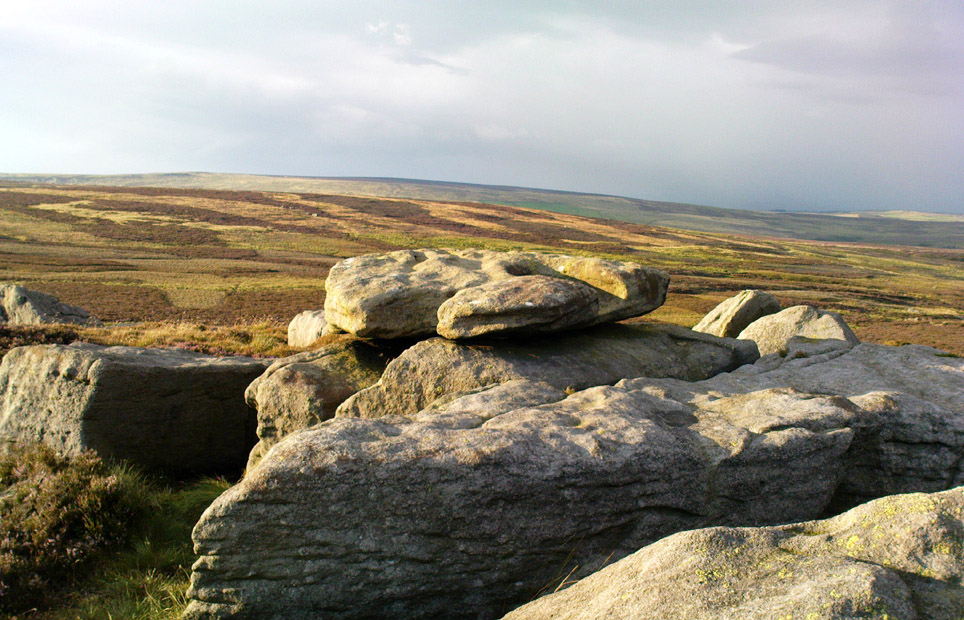
To those of you who like a bitta wilderness, or healthy normal people I suppose, this is a stunning place! Even though there’s little by way of archaeology here — save the usual expectations of a few flints and arrowheads — its geomancy, its position in the landscape, makes it excel as a once important ritual site for our ancestors in not-so-distant centuries. Although local tradition gave these great rocks a prehistoric pedigree, the archaeological record doesn’t say as much — but that doesn’t really mean much up here. We’ve found a singular Bronze Age cairn on the level at Middle Moor Flat 400 yards northwest (not in the record books), some prehistoric walling on the flat east of here (not in the record books), so a lot more attention is needed hereby to see what more may be hiding in this rocky heathland area.
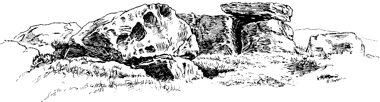
The main feature amidst this extensive scattering of rocks is the large rocking stone, said to weigh six- or seven-tons, resting upon other glacial deposits. The rock itself can be made to rock very slightly. It was described in Lewis’ Topographical Dictionary as a
“cromlech, an evident druidical remain, (which) consists of one flat stone, weight about six tons, placed horizontally upon two huge upright blocks.”
But the placement here was done by Nature and not humans — making it much more important to our ancestors. This was a site for solace, for ritual and to commune with the gods themselves. A few visits to this place show this quite clearly — unless you’re unable to relax that is! It’s a place I wanna spend more time working with, as the mythic history around these stones feels strong, despite their absence from written records.
The ‘altar’ resting on rocksAlcomden’s “altar”
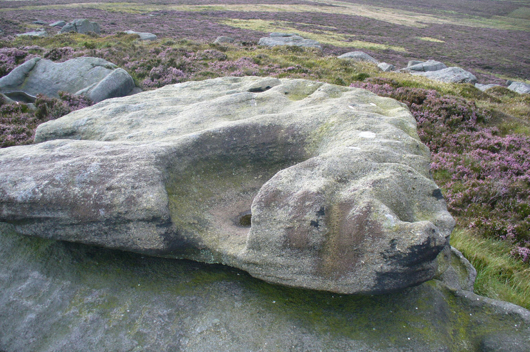
The druidic sentiments espoused by Lewis were all but echoed by our otherwise sober historian, J. Horsfall Turner, in his history of Haworth (1879), where he describes the Alcomden Stones as “the remains of a Druid’s Altar.” On top of the main ‘altar stone’ are what could be ascribed as worn cup-markings, but it seems they’re Nature’s handiwork once again; though this wouldn’t deny them as having some significance to our ancestors. A number of other boulders amidst this mass of rocks also have what seem like cup-markings, but none of them can be said with any certainty to have been carved by people. Indeed, the entirety of this legendary rock outcrop seems to have been created solely by the spirits of Nature.
View of Earth, from Alcomden
It was first described as ‘Alconley’ in 1371, then in the 1379 Poll Tax returns as ‘Halcom’, the etymology of which is difficult. Al- is a cliff or rock, many of which occur here; den is certainly a valley, over which we look to the northeast (to Ponden Kirk, 500 yards away); but the central element of ‘com‘ is the greatest puzzle. Blakeborough (1911) tells of the old Yorkshire word ‘con’ — found in the 1371 spelling — meaning “to scan, or observe critically,” which one can certainly apply here in a topographical sense, i.e., “observation stones above a valley.” It’s simple, succinct, and makes sense!
Folklore
As Elizabeth Southwart (1923) rightly said,
“Our forefathers, instinct and imagination more highly developed than knowledge, peopled their woods with fairies and their valleys with ghosts. On the high, wind-swept spaces they built their altars to Unknown Gods.”
Turner’s 1913 drawing
And such she thought was done at this “heap of rocks called Oakenden Stones.” It seems likely, as this place is superb for ritual magick and meditative systems. But all we have are the repeats of numerous old historians, from Whiteley Turner (1913) and his namesake J. Horsfall, to James Whalley, J.W. Parker and more, who recorded what the old locals said: that is was a place of the druids. There may be a grain of truth in it somewhere…
References:
Bennett, Paul, The Old Stones of Elmet, Capall Bann: Milverton 2001.
Blakeborough, Richard, Wit, Character, Folklore and Customs of the North Riding of Yorkshire, W. Rapp: Saltburn 1911.
Parker, J.W., Guide to the Bronte Country, J.W. Parker: Haworth n.d. (c.1971)
Southwart, Elizabeth, Bronte Moors and Villages: From Thornton to Haworth, John Lane Bodley Head: London 1923.
Turner, J. Horsfall, Haworth, Past and Present, Hendon Mill: Nelson 1879.
Turner, Whiteley, A Spring-Time Saunter round and about Bronte Lane, Halifax Courier 1913.
Along the Brighouse to Mirfield A644 road, a half-mile east of M62’s junction 25 on Wakefield Road, note the woodland on your left-hand side, above the walling. Although on allegedly private land, you can approach by hopping over the wall by the main road into the woods. Wander up the slope until it levels out and, just at the edge of the tree-line, past the brilliant overgrown folly amidst a mass of rhododendrons, you’ll see the denuded edges of this earthwork. Though you might need a bitta patience seeking it out…
Archaeology & History
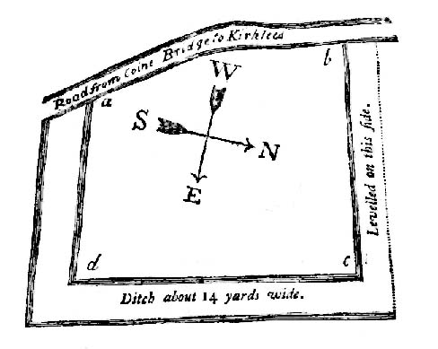
Very first sketch of this site (John Watson, 1775)
The remains of this low earthwork is found on the private land of Kirklees Hall and appointment is supposed to be made to explore, both this and the more famous Robin Hood’s Grave, a few hundred yards away. But if you can’t be bothered with that and find this little-known earthwork, you’ll see that it’s roughly squared in shape, though pretty overgrown. In Bernard Barnes’ survey (1982) he described it as a “square or five sided enclosure, 2-3 acres in size, with bank and external ditch”, wondering whether it was used to enclosure cattle and stretching its possible origin between the Iron Age to the medieval.
Although the classical Roman archaeologist Ian Richmond (1925) believed the site to be from that period, the archaeologist J.J. Keighley thought that the site was “more likely to be Iron Age than Roman.” He wrote:
“The earthwork in Kirklees Park is a square or five-sided enclosure with bank and external ditch… The site lies on Richmond’s trans-Pennine route. According to Armitage and Montgomerie, the earthwork is 0.5 hectares in area, but it is actually nearer 0.8 to 1.2 hectares. They compare its construction with the fort at Wincobank (South Yorkshire), stating that the bank on the counterscarp when excavated, revealed “a very rudely composed wall of undressed dry stone.”
Earlier local writers such as John Watson (1775) — whose early sketch of the site is reproduced above — and others also opted for the Roman date. But, unless you’re a bit of an earthwork fanatic, this site may not be too much your cuppa tea. If you are gonna check this out though, make sure you check out Robin Hood’s old tomb in the trees not far away. Very odd.
References:
Barnes, Bernard, Man and the Changing Landscape, Merseyside County Council & University of Liverpool 1982.
Keighley, J.J., “The Prehistoric Period,” in West Yorkshire: An Archaeological Survey to AD 1500 (WYMCC: Wakefield 1981).
Richmond, I.A., Huddersfield in Roman Times, Tolson Memorial Museum: Huddersfield 1925.
Watson, John, The History and Antiquities of Halifax, J. Lowndes: London 1775.
Many ways to get here, but you’ve gotta amble off-path through the woods to eventually find it — but it’s not difficult. From Kilmartin village head to Slockavullin and walk up the winding track which takes you towards the Ballygowan cup-and-ring stones, but follow it into the woods instead. The OS-map’s gonna be your best guide here. I first visited this spot from the south and ambled about, aimlessly at times for several hours, after I’d first been to the great ruined mansion of Poltalloch. Well worth checking out if you enjoy finding allsorts!
Archaeology & History
The old tomb is actually a few hundred yards beneath the small rocky summit of Barr a’ Chuirn, with the overgrowth of the woods imposing itself upon it. The Scottish Royal Commission report (1988) told that there was a large seat built here in the 19th century called the Lady’s Seat, and actually set up on the cairn itself so giving groovy views all round to those who came here. The Seat was made from large slabs of stone, which may originally have come from the old tomb. An excavation here in the mid-19th century,
“found the remains of two cists and some burnt bones, with a ‘skeleton of later date, between the two cists, but probably put there by the men who destroyed the cairn.’ In 1929 Craw re-examined the site and found that the central cist had chambered and grooved slabs. This cist is aligned ENE and WSW, and the E end-slab is now missing; the cist measured about 1m by 0.5m and about 0.3m in depth internally. The northern side-slab is grooved at the west end.”
References:
Royal Commission on the Ancient & Historical Monuments of Scotland, Argyll: volume 6 – Mid-Argyll and Cowal, HMSO: Edinburgh 1988.
Standing Stone (destroyed): OS Grid Reference – SO 117 544
Also Known as:
Hundred House Standing Stone
Archaeology & History
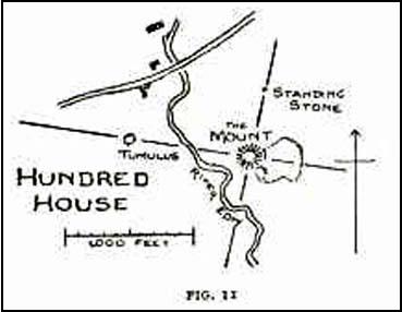
Position of the old stone (on one of Alf’s leys)
In a field less than 200 yards north of an old medieval mound known as The Mount, the great ley-hunter Alfred Watkins (1925) described a standing stone that used to be here along one of his leys, but which, even then, had been “inexplicably blown into several pieces by a quarrymen’s charge.”
The stone was said to have originally come from an adjacent field and then moved next to yet another monolith, which was also broken up. Can any remnants of these poor fellas still to be seen anywhere nearby? Or is it a case of yet another one bites the dust?
References:
Watkins, Alfred, The Old Straight Track: Its Mounds, Beacons, Moats, Sites and Mark Stones, Methuen: London 1925.
Prehistoric petroglyphs are rare things indeed in Leicestershire! But the example that was found here — at the now destroyed prehistoric tomb which archaeologists catalogued as ‘Lockington Barrow VI’ in this small graveyard — shows that such ritual art spreads further afield than previously reported by archaeologists. Yet as with countless other cup-marked stones, it should come as no surprise to be found associated with a tumulus. Death and petroglyphs are common bedfellows – even in this part of Britain!
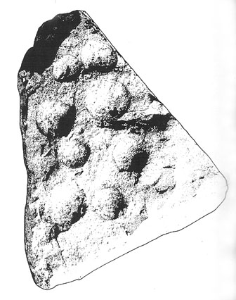
Lockington cup-marking (courtesy Gwilym Hughes)Lockington cup-marked stone
Found on the northern edge of a ring ditch surrounding this once-fine tomb, the carving was found on a small, triangular-shaped, broken piece of rock , less than 12 inches across along its longest side. The small stone has what seems to be eight cup-marks (5 seem certain) pecked onto the stone: simple, without additional ingredients, akin to the basic forms found at Baildon and other more northern climes. The stone itself didn’t seem to be local and was thought by Hughes (2000) “to be from one of the outcrops of millstone grit to the north of the site in southern Derbyshire.”
Less than 7 feet from this petroglyph, inside the barrow, was a pit containing a hoard of ancient gold and copper ware — though any likely relationship between the carving and the treasure hoard is doubtful. The carving was probably a “portable” relic, carried some distance and put here for some reason or other: perhaps as an offering; perhaps a magickal artifact — we’ll probably never know…
If you’re not into the walk, get the bus running NE between Dunblane and Greenloaning — the A9 — getting off at the Little Chef on the dual carriageway and cross the road, walking up the track to Upper Whiteston Farm (the owners here are very helpful). As you walk up the track you’ll notice the large upright in the edge of the field a coupla hundred yards to your right. That’s the one!
Archaeology & History
This is a mightily impressive site if you’re into yer megaliths! When it was visited and measured by Mr Hutchinson (1893) in the 19th century he found it to be 9ft 4 in tall; and although it seems quite isolated at first sight, we find that there is another large stone companion laid down not far to the north of here which may have had some relationship with it . But that aside… There are also as many as eight cup-markings on the stone’s eastern face: one large one and seven smaller ones, in no particular order as usual! It was these cup-marks that gave me the impression there was once a burial associated with the stone, but the archaeology records seem silent on such a matter; though folklore tradition tells another story…
Folklore
Mr Hutchinson (1893) told that the legend attached to this stone appears to be “of quite recent date.” He said how,
“In the district the stone is known as the MacGregor Stone, and the tradition accounting for the name is to the effect that here a countryman was sacrificed by the followers of Rob Roy, when forming for the engagement on Sheriffmuir, in order to satisfy the ancient Highland superstition that first-blood was an infallible omen of success… The tradition is precise enough to state that a man of the name Dawson was seized in the adjoining hamlet of Whiteheadston (for such is the orignal name) as a whig, and therefore a foeman and proper victim. Dawson, however, suspecting the intentions of the captors, vehemently professed himself a supporter of King James and was left off. But another inhabitant of the hamlet not so acute or not so hypocritical, was immolated at the stone.”
Hutchinson however, doubts the accuracy of the tale and suggests that the local name of the MacGregor’s Stone derives from the fact that the monolith stands upon land once owned by the MacGregors of Balhaldies, countenancing that the stone “is of much earlier date than the MacGregors of Balhaldie or any other sept of the Children of the Mist.” I think he’s got a point!
References:
Hutchinson, A.F., “The Standing Stones of Stirling District,” in The Stirling Antiquary, volume 1, 1893.
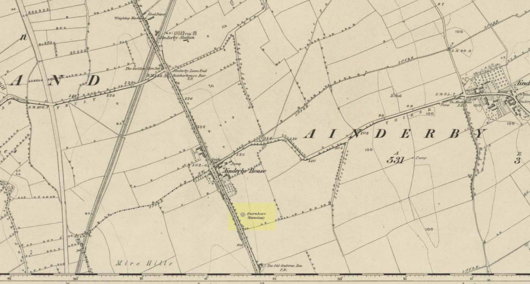
Long since destroyed by the self-righteous advance of the Industrialists, this was a pretty impressive-looking tomb according to the account of D.M. Waterman (1951). Found between the villages of Ainderby Quernhow and Kirklington, right at the side of an important prehistoric trackway—later used by the Romans and known as Leeming Street (on what is now the A1 motorway). Waterman cited it as being “of primary importance in prehistoric times” as it stood on the great plain between the three great henges of Thornborough to the north and those on Hutton Moor to the south, accompanied by a number of other tumuli nearby.
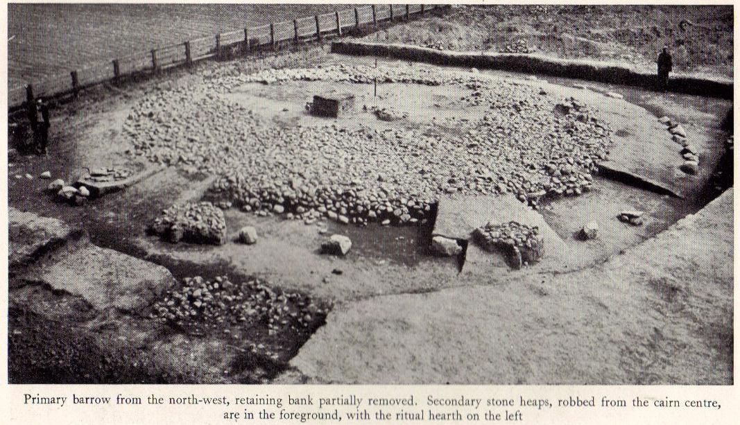
Quernhow tomb on 1856 OS mapThe excavated monument
When Waterman and his team arrived here, the barrow “appeared as a low-spread mound, about 3ft in elevation, the exact limits of which were difficult to define,” due to large parts of it being covered over in mud that’d been dumped there by the local land-owner, aswell as erosion due to other farming or industrial activity. But once the archaeologists had stripped the centuries of soil from the damaged surface of the monument, a most impressive site emerged! At the heart of this great burial mound was found “an imposing stone cairn, more or less flat-topped and with a circular constructed face.” He (1951) continued:
“The material of the cairn was composed of cobbles or boulders, all of local geological origin, ranging in size from a few inches up to a foot in diameter or more. A stone considerably larger in size was occasionally encountered , the largest found measuring 23in by 20in and from 3in to 5in in thickness. The stones were heaped up without any deliberate attempt at producing a stable structure and used indiscriminately, irrespective of size or shape, although there was a tendency for the larger stones to occur towards the perimeter of the cairn. Since the cairn itself was built to a flat surface, and the underlying barrow-mound assumed a saucer-shaped profile, the cobbles perforce increased in depth towards the cairn face; at the very centre they were laid one, occasionally two deep, at the face three or four deep, although irregular size and placing precluded any consistency whatsoever in the work. The standard of the building in fact differed considerably throughout the structure. On the northeast and northwest the facing-stones were quite carefully laid, standing to a height of 22in, the work becoming increasingly shoddy towards the south where the construction had so deteriorated that whole sections of the facing had fallen bodily away from the cairn mass, slipping down the tail of the underlying mound…”
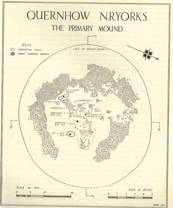
Plan of Quernhow
In the middle of the large cairn were found four small pits and a number of small cremations in and around them. There were also found the usual broken remains of pottery, human bones, charcoal, foods vessels and burnt pieces of oak and other vegetation. Near the centre of the cairn was a curious “four poster” of upright stones, “about 1.4ft long and rather less in breadth and thickness (which) suggest, from consideration of their obviously deliberate and careful placing, some significant function in burial ritual.” The four corners of these stones were close to the cardinal points: north, south, east and west.
References:
Waterman, D.M., “Quernhow: A Food Vessel Barrow in Yorkshire,” in Antiquaries Journal, volume 31, 1951.
From the Askwith Moor Road parking spot, walk up the road for about 500 yards and head to your right (east) onto the moor. Walk past the upper side of the disused quarry and through the heather for about 200 yards until the moorland slopes down and you’re on another flat moorland ridge. You should now be stood on the edge of the Snowden Crags Necropolis or cairnfield. There’s a large patch of bracken near the top of Snowden Crags in the middle of the prehistoric cemetery. That’s the spot!
Archaeology & History
Very little has been written of this site and for years several of us have wondered whether or not a stone circle was the antiquity that was being described in the only singular reference of the place, mentioned almost in passing in Mr Cowling’s (1946) fine survey of this area more than fifty years back, where he reported:
“A large circle of heavy material, some thirty feet in diameter, is isolated on the shelf above Snowden Crags to the west.”
But despite the various explorations of me and a number of other students on these moors over the last 20-30 years, Cowling’s curious singular reference (which some have taken as an error of judgement on his behalf) has remained a mystery. Until now!
South & west portion of the ring (photo credit: Geoff Watson)The complete circle, looking NW (photo credit: Geoff Watson)
Thankfully, with the help and attention of the hardworking Keighley volunteer Michala Potts on Thursday, 20 May, 2010, this large and very well-defined antiquity has been relocated — and a damn fine find it is indeed! It would appear (unless someone has notes to the contrary) that when Cowling did his extensive walkabouts on these and adjacent moors, this Snowden Crags Circle was much overgrown in heather and bracken; and I think we can safely assume this due to him making no further remarks regarding the site. Indeed, it would seem that Cowling’s consequent silence on the matter would lend us to think he never caught good sight of this “large circle” ever again. And upon these moors, that’s easily done when the heather gets deep up here! (numerous cup-and-ring stones on these and other northern moors still lay hidden amidst moorland undergrowth, awaiting rediscovery as a consequence of the deep vegetation) But thankfully now we have a good view of the place.
Wrongly ascribed by Neil Redfern of English Heritage to be a part of Scheduled Monument Record number 28065: Cairnfield, Enclosures, Boulder Walling, Hollow Way and Carved Rocks (it’s actually a short distance north of SMR 28065), the site here was relocated during one of The Northern Antiquarian exploratory walks, assessing the extensive walling, settlement pattern and prehistoric graveyard that scatters the central and northwestern section of the moors here. Michala Potts stopped and shouted for Dave Hazell and I to come and have a look at something she’d found whilst we were carefully peeling turf back from a previously unrecorded site about 100 yards away.
“What is it?” I asked; expecting just another small tomb or new cup-and-ring stone. But her tone of voice was different this time.
“I think you’d better take a look at this,” she emphasized.
As we walked through the shallow heather towards her, it became obvious she was standing in a rough circle of dead bracken, unbroken by the lack of rain over the previous months. We’d actually walked past it a couple of times the previous week and gave it no attention due to the depth of the dead vegetation covering the area. But this time it was different. I got within 50 yards of where Mikki was stood and my footsteps slowed; a couple more steps perhaps; then I stopped dead in my track. My arms lifted up and I held my head gazing at what she appeared to be stood in.
“Aww my god….” I said — transfixed at what was in front of me (I’m easily pleased aswell!).
Snowden Crags circle, looking west (photo credit: Geoff Watson)
I’m not quite sure how long I stood there with my head in my hands. Ten seconds or so. I couldn’t really say. I think it was when Dave caught up to where I stood, rooted, and appeared at my side. We walked a bit closer to make sure that what we could see wasn’t just another one of those curious shapes in the landscape that you find when seeking out prehistoric sites and turn out to be bugger all — but it wasn’t. Instead, Mikki Potts had stumbled upon an average-sized ring of stones, between 1-3 feet tall, and about 13 yards across, with what seemed like an entrance on its southern side, seemingly untouched in the middle of the mass of decaying bracken! It was an exciting find — as it’s not everyday that you come across a previously unrecorded stone circle. But, once we’d calmed down and walked round and round the site to make sure that something man-made was under our feet, we decided to make our way home (we’d been on the moors all day) and get back up to have a more detailed look at the place in a few days time. On Tuesday, May 25, we went back up for a second time and had a better look at the place…
It was another lucky day. For before we even reached Askwith Moor, Mikki pointed out what looked like a small cup-marking on a stone yards from the edge of the River Wharfe. We brushed off a bit of the dusty earth and were greeted the single cup-marked stone we’ve named the Riverbank Stone. It sat there all alone and dusty and we were very tempted to look for more potential carvings along the riverbank, but the Snowden Crags site was calling for attention and so up the hill we walked.
The ring of stones was still covered in a carpet of dead bracken and also had the new shoots of Spring emerging from the Earth, so we spent the next few hours picking up much of the dead bracken and carrying it beyond the outskirts of the circle, hence enabling us to see with greater clarity the monument Mikki had found a few days previously. The hot sun shone down on us all day and it took longer than we expected to shift all the bracken; but eventually, once we’d done it, we were looking at a very distinct man-made circular monument, measuring 13 yards by 12 yards across and, at its highest point, not even three feet above the present ground level. But today’s ground level is certainly much higher than it was when these stones were first placed here — at least 12 inches higher.
Rubble bank, NE-SE section (photo credit: Geoff Watson)
When Mikki first clapped eyes on the place, only a few small upright stones were sticking up amidst the mass of compacted bracken, but once all this had been brushed off we could see the stony earthworks averaging 18 inches high around the edges; and in places this outer ring is nearly 6 feet across. The ring consists mainly of smaller packing stones (perhaps thousands of them) between a number of larger upright stones — a dozen of them — making up the perimeter; but much of this perimeter is still considerably overgrown in compacted vegetation that’s prevented us seeing the ring in its proper glory: what archaeologists in the past have called a rubble bank. On its southern side is what appears to be an entrance, i.e., in this part of the circle there are no larger stones at all and only a handful of small stones have been noticed; but we must take into account the fact that we’ve done no excavation work here and this “entrance” may in fact be illusory, as the centuries of compacted vegetation (in all probability at least 12 inches deep) could be overlaying an unseen portion of the ring. This “entrance” is about 2 yards across.
The circle has similarities in size and design to the better-known site of Roms Law on Ilkley Moor. The difference between the two however is Roms Law has been robbed, whilst the Snowden Crags circle hasn’t even been catalogued. Yet there is a distinct anomaly here.
As we walked through the southern “entrance” and into the circle, we noticed what seemed to be some form of internal walling running roughly north-to-south. This “walling” started about three yards between the southern “entrance” and the inside of the ring, but then it ran roughly through the centre and all the way to the northern perimeter. This was indicated by a distinct rise in the ground which, as you walked over and stomped your feet, proved to be a mass of numerous small stones seemingly a few inches under the ground, some of which were poking through the Earth’s surface. This ingredient alone made me stop and wonder about the nature of the site. Had we come across a cairn circle of some sort? Or were we in fact stood in the middle of a small walled enclosure, which itself sits in the middle of this prehistoric graveyard? Indeed, was this walled enclosure a potential living quarter: some sort of large hut circle with a wall through the centre splitting it in two? It was hard to say for sure. On another visit to this site a couple of weeks later, in the company of Geoff Watson, Paul Hornby and Dave Hazell, this potential internal walling was given a bit more scrutiny.
We were dying to get our hands and feet digging at the heart of this ring of stones but — as yet! — we’ve managed to restrain ourselves. Although carrying off the mass of dead bracken has dislodged a couple of the small fist-sized stones at the edge of the ring (we carefully placed ’em back into position; yet it was only as much as you’d unintentionally disturb if you walked over the place a few times), we needed to use a couple of small brushes to have a look at this apparent internal walling running through the middle of the ring. But after carefully brushing off the dry dead earth, we found this “walling” was nothing of the sort! Instead, it seemed, someone at some time in the past had beaten us to this place! The central walling was, in fact, where someone had dug into the central region of the circle — probably looking for treasure or other wealthy valuables — and in doing so had dislodged a great number of the small stones that were initially in the middle of the ring, and in doing so pushed them up into small piles of stones, away from their original central position, creating an obvious long line of rocks which, once covered with dead vegetation, gave the impression of it being a length of walling. We also found that the mass of rocks that were around the centre of the ring also spread outwards covering all of the ground inside the outer kerb of stones — probably thousands of them. Geoff called this trench in the middle, the Robber’s Trench!
This begged the question: who the hell had been here, dug out a trench in the middle of this cairn circle (possibly taking out whatever remains were in the middle) centuries before the site had even been catalogued? It didn’t seem like it could have been Mr Cowling, as the covering vegetation was much more than a mere 50 years of age; and Cowling would very likely have reported any finds that he might have made here. So it is a mystery that needs solving.* Again, an accurate archaeological excavation would be invaluable here — but I wouldn’t hold your breath. Archaeological officials don’t seem interested in helping here. I was informed by Neil Redfern of the archaeology department of English Heritage for North Yorkshire that they are unable to support any funding that might help towards any decent analysis of this important archaeological arena (probably spent all their cash on prawn sandwiches and tedious autocrats, as usual).
So what we have so far is this: a large flattened circle consisting of at least a dozen upright stones that define the edges. Between these uprights are hundreds, perhaps thousands of smaller stones, making a rubble bank of a near unbroken circle, apart from where there seems a small entrance on its southern side. Inside the circle is a scattered mass of many small stones, typical of cairn material, filling the entirety of the monument; but the central region has been dug into at some time in the past, by persons unknown. It sits on a flat plain of moorland amidst the Snowden Crags Necropolis with around 30 other small cairns. But this particular site is several times larger than all the others, probably indicating that whoever was buried/cremated here was of some considerable importance in the tribal group: a local king, queen, tribal elder or shaman. Whoever it was that this monument was made for, the landscape reaching northwards from here looks across to the giant morphic temples of Brimham Rocks and the heavenly landscape beyond and above them. It is very likely that the Lands of the Ancestors this way beckoned…
References:
Cowling, Eric T., Rombald’s Way: A Prehistory of mid-Wharfedale, William Walker: Otley 1946.
Huge thanks for the help, assistance and photographs of this newly discovered site — and others nearby — to Michala Potts, Dave Hazell, Paul Hornby and Geoff Watson.
* There is a legend that tells of gold and treasure found at a nearby pre-christian well, but this site is a mile to the north of here. Another nearby treasure legend is that of a chap called “Robinson”, who came upon tons of wealth from an unknown source, enabling him to build the eloquent Swinsty Hall a mile northwest of here (though such a chap didn’t actually build Swinsty!). Perhaps there’s some grain of truth somewhere down the line about someone finding some treasure hereby…perhaps here…perhaps not!
AN APPEAL TO SOME DECENT RICH CHAP FOR SOME MONEY TO ENABLE EXCAVATION HERE!
This site and the surrounding monuments have received no archaeological attention of any worth. If it wasn’t for the fact that us amateurs had explored these (and adjacent) moors, this cairn circle would remain unknown, many of the cup-and-rings upon these moors would remain unknown, the extensive enclosures and walling (of indeterminate age and function) would remain unknown, many prehistoric tombs would remain unknown, etc. It is clearly evident that we have quite extensive domestic and ritual remains covering this small moorland region, from the neolithic period onwards. In the event that anyone reading this with a healthy financial backing behind them could work out a financial strategy enabling us to accurately excavate this and the adjacent monuments, please get in touch. We need an archaeologist to be paid for in order that we can do the duties correctly, but there is a group of a dozen volunteers willing to put a lotta work in to do the right job in this and the surrounding sites. Is there anyone out there who has the finance to enable this? I’m serious! Or are these important sites merely going to be left alone for the elements to consume and disappear over time? Surely there are one or two rich antiquarians left in this country who, as in times of old, are willing to help in the investigation of our country’s ancient monuments? Does anyone out there know how we can get the ball rolling?