St Peter’s Well, York Minster, North Yorkshire

Holy Well:  OS Grid Reference – SE 6038 5219

Also Known as:

  1. Holy Well, York Minster

Archaeology & History
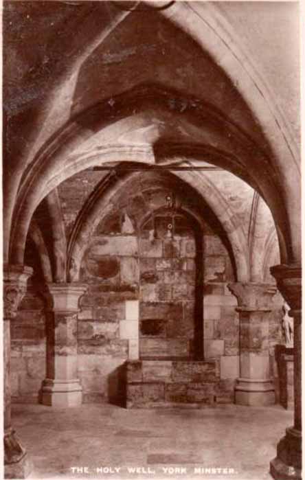
Old photo of the well

Old photo of the well

For people who like to visit the sacred sites that determined a cross-over from Earth-based animism to one which ceased sanctifying the Earth, this ancient water source in the cellars beneath York Minster would be a good example.  Sadly, the church has closed off access to this ancient heritage and you can no longer see it.  Yet despite the fact that the modern-day christians have closed off your encounter with this important heritage site (York Minster’s website doesn’t even mention its existence!), we should not forget its mythic history…

As you walk into the building (at some great expense, it has to be said), the location of the holy well is said to be at its more western end, albeit in the crypt underground—although there does seems to be some confusion with some authors about exactly where the well is positioned.
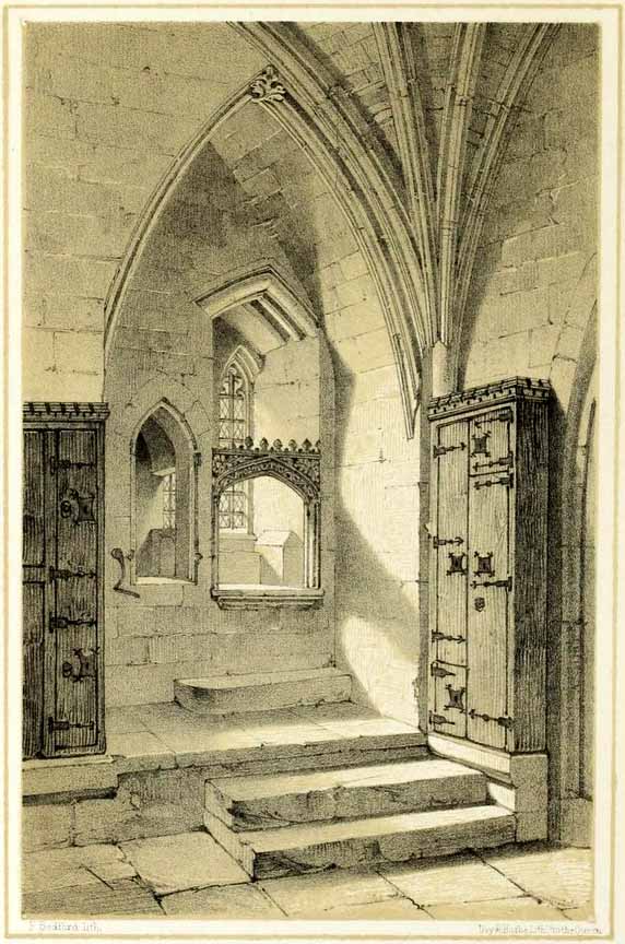
1850 sketch of the well

1850 sketch of the well

The earliest account we hear of the place relates to when the northern tribal King Edwin, along with his sons Osfrid and Esfrid, came here to be “baptized” in the waters of this clear spring “on Easter day, April 12, 627” CE.  Immediately thereafter a small wooden chapel was constructed next to or above the well.  From then on, as the centuries passed, the renown of the well grew and eventually the magnificent ritual temple of York Minster was eventually built.  The waters eventually became dedicated to St. Peter and an annual festival occurred here soon after the Midsummer solstice on what became known as St. Peter’s Day (June 29).  After the year 1462, a secondary festival date was also given to the site by the Church and another annual celebration occurred here on October 1 too.  Its waters remained accessible to people for drinking, healing and rites throughout the centuries.  It is only now, in the 21st century, that its sacrality and spirit has been closed-off.  This is a situation that must be remedied!

In Mr Goole’s (1850) survey of York Minster, his architectural illustration of the building showed that the water from the well had been brought up onto the ground floor, on the southeast side of the inner cathedral building in the easternmost vestry, and named as St Peter’s Pump.  This is illustrated in the 1850 drawing above-left.

A whole series of early writers mention the well in earlier centuries—of whom a brief sample is given here.  When Celia Feinnes came here in the 17th century, she said that,

“In the vestry of York Minster there is a well of sweet spring water called St Peter’s Well ye saint of ye Church, so it is called St Peter’s Cathedral.”(Smith 1923)

Mr Torre (1719) gave it equal brevity, saying simply that,

“at the south-west corner thereof is a draw-well (called St. Peter’s Well) of very wholesome clear water much drunk by the common people.”

In R.C. Hope’s (1893) national survey of sacred wells, he told that

“There is a draw well with a stone cistern in the eastern part of the crypt of York Minster… The Crypt is about 40 feet by 35 feet.”

The well was even included in Murray’s Handbook to Yorkshire (1892) as being “in the southwest corner of the Minster.” William Smith (1923) included the site in his fine survey, telling his readers that,

“The water is excellent in quality, which in measure, so chemists say, is due to the lime washed into it by the rain from the walls of the Minster.  The water has for centuries been used for baptisms, and is so used today.  The well has now for some years been covered with a pump.”

Folklore

In Geoffrey of Monmouth’s famous early History, we find that King Arthur visited here. …And one final note, about which we know not for certain whether it was relevant to the holy well hiding in the crypt, but a fascinating heathen custom was enacted here in bygone days, almost above the spring.  Mistletoe, as Christina Hole (1950) told,

“was ceremonially carried to the cathedral on Christmas Eve and laid upon the high altar, after which a universal pardon and liberty for all was proclaimed at the four gates of the city for as long as the branch lay upon the altar.”

Mistletoe is one element that is known to have been sacred to the druids (not the present-day druids!) and was sacred to the ancient Scandinavians (who came here), and also possessed the powers of life and death in its prodigious folklore and phytochemistry.  Fascinating…

References:

  1. Bord, Janet, Cures and Curses: Ritual and Cult at Holy Wells, HOAP: Wymeswold 2006.
  2. Gutch, Mrs, County Folk-lore volume 2 – North Riding of Yorkshire, York and the Ainsty, David Nutt: London 1901.
  3. Hole, Christina, English Custom and Usage, Batsford: London 1950.
  4. Hole, Christina, English Shrines and Sanctuaries, Batsford: London 1954.
  5. Hope, Robert Charles, Legendary Lore of the Holy Wells of England, Elliott Stock: London 1893.
  6. Murray, John, Handbook for Travellers in Yorkshire, J.Murray: London 1874.
  7. Parkinson, Thomas, Yorkshire Legends and Traditions, Elliot Stock: London 1888.
  8. Poole, G.A., An Historical and Descriptive Guide to York Cathedral and its Antiquities, R. Sunter: York 1850.
  9. Purey-Cust, A.P., York Minster, Isbister: London 1898.
  10. Rattue, James, The Living Stream: Holy Wells in Historical Context, Boydell: Woodbridge 1995.
  11. Smith, William, Ancient Springs and Streams of the East Riding of Yorkshire, A. Brown: Hull 1923.
  12. Torre, James, The Antiquities of York, York 1719.
  13. Whelan, Edna, “Holy Wells in Yorkshire – part 1,” in Source, No.3, November 1985.
  14. Whelan, Edna, The Magic and Mystery of Holy Wells, Capall Bann: Chieveley 2001.
  15. Whelan, Edna & Taylor, Ian, Yorkshire Holy Wells and Sacred Springs, Northern Lights: Dunnington 1989.

© Paul BennettThe Northern Antiquarian


Arncliffe, Littondale, North Yorkshire

‘Carved Stone’:  OS Grid Reference – SD 93 72

Archaeology & History

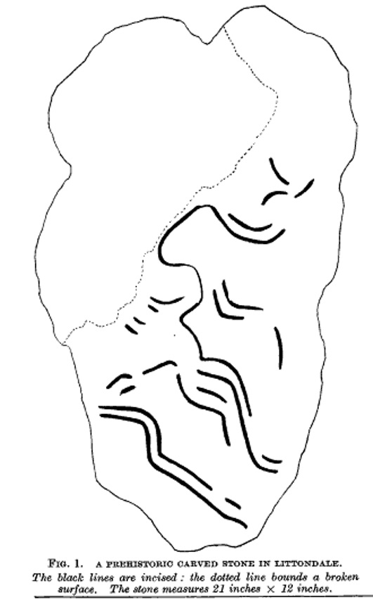
The Arncliffe Carving

The Arncliffe Carving

This is a frustrating site entry.  Not only do we not know where it is, this carving is not listed in any of the modern books on British petroglyphs, yet it was described and referenced by the famous archaeologist Jacquetta Hawkes following its discovery more than 80 years ago.  After a brief mention of the carving in Frank Elgee’s (1933) Archaeology of Yorkshire, an article describing the carving was penned in the journal Man, from which I draw the only information available. It appears to have been found in the early 1930s (no date or discoverer is cited), but has a couple of peculiarities which may bring the authenticity of the stone into question.  Mrs Hawkes (1934) told that the carved stone was,

“found in the bed of a moorland beck in the village of Arncliffe, Littondale, West Riding of Yorkshire.  It is of buff-coloured limestone measuring 21 inches x 12 inches x 6 inches in thickness; the decorated surface is almost flat.  The curvilinear pattern is executed in regular incisions about 4mm wide and 3mm deep; portions of it have been obliterated by water actions and, as is illustrated in the illustration, at one end the surface has broken away altogether.  The whole stone has been much battered and may well be only a fragment of a much larger one.  The state of preservation suggested that it had been in the stream for a considerable period; it is therefore probable that it was washed down from the open moorland above Arncliffe.  In the original (carving), the design is more coherent than it here appears owing to the fact that in the water-worn portions faint lines are visible to the eye which cannot be shown on a tracing.

“Mr W.J. Hemp, who has kindly examined the Arncliffe tracing, identifies the style of the design with the ‘entrail’ pattern of the well-known Pattern Stone from the chambered cairn of Bryn Celli Ddu in Anglesey…

“The technique of the Arncliffe tracing is comparable with the simple incisions which form the oldest of the four techniques recognizable in the Irish megalithic tumuli, where its early date is indicated by the fact that some examples are demonstrably older than the construction of the tumuli in which they occur…

“Mr Frank Elgee, who has also been good enough to comment on the Arncliffe tracing, cannot suggest immediate comparisons from this neighbouring group (around Ilkley, PB), but such evidence as there is he considers to be against assigning a date earlier than the MIddle Bronze Age.”

The late great Eric Cowling also mentioned the stone in his prehistoric survey of the mid-Pennines, but added no further details of his own and seems to have just copied what we have just read.

The fact that the ‘carving’ was found in a stream-bed may mean that the markings on the stone were due to natural erosion; and the fact that the rock was limestone may give added weight to this idea.  However, the fact that Mrs Hawkes, Frank Elgee and W.J. Hemp thought the carving to be authentic cannot be overlooked.  The area is also rich in prehistoric remains (see Douky BottomDewbottoms, Yockenthwaite, Blue Scar, etc)  The design itself is an odd one and has none of the traditional hallmarks consistent with neolithic and Bronze Age cup-and-ring stones, but seems more reminiscent of much earlier mesolithic and palaeolithic images of carved animals and dancing human figures.

If anyone knows more about this site, particularly its whereabouts (perhaps in private possession or hiding in some museum box, where increasing numbers of cup-and-rings are wrongfully kept), or whether the ‘carving’ has been disregarded as little more than natural weathering, it would be good to know for certain.

References:

  1. Cowling, E.T., Rombald’s Way: A Prehistory of Mid-Wharfedale, William Walker: Otley 1946.
  2. Elgee, Frank & Harriet, The Archaeology of Yorkshire, Methuen: London 1933.
  3. Hawkes, Jacquetta, “A Prehistoric Carved Stone in Littondale,” in Man, volume 34, 1934.

© Paul BennettThe Northern Antiquarian


Cow Keeper’s Field (1), Boulby, Easington, North Yorkshire

Cup-Marked Stone:  OS Grid Reference – NZ 75398 19218

Also Known as:

  1. BOU-5 (Brown & Chappell)

Archaeology & History

Cup-marked stone inside Cow keepers Field tomb

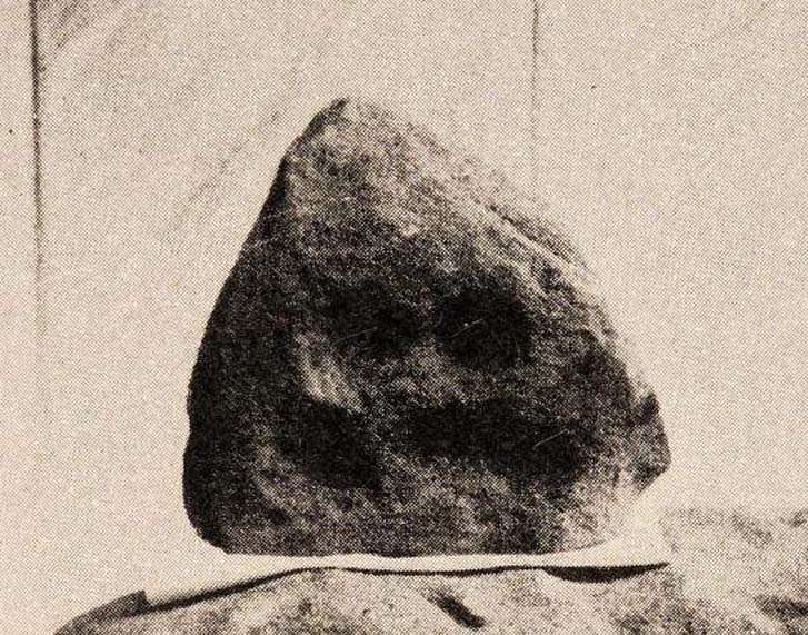
Inside the once prominent prehistoric tomb on the Cow Keeper’s Field, the northern antiquarians William Hornsby and John Laverick (1920) came across two small petroglyphs in association with a cremation burial, several feet south of the central cist: the Cow Keeper’s Field 2 carving, plus this small, triangular-shaped stone, 8in by 6in, consisting of five standard cup-marks, with two of the cups (as the photo shows) connected to each other.  It is akin to the numerous ‘portable’ cup-marked stones which, in other cultures, were deposited onto cairns in remembrance of the ancestral spirits of the tomb.  Such widespread practices may also have occurred here.  Petroglyph researcher and writer Graeme Chappell (2017) informed us that the carving “is in storage in the Dorman museum in Middlesborough.”

References:

  1. Brown, Paul & Chappell, Graeme, Prehistoric Rock Art in the North York Moors, Tempus: Stroud 2005.
  2. Chappell, Graeme, Personal communication, October 4, 2017.
  3. Crawford, G.M., Bronze Age Burial Mounds in Cleveland, Cleveland County Council 1990.
  4. Elgee, Frank, Early Man in North-East Yorkshire, John Bellows: Gloucester 1930.
  5. Hornsby, William & Laverick, John D., “British Barrows round Boulby,” in Yorkshire Archaeological Journal, volume 25, 1920.

© Paul BennettThe Northern Antiquarian 


Cow Keeper’s Field (2), Boulby, Easington, North Yorkshire

Cup-and-Line Stone:  OS Grid Reference – NZ 75402 19222

Also Known as:

  1. BOU-5 (Brown & Chappell)

Archaeology & History

Cup-marks and linear forms

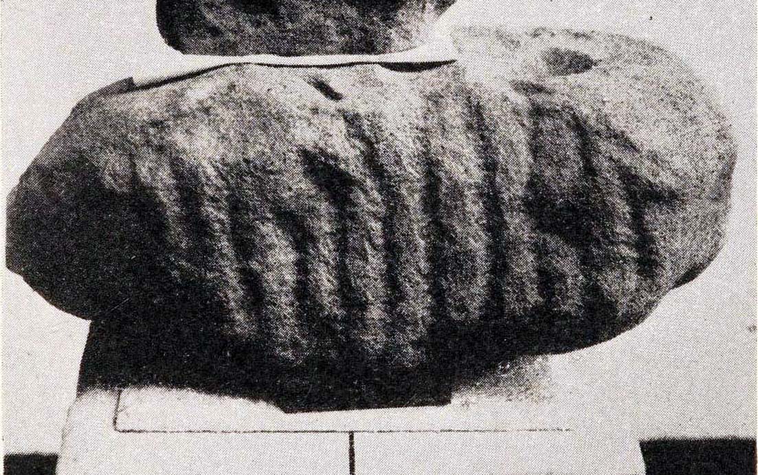
Inside the once prominent prehistoric tumulus on the Cow Keeper’s Field (now destroyed), the northern antiquarians William Hornsby and John Laverick (1920) came across two small portable petroglyphs: the Cow Keeper’s Field 1 carving, plus this “peculiarly marked stone” as they put it, some “5ft south of the centre” where a cist, or stone-lined burial existed.  Measuring 18in by 7in, the rock carving consists of at least one large cup-marking which is clearly evident on top of the stone, plus what seems to be another one next to it, half-covered.  Along the side of the stone, a series of twelve roughly parallel lines have been carved out, running down to the bottom of the stone.  Rock art researcher and writer Graeme Chappell (2017) tells us the carving is supposed to be “in storage in the Dorman museum in Middlesborough,” although no one has seen it in years.  It would be worthwhile if fellow research students could visit the said museum to recover this and other portable cup-marked stones that were found in the area.

References:

  1. Brown, Paul & Chappell, Graeme, Prehistoric Rock Art in the North York Moors, Tempus: Stroud 2005.
  2. Chappell, Graeme, Personal communication, October 4, 2017.
  3. Crawford, G.M., Bronze Age Burial Mounds in Cleveland, Cleveland County Council 1990.
  4. Elgee, Frank, Early Man in North-East Yorkshire, John Bellows: Gloucester 1930.
  5. Hornsby, William & Laverick, John D., “British Barrows round Boulby,” in Yorkshire Archaeological Journal, volume 25, 1920.

© Paul BennettThe Northern Antiquarian


Cow Keepers Field, Boulby, Easington, North Yorkshire

Tumulus (destroyed):  OS Grid Reference – NZ 75400 19220

Also Known as:

  1. Boulby Barns

Archaeology & History

This prehistoric tomb was one in a cluster of tumuli in the Boulby district, uncovered by the northern antiquarians, William Hornsby and John Laverick in 1918.   Most of them have subsequently been destroyed – this one included.  When they visited the site, they described it as “a barrow…with a diameter of 36 feet.”  Once they began digging into it,

“at the centre we found a cist, the top of which was 2ft 7in below the present surface. The cist lay north 64° west, and south 64° east.  It had no cover and the slab at the north-west end was wanting.  The cist measured: side 3ft 6in, end 3ft 2in.  Its depth was 2ft 2in.  In it we found nothing except sandstone chips.  With these there was no admixture of soil. Above the cist and covering a space of 5 ft by 5 ft there was a layer of burnt earth and black ashes (of furze bushes).  At a distance of 5 ft south of the centre, and 1ft 10in below the present surface, there was a burnt burial, 20in in diameter.  With this we found many flint chips, a shale pendant, and the peculiarly marked stone” we’ve called, simply the Cow Keeper’s Field 2 carving.

A second cup-marked stone was also found inside the tomb, a few feet south of the cist. When G.M. Crawford went to survey the burial mound in the late 1970s, he reported “there is no trace of it” and “has probably been destroyed by ploughing.”

References:

  1. Brown, Paul & Chappell, Graeme, Prehistoric Rock Art in the North York Moors, Tempus: Stroud 2005.
  2. Crawford, G.M., Bronze Age Burial Mounds in Cleveland, Cleveland County Council 1990.
  3. Elgee, Frank, Early Man in North-East Yorkshire, John Bellows: Gloucester 1930.
  4. Hornsby, William & Laverick, John D., “British Barrows round Boulby,” in Yorkshire Archaeological Journal, volume 25, 1920.

© Paul BennettThe Northern Antiquarian 


The Falls (1), Boulby, Easington, North Yorkshire

Cairn:  OS Grid Reference – NZ 74954 19429

Also Known as:

  1. Rockcliff Beacon

Archaeology & History

Tumulus on 1920 map

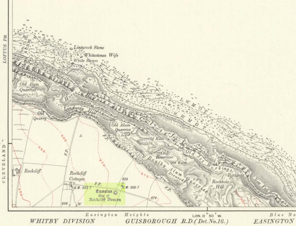
Occupying a prominent position above the ever-closer North Sea, upon which an old beacon was subsequently placed, this denuded prehistoric tomb was first surveyed by the Ordnance Survey lads in 1913, and subsequently in an essay by Messers Hornsby & Laverick (1920) on the ancient sites of Boulby, east of Easington.  This was the first one they explored, calling it ‘Mound No.1.”  They located it,

“due south of the ‘Soldier’s Garth’ in the east corner of the field called The Falls.  It was a cairn with a diameter of 50ft.  Two-and-a-half feet northwest of the centre peg, at a depth of 21 inches below the present surface, there was an unaccompanied burnt burial, which occupied a space of 15in by 18in.  In a centre cut 7ft 6in by 6ft, at a depth of 3ft 6in, we found much burnt bone and many potsherds of the Bronze Age type, scattered over the whole space of the trench, down to a further depth of 3ft 10½in.  In the south corner there were four stones set on edge and running in a direct (straight) line.  The interment had been placed upon the clay, the soil of the original surface having been cleaned off.  With this burial we found a good flint made from a polished celt and worn smooth at the point—possibly through having been used for striking fire on iron pyrites—many chips and several cupstones.”

The “several” cup-marked stones they describe at the end seem to have been lost; perhaps sleeping in some museum cellar somewhere (does anyone know?).

This cairn was one in a complex of eight that Frank Elgee (1930) suggested may have been laid out deliberately in the form of the constellation of Ursa Major, or The Plough, also known as ‘Charles Wain’.

References:

  1. Brown, Paul & Chappell, Graeme, Prehistoric Rock Art in the North York Moors, Tempus: Stroud 2005.
  2. Crawford, G.M., Bronze Age Burial Mounds in Cleveland, Cleveland County Council 1990.
  3. Elgee, Frank, Early Man in North-East Yorkshire, John Bellows: Gloucester 1930.
  4. Hornsby, William & Laverick, John D., “British Barrows round Boulby,” in Yorkshire Archaeological Journal, volume 25, 1920.

© Paul BennettThe Northern Antiquarian 


Snowden Carr carving (610), Askwith, North Yorkshire

Cup-Marked Stone:  OS Grid Reference – SE 18105 51210

Getting Here

Snowden Carr carving 610

From Otley, take the road north across the River Wharfe up and up, heading towards Askwith Moor.  As the moorland opens up ahead of you, at the crossroads turn right along Snowden Carr Road and literally ¾-mile along (1.25km) where a track on your right goes to Carr Farm, on the left-side of the road is a gate.  Go through here to the Naked Jogger Stone and walk up the rocky ridge ahead of you, alongside the walling (as if you’re going to the Sunrise Stone), and about 20-30 yards up you’ll reach this carving.

Archaeology & History

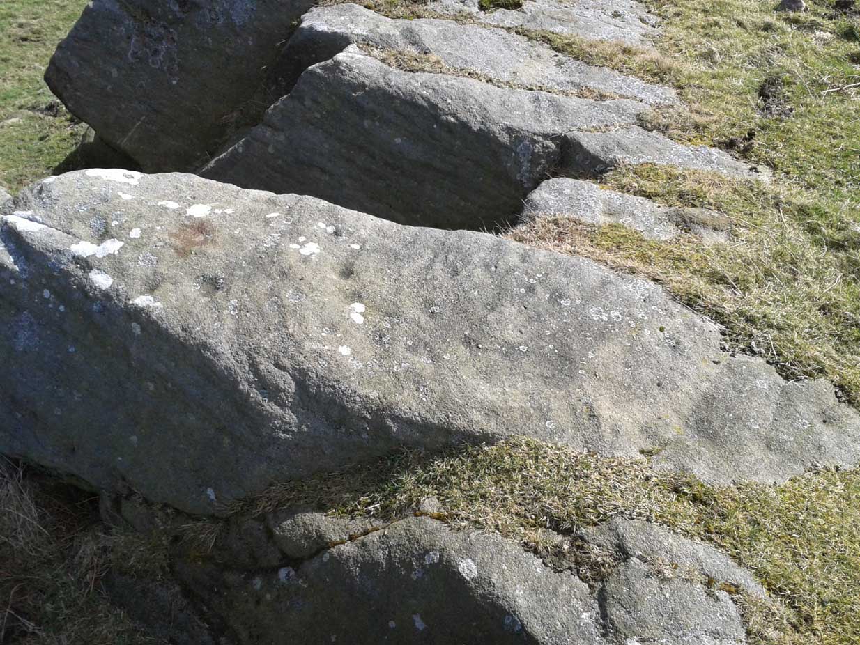
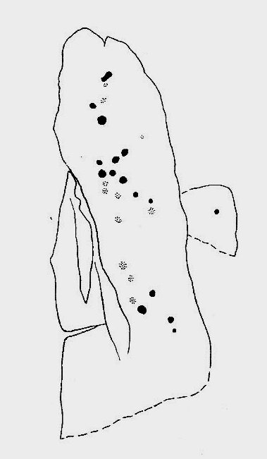
Best visited on a clear day, this is one carving amidst a small cluster of cup-marked petroglyphs found along the small geological ridge between the Sunrise Stone and Naked Jogger carving (none of which are as impressive as those two!).  This particular design consists of a number of faint cup-marks— between 17 and 25 of them—reaching along the horizontal surface, with no distinct formal pattern, as usual.  The carving continues beneath the encroaching soil.

Looking down at the carving
Archaeo-sketch

It seems to have been described for the first time by Stuart Feather (1973); then subsequently in Boughey & Vickerman’s (2003) survey, in which they attach a single cup-marking on an adjacent rock into the matrix of this design—but the two rock surfaces are distinctly separate.  This apart, their description tells, briefly as always: “Large long rock which may be outcrop, with hill falling away steeply below. Seventeen worn cups.”

References:

  1. Boughey, Keith & Vickerman, E.A., Prehistoric Rock Art of the West Riding, WYAS: Leeds 2003.
  2. Feather, Stuart, “Askwith, W.Yorkshire,” in ‘Yorkshire Archaeological Register’, Yorkshire Archaeology Journal, volume 45, 1973.

© Paul BennettThe Northern Antiquarian 


Yockenthwaite Circle, Buckden, North Yorkshire

Stone Circle:  OS Grid Reference – SD 89975 79365

Also Known as:

  1. Druid’s Circle

Getting Here

Yockenthwaite circle (photo by James Elkington)

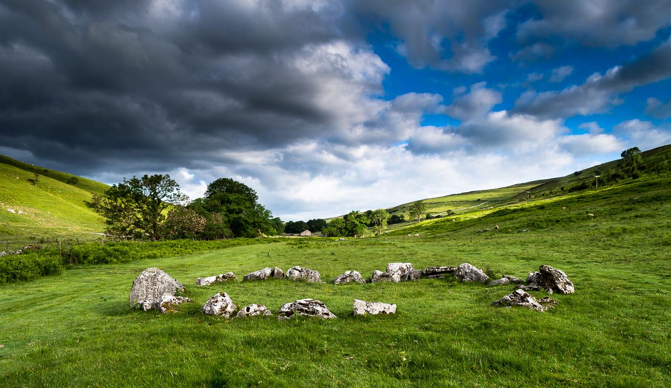
The long country road running between Aysgarth and Kettlewell is the B6160.  Whether you’re coming from the north (Aysgarth) or south (Kettlewell), when you reach either Buckden or Cray, take the minor road west to Hubberholme.  Just over 1½ miles further on, you reach the tiny hamlet of Yockenthwaite itself.  Cross the river bridge, then turn left and walk along the footpath parallel with the river.  600 yards or so along, keep your eyes peeled for the low small ring of stones in front of you.

Archaeology & History

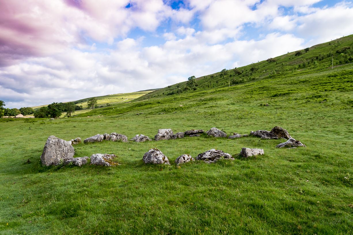
Just above the well-trod path that runs parallel with the usually shallow River Wharfe, this small and silent ring of stones rests in the idyllic host of Langstrothdale, deep in olde Yorkshire.  Tis a wonderful spot… Classed as a ‘stone circle’ for many a decade (even by the esteemed Aubrey Burl), this small but ancient ring shouldn’t really be held in the same category as our larger megalithic circles.  In truth, it looks more like some of the larger hut circles I’ve seen and uncovered down the decades—and it may well be that.  Indeed, even the archaeo’s aren’t in agreement as to what it is, with the general idea being that it is the remains of a ring cairn of some type, despite no human remains being found here.

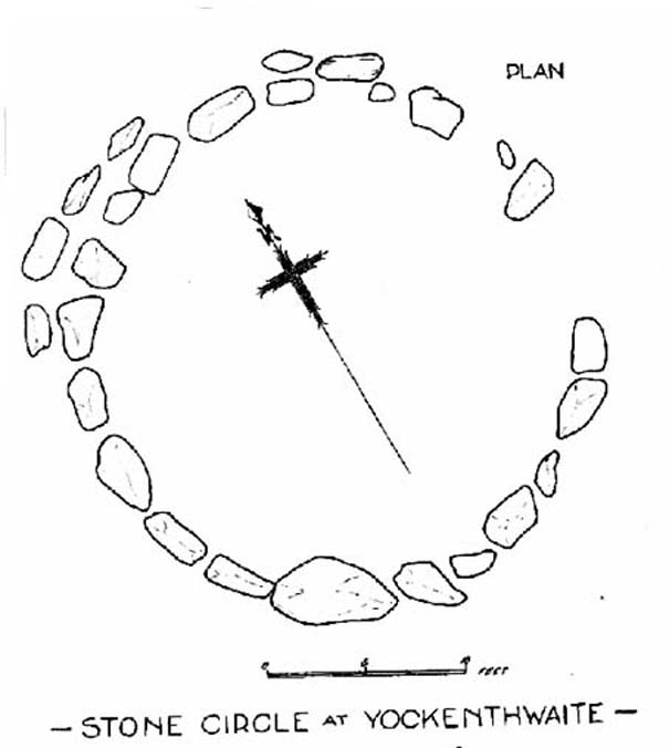
Raistrick’s 1929 plan
Looking northwest

Yockenthwaite itself was already know by this name in 1241 CE, when the monks of Fountains Abbey were given the land by one of the murderous invading Norman families of the period.  This ingredient may be relevant to the history of the circle, for as the great northern antiquarian Harry Speight (1900) pointed out,

“in several places in the dales there are traces of what seems like ancient sheep or cattle enclosures, which are probably vestiges of this grant to the monks of Fountains in 1241.”

And Speight thought the circle had a similar origin to these remains.  He continued:

“An enclosure of this kind, composed of a number of big stones on end, lies at the low end of the second pasture on the north side of the river between Yockenthwaite and Deepdale, and has been described as a Druid’s Circle.  It is doubtless one of these monastic folds.”

And he may have a point.  Although when Arthur Raistrick (1929) ventured here in the early 1920s, he had other ideas, pushing the date of the site way way back into the Bronze Age.  “The circle,” Raistrick told,

“is slightly raised above the surrounding ground-level, and the stones, standing edge to edge, can be seen from a considerable distance on either fell side.  The circle is 25 feet diameter, very nearly a true circle, there being only about 6 inches variation in diameter.  The stones number 20, placed on edge to edge to edge…with only two small gaps, which would accommodate three or perhaps four more stones.  These stones were probably removed some years ago to repair the stile in the neighbouring wall.  Outside this circle of 20 stones, on the northwest side, there are four others placed concentrically, and very close to the circle, but there is no evidence that the circle was ever double, or that there were ever more than these extra four stones.  There is a slight mound at the centre, and probing with a rod proved a small circle of stones, about 9 feet diameter at the centre, indicating probably a burial.  Several large boulders lie on the level ground around the circle, but these are all rolled down from the fell-side above, and not placed in any connection with the circle.  All the stones of the circle are of limestone…”

It was this designation that led to Burl (1976; 2000) to include it in his corpus of megalithic rings; although John Barnatt (1989) did question the validity of the site as a true ‘stone circle’ in his own gazetteer, saying:

“This unusual site comprises a contiguous ring of orthostats of c. 7.5m diameter, which are graded downslope to the SSW to allow for the gradient; their tops are all roughly horizontal.  They range from 0.30 to 1.05m in height, 22-3 stones survive today and 3-4 appear to be missing.  To the NNW there is a short outer arc of 4-5 stones placed immediately outside the main ring.  4 loose stones appear to have been added to the ring recently.  Raistrick’s plan does not tally with the present remains, despite the sites undisturbed nature.  The interior of the site is filled by a low horizontal platform, with virtually no height upslope to the north-east and a height of c. 0.5m to the south-west.  The ring of stones stand well proud of this round the full circumference.  This site appears to be a variant form of kerb-cairn rather than a true stone circle.”

The structure has been built onto a slight but notable platform, as has also been done with many hut circles—and the Yockenthwaite site may just be one of them.  Only an excavation will tell us for sure.  It’s isolated from other remains, but on the hills above, both north and south, denuded Iron Age and Bronze Age settlements look down on this solitary ring.  Whatever it may be, it’s olde and in a beautiful setting.  Well worth checking out if you like yer ancient sites!

References:

  1. Barnatt, John, Stone Circles of Britain (2 volumes), BAR: Oxford 1989.
  2. Burl, Aubrey, A Guide to the Stone Circles of Britain, Ireland and Brittany, New Haven & London 1995.
  3. Burl, Aubrey, The Stone Circles of Britain, Ireland and Brittany, Yale University Press 2000.
  4. Elgee, Frank & Harriet, The Archaeology of Yorkshire, Methuen: London 1933.
  5. Longworth, Ian H., Regional Archaeologies: Yorkshire, Cory, Adams & MacKay: London 1965.
  6. Raistrick, Arthur, ‘The Bronze Age in West Yorkshire,’ in Yorkshire Archaeology Journal, volume 29, 1929.
  7. Raistrick, Arthur, Prehistoric Yorkshire, Dalesman: Clapham 1972.
  8. Speight, Harry, Upper Wharfedale, Elliott Stock: London 1900.

Links:  James Elkington Photos

Acknowledgements:  Huge thanks to James Elkington for use of his photos in this site profile.  Cheers mate!

© Paul BennettThe Northern Antiquarian 


Cock Lakes, Blubberhouses Moor, North Yorkshire

Cup-Marked Stone:  OS Grid Reference – SE 1524 5469

Getting Here

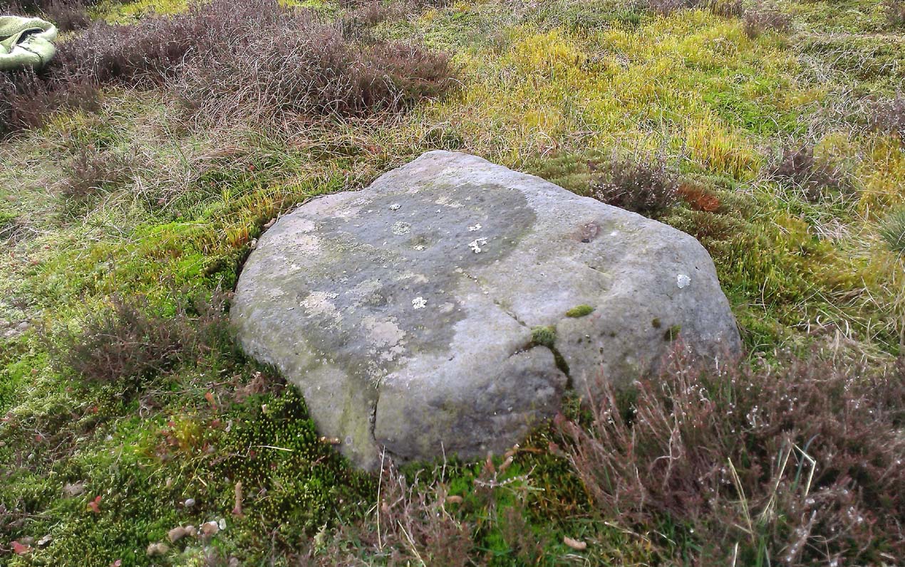
Faint cups highlighted by water

Follow the same directions as if you’re visiting the James Stone monolith.  From here, walk about 60 yards southeast and zigzag about in the heather until you find a small squarish-shaped earthfast rock, barely 6 inches above ground-level (might be hard to find when the heather’s fully grown).  If you’ve got a petroglyphic nose, you’ll find it!

Archaeology & History

A simple faded cup-marked stone, roughly 2½ feet by 2 feet across, can be found about 65 feet southeast of the James Stone and 40 yards west of the Benty Gate prehistoric enclosure.  Sadly when we visited the place a few days ago, the sky was grey and the conditions for good photos were poor.

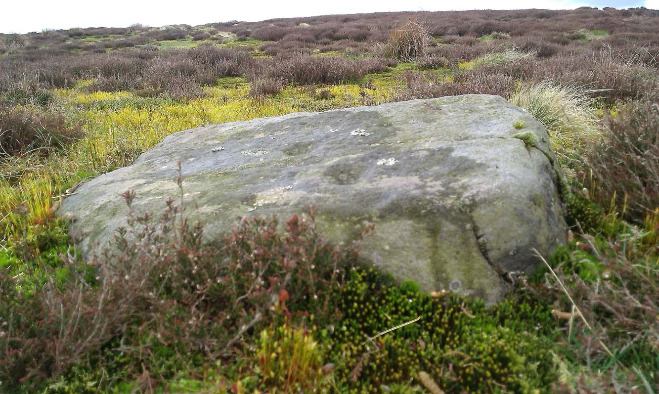
Line of faint cups from centre
Extra faint cup near centre left

At least five cup-marks have been etched onto the stone, with the main element being a row a three cups in a straight line from the centre of the stone to its SE edge.  The central cup-mark has been carved where a natural crack in the rock, running from the edge of the stone, terminates.  There also seemed to be a carved faded line running along the bottom edge of the stone—but it was unclear and another visit is needed in better light to see if there’s more on the stone.

© Paul Bennett, The Northern Antiquarian

James Stone, Blubberhouses Moor, North Yorkshire

Standing Stone: OS Grid reference – SE 15196 54722

Getting Here

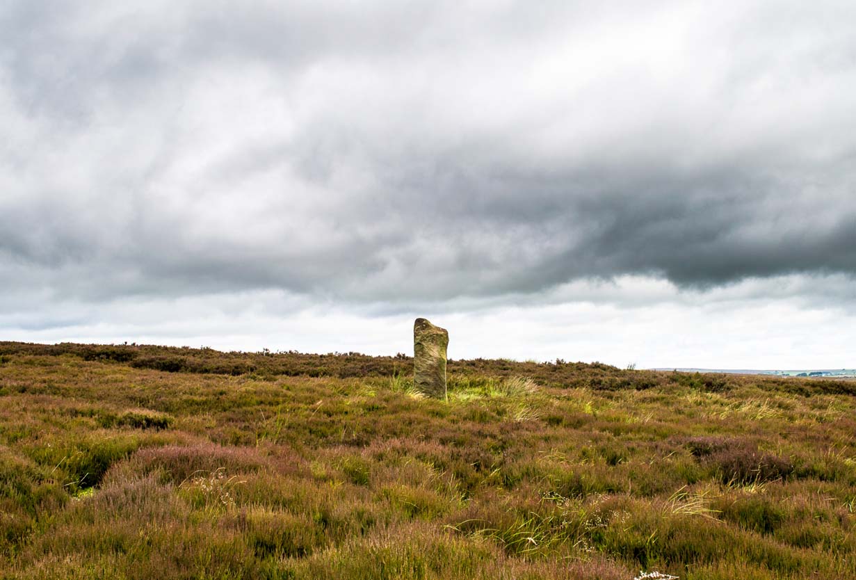
James Stone, looking SW

From Blubberhouses church by the crossroads, walk up the slope (south) as if you’re going to Askwith, for 100 yards or so, taking the track and footpath past the Manor House and onto the moor.  Once you hit the moorland proper, take the footpath that bears left going down into heather and keep going till you hit the dead straight Roman Road path running west onto Blubberhouses Moor. Carry along the Roman Road for about 200 yards as though you are going towards the Eagle Stone, and looking right (if you squint) you can just make out a small pimple on the top of the moors about a quarter of a mile away. That is where you are heading (be warned – it is boggy getting there).

Archaeology and History

James Stone, looking NE

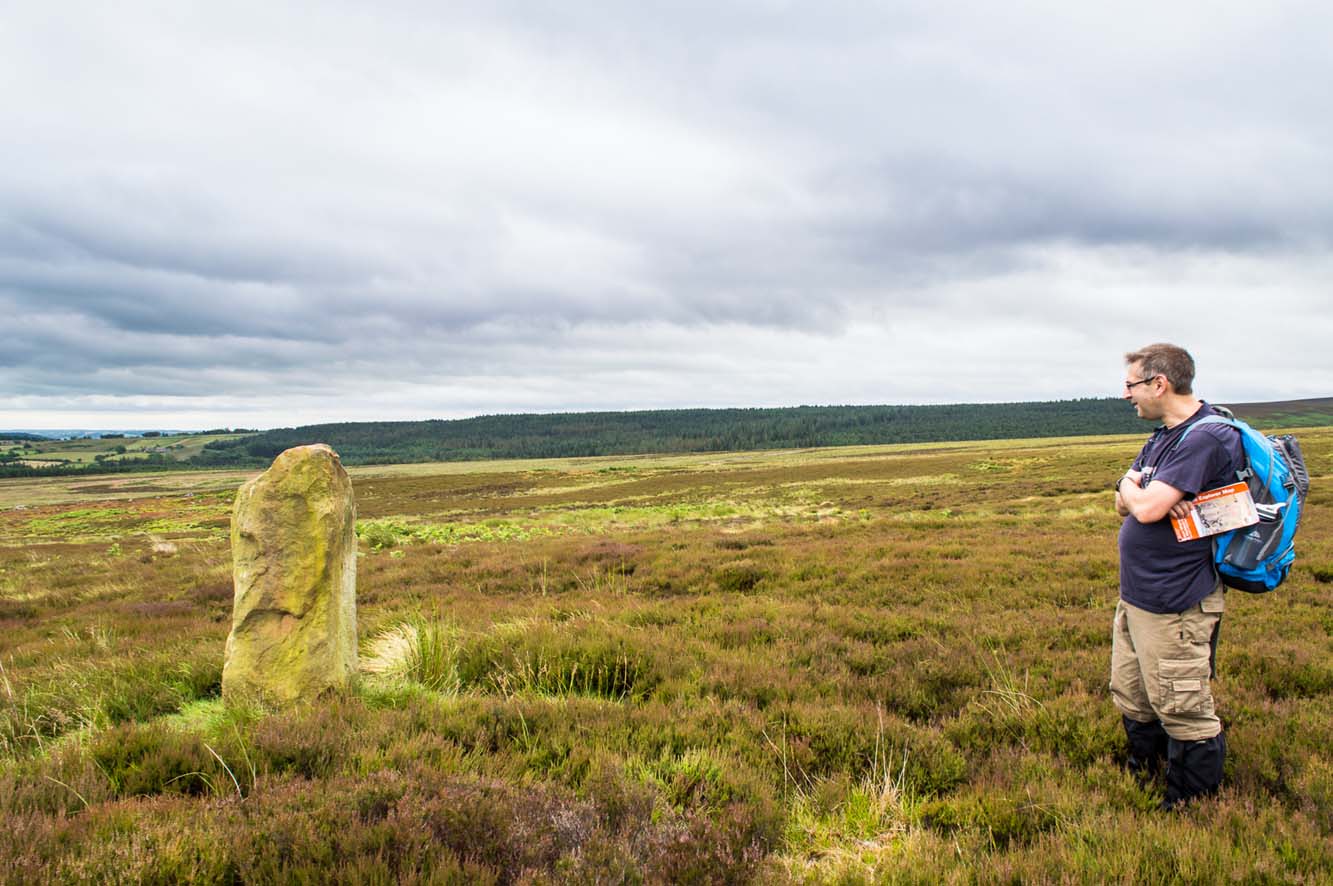
Discovered (or rather ‘noticed’) by James Turner and James Elkington in July 2016 (hence the name James Stone), this standing stone is of an indeterminable age – although it does look ancient.  Standing more than 5 feet tall, and in the middle of nowhere, it is fairly difficult to get to unless you want to get wet feet.  It is situated very close to a small and unexcavated prehistoric settlement and we could find no physical evidence of any tracks nearby (although Google Earth does show what looks like one or two very short, faint tracks near the stone, which is the old ‘Benty Gate’ track).

It could be a boundary stone, although doubtful – it has a feel to it that says it is prehistoric, although this is just guesswork on our part.  I can find no reference to it in Cowlings Rombalds Way (1946) and there seems nothing about it in either of William Grainge’s (1871; 1895) detailed history works of the region.

Mr Turner gazing at the stone

At first we thought it unlikely to be a new find, however the stone is difficult to see from the Roman Road (I had been up here dozens of times before I noticed it) and seeing that people rarely go up here anyway, and it is relatively difficult terrain getting to it, it is not surprising that no one has bothered visiting it. It would take someone who is quite keen on megaliths to want to examine it and it is well off any tracks.

Having said that, it is a nice find and it could be linked in some way with the small unexcavated settlement nearby, or possibly the large Green Plain settlement nearly a mile away.  Well worth a visit…bring your wellies!

References:

  1. Cowling, Eric T., Rombald’s Way, William Walker: Otley 1946.
  2. Grainge, William, The History and Topography of Harrogate and the Forest of Knaresborough, John Russell Smith: London 1871.
  3. Grainge, William, The History and Topography of the Townships of Little Timble, Great Timble and the Hamlet of Snowden, William Walker: Otley 1895.

© James Elkington, The Northern Antiquarian