Our Lady’s Well, Runwell, Essex

Holy Well:  OS Grid Reference — TQ 7510 9658

Also Known as:

  1. Running Well

Getting Here

The runwell. copyright with permission http://www.spiritrealms.co.uk/gallery.htm
The Runwell (copyright with permission http://www.spiritrealms.co.uk/gallery.htm )

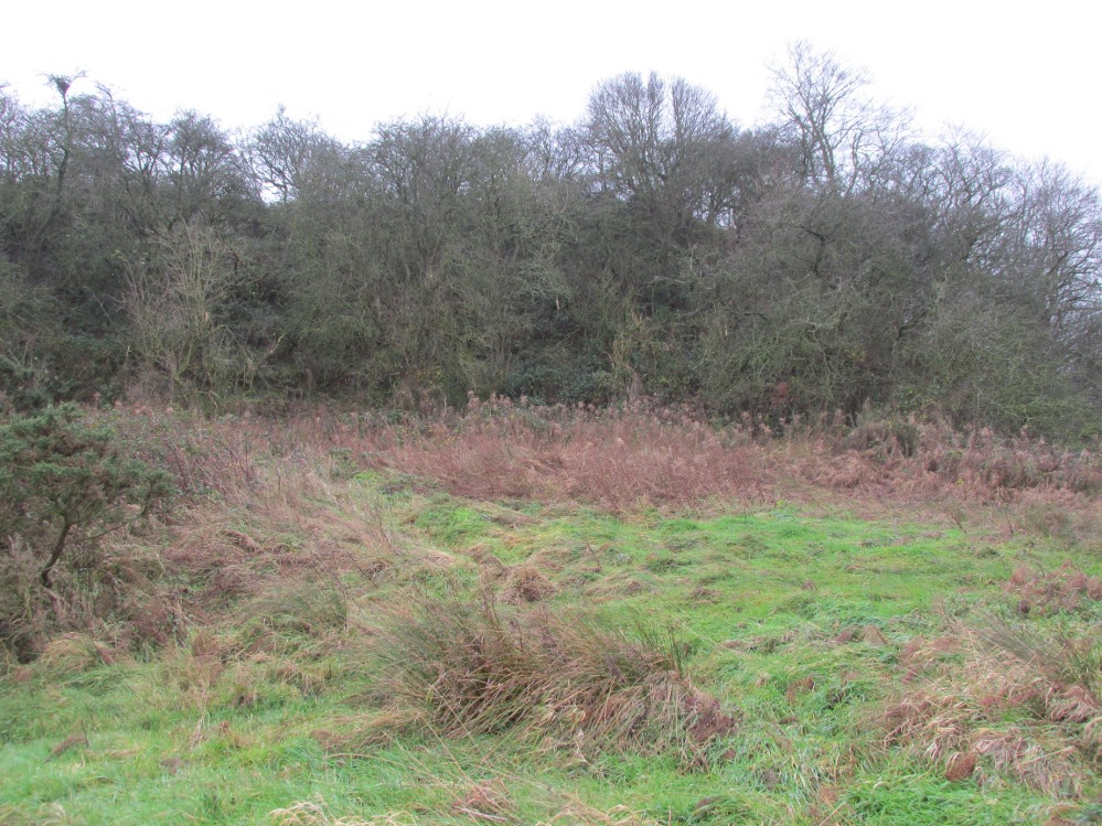
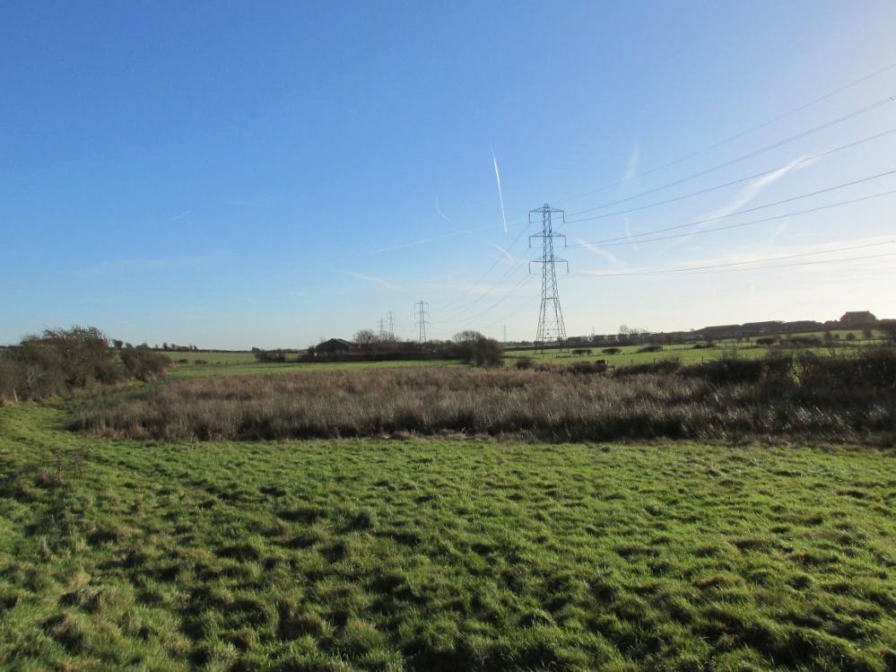
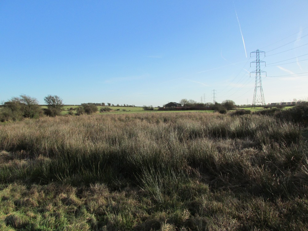
It can be found by taking a road off the A132 (Wickford Road) which leads to Stock (directly opposite the Parish Church), continuing until you reach another minor road to Rettendon. A short way up this road it forks. Take the road to the right & continue until one reaches a minor drive to Poplars Farm (distinctive with its trees each side of the drive). Continue up here until one passes the house to a small piece of tarmac. Here a footpath continues directly in front, continue until one reaches on the left a gate. Enter through here, and head across the field towards a notable tree, and a gap in the hedge. To the left, follow the edge of the field, until one sees another opening into the well. The approach from the south is the only route worth considering as northerly access is blocked by a fence. It can be extremely muddy, so good footwear is advisable.

Archaeology & History

Philip Morant (1763-8) is the first to mention it, suggesting that the settlement is named:

“..from a considerable Running well in the Parish.”

Again, Chandler (1896)—noted in Collins (1986)—emphasises:

“a remarkable spring of water on Poplars Farm, which is always running and has never been known to fail.”

Despite this obvious assumption, Ekwall (1936) suggested that the prefix originates from O.E rune for ‘mystery’ or implying a well possessing a secret of some religious observance. This is suggestive of the strange legends and traditions involved with the site.  Alternatively it could derive from hruna referring to the tree trunk—and it does arise in a copse. A roman road runs by here.

The only reference to a religious site appears to be in 1602 when the parish register records ‘Shrine of the Bl. Virgin of RunnyngeWelle’.  However, stone remains found over the years around the well may support the idea of a well chapel; these remains were two pieces of limestone window mullion and a piece which appears to be part of a step as well as pieces of Kentish ragstone.

Folklore

According to Bazille-Corbin (1940), Runwell is steeped in lore and legend. One must take these stories as possible antiquarian fancy as there does not appear to be any concrete evidence for them.  Doubtless some of it is true, other bits not. He states that in the Sixth Century AD, Christian missionaries Lucus and Lucilus visited Essex and found a scene of paganism here, built a chapel, and rededicated the well to “Our Lady St Mary.”  The floor of this chapel had a unique designed cross, with black flint and red strawberry stone, to show the teachings of the tenets of the Christian Faith.

To protect this and collect subsequent devotional gifts, a nunnery, of six members, was developed around the site. They tended to the shrine, well head and the statue of Our Lady, to which many miracles were attributed. Little evidence exists concerning this foundation, but it is believed to have been dissolved in the 16th Century. Locally it is said parts of the nunnery were incorporated into the nearby farm-house ‘The Poplars’. In the 1980s, Andrew Collins, searched for records of this local priory, but found none.

Another legend connected with the well accords that a young nun, Sister Lucy, after renouncing her vows, found the outside world not to her liking and returned in repentance, one snowy night, to the chapel for forgiveness. Yet, upon reaching the chapel steps, she slipped and fell into the icy waters of the well. (cf. The Single or St. Thomas’ Well at Ifield, Kent)

Her ghost is said to haunt the area, preserving perhaps the memories of these past water deities. This is enforced by the belief by some authorities that the well’s dedication indicates a Christianisation of the Iceni goddess Epona. This is supported by these horseshoe-shaped motifs, and that the approach to the well being haunted by a horse.

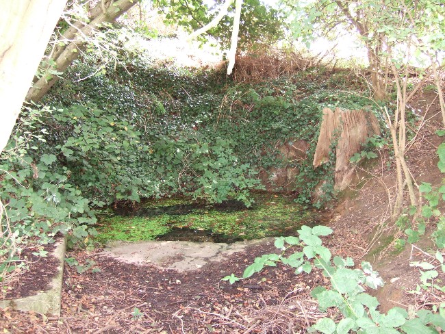
Andy Collins (1986) was informed that a concrete water tank was installed over the spring.  This proved to be inaccurate, but the well was defined by a concrete chamber.  Collins thought that this may be the remains of some adaptation for a spa bath, but no hard evidence was forthcoming regarding this.

It certainly had passed through considerable years of neglect, as noted by the Runwell Rector John Edward Bazille-Corbin (1942), who said it was “in much need of dredging and cleaning out.”

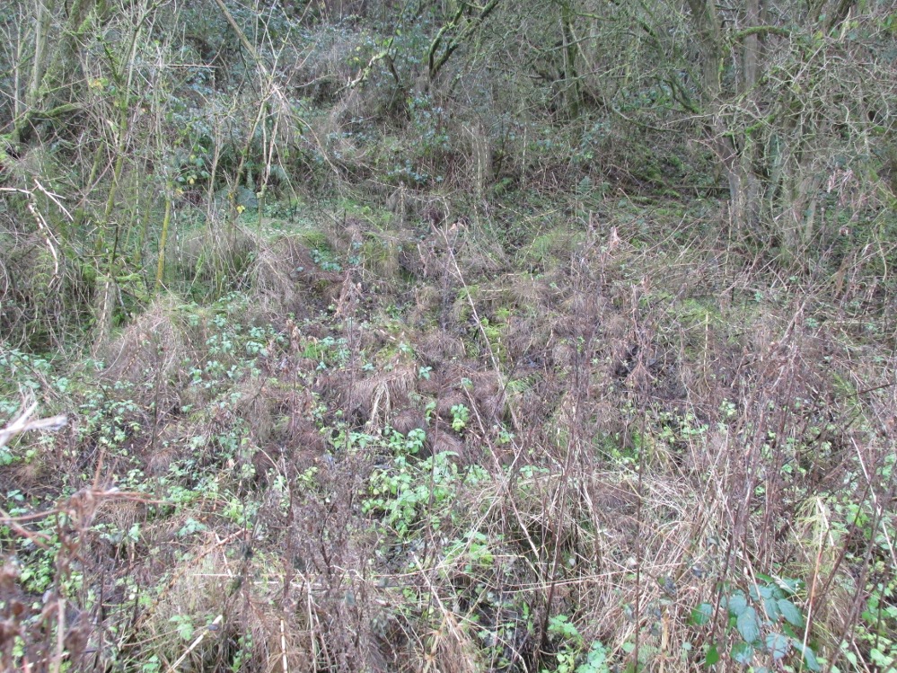
The photo shown in Collins’s (1986) work shows a concrete lined rectangular pond, defined by corrugated iron. He was thus responsible for its repair and clearing away the years of neglect, also revealing the concrete rectangular pond, which was reached by a series of steps from its north side. A flight of steps appear to enter the well itself from the front. The body of water is of considerable size and depth and one could easily immerse oneself in it. When I last visited here, the water appeared murky but a sample revealed (apart from the pond fauna) a remarkable clarity.

Within recent years the well appears to have attracted a ‘cult following’, clearly manifesting itself in two ways. One is a seasonal Boxing Day walk to the well started in 1975, which is still undertaken (see link, below). The other more traditionally is the attachment of rags or cloutties to the surrounding shrubbery. Such activity, although probably done by those ‘in the know’ rather than any continuation of any local tradition, is the only such example I have come across in East Anglia—although recent photographs fail to show this and it appears that the tree has been cut down where these have been placed and the area opened up.

References:

  1. Bazille-Corbin, J. E., Runwell St. Mary: A farrago of History, Archaeology, Legend and Folk-lore, 1940. 
  2. Collins, Andrew, “Devilish Mysteries at Runwell,” in Essex Countryside Vol. 33 no.431, p38-39, 1985.
  3. Collins, Andrew, The Running Well Mystery, 1986.
  4. Ekwall, Eilert, Studies in English Place and Personal Names, Lund 1931.
  5. Ekwall, Eilert, The Concise Oxford Dictionary of English Place-Names, Oxford 1936.
  6. Morant, Philip, The History and Antiquities of the County of Essex – 3 volumes, London 1763-8 (reprinted by EP: Wakefield 1978).
  7. Parish, R.B., Holy Wells and Healing Springs of Essex, Pixy Led Publications 2008.
  8. Reaney, Paul, The Place-Names of Essex, Cambridge University Press 1935.

Links:

  1. Runwell Boxing Day History Walk – Wickford History
  2. Runwell History Walk – Photo Guide

This site profile is an edited extract from the book Holy wells and healing springs of Essex

© R.B. Parish, The Northern Antiquarian


Fairy Well, Preesall, Overwyre, Lancashire

Sacred Well:  OS Grid Reference – SD 36711 47562

Getting Here

Fairy Well is found to the centre below the trees

The 6″ OS map of 1913 has a ‘Fairy Well’ marked on the northern edge of Preesall Hill.  Travelling north through the village on the B5377, the Hill is to your right. Immediately past it is a stile, cross over this and go straight on with the hill to your right.  The approximate site of the fairy well is now marked by a boggy area at the foot of the hill.

Archaeology & History

Almost a footnote in Reverend William Thornber’s 1852 paper on the Britons, Saxons and Danes in the Foreland of the Fylde, here is how this site is described by him in the quaint (to our eyes) language of the mid-nineteenth century:

“…the hill of Presal, (the ‘Pressonde’ of Domesday), with its well all but deified; and although the votaries, like those in the pool of Laconia, may not have cast into it cakes of bread-corn to Juno,* yet a bush was named ‘Beggar’s bush,’ from the circumstances of the offerings of rags and clouts being affixed to it, over which a prayer was said; for Bishop Hale ridicules a superstitious prayer for the blessing of clouts for the cure of diseases.”

In addition, the following reference was found on-line:

“…If the travellers had lingered, however, they would observe the inhabitants placing half eggshells on the edge of the Fairy Well at the foot of Preesall Hill; a practice of the local school children even at the beginning of the 20th century. Recording some of the traditions of the country areas of 19th century Wales, Sir John Rhys in his “Celtic Folklore”, mentioned how half eggshells were left out for the fairy folk to use as cooking pots in which to prepare food and brew beer for the reapers at harvest time.”

Close-up of the boggy waters

The Beggar’s Bush is long gone, but the red colour of the deposits in the adjoining ditches would indicate a chalybeate (iron-bearing) spring rather than a well, and the northern slope of the hill seems to have become an unofficial children’s play area.  Curiously, at the top of the hill, next to the playground of the Fleetwood’s Charity School, there is a modern ‘beggar’s bush’, festooned with white and yellow plastic strips, in a small nature trail area…

  • * quoted from Borlase, in his Natural History of Cornwall (1758): “…In Laconia they cast into a pool, sacred to Juno, cakes of bread-corn; if they sunk, good was portended; if they swam, something dreadful was to ensue.”
  • ¶  http://www.lancastrians4ever.homecall.co.uk/lancastrians4ever/precha1.htm – Believed to be an online digest of out of print Preesall history publications by Stan Jones

References:

  1. Thornber, William, ‘Traces of the Britons, Saxons and Danes in the Foreland of the Fylde,’ in Proceedings and Papers of the Historic Society of Lancashire and Cheshire, Liverpool 1852.

Acknowledgements: – My thanks to the staff of the Local Studies Department, Borough of Blackpool Library Services for their assistance

© Paul T. Hornby, The Northern Antiquarian


Bull Spring, Staining, Poulton-le-Fylde, Lancashire

Sacred Well:  OS Grid Reference – SD 35569 36707

Getting Here

The boggy ground of the Bull Spring - from the site of possible cairn
The boggy ground of the Bull Spring – from the site of possible cairn

To get here, leave Staining village along Mill Lane, turning right at the windmill along Smithy Lane.  Walk along Smithy Lane, then 2-300 yards past a derelict piggery on the left go into the gated trackway on the right, and Bull Meadow is to the south-east, a boggy area at the western end of OS parcel 356.  Be prepared to cross barbed wire fences.

Archaeology & History

Like the Staining Wrangdomwell or Fairy Spring recorded elsewhere, knowledge of this site owes its historical survival to the writings of Blackpool cleric, Rev. William Thornber (1803 – 1885), who wrote in 1851 about the now forgotton ‘Teanla’ or Hallowe’en bonfire cairns of Hardhorn:

“…but here adjoining the cairns are attached two wells, the one celebrated as Fairy or Wrangdomwell, and the other, issuing from a huge oblong mound of stones, as Bel spring or vulgarly Bull spring, in the Bull meadows, evidently bearing the same name as Beltain Meadow in Blackpool.  Here on this Hardhorn oblong cairn, ceremonies were observed for the purpose of obtaining health to the herds of the farmers of the township – to free the wheat-land from tares, weed &c. – to bring good luck to the votaries, and to enquire into the secrets of futurity.

The ceremony was thus:- first, large fires were lighted, two or three families joining at a circular cairn, the ashes of which were carefully collected. Then the white stones, which at first, had circled the fire were thrown into the ashes, and being left all night, were sought with anxious care at sunrise, when the person who could not distinguish his own particular boulder was considered fey, i.e. some misfortune would happen to him, during the course of the ensuing year¹.

As a finale, the stones recognised were thrown, as an offering, on the oblong cairn to the god or saint who presided over it, and the well, and thus, such collections were made in a succession of years, as to astonish the curious. The water of the wells also had a sovereign virtue for healing the disease of men and cattle….”

The healing procedure at the wells is transcribed in the description of the nearby Fairy Well. Mr Thornber continues:

“The site of the large circular cairn (at Bull Meadow) is not now easily to be distinguished, since Mr. Fisher, the proprietor of the field, has carted away upwards of twenty loads of the refuse that composed it, but the soil around it is burnt red and black. This farce was carried on in its pristine glory long after the reformation; for rational Christianity (sic), which had been almost lost previously, progressed but slowly in the district of the Fylde. Even the waters of Marton Mere (SW of Bull Meadow),…were held sacred.”

Perusal was made of the Schedule to the 1839 Tithe map which revealed a ‘Bull Meadow’, owned and occupied by William Fisher, and from this, its location was able to be identified on the OS map.

Possible source of the waters

Like Wrangdom Well, half a mile to the north-west, the Bull Spring issues from an area of swampy ground, and the exact place of issue was hard to pinpoint when this writer visited in December (see photo the right).  The oblong cairn—if indeed that is what it is—can still be identified, about 2 feet above the marsh, it is firm to stand on but not easy to distinguish owing to the amount of vegetation.

¹ Writing in the January 1883 edition of the The Folk-lore Journal, the Reverend Walter Gregor describes ‘ristin the halla-fire’ a broadly similar Scottish ritual carried on in the Fraserburgh area up to the late 18th century.

References:

  1. Thornber, William, ‘Traces of the Britons, Saxons and Danes in the Foreland of the Fylde,’ in Proceedings and Papers of the Historic Society of Lancashire and Cheshire, Liverpool 1852.
  2. Tithe Map & Schedule Transcript – ‘The Township of Hardhorn with Newton’ Surveyed by Thomas Hull in 1838, with Schedule dated 1839.’

Acknowledgement:  My thanks to the staff of the Local Studies Department, Borough of Blackpool Library Services for their assistance.

© Paul T. Hornby, The Northern Antiquarian


Fairy Well, Staining, Poulton-le-Fylde, Lancashire

Sacred Well:  OS Grid Reference – SD 34908 37119

Also Known as:

  1. Wrangdom Well

Getting Here

The site of the Fairy Well, Staining

One and a half centuries of neglect have not been kind to the Wrangdomwell, which is now in the middle of a large area of swampy land, reached from Staining village along Mill Lane, turning right at the windmill then walking along Smithy Lane.  Just before a derelict piggery on the left go into the field, and Wrong Well Meadow is on the right at the back of the piggery, with the spring issuing from the boggy ground. Be prepared to cross barbed wire fences, and to meet some friendly ponies.

Archaeology & History
Were it not for the researches and writings of an eccentric cleric, this site would almost certainly now be lost to history.  The Reverend William Thornber recorded, in his 1837 History of Blackpool that:

“The fairies of our fathers…were kind good natured creatures, at times seeking the assistance of mortals, and in return liberally rewarding them. They had a favourite spot between Hardhorn and Staining, at a cold spring of water, called Fairies’ Well to this day.”

The legendary waters hide in the rushes

Writing in a paper published in 1851, Thornber described the Fairy Well or Wrangdomwell in the context of the “Teanlas”, the enormous Hallowe’en bonfires (4) that were still at that time being lit at ritual cairns of stones in parts of west Lancashire.  One of these fire cairns once adjoined the Fairy Well, which in 1850 was still being visited for its,

“sovereign virtue for healing the diseases of men and cattle.  To succeed in obtaining a cure, the patient, escorted by his friends, was made to pass through the cairn, then he was sprinkled or dipped in the well, and lastly, he made an offering of a shell, pin, a rusty nail or a rag, but principally three white stones burnt in the Teanla fire. It is surprising in what numbers pieces of iron may be picked up. I have found since the meadows were ploughed, nails, an old shaped knife, leather thongs etc.”

Thornber wrote that the cairn no longer existed, and gave no precise location for the well.

Looking at the area between Hardhorn and Staining on the 1891 25″ OS map revealed only one ‘spring’; in land parcel 295. This parcel of land is recorded in the Schedule to the 1839 Tithe map as ‘Wrong Well Meadow’, occupied by Thomas Dobson, and owned by ‘School of Marton’, a charitable endowment established in 1717.  Adjoining Wrong Well Meadow are Old Meadow and Nickers Meadow (‘Old Nick’?), which might appear to show the Wrangdomwell as in the past having been part of a larger heathen ritual locality. Notwithstanding this, the Church was happy to take its tithe.

References:

  1. Thornber, William, The History of Blackpool, Smith Market Place: Poulton-le-Fylde 1837 (republished in 1985 by the Blackpool and Fylde Historical Society).
  2. Thornber, William, ‘Traces of the Britons, Saxons and Danes in the Foreland of the Fylde,’ in Proceedings and Papers of the Historic Society of Lancashire and Cheshire, Liverpool 1852.
  3. Tithe Map & Schedule Transcript, ‘The Township of Hardhorn with Newton’ Surveyed by Thomas Hull in 1838, with Schedule dated 1839.’
  4. Michelle Harris & Brian Hughes, in their ‘The History of the Wyre from Harold the Elk to Cardinal Allen‘ (4th ed. 2007) p35, write – “According to Tom C. Smith’s ‘History of the Parish of Chipping‘ published in 1891: ‘Teanlaes was the name given to fire celebrations, observed until quite recent years on May 1st, Midsummer Day, August 31st, and November 1st.’ These dates, it should be said, are at variance with Henry Taylor who, in his 1899 publication ‘Ancient Crosses of Lancashire’, quotes Atticus as saying: ‘The ceremony observed on Teanlow night, the last night of October, consisted of making bonfires on all the neighbouring hills.'”

AcknowledgementsMy thanks to the staff of the Local Studies Department, Borough of Blackpool Library Services for their assistance.

© Paul T. Hornby, The Northern Antiquarian


Tobar Mor, Tarbert, Gigha, Argyll

Sacred Well:  OS Grid Reference – NR 6564 5190

Also Known as:

  1. Canmore ID 38609
  2. Great Well of the Winds
  3. St Beathag’s Well
  4. Tobar Bheathaig

Folklore

There are a number of sacred and healing wells on this small island, but this site in particular was deemed magickal by folk from far and wide.  Found on the northwest slopes of Cnoc Largie (around which are other heathen spots) this legendary site had an attendant keeper of the well:

“an aged female direach, or guardian, whose uncanny powers could be commanded by a small offering of silver.  Following this the cover of the sacred well would be removed in order that its waters might be ceremonially cleansed with a white clamshell prior to being stirred three times, sunwise, to the accompaniment of ritual incantations.  Then three shell-fulls of the sacred water would be hurled aloft in the direction of the desired wind which, before the day was out, invariably appeared.”

This simple ritual obviously tells that it was a heathen site, seemingly one for divination and magick.  Another piece of folklore (found at other wells) told that if the cover on the well were left unattended, its waters could overflow and flood the entire island.

References:

  1. Anonymous, Exploring Historic Kintyre and the Isle of Gigha, Harlequin Press: Oban n.d.

© Paul Bennett, The Northern Antiquarian