Carlowrie, Kirkliston, Midlothian

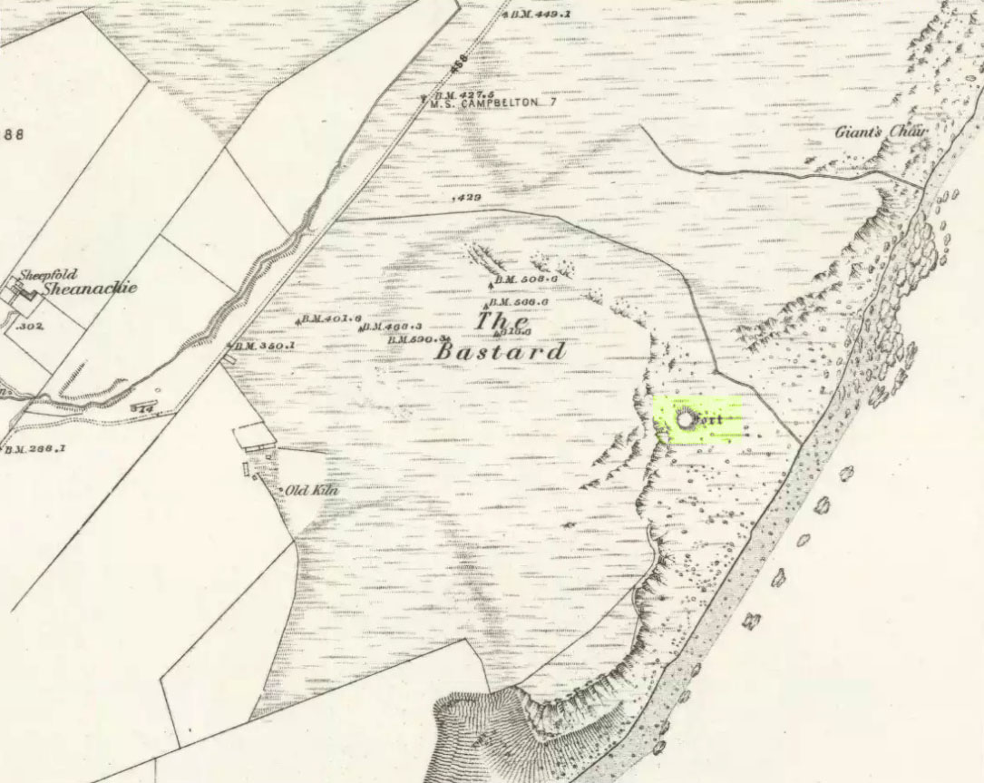
Cup-and-Ring Stone (destroyed):  OS Grid Reference – NT 138 746

Archaeology & History

Lost carving of Carlowrie

Two-thirds of a mile west of the Cat Stane, on land immediately north of the River Almond by Edinburgh Airport in an area that was reported in 1780 to be “filled with the skeletons of human bodies,” this old petroglyph could once be found.  The Scottish Royal Commission (1929) described it as being a covering stone for a short prehistoric tomb near the OS-grid reference cited here, “but when discovered it was much broken by the plough that it does not appear to have been preserved.”  They refer instead to the last report of the site in the Scottish Society of Antiquaries journal, where we were informed that the cover stone was,

“marked with three series at least of concentric circles… The widest diameters of the sets of rings cut on the inside of the lid is about five inches, and each set is composed of five concentric circles.”

All trace of this carving appears to have been lost.  Other carvings reported nearby in the 19th century also appear to have been lost or destroyed.

References:

  1. Morris, Ronald W.B., The Prehistoric Rock Art of Southern Scotland, BAR 86: Oxford 1981.
  2. Royal Commission on Ancient & Historical Monuments, Scotland, Midlothian and Westlothian, HMSO: Edinburgh 1929.
  3. Simpson, J.Y., The Cat-Stane, Edinburghshire, Neill & Co: Edinburgh 1862.
  4. Simpson, J.Y., “On Ancient Sculpturings of Cups and Concentric Rings,” in Proceedings of the Society of Antiquaries, Scotland, volume 6, 1864-66.

© Paul Bennett, The Northern Antiquarian


Pathfoot Stone, Airthrey, Stirling, Stirlingshire

Standing Stone:  OS Grid Reference – NS 80604 96871

Also Known as:

  1. Airthrey Castle West
  2. Canmore ID 47166

Getting Here

Not too troublesome to locate really… It’s at the top-end of the University, just above the side of the small Hermitage Road, about 100 yards along.  Keep your eyes peeled to your left!

Archaeology & History

Pathfoot Stone

Today standing proud and upright, this ruinous standing stone has been knocked about in the last couple of hundred years.   Although we can clearly see that it’s been “fixed” in its present condition, standing more than 10 feet high, when the Royal Commission lads came here in August 1952 (as they reported in their utterly spiffing Stirlingshire (1963) inventory), it wasn’t quite as healthy back.  They reported:

“Many years ago the stone, which is of dark grey dolerite, fell down and was broken, and the basal portion, now re-erected, is only 3ft 10in high; two large fragments however, still lie beside the base, and the original stone is said to have stood to a height of 9ft 4in.  Of a more or less oblong section throughout, the re-erected stones measures 2ft 10in by 1ft 10in at ground level, swells to its greatest dimensions (3ft 2 in by 1ft 9in) at a height of 1ft 4in, and diminishes at the top…”

…and again!

But the scenario got even worse, cos after the Royal Commission boys had measured it up and did their report, it was completely removed!  Thankfully, following pressure from themselves and the help of the usual locals, the stone was stood back upright in the position we can see it today.  And — fingers crossed — long may it stay here!

Folklore

Commemorative plaque!

A plaque that accompanies the monolith tells that the old village of Pathfoot itself was actually “built around this standing stone” — which sounds more like it was the ‘centre’ or focus of the old place.  An omphalos perhaps?  The additional piece of lore described in Menzies (1905) work, that an annual cattle fair was held here,  indicates it as an ancient site of trade, as well as a possible gathering stone: folklore that we find is attributed to another standing stone nearby.

References:

  1. Fergusson, R. Menzies, Logie: A Parish History – volume 1, Alexander Gardner: Paisley 1905.
  2. Hutchinson, A.F., “The Standing Stones of Stirling District,” in The Stirling Antiquary, volume 1, 1893.
  3. Hutchinson, A.F., “The Standing Stones and other Rude Monuments of Stirling District,” in Transactions of the Stirling Natural History and Antiquarian Society, 1893.
  4. Royal Commission on the Ancient and Historical Monuments of Scotland, Stirlingshire – volume 1, HMSO: Edinburgh 1963.

© Paul Bennett, The Northern Antiquarian


The Bastard, Campbeltown, Argyll

Hillfort / Dun:  OS Grid Reference – NR 7612 1220

Also Known as:

  1. Canmore ID 38722
  2. Dun Bastard

Getting Here

The Bastard on 1869 map

Pretty easy.  From Campbeltown, follow the coastal round south for about 8 miles, past the TV masts on the skyline and the hamlet of Feochaig, where you’ll see the large rounded hill on your left near the coast: that’s The Bastard!  Go onto the hill’s eastern sides and drop down the steep slope towards the large bend in the burn where its remains are on a ridge close to the cliffs overlooking the sea.  The ruins are pretty faint but if you scout around, you’ll find it.

Archaeology & History

I couldn’t believe it when I found this one – so had to get the notes to the site and add what I could find!  When the fellas from the Scottish Royal Commission checked the place in 1960, they described,

“On a narrow shelf halfway down the east flank of the hill named The Bastard there are the remains of a dun…  Oval in plan, the dun measures about 15m by 12m internally and is entered from the east, where a stretch of the outer face is visible. Here the wall is 4m thick on either side of a straight passageway, 0.9m wide, which exhibits no trace of door-checks.”

The Bastard (RCAHMS 1971)

There are other remains a few yards to the southeast of the main structure which are thought to be “remains of an outer wall…about 1.2m in thickness, which has been drawn across the shelf to provide additional protection for the entrance”, more probably from the weather conditions than invasive incoming humans.

To the immediate north we have a mythic-sounding Giant’s Seat (just above the natural arch) and west is the abode of the fairy folk – but I aint checked out the tales behind them yet.

References:

  1. Royal Commission Ancient & Historic Monuments, Scotland, Argyll – Volume 1: Kintyre, HMSO 1971.

© Paul Bennett, The Northern Antiquarian


Leathad Carnaich, Dalhalvaig, Caithness

Cairn:  OS Grid Reference – NC 89044 55882

Archaeology & History

An unexcavated ring cairn in a very good state of preservation can be seen in the field immediately west of the River Halladale.  Measuring more than 14 yards across east-west and 15 yards north-south, the site stands in association with several other unexcavated cairns.

Folklore

Although some of the cairns here have been found with prehistoric burials in them, tradition tells that the cairns here were the result of “a great battle between the native Pictish inhabitants and the invading Norsemen.” So wrote George Sutherland, many moons ago. He continued:

“The Norsemen were defeated in that battle, and Halladha, their leader, was slain. It is from him that the river and the dale take their name. The battle was fought on a hillside, on the east side of the river and that hillside is covered with cairns which are supposed to mark the graves of those slain in this battle, but the body of Halladha, the norse leader, was interred on the west side of the river, and his sword was laid in the grave beside his body. Near the circular trench where he is said to have been buried there are several heaps of stones which are supposed to mark the graves of other Norsemen of note who fell in the battle.”

References:

  1. Sutherland, G., Folklore Gleanings and Character Sketches from the Far North, John o’ Groats Journal: Wick 1937.

© Paul Bennett, The Northern Antiquarian


Serpent Mound, Scallasaig, Glen More, Inverness-shire

Cairn:  OS Grid Reference – NG 848 202

Folklore

I’m presuming that this burial site is the right one, described in the fine Mr MacGregor’s Peat Fire Flame (1937) as being “by the roadside up near Scallasaig.”  There certainly doesn’t appear to be another alternative site close by (though if I’ve got it wrong, someone please lemme know!).  This place was, said MacGregor, a site “where the people in olden times used to worship the serpent.”

MacGregor spoke with a local man about the myths here and asked how long it had been associated with serpents.

“Och, about two thousand years,” said Mr John MacRae. “The mound was in the shape of a serpent, and when the chief of the people would die, he would be buried in the head of the serpent..”

He continued, saying, “One from London, that was going about searching things like that, opened the mound, and they found in the mound a big stone coffin with a big stone slab on the top. And there the bowl was found with the ashes of the chief of the people at that time. The bowl was taken to the Manse. That’s about fifty years ago. It was there for a few months; and they took it to Edinburgh, to some museum or something. They were saying that there was a funny noise in the Manse when the bowl was lying there. If there was any treasure in the bowl, or in the grave along with the bowl, it was taken out before. You see, had he any treasure – the chief like – guns and money and the like – I’m sure they wouldn’t be putting much money in the grave. It would be going into the grave with the dead man, so, when he would rise in the next world, he would be ready to start at the same game as he was carrying on here on Earth.”

This sounds a little like the folk-memory of an idea of a heathen afterlife – and of course it’d make sense finding such lore here at a tomb.

I’ve come across references to several other serpent mounds scattering the western side of Scotland, but their exact locations have proven hard to pin down. It makes y’ wonder how many more there once were before the christian paradigm became entangled in the myths of the country people.

References:

  1. MacGregor, Alisdair Alpin, The Peat-Fire Flame: Folk-Tales and Traditions of the Highlands and Islands, Ettrick Press: Edinburgh 1937.

© Paul Bennett, The Northern Antiquarian


Lattice Stone, Middleton Moor, North Yorkshire

Cup-and-Ring Stone:  OS Grid Reference – SE 11571 51635

Also Known as:

  1. Carving no.481 (Boughey & Vickerman)

Getting Here

Lattice Stone carving

This is a lovely-looking stone in the pictures and diagrams, and is quite easy to find close to the meeting of the footpaths along Foldshaw Ridge and the Parks Lane track, near the gate. It lays at an angle in the short grass just by the path…but to me, all is not what it seems…

Archaeology & History

This was a carving I saw pictures of in the 1970s, and always thought it would be something to behold – but my first impression here wasn’t just disappointment, but the most distinct thought that the carving’s modern! It’s a real oddity. For a start, the cups in this carving are very small – much smaller than the countless authentic carvings on the moors here and at Ilkley to the south. And after seeing thousands of these things, this one didn’t seem at all right.

The lack of erosion on the cups may be due to it once accompanying a prehistoric tomb some time in the past, though no such remains have been noted here.  However, at carved stones Middleton Moor 001 and Middleton Moor 2 — less than 100 yards to the east — cairns are in evidence next to the petroglyphs, indicating that this relationship occurs at some cup-and-ring stones in this small geographical region and, perhaps, explaining the ideosyncratic nature of this design.

But such speculation aside – the brief literary history of this stone is: first described by Stuart Feather in 1965 and illustrated by Sidney Jackson the same year.  The rock art students Boughey & Vickerman’s (2003) described around sixty ‘cups’ etched onto the stone here, but they made no comment about either the odd nature of the cups or the possibility of it being modern. Perhaps it’s just me…

References:

  1. Boughey, Keith & Vickerman, E.A., Prehistoric Rock Art of the West Riding, West Yorkshire Archaeology Service 2003.

© Paul Bennett, The Northern Antiquarian 


Fearby Cross, Masham, North Yorkshire

Cross: OS Grid Reference – SE 1984 8127

Getting Here

Take the road from Masham into this lovely hamlet and, as you reach the staggered crossroads, you’ll see a small village green with a single tree at where the four roads meet.  In the grass below the tree is this forgotten monument!

Archaeology & History

Fearby Cross remains

Found at the meeting point of five old lanes, little has been written about the old cross remnants here, which is barely a foot high and rests on its roughly circular stone base.  It sits where five old tracks meet and is thought to be medieval in origin.  Speculation alone pronounces the site to have been a place where local council proclamations occurred, and where funerals stopped and the dead were rested.

One intriguing piece of information narrated by Edmund Bogg (1906) that may have had some relevance to the siting of this old cross, told that between here and the hamlet of Healey a mile west,

“there were formerly circles of upright stones and other relics suggestive of druidical origin.”

Any historical information or folklore relating to these apparent megalithic remains needs to be uncovered!

References:

  1. Bogg, Edmund, Richmondshire and the Vale of Mowbray, James Miles: Leeds 1906.

© Paul Bennett, The Northern Antiquarian


Springfield Lyons, Chelmsford, Essex

Enclosure:  OS Grid Reference – TL 7357 0818

Archaeology & History

Springfield Lyons enclosure (after Brown, 2001)

We’ve known that there was an excessive number of prehistoric archaeological sites in and around the Chelmsford region for quite a long time now, but defining precisely the age and nature of the finds takes some doing! (as you’d expect)  It hasn’t helped, of course, with the housing estates and other ecologically destructive building operations in and around the area, screwing up a more accurate and patient assessment of the material there.  And this predicament was exemplified with the Springfield Lyons neolithic causewayed enclosure just as much as at the Springfield Cursus and other sites nearby.

Although excavations here found a large, deep ditch with impressive ramparts and entrance, in Oswald, Dyer & Barber’s (2001) survey of these giant monuments, they defined the remains here as “probable,” pending further investigations.  But the site was primarily defined by the large deep ditch, broken in several places round its edges with the ’causeways’ built leading onto the site.  The enclosure gave good views over the small valley from here and had streams running either side of it.

Adjacent to the site were the remains of a “small circular enclosure with multiple entrances,” saying that excavation here,

“has proved that it is of late Bronze Age date and might be interepreted variously as a defended settlement, or a ritual monument.”

This external small enclosure site was then conjectured, quite spuriously it’s gotta be said, to be a mini-version of the great causewayed enclosure monument, saying:

“Its siting and form both hint that it could have been a conscious imitation of, or re-invention of, the perceived form of the earthworks of the neolithic enclosure.”

I like the idea, it’s gotta be said — but without direct evidence we’ve gotta take this idea with a large pinch of salt!

…to be continued…

References:

  1. Brown, N., ‘The Archaeology of Essex 1500 – 500 BC,’ in Bedwin, O. (ed.), The Archaeology of Essex, ECC: Chelmsford 1996.
  2. Brown, N., “The Late Bronze Age Enclosure at Springfield Lyons in its Landscape Context,” in Essex Archaeology & History, volume 32, 2001.
  3. Oswald, Alastair, Dyer, Caroline & Barber, Martyn, The Creation of Monuments: Neolithic Causewayed Enclosures in the British Isles, EH: Swindon 2001.
  4. Priddy, D., ‘Excavations in Essex, 1987,’ in Essex Archaeology & History, 19, 1988.

© Paul Bennett, The Northern Antiquarian


Ringstone, Cropredy, Oxfordshire

Stone Circle (destroyed):  OS Grid Reference – SP 470 464?     

Also Known as:

  1. Ringstone Well

Archaeology & History

In 1239 CE we find records of a field-name site called “Ringstoneswelle.” Although the place-name writer Margaret Gelling (1954) initially ascribed this as the watering-place of some dood called Hringstan, it is in fact the only record that I’ve found of a “stone circle by a well” in the village.  This etymological root is confirmed in A.H. Smith’s English Place-Name Elements (vol.1, p.265) as a probable stone circle.

Folklore

There is also the curious field-name legend of a place in Cropredy called Kirk or Church Piece, where a christian church was being built, but in the morning all the stones had been uprooted & moved back from whence they came. This happened several times according to the folktale – a story that has with all the hallmarks of a megalithic site. (see Grinsell’s Folklore)  To me it seems likely that the nearby Cup and Saucer Stone also had something to do with this lost stone circle.

In the same area we have another intriguing bit of folklore that was reported in an early edition of the Banbury Guardian (1932) which told that,

“on one of the top stones of a wall in front of one of the farmhouses is what is supposed to be the Devil’s footprint and there are nail-marks in the stone, but how it gots it name is a puzzle.  At the back of the vicarage gardens is a small jetty called HellHole, the old ‘Old Man’ must have visited this village a time or two.”

Are there any local antiquarians or historians who can throw further light on this seemingly lost megalithic ring?

References:

  1. Anonymous, ‘Cropredy and its Legends,’ in Banbury Guardian, December 29, 1932.
  2. Bennett, Paul & Wilson, Tom, The Old Stones of Rollright and District, Cockley: London 1999.
  3. Gelling, Margaret, The Place-Names of Oxfordshire – volume 2, Cambridge University Press 1954.
  4. Grinsell, Leslie V., Folklore of Prehistoric Sites in Britain, David & Charles: London 1976.
  5. Smith, A.H., English Place-Name Elements – Part 1, Cambridge University Press 1954.

© Paul Bennett, The Northern Antiquarian 


Ring Stones, Worsthorne, Lancashire

‘Stone Circle’:  OS Grid Reference – SD 886 330

Also Known as:

  1. Ringstones

Getting Here

Ring Stones plan (after Bennett 1946)

Various ways to get here. From Worsthorne village, go east, up past the church, uphill following the dead straight path.  After about 600 yards there’s a crossing in the footpath: go left here and walk another coupla hundred yards, over 2 walls, and after you’ve past the second wall you’ll notice the earthworks in the ground to your right.  That’s it!

Archaeology & History

There’s nowt much to see here to be honest.  It was included in Walter Bennett’s (1946) survey of ROMAN remains (oh dear) in the region — and his archaeological description of this place certainly seems to imply it was those doods (the Romans) who built this structure and not our neolithic ancestors.  He wrote:

“Ringstones is a rectangular enclosure 50 yards square, surrounded by a mound or rampart 2 yards wide and one yard high, and an outer ditch two yards wide. Sepereated from the main enclosure by the ditch on the southeast side is another enclosure 18 yards square. Excavations made in 1925 gave the following information: a gateway, seven yards wide, was paved with boulder stones regularly laid on a gravel foundation, and on the south side of the gateway flat stones were sunk below the general floor level to act as a drain; a regular course of large stones flanked the gateway entrance on either side, and a foundation or irregular boulder stones was laid outside the gateway between the rampart and the ditch: inside the enclosure and 9 inches below the present grass surface., a floor had been made of gravel in some places and of flat stones or cobbles in others; the rampart was of earth and stones; a well-constructed road, 7 feet wide, ran from the earthwork in the direction of Bottin Farm, wich is situated on the Worsthorne-Roggerham road.”

There used to be a rough circle of stones on top of the site (probably giving the place its name), but these were apparently from the old remains of a lime-kiln from the 16th or 17th century — not prehistory.  There is, therefore, a case that this site may not be prehistoric as archaeologists have classed it — and if the ground-plan above is anything to go by, you’d have to say it looks less than promising.  More diggings are needed!

References:

  1. Abraham, John Harris, Hidden Prehistory around the North West, Kindle 2012.
  2. Bennett, Walter, History of Burnley – volume 1, Burnley Corporation 1946.

© Paul Bennett, The Northern Antiquarian