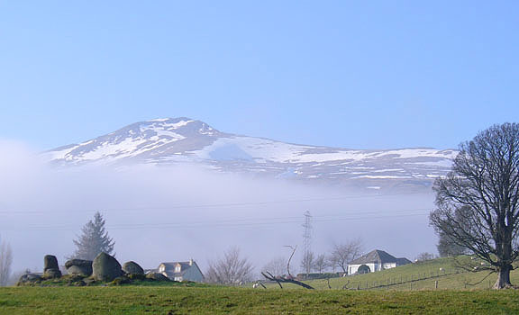
From the north-end of Loch Tay at Kenmore, follow the road (A827) round down the lochside, through the village of Fearnan and then another 4 miles down. If you park up at the pub at Lawers, walk back up the road for ½-mile, keeping your eyes peeled up the slope on the left where you’ll see the circle visible from the road.
Archaeology & History
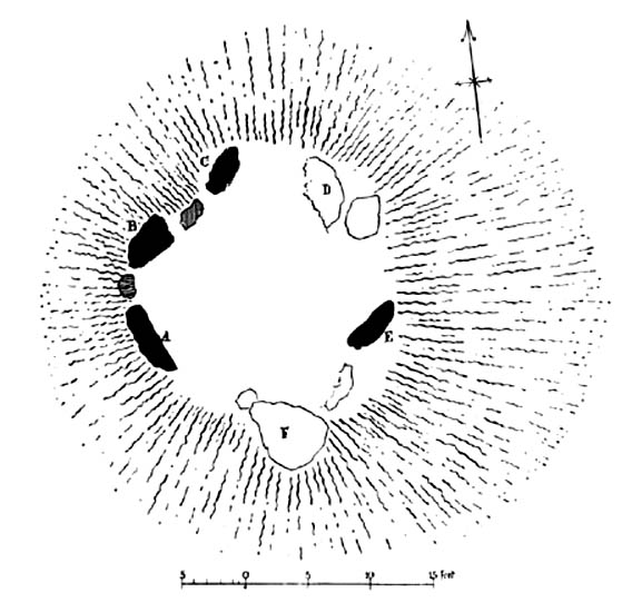
Much has been said of this fine old place – also known as Lawer’s Mill – which seems to have been first described by Thomas Pennant in his rambling Tour in Scotland (1772). The local writer William A. Gillies (1938) told that after
“a recent examination of the ground around the circle…suggests that at one time there was an outer circle of stones concentric with the existing one. Most of the stones were removed in order to make more of the field available for cultivation, but there are still large stones buried within a few inches of the surface.”
Folklore
In J. McDiarmid’s Folklore of Breadalbane (1910) he tells of a man from Killin who, on passing by this old circle, heard haunting fairy music. Being inquisitive, he walked up to see what was going on and walked into the circle where the little people were playing. He was obviously lucky and the faerie-folk enjoyed his company, for when he left he was given the gift of a strong, fast, white steed.
Solar folklore may be…?
References:
Gillies, William A., In Famed Breadalbane, Munro Press: Perth 1938.
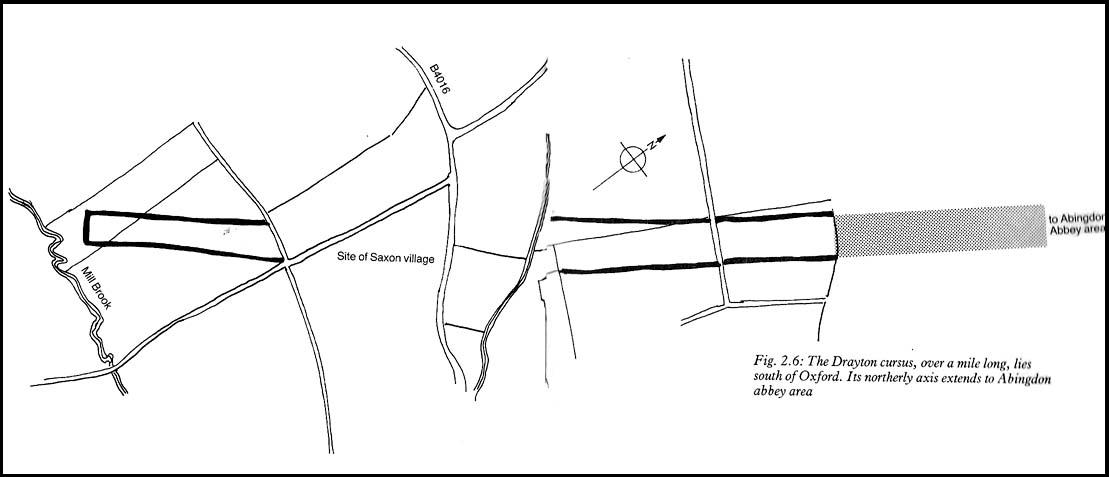
This minor cursus monument was etched into the landscape in neolithic times. Found to the south of Abingdon and close to the River Thames, one report showed finds from the site dating from 2900 BC. There is also a neolithic henge monument very close to its northern terminus and a plethora of other Bronze Age remains all round. Paul Devereux (1989) described how crop marks revealed,
“a substantial former cursus immediately to the east of Drayton: its crop marks extend southwest to northeast for a little over a mile, and are 225 feet (68 metres) wide. The cursus has a squared south end, but the northern terminus has not been found. The crop marks are not evident in the middle portion of the cursus, as it was formerly overlaid by a Saxon village. There is a plethora of other crop marks within and around the cursus… The northern section…which has a slightly different orientation to the southern segment, points squarely to the ancient heart of Abingdon.”
References:
Ainslie, R. & Wallis, J., ‘Excavations on the Cursus at Drayton, Oxon’, in Oxoniensis 52, 1987.
Barclay, A., Lambrick, G., Moore, J. & Robinson, M., Lines in the Landscape, OAU: Oxford 2003.
Loveday, Roy, Inscribed Across the Landscape, Tempus: Stroud 2006.
Pennick, Nigel & Devereux, Paul, Lines on the Landscape, Hale: London 1989.
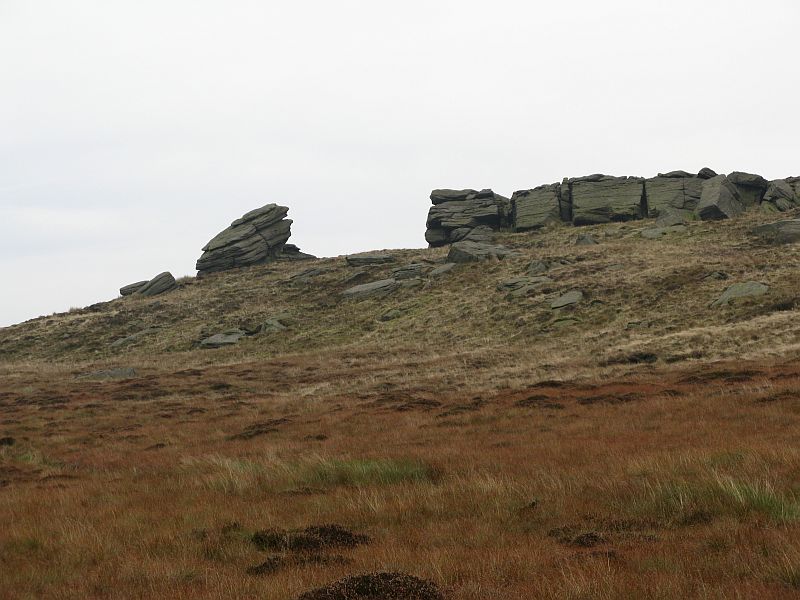
Get to Widdop reservoir in the hills west of Hebden Bridge and park up. The great rock faces to your right (north) is where you’re going. Clamber to the top until the moor levels out, making sure you head NNW for less than a mile. The moors you’re now on are supposed to be private – but folk like me pay no attention! There are no footpaths to this great outcrop, only the heathlands and scattered stones – but keep walking for a half-mile north and you’ll get to them!
Archaeology & History
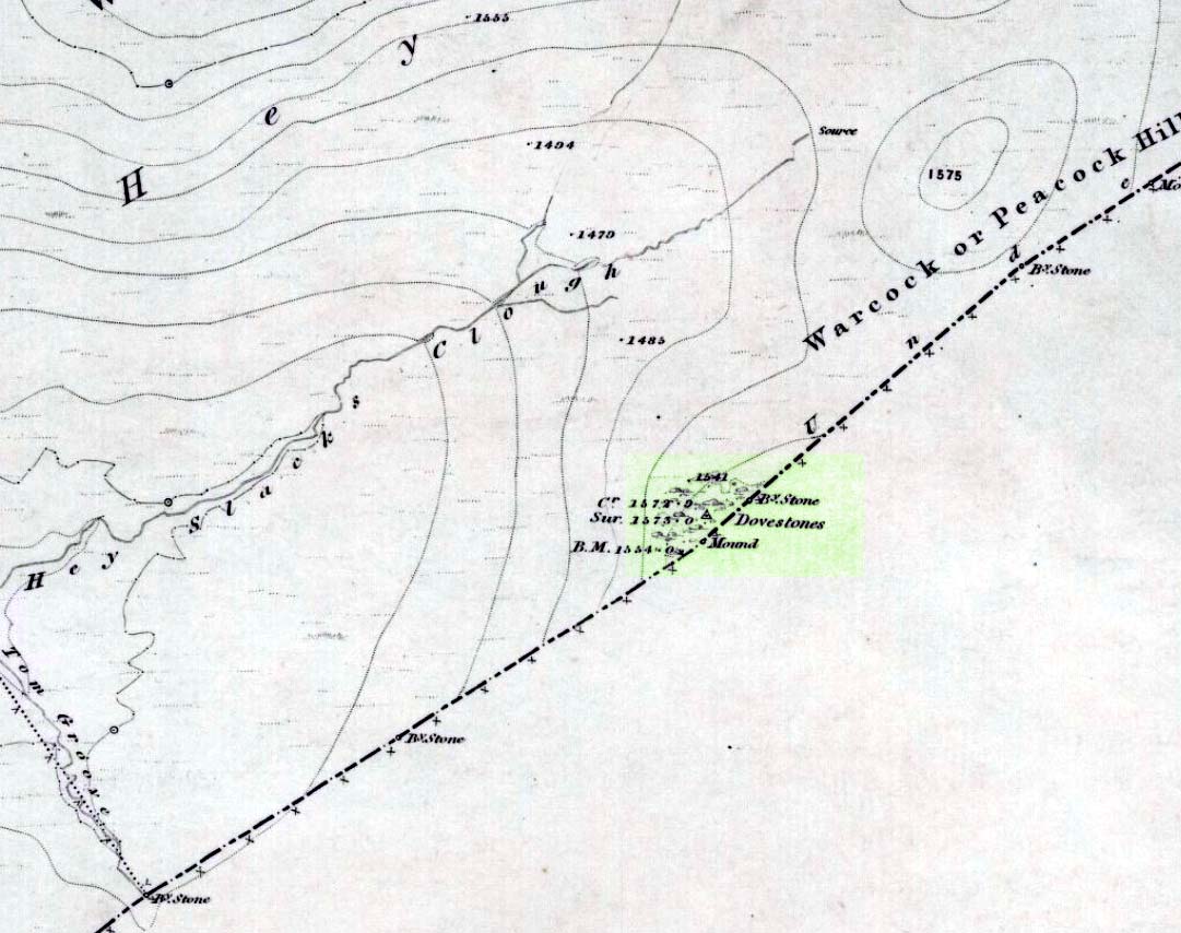
Erroneously ascribed by the place-name masters Eilert Ekwall and A.H. Smith (1961) as being ‘a place where doves gathered,’ this gigantic rock outcrop on the Yorkshire-Lancashire border — as shown on early maps — is actually the Dew or Black Stones (from the Gaelic, dubh). It’s an awesome place! Takes a bitta getting to, but it’s well worth the venture.
Dove Stones on 1848 map
This long geological ridge, rising higher as you walk along it to the north, has the occasional cup-mark on it, with the giant Dove Stone at the very end having a cup-and-half-ring on its crown (be careful not to fall off). From here, you look across a huge, desolate, U-shaped valley, the far side of which we rise to 1700 feet and the grand setting of the Lad Law.
Folklore
The folklorists Harland and Wilkinson (1882) included this in their survey of druidical sites, mentioning the several cup-markings, or druid basins as they called them. (though most of ’em on here are Nature’s handiwork)
For me, this is an incredible place – full of raw power and magick. It has a curious geomantic relationship with the Whinberry Stones, a couple of miles to the south, around which should be a ring of stones…though none can be found.
Easy one this! Go up thru Baildon, on towards Baildon Moor over the cattle-grid. Take your first left and go up for several hundred yards past the reservoir until you reach the track on the left which takes you onto the Low Plain, Baildon Moor.
Archaeology & History
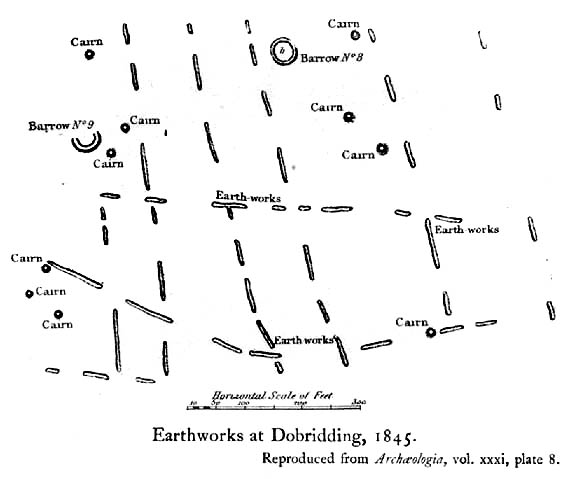
1845 plan of Cairns & Earthworks on Baildon Moor (after J.N.M. Colls)
In the year 1845, on the Low Plain on the western side of Baildon Hill, an intrepid archaeologist and historian, Mr. J.N.M. Colls, came across extensive earthworks and a number of prehistoric tombs in a very small area. Upon excavation, the ‘earthworks’ were found to be what sounds like neolithic walling running parallel to each other in a roughly north-south direction (north is the traditional direction for death). Scattered amidst these lines he found more than a dozen cairns and barrows, along with remains of “a circle, or ring.” Although the majority of what Colls wrote about has been destroyed, leaving only scanty remains of a once considerable archaeological arena, his lengthy description deserves being reprinted in full. He wrote:
“This level (the Low Plain) bears numerous traces of earthworks or other embankments running in many cases parallel with one another, at distances varying from 50 to 80 yards apart, and intersected by other works of similar construction. These earthworks can be remembered to have been from four to five feet in height; their bases nearly invariably appear to have been eight feet in diameter, composed of loose blocks of calliard, or close-grained sandstone, and earth. The greater part of the stone has been torn away to make and repair the roads of the neighbouring district; and the surface of the earth has been so nearly levelled that it is only by the scattered and disfigured remains, carefully delineated upon my plan, that any idea can be formed of their original character.
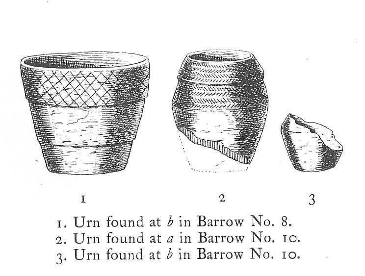
“In connection with these earthworks, and upon the north side of them, immediately above a steep fall to the next lower level (approx SE 1372 4020, Ed.), is a circle, or ring, formed originally of earthworks of precisely similar character, size and construction to those I have just described. The diameter of this ring is about fifty feet; its interior area is perfectly level; but the earthwork forming its circumference has been defaced and torn up for a considerable extent for the stone it contained. Circles of this nature have generally been termed druidical, from their presumed use as places of worship or sacrifice. I therefore opened its centre, in the hope of finding some trace of fire confirmatory of its character; and commenced clearing away a layer of peat earth, of from 10-11 inches in depth. I then found a layer of calliard boulders one-and-a-half feet in depth, the lower ones slightly burned, and resting upon a deposit of peat-ashes three inches in depth and from 2-3 feet in diameter (see Barrow No.8 in plan, Ed.). This I should have concluded to be the remains of a beacon fire, but, upon continuing the excavations, I found about three feet SSE of this deposit of ashes (at point b on the plan) a rude urn standing in an upright position, at a depth of two feet from the surface, a layer of calliard stones having been removed from above it, one of which appeared to have covered it. This urn was 12 inches in diameter and 9-10 inches in depth, of a circular or bowl shape, the upper stage of it being rudely ornamented by incised lines crossing each other at acute angles: it was filled with calcined bones (some remaining tolerably perfect), ashes and charcoal; and I selected some half-dozen of them as specimens, which Mr Keyworth, surgeon and lecturer on anatomy at York, has examined… He is of the opinion that they belonged to a very young subject, perhaps from 9-12 or 13 years of age; he thinks it possible however, that they may all have belonged to the same subject… The urn in which the were placed appears to have been rudely formed by the hand, without the assistance of a lathe; in substance about half-an-inch…it appears pretty evident that this urn has been formed of the black earth of the mountain and coal measures of which Baildon Hill is formed…
“A little to the west by south of the circle…are the almost obliterated remains of another circle (fig.9 on the plan), which I had not an opportunity of thoroughly examining; the slight traces remaining bear strong testimony of its character being similar to that of fig.8.
“Scattered over the surface of the Plain, and at irregular distances, cairns or heaps of stones, composed of bare sandstone and calliards (and not mixed with earth), frequently occur; they are generally about twenty feet in diameter and appear to have been originally 4 or 5 feet in height: these remains still require examination. In passing over them, I remarked that some of the stones of which they and the earthworks near them were constructed, had marks, or characters, but so rude that a doubt remains whether they may not have been caused by the action of the atmosphere on the softer portions of the stone.”
Urns found near Dobrudden
This final remark seems to be the very first written intimation of the cup-and-ring marked stones which can still be found amidst the grasses in the very area Mr Colls described. Sadly, much of the other remains shown in the drawing have been all but obliterated, or grown over. However, the decent concentration of cup-and-ring stones in this small area (see other Baildon Moor entries), highlights once again an associated prevalence of these carvings with our ancestor’s notions of death.
Sadly, year by year, the important neolithic and Bronze Age english heritage remains across this upland ridge are slowly being destroyed. The lack of attention and concern by regional archaeologists and local councillors, and the gradual encroachment of human erosion are the primary causative factors. Hopefully there are some sincere archaeologists in the West Yorkshire region who will have the strength to correctly address this issue. Under previous archaeological administrators, Bradford Council have allowed for the complete destruction of giant tombs, stone circles and other important prehistoric remains in their region—a habit that seems not to be curtailed as they maintain a program of footpath “improvements” on local moors without any hands-on assessment of the archaeology on the ground.
…to be continued…
References:
Baildon, W. Paley, Baildon and the Baildons – volume 1, St. Catherine Press: Adelphi 1913.
Barnes, Bernard, Man and the Changing Landscape, Eaton Press: Wallasey 1982.
Colls, J.N.M., ‘Letter upon some Early Remains Discovered in Yorkshire,’ in Archaeologia, volume 31, 1846.
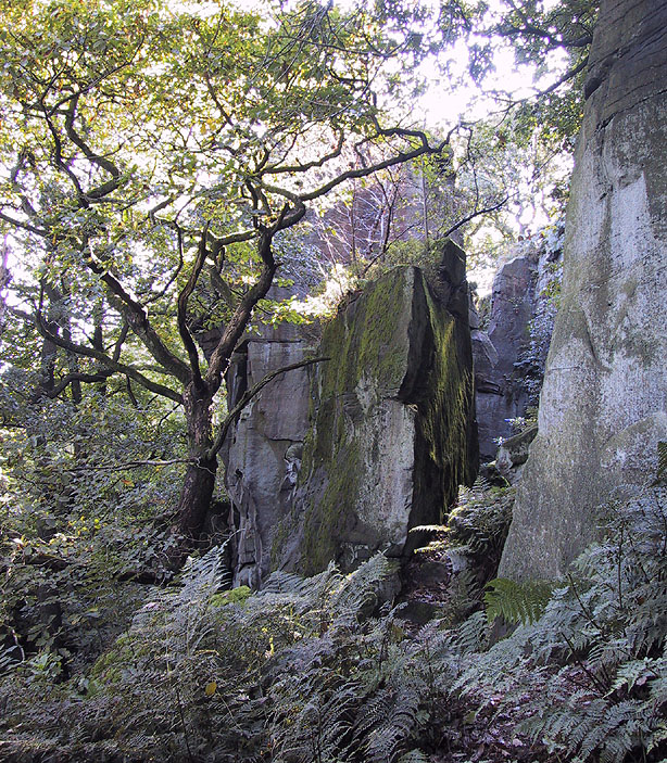
This is a stupendous site! It looks like some of this may have been quarried, a long time ago, but it also seems that nothing at all has been written about it – even in the simple travelogues beloved by our Victorian historians. To come across it quite by accident, as I did (only yesterday), was excellent! When I first got here, by following the wooded ridge betwixt Hollins Lane and the main Keighley-to-Steeton road (A629), the place seemed brilliant; but as time went on and my amblings through the sometimes dense and also very old woodland were overcome by the dream of the place, I couldn’t believe how this place had become forgotten. Adrenalin rushed through me for a while, but then it was the dream of the place again. The memories here were ancient – and you could feel them. In places there was the solace of darkness, beloved of those who know old trees and dangerous places. For here, walk the wrong place too quickly and Death comes. Broken limbs await in the curious gorges which just appear in the woods, only a yard wide, but 50-60 foot deep, only to vanish again away from sight a few yards later. Caves and dark recesses, seemingly unknown, reach out to climb down. And all round is the aged covering of lichens and mosses that know centuries.
Shown as ‘Garlic Kirk’ on 1853 map
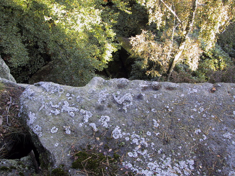
The Kirk itself – meaning simply, ‘place of worship’, in the old sense – is like something out of Lord of the Rings! If you walk along its top, as I did, the great cliffs below come late to the senses. A curious ridge of cup-markings, seemingly natural ones, stretch along the very edges of the drop – which stretches on for some distance. And then as you walk along its edge, you find this great drop which looks north, is now on both sides of your feet! It’s quite breathtaking!
Cup-markings on the edge (probably natural)
Trying to get down into the gorge below can be done, but it’s a bit dodgy! If you aint agile and crazy, stick to doing it by walking round – a long way round… Someone a few centuries back either cut into the rock, or laid steps, reaching into the mossy gorge, which runs to nowhere.
You can appreciate how this place would have been a sacred site: it’s big, it’s old, it takes your breath away, and it looks across to the great Rivock Edge where many fine cup-and-ring stones were cut. I’ll try and get some images of the place when I call here again in the very near future, but they’ll never capture the experience of being here.
Folklore
The only thing I have come across which seemingly relates to this great edifice, tells of a great cave in the woodland, which legend tells stretches many miles to the north and emerges at Bolton Abbey. (Clough 1886) I wondered about the potential visibility factor in this legend and found it obviously didn’t work. However, if you stand on a certain part of The Kirk and look north, a dip in the horizon enables us to see, far away, hills which rise up directly above the swastika-clad Bolton Abbey. Twouldst be good to work out exactly which hill above the Abbey we can see from here.
On another issue, John Clough (1886) told that “on top of the rock there is a footprint and the initials of one of the Waites, who is said to have leaped over the chasm.”
References:
Clough, John, History of Steeton, S. Billows: Keighley 1886.
Gray, Johnnie, Through Airedale from Goole to Malham, Walker & Laycock: Leeds 1891.
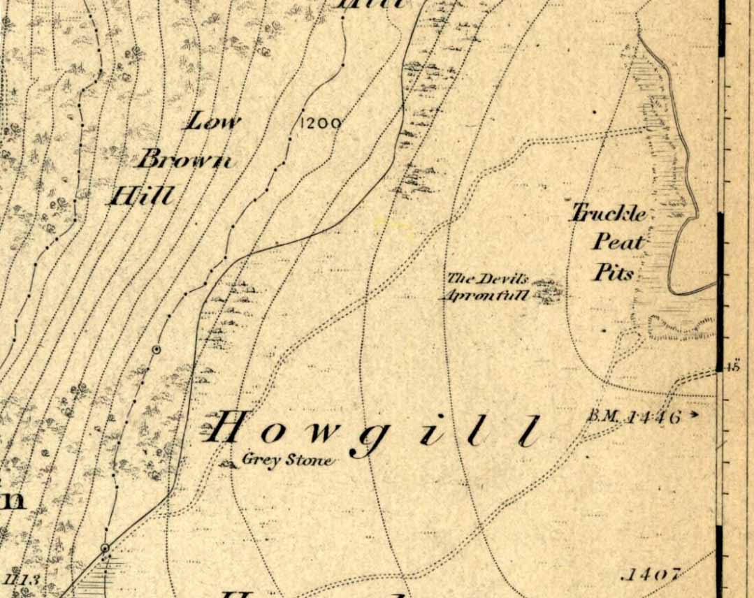
An excellent spot with fantastic views. There’s many ways to approach the place, but a good one is from the roadside by Howgill, then following the track uphill until you reach the moor, then head towards the spectacular and legendary, Simon’s Seat (which folklore ascribes to be named after the great druid, Simon Magus). You’ll pass an old Grey Stone (two large rocks) from which you can espy the old tomb if you stand on top of ’em. Keep walking uphill and it’s about 100 yards off the footpath to your right. A large boulder is nestled just beneath the tomb itself, which stands out on a ridge.
Archaeology & History
When Harry Speight visited here (1900) he described it as being 40 yards in circumference. He also described “an upright stone below the cairn” with apparent cup-markings on the west-side. I’m not quite sure where this has got to – but the site has shrunk somewhat since Speight’s day. It’s only about 20 feet across now, and the middle of it has been hollowed into a grouse-shooting butt for the toffs!
About 100 yards southeast (towards the Truckle Stones) are the remains of some neolithic walling in a straight line.
Folklore
One of many old tombs in our northern hills said to have been created by the devil who, as usual, accidentally dropped some stones he was carrying. The old folklorist Thomas Parkinson (1888) said the following of this place:
“The Apronful of Stones is a group of rocks heaped together in delightful confusion, their disorder and name being thus explained: Once upon a time—whether when he built the bridge over the valley, or at some other time, the record saith not—the Devil was determined to fill up the ravine, or gill, of the Dibble. For this purpose he was carrying these enormous crags in his apron, when, too intent upon his object to properly observe where he placed his feet, he caught with one foot upon the top of Nursa Knott, and, stumbling, the strings of the apron broke, and the contents were thrown upon the ground as they now appear. It is also said of them that if any of them, even now, were to be removed, they would certainly be brought back to their original place during the succeeding night.”
Another legend tells that the Devil’s Apronful is also the grave of some local unnamed hero.
References:
Parkinson, Thomas, Yorkshire Legends and Traditions – volume 1, Elliott Stock: London 1888.
Speight, Harry, Upper Wharfedale, Elliott Stock: London 1900.
From Keighley town centre, head north towards Cliffe Castle, but turn left beforehand and along Hollins Lane. Go past Hollins Hall for a few hundred yards and then through the gate on your left, then straight up the steep hill to the small woodland at the top. On the OS-map it’s shown as ‘Great Snowden.’ You’re here!
Archaeology & History
A standing stone found recently by Lindsay Lockwood to the west of Keighley, albeit on supposedly private—ahem!—land (a number of old locals tell you, quite rightly, to ignore this selfishness; but be careful of the land-owners here, who can be quite miserable). Tis less than four-feet tall but with a very noticeable female genital carving on its top western face. This carving however, is perhaps 200 years old at the very most. It’s in a quite beautiful setting aswell…
The Yoni or Cunt Stone, UtleyBuddhist scholar Steve Hart fondling the stone
What may be the remains of an old hut circle, or an old drained-out pond (a big difference, I know!), can be found about 100 yards northwest, and one – possibly two – ‘cairns’ can also be found in the scattered trees immediately to the northeast. An old ‘druid’s bowl’ (natural cup-marking into which rain-water collects) can also be seen on an adjacent earthfast boulder. Some folk might wanna allege a bullaun, but it’d be pushing it a bit I think. More recent walling and what appears to be stonework from more recent centuries (medieval) appears evident close by. Whilst below the hill we have the recently discovered Dragon Stone cup-and-ring carving just a few hundred yards away.
The setting is not unlike the beautiful little standing stone of Tirai on the slopes of Glen Lochay, where amidst the recently deserted village the short squat standing stone is found. You get the same sorta feeling of more recent going-on with this site aswell.
The carved ‘cunt’ gives an even more intriguing thought as to what the stone was used for, around Beltane perhaps, by folk like misself and other straightforward doods!
I wasn’t sure exactly what to call the stone after Lindsay had found it. However, due to the carved minge near the top, it seemed right to give the stone a name relative to the carving — and as we have a Devil’s Cunt in the Netherlands, I opted to call it something similar.* Although ‘cunt’ is an old European word for ladies’ lovely parts, the word ‘Yoni’ is an eastern title, which has become very acceptable in Western parlance. In recent years there has emerged a distinct aversion to using our own, old word for female genitals (indicating how detached people have become from even their own roots).
* of the name ‘cunt stone’: the word cunt itself, as explored eloquently in the fine study by Peter Fryer, Mrs Grundy: Studies in English Prudery (Corgi: London 1965), was the acceptable term for ladies’ genitals in the days when this carving was evidently done, so thought it a most applicable title.
Best approached from Haworth and then walking along the Bronte Way footpath onto the moors (ask at the local Tourist Info if you aint sure). A few hundred yards along, cross the ‘Bronte Bridge’ and keep following the footpath up until you get past the trees and get onto the moors. Once on the heathland, a few hundred yards along keep your eyes to the right and at least one of the two stones here will appear!
Archaeology & History
The original Cuckoo Stone
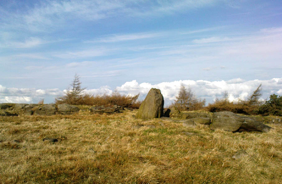
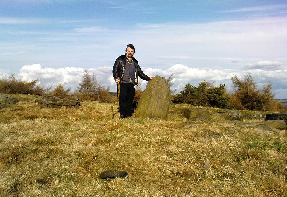
This is a fascinating little site that has been mentioned in a few old local history guides, including John Lock’s Guide to Haworth (c.1965). First described in 1852 and only briefly noted in passing by Horsfall Turner (1879), the place was previously thought to have comprised just one standing stone, but in recent years explorations by Mark Davey and I found there to be two standing stones close to each other. They are not marked on any maps and are unknown even to many local people. However, the place once had a bit of a reputation (see folklore) and seemed to be well known in the region when the cult of the Church was at its height!
Both of the stones are between three and four feet tall, but the westernmost of the two was probably much taller in bygone days – that’s because the top of the stone was vandalised in centuries past, presumably by some christians if the folktale is anything to go by! On the north-facing side of the western stone is the faint carved outline of an old cross, first described by local historians in the 1960s. It’s faint, but you can work it out if your eyes work properly! The newly-recovered (July 2005) easternmost stone is in two sections, with the very top of it having been hacked off in centuries gone by, as seen in the photos.
The second Cuckoo Stone, resurrected!
When we unearthed the previously unknown Cuckoo Stone (which was laid in the earth and covered with heather and peat), a small deposit of quartz crystals was found in the original socket beneath it when we came to stand the stone back in position. Question is: who put the quartz there? The original builders, or the nutters who knocked it down? And then we might ask: what was the reason behind placing a large handful of quartz beneath the standing stone?
In the heather beyond, about thirty yards to the north, we also find what looks like the remains of an old prehistoric tomb. If we make sense of the Cuckoo Stone’s folklore, we can safely assert that these monoliths were the spirit-home of the old dood/s buried in the tomb behind…
Tis a lovely little place…
There’s also something from that strange electromagnetic-anomaly region attached to this site, well-known to students exploring the physics of megalithic sites. When my lovely friend Mark – “grope me baby! grope me!” – Davey and I rediscovered the second Cuckoo Stone, Mark brought with him a device that measures fluctuations in electromagnetic radiation. The readings taken were fine just about everywhere (background, with minor fluctuations), apart from two very curious straight lines which ran either side of the burial mound down towards the two Cuckoo Stones, with radiation readings being between 10 and more than 60 times above background! The highest readings came from those closest to the burial mound, with levels dropping as we approached the standing stones. Such magnetic anomalies have been found at a number of megalithic sites in the UK, as described in Paul Devereux’s Place of Power (1989) and other books. But the fact that the anomaly lines here seemed to run in lines would be something that those ley enthusiasts would no doubt be intrigued by!
Folklore
The creation myth of this site tells that once, long ago, a great giant lived upon these old moors. He wasn’t a good giant though, from all acounts: robbing and persecuting those who would venture onto the hills hereabouts. The local people wouldn’t dare venture onto the moors and they long sought for a hero who’d be able to sort him out! This eventually happened and in a great fight, our unnamed hero caught and killed the old giant. But just as the giant was about to die, he used his ancient magick powers and, “with a magical groan, he did transform before them and became the Cuckoo Stone.”
But that wasn’t the end of the matter because, as our unnamed hero realised, knowing that the head was the seat of the soul, even in his petrified stoney state the giant may one day recover his life, and so he chopped off the top of the Cuckoo Stone and rolled it into the valley below, dismembering the ‘head’ from the giant, seemingly forever…
It is said that the winnings of this old giant, stolen from his countless victims, are hidden somewhere high upon these hills, awaiting the shovel of some fortunate treasure hunter!
The motif of this tale is universal and archaic, echoing traditional or aboriginal lore from elsewhere in the world. The tale is a simple one: originally the ‘giant’ was a local hero, chief or medicine man who lived on these hills and the Cuckoo Stones his petrified body, and with the incoming christian cult, the giant became demonised. It seems that the ingredient of the giant’s death may infer a burial of sorts and, a hundred yards behind the Cuckoo Stones (both of whom have had their ‘heads’ hacked off), is a mound of earth which, when seen after all the heather’s been burnt away, has all the hallmarks of a prehistoric tomb (it is seen in the top photo above, as the mound in the background behind the standing stones).
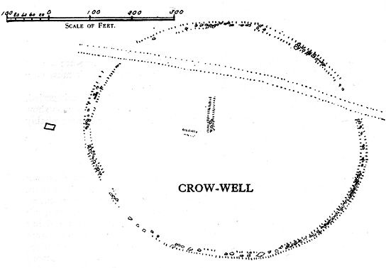
Using the OS-map as a guide, from Denton village head up the road northwest, past Moorside Farm and onto the moor. Before you reach the rise of Lippersley Pike you’ll reach the Crow Well itself (completely covered over by Yorkshire Water’s handiwork, stopping anyone from drinking the previously fresh waters here). In the middle of nowhere, just above the completely ruined well, is the old shooter’s cottage and from here, Eric Cowling (1946) told us to look in the heather immediately east. When Richard Stroud and I ventured here a few years back (2.8.5) we couldn’t find a thing — though a vaguely reminiscent structure seemed possible 300 yards away.
Archaeology & History
If the heather’s deep, you’ll have little chance of seeing the site as Eric Cowling (1946) obviously did! He described and illustrated this place — so was fortunate enough to have ventured here following the heather-burning.
The site is not a stone circle, but what Cowling thought to be an Iron Age settlement: ellipsoid in shape and nearly 400 feet across; it’s obviously an impressive archaeological site when visible (akin to the Snowden Carr settlement a couple of miles east). In all probability the site is much earlier than Iron Age.
An aerial image of the site indicates its size to be very close to Cowling’s initial measurements. The ‘settlement’ is quite huge, with the walling or defining edges being between 4 and 6 yards across in places, with double-walled sections akin to that found at the Brackenhall circle on Shipley Glen, just over 8 miles (13km) to the south. However, it’s probably much older than its Brackenhall compatriot. Its maximum diameters measure 130.5 yards (119.3m) roughly east-west and 98.5 yards (90m) roughly north-south, with an external circumference of about 345 yards (315m). This is a big fella! Near its centre is a well-defined ring, or ellipse, measuring approximately 20 yards (18.3m) north-south and 18 yards (17.5m) east-west.
It’s difficult to say what this might be without a site analysis, and we need the heather burning back at this site to enable a good inspection of the place! We may be looking at Denton Moor’s equivalent of the Woofa Bank Enclosure just over 4 miles (6.5km) to the south, above Ilkley, with its host of cup-and-rings and surrounding cairns. A good inspection of this site is long long overdue…
Hereabouts Cowling also found other remains dating from the neolithic period, including walling, cairns, hut circles and cup-and-ring stones. He thought that “the name Crow-well appears to be the modern equivalent of ‘the circle of the well'” — and although I doubted this in my Old Stones of Elmet, I have since come to realise the truth of his words!
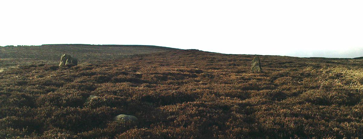
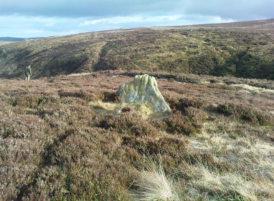
Best approached by taking the same direction to the unexcavated Foster Clough ‘enclosure.’ From here, walk towards the walling about 100 yards to your east. Follow it along on the moorside for another 100 yards then follow the small sheep-path up the angle of the slope onto the moor itself. Once you’re at the top and on the level, it’s right ahead of you! If the heather’s deep though, you might as well give up before y’ start! (honest – I went there a while back for a night’s sleep & couldn’t find the damn thing!) But if you’ve made the effort getting here, wander 200 yards towards Crow Hill and keep yer eye out for the large heather-clad tumulus.
Archaeology & History
This site was rediscovered in October 1995, when I was bimbling about on the southern side of Crow Hill. It was one of those good periods, when the heather had been extensively burnt back, so enabling a better examination of the moors for any potential prehistoric remains. I unknowingly walked right into the middle of this small ring of stones with a fella called John Billingsley, who seemed quite unaware of what I was getting excited about until I pointed out to him exactly what we were standing in the middle of! (he couldn’t see what was under his nose, which was a bit weird considering he edits an earth-mystery mag) But I wouldn’t have even been looking for this site, were it not for what happened just a few days earlier…
I was on one of my many ambles across the moortops, which to many people watching would seem like some seemingly aimless, lost soul – an apt description at times! – wandering across the hills (those who know me well, have long called such seemingly aimless treks, Barmy Bennett Expeditions!). It was a lovely day: a shallow snow-cover lay across the moors and as the wind brushed across the earth and up, Her wisps of breath were freezing. But I was well-wrapped and sat, upon occasion, behind the small rock outcrops I was checking for cup-and-rings for shelter when needed. But as the day fell on and the sun touched the western hills, I had to turn for home as the cold was strengthening. Being on the moors at night, in this sort of weather, is never a good idea unless you’ve got your gear with you — and this day I hadn’t. So I set off back for home in Hebden Bridge, in that dreamy sort of state which the hills elicit after a day’s ambling. The colours of Earth and Sky were crisp in the bracing air and as I headed for the footpath towards the old stone known as Churn Milk Joan, I gazed at Crow Hill a half-mile or so away…
Without warning, it came like a thunderbolt up through my dreaming mind: ‘There’s a stone circle over there!‘ came the words. And though the words were quiet and simple, their effect was anything but! I focused quickly – very quickly! My mind staggered out of the dreaming and into the ego state, trying quick to rationalise what had just emerged from my unconscious. An adrenalin rush hit me and amidst the snow-filled hills I started to bound, gazelle-like, across the wibbling moors, straight towards Crow Hill. But then I stopped!
“Wait… She’s nearly dark,” I said to myself. “You’ve no food and there’s gonna be no no light. Come back in a day or two and you’ll have all the time you need to explore.”
And so I wandered back in the dark to the warmth of fire and home and waited a few days, for the Earth to drink Her snow, and hope that the curious intuition — as it had been on numerous other occasions — proved fruitful. And so it did…
If you can find the place (almost impossible when the heather’s in full growth), you’ll see that this ‘cairn circle’ is little more than 32 feet across, with the tallest stone in the ring little more than 2 feet tall. A curious small squared circle of loose stones exists in the south side of the ring and a raised embankment surrounds the site. Scatterings of small, football-sized stones are found both in, out and at the edge of the circle. (Please note – to those of you who wanna cross-reference – that the photos alleging to show this site on The Megalithic Portal are not of the right place.)
Close by are other neolithic remains, including extensive walling, 2 or 3 other small standing stones and a large tumulus which one rather myopic hobbyist (Mike Haigh) reckoned – in a poor attempt at sarcasm – might be the burial tomb of a successful local farmer. Hmmmm…..
The site was later described in an article by the same Mike Haigh (in Billingsley’s Aspects of Calderdale) as being discovered by John Billingsley himself, which wasn’t just a mistake but a rather huge lie. John was there with me when I found it, as he knows full well. But it seems here we have an example of people who like to try give themselves credit for discovering things that they did not do.* Even sillier, Mr Billingsley then moaned when I described the site (in my Old Stones of Elmet) without mentioning his name! But in all honesty, if that’s the disreputable way in which they go about their business, what do they expect in return!? (What’s worse is that the site was first described in an article in his own Northern Earth Mysteries mag in 1995, which I co-authored, and then when I asked if he could point out the error and correct it, he ignored the request in just the same way politicians do. Pure bloody ignorance no less. But then, he is one of those incoming Southern-types – y’ know the sort…)
This aside: the entire region hereabouts requires considerable archaeological attention as we have here the remains of either a neolithic settlement, or graveyard, or both!
* see the note at the bottom of the ‘About TNA‘ page on such issues.