St. David’s Well, Weem, Aberfeldy, Perthshire

Holy Well:  OS Grid Reference – NN 8445 5002

Also Known as:

  1. Canmore ID 25672
  2. Chapel Rock Spring
  3. Fuaran Creig a’ Chaibeul
  4. St. Cuthbert’s Well

Getting Here

In the dark, dark wood... hides St. David's Well
In the dark, dark wood… hides St. David’s Well

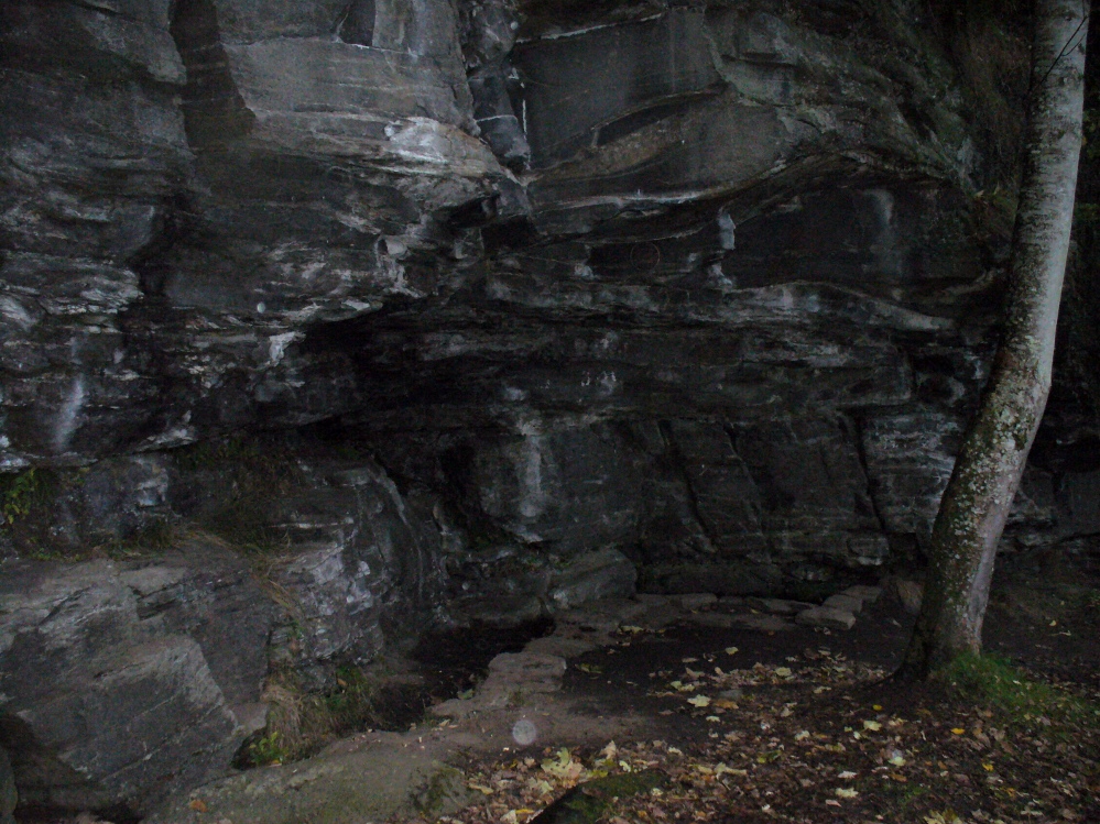
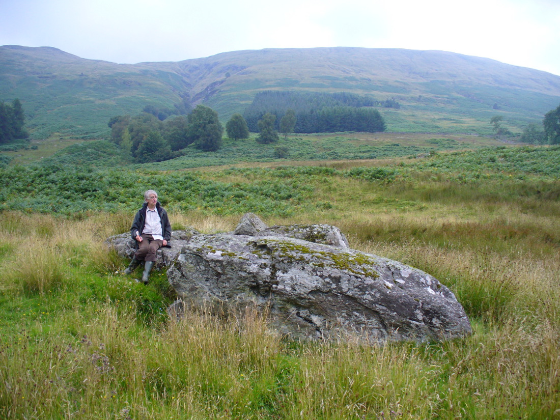
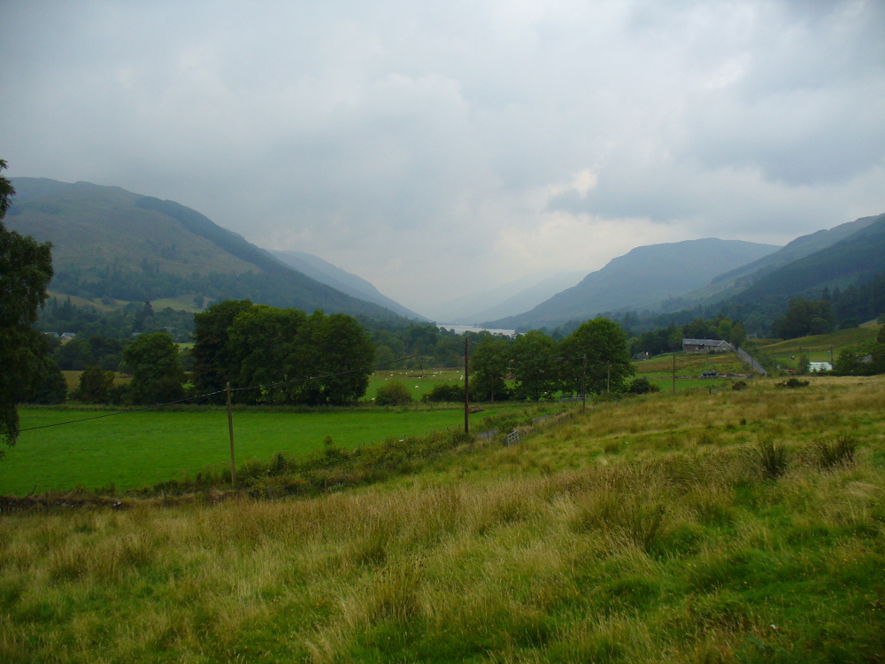
The best way to find this site, in the middle of the large woods up the slopes, is to follow the circular mile-long tourist path that runs through it. Take the B846 road out of Aberfeldy over the bridge towards Dull and Weem.  As you go through Weem, watch closely for the signpost directing you into the trees of Weem Rock and Woods on the right. Follow this tiny road up until you reach the parking circle in the edge of the trees.  Follow the directed footpath up into the woods & keep to the winding track, up, zigzagging, and up again, until it levels out a bit and runs below the large long crags. Tis beneath here you need to be!

Archaeology & History

The pool of St David's Well
The pool of St David’s Well

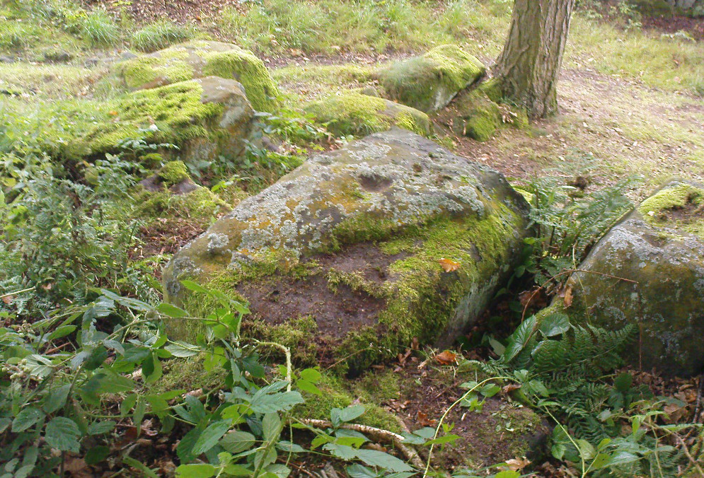
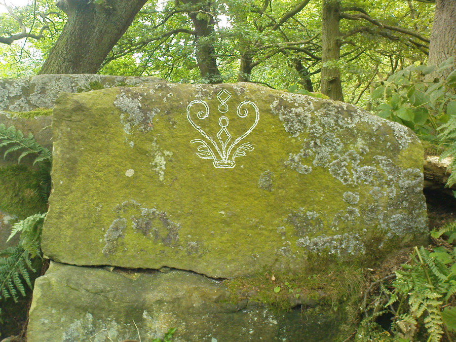
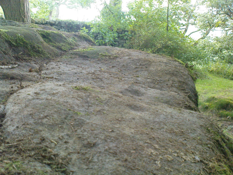
Not far from the curious Weem Wood carvings, hidden beneath one section of the long high crags in remains of the ancient forest, is this trickle of fresh water which collects into a small stone-lined pool. (a small round plaque which reads ‘St. David’s Well’ on the cliff-face above the waters is helpful) It’s in a truly lovely setting, with a small ‘cave’ about 50 yards west along the same footpath and a modern carved ‘cross’ in front of it.

The well was formerly known as St. Cuthbert’s Well (date: 20 March) who, so legend tells, lived nearby—probably at the christian-druid college at Dull, a mile west of here. It was he who collected the waters from the rock face into the small pool we see today.  This used to be known as St. Cuthbert’s Bath.  But several centuries after the saint’s death, the local laird, Sir David Menzies, came and restored the well and gained a reputation for spending much time living hereby, sometimes in the small cave along the edge of the cliffs.  It was to him that the New Statistical Account wrongly dedicated the waters to in the 19th century—but the title has stuck!

Described in several old local history works, the site was included in the giant folklore tome on Scottish waters by MacKinlay (1893), who wrote the following:

“In the wood clothing the steep hill of Weem, in Perthshire, is St. David’s Well, said to be named after a former laird who turned hermit.  The spring has a considerable local fame, and many have been the wishes silently breathed over its water.  Part of an ancient stone cross lies at its margin, and on it the visitor kneels while framing his or her wish.”

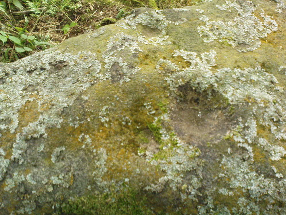
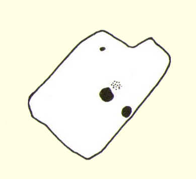
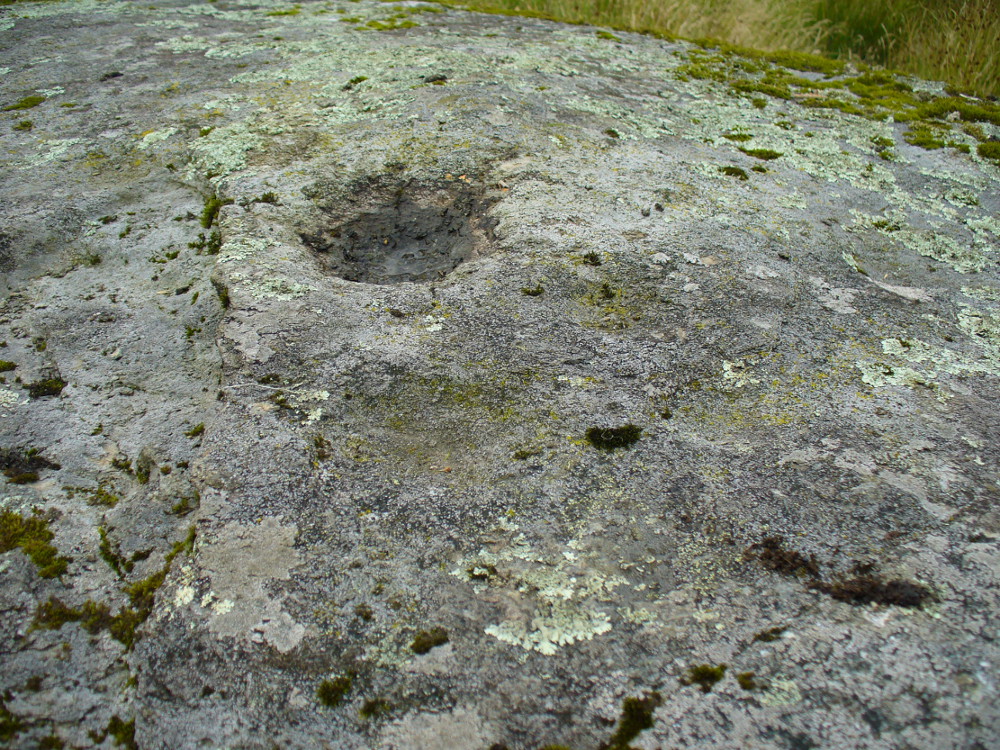
Nothing of this ‘cross’ can now be seen, but it is said that its remnants are housed at Weem church in the village below.  Also in the 19th century, occasional christian gatherings were held here and as many as fifty people came “for religious services.” Thomas Hunter (1886) reported that “a collection of human bones” were found near the well in front of the crags. There is also what looks like a newly cut large cup-marking with two carved lines reaching out from it, heading towards the well, on a small ledge of stone close to the pool.

Folklore

Folklore tells that once, long ago, dragons lived in these old woods—overcome no doubt by the incoming christians who stole and denigrated the olde peasant ways of our ancestors.  In bygone times, locals used the waters here for their health-giving properties.  As Ruth and Frank Morris (1982) told,

“it was an ancient wishing well which was still visited in 1954, when such objects as pins and buttons and an occasional penny was thrown in.”

References:

  1. Ferguson, Malcolm, Rambles in Breadalbane, Thomas Murray: Glasgow 1891.
  2. Hunter, Thomas, Illustrated Guide to Perthshire, Robertson & Hunter: Perth 1886.
  3. MacKinlay, James M., Folklore of Scottish Lochs and Springs, William Hodge: Glasgow 1893.
  4. Morris, Ruth & Frank, Scottish Healing Wells, Alethea: Sandy 1982.

© Paul Bennett, The Northern Antiquarian


Calverley Woods Stone Circle, Leeds, West Yorkshire

Stone Circle:  OS Grid Reference — SE 20 37

Archaeology & History

Having lived close to these woods in the past, I have searched extensively for any remains of the stone circle described by a Miss Alice Wells in the very first issue of the Cartwright Hall Archaeology Group Bulletin, but to no avail.  A meeting to examine this site was supposed to have taken place in September 1953, “but as Miss Wells was unavoidably absent this was not seen.”  And still to this day it remains hidden [or non-existent, whatever the case may be].  There is ample evidence that prehistoric man roamed this region, as finds of cup-and-ring stones and iron age walling indicate.  A possible contender for this stone circle could be the small ring of rocks seen near the bottom of the wooded hill beneath the giant Hanging Stone, close to grid reference SE 2003 3748.  About 10 yards across, this looked like a smaller version of the Roms Law circle several miles west, but is much overgrown and not visible beneath the undergrowth of summer vegetation.

The presence of prehistoric cup-marked stones in this woodland clearly indicates Bronze Age activity here and—as such petroglyphs have a tendency in West Yorkshire to be associated with tombs and death in many cases—may indicate the lost site was indeed a cairn circle and not a true stone circle. Seems likely to me. If anyone has any photos of this site, or can ascertain its exact whereabouts, please let us know and all credits will be given for its rediscovery.

References:

  1. Bennett, Paul, The Old Stones of Elmet, Capall Bann: Milverton 2001.
  2. Jackson, Sidney (ed.), “Calverley Wood,”in Cartwright Hall Archaeology Group Bulletin, 1:1, July 1954.

© Paul Bennett, The Northern Antiquarian


Calverley Woods (03), Leeds, West Yorkshire

Cup-Marked Stone:  OS Grid Reference – SE 20370 37925

Getting Here

Cup-Marked Stone near centre (courtesy Mike Short)
Cup-Marked Stone near centre (photo, Mike Short)

Mike Short tells: Walk ENE along Thornhill Drive (no vehicular access) to gate across road at the last house on the Drive and continue on for approx 475m where road starts to narrow slightly, becomes a little steeper and gently turns to E.  Thornhill Drive is now cut into the hillside at this point with an upwards sloping bank on the S side of the path. After approx 25m further on at approx SE 20375 37950 look out on the S side of the path for a pile of boulders sitting on bedrock on top of the bank and a large rectangular tabular rock on the side of the bank.  Ascend the bank and from the boulder pile the panel is approx 22m 200º(T) in the middle of an ephemeral E-W path more defined to W.

Archaeology & History

The profile (and ‘How to Get There’) for this recently discovered cup-marked stone was forwarded to me by fellow rock art explorer, Mike Short.  The carving is another basic design found in Calverley Woods, between Leeds and Bradford, nearly halfway between the missing petroglyphs of West Woods 2 and Sidney Jackson’s Calverley Woods Stone.  Rediscovered by Lisa Volichenko some time ago, Mike described the new carving here as follows:

Sketch of the carving
(courtesy Mike Short)
Cup-Marked Stone nr centre (courtesy Mike Short)

“Panel is carved on W sloping face of a sub-triangular earthfast coarse-grained sandstone boulder 0.81m X 0.50m X 0.38m, the longest axis lying almost exactly N-S. Carving consists of 3 cups, the most N of which is elliptical approx 65mm X 55mm; the central cup is elliptical approx 50mm X 40mm and the most S is circular diameter approx 40mm. On the N edge of the W face is a shallow elliptical depression thought to be of natural origin. There is an area of damage along the ‘crest’ of the boulder close to its S end.

“Carved rock is the most E of five rocks, measuring between 0.70m and 1.15m in length, in very close proximity forming an arc, 3 of which are in the footpath and one of which is resting on a large slab of rock almost completely covered by soil and vegetation.”

And so the small number of cup-marked stones in this woodland slowly grows.  One wonders how many more are hidden beneath the roots of the trees—and are all of the lines and cups atop of the great Hanging Stone, a short distant away, all Nature’s handiwork…?

Acknowledgements:  Huge thanks for Mike Short for the data, photos and sketch of this carving.

© Paul Bennett, The Northern Antiquarian


Deil’s Cradle, Dollar, Clackmannanshire

Legendary Rock:  OS Grid Reference – NS 9686 9906

Also Known as:

  1. Devil’s Cradle

  2. Devil’s Rock

Folklore

The Deil’s Cradle stone

A few hundred yards below the legendary old Wizard’s Stone, we find there’s a real cluster of witch-lore in the small area to the north of Dollar which, to be honest, is deserving of wider analysis from competent researchers and historians.  Not only is there the legendary Lochy Launds of the Black Goddess hereby, but we also find this curious rock, described by one ‘J.C.’  in an early edition of the Scottish Journal (1848), which told:

“On the confines of the parish of Dollar, not far from Hillfoot, the seat of John McArthur Moir, Esq., lies a glen, called Burngrens, watered by a small stream and planted with numerous large trees.  A great number of these, however, have fallen, during the last few years, beneath the unsparing axe; but strong, healthy saplings are rising rapidly to supply their place.

“In this glen there is a large stone, of peculiar formation, in every way like a cradle. It is currently believed by the superstitious in the vicinity, that the stone, every Hallowe’en night, is raised from its place, and suspended in the air by some unseen agency, while “Old Sandy,” snugly seated upon it, is swung backwards and forwards by his adherents, the witches, until daylight warns them to decamp.

The following rather curious affair is told in connection with the “Cradle:”

“One Hallowe’en night a young man, who had partaken somewhat freely of the intoxicating cup, boasted before a few of his companions that he would, unaccompanied, visit the stone. Providing himself with a bottle, to keep his courage up, he accordingly set out.  The distance not being great, he soon reached his destination.  After a lusty pull at the bottle, he sat down upon the “Cradle,” boldly determined to dispute the right of possession, should his Satanic majesty appear to claim his seat. Every rustle of a leaf, as the wind moaned through the glen, seemed to our hero as announcing the approach of the enemy, and occasioned another application to fortifying “bauld John Barleycorn.” Overpowered at last by repeated potations, our hero, dreaming of “Auld Nick,” and his cohort of “rigwuddie hags,” fell sound asleep upon the stone.

“His companions, who had followed him, now came forward. With much shouting and noise, they laid hold of him, one by the head and another by the feet, and carrying him, half-awake, to the burn, dipped him repeatedly, accompanying each immersion with terrific yells. The poor fellow, thinking a whole legion of devils were about him, was almost frightened to death, and roared for mercy so piteously that his tormentors thought proper to desist. No sooner had our hero gained his feet than he rushed up the glen, and ran home, resolving never to drink more, or attempt such a feat again. For many a long day he was ignorant who his tormentors really were.

“We stood upon the stone about a week ago. Ivy and moss are slowly mantling over it, a proof that it is some considerable time since the Devil has been rocked on it.”

Historian Angus Watson (1995) told the place to be “south of Wizard’s Stone…near Kelty Burn,” and also that,

“it is said to be where witches rock Satan to sleep on Halloween.”

Above here, the tree-topped rounded hill to the north was one of the meeting places of the witches of Fife, Perthshire and Clackmannan.  Something of sincere pre-christian ritual importance was undoubtedly enacted in this region, as we also find sites of the Maiden a short distance due north.  Does anyone know more about this fascinating sounding place?

References:

  1. ‘J.C.,’ “The Deil’s Cradle”, in The Scottish Journal, February 5, T.G. Stevenson: Edinburgh 1848.
  2. Simpkins, John Ewart, County Folklore – volume VII: Examples of Printed Folk-Lore Concerning Fife, with some Notes on Clackmannan and Kinross-Shires, Folk-Lore Society: London 1914.
  3. Watson, Angus, The Ochils: Placenames, History, Tradition, PKDC: Perth 1995.

© Paul Bennett, The Northern Antiquarian


Foster Clough Delph, Midgley Moor, West Yorkshire

Enclosure:  OS Grid Reference – SE 0234 2708

Getting Here

Near the centre of this photo, the large 'ring' can be seen
Near the centre of this photo, the large ‘ring’ can be seen

From Midgley go west along Height Road and take the track up on your right, at the tree-lined bend, up Foster Clough and onto the moor as if you’re gonna go to Churn Milk Joan.  As you reach the footpath at the quarries up the hill, go to the top of them and take the small footpath where the land levels-out and head east towards the walling.  Just a hundred yards or so before the walling, keep your eyes peeled, cos you’re damn close!

Archaeology & History

Best seen when looking down from the slopes above, this is a fascinating site that is lucky to still be here!  For just a few yards to the west are extensive quarry works that could easily have destroyed the place had they continued.  But thankfully we have here a near-perfect circular enclosure: measuring roughly 27 yards in diameter east-west, and about 25 yards north-south, the circumference around the outer-edge is approximately 82 yards (75m).  It has all the appearance of an overgrown henge monument, with an outer bank and inner ditch, then a central flat arena—and it may indeed be such a monument—but until we have a decent excavation of the site, we’ll stick to calling it a simple enclosure—which it is!

Eastern arc of bank & ditch

The outer bank is very much overgrown, but as it runs round and defines this site, it measures 1-2 feet high most of the way, except on the westernmost spot, where it seems there may be an ‘entrance’.  The inner ditch is only a couple of feet deep, again all the way round the monument.  The internal level of the site is pretty flat, like most henges; but there seems to be a small central ‘cairn’ of some sort in the middle.  Again, this is very overgrown by our traditional moorland vegetation.

Aerial image, 2009
Aerial image, 2009
Aerial image, 2006
Aerial image, 2006

So what is it exactly?  An enclosure, a settlement, or even (as local research student John Billingsley once suggested) a henge?  Tis difficult to say for sure without further and more detailed archaeological excavation.  My estimate is that the site is either Bronze- or Iron-Age in nature, and is definitely an ‘enclosure’ of some sort.  We have located other prehistoric sites on the slopes just above here to the north, like the Crow Hill cairn circle and accompanying tumulus, remains of a neolithic settlement and a number of other small single cairns that are only visible when the heather has been burnt back.  If you intend to explore any of the ancient sites sites on this moor, check this one out!

References:

  1. Bennett, Paul, The Old Stones of Elmet, Capall Bann: Milverton 2001.

© Paul Bennett, The Northern Antiquarian


Panorama Woods (230), Ilkley, West Yorkshire

Cup-Marked Stone:  OS Grid Reference – SE 10377 47027

Also Known as:

  1. Carving no.63 (Hedges)
Panorama Woods stone 230

Getting Here

From Ilkley, take the directions up to the Panorama Woods 232 carving.  From here you can step from this rock over the stride onto the cup-marked carving 231b, and then go onto the next adjoining rock surface a little lower down. From here, you’ll see another mossy rock surface in front of you by a yard or two. That’s the one!

Archaeology & History

The three cup-markings

Here’s another simple cup-marked stone, probably only for the purists amongst you—although in visiting here please take into account the primary carving’s association with other more prominent designs that once existed only a few yards to the west where the houses now stand.  There is also the cluster of other carvings right next to this stone.  A prehistoric settlement was also in evidence adjacent to this carving which was destroyed in the latter half of the 19th century.

Close-up of the cups
John Hedges 1986 drawing

Described simply in John Hedge’s (1986) fine survey as a small “piece of rock with three clear cups and one depression.”  Boughey & Vickerman’s (2003) survey added nothing more and merely copied the same words.  For some reason or other (mebbe cos I’m simple!) I really like this otherwise innocuous design and its close simplistic relatives. It’s probably due to the trees amidst which the stones are found and the bright mosses on the rocks, giving the site a slightly extra sense of more living genius loci than others on the top of these moors, where the winds move the subtle spirits with greater ease.

19th century addition

If you step down and look at the vertical side of this stone, you’ll notice a more modern stylistic carving etched onto the surface.  Not as deep as the prehistoric cups on the top, it seems probable that a local artist by the name of Ambrose Collins carved this on here (and other similar designs on other rocks nearby) in the late 19th century.

References:

  1. Bennett, Paul, The Panorama Stones, Ilkley, TNA: Yorkshire 2012.
  2. Boughey, Keith & Vickerman, E.A., Prehistoric Rock Art of the West Riding, WYAS: Wakefield 2003.
  3. Hedges, John (ed.), The Carved Rocks on Rombalds Moor, WYMCC: Wakefield 1986.

© Paul Bennett, The Northern Antiquarian


West Woods 02, Calverley, Leeds, West Yorkshire

Cup-and-Ring Stone (lost):  OS Grid Reference –SE 1956 3734

Getting Here

Old photo of lost carving

Although now seemingly lost, it’s location is damn close to this: Along the A657 between Greengates and Bradford, where the New Line meets Carr Road, the dirt-track takes you into Calverley Woods, down Eleanor Drive. About 250 yards along (just before you get to the field on the left), take the footpath down the embankment towards the stream where it bends to the left and where the land levels out (don’t cross the stream). It’s somewhere round there!

Archaeology & History

This was one of two previously unrecognised carvings we came across sometime in 1985 (see West Woods 1 stone), when we were seeking out another missing carving in the same woods.  It was clear and well-defined as the faded photo here shows; but having been back to try find it twice in the last two years in the hope of getting better photos, I’ve been unable to locate it.  The carving was described in an article I did in an old earth mysteries magazine.  It comprises simply of a large ring surrounding and enclosing two deep cups, which were linked to each other by a connecting carved line.  Parts of the stone had been chipped in parts—including a section of the large ring— due to some industrial workings that had happened here in the past. Thankfully I managed to find the old photo and hopefully, perhaps, some local explorer could try and seek out where it’s hiding beneath the trees and other vegetation.

References:

  1. Bennett, Paul, “The Undiscovered Old Stones of Calverley Woods,” in Earth no.2, 1986.

© Paul Bennett, The Northern Antiquarian


Wester Auchleskine, Balquhidder, Perthshire

Cup-Marked Stone:  OS Grid Reference – NN 54584 20876

Also Known as:

  1. Canmore ID 24154

Getting Here

Wester Auchleskine cup-marked stone

From Balquhidder village, walk eastwards along the road for a few hundred yards until you reach Auchleskine Farm on your left.  A short distance past here there’s a gate taking you into the rough field on the left. Go through here and note a large clump of rocks diagonally up the slope about 100 yards away.  That’s your spot!

Archaeology & History

Very little has been said of this large cup-marked stone, just up from the road near Balquhidder.  It was first found and described in J.M. Gow’s (1887) fine essay on the local antiquities of the area, where he told:

“About 400 yards directly east from the farm-house there is a group of three large water-worn boulders of coarse mica-schist, with veins of quartz, the largest of which is about 15 feet long, 7 feet broad, and nearly 5 feet above ground. On the top of this stone there are seven cup-marks of various sizes. The largest are 5 inches in diameter and 2 inches deep; the smaller ones are shallower and from 1½ to 2½ inches in diameter. There may have been more marks on this stone, as a portion of the top near the marks has been broken off, and there are several other faint hollows, but, in my opinion, not sufficiently pronounced to indicate that they ever were cups.”

Cupmarks on top of the rock
The carving from above

Although his caution on the number of cups on the stone is to be commended, it was obvious during our visit to the site a few days ago that there are at least 18 cup-marks on the surface of this large rock.  There may be more (the grey cloudy day and misty light wasn’t good in allowing us to see the carving clearly). The most pronounced of the cups are on the very top of the stone, whilst others were carved mainly on the eastern slope of the rock.

At least two other cup-marked stones occur at the farmhouse itself, whilst on the road immediately below was once the cup-marked healing stone known as Clach nan Sul. It’s likely that other carvings are hiding away in the hills hereby…

References:

  1. Gow, James M., “Notes in Balquhidder: Saint Angus, Curing Wells, Cup-Marked Stones, etc”, in Proceedings of the Society of Antiquaries Scotland, volume 21, 1887.

© Paul BennettThe Northern Antiquarian 


Clach nan Sul, Balquhidder, Perthshire

Cup-Marked Stone (destroyed):  OS Grid Reference – NN 5456 2084

Also Known as:

  1. Canmore ID 24150
  2. Stone of the Eyes

Archaeology & History

Looking down Balquhidder Glen from the Clach nan Sul's old home
Looking down Balquhidder Glen from Clach nan Sul’s old home

Apparently destroyed, although some remains of the stone were said to be seen in the walling by the roadside; but when visiting this spot a few days ago the summer vegetation had completely covered any potential finds here.  The stone fell foul of the usual self-righteous industrialists when the track alongside which it had sat for countless centuries was turned into a road and the stone was “blasted”.  It was found some 20 yards below the large cup-marked stone known as Wester Auchleskine, seen amidst the clump of rocks in the field above.

The stone was described in MacKinlay’s (1893) fine survey on Scottish holy wells due to the healing properties of the waters that collected into the rock basin here.  The earliest record of the site that I’ve found comes from the hallowed papers of the Scottish Society of Antiquaries, where—in J.M. Gow’s (1887) rambles just east of Balquidder—he told us the following:

“Going still further east to the first turning of the road beyond the farmhouse of Wester Auchleskine, and on the left-hand side, there used to be a large boulder with a natural cavity in its side, famous as a curing well for sore eyes.  This stone was called “Clach nan sul” (the Stone of the Eyes).  In 1878 the road trustees caused it to be blasted, as it was supposed to be a danger in the dark to passing vehicles.  Its fragments were broken up, and used as road metal.”

Whether or not the site known as the Priest’s Basin, or Basan an Sagairt—a couple of hundred yards west by the roadside—was of a similar nature, or an attempt by christians to draw people away from the old healing Clach nan Sul and use this other one instead, we do not know.  There are numerous accounts of other stones in this mountainous region of Scotland where rocks-with-hollows filled with water were attributed with healing properties, like the Whooping Cough Stone at Struan, the Measles Stone at Fearnan, and many others.

Folklore

The folklore described by Mr Gow was reiterated in MacKinlay’s (1893) survey. He also told how,

“The hollow in the Clach-nan-Sul at Balquhidder…contained small coins placed there by those who sought a cure for their sore eyes. Mr J. Macintosh Gow was told by some one in the district that ‘people, when going to church, having forgotten their small change, used in passing to put their hands in the well and find a coin.’  Mr Gow’s informant mentioned that he had done so himself.”

References:

  1. Gow, James M., “Notes in Balquhidder: Saint Angus, Curing Wells, Cup-Marked Stones, etc”, in Proceedings of the Society of Antiquaries Scotland, volume 21, 1887.
  2. MacKinlay, James M., Folklore of Scottish Lochs and Springs, William Hodge: Glasgow 1893.

© Paul Bennett, The Northern Antiquarian


Panorama Woods (231b), Ilkley, West Yorkshire

Cup-Marked Stone:  OS Grid Reference – SE 10378 47027

The rock in question

Getting Here

Follow the directions to reach Panorama Woods carving 232.  Barely a yard or two southwest across the small gap where the kids have their little den or hideout, this long curvaceous rock is the fella in question.

Archaeology & History

Cup-markings on the rock

Curiously not included in the ‘official’ records, this large piece of rock, living right in between the Panorama Woods carvings 231 and 232, has at least two, possibly three faint cup-marks etched in the top northeastern portion of the rock.  Of the same style and probably period as the basic designs on stones 230 and 231, this is one in a cluster of petroglyphs that used to live at the edge of a prehistoric enclosure, destroyed at the end of the 19th century.

References:

  1. Bennett, Paul, Of Cups and Rings and Things, unpublished: Shipley 1981.
  2. Bennett, Paul, The Panorama Stones, Ilkley, TNA: Yorkshire 2012.

© Paul Bennett, The Northern Antiquarian