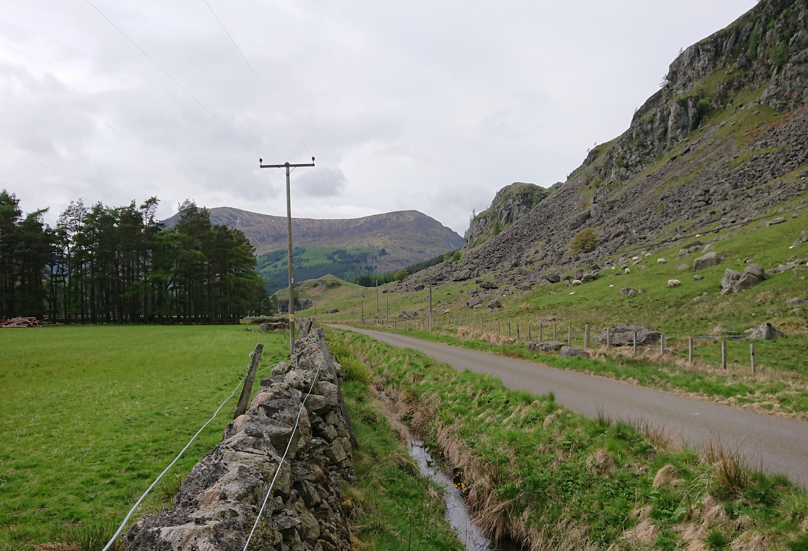
From Kirriemuir town centre up the B956 Kinnordy Road, turn left where it goes along the B955 road for several miles towards Cortachy. Keep going on the B955 for a few more miles into Glen Clova, past the Caddam stone and eventually, after going over the bridge into Clova village, you turn left and go up towards the mountains. Nearly 3 miles along you see the very conspicuous and impressive rising crag, like a small volcano on the right-hand side of the road, which is Dun Mor. Walk up the steep climb round to the back of it – and you’re in the middle of the old ruins…
Archaeology & History
Highlighted on the 1865 OS map of the region, Dun Mor is Gaelic for a “large or great fort” – and such it is! Those of you with a nose for these sorts o’ things will no doubt take to the remains pretty quickly. Its position in the landscape is a bit of a gem! On its north-side— invisible to anyone in the glen below—an overgrown arc of walling some 3 feet high and about 70 yards long bends towards the crag of rocks on each side, with a notable “dip” or entrance about 8 feet wide in the middle of it. The walling itself averages about 4 yards wide all along its arc.
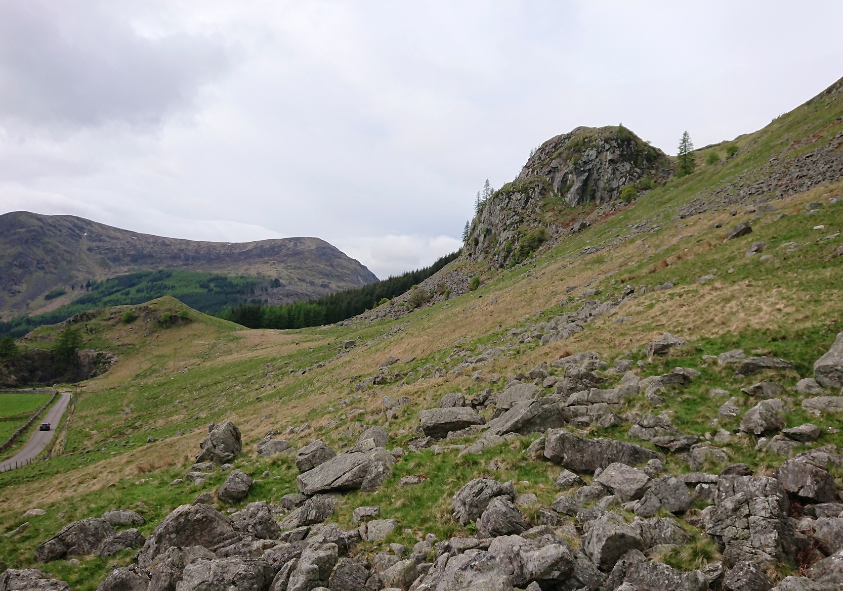
The crag of Dun Mor
It’s quite impressive once you get a good feel of the place and envisage it as it once was. The sheltered fortress within the rise of Nature’s crags is about 100 yards across and would be ample space for several families to live in when it was first built, in those mythic times of so so long ago. It was probably constructed in the Iron Age, although several ruined rectangular stone structures inside it are thought to be mediaeval shelters; and even in those more recent times, the people here would have regularly heard the howl of the wolves, whose names are kept in the hills above as reminders of a world not too long past….
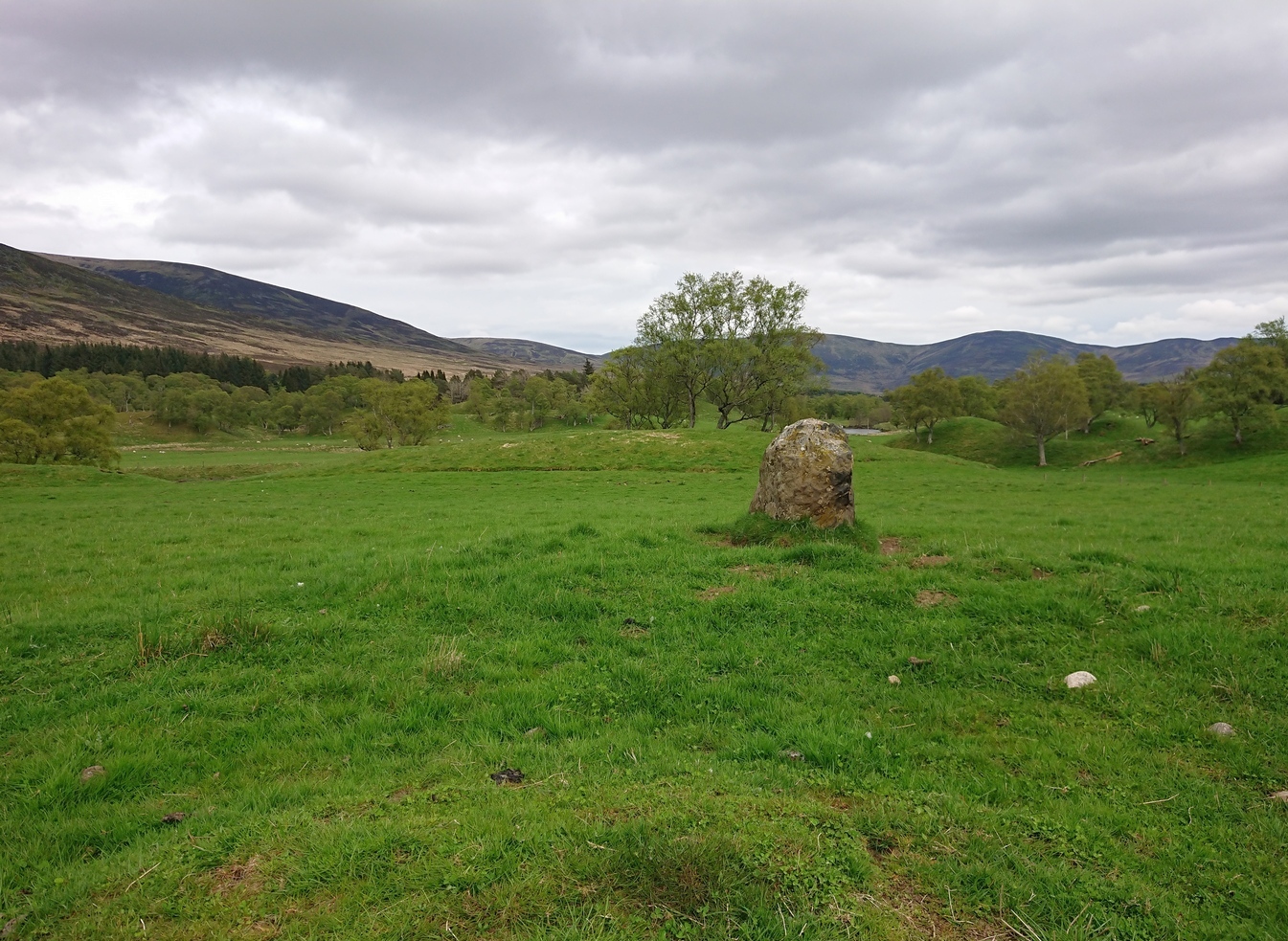
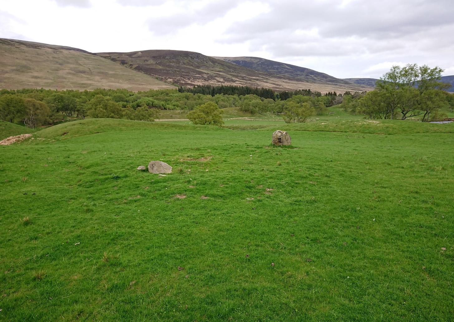
The only real way to get here is via Kirriemuir. Head north to the hamlet of Cortachy and past it, as you enter Glen Clova, where the road splits make sure you bear to the left-hand (western) side. Nearly 5½ miles along, keep your eyes peeled on your right where you can’t really miss it. The stone’s less than 100 yards into the field. …It may perhaps be a bit easier if you take the eastern road of the glen all the way to Clova village. Turn right from there, over the small river bridge and as it curves to go back down the glen, a half-mile along you pass Caddam house. Keep going for another 500 yards and you’ll notice it in the field.
Archaeology & History
Stone and its hut circle
Not to be confused with the ruined stone circle of the same name 10 miles to the south, this small standing stone—only some three feet in height—is at the eastern edge of a small overgrown hut circle measuring some 3 yards by 4 yards across. You can just make out the overgrown low walling in the second photo (right). The stone probably had some architectural relationship with the hut circle, but without an excavation we can’t know for certain what that relationship might have been. A settlement of much larger hut circles can be found on the other side of the river, near Rottal, two miles southeast of here.
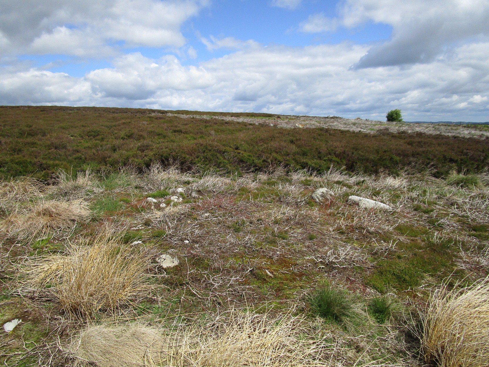
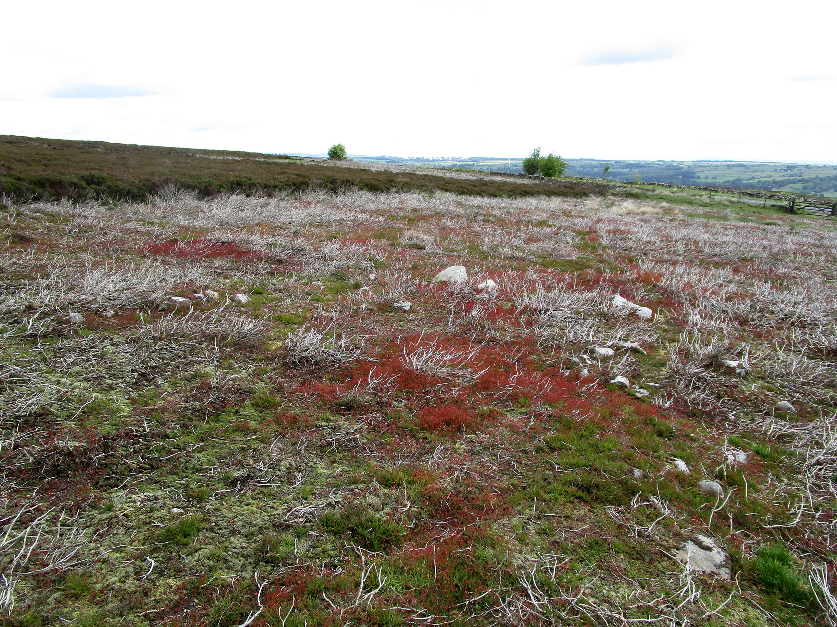
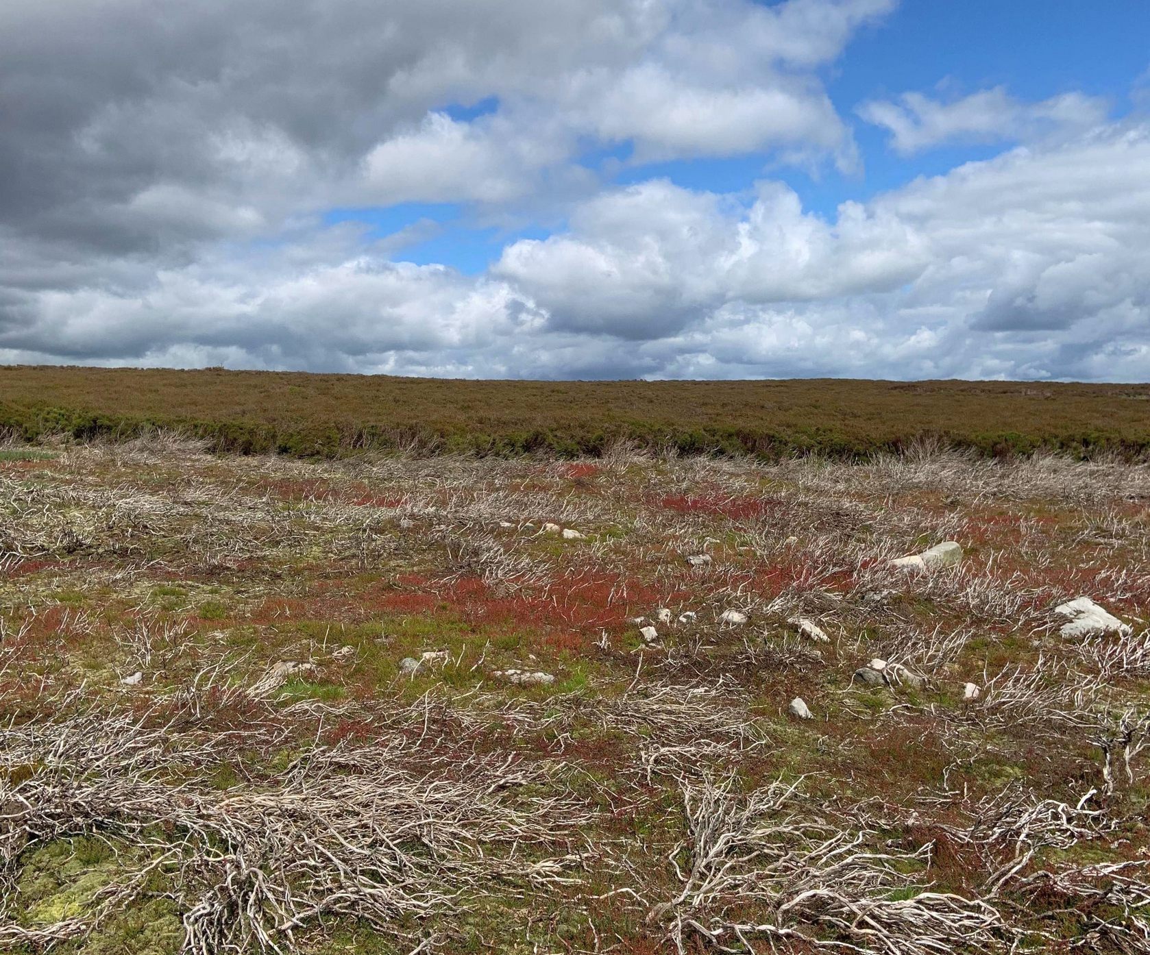
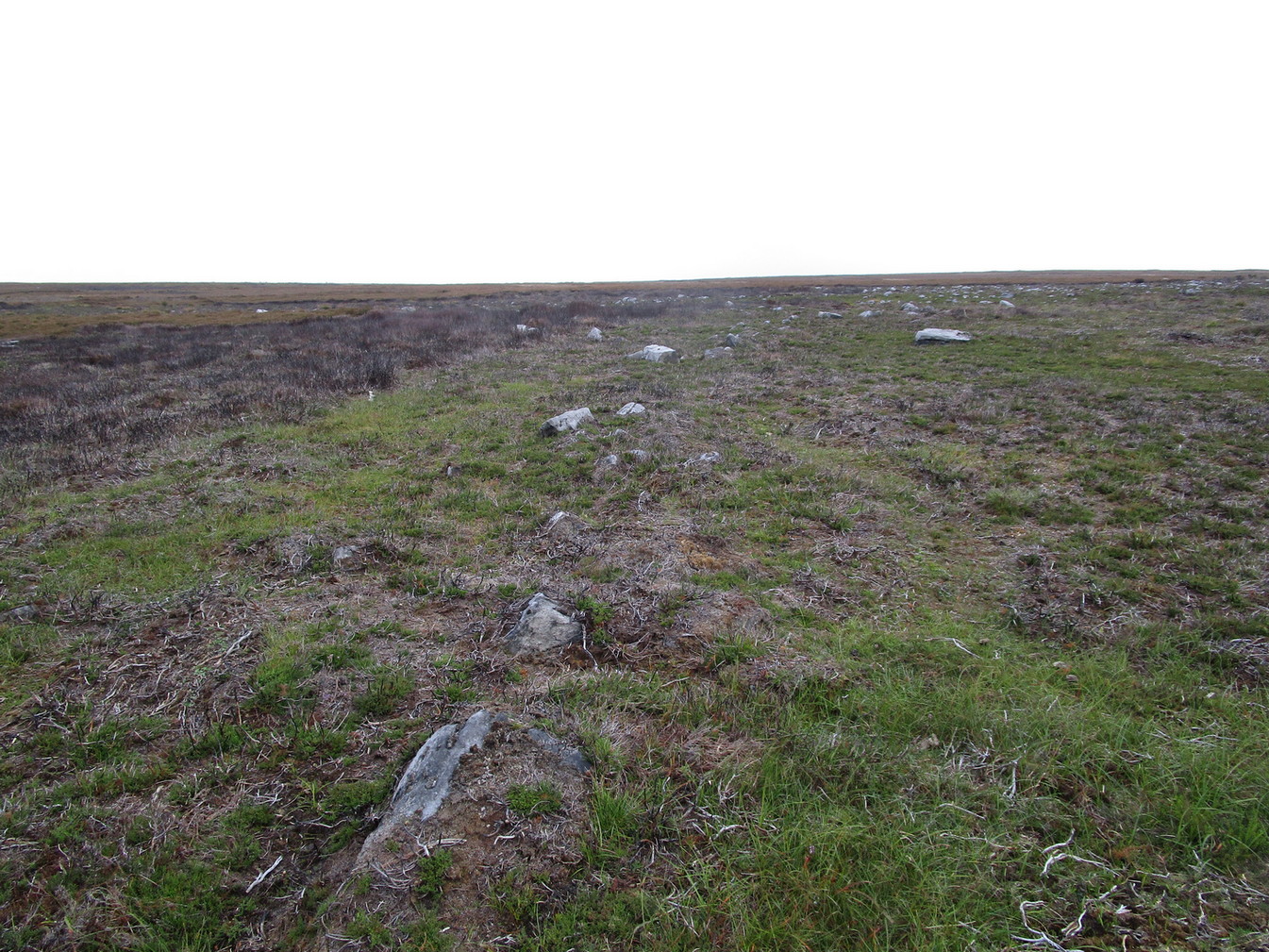
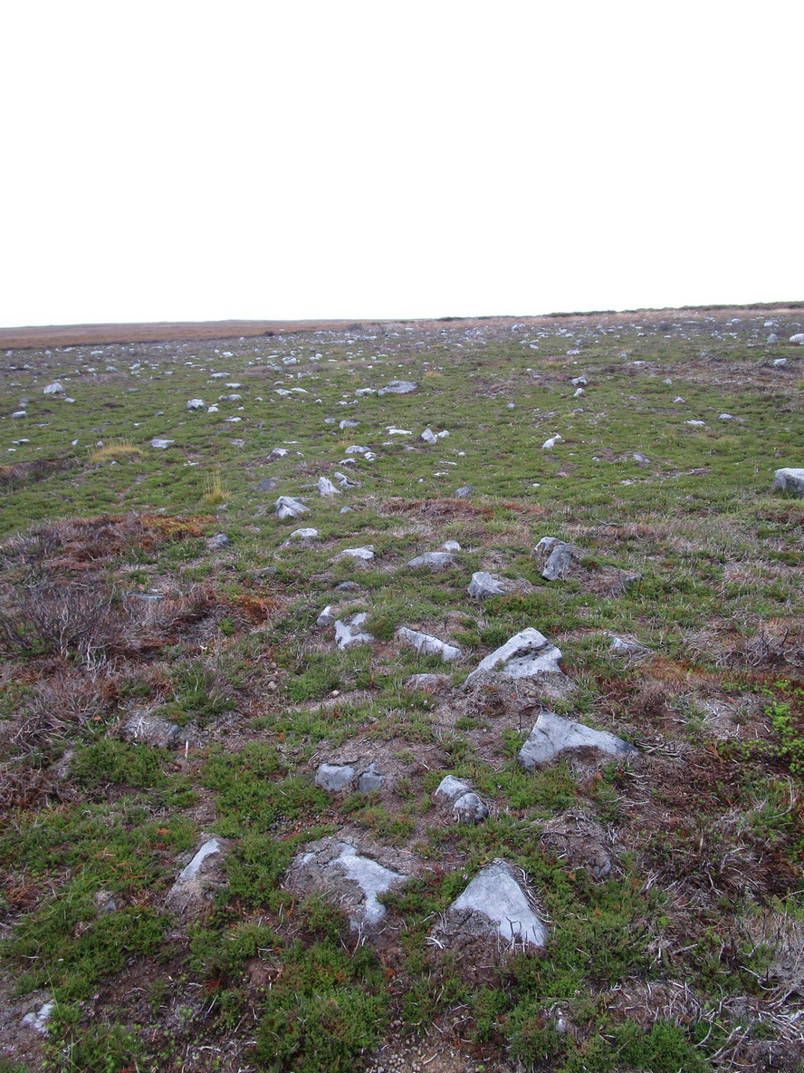
Along the only road that crosses Askwith Moor, park up at the single carpark on the east-side of the road. Walk up the road for 350 yards and through the gate on the left-hand (west) side of the road onto the moorland. Once through the gate, walk directly west into the heather immediately below the path for some 25-30 yards. Look around!
Archaeology & History
Rediscovered by Helen Summerton in May 2022 are at least two simple hut circles on this level piece of land close to the roadside, amidst this much wider and impressive prehistoric landscape.
The small ring of stones (SE 17430 50978) closest to the road is slightly more troublesome to make out due to it being more deeply embedded in the peat than its companion about 30 yards away. Comprising of typically small rubble walling, this first circle is only 4 yards across and would certainly have been fine for one person or, at a push, perhaps a small family.
Askwith Moor hut circle (2)Askwith Moor hut circle (2)
Its companion immediately west (SE 17401 50953) is somewhat larger and slightly more elongated in shape, being 10 yards along and 5-6 yards across, as well as being in a better state of preservation. This larger hut circle has been raised on a notable artificial earth-and-rubble plinth, being one or two feet higher than the surrounding peatland. A notable internal stretch of walling only a yard or two in length exists within the southeastern side of the construction, whose nature can only be discerned upon excavation: an issue we can say applies to the many prehistoric settlements and tombs across this small moorland. It’s very likely that other settlement remains will be found close to these two hut circles.
The remains of another hut circle can be found closer to Shooting House Hill, several hundred yards away; whilst five hundred yards southwest we find a small but impressive cairnfield. There are also a good number of petroglyphs close by and on much of the surrounding landscape.
Acknowledgments: Huge thanks to Helen Summerton (not Winterton) for finding these ‘ere remains – and for the photos accompanying this site profile.
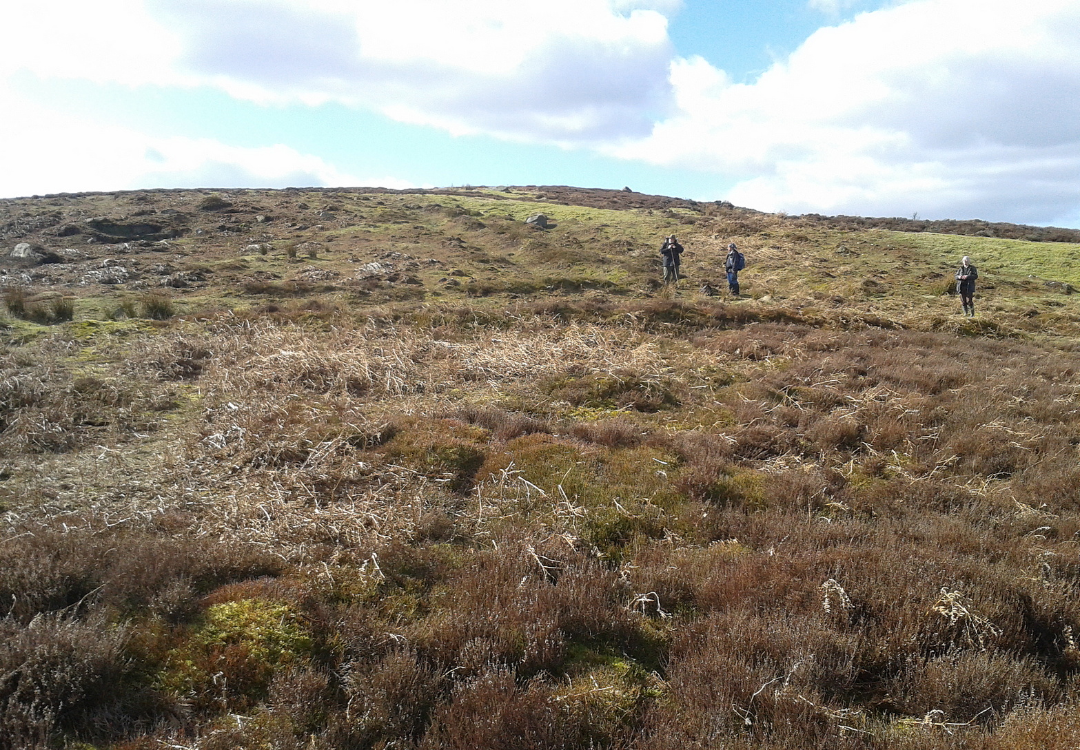
Coming up from Otley, make your way up to the Askwith Moor road (the only one that goes across the moors) and park up on the rough parking spot on the right-side (east) of the road. You can’t really miss it. From here walk up the road for less than 500 yards until your reach the rickety gate and the path onto the moors. From here I walked 600 yards east, thru the heather until I reached the wall (close to the Tree of Life Stone) and then followed the wall up for 150 yards, then back up (west) onto the moor again and, about 50 yards along at the foot of the slope, keep your eyes peeled for the earthworky undulations beneath your tiny feet!
Archaeology & History
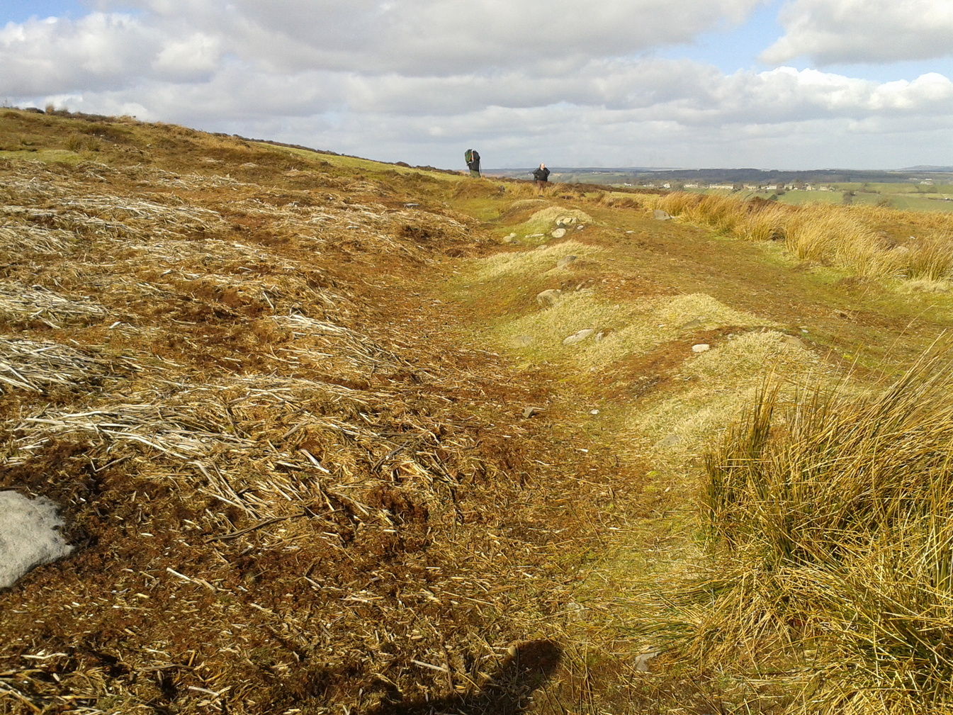
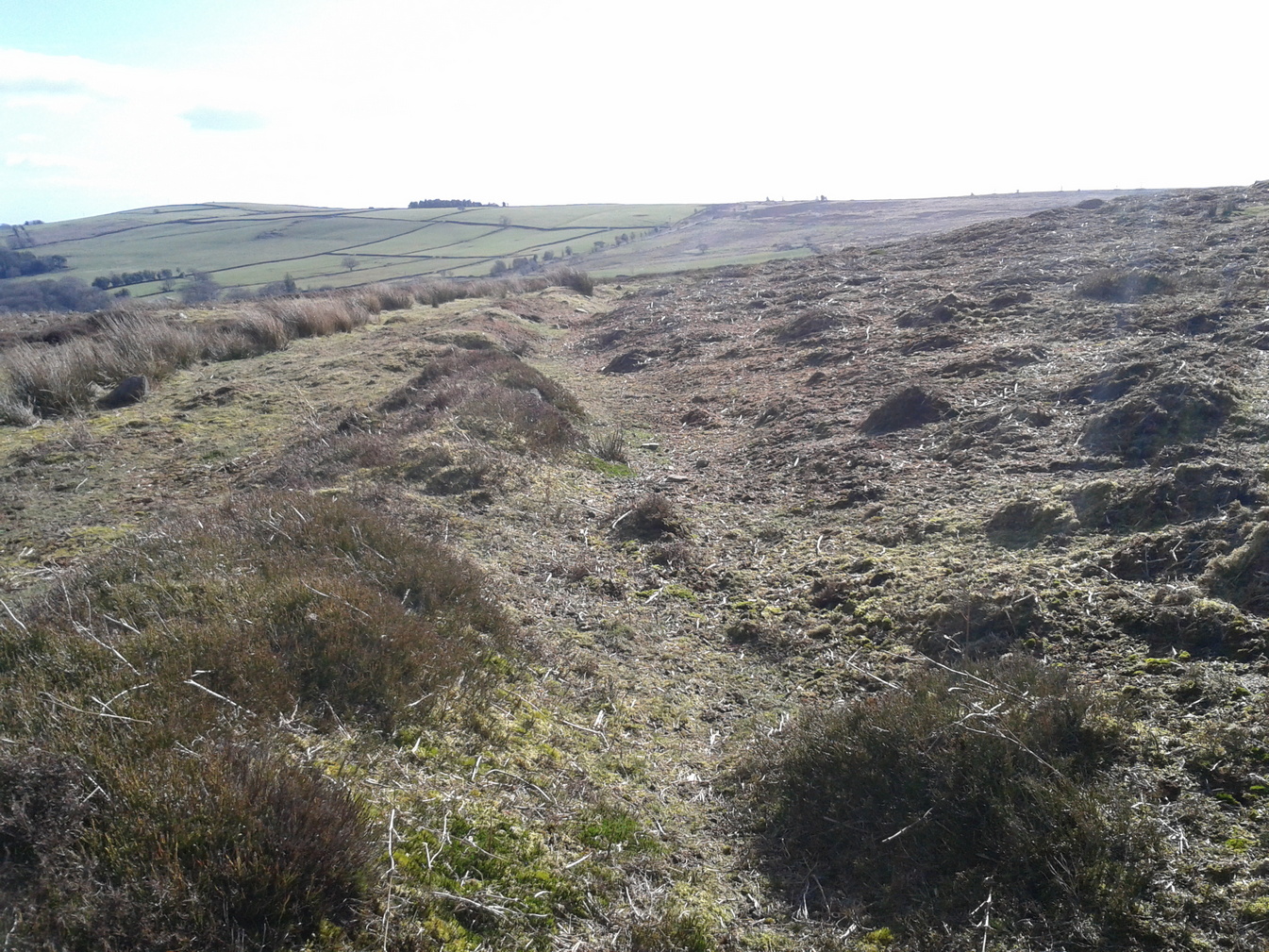
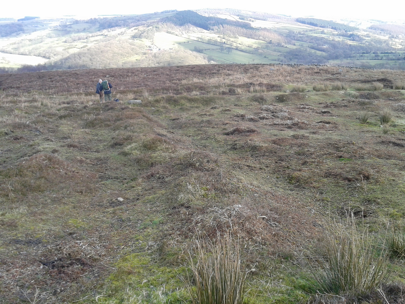
Just below the scattered Snowden Moor settlement we find this curious large structure, first described 75 years ago by the northern antiquarian Eric T. Cowling (1946). Since then, apart from a cursory overview, archaeologists haven’t really paid it much attention.
Eastern ditch, looking NEastern ditch, looking S
It’s a large site – and one which Cowling thought was constructed in the Iron Age. He may have been right, but there’s such a profusion of ancient sites on this small moorland area—dating from Neolithic times onwards—that it could be earlier than he thought. It’s an odd site too! Unlike the prehistoric D-shaped enclosure and settlement on the top of the slope less than 100 yards away, and an equivalent D-shaped enclosure to the south, the area inside Cowling’s enclosure ostensibly is on quite sloping ground, with barely a flat level area anywhere inside it. As a result of this, we can safely conclude that it wasn’t where people lived; and the complete lack of any inner hut circles (which you’d expect in a standard enclosure of this size) encourages this view. It’s a bit of a puzzle! Cowling opted for the idea that it was built to enclose cattle – which may be right; but again, even this must be questioned, as there is ample space on more level ground where this could have been done. His description of the site is as follows:
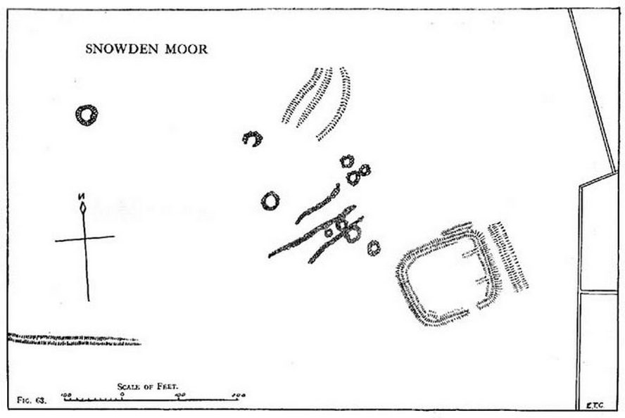
“The most prominent feature (on these moors) is a D-shaped enclosure which covers the nose of the spur; the area is eighty feet from north to south and seventy feet from east to west. The enclosing bank is of piled boulders, three feet high and eight feet wide. Cuttings across the north side revealed no evidence of dry walling, but rather a bank to carry a heavy stockade. A shallow trench runs inside the bank, which is doubled where it is overlooked by higher ground at the northeast corner. A second outer bank at the eastern side has an outer trench. Along the ridge to the east are circles of varying size, probably a hut group. A larger circle (?) of heavy material, some thirty feet in diameter, is isolated on the shelf above Snowden Crags to the west. Strips of wall and remains of enclosures of circular shape abound.”
Cowling’s plan of the siteNorthern bank, looking E
Cowling’s initial measurements of the site underestimated its real size, as the bank and ditch that runs roughly north-south is close to 52 yards—nearly twice as long! The same was found along its east-west size: being 56 yards, which is more than twice what Cowling measured. Altogether, the enclosure measures approximately 225 yards around its outer edges. In fairness, Cowling’s error was probably due to it being covered in vegetation when he came to do his measurements here. …So, if you’re gonna check this place out, make sure you do it in the winter or early spring months, before the bracken encroaches.
There’s a real abundance of prehistoric sites all over this part of the moor, from more settlement remains, cairns, ring cairns and petroglyphs. Make a day out of it.
References:
Cowling, Eric T., Rombald’s Way, William Walker: Otley 1946.
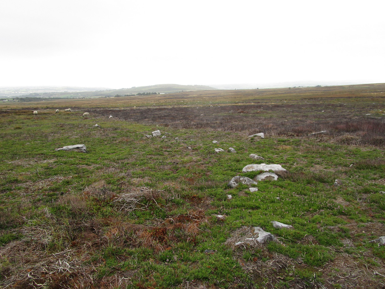
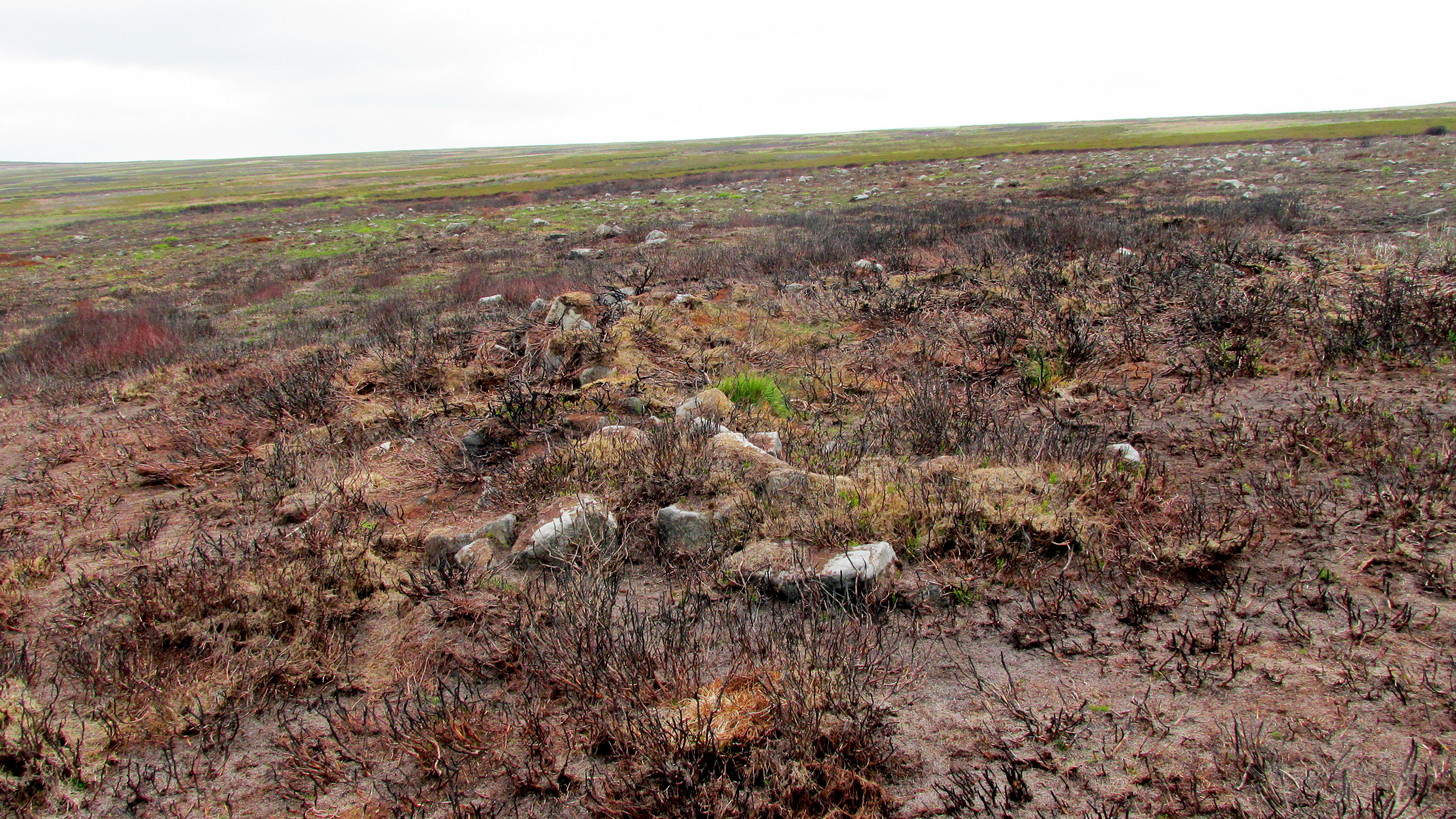
Make your way to the Black Beck tomb and walk west for some 50 yards. If the heather has grown any more than a foot tall, it’s impossible to see.
Archaeology & History
Near the northernmost section of the Hawksworth Shaw prehistoric graveyard, some 50 yards west of the Black Beck cairn, exists the remains of a small prehistoric enclosure whose walling is deeply embedded in the peat. Although I describe the place as an ‘enclosure’, we don’t know for certain whether it is a ruined settlement or large hut circles (although this latter idea is the more improbable).
Walling, looking NArc of walling, looking S
Two large open arcs of walling—like large letter “C’s”—with their open sides to the east, have been constructed next to each other, virtually coming together in the shape of an inverted number “3”. The walling in the southern arc—measuring some 33 yards in length and barely higher than 1 foot above ground level—consists of standard stones and rubble, similar to some of the hut circles that are found in greater abundance on the north-side of Ilkley Moor. The smaller, less visible arc of stones—some 18 yards of it—is lower in the earth. Both lines of walling may have been robbed in part to construct some of the extensive cairns close by, as neither of the two arcs were very high and it was very difficult to work out even what sort of structure they might have been.
Like many other prehistoric sites on Rombalds Moor, only an excavation is going to tell us precisely what was going on here…
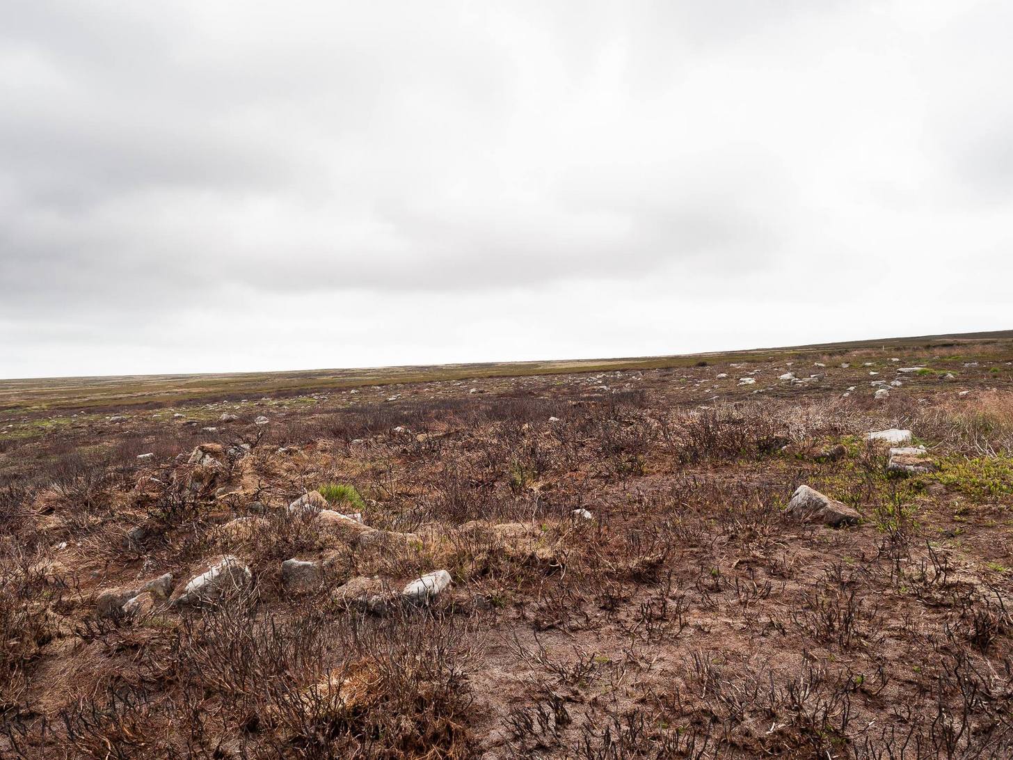
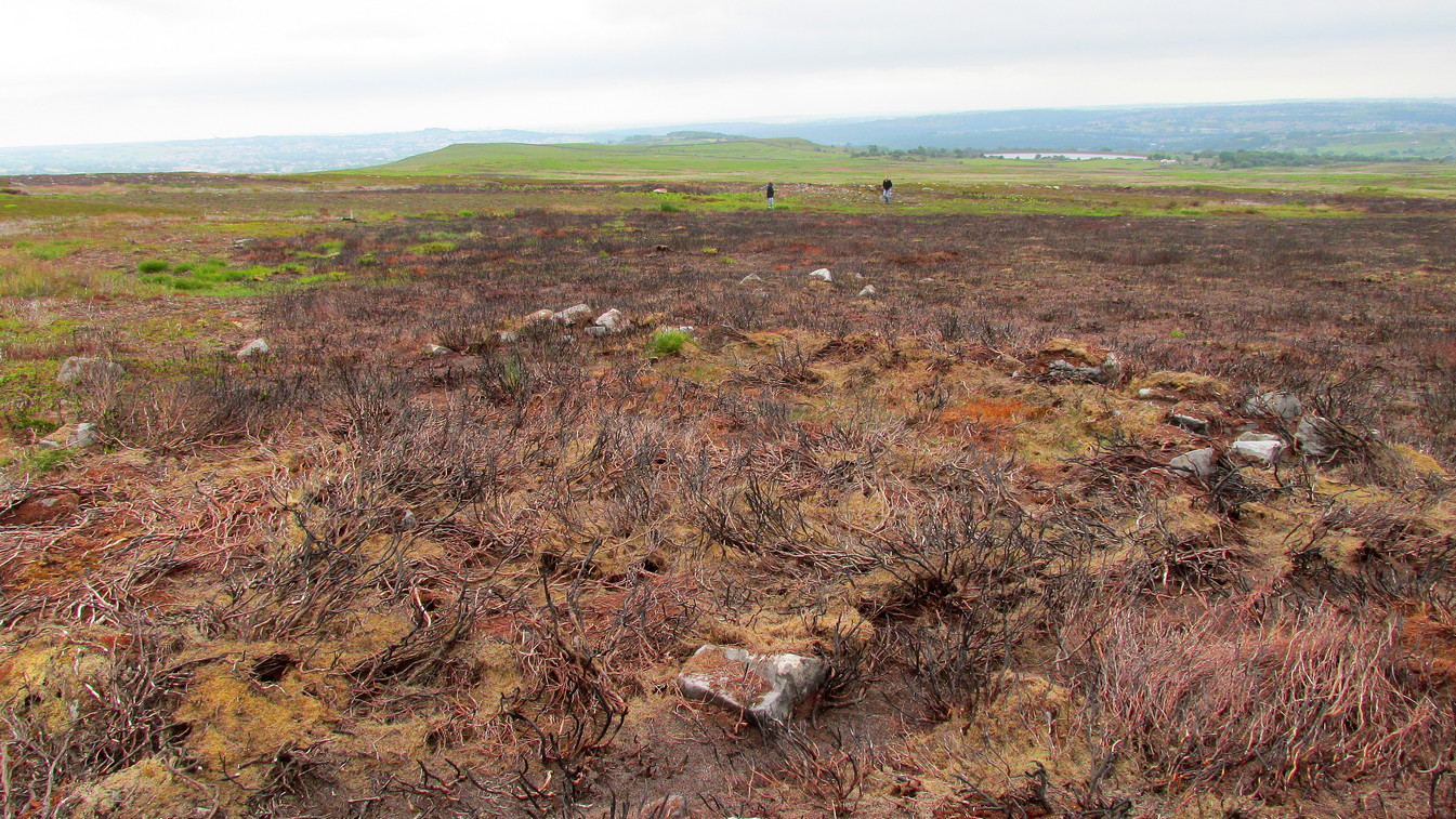
Take the same directions as if you’re going to visit the Black Beck cairn. From here, walk through the heather northwest for about 60 yards. If the heather’s been cleared, you’ll see it low down, otherwise you’re pretty much screwed when it comes to finding this one!
Archaeology & History
Seemingly in isolation, this low-walled, D-shaped hut circle is presently the only the structure of its kind known to exist on this part of Hawksworth Moor; although to be honest we should expect there to be such structures in the area when we consider the size and proximity of the associated cairnfields immediately north and southeast of here.
Southern arc of wallingNW section of walling; Black Beck tomb to rear
As with most hut circles, it’s nowt special to look at in all honesty. The south side of the structure is rubble walling typical of these structures, curving round as usual; but its more northern section straightens out, creating a D-shaped structure. This line of straight walling seems attached to another, outer parallel wall 3 feet away, creating its very outer edge. The rubble walls themselves average three feet across; whilst the hut circle measures 6-7 yards across. We assume that it was constructed during the same period as the adjacent prehistoric necropolis.
Acknowledgements: With huge thanks, as always, for James Elkington for use of his photos. Also to the evolving megalith and landscape explorer Mackenzie Erichs; and to Linzi Mitchell, for additional input…
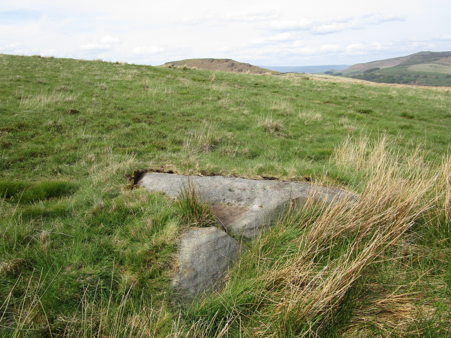
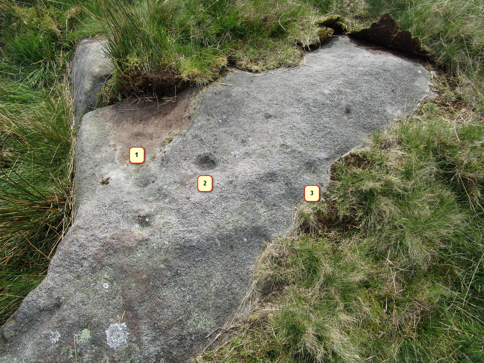
From Skipton head up the B6265 Grassington Road and after a short distance you will reach the Craven Heifer Pub on your left. About ¾-mile past the pub is a small turning on your left called Bog Lane. Go along here for about ¼-mile till you come to a sharp left bend and on the right you will see a gateway with room to park. Once here you’ll notice a sharp-pointed hill—and that’s Sharp Haw! Go through the gate, up the gravel track parallel to the wall on your left for 500 yards. Where the wall ends take the small path on your right and walk up here for ¾-mile where the path splits again. Take the right-hand path for 85 yards and the stone is on the left of the path.
Archaeology & History
Positions of cup-marks
Nowt special to look at, this is merely an elongated earthfast female stone that will be hard to find when the reeds grow high. The design consists of at least three cup-marks, with the most prominent one near the middle of the stone. A second one is shallow and on its northern side, near the middle; whilst the third one on its southern side was uncovered when we peeled back the vegetation; the peck marks are still visible. In the photo to the left I’ve placed numbers below the position of the respective cup-marks. In a cursory meander here, we found no other carvings – but that doesn’t mean there aren’t any!
It’s probably easiest to start from the Green Plain settlement, from here crossing the Sun Bank Gill stream and walking east through the scattered heather and grasslands for 450 yards to the right-angled edge of the woodland. Keep walking eastwards alongside the woods for about another 250 yards, then walk into the grasslands north for about 140 yards or so. Zigzag about – you’re damn close!
Archaeology & History
Only for the purists amongst you. This is a simple small triangular stone, with a single notable cup-mark near the middle. It would seem to be in isolation as we could find no others in the immediate vicinity. An early marker no doubt.
Acknowledgements: With thanks to Helen Summerton, who helped with location on this fine day.
Take the directions to find the unusual and impressive West Strathan petroglyph, and keep following the road up past the carving until you reach the dead-end. A footpath takes you down to the river, where a rickety bridge takes you to the other side. From here, a footpath to your right goes up the slope at an easy angle and into the wilds ahead. Just a couple of hundred yards up, keeps your eyes peeled some 10-20 yards above you, to the left. It is a little difficult to see, and perhaps is better looked at from above the footpath, then looking down onto it. If you’re patient, you’ll find it!
Archaeology & History
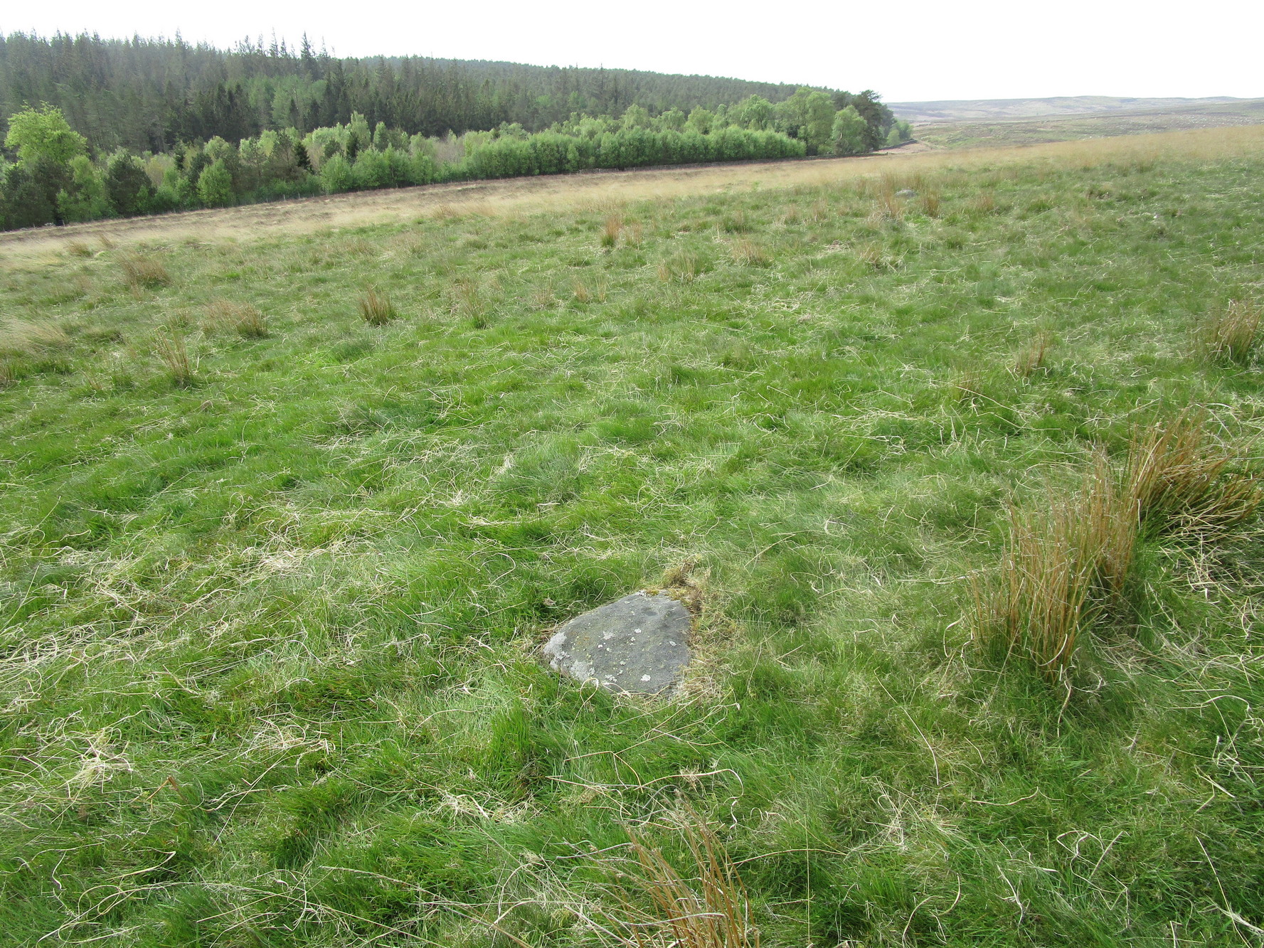
Stuck out on its own, way off the beaten track, this seemingly isolated ‘hut circle’—as it’s been officially termed—rests on a small level piece of land some 400 yards north from the ruins of Dalvraid’s chambered cairn. It’s nowt much to look at to be honest, and is probably only gonna be of interest to the hardcore antiquarians amongst you.
When I came here, the walling was mainly covered in dead bracken and internally is a veritable lawn!—but it was pretty easy to make out. Slightly ovoid in form, with its entrance on the southern side, the circle is 10 yards across; and the although the low walling is barely a yard high on three sides, on the eastern section the natural slope was dug into to create a higher wall on that side.
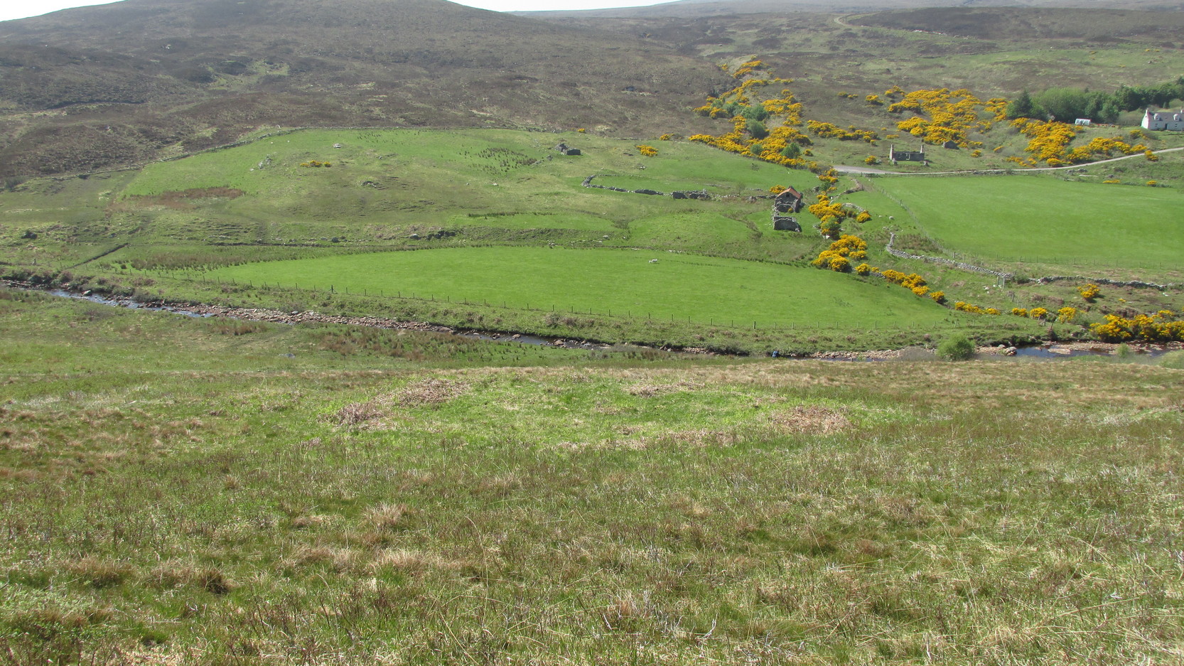
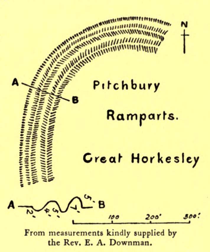
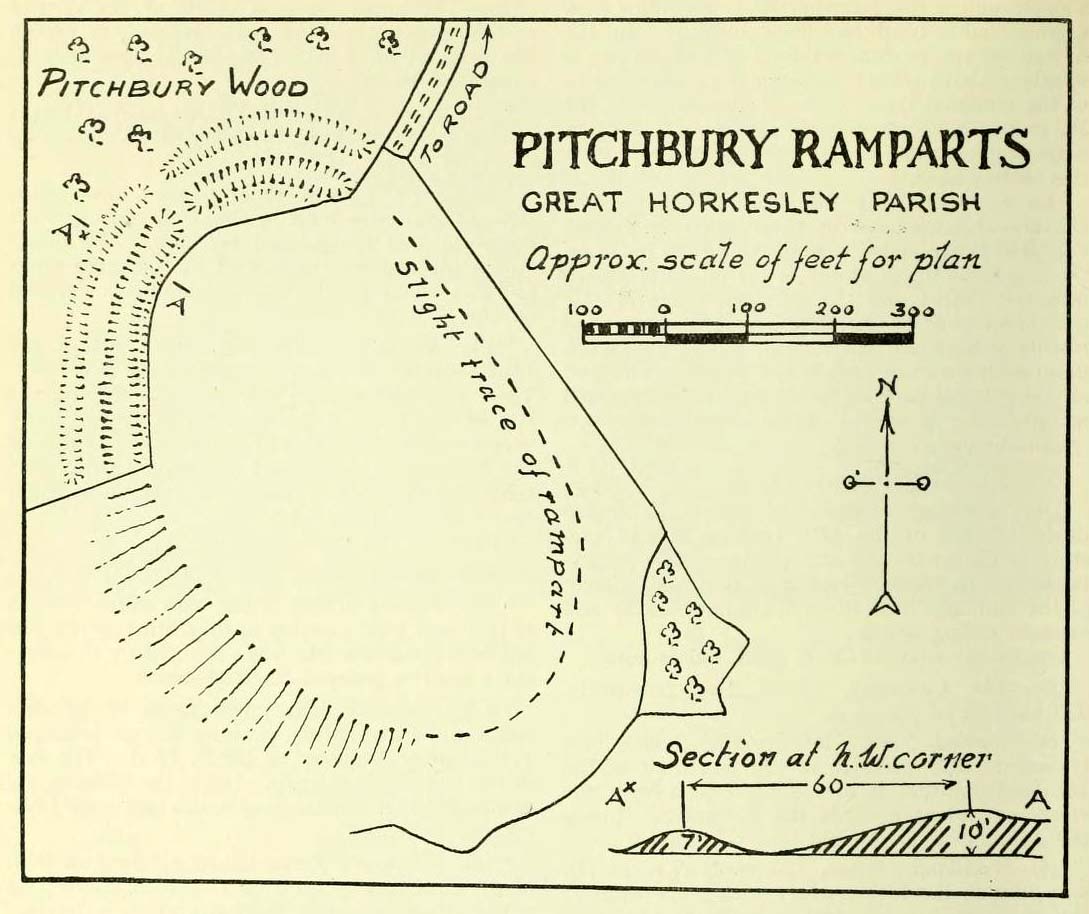
Along the A134 in Horkesley Heath, turn west along Coach Road and after a half-mile where it veers right, keep going for another half-mile where you’ll reach the woodland on your left. A path goes into the trees just before Pitchbury Lodge. Go along here and near the very far (southern) end of the trees, just before the open fields, you’ll see the large undulating ramparts of earth. Keep your eyes peeled. You’ll see them!
Archaeology & History
Stukeley’s 1759 map
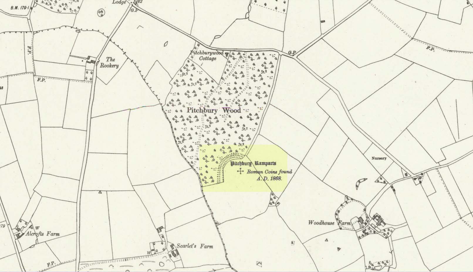
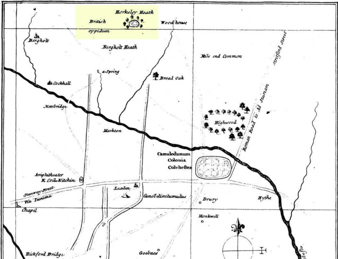
This once large hillfort was described in the Colchester township perambulations of 1671 and cited in Philip Morant’s classic work. (1748) He told how the boundary line ran “under Chesterwell along the Rampiers by Horkesley Heath,” and which P.H. Reaney (1935) tells was our wooded hillfort. In Morant’s day, the place was all but complete and so would have been well recognised by local people. Certainly it came the attention of the great antiquarian William Stukeley who, in 1759, came to Colchester and met with Morant. Stukeley mainly surveyed the area south of here, at Lexden Heath, but one of his sketch maps clearly highlighted a place he called “a circular work on Horkesley Heath”, i.e., Pitchbury Rings. The site seems to have remained relatively intact until the middle of the 19th century when a local land-owner took it upon himself to plough over and vandalise much of the site, leaving only a small proportion of the earthworks that we can still see to this day.
The ruins were described in I.C. Gould’s (1903) piece for the Victoria County History, where he told, at Great Horkesley,
Gould’s 1903 sketch of the remainsRoyal Commission’s 1923 ground-plan
“are some remains of an earthwork known as ‘Pitchbury’ or ‘Pitsbury Ramparts.’ When the late Rev. Henry Jenkins described the camp in 1841, he stated that it was of oval shape, and contained about 6 acres. Most of it was levelled for agricultural operations about fifty years ago, but there are still some remains, consisting of two banks with their accompanying ditches. The lines moreover of that part which was destroyed, can be partially traced in the adjoining fields.”
When the Royal Commission (1922) doods wrote about the site nearly twenty years later, things hadn’t changed too much and they simply reported how the “ramparts have nearly disappeared, except for the north section.” In this “imperfect” condition, as they called it, they gave the following brief description:
“Pitchbury Ramparts, in Pitchbury Wood, about 2 mile south of the church, are the north end of a large camp, roughly oval in shape, and defended by a double rampart and ditch. The defences are well preserved in the wood, the inner rampart being 10 ft. above the ditch, which is 60ft wide from crest to crest, but the greater part of the work has been almost obliterated by the plough, and is now only faintly discernible in a large field S. of the wood. The camp appears to have been 800 ft. long and 600 ft. wide.”
Thankfully there seems to have been no real increase in damage to the site since then. It was excavated in some detail in 1933 and again in 1973 and the finds were published by the highly reputable Colchester Archaeological Trust, whose subsequent report by Hawkes & Crummy (1995) is required reading for anyone wanting to know the detailed archaeology of this and other sites in the area.
Folklore
An intriguing piece of folklore was described in John Round’s (1882) history of the early battles around Colchester Castle. During the time when the Roman Empire was starting to crumble, the great Pictish tribes of Scotland ventured here and, we are told, took control of the Pitchbury Rings where they stayed before attacking Colchester Castle.
“Traces have been discovered of some violent catastrophe, possibly the first capture of the Colony by the marauding Picts from the North. Allured, in one of their Southern raids, by the wealth of the goodly Colony, they swooped down like eagles on their quarry from the wooded heights of ‘Pictsbury’.”
References:
Gould, I. Chalkley, “Ancient Earthworks“, in Victoria History of the County of Essex – volume 1, Archibald Constable: Westminster 1903.
Reaney, P.H., The Place-Names of Essex, Cambridge University Press 1935.
Watson, J.Y., Sketches of Ancient Colchester, Benham & Harrison: Colchester 1879.
Acknowledgements: Big thanks for use of the 1st edition OS-map in this site profile, Reproduced with the kind permission of the National Library of Scotland.