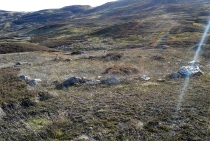
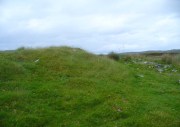
Overlee, Clarkston, Renfrewshire

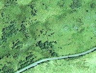
Souterrains & Settlement (destroyed):  OS Grid Reference – NS 577 572

Also Known as:

  1. Canmore ID 43802

Archaeology & History

Overlee Farm in 1896 – no remains highlighted

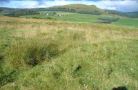
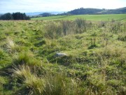
This was an astonishing-sounding place, little-known beyond the pages of specialist historians.  It has been described in modern terms as simply “subterranean structures”, “weems”, or “prehistoric underground houses”; but were this site still in evidence it would be a huge attraction!  From the literary descriptions we possess, the extensive remains found and destroyed sound very much like the much-visited fogous found throughout Cornwall, or more commonly known as ‘souterrains’ in Scotland—although there’s no mention of the place in Wainwright’s (1963) singular study on such monuments.  Despite this, here, on the south-side of modern Clarkston, it seems we once had a Renfrewshire equivalent to the prehistoric Cornish village and fogous known as Carn Euny.

The first known account of this site was written by James Smith (1845) in the survey for the New Statistical Account, who thankfully gave us a reasonably lengthy account of what was once here.  He told:

“About thirty years ago, on the farm of Overlee, which lies on the north bank of the river Cart, in the south-west angle of the parish, Mr Watson, the proprietor, on removing the earth from a quarry which he wished to open, discovered a great many subterraneous houses ranged round the slope of a small swelling hill. Each house consisted of one apartment, from eight to twelve feet square. The sides, which were from four to five feet high, were faced with rough undressed stone, and the floors were neatly paved with thin flag stones which are found in the neighbourhood.  In the centre of each floor was a hole scooped out as a fire-place, in which coal-ashes still remained, and seemed to indicate that their occupiers had left the place on a sudden.  That coal and not wood or peat had been employed as fuel, seemed at first an argument against the antiquity of the houses, until it was remembered that many seams of coal crop out on the steep banks of the river in the immediate vicinity, which may have been picked out for firing by the aboriginal inhabitants, as is still done to a limited extent by a few of the poorer classes in the neighbourhood. Near the fire-places were found small heaps of water-worn pebbles, from two to three inches in diameter, the use of which it is difficult to conjecture. They may have been used as missiles for attack or defence in the rude warfare of ancient days, or more probably they served the purposes of an equally rude system of cookery, by which meat was prepared for being eaten by heated stones placed round it, as is still done in many of the South Sea islands.  The floors of the houses were covered to the depth of about a foot with a rich black vegetable mould, which was in all likelihood the decayed remains of the roofs mixed with soil filtered from the surface.  As was gathered from the different appearances of the soil, in and over them, the houses were partly excavated from the hill and partly built above ground, and a level approach to the entrances was dug out of the slope.  The number discovered amounted to forty-two, of which thirty-six formed the arc of a lower and larger circle, and the remaining six, also circularly ranged, stood a little higher up the hill.  The writer is informed that the ruins of villages of a similar description have been discovered in several parts of Scotland; and there is an account of one very much the same as the above, recorded in the third volume of the Transactions of the Antiquarian Society of Scotland.  About twelve querns or small hand-mills were found near the site of these houses, and a grave lined with stone containing a rude urn filled with ashes.  These latter relics, however, may have belonged to a still distant but less remote antiquity. The old castle of Lee or Williamwood was erected near the place, and it is not improbable that, in procuring materials for the building from the freestone, of which the hill consists, the soil, which for so many centuries concealed the remains of the village, was thrown down upon it. Several years ago, the proprietor, in clearing away the old foundations of the castle, which interfered with the rectilineal operations of the plough, found within the square which they enclosed many human bones, which he avers were of almost superhuman magnitude.

“If the natives of the village, described above, deserted their homes hastily, as may be conjectured from the fact of the fuel remaining on their hearths, it may have been in terror of the Romans—one division of whose invading army must have passed not far from the place. In a direct north-east line from this hill, without any intervening eminence, and at the distance of about two miles, there are still very distinct traces of a small Roman encampment on the summit of a hill, the name of which, from the circumstance, is Camp Hill…”

Although the modern official description of these remains is simply that of “a settlement”, the idea that some of the remains here were souterrains seems beyond doubt.  The comparison James Smith makes with remains that were found shortly afterwards that were “very much the same”, unearthed at Cairnconon—or the West Grange of Conon, as Canmore call it—northwest of Arbroath, confirms this idea.

Just over a decade after Mr Smith’s initial account, the Glaswegian historian James Pagan (1856), in his huge History of Glasgow, included another description of the place from the pseudonymous 19th century writer “J.B.”  In what were called Desultory Sketches, much of what he wrote merely echoed the original notes by Smith, but they are still worth repeating:

“Specimens of the winter houses, or weems, were to be seen, till recently, in our own district, at Cartland Craigs, near Stonebyres, on the Clyde; and one very interesting example of the pit-houses was revealed in 1808, on the farm of Overlee, near Busby, in the vicinity of Glasgow.  The following particulars regarding these were communicated to the writer of this sketch, by the parish minister of Cathcart, who had his information from an eye-witness.

“While the farmer was removing soil to get at freestone, for building a new steading, he came on a cluster of subterranean aboriginal huts. They were forty in number, and ranged round the face of the hill on which the farm-house of Overlee now stands. These huts were of the most primitive kind. They were mere semicircular pits, cut out of the hillside, with a passage to the door, also dug out of the slope, on a level with the floor, as indicated by the different colour of the soil. Each consisted of one small apartment, about twelve feet square, five feet high, and faced with stone. The floors were neatly paved with thin flag-stones, found in the neighbourhood. In the centre of each was a hole for a fireplace, in which ashes were still visible. Near the fireplace were small piles of water-worn stones, two or three inches in diameter, probably for cooking food, by placing heated stones round it, as is yet done by some of the islanders in the Pacific Twelve hand-querns of stone for grinding grain were found in the houses. At a short distance, a grave was discovered, lined with stone, and containing rude urns filled with ashes, thus indicating that the inhabitants of this primitive cluster, near what is now Glasgow, burned their dead. Unfortunately, the whole of these curious pit-houses were ruthlessly destroyed.

“In some of the weems and pit-houses, small groups of pretty oyster-shells have been found, perforated with small holes, as if they had been strung together, and formed an ornamental necklace—shall we say for the lady-savage of that distant epoch?  In others were discovered bodkins and skewers, made of horn, probably to hold together the folds of the wild beasts’ skins forming the savages’ winter covering; the bones of oxen, neatly notched, as if for ornament; bowls made of stone, the hollow having been drilled out by the circular action of another stone, sharper and harder, aided by the grit of sand (one of which is now before me); arrow-heads and lances formed of flint or bone, some of the former of which I happen to possess; —nay, swords have been found, fashioned from the bone of a large fish! Heavy oaken war-clubs, too, must not be omitted from this curious catalogue.”

Although highly unlikely, there is the remote possibility that some remains of these underground ‘houses’, or souterrains, could possibly still be unearthed hereby.  In recent years we’ve encountered a number of good farmers and land-owners who’ve told us about souterrains beneath their fields that are not in any record-books.  Intriguingly, each one asked us, “who are you working for?” – and when we’ve assured them that we have nothing to do with the ‘official’ bodies, they’ve opened up and showed us.  In one instance, a land-owner in Angus told us how he was farming the field as he’d always done, “when my tractor fell into a huge hole in the ground – and there was another souterrain!”

Why am I telling you this?  Well, if you’re a local, maybe get round to Overlee and ask around some of the olde local people.  You never know what you might find!  And we could perhaps try find more about the other souterrain which the pseudonymous ‘J.B.’ said was “at Cartland Craigs, near Stonebyres, on the Clyde.”

References:

  1. McBeath, H.D., Walks by Busby and Thorntonhall, with Historical Notes on the Area, EKDC: East Kilbride 1980.
  2. Pagan, James (ed.), Glasgow, Past and Present – volume 2, David Robertson: Glasgow 1856.
  3. Ross, William, Busby and its Neighbourhood, David Bryce: Glasgow 1883.
  4. Smith, James, “Parish of Cathcart,” in New Statistical Account of Scotland – volume 7: Renfrew, William Blackwood: Edinburgh 1845.
  5. Stuart, John, “Notice of Underground Chambers recently Excavated on the Hill of Cairn Conan, Forfarshire,” in Proceedings Society of Antiquaries, Scotland – volume 3, 1862.
  6. Wainwright, F T., The Souterrains of Southern Pictland. RKP: London 1963.

© Paul BennettThe Northern Antiquarian


Shealwalls Enclosure, Alyth, Perthshire

Enclosure:  OS Grid reference – NO 23922 51484  —  NEW FIND

Getting Here

Aerial view of the oval, at centre

Aerial view of the oval, at centre

Take the B954 north out of the Alyth, up through the hills.  After just over 2 miles (3km), take the left turn up to Bamff.  Go along here and past the copse of trees on your right for literally three-quarters of a mile (1.2km), where a gate takes you into the overgrown meadows on your right.  Walk back on yourself for about 100 yards or more, across the boggy stream and up the slope.  The embankments of this enclosure are right under nose!

Archaeology & History

Some 70 yards west of the little four-poster ‘stone circle’ of Shealwalls, is this previously unrecorded enclosure.  Oval in shape and well-defined at ground level, the great majority of the inside of this enclosure is relatively even and flat.  Around its perimeter there are, at intervals, a number of small stones defining its edges along its internal embankment, but these are intermittent and seem to have no deliberate architectural regularity: they may simply be elements of an internal raised platform that have become visible due to erosion processes.

Northwest section of ditch

Northwest section of ditch

At its greatest width from the edges of the outer ditch to outer ditch, the enclosure measures more than 22 yards (20.3m) east-west, and at its longest it is 30 yards (27.3m) north-south.  The circumference of the enclosure is between 88-89 yards (80m).  The average width of the surrounding or enclosing ‘ditch’ is between 2 and 2½ yards (2m) and it has a depth of no more than 2 feet all round.  All along the southern side, very little remains of the ditch and in sections it has been eaten into by foraging rabbits and cattle.  The most conspicuous section of the surrounding ditch and embankment is along the eastern length (where it gives the impression of being hengi-form in nature); the more rounded northern section of the ditch is very distinct, but is overgrown in Juncus reeds; whilst the western section of the ditch is clear until reaching its southernmost part, where its outer edges become less visible.

SW edge of enclosure

SW edge of enclosure

NE arc of ditch, looking west

NE arc of ditch, looking west

There seemed to be no visible structures within the enclosure itself, which added to my thoughts that the site was hengi-form in nature, as defined in the surveys by A.F. Harding (1987) and Jan Harding (2006).  However, it is best to maintain a simple description regarding the nature of the site until archaeological evaluation can give us a more accurate assessment.  Without excavation it is obviously impossible to give an accurate idea of its age, but its architectural form and similarity with other enclosures would seem to place its construction in the late Bronze Age to early Iron Age period.

The monument proved very difficult to photograph with any success as it is much overgrown and the bright sun was in the wrong place! (serious) So, another visit is needed in the hope that we can get better images.  A fascinating little site!

References:

  1. Harding, A.F., Henge Monuments and Related Sites of Great Britain, BAR 175: Oxford 1987.
  2. Harding, Jan, The Henge Monuments of the British Isles, Tempus: Stroud 2006.

© Paul BennettThe Northern Antiquarian


Glen Cochill Circle (01), Little Dunkeld, Perthshire

Hut Circle:  OS Grid Reference – NN 90324 41487

Getting Here

Glen Cochill Circle - No.1

Glen Cochill Circle – No.1

Take the same directions to reach the impressive Carn Ban prehistoric tomb.  From here, walk along the winding track past the giant cairn onto the moors for about 350 yards, until the track goes dead straight and heads NNW uphill.  Walk up here for another 350 yards keeping your eyes peeled on the rounded pyramidal hill with the large rock on top.  The circle is 20 yards off the track as you head up to the pyramidal hill stone.

Archaeology & History

Although this site is mentioned in notes by the Scottish Royal Commission and highlighted by Ordnance Survey, information thereafter is pretty scarce.  Which is surprising when you check this place out first-hand.  It’s bloody impressive!  David Cowley (1997) describes the area, but not in much detail.

Northern arc of walling

Northern arc of walling

Eastern arc of walling

Eastern arc of walling

The circle seems to have been rediscovered first of all by the dowser J. Scott Elliott (1964), who thought it was a cairn circle – which is understandable.  However, it has been classified by the Royal Commission lads as a “hut circle”, so we’ll stick with that for the time being.

An entrance to the circle doesn’t stand out.  There may be one on the southeastern side, but this isn’t clear; and what looked like a possible entrance on its northern edge was discounted, as a larger stone blocked this on the outside.  There was no immediate evidence of any internal structure, no hearth, no tomb – merely a small stone at its centre, deeply embedded in the peat.  This may, however, cover a central cist – which would make this a cairn circle and not a large hut circle.  But that’s guesswork on my behalf!

Arc of ring from east to south
WNW arc of walling

Never excavated, what we’ve got here is a very well-preserved, large ring of stones, more typical of Pennine and Derbyshire ring cairns than any standard hut circles.  But this is Scotland we’re talking about!  This impressive ring measures outer-edge to outer-edge 12 yards in diameter (north-south), by 11 yards (east-west), with the stone walling that defines the ring being between 3 and 4 feet across all round, and between 1-2 feet high.  And it’s in damn good nick!  More similar in structure to the likes of Roms Law, a number of notably large stones define the edges, but many hundreds of smaller packing stones build up the ring walls.  Of the larger rocks in the ring, the most notable one is a large white quartz crystal stone on its NNE side.

Quartz rock reflects the sun, looking W

Quartz rock reflects the sun, looking W

It’s an impressive site whatever it may be! – in very good condition for its age (Bronze Age by the look of it) and, whilst still visible above the heather, well worth checking out if you like your stone circles and prehistoric rings.  The small prehistoric graveyard 30-40 yards south and east, plus the extensive settlement systems all over these moors are all worth exploring if you visit this place.

References:

  1. Cowley, David C., “Archaeological Landscapes in Strathbraan,” in Tayside & Fife Archaeological Journal, volume 3, 1997.
  2. Scott-Elliot, J., “Kinloch House, Amulree,” in Discovery & Excavation in Scotland, 1964.
  3. Scott-Elliot, J., Dowsing – One Man’s Way, Neville Spearman: London 1977.

Links:

  1. Canmore notes on Glen Cochill

Acknowledgements:  Many thanks to Mr Paul Hornby for his help, as usual.  Cheers fella!

© Paul BennettThe Northern Antiquarian

Modsary, Tongue, Sutherland

Hut Circle:  OS Grid Reference – NC 65189 61639

Getting Here

Faint outline of Modsary hut circle, across centre

Along the A836 between Tongue and Bettyhill—nearly 5 miles (7.75km) east of Tongue—take the minor road north to Modsary and Skerray.  Some 1.75 miles along you’ll notice an inland loch to your right, and where the loch finishes, take the minor track up on your right to Modsary.  Walk past the cottages, through the gate and walk diagonally left down onto the moor. A small cave is across in front of you. Head towards that, but on the flat-ish piece of heathland barely 50 yards before it, above the small burn, look around for the low circular walling.

Archaeology & History

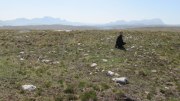
This previously unrecorded prehistoric hut circle was rediscovered in May 2018 by Sarah Maclean of Borgie during a brief excursion here, looking at the ancient clearance village of Modsary (which appears to be Iron Age in origin).  In walking onto the moor, shortly before leaving me to my own devices, she pointed out this low ring of barely discernible stones, wondering, “is this another hut circle?” (there are some on the western-side of the road from Modsary)  It would certainly seem so!

Grass showing centre of hut circle

It is constructed upon what seems to be a natural platform of earth above the slow-running burn.  A low ring of stone walling defines the construction: visible in parts, covered in vegetation for the most.  With an entrance on its southeast, the ring measures roughly 9 yards by 10 yards in diameter; with its outer walls being less than 2 feet high all round; but the width of the walls in some places measures up to 3 feet across.  It is certainly man-made and is certainly olde.  It requires excavation to assess its original construction period, although based on others I’ve seen that have been dated, would seem to be Iron Age in origin.

From this to the small cave that I mentioned, a most peculiar rectangular stone construction is evident 2-3 yards below it; and heading 40 yards south, beneath a craggy hill, a line of ancient walling runs SE-NW, with a much overgrown semi-circular arc of large stones, seemingly artificial in nature.  It would seem there is a lot more hiding beneath the heather hereby than official records suggest…

Acknowledgements:  Massive thanks to Sarah Maclean for locating and showing me this site; and also to Donna Murray for giving me a base-camp. Huge huge thanks indeed.

© Paul BennettThe Northern Antiquarian

Talmine (west), Melness, Tongue, Sutherland

Settlement:  OS Grid Reference – NC 5764 6248 

Getting Here

Large arc of low walling, across upper-centre

Along the A836 road between Durness and Tongue, take the minor road north to Melness and Talmine. 400 yards or so past Talmine Stores shop, walk left up the track onto the moor. Half a mile on, walk straight uphill on yer right for about 150 yards until it levels out.  Look all around you!

Archaeology & History

This is a fascinating new find, explored under the guidance of Sarah MacLean of Borgie.  After looking at the nearby cairnfield and hut circles to the southeast, our noses took us onto the hilltop, where an extravaganza of curved and straight walling, hut circles, denuded cairns, cists, possible chambered cairn remnants and even unrecorded stone rows had us almost bemused at the extent of the remains.  A lot of it has been severely damaged and robbed – but in the low vegetation scattering the hilltop, it became clear that a lot of activity had been going on in the ancient and perhaps not-too-ancient past, with a social and/or tribal continuity stretching way way back (as found at Baile Mhargaite near Bettyhill).

Straight line of low walling

As we walked up the unnamed hill (well, to be honest, we zigged and zagged, or bimbled, until we got to the top), above a line of prehistoric cairns on the slopes below, small lines of walling barely above ground-level stretched out before us.  Structurally akin to the neolithic and Bronze Age features found from northern England to this far northern region, they are low and deeply embedded in the peat, but are quite unmistakable.

In following the first real line of walling near the eastern edge of the hill, a flat panorama eventually opened up as we reached the top and there, in front of us, appeared arcs and lines of more walled structures, thankfully unobstructed by vegetation.  A few expletives came out of my mouth (for a change!) at the remains we could see right in front of us—and then we set walking in different directions and began to explore the remains beneath our respective feet.

The first main element on the southeastern top of the hill was a wide curvaceous arc of walling, undoubtedly prehistoric – in my opinion either Bronze Age or neolithic in origin.  As I was looking at this section, Sarah walked only a short distance to the northwest and, with some excitement in her tone called out, “there’s some here too!” And so we continued, back and forth to each other as we zigzagged across the tops.

Stone row or denuded walling?

Intersecting lines of walling

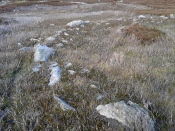
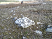
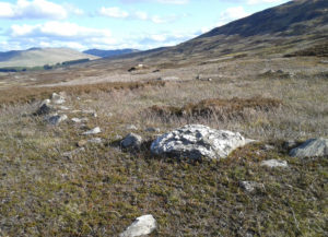
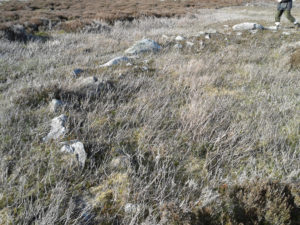
Much of what we found (as the photos show) were low lines of settlement walling—some dead straight, others curving to form denuded hut circles and larger domestic forms. A lot of the walls had been knocked down and scattered on the hilltop, making it troublesome at times ascertaining precisely what we were looking at: but a settlement or large enclosure it certainly is!

The south and western edges of the hill itself seemed to be marked by low sections of walling, again deeply embedded into the peat; and on the same two sides are what appear to be remnants of stone rows leading up onto the top.  As with other stone rows in this region, they are defined by low upright monoliths.  The one that runs north-south runs into a low section of walling that cuts right across the top of the hill and away into the deep peat, roughly NNE, where we lost sight of it (where some old peat-cutting is evident).  The stone row running up the western face of the hill seems to begin near the bottom of the slope and is defined by a leaning standing stone that Sarah found.  Looking uphill from this there’s a gap of roughly fifty yards, where a small stone sits on the near-horizon; and from this small stone is a clear line of small stones, ending (it seems) at a stone less than three feet tall.  Just past this is the denuded remains of what seems to be a cist and a small robbed cairn, clearly defined by a curious rectangle of base-stones, barely 5 feet by 3 feet wide.

Intersecting arc & line of walling

Outline of robbed cairn?

My personal favourite of all the things on top of this hill has to be the small sections of interconnecting walling that we found on the more northern portion of the settlement.  At first glance, it seemed that we were just looking at a small hut circle; but then we realised this initial ‘hut circle’ was linked to a slightly larger ‘hut circle’, which was linked to another, all in a linear east-west direction (roughly).  As I saw looked at it from the western-side (looking east), Sarah was on its east looking west.  This difference in visual perspective gave us a wider view of what we were both looking at.  The easternmost section comprised of an arc of walling that joined into another ‘hut circle’, neither of which had axes any greater than 3 yards.  As we stepped further and further back from this, it seemed that other walled sections ran into it, expanding it into a form which I can only describe as a ‘stripped long cairn’, down to its initial architectural basis, upon which you’d construct the larger monument—but it was only 10 yards long at the most.  Most odd…  Sarah pointed out what may have been a stoned-lined trackway running parallel to this neolithic curiosum.  It still puzzles me as to what it may have been.

This short description doesn’t really do this site justice and, in truth, it needs a more competent survey than I could give it in just one short visit.  It’s very probable that a lot more is still to be found on these hills, from prehistoric all through to post-medieval (pre-Clearance) times.  So if you live in this part of Sutherland, get yer twitching noses and boots on and bimble with intent to find!  There’s still plenty of stuff hiding away…

Acknowledgements:  Huge thanks to Donna Murray of Borgie for putting me up (or should that be, putting up with me?!) and equally massive thanks to Sarah Maclean—also of Borgie—for guiding me up here and being an integral part of rediscovering this site. Without them both, this place would still be unrecognised. And thanks to Miles Newman too. 😉

© Paul BennettThe Northern Antiquarian

Baile Mhargaite Enclosure 1, Bettyhill, Sutherland

Enclosure:  OS Grid Reference – NC 69843 61228

Also Known as:

  1. Bail Margait
  2. Margaret’s Town

Getting Here

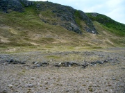
Baile Mhargaite 1 enclosure, looking NW

Baile Mhargaite 1 enclosure, looking NW

Take the A836 road west out of Bettyhill, down the road and cross the river on the tiny bridge.  From here, go over the gate on the right-hand side of the road and follow the edge of the river towards the sea. Crossing the large extensive sands, you’ll reach a large sand and gravel rise ahead of you. Once on top of this natural feature, walk NNE for 550 yards (0.5km) until you reach one of many extensive sandy expanses in the grasses (and pass tons of archaeological remains as you walk!).  You’ll get there!

Archaeology & History

Arc of south, west & north walling

Arc of south, west & north walling

On this naturally raised sand-and-gravel platform at the edge of this beautiful sandy coastline in the far north of Scotland, walking in search of this particular enclosure, you’ll meander past a whole host of prehistoric sites and remains – some of which are plain to see, others hiding almost just above ground level, barely visible.  But if you’re an antiquarian or historian, this plateau is a minefield of forgotten history!

The site is shown on the 1878 Ordnance Survey map of the region as a “hut circle”, which it may well have been—but this is a large hut circle and was more probably a place where a large family would easily have lived.  When I visited the place the other week, there were no internal features visible.  It is a large ring of stones made up of thousands of small rocks whose walls are low and scattered, barely a foot above present ground-level in places, and barely two-feet at the very highest.  It has been greatly ruined or robbed of other architectural elements and an excavation is in order.  My initial evaluation is that this structure is at least Iron Age in origin.  In Angus Mackay’s (1906) venture here in the early 1900s, he suggested that this and the other “circular rings” were “cattle folds.”

Aerial view, looking straight down

Aerial view, looking straight down

Looking down from the broch above

Looking down from the broch above

The enclosure measures, from outer-edge to outer-edge of the walling, 16.5 yards (15.1m) east-west by 18 yards (16.5m) north-south, and has a circumference of roughly 52.5 yards (4mm); although an accurate measure of its circumference is hampered by the scatter of spoilage from the collapsed walls stretching outwards.  Only the western walled section remains in reasonably good condition.

Looking south, thru the enclosure

Looking south, thru the enclosure

Close by are many cairns, some of which are prehistoric.  A chambered cairn  on the same ridge less than 200 yards away, with another enclosure of the same type yards away, clearly shows that people have lived and used this raised section of land for thousands of years.  We know that people were still living here at the end of the 18th century which—for me at least—begs the question: what ancient traditions, customs and lore did these people know about, which may have dated back into truly ancient history?  …And then the english Clearances destroyed them…

References:

  1. Mackay, Angus, “Notes on a Slab with Incised Crescentic Design, Stone Mould for Casting Bronze Spear-Heads, a Cup-Marked Stone, Holy Water Stoup, and other Antiquities in Strathnaver, Sutherlandshire,” in Proceedings of the Society Antiquaries, Scotland, volume 40, 1906.
  2. Royal Commission on Ancient & Historical Monuments, Scotland, Second report and inventory of monuments and constructions in the county of Sutherland. HMSO: Edinburgh 1911.

© Paul BennettThe Northern Antiquarian
Achamore Hut Circles, Bettyhill, Farr, Sutherland

Hut Circles:  OS Grid Reference – NC 74219 58055

Also Known as:

  1. Canmore ID 6262

Getting Here

Achamore's NE 'hut' circle, looking E

Achamore’s NE ‘hut’ circle, looking E

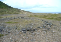
Along the A836 road a mile east of Bettyhill, a track goes south onto the moors just before Loch Salachaidh. Walk along here for several miles, past the windmills and past the Achadh Thaibstil Cairn, until you reach the remote green fields that are the remains of the clearance village of Achamore.  As you walk into the green grasses, a ruined building is to your left.  In front of you, a large raised round structure almost entirely covered in grass.  You’re here!

Archaeology & History

This is a curious structure – and were it not for being labelled as a ‘hut circle’ by the lads at Ordnance Survey, on first impression I’d be more tempted to classify it as either a collapsed broch, or a large cairn circle.  This is entirely due to the size of the thing, as it’s big for a hut circle!

NW arc of the circle

NW arc of the circle

Eastermost embankment

Eastermost embankment

Circular in form, the sides of the structure on its eastern face are nearly three feet high, piled at an angle of nearly 45 degrees, and several feet across before you reach the internal section of the said ‘hut circle.’  As you walk around it, the height of the piled stones diminishes to between 1-2 feet, but the diameter of the walling all round is consistently wide – increasing the thought of it being a collapsed or robbed-out broch.  The diameter of the structure is some 20 yards across, with an approximate circumference of 64 yards.

'Hut circle' atop of nearby hill

‘Hut circle’ atop of nearby hill

Another “hut circle” is immediately visible some 80 yards to the south, on top of the nearby grassy hilltop.  The majority of this is also covered in meadow grasses, with edges and upper surfaces all but hidden.  On its southeastern edge is what looks like a structural stone ‘entrance’ some two yards across and three yards long.

Other smaller hut circles in the area indicate that this region – like others nearby – was a place of consistent human habitation from prehistoric (probably Neolithic) times, unbroken all the way through until the 18th century.

© Paul BennettThe Northern Antiquarian 
Power Station Road, Sheerness, Isle of Sheppey, Kent

Settlement (destroyed):  OS Grid Reference – TQ 932 733

Archaeology & History

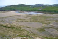
An extensive site that was uncovered when a housing estate was being built on the south-side of Power Station Road at the end of the 20th century.  During the Spring and Summer of 1998, the Canterbury Archaeological Trust began cutting trenches across the land and did some minor excavation work on the west side of the area, finding some traces of early human activity.

A second series of investigations was then undertaken by the Hertfordshire Archaeological Trust  over the Autumn and Winter months of 1998-99, with the Kent Archaeological Rescue Unit then taking over for the rest of the year.  Their team split the land into eight large sections and began a more detailed analysis and uncovered a huge number of finds.  Amidst this, wrote Brian Philp (2002), there

“included an important collection of Bronze Age material, including large clay-weights, perforated baked-clay slabs and a good range of pottery types.  Of special interest was the spinal bone of a large whale, perhaps washed up on the nearby shore.

“The picture now emerging is that of a substantial Bronze Age settlement site, spread across several acres and probably farming the adjacent land… It seems likely that three large ponds and…eight stone-lined pits were primarily for water-storage, both for watering cattle and for other agricultural or semi-industrial purposes… All this seemed to be happening about 900-400 BC on what still appears to be the largest Bronze Age settlement so far discovered on this important island.”

The archaeocentric place-name of Barrows Hill rises a mile to the southwest.

References:

  1. Philp, Brian, Archaeology in the Front Line, KARU: Dover 2002.
  2. Schuster, Jorn, “The Neolithic to Post-Medieval Archaeology of Kingsborough, Eastchurch, Isle of Sheppey: From Monuments to Fields,” in Archaeologia Cantiana, volume 130, 2010.

Links:

  1. Kent Archaeological Review

© Paul BennettThe Northern Antiquarian 2016

Baston Manor, Hayes, Kent

Settlement:  OS Grid Reference – TQ 407 649

Archaeology & History

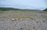
This settlement site was found thanks to the good work of the Bromley & West Kent Archaeology Group in the 1960s, when they decided to do follow-up work to what Brian Philp (2002) described as “doubtful sites reported mainly in the 19th century.”  Time and again these “doubtful sites” at least turn into something of value — and such was the case here!  The group commenced digging selective trenches in July 1964 in a small wooded area near to Baston Manor and they soon came across “a stratified deposit of late-Neolithic (2500 BC) pottery and flint.”

In successive returns to the site over two years, 5630 items—primarily fire-cracked stones, flints and more than 200 pieces of pottery, some of which was highly decorative—were unearthed and the site was recognised as an important settlement arena many thousands of years ago.  In Kent, this was a rarity!  Philps’ resumé of the site and its many remains told,

“Sometime about 2500 BC, a group of late-Stone Age farmers had selected this quiet hillside (now just in Hayes) to settle and live.  Here they must have farmed  small cultivated areas close to their huts and herded sheep and cattle to fresh areas and nearby streams.  These were the first occupants of the West Wickham valley over 4000 years ago…”

References:

  1. Philp, Brian, “The Discovery of a Secondary Neolithic Site at Hayes,” in Kent Archaeological Review, no.5, 1966.
  2. Philp, Brian, Archaeology in the Front Line, KARU: Dover 2002.
  3. Smith, Isobel, “Prehistoric Pottery from Baston Manor, Hayes,” in Kent Archaeological Review, no.18, 1969.

Links:

  1. Kent Archaeological Review

© Paul BennettThe Northern Antiquarian

Hickford Hill, Belchamp St Paul, Essex

Enclosure:  OS Grid Reference – TL 7872 4537

Archaeology & History

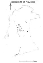
Ground-plan of enclosure & surrounding barrows

Plan of enclosure & surrounding barrows

Several hundred yards northeast from Hickford Hill, a cluster of prehistoric sites could once be seen close to each other just south of the River Stour below line of the Essex-Suffolk county boundary.  Several of these were tombs and are accounted for in Priddy’s (1981) essay on the prehistoric Barrows of Essex; but adjacent to them were also found faint traces of a large circular enclosure of some sort, which Harding & Lee (1987) included in their definitive survey of British henge monuments. Their account of it was brief and simple, saying:

“Enclosure defined by the cropmark of a sub-circular rather narrow ditch broken by two entrances.  No trace of a bank.  Internal traces of a concentric innner ditch in part of the circuit… Internal diameter range 56-57m…; width of outer ditch c.1.5-2.5m; width of entrances, c.7m (E) and 16m (NW); width of inner ditch c.2.5-5m.”

Although this large ringed enclosure was thought by the Haverhill & District Archaeology Group to “be a henge-type monument,” Harding & Lee (1987) thought it unlikely that these remains “belong to the henge class” of monuments.  A brief archaeological dig into one of the trenches here in 1997 showed the site to be Bronze Age; but finds by the local archaeology team have also come across finds in the fields hereby dating from the Mesolithic and Neolithic periods.

References:

  1. Harding, A.F. & Lee, G.E., Henge Monuments and Related Sites of Great Britain, BAR 175: Oxford 1987.
  2. Priddy, D., “The Barrows of Essex,” in A.J. Lawson’s The Barrows of East Anglia, Norfolk Museums Service 1981.

© Paul Bennett, The Northern Antiquarian