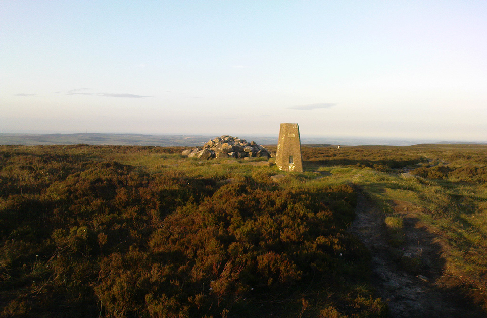
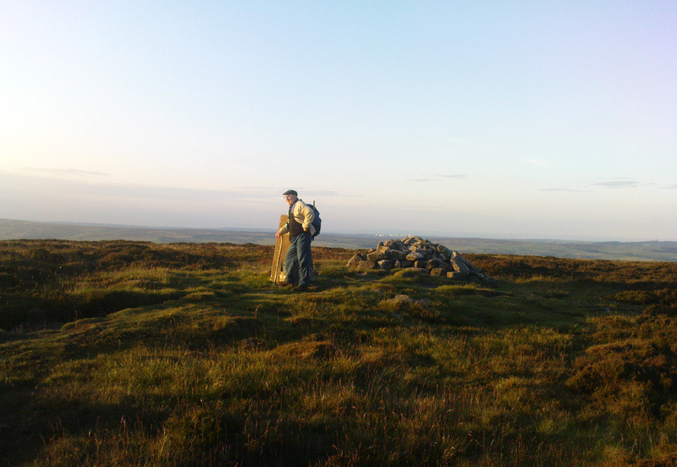
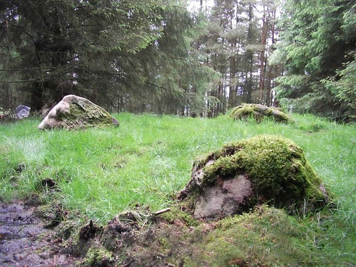
Follow the same directions to reach the Tree of Life Stone, then walk up the well-worn footpath up the slope for about 100 yards and, as you get to near the top of the hill, just watch out for a large-ish stone on the right. That’s it!
Archaeology & History
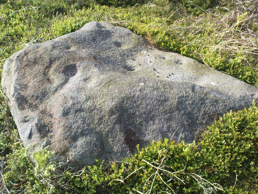
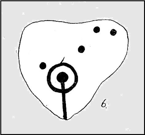
First described by Eric Cowling 1937, here we have what here looks like a faded cup-and-ring plus at least eight other cup-markings near Snowden Crags (though Boughey & Vickerman [2003] counted only 6 cups here). In more recent years it has become known as the “Fence Stone” due to its proximity the straight line of fencing which ran across the moor hereby. Cowling’s description of the site told:
Faded cup-and-ringCowling’s 1937 drawing
“The spur of hill separating Snowden Carr from Snowden Craggs is surmounted by a D-shaped enclosure which has a small level area in the highest corner. Here, on a triangular table stone amongst the heather, is a well-cut cup, ring and radial groove running to the margin of the surface. Four other cups appear to have no definite arrangement.”
He went onto say that “many of the boulders which surround this table are marked with cups.” They are indeed!
References:
Boughey, Keith & Vickerman, E.A., Prehistoric Rock Art of the West Riding, WYAS 2003.
Cowling, Eric T., “Cup and Ring Markings to the North of Otley,” in Yorkshire Archaeological Journal, part 131, 33:3, 1937.
Cowling, Eric T., Rombald’s Way: A Prehistory of Mid-Wharfedale, William Walker: Otley 1946.
Acknowledgements: A huge thanks to James Elkington for use of his photo for this site profile.
Although apparently long gone, we could find this giant prehistoric tomb on the eastern side of the great Ingleborough and was one of many with this name once scattering the mid-Pennines. It was found less than a mile south of the hamlet of Selside, a few miles above Horton-in-Ribblesdale, on the west side of the B6479 and its existence is thankfully preserved in the place-name, ‘Borrens’, where the giant tomb was once found, 200 yards south of Gill Garth Farm. If you look on the OS-map, you’ll notice an ancient settlement site close by.
Archaeology & History
In 1892, the great Yorkshire historian Harry Speight told us:
“We have no proper account of it, but it was doubtless ransacked and removed in the expectation of finding treasure. It is mentioned…in the Gentleman’s Magazine for 1761, as follows:
‘In the valley above Horton, near the base of this mountain (Ingleborough), I observed a large heap or pile of greet-stones all thrown promiscuously together, without any appearance of building or workmanship, which yet cannot be reasonably thought to be the work of Nature. Few stones are found near it, though ’tis computed to contain 400 of that country cart-loads of stones, or upwards. There is likewise another at the base north-east, in resemblance much the same, but scarce so large.'”
Speight speculated that it may have been raised to commemorate “some dire conflict between the Romans and the native hill tribes, as it lay on the old Roman thoroughfare across Ribblehead to the camp under Smearside.” We may never know this for sure, but there are plenty of Iron- and Bronze Age remains scattering this region – and just a few hundred yards south of this lost cairn are the old remnants of an ancient settlement…whose pages and images (it is hoped) will appear on TNA in the near future…
References:
Smith, A.H., English Place-Name Elements, volume 1, Cambridge University Press 1956.
Smith, A.H., Place-Names of the West Riding, volume 6, Cambridge University Press 1961.
Speight, Harry, The Craven and Northwest Yorkshire Highlands, Elliott Stock: London 1892.
Pretty simple really. Go up the B6265 Skipton-Rylstone road for about 3 miles, past the Nettlehole Ridge woodland on your right. The next turn along to your right, up the track, is Scale House. Go past this until you get to Scale House Farm. The remains of the burial mound is in the field to your left, just before the farm. Knock on the door and ask!
Archaeology & History
This ‘tumulus’ (as it’s marked on the OS-map) was one of the many explored by the legendary reverend William Greenwell (1864) in the middle to latter-half of the 19th century. His description of the finds at Scale House were considerable; thankfully our old Yorkshire antiquarian Edmund Bogg (1904) shortened it and told us the following:
“The tumulus was 31 feet in diameter and about 7 feet high; it opened from the southeast; the soil immediately under the sod consisting of yellow clay to a considerable depth; then layers of blue clay… Exactly in the centre…at a depth of 7 feet, and on a level with the plane of the field, was found an oak coffin, formed out of a tree, split and hollowed-out, and placed due north and south, the head being placed to the south, as that as the larger part of the tree. After being exposed to the air for about 2 minutes, the bared coffin parted at the sides, and could not be moved except by detached pieces. The body had been wrapped in a cloth or shroud of texture resembling wool and coarsely-woven, of which there was a considerable quantity remaining; but the body itself was dissolved… The interment was considered to be that of an ancient Briton… The learned antiquary said it was the only instance (except the one at Gristhorpe, near Scarborough) where an interment in an oak tree hollowed out had a tumulus placed over it. It was more than 6 feet in length inside and about 7 feet 6 inches outside. The remains were carefully replaced and the mound restored to its former shape; a small leaden tablet being placed within, stating that it had been opened in AD 1864.”
Folklore
Jessica Lofthouse (1976) listed this as one of the places reputed to be an old fairy haunt, wherein “the folk of Scale House discovered a fairy kist or chest.”
References:
Bogg, Edmund, Higher Wharfeland, James Miles: Leeds 1904.
Greenwell, William, British Barrows, Clarendon Press: Oxford 1877.
Lofthouse, Jessica, North Country Folklore, Hale: London 1976.
Stone Circle (destroyed): OS Grid Reference – SD 664 655
Archaeology & History
I have found no archaeological references whatsoever to this site (though to be honest, the Lancashire archaeological fraternity are pretty poor when it comes to finding and recording sites). The place has its existence preserved in the aptly-named Ringstones Lane and the farmhouse, Ringstones.
Michala Potts found several records of the place in the 17th century, and the site is shown on the 1844 OS-map with the same name, but we have been unable to ascertain when/if any standing stones were here. The place may well have been a burial-site of some sort, as found at other Ringstone place-names in Lancashire. But we can clearly see on aerial imagery that there is a large, distinct, circular outline in the heavily ploughed fields about 100 yards north of the farm. There is what may be the remains of a second circle above this, but the outline is faint; but it appears that an enclosure of some sort, ovoid in shape and a couple of hundred feet across, was also evident in the same field where the more distinct circular outline is seen.
My favourite outline however, is a large linear mark on the ground stretching for several hundred yards running roughly north-south, starting in the field between Aikengill and Ringstones and going dead straight, bypassing the circle and crossing Ringstones Lane, where it seems to disappear and is no longer visible. The curious ‘ground line’ is roughly 100 feet across. Cursus anyone!?
Standing Stone (destroyed): OS Grid Reference – SE 15940 34211
Also known as:
Ash Stone
Pin Stone
Archaeology & History
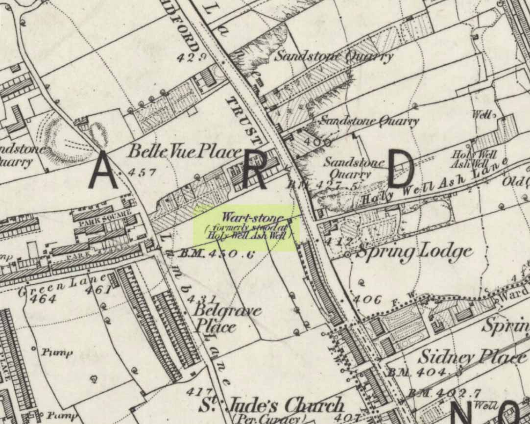
Wart Stone on 1852 OS-map
At Bradford City’s football ground there used to be the holy well known as the Holy Ash Well, adjacent to which was this old stone (as shown on the 1852 OS map). For some reason it was uprooted and moved further up the hill around the end of the 19th century and was resurrected beside the old Belle Vue Hotel on Manningham Lane. From thereon however, I’ve not been able to trace what happened to it, and presume it’s been destroyed. It was known by local people to have had a ritual relationship with the adjacent healing well, to which people were said to visit from far and wide.
It seems to have been described first by Abraham Holroyd (1873), who told us that:
“In Manningham Lane there is a fine well, in old deeds called Hellywell, i.e., holy well, in a field now called Halliwell Ash, now a stone quarry… Near this is the ancient Pin Stone.”
The Bradford historian William Preston also made mention of the stone in one of his early surveys, where he told how local people also knew the stone as the Ash Stone, due to its proximity and ritual relationship to a great old tree.
Folklore
Also known as the Wart Stone, thanks to its ability to cure them and other skin afflictions. Intriguingly, the building which now stands on the site is said to be haunted.
As my old school-mate, Dave Pendleton (1997), said of the place and its associated well:
“Prior to 1886 the only feature of any real note in the Valley Parade environs was a holy well that emerged near the corner of the football grounds Midland Road and Bradford End stands; hence the road Holywell Ash Lane. Today the site of the well is covered by the football pitch.
Only the road name survives as a reminder of what was apparently one of the district’s foremost attractions. On Sundays and holidays people would gather to take the waters and leave pins, coins, rags and food as offerings to the spirit that resided in the waters.
Accounts suggest that the well was covered and had a great ash tree standing over it (hence ‘holy ash’). There was also a standing stone called the wart stone of unknown antiquity. The stone had a carved depression that collected water. It was believed that the water was a miraculous cure for warts. Indeed, as early as 1638 the Holy Well had been credited with healing powers.
The well suffered a decline in popularity during the late nineteenth century and its keepers resorted to importing sulphur water from Harrogate, which they sold for a half penny per cup. The well disappeared under the Valley Parade pitch during the summer of 1886 and the wart stone was moved to the top of Holywell Ash Lane – which then ran straight up to Manningham Lane. The stone was still there as late as 1911 but thereafter it seems to have disappeared into the mists of time.”
Unfortunately we have no old photos or drawings of this lost standing stone – though I imagine that some local, somewhere must be able to help us out with this one. Surely there’s summat hiding away…
References:
Bennett, Paul, The Old Stones of Elmet, Capall Bann: Milverton 2001.
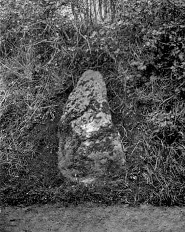
In September, 1928, the old ley-hunter Alfred Watkins was out on one of his many rambles when he “saw a tall stone almost buried in the bank at this crossroads,” appropriately known as Picts Cross, about a mile south of Sellack — so he called it the ‘Picts Cross Stone.’ He also said, “It was Pricker’s and Prick’s Cross in 18th century maps, and Pig’s Cross in the 1832 Ord. Map. Now ‘pig’ is the present Welsh word for “a peak, a point, a pike.””
And a lovely pointy old stone it looks in his old photo! The monolith is in the hedgerow along the old boundary line.
References:
Watkins, Alfred, The Old Standing Crosses of Herefordshire, Simpkin Marshall: London 1930.
This is the highest point of the moors, 1320 feet up. There’s various ways of getting there: I’d favour the wander up to Twelve Apostles then taking the 15 minute walk west to the triangulation point which marks the spot. If you reach the large rocky outcrop of the Thimble Stones, you’ve gone too far; although you can walk past the Thimbles, if you’ve started your walk from the two radio masts atop of the moor where the old Roman road hits the dirt-track. Either way, unless you’re damn stupid, this is an easy spot to find!
Archaeology & History
Although today there’s little to be seen, when Collyer & Turner (1885) described the place it was 175 yards in circumference! Bloody huge! When Harry Speight got here in 1900, it had shrunk slightly to 150 yards. Now however, almost all the stones have been robbed. I first came here when I was just 11 years old and remember it was a decent size even then – at least as large as the Little Skirtful and Great Skirtful of Stones more than a mile to the east. Today however, unless you knew it was once a giant cairn, you wouldn’t give it a second look.
It’s quite appalling what’s happened to this site thanks to the sheer ignorance and neglect of the local archaeologist in tandem with his paymasters at Bradford Council: 90% of the site has been utterly vandalised and destroyed as a result of these incompetent idiots in the last 20 years. Nowadays, all you can make out here is the raised earth for about 10 yards surrounding the trig-point. It seems that most of the stones that comprised this giant cairn have been taken for use in walling, and to prop up the stupid paved footpaths which the local Council and its affiliated halfwits are slowly building o’er these hills.* Morons!
Aar Dave on top o’ t’ moors
I’m not quite sure why it was called Nixon’s Station. It was J. Atkinson Busfield (1875) who mentioned this name, quite casually in his fine local history work, as if local folk had known it as such for sometime. There was also an inference of it being the resting place of some old general, but I’ve found nor heard anything more along such lines — though worra superb place for your spirit to roam free…..
If anyone has any old photos of this once giant prehistoric site, it would be good to see it in its old glory once again. When I wandered up here as a kid, I never carried things like a camera about (being a Luddite by nature!).
References:
Busfield, J.A., Fragments Relating to the History of Bingley Parish, Bradford 1875.
Collyer, R. & Turner, J.H., Ilkley, Ancient & Modern, Otley 1885.
* Anyone know exactly which idiots are responsible for the stone footpaths being laid over the moors here? They’re damn stupid and cause even more erosion and damage to the environment and prehistoric heritage up here, as anyone with an ounce of common sense can see. Can someone please get them stopped!?
There are several ways to get here, but I took the one from the road (B6265) walking up the track into Crookrise Woods. Unless you’ve got a decent OS-map with it marked on, this might take some finding to some folk as it’s tucked away on the northern edge of Crookrise Woods (which one Southerner bloke told us was private – though he was ‘allowed’ there!). It’s right on the rounded knoll at the top of the woods, beneath the prominent slopes which lead to the moor.
Archaeology & History
Our old mate and Yorkshire historian Arthur Raistrick seems to have been the first to describe this place in the Yorkshire Archaeological Register of 1964 – though the holy wells writer Edna Whelan told me she knew about the place many years back. Today hidden in woodland and mostly overgrown, Raistrick’s brief description of the place said:
“A small stone circle of six stones set symmetrically within a diameter of 26 feet. The stones vary in size from 21 to 58 inches. Surveyed 1963.”
The site has been badly affected by the erosion of time, forestry and god-knows what else. Scattered around are numerous small stones giving the impression that it may once have been a cairn-circle, more than a stone circle. Four of the six stones mentioned by Raistrick (1965) are visible, but none are impressive – and unless you’d read about the place first or found it in Mr Burl’s Stones Circles of Britain… (2000), you wouldn’t really give it the time of day.
Although sadly disappointing in its present status – completely surrounded by trees, with no view at all – it seems probable that it would have had some geomantic relationship with the hillfort-looking site of Rough Haw immediately west, and very probably the adjacent ritual site of Sharp Haw. It seems that the equinox sun would set between Rough Haw and the other small rounded hill above.
References:
Burl, Aubrey, The Stone Circles of Britain, Ireland and Brittany, Yale University Press 2000.
Various ways to get here. I s’ppose the easiest is from Dacre village. If you go just past Sunny House, take the footpath on your right & walk along it, roughly straight across a number of fields, until you hit the footpath known as the Nidderdale Way. The field you’re now in should be scattered with numerous rocks all over the place (if it aint, you’re in the wrong place), reaching down towards the trees. Walk straight towards the trees for another 100 yards and the carving is somewhere hereabouts under your nose! You’re very close! If, however, you decide to walk up the Nidderdale Way from Dacre Banks, the field you need is the one immediately to your right just before you reach the Monk Ing Road trackway. The Tadpole Stone (or Eastwoods Rough II carving) is in the same field, close to the Nidderdale Way path — check that out aswell!
Archaeology & History
This is a large carving I found in April, 2006, in the company of rock-art student Richard Stroud (who sent us the pictures). Twas in the midst of a fine day wandering about checking some of the ‘known’ sites in the area, when we happened across two or three previously unknown sites — and as the day wore on, just before we were gonna head for home, this little beauty poked the edge of its head out of the turf! It had the pair of us in near rapture, with numerous “Wow’s” and excitable expletives coming from our mouths! We’re easily pleased us rock-art doods — but then it is a beauty when you first see it.
We came here several times in the weeks following its initial discovery, and it seemed that on each visit, we found an additional aspect to the carving. It seemed to keep changing each time we came here — hence the name ‘Morphing Stone’!
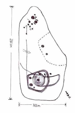
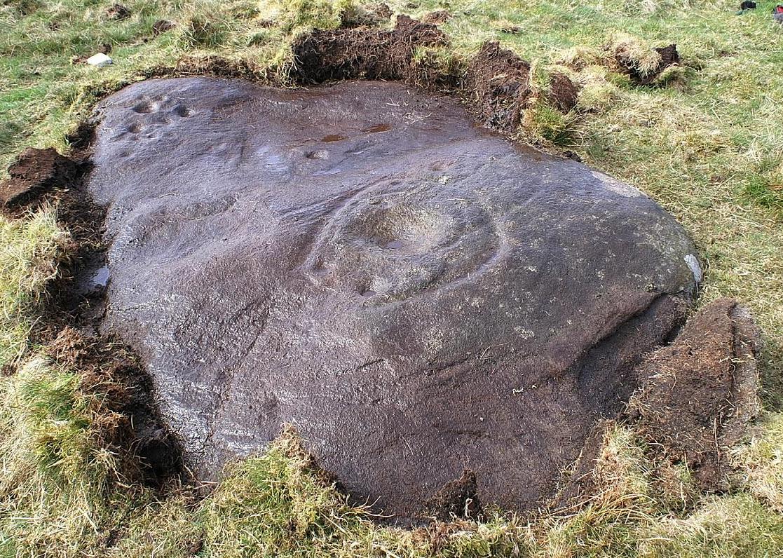
The prime feature in the carving is the very large oval-shaped ‘ring’ with huge carved bowl in the middle and several outlying cups-markings around it. Although it’s not plain to see in the photos, there’s a large tongue-shaped protuberance jutting out from one side of the main ringed feature. You can also see a small cluster of cup-marks on the top-right of the rock: from here — though it isn’t easy to see in the photo — a long straight line links up with the edge of the major central ring. Other lines run off on the top of the main feature and there are several other cup-markings on different parts of the stone. It’s obviously best to see the carving “in the flesh”, so to speak, to get a good impression of what it actually looks like. And, to those of you who might wanna venture up here, there are several others nearby.
A year or two after rediscovering the carving, rock art student Keith Boughey (2007) described the stone, saying:
“Measuring 2.61m from N-S and 1.88m from W-E at its greatest extent, the carved surface carries quite a complex design… At its N end is a large cup/basin with an approximate diameter of 25-30cm, surrounded by a ring that may or may not be complete: 2 cups have been incorporated into the ring on its N and W side. W of this ring a groove leads off S to a further possible cup. On the E side of the large central cup are 3 further cups of varying size. These motifs are all enclosed within a wide groove, which forms almost a dome pattern. Out of the ring, a further groove runs NW out of the design, bisecting the enclosing groove, curving round to form a handle shape before running back in towards the large central cup. The groove shows signs of continuing E towards the edge of the stone. Just outside the W edge of the enclosing dome is one well-defined cup. S of this, in a slight depression, are 2 further cups of differing size. A straight groove appears to run SW out of the enclosing dome shape on its E side towards further motifs on the stone’s S side. The groove may run into an area of cup marks, but there appears to be a break before it continues. When exposed, the carvings looked quite fresh and sharp, suggesting that they had remained covered for some considerable time – possible since antiquity or at least from a time in the prehistoric past when cup-and-ring-markings had begun to lose their significance and were no longer required to be visible in the landscape.”
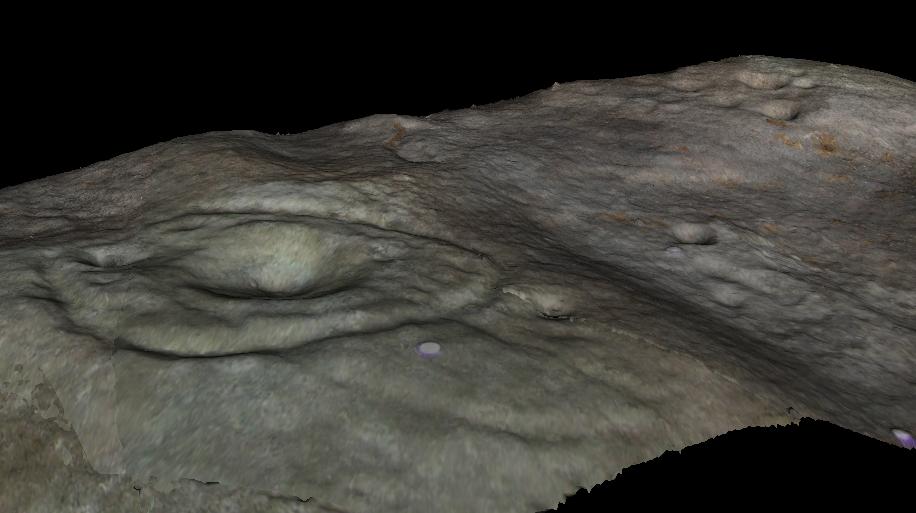
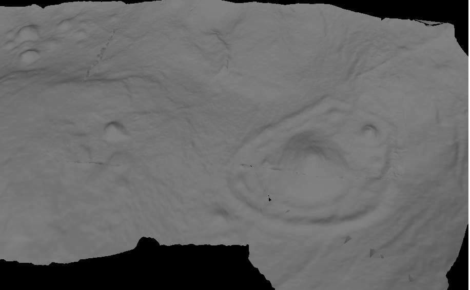
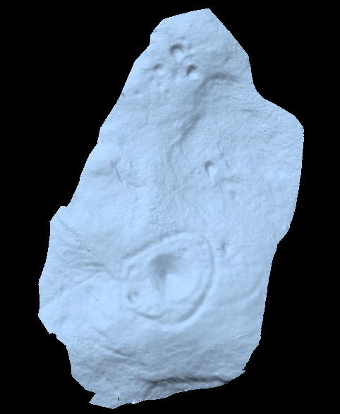
To those of you who like the new computer images of cup-and-rings, the three below are samples from a number of such images done after the stone had been discovered. Intriguingly, the long line running between the cluster of cups to the large cup-and-ring doesn’t show up too well; but the barely perceptible line running out, zigzag-fashion, from the large central cup-and-ring, shows up much clearer than when looking with the naked eye.
Although destroyed, to those who wanna check the locale, from Bingley take the Eldwick road and keep going all the way up to Dick Hudson’s public house, right on the edge of the moor. From here, go left (east) on the road for less than a mile until you reach the reservoir/lake on your right. Take the dirt-track down here for 100 yards and stop! It was somewhere here!
Archaeology & History
I first went looking for this site when I was a kid (about 13 years old), but soon discovered that it had been destroyed. The first person to write about it was lucky enough to see it when it was still there. Harry Speight came here around 1890 and described,
“descending (from Pennythorn Hill) towards Faweather we enter (by permission) a field at Birch Close Farm, and here we find evidence of an extensive stone circle, some of the large unhewn stones having been built into an adjoining wall. In the next field is a rock sculpture with…cup and ring marks.”
This cup-marked stone still exists at Faweather, though has now been enclosed by a garden. The occupiers are quite friendly and are willing to let you look at the stone if you ask kindly. Anyway…..by the time Butler Wood wrote about the place in 1905, he was telling that “the finest stone circle in the Rombald’s Moor area was demolished some years ago.”
The local historian W.E. Preston, marking an old map of the region with an “X,” wrote:
“NOTE! The circle was destroyed here during construction of the Baildon Waterworks, 1892. Diameter 25 yards. It consisted of a wall of rubble with upright stones at frequent intervals.”
Subsequent descriptions of the site in 1905, 1929 and 1946, cited Weecher to be 27 yards across. My last search for any remains of this circle was in 1990 when I explored every wall in the region, hoping to find one or two of the old uprights, but they had all gone. Sadly, there appear to be no drawings or illustrations of the site either…
Folklore
This stone circle was one of at least four circles that played a part in one of the most impressive leys I have seen! Starting at the circle in Hirst Woods, Saltaire, the alignment goes north, crossing the Brackenhall circle, a few other Bronze Age sites, across the site of Weecher, and finally terminates at the Great Skirtful giant tomb a short distance north of here.
References:
Bennett, Paul, The Old Stones of Elmet, Capall Bann: Milverton 2001.
Cowling, E.T., Rombald’s Way, William Walker: Otley 1946.
Gray, Johnnie, Through Airedale from Goole to Malham, Walker & Laycock: Leeds 1891.
Raistrick, Arthur, ‘The Bronze Age in West Yorkshire,’ in YAJ 1929.
Wood, Butler, ‘Prehistoric Antiquities of the Bradford District,’ in Bradford Antiquary, 2, 1905.