Various ways here, but for the sake of newcomers I’d say it was best following directions from Burnsall. From here, take the Appletreewick road thru the village, past the left turn a few hundred yards along, and another 500 yards or so there’s a split in the road: take the one on your right! Follow this up, keeping right (don’t turn into Perceval Hall, tempting though it may be!) and park-up where the road turns into a track. Walk up the track, past the haunted junction, bearing left uphill up Black Hill Road until you reach the very peak of the track where, in the walling on your left, you’ll see this big boulder. If you can’t see it, you’re bloody close!
Archaeology & History
This is at the very peak of Black Hill Road, with excellent views of Simon’s Seat climbing to the immediate south, the prominent and rounded Nursery Knot Hill immediately north, and grand views to peaks east and west. It is very likely this position had something to do with it being deemed worthy of relevance. The rock itself defines a point along the old boundary line.
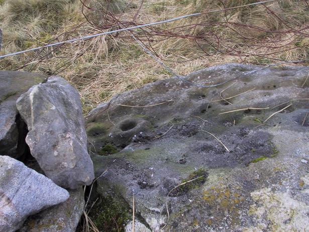
Skyreholme Wall Boundary carving
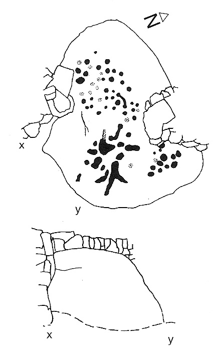
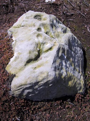
One peculiarity on this boulder is the deep cup-mark with a strange ‘lip’ to it, which has been mentioned by others in the past. This is surrounded by at least five others cups — not dissimilar to some of the ‘rosary-designs’ of cup-and-rings further north.
The rock art student’s Boughey & Vickerman’s (2003) drawing of this design is pretty accurate — where they call it stone 413 — though it doesn’t actually give this carving the justice it deserves. They also erroneously tell that some of the cups here are doubtful.
Check it out for y’self. This is an excellent stone for cup-and-ring lovers! (with plenty of other sites scattered about all round here)
References:
Boughey, Keith & Vickerman, E.A., Prehistoric Rock Art of the West Riding, WYAS 2003.
This takes a bitta getting to and won’t really be worthwhile unless you’re a rock-art nut! I s’ppose if you’re looking at the other decent cup-and-ring stones on the summit of Addlebrough, it might be worth looking at. In which case, walk a coupla hundred yards southeast towards where the walling meets and climb over. The walk a little further in the same direction and once you’ve gone less than 100 yards, look around. You can’t really miss it if you potter about.
Archaeology & History
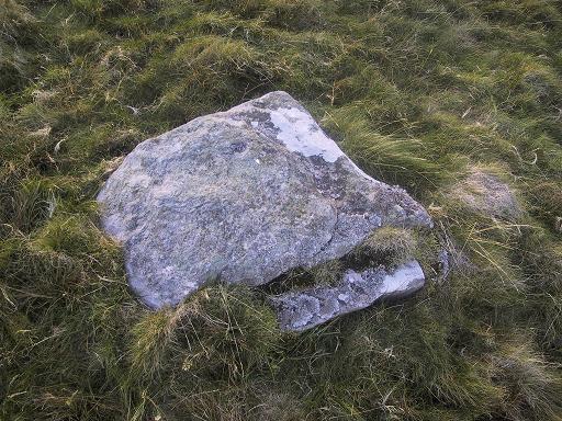
Single cup-marked stone (photo by Richard Stroud)
This possible single cup-marked stone appears to have been discovered before me ‘n Richard Stroud got to the spot, by none other than Stan Beckensall himself — or at least it’s in Stan’s Prehistoric Rock Art of County Durham, Swaledale and Wensleydale book, where he describes it as it only can be done: “a single possible cup-marked stone…SSE of the summit cairn”, which is where you find this. (Another single cup-marked stone found nearby by Barbara Brown aint the same one as this.)
References:
Beckensall, S. & Laurie, T., Prehistoric Rock Art of County Durham, Swaledale and Wensleydale, County Durham Books 1998.
Cross (destroyed): OS Grid Reference – SD 6573 9212
Archaeology & History
More than 150 years ago outside St. Andrew’s Church in Sedbergh, A.E. Platt wrote (1876) that,
“there was a cross standing in the Market Place adjoining the churchyard on the north, but the last remains of it, and the stone steps it stood on, were taken away some years since by private persons, and may now be seen used as gateposts to a farmyard, some ten miles from their original position.”
Intriguing stuff! Does anyone know which farmyard might still possess these old relics? When the legendary Harry Speight (1892: 443) ventured by here fifteen years later he knew little about their new location, but simply echoed what Platt had previously written. It would be good to know what has become of them…
References:
Platt, A.E., The History of the Parish and Grammar School of Sedbergh, Yorkshire, Atkinson & Pollitt: Kendal 1876.
Speight, Harry, The Craven and Northwest District Highlands, Elliot Stock: London 1892.
Follow the directions to reach the Man Stone carving. Walk up the sloping hillside from there until you reach the top. From there, walk down the slope heading slightly to your left. You’ll find it!
Archaeology & History
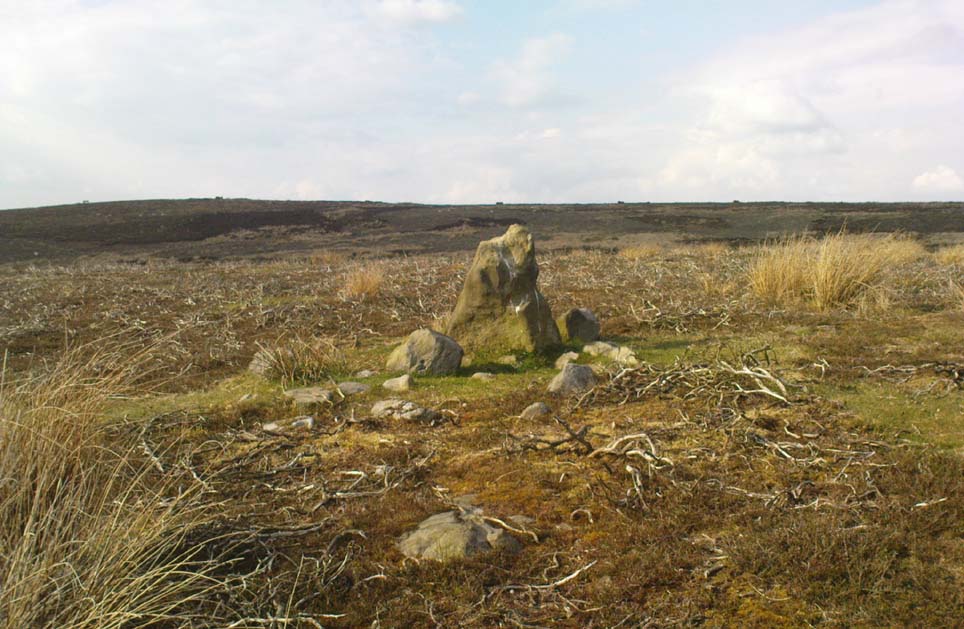
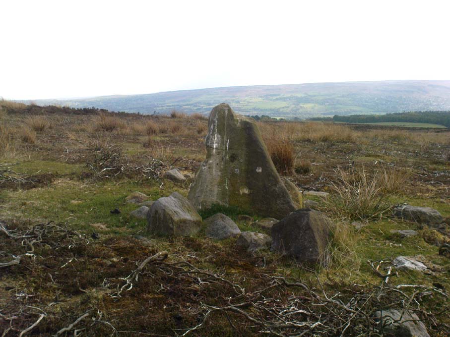
A small upright stone, less than three feet tall, but once a little taller as you’ll see that it’s head has been knocked off in the not-too-distant future and lies on the ground by its side. A small scatter of what seems like possible cairn-material lies around its base, but not enough to imply that a tomb of any sort was ever here (aswell as that, the position on the slope seems wrong).
A curious little thing, without archaeological companions. When we came here the other day, we explored the ground all round the stone as all the heather had been burnt back; but there was nothing anywhere near it to give a hint as to why it stands here, alone, at what seems like a strange spot two-thirds the way up a moorland slope. It’s been speculated that in the middle of its more north-facing side there is a cup-mark on it, but this is very dubious and, in my opinion, should be discounted as such. The marking is a gun-shot wound – and more recent ones have just been added, as seen in the photo.
Standing Stone (destroyed): OS Grid Reference – SE 299 612
Also Known as:
Temple Yarmer
Archaeology & History
It was the legendary Harry Speight who described this in his monumental historico-topographical exploration of the Nidd valley in the 1890s. Nothing else, it seems, has been said of the place, though something of considerable archaeological importance was once here. Not only does he tell of the previous existence of “a large circular enclosure…the outer ditch having a circumference of nearly 1000 yards” at Yarmer Head, but,
“In the hollow on the east side of this hill was formerly a large natural marsh or lakelet, near which remains the base of an immense menhir or standing monolith, erected doubtless in heathen days to commemorate a great victory, or perhaps a treaty.”
The stone is not shown on the early OS-maps (although they did miss quite a lot of sites), and whatever its reason for being here might never be known as all traces of this giant monolith appears (yet again) to have vanished. There is an ancient boundary line immediately below the hill, on its eastern side, so perhaps the stone was an ancient marker along this. Do any local folk round Nidd know owt more about this once important megalithic site?
References:
Speight, Harry, Nidderdale and the Garden of the Nidd, Elliot Stock: London 1894.
Take the same directions as to reach the Snowden Crags Necropolis, and where the small rounded hill rises up on the eastern end of the plain, look around and you’ll find the stone in question.
Archaeology & History
Up near the edge of the Snowden Moor settlement, just a few yards away from Carving-570, is this medium-sized earthfast boulder with what seems to be three or four cup-markings on its western-face. Boughey & Vickerman (2003) describe the stone as with a “deep gully, cups and enlarged cup, perhaps weathered carving but could be natural” — which seems a reasonable assessment. Certainly the cups seem weathered, although a couple of them may have been man-made. At the side of the rock are the remains of a small cairn, and it is positioned next to the beginning of the Snowden Moor Cemetery.
References:
Boughey, Keith & Vickerman, E.A., Prehistoric Rock Art of the West Riding, WYAS 2003.
Cowling, Eric T., Rombald’s Way: A Prehistory of Mid-Wharfedale, William Walker: Otley 1946.
Travelling up (north) the A19, just as you get to Riccal village, there’s a small road to your right: take this! A mile along there’s a parking place just where the track veers into the woods. That’s where you’re heading. The remains of the tombs hereabouts can be hard to discern – but if your lucky you’ll either meet a local, or the virtue of patience will bring these overgrown tombs into focus! There are other tumuli a few hundred yards east and north of here aswell. If you wanna get a clear picture of them all, a full day would be a good bet!
Archaeology & History
Not to be confused with the other Danes Hills tombs a couple of miles northeast of here (as done on some other sites), the early Victorian geologist and explorer John Phillips (1853) was one of several early writers who described what, today, are known to be Iron Age tombs, scattered about a short distance east of Riccall village, saying:
“On Skipwith Common are many tumuli, old banks, and the slightly-marked foundations of ancient (turf or log?) houses or wigwams. These, by some error of tradition, are called ‘Danes’ Hills/ but, on opening the tumuli, no confirmation of so modern a date appeared. The tumuli are set in square fosses; the sides of the fossae range north and south and east and west (true). Similar facts appear in connexion with the tumuli on Thorganby Common adjacent. Burnt ashes and bones occur in the mounds; facts which suffice to overthrow the supposition of these hills being funeral heaps of the Danes of the llth century, for they then buried their dead. No instruments of metal, bone, or stone, or pottery were found.”
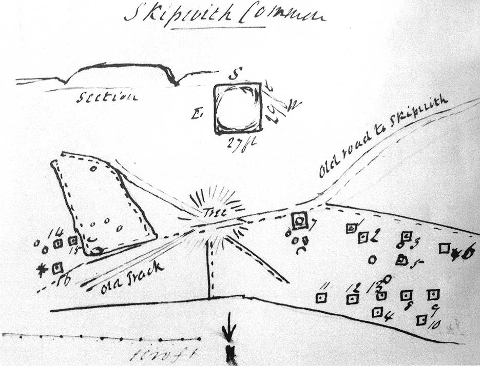
There were dozens of tombs that could be seen here in the past, but today many have been destroyed or are hidden by the cover of trees. A sketch-map (above) showing the rough location of many of the graves was made by the Yorkshire Antiquarian Club after a visit here in 1849 (Proctor 1855), who opened several of the barrows. Archaeologist Ian Stead (1961; 1979) defined these remains as being of the famous La Tene burials — though I’m unsure as to whether any of the tombs here had the great horse-chariots found in them, as found in the more famous Danes Graves tombs close to Driffield.
Folklore
The name of these small hills acquired their Danish title via a mix of real history and folklore. History tells of the old Danish King Harald Hardrada, who moored his fleet of ships a few miles away from here before going into battle against the armies of Northumbria and Mercia. “Dane’s Hill,” said Bogg (c.1895), “still marks the spot where the fight took place.” As John Burton (1758) told us:
“Ever since the aforesaid battle, it is by tradition to this day said, that the Danes were permitted to encamp here till they had buried their dead, and their ships at Riccal should be ready for their re-embarking for Norway.”
Local folk used to tell of the tradition of the local swamp — called Riccal Towdyke — being choked with the bodies of many slain in the battle hereabouts. Many pieces of red cloth were found all around in the neighbourhood of these tombs. However, despite this mix of fact and folklore, the tumuli were see marked on the modern OS-maps have been found to be Iron Age in origin.
…to be continued…
References:
Bogg, Edmund, From Eden Vale to the Plains of York, James Miles: Leeds n.d.
Burton, John, Monasticon Eboracense, N. Nickson: York 1758.
Elgee, F. & H.W., The Archaeology of Yorkshire, Methuen: London 1933.
Morrell, W. Wilberforce, The History and Antiquities of Selby, W.B. Bellerby: Selby 1867.
Phillips, John, The Rivers, Mountains and Sea-Coast of Yorkshire, John Murray: London 1853.
Proctor, W., ‘Report of the Proceedings of the Yorkshire Antiquarian Club, in the Excavation of Barrows from the Year 1849,’ in Proceedings of the Yorkshire Philosophical Society, 1855.
Stead, I.M., ‘A Distinctive Form of La Tene Barrow in Eastern Yorkshire,’ in Antiquaries Journal, volume 41, 1961.
Stead, I.M., The Arras Culture, Yorkshire Philosophical Society: York 1979.
Standing Stone (destroyed?): OS Grid Reference – SE 1765 5032
Archaeology & History
Eric Cowling (1946) described this lost or destroyed stone as “a squat standing stone at junction of the Askwith bridge-path with the Otley-Timble highway, saying how it gave its name to Stoop Hill, “which it surmounts.” But in several ambles here in search of this old stone, we’ve yet to locate it; though we did find the Stoup Hill cup-marking and possible neighbour on the southern edge of the hilltop.
Folklore
In days of olde, the ‘Old Man’ was the fabled companion of the legendary ‘Old Woman,’ or great cailleach (the christian cult stupidly, somehow, turned this mythic figure into their ‘devil’ – to which it has no relationship whatsoever). Although no specific folktale remains here, the name of this lost stone tells that it had some mythic tale underscoring it; perhaps simply that it marked the burial of some forgotten chief or elder.
The local historian, H.B. McCall (1910) described this ‘Saint Lambert’s fountain’, as it was first called, in his fine work on local churches, telling of its early description in the 12th century, saying:
“This is a very early mention of St. Lambert, the patron saint of the church and parish (of Burneston). The fountain or well was probably situated in what is now the new portion of the churchyard, and the rivulet is now enclosed as a drain. The name of the wapentake of Halikeld is said to be derived from St. Lambert’s Well at Burneston.”
I can find little else about these old healing waters. Anyone got anymore info?
References:
McCall, H.B., Richmondshire Churches, Elliott Stock: London 1910.
Having not been here, I can’t say for sure exactly where this forgotten site happens to live! It may be the one shown on modern OS-maps, behind the old post office, on the west-side of the village, but I aint sure. If any local people out there who can help us, we would be hugely grateful!
Archaeology & History
Not to be confused with the other St. Michael’s Well a few miles away in the village of Well, this is a little-known holy well that was described by the historian H.B. McCall (1910), who wrote:
“As Burneston had Saint Lambert’s Fountain, mentioned so early as the 12th Century, so Kirklington possesses its holy well, beside the old Mill House on the north side of the village. Althoguh its name has now passed from the popular remembrance, it is provided in a lease of lands to Roger Croft, in 1628, that his cattle shall have right of access to go into the water near unto a spring called ‘Michaell-well’. both in winter and summer; and we are left in no doubt as to where the spring was situated, for Mrs Alice Thornton has recorded that her father brought water to the Hall in lead pipes from a cistern of the same metal, “near St. Michael’s Well near the mill-race.””
Does anyone know anything more of this all-but-forgotten site?
A short distance to the north in the same village, another sacred water source known as the Lady Well can also be found.
References:
McCall, H.B., Richmondshire Churches, Elliott Stock: London 1910.