Dead easy this. From Otley, take the north road over the River Wharfe and turn left following the signs to Askwith, where you’ll hit Weston village first. Once here, take the small left turn down to Weston Hall and the accompanying church. Go into the churchyard and check the graves!
Archaeology & History
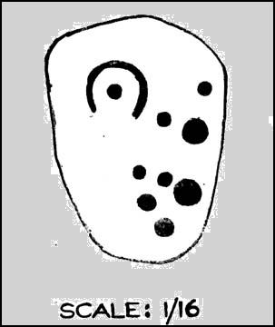
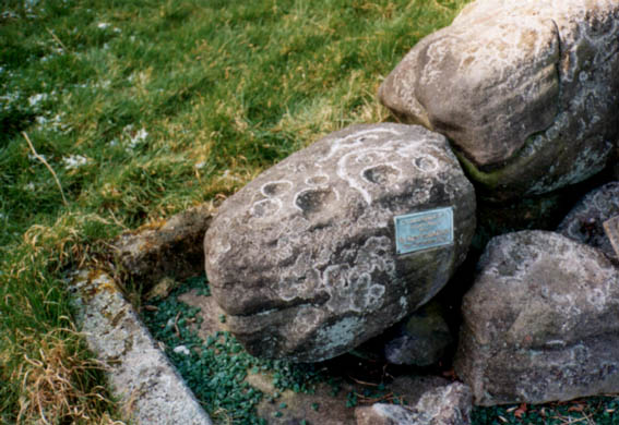
This is a real curiosity. It’s found in the graveyard of All Saints church, Weston, where one of the graves has several small stones on it, with this small stone with the following cup-and-ring designs upon it. A plaque has been attached to it as a memorial to one ‘Susan Mary Dawson’. Strange…
Sid Jackson’s 1958 sketchCup-marked stone deliberately placed on a christian grave
It was first written about by Sidney Jackson (1957), but where it first came from and why it has been placed here in a christian setting is something of a mystery. It’s also odd inasmuch as although we know that there was some form of ritual or geomantic use of cup-and-rings in relation to neolithic and Bronze Age burials — that such a tradition has been performed by this particular family on this grave. It is obviously highly unlikely that this family had any knowledge whatsoever of burial traditions in relation to cup-and-ring art (please, shoot me down in flames if you know otherwise), so this re-use of this prehistoric stone is likely to be little other than fortuitous. But then, the occult history of some of the influential families in and around this region in relation to witchcraft, ancient kingship and esoteric practices, might indicate otherwise…
Does anyone know anything about the Dawson family history which might throw light on this modern use of a prehistoric tomb marker? It has all the hallmarks of once coming from a prehistoric cairn, but we know little of its history prior to 1957.
References:
Boughey, Keith & Vickerman, E.A., Prehistoric Rock Art of the West Riding, WYAS 2003.
Jackson, Sidney, ‘Cup-and-Ring Boulder, Weston Churchyard,’ in Cartwright Hall Archaeology Group Bulletin, 2:16, 1957.
Very troublesome to locate when the heather’s deep. To get here take the Askwith Moor Road heading north and park-up at the big gritted parking spot halfway along. Cross the road (west) and walk up a little and onto the moorland track. When you hit the triangulation pillar, walk down (left) onto the moor, heading for the small rise in the land a few hundred yards away. Once there, start walking down its sloping south-face, watching for any evidence after 100 yards. Be vigilant!
Archaeology & History
One of 4 hut circles in very good state of preservation
This small settlement was first found on 18 July, 2004, when a small group of us, in search of the troublesome Man Stone carving, were lucky to be on the moors shortly after the heather had been burnt back, amidst this archaeologically rich area of Askwith Moor, on the northern end of Hollin Tree Hill.
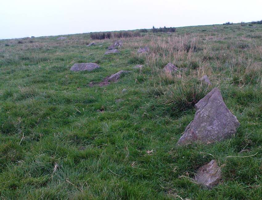
There were at least four hut circles found here (on the right of the track as you walk up the slope), with one in particular — the northernmost of the group — in a very good state of preservation. This particular circle measured approximately 20 feet in diameter, with an entrance to the south side. It is marked by a low earthfast boulder on the northeast side, visible even when the heather is deep.
Although we counted four such circles, it’s very likely that an intensive search would uncover more remains on this hillside. In revisiting this site in October 2016, the heather had grown back over the entire complex and the circles were very difficult to see; but we were able to discern the one on the very top of the hill (the one in the photo). The other hut circles, lower down the slopes, were notable only by zigzagging back and forth until we walked onto loose walling.
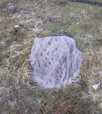
This is a lovely-looking stone in the pictures and diagrams, and is quite easy to find close to the meeting of the footpaths along Foldshaw Ridge and the Parks Lane track, near the gate. It lays at an angle in the short grass just by the path…but to me, all is not what it seems…
Archaeology & History
This was a carving I saw pictures of in the 1970s, and always thought it would be something to behold – but my first impression here wasn’t just disappointment, but the most distinct thought that the carving’s modern! It’s a real oddity. For a start, the cups in this carving are very small – much smaller than the countless authentic carvings on the moors here and at Ilkley to the south. And after seeing thousands of these things, this one didn’t seem at all right.
The lack of erosion on the cups may be due to it once accompanying a prehistoric tomb some time in the past, though no such remains have been noted here. However, at carved stones Middleton Moor 001 and Middleton Moor 2 — less than 100 yards to the east — cairns are in evidence next to the petroglyphs, indicating that this relationship occurs at some cup-and-ring stones in this small geographical region and, perhaps, explaining the ideosyncratic nature of this design.
But such speculation aside – the brief literary history of this stone is: first described by Stuart Feather in 1965 and illustrated by Sidney Jackson the same year. The rock art students Boughey & Vickerman’s (2003) described around sixty ‘cups’ etched onto the stone here, but they made no comment about either the odd nature of the cups or the possibility of it being modern. Perhaps it’s just me…
References:
Boughey, Keith & Vickerman, E.A., Prehistoric Rock Art of the West Riding, West Yorkshire Archaeology Service 2003.
Take the road from Masham into this lovely hamlet and, as you reach the staggered crossroads, you’ll see a small village green with a single tree at where the four roads meet. In the grass below the tree is this forgotten monument!
Archaeology & History
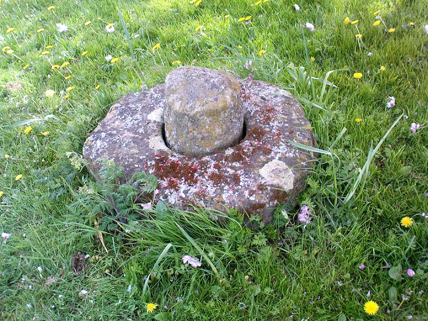
Fearby Cross remains
Found at the meeting point of five old lanes, little has been written about the old cross remnants here, which is barely a foot high and rests on its roughly circular stone base. It sits where five old tracks meet and is thought to be medieval in origin. Speculation alone pronounces the site to have been a place where local council proclamations occurred, and where funerals stopped and the dead were rested.
One intriguing piece of information narrated by Edmund Bogg (1906) that may have had some relevance to the siting of this old cross, told that between here and the hamlet of Healey a mile west,
“there were formerly circles of upright stones and other relics suggestive of druidical origin.”
Any historical information or folklore relating to these apparent megalithic remains needs to be uncovered!
References:
Bogg, Edmund, Richmondshire and the Vale of Mowbray, James Miles: Leeds 1906.
Dead easy. Take the road up through Grassington village, up Moor Lane, onto the grassy tops towards Yarnbury. As the road levels out, and before you reach the tree-border of Yarnbury house, there’s a field on your left-hand side, opposite the one where the Yarnbury Henge lives. If y’ go in there to check out this walling, shut the effing gate!
Archaeology & History
Section of walling, Yarnbury
It appears that there’s little information on the remains of what seems to be some Iron Age walling a few hundred yards away, northwest of the little Yarnbury ‘henge’ monument. Mikki Potts noticed it first of all, in one of the Northern Antiquarian ambles here t’other day. The walling is quite distinct and typical of finds elsewhere, particularly the excessive Iron Age and Bronze Age walling remains less than a mile west of here, down the slopes near Grasssington. At least two lines of walling are clearly apparent, running roughly northeast-southwest. Another section runs off towards the extant walling back towards the road. But more intriguing (for me anyway!), is what seems to be the remains of an old circle less than 100 yards north, on the other side of the footpath in the same field.
We didn’t spend too much time here and so another visit is obviously needed for further exploratory wanderings, but there appear to be further remains. Although much of the terrain hereabouts is scattered with an excess of medieval archaeological relics — including some disused shafts at the very top of this same field — this section of walling has all the hallmarks of a much earlier period. (sadly, a lot of the early mine-workings up here has destroyed a considerable amount our earlier prehistoric heritage). As one local told us a a coupla weeks back, “There’s loadsa stuff up here which aint in the record books!”
Certainly seems like it!
(In the event that these remains turn out to be of a later period, this profile entry will be removed from TNA.)
From the Askwith Moor dusty parking spot, walk up the road for 160 yards where, on each side of the road, you’ll see a straight line running across the moors. On the left-side (west) walk onto the moor for 50-60 yards along this line, then dead straight west into the heather for another 50-60 yards and look around. It’s hard to see if the heather’s grown.
Archaeology & History
Found by Richard Stroud on July 20, 2004, this single hut circle is in faint evidence. About twenty feet across with a section of the low walling either missing, or more probably buried in the peat. Although no other hut-circles were immediately visible, this was probably because of the excessive heather-growth. I have little doubt that others will be close to this one, as the area is littered with prehistoric sites. The petroglyph catalogued as Askwith Moor 529 is very close to this hut circle.
Pretty easy really. Get to the ancient St. Michael’s Church on the dead-end road just outside of Linton village. As you approach it, look into the field on your right. Y’ can’t miss it!
Archaeology & History
Linton ‘Standing Stone’
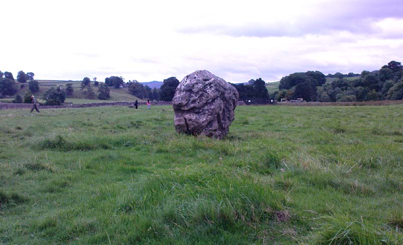
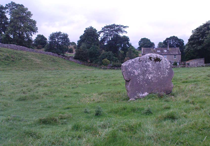
This is an oddity. It could perhaps be little more than one of the Norber erratics found a few miles further north — but it looks more like a smaller version of one of the Avebury sarsens! Just under six-feet tall, it was shown to me by Adrian Lord yesterday (when the heavens subsequently opened and an outstanding downpour-and-half followed), who’d come across it only a week or two earlier themselves when they visited the ancient church next door. The stone certainly aint in any archaeology registers (no surprise there); and as one local man we spoke to yesterday told us, “there used to be several other standing stones in the same field, cos I remember ’em when I was a kid. ” The gent we spoke to seemed to know just about everything about the local archaeology and history of the area (one of those “damn good locals” you’re sometimes lucky to find!). He told us that the other stones which used to be there had been moved by the local farmer over the years, for use in his walls. So it seems that this is the last one standing. What looks like several other fallen stones can be seen further down the field, just next to the church. But this one’s pretty impressive.
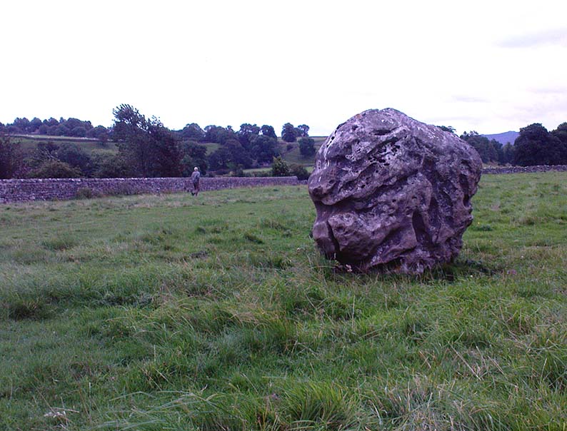
Close-up of gnarled rockLooking south-ish!
The church of St. Michael next door was, tells the information inside, built upon some old pagan site — which gives added thought to this upright stone perhaps being the ruin of an old circle, or summat along those lines. The church, incidentally, is built right next to the River Wharfe.
Not far from here we find an almost inexhaustible supply of prehistoric remains at Grassington and district (less than a mile north). A huge excess of Bronze- and Iron Age remains scatter the fields all round the town. And aswell as the Yarnbury henge close by, there is — our local man told us, “another one which no-one knows abaat, not far away”!
Folklore
The folklore of this area is prodigious! There is faerie-lore, underworld tales, healing wells, black-dogs, ghosts, earthlights – tons of the damn stuff. But with such a mass of prehistoric remains, that aint too surprising. And although there appears no direct reference to this particular stone (cos I can’t find a damn reference about it), the old Yorkshire history magus, Harry Speight (1900), wrote of something a short distance away along the lane from the church. He told that,
“In the field-wall beside the road may be seen some huge glacial boulders, and there is one very large one standing alone in the adjoining field, which from one point of view bears a striking resemblance to a human visage; and a notion prevails among the young folk of the neighbourhood that this stone will fall on its face when it hears the cock crow.”
Just the sort of lore we find attached to some other standing stones in certain parts of the country. And in fact, from some angles, this ‘ere stone has the simulacrum of a face upon it; so this could be the one Speight mentions (though his directions would be, unusually, a little out).
There are heathen oddities about the church aswell: distinctly pre-christian ones. An old “posset-pot” was used for local families to drink from after the celebration of a birth, wedding or funeral here. And at Hallowtide – the old heathen New Year’s Day,
“certain herbs possessed the power of enabling those who were inclined to see their future husbands or wives, or even recognizing who was to die in the near future.”
And in an invocation of the great heathen god (the Church called it the devil), Speight also went on to tell that:
“The practice at Linton was to walk seven times round the church when the doomed one would appear.”
In a watered down version of this, local people found guilty of minor transgressions in and around Linton (thieves, fighters, piss-heads, etc),
“was compelled to seek expiation by walking three time around Linton Church.”
This would allegedly cure them of their ‘sins’! Rush-bearing ceremonies were also enacted here. On the hill above, the faerie-folk lived. And until recently, time itself was still being measured by the three stages of the day: sunrise, midday and sunset; avoiding the modern contrivances of the clock, and maintaining the old pre-christian tradition of time-keeping. Much more remains hidden…
References:
Speight, Harry, Upper Wharfedale, Elliott Stock: London 1900.
In the midst of the great henge monuments at Thornborough — specifically, the central henge — archaeologist Ian Longworth (1965) said there “was built …a still earlier structure known as a cursus.” This giant monument was one of the earlier such sites located in Britain. Longworth continued, saying:
“This was a ceremonial avenue, running for nearly a mile in a northeast / southwesterly direction. The avenue is defined by ditches 144 feet apart with a bank running along the inside of each ditch. The ditches are now completely filled with plough soil and, as with other cursus monuments in the county, were discovered from the air as two dark lines in the cereal crop… Probably used for ritual ceremonies, no clues remain to show what actually took place.”
Thornborough Cursus (& henges)
This cursus runs almost at right angles to the alignment of the three Thornborough Henges, on the southern side of the central henge, and was first found through the aerial photography of J.K. St. Joseph between 1945 and 1952. When excavation work was carried out, “a crouched burial was found in a stone cist within the southwest end” of the cursus. This end of the monument is rounded, like the Stonehenge Cursus; whilst the northeast end of the monument has not been located. The southwest end of the cursus begins at OS grid-reference SE 2799 7906 and its northeasterly end is roughly at SE 2881 7954. The middle of the known cursus is roughly in Thornborough’s central henge.
Paul Devereux (1989) said that the monument, “which had become silted-up and grass-covered by the time the henge was built, had two main orientations, with a curvilinear, irregular section just to the east of the henge.” Although Norris Ward (1969) thought that the cursus actually went all the way down the River Ure, it stops some distance beforehand, though may obviously have had some important relationship with the waters.
References:
Longworth, Ian H., Regional Archaeologies: Yorkshire, Cory, Adams & Mackay: London 1965.
Pennick, N. & Devereux, P., Lines on the Landscape, Hale: London 1989.
Thomas, Charles, ‘Folklore from a Northern Henge Monument,’ in Folklore Journal, volume 64:3, 1953.
Ward, Norrie, Yorkshire’s Mine, J.M. Dent: London 1969.
Dead easy. Take the A170 road from Pickering to Thornton-le-Dale and as you go into the large village, you’ll hit the old crossroads with the village green. Here be your cross!
Archaeology & History
Shown on the 1854 OS-map, I first came across a description of this old site in Creaser & Rushton’s (1972) scarce but lovely little work on the history of the old village here, where they told that,
“A cross has stood here since John de Eston in 1281 had the grant of a Tuesday market and two yearly fairs. It was repaired in 1820. Every year, the Abbot of Whitby unloaded 1500 red and 1500 white herrings here from his packhorse ponies for transhipment to the Master of St. Leonard’s Hospital at York.”
Or at least, that’s what he got folk to write down in the record-books! Close by were the old village stocks of the village (whose usage should be resurrected in many parts of this country nowadays).
References:
Creaser, A. & Rushton, J.H., A Guide and History of Thornton-le-Dale, Pickering, Yorkshire, E. Dewing: Pickering 1972.
Along the B6265 Pateley Bridge-Grassington road, roughly halfway between Stump Cross Caverns and the turn down to Skyreholme and Appletreewick (New Lane) is a dirt-track on your right-hand side called Black Hill Road. Walk along here for a few hundred yards till y’ reach the gate on the right. A track meanders downhill to the psilocybin-rich pastures of Nussey Green. Several hundred yards down, to the right-hand side of the track, we find this stone and its several nearby companions. Look around – you’ll find it!
Archaeology & History
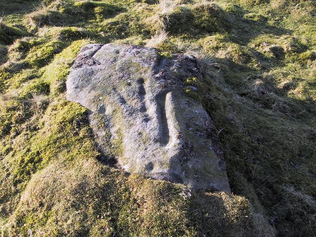
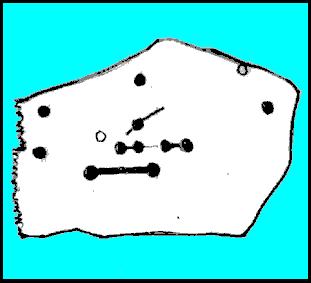
I like this carving — I think because of the initial impression it gave, which was one of numeracy and linearity: an unusual quality for a cup-and-ring stone. Those of you with an astronomical or mathematical slant may have a similar response.
Line Stone Carving, Skyreholme
The stone was first described in one of Stuart Feather’s (1964) many short notices. Its existence then remained dormant until it was eventually listed in Boughey & Vickerman’s (2003) survey on the West Riding rock-art, where they catalogued it as ‘stone no.401.’ The carving comprises of two parallel lines—one quite deep—with cup-marks at either end; one of the lines having another 2 cups along it. A third line at an angle has one or two cups along it aswell. Several other single cups scatter the rock (forgive my crap drawing of it!).
References:
Boughey, Keith & Vickerman, E.A., Prehistoric Rock Art of the West Riding, WYAS 2003.
Feather, Stuart, ‘Appletreewick (WR),’ in Yorkshire Archaeology Journal 41, 1964.