St. Michael’s Well, Well, North Yorkshire

Holy Well:  OS Grid Reference – SE 2633 8176

Also Known as:

  1. Mickel Well
  2. Mickey Well

Getting Here

Found near the bottom of Holly Hill, as Graeme Chappell tells us, this old site “is located by the side of a narrow lane on the west side of the village of Well (aptly named). The OS map places the well on the north side of the lane, but this is only the outflow from a pipe that carries the water under the road.  The spring actually rises at the foot of a small rock outcrop, on the opposite side of the road.”

Archaeology & History
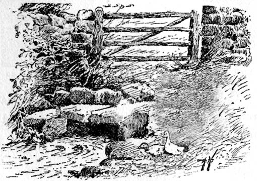
St. Michael's Well, Well (Bogg 1895)
St. Michael’s Well, Well (Bogg 1895)

Although the village of Well is mentioned in Domesday in 1086 and the origin of the place-name derives from “certain springs in the township now known as The Springs, St. Michael’s Well and Whitwell,” very little appears to have been written about this place.  Edmund Bogg (c.1895) wrote that an old iron cup — still there in the 19th century — was attached next to this spring for weary travellers or locals to partake of the fine fresh water.  Nearby there was once an old Roman bath-house and, at the local church, one writer thinks that the appearance of “a fish-bodied female figure…carved into one of the external window lintels” is representative of the goddess of these waters.  Not so sure misself — but I’m willing to be shown otherwise.

Folklore

Around 1895, that old traveller Edmund Bogg once again wrote how the villagers at Well village called this site the Mickey or Mickel Well,* explaining: “the Saxons dwelling at this spot reverently dedicated this spring of water to St. Michael.” A dragon-slayer no less!

Although not realising the Michael/dragon connection, the same writer later goes on to write:

“There is a dim tradition still existing in this village of an enormous dragon having once had its lair in the vicinity of Well, and was a source of terror to the inhabitants, until a champion was found in an ancestor of the Latimers, who went boldly forth like a true knight of olden times, and after a long and terrible fight he slew the monster, hence a dragon on the coat of arms of this family. The scene of the conflict is still pointed out, and is midway between Tanfield and Well.”

This fable occurred very close to the gigantic Thornborough Henges!  It would be sensible to look more closely at the mythic nature of this complex with this legend in mind.  A few miles away in the village of Kirklington, the cult of St. Michael could also be found.

References:

  1. Bogg, Edmund, From Eden Vale to the Plains of York, James Miles: Leeds n.d. (c.1895)
  2. Smith, A.H., The Place-Names of the North Riding of Yorkshire, Cambridge University Press 1928.

* In old english the word ‘micel‘ (which usually accounts for this word) means big or great. On the same issue, the ‘Holly Hill’ in the case here at Well actually derives from the holly tree and NOT a ‘holy’ well. However, check the folklore of this tree in Britain and you find a whole host of heathen stuff.

© Paul Bennett, The Northern Antiquarian

Elm Crag Well, Bingley, West Yorkshire

Healing Well:  OS Grid Reference – SE 1028 3907

Getting Here

From Bingley, take the B6429 road up to Harden.  After going up the wooded winding road for a few hundred yards, stop where it levels out.  Cross onto the right-hand side of the road and walk up the slope a little, veering to your right.  You’ll notice a small disused building just off the roadside, in overgrowth, with a pool of water.  You need to be about 100 yards up the slope above it!

Archaeology & History

Elm Crag Well, Bell Bank Wood, Bingley

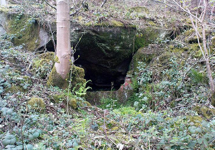
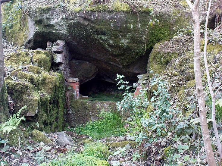
This is a beautiful old place.  If you walk straight up to it from the roadside, past the derelict building, you have to struggle through the brambles and prickly slope like we did – but it’s worth it if you like your wells!  However, if you try getting here in the summertime, expect to be attacked on all sides by the indigenous flora!  The waters here emerge from a low dark cave, in which, a century of three ago, someone placed a large stone trough.  When I first came here about 25 years ago, some halfwits had built an ugly red-brick wall into the cave which, thankfully, someone has had the sense to destroy and rip-out.

Shown on the 1852 Ordnance Survey map and highlighted as a ‘spring,’ Harry Speight (1898) gives a brief mention to this site, though refers us to an even earlier literary source when it was first mentioned. In John Richardson’s 18th century survey of the Craven area, he makes reference to an exceedingly rare fern, Trichomanes radicans, which was later included in Bolton’s classic monograph on British ferns of 1785.  In it, Bolton wrote that the very first specimen of this plant was “first discovered by Dr. Richardson in a little dark cavern, under a dripping rock, below the spring of Elm Crag Well, in Bell Bank.”

Elm Crag Well
Elm Crag Well

The waters from here come from two sides inside the small cave and no longer run into the lichen-encrusted trough, seemingly just dropping down to Earth and re-emerging halfway down the hillside.  But the waters here taste absolutely gorgeous and are very refreshing indeed!  And the old elms which gave this old well its name can still be seen, only just hanging on to the rocks above and to the side, with not much time left for the dear things.

References:

  1. Bolton, James, Filices Britannicae: An History of the British Proper Ferns, Thomas Wright 1785.
  2. Speight, Harry, Chronicles and Stories of Old Bingley, Elliott Stock: London 1898.

© Paul Bennett, The Northern Antiquarian

Little Skirtful of Stones, Burley Moor, West Yorkshire

Cairn:  OS Grid Reference – SE 13829 45186

Also Known as:

  1. Little Apronful of Stones

Getting Here

Little Skirtful of Stones, looking north

Probably the easiest way to get here is by starting on the Moor Road above Burley Woodhead, where the road crosses the Rushy Beck stream.  Looking upstream, follow the footpath up the right-hand side of the waters, nearly all the way to the top.  Where it crosses a footpath near where the moor begins to level out, look up to your right and you’ll see the raised crown of stones a coupla hundred yards off path, NNW.  That’s it!

Archaeology & History

This very large Bronze Age cairn was reported by Faull & Moorhouse (1981) to have been surrounded by a multiple stone circle, citing it to have been shown as such on an estate map of Hawksworth Common in 1734. When I contacted the Yorkshire Archaeology Society to enquire about this map, it could not be located. (This needs to be found!) No evidence of such a stone circle presently remains, though there were at least two standing stones once to be seen at the edge of this tomb, though only one of them — now laid more than five-feet long in the heather — is still evident on the western side of this giant tomb.  But anyone who might know anything about the 1734 Estate Map – pleeeeez gerrit copied or take a photo of it! Then stick it on TNA so everyone can see whether the circle surrounded this, or the Great Skirtful of Stones, 500 yards to the south.

Single cup-marked stone on outer edge of Little Skirtful

The Little Skirtful is in better condition than its big brother on the hill to the south and — unlike the Great Skirtful — there are said to be at least five cup-marked stones amidst the great mass or rocks constituting this site.  There could be more.  The carvings are just single cup-markings etched onto small portable stones, typical of sites like this.  They are found near the centre above a small cist and outwardly towards the northern edges of the cairn (for more info about them, see the main entry for the Little Skirtful Carvings).

It’s been said by Stan Beckensall (1999, 2002) that no cup-marked rocks “are known near…the really large cairns” on the moor—meaning the Little Skirtful and her allies—but this isn’t true as there are at least 4 definite carvings (a possible fifth seems likely) on the moorland immediately around the Little Skirtful.  Though to give Beckensall his due, if he got his data from the Ilkley archaeologists, his information isn’t gonna be too accurate, as they’re quite unaware of many sites on these moors!  A good number of local people have a much greater knowledge-base on such matters than those in paid offices, as this and other websites clearly shows.  The times they are a-changin’, as one dood said, not so long ago…!

Folklore

Paul Bowers & Mikki on top for scale!

The creation myth of this place tells that the giant Rombald (who gives his name to the moor) was in trouble with his wife and when he stepped over to Almscliffe Crags from here, his giant wife – who is never named – dropped a small bundle of stones she was carrying in her apron. (In traditional societies elsewhere in the world where this motif is also found, it tends to relate to the site being created by women.) Harry Speight (1900) tells us of a variation of the tale,

“which tradition says was let fall by the aforementioned giant Rumbalds, while hastening to build a bridge over the Wharfe.”

Variations on this story have said it was the devil who made the site, but this is a denigrated christian variant on the earlier, and probably healthier, creation tale. Similar tales are told of the Great Skirtful of Stones, 500 yards south.

References:

  1. Beckensall, Stan, British Prehistoric Rock Art, Tempus: Stroud 1999.
  2. Beckensall, Stan, “British Prehistoric Rock Art in the Landscape,” in G. Nash & C. Chippindale’s European Landscapes of Rock Art, Routledge: London 2002.
  3. Bennett, Paul, The Old Stones of Elmet, Capall Bann: Chieveley 2001.
  4. Boughey, Keith & Vickerman, E.A., Prehistoric Rock Art of the West Riding, WYAA 2003.
  5. Collyer, Robert & Turner, J. Horsfall, Ilkley: Ancient and Modern, William Walker: Otley 1885.
  6. Colls, J.N.M., ‘Letter upon some Early Remains Discovered in Yorkshire,’ in Archaeologia 31, 1846.
  7. Cowling, E.T., Rombald’s Way, William Walker: Otley 1946.
  8. Faull & Moorhouse, West Yorkshire: An Archaeological Survey – volume 3, WYMCC: Wakefield 1981.
  9. Hedges, John (ed.), The Carved Rocks on Rombalds Moor, WYMCC: Wakefield 1986.
  10. Speight, Harry, Upper Wharfedale, Elliott Stock: London 1900.
  11. Wood, Butler, ‘Prehistoric Antiquities of the Bradford District,’ in Bradford Antiquary, volume 2, 1901.

© Paul Bennett, The Northern Antiquarian
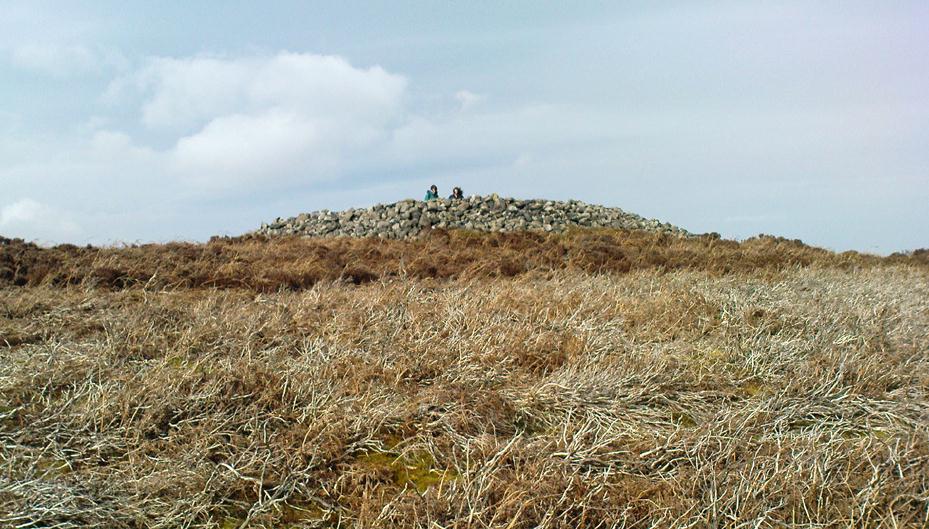

Fairy Loch, Arrochar, Argyll

Sacred Loch:  OS Grid Reference – NS 3384 9937

Also Known as:

  1. Lochan Uiane

Getting Here

Fairy Loch on 1865 map

To get here, go down the A82 about four-and-a-half miles south of Tarbet (along the Loch Lomond road). Near a burn coming down the hill is an old house, long in ruin, and near the side of this is an old path – more for deer than city-folk. Go up through the wooded hillside for about a half-mile (amble the trek and make it a nice hour’s walk to get into the place). I’d take the stream itself, as you get more into the nature of the place once you get up the slope: there’s more to see, feel and a healthy water supply en route.

Folklore

This is more of a ‘holy loch’ than a holy well — for obvious reasons.  Although it’s not much bigger than a large pond, it is little-known, but has long had the tradition of being an abode of the sith, or faerie-folk. There is, of course, a tendency to find prehistoric remains where the sith have their repute, but there seems little on official records nearby.

Tradition tells that the loch was actually formed in ancient times by locals damming the burn for water supply. Another tells the same in order that a mill could be fed with constant water – though no mill can be found. If this latter tradition is true however, the fairy creature here could have been a brownie – though they are generally more a lowland elemental. One of the reasons the place has been named after the little people is that when certain light falls on it, at the right time of day and year, green triangular shapes emerge from the water formed by deposits hidden beneath the surface (hence the original Gaelic name, Lochan Uaine, or the Green Loch).

Local historian Norman Douglas echoed the folktale described many years earlier by the great John Gregorson Campbell (1900), telling that,

“another story is that the local people would deposit their sheeps’ fleeces in the Fairy Loch overnight, wish for them to be dyed a certain colour, and overnight the fairies would carry out their wish.”

References:

  1. Campbell, John G., Superstitions of the Highlands and Islands of Scotland, James MacLehose: Glasgow 1900.
  2. Douglas, Norman, Arrochar, Reiver Press: Galashiels n.d. (c.1971)

© Paul Bennett, The Northern Antiquarian

Newchurch-in-Pendle, Lancashire

Stone Circle (destroyed):  OS Grid Reference – SD 822 387

Also Known as:

  1. Pendle Stone Circle

Archaeology & History

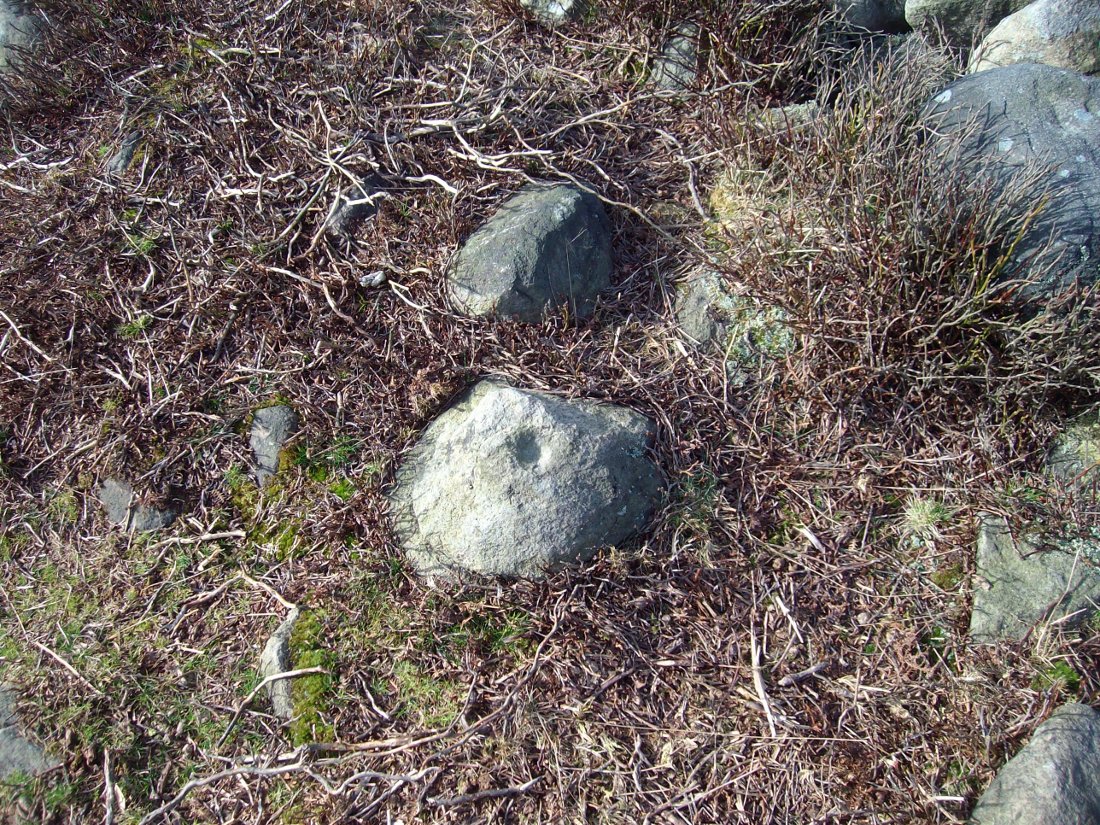
A destroyed site mentioned by several local historians. It was positioned at the valley bottom just below Faughs, a hundred yards west of Lower Moss End, where today it is simply overgrown meadows with the typical excess of Juncus reeds.  As local investigator John Dixon said, there are “five stones shown on (the 1848) map just west of Spen Brook Mill.”

In the 1970s, one writer described there being several uprights still in place, but a visit here a few weeks back (though I – unusually! – didn’t walk all through the boggy grounds and explore as extensively as I normally would) found nothing.

Its geomancy, however, was striking. The unnamed hill immediately to the north of its position (at the southern end of the legendary Pendle Hill, a coupla hundred yards west of St. Mary’s church) rises up like a great singular ‘pap’ which, to our old ancestors, was animated with female spirit. I sat here in the pouring rain looking up at this hill and its presence in front of the circle was striking.

…And so I walked onto the top of the said hill. Thereupon I found a small gathering of rocks, not unlike a cairn-spoil. When I enquired with a few local people about the age or nature of this rock-pile, I found no-one seemed aware of its existence. Weird. But from the hill itself, the view is excellent – and the small valley amidst which the old circle once stood teems with legends and myth: of cailleachs, ghosts, wells, witches and more. An excellent spot!

The local writer, historian and walker, John Dixon, sent us the following notes of his exploration here:

“Clifford Byrne, the late Nelson antiquarian, mentions in his book ‘Newchurch in Pendle’ the site of a former stone circle that stood just below Faughs, a hundred yards west of Lower Moss End. Today no large stones of any kind can be located anywhere near this spot, the stones having been removed or broken up some time in the past. However, the 1848 6” OS map records the number and position of these stones as being in two parallel lines about a hundred yards apart lined up west to east. The northerly line (SD 823 389) consists of 3 stones, the southerly (SD 823 387) of 4 stones, all being some 3 yards apart.

“It appears that we have an avenue of stones, not a circle. But why their position in the landscape at the headwaters of two valley streams? The Sabden Brook starts its journey westward to meet with the Calder from the stones, while Dimpenley Clough rises from the stones running east to join Pendle Water – could this be of any significance?”

References:

  1. Byrne, Clifford, Newchurch-in-Pendle: Folklore, Fact, Fancy, Legends and Traditions, Marsden Antiquarians: Nelson 1982.

© Paul Bennett, The Northern Antiquarian


Cat Heaps, Swanston, Edinburgh, Midlothian

Cairns (destroyed):  OS Grid Reference – NT 2447 6828

Archaeology & History

Not far from the giant cup-marked Caiy Stone, there used to be two very large prehistoric cairns, which local historian Daviid Shankie told us “were foolishly broken up by some sacriligious hand and used for road metal”!  Not good…  Remains of human bones and several fragments of old weapons were found in them.  Fred Coles (1903) told us that:

“In the neighbourhood of this [i.e. Morton Hall], but further southwest, on the grounds of Comiston, were found, in forming the public road, under large heaps of stones, various sepulchral stone enclosures, in which were deposited urns with dead men’s ashes, and divers warlike weapons.” And again, when speaking of the levelling of a part of the ground close to the old (so-called Roman) road, by Sir John Clerk of Pennycuick, the same writer adds, there ” were discovered several stone coffins with human bones.”

Folklore

According to Shankie (1902), these two great cairns were built upon lands previously known as the Templelands of Swanston and commemorated a great battle that was fought “between the ancient Picts and Scots.”

References:

  1. Coles, Fred, ‘Notice of…Cairns and Standing Stones in Midlothian and Fife,’ in PSAS 37, 1903.
  2. Harris, Stuart, The Place-Names of Edinburgh, Gordon Wright: Edinburgh 1996.
  3. Royal Commission for the Ancient & Historical Monuments of Scotland, Midlothian and West Lothian, HMSO: Edinburgh 1929.
  4. Shankie, David, The Parish of Colinton, John Wilson: Edinburgh 1902.

© Paul Bennett, The Northern Antiquarian
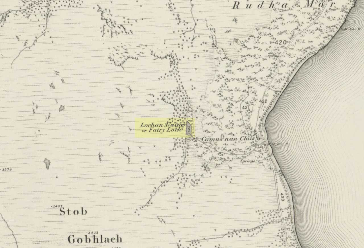

Lidstone, Chipping Norton, Oxfordshire

Standing Stones:  OS Grid Reference – SP 35487 24627

Also Known as:

  1. King Lud’s Stone
  2. Leodwine’s stone

Getting Here

Just get to the top of the hill thru the village and where the sharp bend turns, you’ll find one of the monoliths up against the wall above the roadside (hard to find in the undergrowth sometimes!).  The other stone is on the eastern side of the road through Lidstone from the A44, halfway into the village itself.

Archaeology & History

Lidstone monolith
Lidstone monolith

There are two small stones to be found in the lovely little hamlet of Lidstone.  The main one—Leodwin’s Stone—is at coordinate SP 35517 24656; and the smaller stone further up the hill is at SP 35487 24627.  First described in a treatise from 1235 AD as Lidenstan, the great place-name writer Ekwall (1940) thought this derived from ‘Leodwine’s Stone.” A few years later Gelling (1954) told us that “there is a monolith at Lidstone”, which she thought gave rise to the place-name, and not some chap named Leodwine.  Whichever it may be, we certainly have two small upright stones here — both worth having a look at if such things take your interest. (Tom Wilson and I included them in our short survey of the standing stones of the region in 1999) Further up at the top of the hill from here are the remains of an old tumulus.

Folklore

Said by Caroline Pumphrey (1990) to be the resting place of old King Lud, one of England’s last great pagan kings; another local writer Elsie Corbett (1962) also told a tale well-known to folklore students about this little monolith.  She related how a local man they knew as Mr Hitchcock told them,

“that they used to kid the boys there by telling them that when the stone hears the clock strike twelve it goes down to the stream to drink, and that it was just a ‘catch’ because there was no striking clock in the first place; but it is a ‘catch’ tacked onto some tale that must have been told in the hamlet long ages before there were clocks at all.”

The said stream is a short distance due north of here, down the little valley.  The tale may come from it once acting as a shadow-marker, highlighting midday when the sun was high in the sky due south.  Makes sense of the folktale anyway!

References:

  1. Bennett, Paul & Wilson, Tom, The Old Stones of Rollright and District, Cockley: London 1999.
  2. Corbett, Elsie, A History of Spelsbury, Cheney & Sons: Banbury 1962.
  3. Ekwall, Eilert, Oxford Dictionary of Place-Names, OUP: Oxford 1940.
  4. Gelling, Margaret, The Place-Names of Oxfordshire – volume 2, Cambridge University Press 1954.
  5. Pumphrey, Caroline, Charlbury of our Childhood, Sessions Books: York 1990.

© Paul Bennett, The Northern Antiquarian 

Haworth Moor Spa Wells, West Yorkshire

Healing Wells:  OS Grid Reference – SE 0041 3513

Getting Here

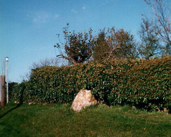
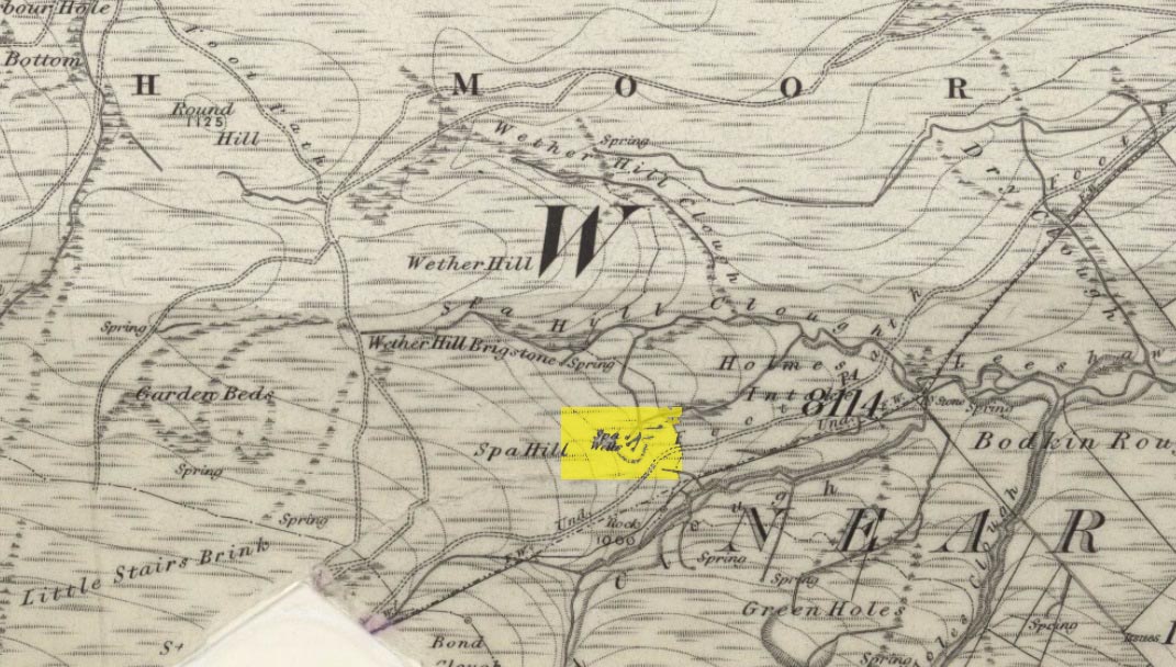
Spa Wells on 1852 map

Go through Haworth and head for the well-known Penistone Hill country park.  On the far western side of the hill up near the top of Moorside Lane, there’s a car-park.  Right across the road from this there are two footpaths: one heads you into the moor, whilst the other (going the same direction) follows the edge of walling onto the moors.  Take this path. Walk on and downhill, past the end of the reservoir, then the path continues uphill. You’ll hit a nice cheery tree beside the path a few hundred yards up.  Stop here, look into the boggy region with bits of walling on the moor in front of you.  That’s where you’re heading!

Archaeology & History

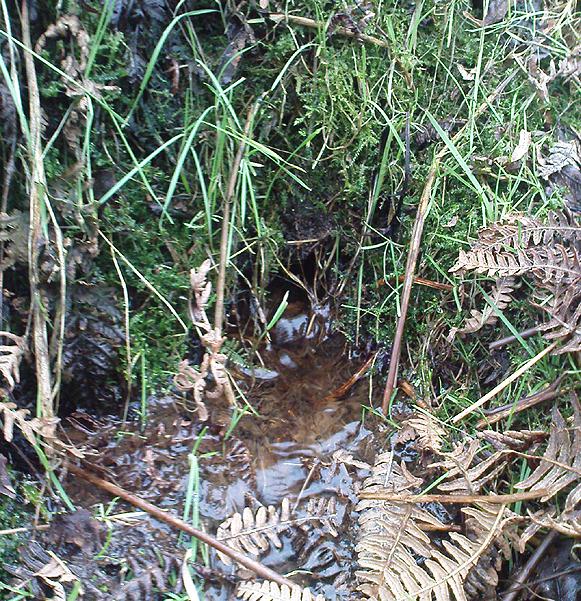
The first, weaker of the Spa Wells

This was a really curious spot to me, as I found absolutely nothing about the damn place!  But thanks to the assistance of local historian and writer Steven Wood (2009), that’s changed.  Shown on the 1852 OS-map, at least two springs of clear water trickle slowly from the wet slope above you into the boggy reeds.  Close by there are overgrown remains of old buildings, covered with the time of moorland vegetation, seemingly telling that the waters were collected for bathing rooms.  But who the hell even started the notion that they’d be able to get Victorian rich-folk up here at the crack-of-dawn to drink or bathe in the waters is seemingly forgotten.  And, as is evident from the lack of local history, the project was a failed one which seemed not to have lasted too long. 

Folklore

The stronger of the Spa Wells
The stronger Spa Well

It was quite obvious that of all the springs around here and despite the strong-flowing streams either side of these spa well, that the local animals drink here more than the other nearby springs of water, as there were literally hundreds of animal tracks all across the boggy ground of the spas.*  The waters also seem to have the usual ‘spa’ qualities of stinking, but once we’d cleaned out the overgrown springs — which looked as if they hadn’t been touched for 100 years or more the waters were clear and tasted good, and were curiously slightly warm!

Although my initial search for information on this site drew a blank, Steve Wood pointed us in the right direction for info on the place.  As with many other holy wells and spas in Yorkshire, it turned out that this was another spot much revered around Beltane, indicating strongly there would have been  earlier pre-christian rites practiced at this site.   Steve pointed me to Martha Heaton’s (2006) local history work, which told:

“For many years the first Sunday in May was a special day. It was known as Spa Sunday, for on this day people gathered up in the hills overlooking what is now Leeshaw Reservoir, here was a well, known as Spa Well, and the stream which now feeds the reservoir is known as Spa Beck. People came from Haworth, Oxenhope, Stanbury, and other villages sitting round the well, they sang songs, some bringing their musical instruments to accompany the singing. Children brought bottles with hard spanish in the bottom filling the bottle with water from the well, shaking it until all the spanish or liquorice had been dissolved. This mixture was known as ‘Poppa Lol’ and would be kept for weeks after a little sugar had been added, then it was used sparingly as medicine.  The custom seems to have died out when Bradford Corporation took over the water and made Leeshaw Compensation Reservoir in 1875, though up to about 1930 two men from Haworth would wend their way to the spot on the moor, the first Sunday in May. The men were John Mitchell and Riley Sunderland, better known, in those days as ‘Johnny o’Paul’s’ and ‘Rile Sun’.

It was a great day for many people, the Keighley News of May 1867 mentioned it, the report of local news reads thus: ‘A large assembly met on Spa Sunday on the moors about two miles from Haworth, and a party of musicians from Denholme performed sacred music’.

This locality was often visited during the summer months by the Bronte family.”

References:

  1. Heaton, Martha, Recollections and History of Oxenhope, privately printed 2006.
  2. Wood, Steven & Palmer, Ian, Oxenhope and Stanbury through Time, Amberley Publishing 2009.

Acknowledgements: – Huge thanks to Steven Wood for his help; and to Hazel Holmes for permission to quote from Martha Heaton’s work.

* A common creation myth behind many healing wells is that animals with breaks or illness drag themselves to drink from otherwise small or insignificant springs and wells, despite of the copious streams or rivers which may be nearer.

© Paul Bennett, The Northern Antiquarian

Robin Hood’s Well, Stanbury Moor, West Yorkshire

Sacred Well:  OS Grid Reference – SD 9795 3629

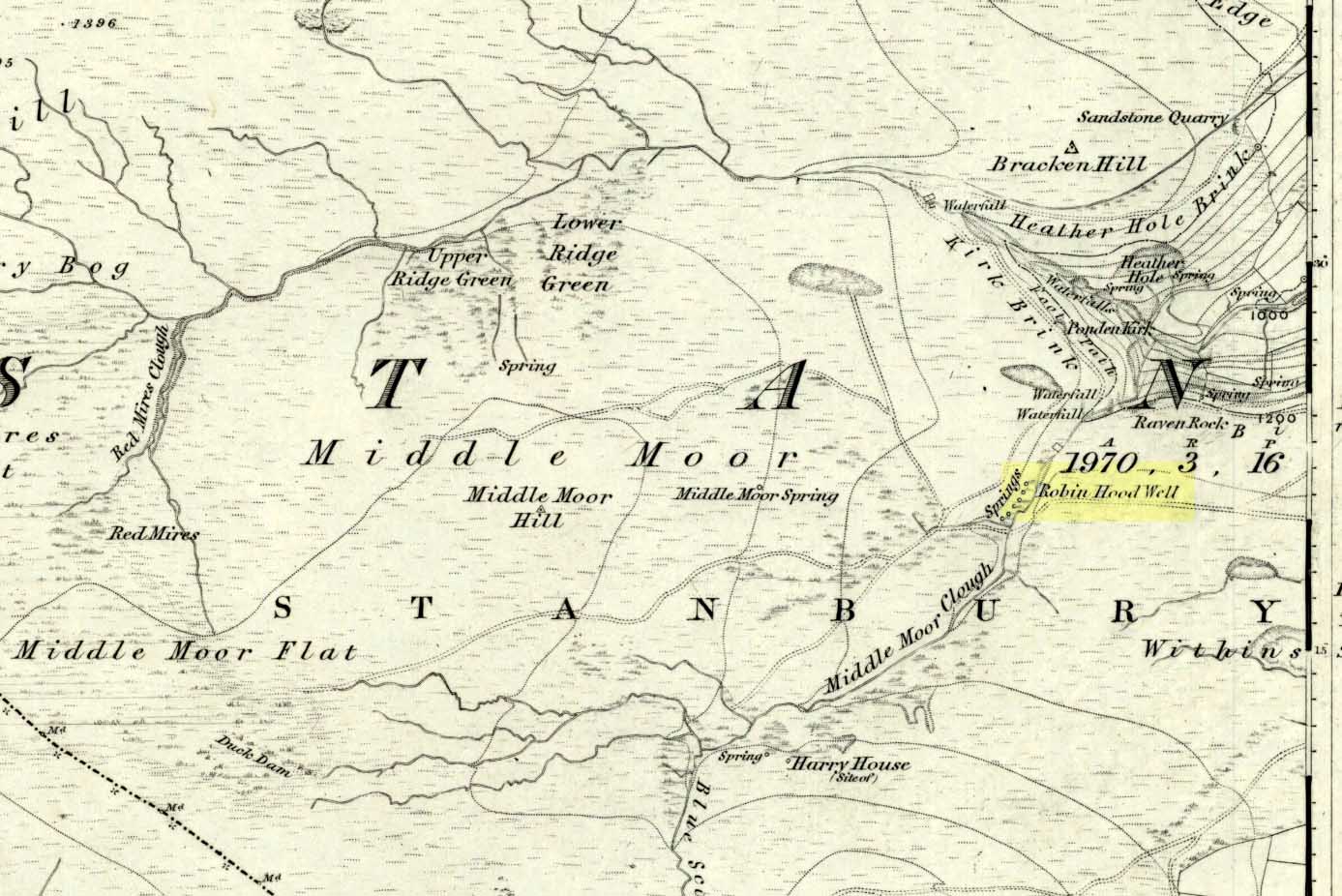
Robin Hoods Well on 1851 map

Getting Here

Follow the same directions to get to the nearby Ponden Kirk and, once on top of the rocks, overlooking the valley, walk on the footpath to your right.  It bends round and follows the stream up onto the moors.  About 100 yards along, walk up the heathery slope to the right and you’ll find several boggy watering holes on the top of the ridge.  In looking at the first OS-map of the area in 1853, it seems that the northernmost of six boggy springs is the Robin Hood’s Well – although we don’t know this for certain.  It’s one of them though!

Archaeology & History

Robin Hood’s Spring, above Ponden Kirk

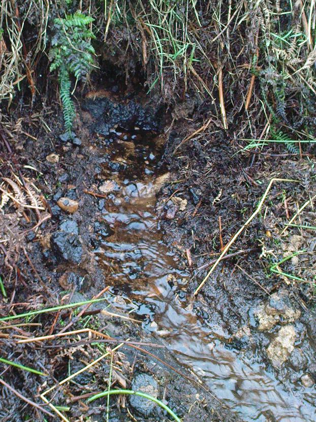
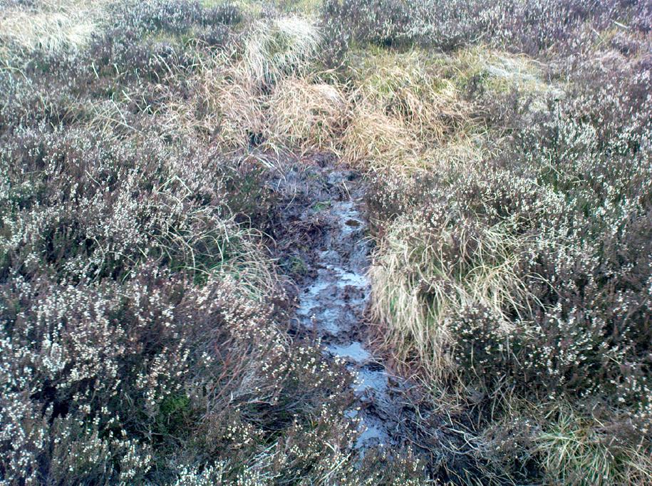
There’s little to see here really: it’s little more than a small boggy spring of water emerging from the edge of the ridge, as the photo shows.  Curiously, descriptions of the site (and its neighbouring compatriots, Will Scarlett’s Well and Little John’s Well) are sparse aswell.  It was noted by the Ordnance Survey lads in 1848 and subsequently posted on the first OS-map of the area in 1851.  Both Horsfall Turner (1879) and Johnnie Gray (1891) mention the site passing, saying nothing of the place. However, several years after Gray’s work, Halliwell Sutcliffe (1899) ventured here and gave us the first real description of the place, telling:

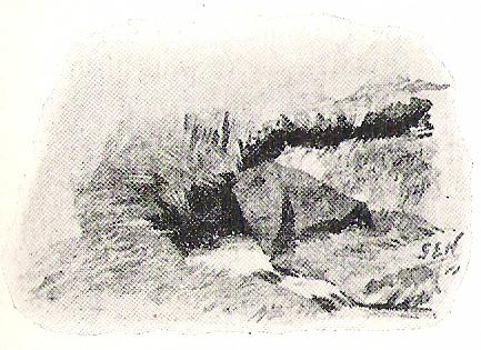
“Half-hidden underground, and fringed with fern and bog-weed, lie the three wells which go by the names of Robin Hood, Little John and Will Scarlett.  One may stop to ask how they came by their birth-names, to wonder why a man should have troubled to fashion them in this out-of-the-way spot; but neither speculation nor questioning of the moor folk brings one nearer to an answer.”

Folklore

Halliwell Sutcliffe's scruffy quick sketch, circa 1898
Halliwell Sutcliffe’s scruffy quick sketch, circa 1898

Apart from this site being a spot where the legendary outlaw stopped and drank in ages past, the healing attributes of these waters have long since been forgotten.  Considering the proximity of the Ponden Kirk and its legendary association with fertility and marriage rites, I’d guess that such lore wold have centred around Beltane, or Mayday; and Robin Hood is very well known in folklore to have close associations with the same period.  So — and I’m guessing here — it’s likely that whatever might have occurred at this well, would have taken place around Beltane aswell.

References:

  1. Gray, Johnnie, Through Airedale from Goole to Malham, Walker & Laycock: Leeds 1891.
  2. Sutcliffe, Halliwell, By Moor and Fell in West Yorkshire, T. Fisher Unwin: London 1899.
  3. Turner, J. Horsfall, Haworth, Past and Present, Hendon Mill: Nelson 1879.

© Paul Bennett, The Northern Antiquarian

St. Helen’s Wells, Whittle-le-Woods, Lancashire

Holy Wells:  OS Grid Reference – SD 5856 2242

Getting Here

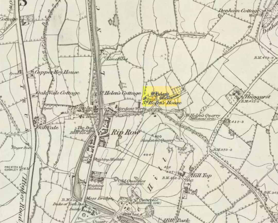
St Helen's Well on 1848 map
St Helen’s Well on 1848 map

Destroyed when the M6 motorway was built – but if you’re a really fanatic and wanna see the setting, simply get to the bridge that crosses the M61 north of the town, leading to Birchin Lane and Denham Lane. (To be honest though, if I lived nearby, I’d have to make 100% certain, and have a look in the trees between the west-side of the M6 and the trees at the end of the Wells Close Fold cul-de-sac, just in case its waters are there. If you find anything, let us know!)

Archaeology & History

St. Helen's Well (after Taylor 1906)
St Helen’s Well (Taylor 1906)

Highlighted on the very first OS-map of the region in 1848, this was one of many examples of a site dedicated to an important pre-christian deity which was eventually morphed into the character of Saint Helen.   Several sites nearby were all named after the saint, including the quarries, a cottage, house and the wells themselves.

When Henry Taylor (1906) came here, he wrote the following about this once important site:

“This celebrated well is situated in a wild, rugged and hilly part of the hundred, in the south of the parish of Brindle… The water, brilliantly clear and sparkling, bubbles up through white sand at the bottom of a stone-lined pit, about seven feet square and four feet deep.  On the southerly side of this pit, a few feet from it, is another similar stone-lined pit of about the same size.  An old inhabitant tells me that formerly both pits — now nearly empty — were filled to the brim; and this was clearly the case, as an open stone channel is in situ, provided to carry the overflow water from the southernmost pit, the water dropping from it down into the valley.  These structures are clearly of considerable antiquity, but the stones are somewhat displaced through neglect.  The water now comes underground, through a pipe, into a farmyard about one hundred yards south of the well in a splendid crystal stream.  Drinking water appears to be scarce in this district, for we met carts full of barrels which were apparently being taken to the neighbouring villages for sale from this spring.”

Folklore

Local folk visited here and dropped crooked pins into the well in the hope of wishes and future blessings one report saying such practices were done by local catholics!

References:

  1. Taylor, Henry, The Ancient Crosses and Holy Wells of Lancashire, Sherratt & Hughes: Manchester 1906.

© Paul Bennett, The Northern Antiquarian