From Carlton, take the western Hirst Road to Temple Hirst village, then turn right once you’re in the village and go up Common Lane up for about a mile. There’s a footpath on your left leading you to the Fair Oaks farmhouse. This was the spot!
Archaeology & History
This is fascinating sounding place which marked the central point of three old township boundaries nearly 1000 years ago. I first found it mentioned in Morrell’s History and Antiquities of Selby (1867: 36-7), where this once famous tree is described in land sale transactions. Morrell told:
“At Carlton the (Selby) abbey had considerable property, which was sold to the neighbouring priory of Drax. The boundary of the property sold was a certain oak tree, called Fair-haia, in Burn Wood, which Adam de Bellaqua gave for this purpose, binding himself and his heirs never to cut it down or root it up, sub poena anathematis.”
But we found a more detailed outline in Dugdale’s Selby Abbey in Yorkshire, where the premises and townships given to Selby Abbey in the 12th and 13th centuries are listed. In the township of ‘Carleton’ (as it was then spelt) Dugdale wrote:
“Peter de Brus gave the grange here, which the monks had held of Agnes, late wife of Ranulph FitzSwain. Richard abbat of Selby granted to Robert prior of Drax all the tithe from the north part of the oak called Fair-haia, in the wood of Birne, or Berlay, through the middle of the marsh to Hundolfsweith; and from thence by the strait ditch directly to Espholm, and all the tithe from Espholme to Appletreholme, as the ditch goes to the new fosse or ditch of Carleton: and the prior granted to the abbat all the tithes on the south to the new ditch, and from thence to the river Ayre. And Adam de Bellaqua gave this oak tree, called Fair-haia, as a boundary, never to be cut down (ad standum in perpetuum et non rescindendum), binding himself and his successors never to cut it down or root it up.”
One wonders: are there any remains left of this once great tree? Has anyone actually transgressed and uprooted it in times past? Is any other lore known of it? And who was Adam de Bellaqua?
One of the most intriguing elements to this site is its name, for the word ‘haia’ literally means ‘god of the land’ — but whether we can take this meaning seriously is questionable, as it’s of Sumerian origin. However, no local dialect words throw any light on the word and it may aswell be the name of the spirit of the tree as anything else. Does anyone know owt more about this place?
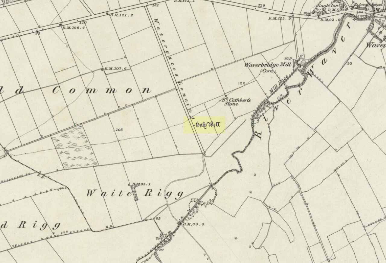
A mile east of Waverbridge, turn down the track called Watergates Lonning. Before you reach the bottom, on the left side of the straight track is a spring of water. This is the old holy well.
Archaeology & History
Although much used in bygone times, very little of it can be seen nowadays. When John Musther (2015) wrote about it recently, he told that although it was
“Once known for its copious amount of remarkably pure and sweet water, it is now only a trickle by a tree.”
Nearly three hundred yards away across the fields northeast of this small spring of water, was once seen “a pretty large rock of granite, called St. Cuthbert’s Stone“, whose mythic history will have been intimately tied to the holy well.
Folklore
In the second volume of William Hutchinson’s History of the County of Cumberland (1794), he tells that the St. Cuthbert’s Well,
“is a fine copious spring of remarkably pure and sweet water which…is called Helly-well, i.e. Haly or Holy Well. It formerly was the custom for the youth of all the neighbouring villages to assemble at this well early in the afternoon of the second Sunday in May, and there to join in a variety of rural sports. It was the village wake, and took place here, it is possible, when the keeping of wakes and fairs in the churchyard was discontinued. And it differed from the wakes of later times chiefly in this, that though it was a meeting entirely devoted to festivity and mirth, no strong drink of any kind was ever seen there, nor anything ever drunk but the beverage furnished by the Naiad of the place. A curate of the parish, about twenty years ago (c.1774), on the idea that it was a profanation of the Sabbath, saw fit to set his face against it; and having deservedly great influence in the parish, the meetings at Helly-well have ever since been discontinued.”
References:
Hutchinson, William, The History and Antiquities of the County of Cumberland, volume 2, F. Jollie: Carlisle 1794.
Musther, John, Springs of Living Waters: The Holy Wells of North Cumbria, J.Musther: Keswick 2015.
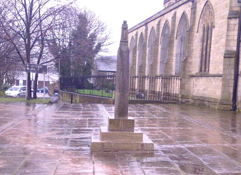
Dead easy this one! Go along North Street in Keighley, towards the main church in the middle of town (a St. Andrew’s church, previously St. Pete), by the once-infamous Lord Rodney pub, and the old stone edifice stands outside by the Green. The much better Red Pig public house is across the road from here.
Archaeology & History
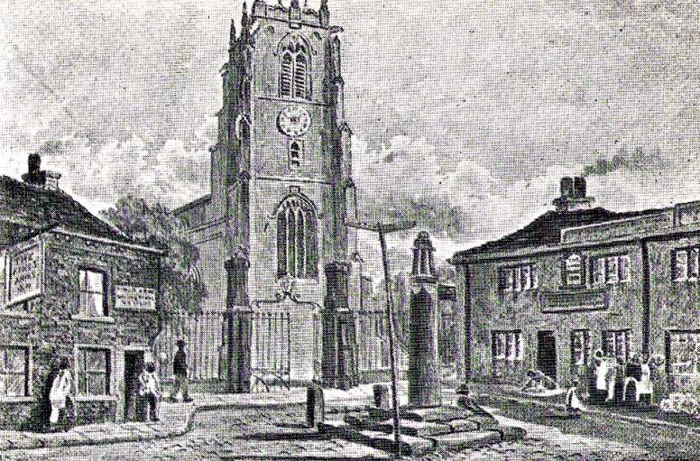
Keighley’s Town Cross, 1847 – on a painting by Edwin Riby
For a relatively trivial archaeological site, it’s got a bittova history. Not that this is an old site either! We’re not sure just when this cross was made, but it’s certainly no more than 300 years old. Before standing in its present position outside St. Andrew’s Church, sometime before 1840 it was said to have been a few hundred yards away above the present roundabout on Oakworth Road; and one record tells that it originally came from nearby Utley, a mile to the north. Due to lack of decent records, we’re not sure about its early status as a market cross, nor when it was first erected. Indeed, even the steps on which the cross presently stands are clearly more recent than the ones illustrated on Edwin Riby’s 1847 portrait, reproduced here.
Keighley Cross, on a grey wet day!
It would be good to get a complete history of this archaeological relic but it’s difficult with artifacts such as these; and although gaining access to the church now takes less time and effort than it used to (the vicar here used to be quite unhelpful, but has recently changed his ways – which is good!), it’s only open at certain times of the week.* Friday afternoons seem OK to have a look round. Please – if folk begin having trouble gaining access to the Church once more, let us know on here so we can make complaints about it. The Church is paid for by local tax-payer’s cash, and so needs to be open to all of us. Let’s hope this humble ingredient can be maintained for the good of all in this otherwise regressive social community (Keighley, that is…).
There’s also some very curious folklore to be added here in relation to the market and its cross, but its tale is gonna have to wait…
References:
Gray, Johnnie, Through Airedale, from Goole to Malham, Elliott Stock: London 1891.
Keighley, William, Keighley, Past and Present, R. Aked: Keighley 1858.
* There isn’t even a notice giving information, email or phone numbers, telling you who you can contact if you want to know anything about the history of the church, or visit it — which is quite dreadful considering how much money they get paid by tax-payers for their supposed socio-spiritual duties.
Various ways to get here, but the 2 most common are: (1) from Brunthwaite village, above Silsden, following the road uphill for a mile, then turning right (west) onto the moorland dirt-track to Doubler Stones Farm. Just before here there’s a footpath uphill (north) for 200 yards to the stones. (2) follow the Millenium Way footpath south up Addingham Moorside, onto Addingham High Moor. Keep going on the same path another 500 yards and they’ll appear ahead of you.
Archaeology & History
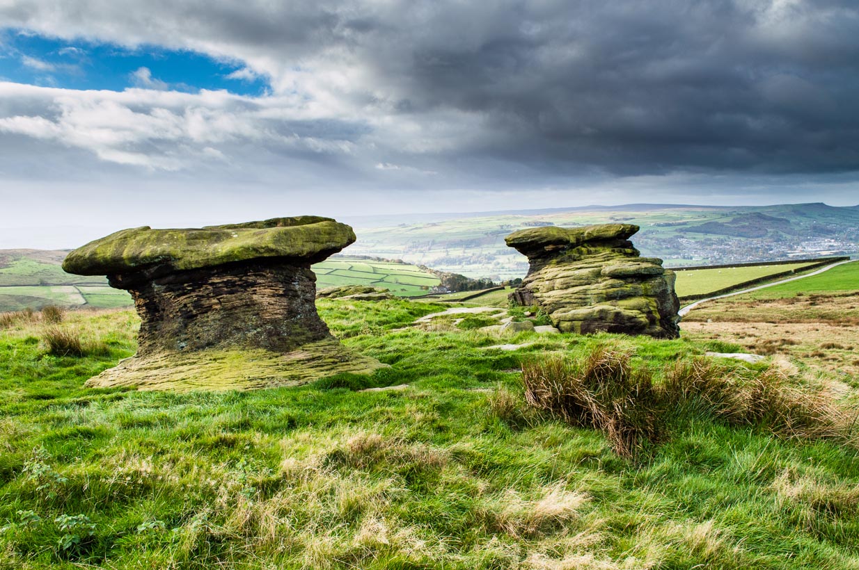
First described as the ‘Doublestones’ in the local Addingham parish records of 1786, these great mushroom-shaped rocks were later brought to the attention of archaeologists by J. Romilly Allen in 1879 and they greatly intrigued numerous Victorian antiquarians, who puzzled as much about their exotic forms as the cup-marks on their tops! Allen wrote of them:
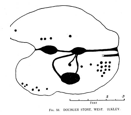
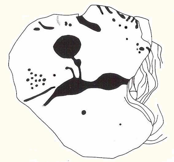
Cowling’s old drawingHedges (1986) sketch of the design
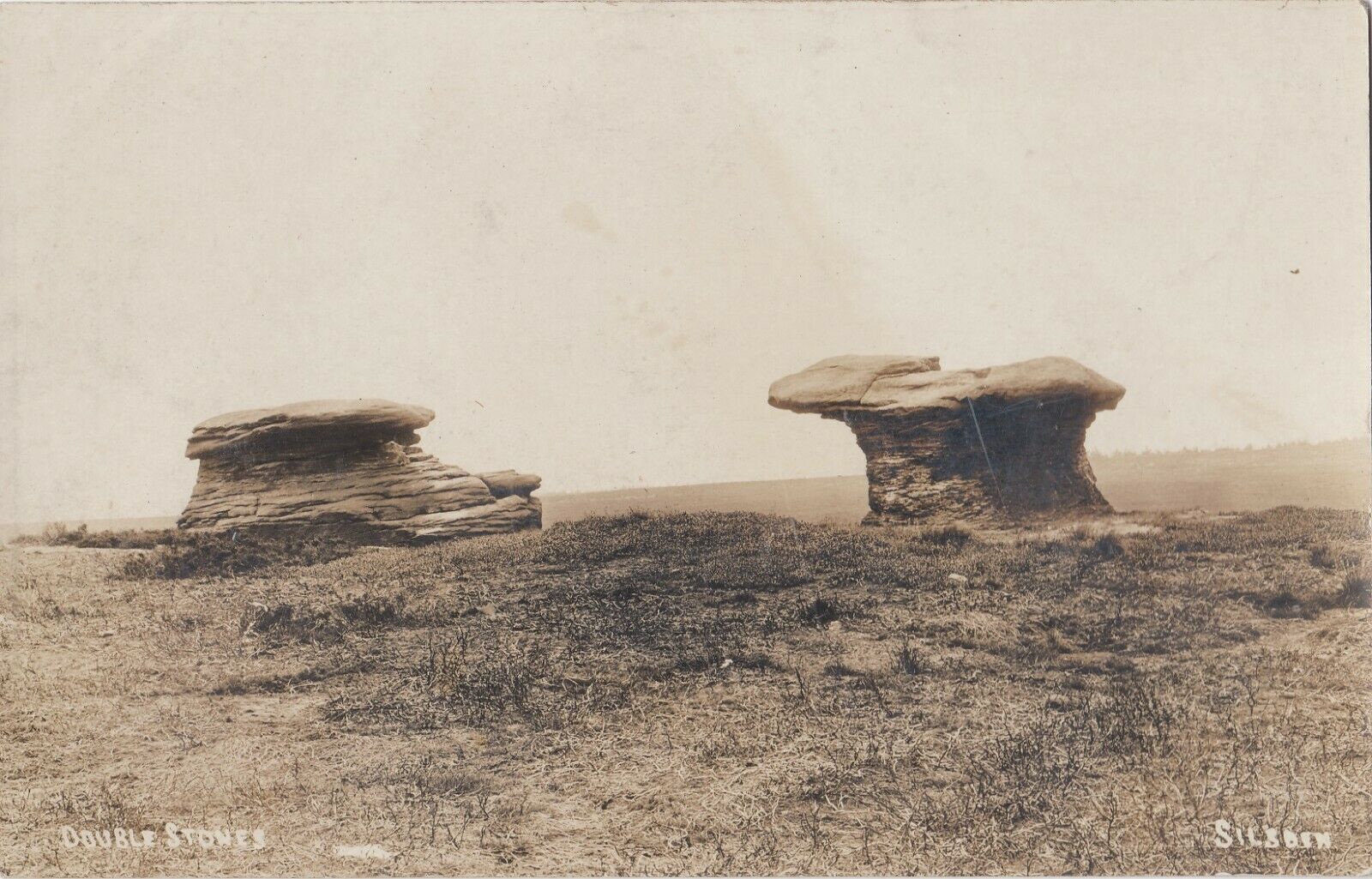
“These rocks are by far the most remarkable freaks of Nature to be seen in the district. They occupy a prominent position, perched on the extremity of a rocky knoll which juts out into the valley; and as seen from below, with their weird forms standing out clear and sharp against the background of blue sky, they present so extraordinary an appearance that they would at once attract the attention of even the most unobservant. In general outline they resemble gigantic toadstools; and I presume that they are called Doubler Stones from the fact of their shapes being almost identical. They may be appropriately described as Nature’s Twins. The upper surface of the cap of one of these stones has three large basin-shaped cavities in it. Two of these lie along the central axis of the stone, and measure respectively 1ft 3in by 2ft 9in deep, and 1ft 9in by 1ft 3in by 9in deep. They are united by a deep groove, a continuation of which runs out over the edge of the stone at each end. There is another basin lying to the west side of the two central ones, with one of which it is connected by grooves. It measures 2ft by 1ft 9in and is 9in deep. There is no direct evidence that these basins are artificial; but it is quite possible that they may have been so originally, and have been enlarged by natural agencies. But in addition to the basins, are twenty-six cup-markings of distinctly artificial origin. They vary in diameter from 2 to 4 in. One group of cups appears to be arranged in parallel rows.”
Doubler Stones, c.1890
Although the writer thought there were no artificial cup-markings on the other Doubler Stone (the one on the left in the photo), John Hedges (1986) and Boughey & Vickerman (2003) cite there to be at least two cup-markings on this rock. Other writers have given different numbers for the respective cup-marks thought to be on these rocks down the years.
If you’re into prehistoric rock-art, check this place out. If you’re a geologist and aint been here, you’ll be even more impressed!
Folklore
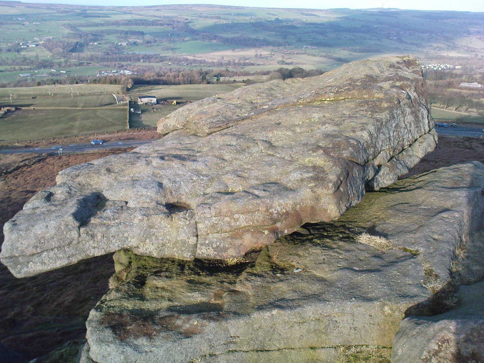
Approaching the Doublers (photo – James Elkington)
In Nicholas Size’s Haunted Moor (1934) he described the Doubler Stones as being the abode of ghosts and a place of sacrificial rites in ancient days. While in Guy Ragland Phillips’ Brigantia, we find that the word ‘doubler’ itself “is a large shallow dish, bowl or plate” – which we find on top of the greater one of these two well-worn-weirdoes. As well as being haunted, there is some other little-known, though not unexpected folklore here, which told these old stones to be the meeting place of witches in previous centuries.
In addition to this, we are told that the witches of Fewston valley to the west used to meet up with the more famous Pendle witches at these stones. One historian proclaimed that this notion was spurious, as it would be too far for the Pendle witches to walk – which says more about the historian in question than the people of previous centuries. The distance from Pendle to the Doublers can be traversed in a day and is an ideal meeting spot, away from the prying eyes of a wrathful Church, that sought war against the animistic practices of our ancestors.
References:
Allen, J. Romilly, ‘The Prehistoric Rock Sculptures of Ilkley,’ in Journal of the British Archaeological Association, volume 35, 1879.
Allen, J. Romilly, ‘Notice of Sculptured Rocks near Ilkley,’ ibid, volume 38, 1882.
Bennett, Paul, The Old Stones of Elmet, Capall Bann: Chieveley 2001.
Boughey & Vickerman, Prehistoric Rock Art of the West Riding, West Yorkshire Archaeology Service 2003.
Cowling, Eric T., Rombald’s Way, William Walker: Otley 1946.
Hedges, John, The Carved Rocks on Rombalds Moor, WYMCC: Wakefield 1986.
Jennings, Hargrave, Archaic Rock Inscriptions, A. Reader: London 1891.
Phillips, Guy Ragland, Brigantia: A Mysteriography, RKP: London 1976.
Size, Nicholas, The Haunted Moor, William Walker: Otley 1934.
Now I aint been here for a few years, but it’s hopefully still where I last left it! You need to get into the trees behind the Christ’s Church just out of the town centre, along the south-side of the Burnley valley road. (A646) When you get to the footpath which runs just above the tree-line in the woods (it’s known locally as the ‘Lover’s Walk’ path), wander along for just a couple of hundred yards. You’ll eventually get to the small spring of water and the tiny stream which runs down the slope, just to the left of the path. According to the old map I’ve got – that’s it!
Archaeology & History
This long-lost sacred well originally emerged a little bit further up the hill from where it is today. Almost nothing is known about it. Seemingly first highlighted in 1852, my first “discovery” of the place came as a result of going through some local old maps I’d had the fortune of obtaining. In Victorian days when the site was much more prominent, the old road that took you into the woods was called Holy Well Lane. Now, its memory has been subdued, and the old road is known simply as ‘Well Lane.’
A local writer, J.W. Crowther, mentioned the site in his local place-name survey, where he told that the Holy Well was a “name given to a well of excellent spring water” — but nothing more. It was later mentioned in an article by J.A. Heginbottom [1988] who wrongly reported it as being “destroyed.”
Folklore
Local tradition told that ‘memaws’ (offerings such as rags, coins, flowers, etc) used to be left here by local people in olden times, as offerings to pacify or give respect to the waters; although what time of the year these were left, and the nature of the resident deity, has all been forgotten. In very recent years however, it seems that some modern NewAge-types are now visiting the place once again.
References:
Crowther, J.W., Place Names of Todmorden, privately printed: Todmorden (n.d.)
Heginbottom, J.A., ‘Early Christian Sites in Calderdale’, in PHAS 1988.
We were up here again the other week: wind, hail and snow blowing like hell, thankfully keeping the place to ourselves! To get here, head up Cow Pasture Road from the train station and up to the Cow & Calf Hotel near the famous rocks. Go past it a 100 yards or so and then look uphill onto the moors ahead of you. You’ll see a great over-hanging rock on the slope above you which looks as though its may fall down at any moment. That’s the Pancake Stone! Either walk up the steep path to get there quickly, or the longer route by taking the sloping diagonal path that runs eastwards until you’re on the same level.
Archaeology & History
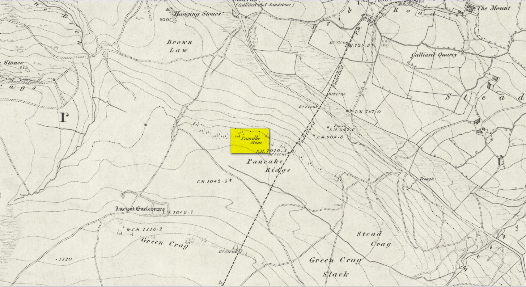
Site shown on 1851 map
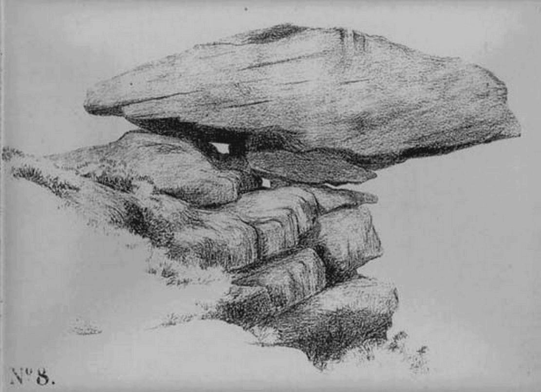
Highlighted on the first Ordnance Survey map of the region in 1851, this prehistoric carved stone had been known as the Pancake Stone by local people long before any antiquarians gave it their literary attention to the place. It would have had tales told of it, no doubt, but they were never written down. It’s an impressive, some would say precarious piece of rock: an elongated thin wedge of stone resting gently on the cliff edge, much like a rocking stone to be honest, seemingly hanging onto the edge of the geological ridge awaiting its fall down the slope; but that’s not gonna happen for many more centuries yet.
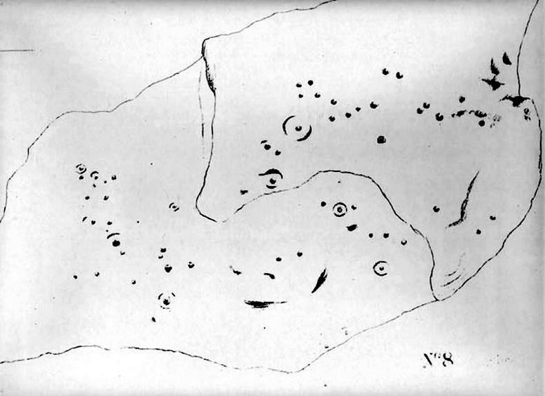
J. Thornton Dale’s 1879 drawingJ. Thornton Dale’s 1879 drawing
Much has been written about the petroglyph on the this wedge of stone, which covers much of its surface. Although a Mr J. Thornton Dale did a fine series of quite accurate drawings of this stone (and others on the moors) between 1878 and 1880, the first literary description of the Pancake rock carving appears to have been by the renowned J. Romilly Allen in 1882 (who evidently visited the stone on a cloudy or overcast day), saying that:
“On its upper surface are several cup-markings much obliterated by the actions of the weather, but some of them sufficiently distinct to prove their origin artificial, and to show that this rock was noticed in ancient times, and very possibly considered an object either of worship or superstition.”
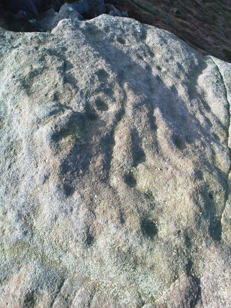
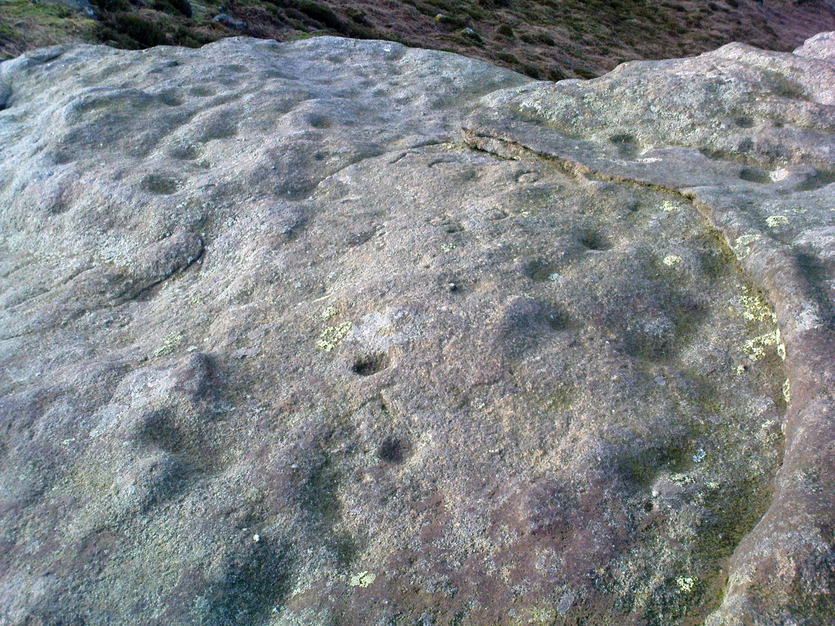
Close-up of CnRsLooking across the stone
This latter assumption is highly probable. Strong animistic notions (moreso than usual) would be very evident here. Its position on the land with its outward focus from here towards other notable points in the landscape (Almscliffe Crags is one obvious focus); as well as looking at the rock itself from other viewpoints, give the stone considerable ritual importance. Sections of the moorland plain behind it—known as Green Crag—was the Land of the Dead in ancient times, and it is more than likely that death rites would have been enacted here — though we may never know what form they took.
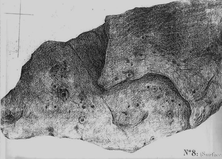
Dale’s 1879 sketch
The stone has what seems to be at least 54 cup-markings on its upper face, with numerous grooves meandering and connecting other points. In J. Thornton Dale’s 1879 drawing of the upper surface, you will note that a couple of the rings he included have all-but faded away and are not included in the more recent surveys. Of the primary design, rock art students Boughey & Vickerman (2003) described there being “six complete and five partial rings” amidst the morass, but much of the design is very worn and, originally, there was probably a bit more to it all. The rock upon which the main Pancake Stone rests also has some worn cup-marks etched on its surface, a couple of which can be made out in the top photo.
Folklore
Good old Nicholas Size (1934) added this site to his list as a place where he had visions of the old christian cult, upon whose bare face were enacted blood rites and sacrifice. One Beltane Eve when he decided to amble up onto the moor edge, he could see a strange glow coming from behind the rock. He continues:
“Then suddenly I noticed there was a figure dancing upon it. The figure seemed to swirl round and round with floating draperies, grey or white, and I can only say that it looked very uncanny. Stupidly, I wondered that anybody could be such a fool as to dance in the darkness upon that precarious footing…”
But such activities on these moors, at certain times of the year, have been enacted for many centuries. It’s just kept quiet and, as more modern pagans (as they like to call ’emselves) keep coming up here and to other places, so the original folk move to their older and increasingly more secluded spots… In the latter half of the 20th century the site was used as a focus by chaos magickians, shortly after the inception of that Current.
References:
Allen, J. Romilly, ‘The Prehistoric Rock Sculptures of Ilkley,’ in Journal of the British Archaeological Association, volume 35, 1879.
Allen, J. Romilly, ‘Notice of Sculptured Rocks near Ilkley, with some Remarks on Rocking Stones,’ in Journal of the British Archaeological Association, volume 38, 1882.
Boughey, Keith & Vickerman, E.A., Prehistoric Rock Art of the West Riding, West Yorkshire Archaeology Service 2003.
Cowling, Eric T., Rombald’s Way, William Walker: Otley 1946.
Hedges, John, The Carved Rocks on Rombalds Moor, WYMCC: Wakefield 1986.
Jennings, Hargrave, Archaic Rock Inscriptions, A. Reader: London 1891.
Size, Nicholas, The Haunted Moor, William Walker: Otley 1934.
Speight, Harry, Upper Wharfedale, Elliott Stock: London 1900.
A 2½-mile long earthwork can obviously be reached from all sorts of ways, but coming out of Flamborough towards Bridlington (B1255 road) you can go down the Home Farm road and park up; and from here walk up the pleasant woodland walk, literally from coast to coast, where you’ll see good portions of the earthwork intact.
Archaeology & History
An impressive site by any means. Running from Dykes End on its southern edge for 2½ mile, roughly north, until hitting the North Sea again at the other Dykes End, this great earthwork had little to do with the Danes. It seems to have been originally started around 3000 years ago in the early Iron Age. As Mr Gower (1975) told:
“Excavations carried out at the end of the (19th) century revealed traces of a flint workshop and many arroheads were found… The earthwork is about 18 feet high and on the western side is a ditch 60 feet wide. Several openings are to be seen, but these are probably comparatively recent.”
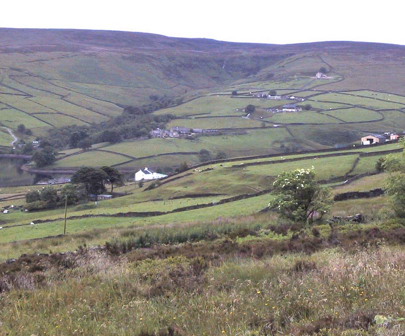
Go west through Stanbury village towards Lancashire for a mile till you reach the end of Ponden Reservoir. Where the water ends, follow the small track up to, and past, Whitestone Farm, till you reach the stream. Follow the valley up…
Archaeology & History
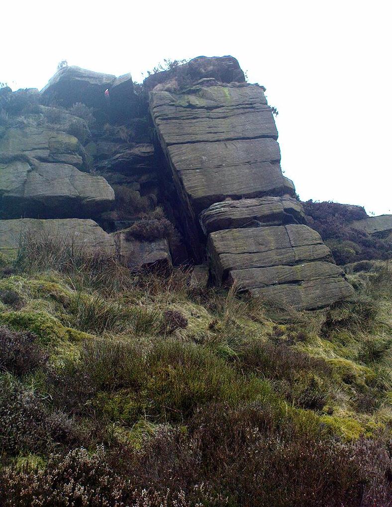
As the great Yorkshire historian J. Horsfall Turner (1879) told, “Ponden Kirk consists of a ledge of high rocks, dry in summer, but forming a stupendous cataract after heavy rain. It was here that Mrs Nicholls (Currer Bell) caught a severe cold shortly before her death.” The site is a fine one – not to be attempted from the base by unfit doods, unless you’re really serious about your climbing! But to those of us who like clambering up rocks and wholesome scenery, walk to the site via the stream (Ponden Clough Beck) and get to the cleft in the rock face. Tis a truly fine place!
Ponden Kirk from below
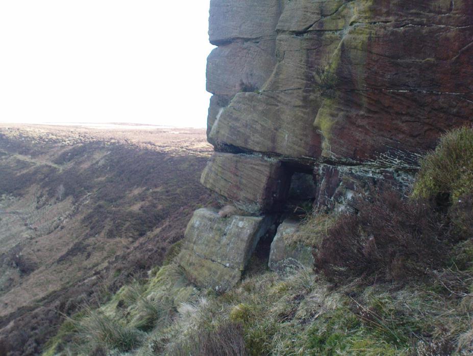
In 1913, one writer posited the notion that the opening in the rocks through which local folk crawl (see Folklore, below) “is seemingly artificial” – which aint quite true, sadly.
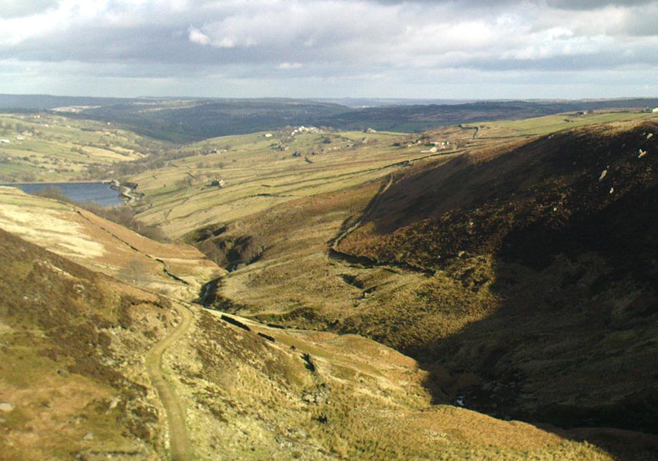
Once on the tops above the Kirk, you’ve one helluva decent view, be it raining or sunny. On the far northeastern horizon arises the great omphalos of Almscliffe Crags; and next to that is the elongated top of Baildon Hill; and a little further northeast is Otley Chevin. It would be good to visit here on a few of the old heathen days and watch the sunrise, just to see if there are any intriguing solar observations to be made! (take a tent though – or p’raps, if you’re like us, don’t bother, but you’ll be bloody cold for the night!) The only potential sunrises of heathen significance appear to be midsummer and Beltane….
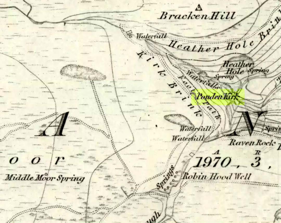
Ponden Kirk on 1851 map
For me at least, one of the things which gives this site an intriguing form of sanctity is the fact that the Kirk itself forms the head at the end of the valley. It is a very fine ritual site and would obviously have had much more to be said of it than just the heathen marriage rites which are left today. The forces of wind and rain scream from its height, and in the valley beneath the chime of the gentlest echoes resonate, giving an altogether different ‘spirit’ amidst the same land. Those old cherubs of ‘male’ and ‘female’ spirit commune potently here – no doubt being the ingredients which gave form to the marriage customs… Those of you into feng-shui (the real stuff, not the modern bollox) and genius loci should spend time with the water and rocks here and you’ll see what I mean. Archaeologists amongst you, if you dare, should amble aimlessly here for sometime…for many hours, a few times, and give yourselves a notion of the ‘ritual landscapes’ you like to write about from the safety of your textbooks, to get a bittova better notion of what ‘experiencing the land’ is actually about.
Ponden Kirk’s opening
This rocky outcrop was also said to be the place that Emily Bronte used in her Wuthering Heights novel as the place called Penistone Crags. A couple of other local writers have also added this legendary place in their tales aswell.
Folklore
Alleged by Elizabeth Southwart (1923) “to be of druidical origin,” the first literary note of this great rock outcrop appears to come from the reverend James Whalley (1869) of Todmorden, who in his romantic amblings over the moorlands here, told that if any gentleman wants to get married,
“he must by all means pay a visit to Ponden Kirk… Here ‘they marry single ones!’ Any lady or gentleman who can successfully ‘go through one part of the rock’ (which is quite possible) is declared to all intents and purposes duly married according to the forms and ceremonies of Ponden Kirk.”
The view from the top
His wording here seems to imply that the event of passing through the rocky opening, is in itself a confirmation of the ceremony of marriage, not needing the blessing of some strange christian rites. If so, this tradition would be a very ancient one indeed, making the stone the witness to the marriage event. This would be a rite witnessed by the stones themselves: a universal heathen attribute found in most of the ancient traditional cultures. But this curious unwritten history was to be echoed a decade later by that great Yorkshire historian, J. Horsfall Turner (1879), who told us that,
“at Ponden Kirk, as at Ripon Minster, a curious wedding ceremony is frequently observed. It consists in dragging one’s-self through a crevice in the rock, the successful performance of which betokens a speedy nuptial… The place is now frequently called ‘Wuthering Heights. Apart from the association of such names as Crimlesworth and Oakden (see the Alcomden Stones), fancy easily ascribes a druidical settlement at the Kirk.”
A not unreasonable assumption – though nothing of this nature, of yet, has been found.
That other great Yorkshire writer, Harry Speight — aka Johnnie Gray (1891) — echoed the same folklore telling how,
“The natives of these parts have a saying, ‘Let’s go to Ponden Kirk where they wed odd ‘uns,’ which has its origin in an old custom of passing through an enormous boulder… The belief is that if you pass through it, you will never die single. No one knows how the rock acquired its name, but the Saxon kirk suggests a temple of worship, possibly extending back to the druidical times.”
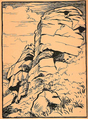
Ponden Kirk – by T. MacKenzie, c.1923
A few years later, Mr Whiteley Turner came here and he too affirmed the old wedding rites, also telling that “according to tradition, maidens (some say bachelors too) who successfully creep through the aperture will be married within the year.” This bit of info also shows that the rocks also had oracular properties – a function known at countless other sites.
The proximity of Robin’s Hood Well, just a couple of hundred yards away, beckons for association with the Ponden Kirk – which it obviously had… But that’s a tale to be told elsewhere…
This seems a bittova cheat really – and on two counts: i) I aint been here yet; and ii) we’re not sure that there’s any remains left to be seen. But these notes might produce a result, so direction pointers are worthwhile I reckon! Various ways to come, but you need to end up on the weird-sounding Bonemill Lane – whether you get there via Worm Hill Terrace or Biddick Lane aint important. Once on the right road, you wanna stand by the supposedly haunted Biddick Inn, and walk down the road a short distance until you reach a path on your right which heads up towards the ruined Worm Hill. Halfway along here – or thereaboots – the old Worm Well could once be seen.
Archaeology & History
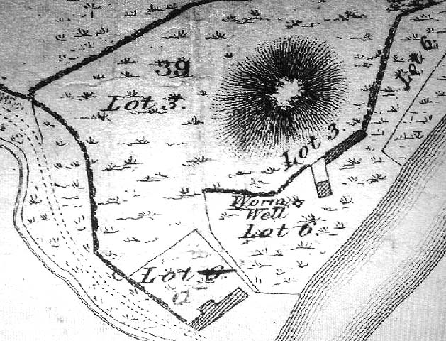
This was initially very difficult to pin down with any certainty, though after a few hours investigation, Keighley archives researcher Michala Potts found it highlighted on a field-map of the region from 1750, as the illustration here clearly shows.
Map highlighting Worm Well, 1750
During its “missing years”, several accounts describe the well as being between Worm Hill and the River Wear, which is what’s clearly shown here. So the possible confusion there may have been (which I initially had aswell) between the riverside spring opposite the pub and the now missing Quarry Well on the far western side of Worm Hill, can at least been dispelled. The position of the site was described by the holy wells writer, Alan Cleaver [1985], who told that “the well still exists, having been restored in 1974, at the foot of Worm Hill at Penshaw on the north bank of the river.” Local history records tell that a plaque commemorating the site was put here the same year; and this note is again confirmed in Paul Screeton’s [1978] excellent survey of the dragon legends hereabouts. Records from the mid-18th century tell that the Worm Well possessed “a cover and an iron dish or ladle” (Binnall & Dodds 1943) to protect the waters.
Folklore
We find from old records that in the middle of the 18th century, “it was a wishing well and a place of festivity on Midsummer Eve.” The common veneration of crooked pins were offered at this legendary site.
…And then, of course, we have the great Legend of the Lambton Worm, whose spirit form gives this site so much importance. This well-known folk-tale tells that the great serpent emerged from this very water source. In this renowned creation myth of the landscape, and the sites upon it, we have the dragon, the cailleach, the waters, and more…
“Simon, the heir to Lambton Castle, was a wild boy who never paid attention to his lessons or his elders. He liked only to play with the local boys from the village and their games were rough and annoyed other people. They went joy-riding with carts and donkeys, they stole apples from the trees, they frightened younger children. They liked to go hunting for rabbits and fishing for eels in the local river. The lord of the manor, Simon’s father, thought his son should behave better since one day he would be in charge. Simon could not be bothered.
“One Sunday, when he should have been in church, Simon played truant with Stephen, his friend, and two other boys from the village, and went fishing in the river Wear. After hours of dull waiting, chatting and eating their picnic, Simon caught a strange-looking animal. It did not look like the regular eels and small fish they usually caught. It was no longer than his finger, dark green and with two little fins on its back. Its skin was rough and scaly, and it had four short legs, with sharp clawed feet. Its face was repellent, with a long pointed snout, twelve little teeth sharp as pins, and red glowing eyes.
“Stephen peered over Simon’s shoulder at the animal. “Yuk, throw it back,” headvised. But Simon had caught nothing else, and he was intrigued by the little beast. He put it in his pouch. As the boys walked home, kicking stones and chatting, they noticed a foul smell. It came from Simon’s pouch. They were just passing the well by the castle, so Simon tossed the squirming worm in, and promptly forgot all about it….”
Binnall, P.B.G. & Dodds, M.H., ‘Holy Wells in Northumberland and Durham,’ in Proc. Soc. Antiq. Newcastle-upon-Tyne, 4th series, volume 10:2, January 1943.
Cleaver, Alan, ‘Holy Wells – Wormholes in Reality,’ in Source magazine, no.3, November 1985.
Very little appears to have been written about this site, due no doubt to lack of archaeological investigation aswell as the destructive powers of intense agricultural practices hereby. It was first described in the Yorkshire Archaeological Register and told about by a Mr. H.G. Ramm, who told us of,
“a probable cursus in the Scales, Fimber Grange and Fimber Station area. An aerial photograph taken by John Dent has entended parallel ditches previously known in fragmentary form and enabling them to be interpreted as a cursus running along the valley floor, the north ditch from SE 8939 6106 to SE 9075 6104 and the southern ditch from SE 8937 6103 to SE 9068 6102. The distance between the ditches varies from 18-27m west of Fimber Grange to 30-37m east of the Grange. A trapezoidal enclosure, 30m by 15m, possibly a small long barrow, has been identified at SE 9008 6104, oblique to the north cursus ditch, which bends to take in account of it. A group of five ring ditches, three of which are in the cursus, lies to the west of Fimber Grange, but indicate a wartime searchlight post.”
This makes the length of this monument pretty short, but the faint remains of this possible cursus are visible on aerial shots. A number of other large ancient earthworks were charted here by the famous archaeologist, J.R. Mortimer (1905), though he made no mention of this particular site.
More info please!
References:
Edmondson, T., History of Fimber, H. Smithson: Malton 1857.
Gutch, Mrs. E., Examples of Printed Folk-lore Concerning the East Riding of Yorkshire, David Nutt: London 1912.