Healing Well (destroyed): OS Grid Reference – SE 0479 4179
Archaeology & History
The Whin Knoll Well, once found bursting into life at the top of Black Hill, Keighley, got its name from the old word ‘whin,’ or gorse bushes (Ulex Europaeus)—also known in Yorkshire as the ‘Spindly Killer Bush’: a most apt title! These great spindly killer shrubs once profused where the waters of this old well used to bubble into view – indeed, there are still quite a few great old spindlies still scattered here and there!
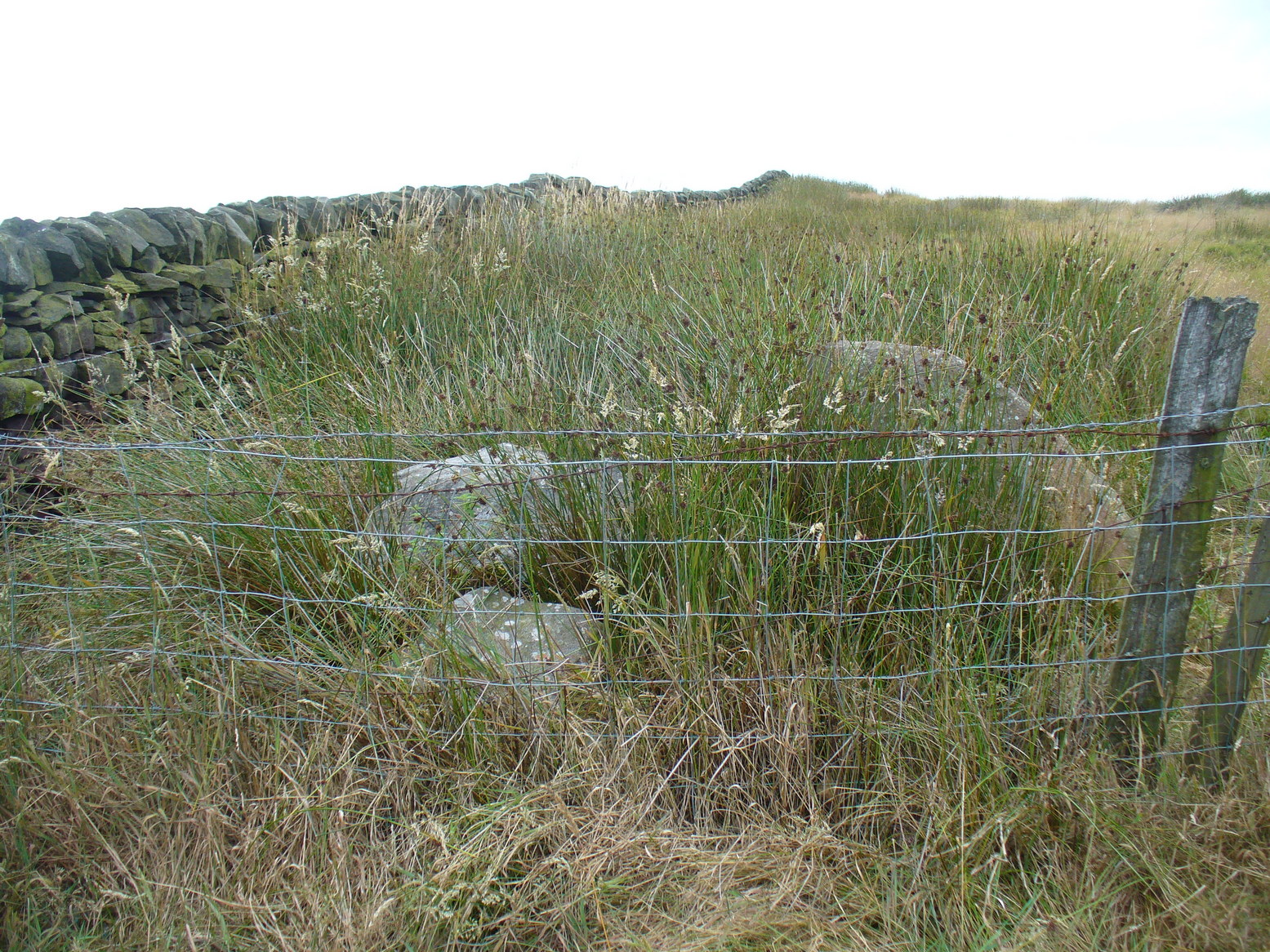
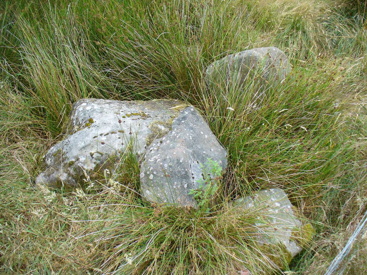
The site was shown on old maps as being just two fields east of the more renowned Jennet’s Well, but this old public water supply that once fed the local people, was covered by a reservoir many moons ago. However, a wander up here recently found the reservoir empty, but a water supply was still bubbling out of the ground into the great concrete hollow. The last remnants of the Whin Knoll Well perhaps…?
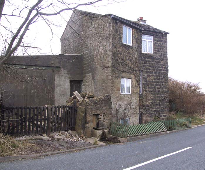
Pretty easy really. From the town centre, head up the B6143 Oakworth Road for barely 100 yards then turn right up the long steep West Lane. Just keep going. Near the very top turn sharp right onto Shann Lane. And there, on the left-hand side of the road, right next to the solitary old-looking house just 100 yards along, is our little well! (if you end up with fields either side of you, breaking into hills, you’ve gone too far)
Archaeology & History
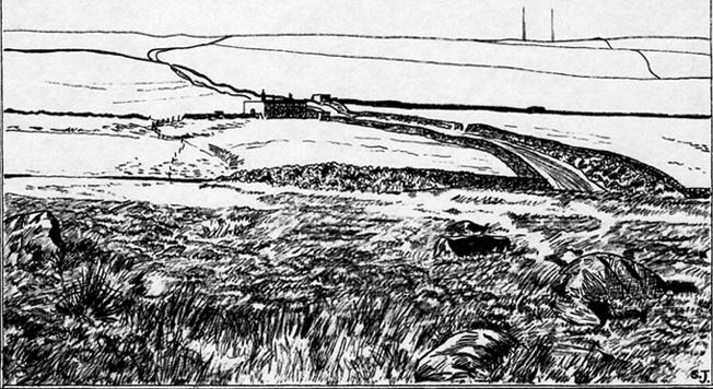
Jennet’s Well, Black Hill, Keighley (middle of the picture, next to house)
The history of this site is very scant. It was written about by local historian William Keighley (1858) as a holy well dedicated to an obscure saint, St. Jennet, although early place-name evidences don’t tell as much. Some have even suggested that the same ‘Jennet’ was the tutelary saint of Keighley and district itself. Local historian Ian Dewhirst (1974), writing about the town’s local water supply, thought that “water from a spring ‘a mile to the west’ above the town…was conveyed by stone troughs through the chief street for the convenience of house-holders,” was probably Jennet’s Well.
Folklore
Described by Will Keighley (1858) as having “great healing abilities,” its specifics were undefined. And when the great Yorkshire writer Harry Speight (1898) came here forty years later, he told of the site “having a great repute, though no one seems to know why.” Mr Keighley was of the opinion that Jennet’s Well may have been the christianized site which overcame the local people’s earlier preference of dedication at the True Well, more than a mile west of here, between the gorgeous hamlets of Newsholme and Goose Eye; but this would seem unlikely, if only by distance alone.
The name ‘Jennet’ itself initially seemed somewhat obscure. It is not recognised by the Catholic Church as a patron saint. The word could be a corruption of the personal name Jenny, perhaps being the name of a lady who once lived hereby. There’s also the possibility that the title may infer the well’s dedication to the bird – a not uncommon practice. And we also have the modern folklorists who could ascribe it to the fairy-folk, as Jennet and Jenny are common fairy names, and old wells have much lore linking the two. But as Michala Potts pointed out, bringing us back to Earth once again, a ‘jennet’ is an old dialect word for a mule. I rushed for my Yorkshire dialect works and, just as Mikki said, the old writer John Wilkinson (1924) told simply, ‘Jennet – a mule.’
References:
Dewhirst, Ian, A History of Keighley, Keighley Corporation 1974.
Keighley, William, Keighley, Past and Present, Arthur Hall: Keighley 1858.
Speight, Harry, Chronicles and Stories of Bingleyand District, Elliott Stock: London 1898.
Wilkinson, John H., Leeds Dialect Glossary and Lore, James Miles: Leeds 1924.
Dead easy! Get to Ilkley train station and look across the road to your left, cross it and walk along. 100 yards on is Cowpasture Road. Walk up it! You’ll be at the rocks in 10-15 minutes.
Archaeology & History
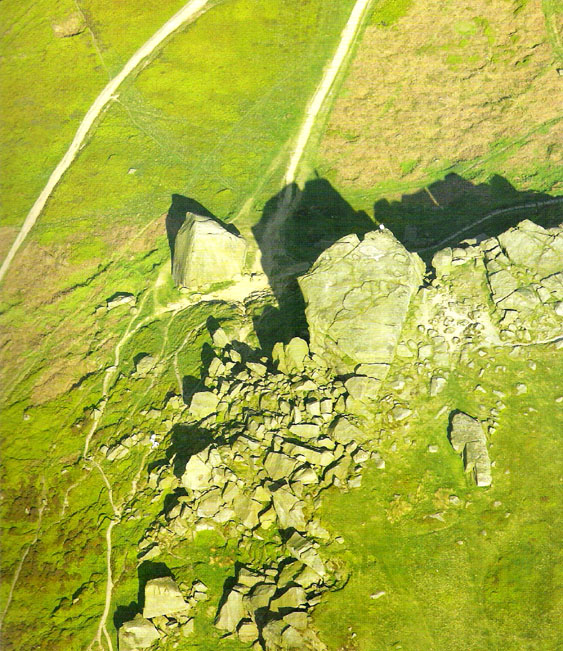
Cow & Calf Rocks from above – thanks to Ian Hay’s superb ‘Yorkshire from the Air’
There’s nowt specifically archaeocentric directly relating to these great rocks — well, nowt that’s been found out about anyway! — though all around here over the last coupla centuries people have found numerous flints, and we have various examples of rock-art (cup-and-rings) carved on rocks close by. There have been attempts to verify what may be cup-marks on both the Cow and the Calf — with the old master, Harry Speight (1900) telling how there used to be remains of cups and lines on the rocks, but apart from some well-worn ‘cups’ on some of the edges, these seem hard to find. For worrits worth: if Speight said there were some carvings here, its more than likely true.
I think the main relationship ancient man would have had with this great rock outcrop would have been a ritual one: the rocks themselves had no need of human imprints: their size and nature would deem them of great spirit indeed, to anyone with an ounce of feeling. Not sure that’s the way most modern folk would see things – but that’s to be expected I s’ppose!
Folklore
These grand rocks once had the even greater Bull Rock as a close companion. It was on top of this, wrote Eric Lodge (1939:40), that,
“the only point in the immediate vicinity of Ilkley from which a view of York Minster was obtainable. ‘Tis some sixty years ago, however, that a local tradesman recognised its value in building stone, and despite strong protests, quarried it for the construction of the Crescent Hotel, situated at the corner of Brook Street and Leeds Road in Ilkley.”
The matter was described in the Leeds Mercury in 1899, thus:
“About the year 1850 an act of vandalism was perpetrated at Ilkley, which would have been impossible in these days, when the Ilkley Local Board watches with such a keen eye anything that may enhance the historical interest of this rapidly increasing watering-place.
“Below the two huge rocks known as ‘The Cow and Calf,’ which have attracted thousands of visitors and invalids on to the breezy heights whereon they stand, stood a rock larger than the Calf, which was known as the ‘Bull.’ It was much nearer the highway than the Calf…
“The ‘Bull’ rock had its name cut in large letters on the side that lay nearest the road, and it is much to be regretted that an unfortunate dispute between the owners of the free-hold and the lord of the manor, in which the former won the day, gave them the right to break up this noble rock and cart it away for building purposes. It is said that the Crescent Hotel was mainly built from this stone, so some idea may be formed of its vast size and proportions.”
Incredible – they’ve turned a gigantic sacred rock into a large hotel! (and I’ve never been in it) Let’s hope it’s haunted to buggery! Does anyone know any Fortean history about the place?
Another legend tells that one day the local giant, Rombald (who gave his name to these moors and lived up here, somewhere, with his even greater but unnamed wife), decided to meet a friend a few miles away to the east, at Almscliffe Crags. So in just one step he strode over the Wharfe valley right across to the legendary crags, but he slightly stumbled and in doing so, left he footprint embedded on the face of the Cow Rock, which can still be seen today.
In modern times, the Cow & Calf have been the centre for occasional UFO, or earthlight sightings. But this appears to go back a bit earlier than when such curious light-forms were thought of as visiting ETs; for good old Nicholas Size (1936) reported seeing burning lights and curious figures up here — but when he saw these lights they took the form of druids and pagan spirits. One wonders what they’ll morph into next!
The grid reference here is an approximation, but the old well was definitely somewhere very close by, as evidenced by the place-name of the farmhouse. But if you wanna get here and wander about in the hope that you can re-locate this once sacred water source, go up the B1269 road north of Guisborough for about a mile. Carling Howe farmhouse is on the left-hand side of the road. Obviously the old well is somewhere close by…
Archaeology & History
The information I have of this site comes from old place-name listings. I found the reference in the directory for North Yorkshire by A.H. Smith (1928), in his entry for the etymology of ‘Carling Howe’ at Guisborough. Smith ascribes the references of ‘Kerlinghou’ (which itself appears to have been lost) to mean the ‘Old woman’s mound’ and variants thereof, also saying, “There is an unidentified place in this township called Kerlingkelde,” (12th century ref. Guisborough Cartulary)—the ‘Old Woman’s Well’. Very commonly in this part of Yorkshire—as at many other locations in northern England—a hou or howe (and variants thereof) relates to a prehistoric tomb – which is probably what we had here: a prehistoric Old Woman’s Grave with an associated Old Woman’s Well in close attendance.
The ‘old woman’ element in this name very probably relates to that primal mythic deity, the cailleach, the great prima mater of indigenous heathen folk, beloved mainly in Scottish and Irish lore, where her copious name and tales resonate to this day. This “well of the Old Woman, or cailleach“, would have been a place of particular importance in the mythic cosmology of our ancestors, but its precise whereabouts seems forgotten. There is a plentiful supply of water around Carling Howe Farm, one or more of which may once have been the site of this well. However, a lot of quarrying operations occurred here in the not-too-distant past, and this may have irreparably damaged our ability to accurately find the site – though perhaps a perusal of old field-maps could be productive.
It would also be good if we could locate the original whereabouts of the old tomb here which gave the place its name – the ‘Carling Howe’. Other ‘howe’ sites in East and North Yorkshire turn out to be prehistoric burials and I have little doubt that the same occurred here.
References:
o’ Crualaoich, Gearoid, The Book of the Cailleach, Cork University Press 2003.
Smith, A.H., The Place-Names of the North Riding of Yorkshire, Cambridge University Press 1928.
Settlements (destroyed): OS Grid Reference – SX 677 653
Archaeology & History
Prior to the submergence of one of the many prehistoric settlements in and around the waters of the Avon Reservoir, excavation work was carried out by Lady Aileen Fox between 1954 and 1956 on behalf of the Ministry of Works. The excavation notes in the Proceedings of the Prehistoric Society for 1957 told what Lady Fox and her fellow archaeologists found at the site that was due to be submerged:
“The walled enclosure of 2½ acres contained nine huts from 15-20 feet in diameter and three pens built against the outer wall. The huts were roofed in the same way as those as Kestor, having a central post and a ring of six or seven uprights supporting the main rafters. Part of the settlement was incorporated into a medieval farmstead, but the prehistoric occupation proved to be from the local Late Bronze Age.”
Since that report, a number of other prehistoric settlement sites have been found on the surrounding moorland heights (as a quick look at the OS-map clearly shows). Obviously a very busy place in ancient days!
References:
Clark, J.G.D. (ed.), “Notes on Excavations in Eire, England, Northern Ireland, Scotland and Wales during 1956,” in Proceedings of the Prehistoric Society, volume 23, 1957.
All sorts of ways to get here – all via road I’m afraid. Those southern-types aint into walking over fields and ambling about like we can do ‘ere up North. Best way to get here really, is get to Chipping Norton (a good little town with many good folk there), and ask! Take the road out of the town to Over Norton, taking the first road left as you enter the village. Go along this country lane for a mile until you reach a crossroads at the top of the hill. Turn right at the crossroads and watch out for the parking space at the roadside a few hundred yards along. Stop there and walk through the gate to go round to the other side of the trees. (if there’s a Rollright Trust member there loitering in the entrance asking you for some money to walk or sit by the stone circle – don’t give ’em it! They’ve used the cash for poisoning the wildlife in the past (killing the moles, field mice and other indigenous creatures there) and then lied about what they did (reckoning it was nowt to do with them!), so I wouldn’t trust them).
Archaeology & History
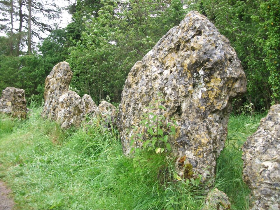
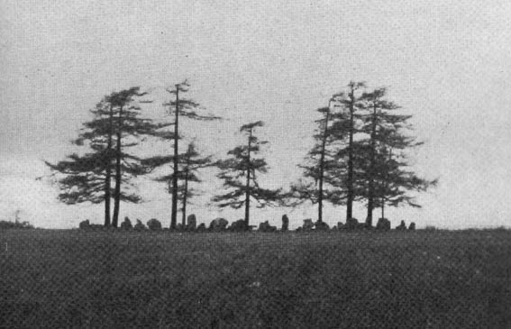
Southern arc of stones
There’s masses to be said on this site, which can’t possibly be added all in one go (I’ve literally got a full unpublished book on the many aspects of this lovely site) — so this entry will be updated occasionally with additional bits and bats of info and images as time floats by.
This remarkable and quite atmospheric megalithic complex has so much to say for itself that entire books have been written on the place (see the extensive references below), dealing with its archaeology, folklore and ritual use. I was very fortunate around the turn of the 21st century, to be able to live in an old hut that used to stand in the copse of trees just outside the circle, where I had numerous weird and wonderful experiences with people, wildlife, and what some might call the more eosteric life of the place…
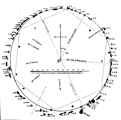
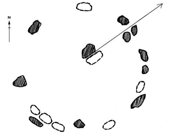
1920s Ground-planMr Taunt’s 1907 plan
The King’s Men is a near-perfect circle of oolitic limestone uprights. Thought for centuries to be the memorial site of some victory by the Danish King Rollo, they have been described by many historians, travellers and antiquarians from the 14th century upwards. Several early writers described a sort of “avenue” running from the circle, not unlike the one perceived at Stonehenge and elsewhere. Evidence for this cannot be fully disregarded, as there are some recumbent monoliths along the road beside the stone complex, known as the Jurassic Way. This was a prehistoric trade route and it is more likely than not that some other uprights would have been nearby.
The Rollright Stones were used as the prime base for what was known as the Dragon Project: an exploratory examination of potential electromagnetic anomalies that were recorded at the standing stones here by scientists, geomancers and archaeologists who were involved daily monitoring work over many years. Much of this was published in Paul Devereux’s book, Places of Power – required reading for everyone who pretends an interest in megalithic sciences.
Northern section of the ring
The Rollright complex today consists primarily of three sites: the Whispering Knight’s portal dolmen, the King’s Men stone circle, and the King Stone. Of these, it is the stone circle which draws most attention. Several alignments are connected with the complex. The original ritual use of the place would have, primarily, involved rites of passage and death rituals; though it seems obvious that menstrual rites were also an important social event here. After dark, this stone circle has distinctly ‘female’ spirit, sometimes manifesting in a quite wrathful form (please don’t confuse any of the modern witchcraft mythos with such things – they are fundamentally different in both social and ritual aspects). Women obviously played a large part in the ritual use and geomantic layout of the original complex. It also seems likely that the stone circle was used as a moot spot, which may have been in use until medieval times. The recent discovery of the carving of a family crest, at least 500 years old, implies this.
Until Tom Wilson and I lived in the hut at the circle in the 1990s, previous reports of ‘carvings’ at the stone circle were few and debatable. But two of the stones in the Rollright circle have quite distinct carvings on them. The most pronounced is etched on the tallest stone (stone 1 – Barnatt Survey) and comprises of a typical heraldic shield – although we cannot, as yet, ascertain the motif in the middle of the shield. This was first seen by a visiting tourist who wanted to remain anonymous, but the finding was written up in an article I wrote shortly afterwards. (Bennett 1999) The image below – reproduced courtesy of Alistair Carty’s Archaeoptics Limited laser scanning company – clearly shows the carving, which confirmed the initial discovery. The report of his findings can be read here.
Not unsurprisingly, since the discovery of the shield various screwy interpretations have been put forward to account for the design. My favourite has to be the one suggested by a pagan friend of the Rollright Trust, who, occult-like and all secret (y’ get the drift) reckoned it was all to do with King Arthur! Needless to say, my response of, “Y’ talking bollox mate!” was received somewhat nervously by pagan Karin Attwood and the twee little entourage who were discussing the shield, in the usual ‘secrecy – secrecy’ hush-hush tone of false witches and similar idiots!
A few months later I found another set of carvings on stone 62 (Barnatt survey), comprising a set of Ogham letters. These Ogham are very faint and are best observed before midday, when lighting conditions highlight them much clearer. If anyone can decipher them, it would be greatly appreciated. (though please don’t gimme some shit about King Arthur)
Folklore
Folklore ascribes that the number of stones in the complex cannot be counted (a motif found at other megalithic sites) and, intriguingly, of the surveys done here, no two are the same! One early illustration of the circle shows 30 stones, nother describes 46, and one survey describes just 22 stones! As the 20th century progressed the numbers increased dramatically, with surveys differing at 58, 60, 71, 72, 73, 77 and 105. The present-day ‘guesstimate’ is about 77. Weird!
Folklore tells that if you can count the stones three times in a row and get the same number, you may have any wish you choose. But recently this has become reversed and it is said to be a curse if you count three times the same. Intriguingly, modern visitors who allege no superstitious beliefs, will not count the stones a third time if the same number crops up twice.
The best-known folk tale of this place is of the King, his men and the knights, who “were once men who were changed into vast rocks and fossilised,” as Camden first put it in 1586. The King’s men sometimes go to drink at a well near Little Rollright, as does the king, but he only goes at certain times. At midnight however, on certain days, the King’s Men have sometimes been known to come to life, join hands and dance in a circle. This sounds more like a folk remnant of ritual use here.
Faerie folk are said to live beneath the circle, in great caverns, some of which are linked up to the single monolith across the road. Ravenhill [1926] described how local folk had sometimes seen the little people dancing around the circle by moonlight, but nobody has seen them of late.
References:
Anonymous, The Rollright Stones: Theories and Legends, privately printed, n.d.
Anonymous, ‘Oxfordshire Mysteries,’ in The Ley Hunter 86, 1979.
Aubrey, John, Monumenta Britannica, Milbourne Port 1980.
Barnatt, John, Stone Circles of Britain (2 volumes), BAR: Oxford 1989.
Bennett, Paul, ‘Remarkable Carving found at the King’s Men Stone Circle, Rollright, Oxfordshire,’ in Right Times 5, 1999.
Bennett, Paul & Wilson, Tom, The Old Stones of Rollright and District, Cockley Press: London 1999.
Bloxham, Christine, Folklore of Oxfordshire, Tempus 2005.
Bord, Janet & Colin, The Secret Country, Paul Elek: London 1976.
Bord, Janet & Colin, A Guide to Ancient Sites in Britain, Paladin 1979.
Brooker, Charles, ‘Magnetism and the Standing Stones,’ in New Scientist, January 1983.
Burl, Aubrey, A Guide to the Stone Circles of Britain, Ireland and Brittany, New Haven & London 1995.
Burl, Aubrey, Great Stone Circles, Yale University Press: New York & London 1999.
Burl, Aubrey, The Stone Circles of Britain, Ireland and Brittany, Yale University Press 2000.
Clayton, Peter, Archaeological Sites of Britain, Weidenfeld & Nicolson: London 1976.
Cooper, Roy, ‘Some Oxfordshire Leys,’ in The Ley Hunter 86, 1979.
Cowper, B.H., ‘Oxfordshire Legend in Stone,’ Notes & Queries (1st series), 7, January 15, 1853.
Crawford, O.G.S., Long Barrows of the Cotswolds, John Bellows: Oxford 1932.
D., A.J., ‘Rollwright or Rollright,’ in Notes & Queries, 2nd series, 7, 1859.
Devereux, Paul, ‘Is This the Image of the Earth Force?’ in The Ley Hunter 87, 1979.
Devereux, Paul, ‘Operation Merlin,’ in The Ley Hunter 88, 1980.
Devereux, Paul, ‘Operation Merlin 2,’ in The Ley Hunter 89, 1980.
Devereux, Paul, ‘The Third Merlin,’ in The Ley Hunter 92, 1981.
Devereux, Paul, Places of Power, Blandford: London 1990.
Devereux, Paul, The Sacred Place, Cassell: London 2000.
Devereux, Paul, Steele, John & Kubrin, David, Earthmind, Harper & Row: New York 1989.
Devereux, Paul & Thomson, Ian, The Ley Hunter’s Companion, Thames & Hudson: London 1979.
Dyer, James, Discovering Regional Archaeology: The Cotswolds and the Upper Thames, Shire: Tring 1970.
Evans, Arthur J., ‘The Rollright Stones,’ in Trans. Bristol & Glouc. Arch. Soc., 40, 1892.
Evans, Arthur J., ‘The Rollright Stones and their Folklore (3 parts),’ in Folklore Journal, 1895.
Graves, Tom, Dowsing, Techniques and Application, Turnstone: London 1976.
Graves, Tom, Needles of Stone, Granada: London 1980.
Graves, Tom (ed.), Dowsing and Archaeology, Turnstone: Wellingborough 1980.
Gray, William, The Rollright Ritual, Helios: Cheltenham 1975.
Grinsell, Leslie V., The Ancient Burial Mounds of England, Methuen: London 1936.
Grinsell, Leslie V., The Rollright Stones and their Folklore, Toucan Press: Guernsey 1977.
Hamper, W., ‘Observations on certain Ancient Pillars of Memorial, called Hoar Stones,’ in Archaeologia, 25, 1833.
Hawkes, Jacquetta, A Guide to the Prehistoric and Roman Monuments in England and Wales, BCA: London 1973.
Higgins, Geoffrey, The Celtic Druids, Rowland Hunter: London 1829.
Krupp, E.C., In Search of Ancient Astronomies, Chatto & Windus: London 1979.
Lambrick, George, The Rollright Stones: The Archaeology and Folklore of the Stones and their Surroundings, Oxford Archaeology Review 1983. (Reprinted and updated in 1988.)
Cup-and-Ring Stone (lost): OS Grid Reference – SE 142 396
Archaeology & History
Listed in Boughey & Vickerman’s (2003) survey as ‘stone 186,’ I first came across a reference to this carving when I was young, in a short article by Sidney Jackson (1964) in his Cartwright Hall archaeology journal. A letter was sent to Mr Jackson in 1963 by a Mr Bernard Stubbs of Baildon, who wrote:
“This morning I visited Hope Farm, Baildon, where Mr Jim Bell, the farmer, told me of a cup-and-ring boulder which he had discovered while digging a hole to bury a sheep, in the polt of land at the rear of the farmhouse… He stated that the hole was covered with cup-and-ring markings. Unfortunately, the hole has been filled and concreted over.”
And no one has seen it since then! Damn! Recently we discovered a cup-marked stone carved on a now-upright stone in old walling in one of the fields immediately west of the farm, but it’s obviously a different one from that described in Mr Stubbs’ letter. There are several other carvings in this region that are not in the official records, but this particular ‘lost’ stone remains lost for the time being!
References:
Boughey, Keith & Vickerman, E.A., Prehistoric Rock Art of the West Riding, WYAS: Wakefield 2003.
Jackson, Sidney, ‘New Cup-and-Ring Boulder,’ in Cartwright Hall Archaeology Group Bulletin, 9:1, 1964.
Cup-and-Ring Stone (destroyed?): OS Grid Reference – SE 129 379
Archaeology & History
Over the years, many of us have looked for this site but without any success. If it hasn’t actually been destroyed, it could be in someone’s garden wall, probably without them even knowing about it. Indeed, even the grid reference given here is only an approximation (mine differs from the one cited by Boughey & Vickerman, who put the carving closer to SE 126 381) and the stone could have been a few hundred yards either side of here. The main description of it comes from a letter written by a Mr T.P. Noble in 1964, which was cited in Sidney Jackson’s article ‘Hirst Wood Cup-and-Ring Boulder,’ in Bradford’s Cartwright Hall archaeology journal, where Mr Noble wrote:
“Mr Cooper, who built these houses (Hirst Wood housing estate) about 1935, once told me that there was a perfect example of a cup-and-ring stone here, but later, when he came to search for it, he couldn’t find it. It appears it must have been removed and possibly broken-up when the foundations of the houses were excavated.”
Of course, as we don’t know the exact whereabouts of the carving, nor have we been left with an illustration of the stone, it’s difficult to say whether the description given by the great archaeologist Sir Mortimer Wheeler in 1958, is referring to the same carving. Wheeler told us that one day in his childhood when he was out walking with his father, R.M. Wheeler, they came across a seemingly unknown prehistoric carving, saying,
“On one memorable day in the woods beyond Saltaire, we found an unrecorded cup-marked stone (later, I believe, recorded by my father in a British Association Handbook)” – that work being the Handbook to Bradford and Neighbourhood (1900), edited by R.M. Wheeler.
Naathen…if there are any people from the Hirst Wood area reading this and who might know of an old carved rock stuck in some old garden walls nearby, let us know. You’ll be credited as the person who re-discovered this long lost carving – and we can get the story in the local newspaper.
References:
Boughey, Keith & Vickerman, E.A., Prehistoric Rock Art of the West Riding, WYAS: Wakefield 2003.
Jackson, Sidney, ‘Hirst Wood Cup-and-Ring Boulder,’ in the Cartwright Hall Archaeology Group Bulletin, 9:2, February 1964.
The best and easist way to get here is to drive west past Dick Hudson’s pub along the moor road for about a mile till you reach the left turn of Heights Lane. Stop here! (if you’re now going downhill to East Morton, you’ve gone past it) On the opposite side of the road is a gate and a footpath onto the moor at the spot called Fenny Shaw Low Well (small copse of woods adjacent to your right). Walk a quarter-mile up the path, bearing left where the path diverges (ignoring the ‘Private’ sign) and head for the derelict building. Less than 100 yards before it, notice the large boulder to your right, on the slope – that’s it!
Archaeology & History
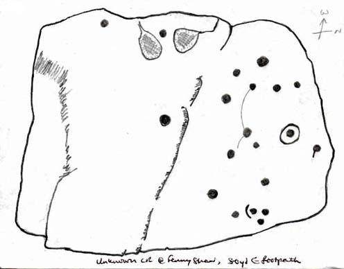
Old inaccurate drawing, c.1982
I first came across this on one of my countless ambles on these moors as a teenager. It was a cold, windy day as I recall – hence the reason for my sketch of the stone being a bit vague! The bit of paper on which I drew it, was included in one of my unpublished hand-written booklets. A few years later an image of the carving appeared in Mr Hedge’s (1986) fine collection, in much better detail than my scratty little pic!
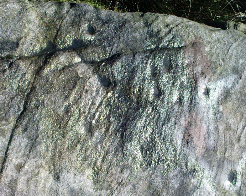
Some cup-marks highlighted
It’s a ‘big rock’ and stands out on the slope here. There’s at least one complete cup-and-ring which is visible on the northern edge of the rock and there are between 17 and 30 other cups scattered across its surface, which has been greatly eroded by our timely forces of wind, rain, ice and snow.
Hedges’ 1986 sketch
In ambling around looking at the other stones in the vicinity, along with finding the small Littlestone cup-marked rock further up the slope, we also found, just below the faded old Big Stone, another quite large rock upon which, quite recently, someone has decided to etch four complete cup-and-ring symbols. These appear to have been done either to,
i) assess degrees and speed of erosion on rock carvings;
or,
ii) pure artistry.
Whichever it may be (and there’s been various cries of “vandalism” when such carvings have been etched by some folk on otherwise virgin rock over the years), let it be known that the Big Stone’s partner was etched c.2008-9. Does anyone out there know who did this ‘new’ carving?
References:
Boughey, K.J.S. & Vickerman, E.A., Prehistoric Rock Art of the West Riding, WYAS: Leeds 2003.
Hedges, John (ed.), The Carved Rocks of Rombald’s Moor, WYMCC: Wakefield 1986.
Stone Circle (destroyed): OS Grid Reference – SE 0898 4393
Also known as:
Bradup Bridge
Brass Castle
Kirkstones Circle
Archaeology & History
Lay-out of the site, c.1929 (after Raistrick)
Not far from the little-known site of Beacon Hill, this once important megalithic ring was described by Arthur Raistrick in 1929 as “the finest stone circle” in West Yorkshire. Sadly however, the complete destruction of the place in recent years has now left us with nothing to go by (you would think such actions were illegal, but we’ll come to that shortly).
The site measured thirty feet across and, until only a few years back, had a distinct embankment surrounding it. In 1885 Robert Collyer described 18 stones here; but in Raistrick’s (1929) survey only 12 were visible. He told:
“The circle is situated on the west side of the Keighley to Ilkley road, in the rough pasture called ‘Brass Castle’…immediately south and west of Bradup Bridge. The circle is approximately 30 feet diameter, but has been very damaged at some period since 1885. At that date 18 stones were standing, but now only 12 remain, though there are large unfilled holes on the sites from which the other stones have been removed. There are slight traces of a bank, but the most notable feature is the large size of the stones (millstone grit from the neighbouring escarpment) of which the circle has been made. There are some traces of a double circle, but it is not possible to be sure of this now. It seems certain that the stones were removed from this circle to repair the neighbouring Bradup Bridge, an act of vandalism always to be deplored… There is no appearance of this circle having been used for interment, nor any record extant of exploration.”
When Eric Cowling (1946) visited the site in the 1930s, his notes indicate that it was much as Raistrick had described a few years prior, telling:
“This circle is situated at the west side of the Keighley-Ilkley road near Bradup Bridge on the Airedale side of Rombalds Moor, near the crest. Only twelve stones remain standing; these are large and apparently obtained from the nearby escarpment (Kirkstones, PB); holes mark the site of stones removed. The ring is thirty feet in diameter with some traces of a circular bank; the position of some stones suggests that the circle may have been continuous. I have heard this place referred to as ‘Kirkstones’ and ‘Brass Castle’, both suggestive names.”
A newspaper account of the site in 1960 reported that 12 stones were still in situ and that “there are large holes from which the other stones have been removed.” This fact was echoed by a local walker, Ken Pickles, who knew the site well and said:
“I first walked this moor in 1945,” he says. “In the late 1960s there were definitely 12 there. It was a perfect stone circle. It offends me that children should be denied things like this.”
As if to affirm the status and number of stones again, when archaeologist Ian Longworth (1965) wrote about it he told that,
“Twelve stones remain in this badly damaged circle, which measures about 30 feet across. The stones are of local millstone grit. Several seem to have been removed from the site to repair Bradup Bridge.”
Sid Jackson’s old drawing
By 1995 only one stone was in situ, but a very distinct, albeit low circular embankment was still in evidence. I sat here quite a few times when I was young, munching mi sarnies, having a rest, alone and with friends (once in the company of holy wells author Edna Whelan and fellow rock art researcher and author Graeme Chappell) before journeying back home. It looked that at least one other stone was buried just beneath the grassy surface on the northeastern side of the banking.
Bradup is included in the respective archaeological magnum opuses of both Burl (2000) and Barnatt (1989); where the latter visited the site in the 1980s and thought it may have been “the last vestiges of a cairn.”
Arthur Raistrick’s (1929) plan shows that at least two stones stood near the centre of the circle, which may have related to a solstice sunrise alignment with the old standing stone at nearby Black Knoll hill on Morton Moor (replaced at an unknown date in the past by a stone cross). And when Mr Raistrick told this to be the best stone circle in the region, he knew what he talking about! He had surveyed many other prehistoric remains and was the leading archaeological authority in the region at the time. Today, we have no such professional authority in the region who is worthy of such an accolade. The sorry series of events that led to the destruction of Bradup’s stone circle took a little time to emerge, but after a series of emails to various departments several years ago, the culpability seemed to spread across several people, each of whom made simple mistakes; but these were mistakes that have led directly to Bradup’s demise. I hope some of you will forgive me telling its story…
Bradup stones removed & dumped near wallBradup stone remains dumped in a pile
I first received an email from a colleague in 2002 asking whether or not I was aware of what seemed to be the final destruction of the Bradup stone circle, as the land-owner from Upwood Farm had been over the field and uprooted some buried stones — plus the last visible upright in the ring — and moved them into a pile at the top southern-end of the field in which the circle previously stood. So a small bunch of us went over to have a look and, much to our horror, found the report to be true. The field itself had been completely levelled and the circular embankment flattened, with the upright stone and any buried ones dragged and dropped into the pile of stones that obviously constituted the megalithic structure we’d sat within and visited so many times down the years up against the wall at the top of the field. Someone — the land-owner it seemed — quite recently in early 2002, had destroyed the Bradup stone circle.
How the hell had this happened…!? So, I contacted those who were supposed to look after the welfare of such monuments.
In 2006, Pippa Pemberton was the person working for English Heritage who had the stately title of ‘Field Monument Warden for West Yorkshire’ and elsewhere — and it was Pippa who told the sorry tale, albeit through the well-disguised erudition of avoiding blame to anyone. Amongst several allegedly ‘professional’ archaeologists who I emailed, it was one to Neil Redfern that was responded to, eventually. As you’ll read below, my email asks how this stone circle had been destroyed, with the lengthy ‘explanation’ giving the official reasoning:
Bradup Stone Circle Destroyed
From: Paul Bennett Sent: 10 March 2006 14:05 To: REDFERN, Neil Subject: Stone circle destroyed nr Ilkley
Hello there!
I sent you an email quite a long time ago (below) concerning the complete destruction of Bradup stone circle on Ilkley Moor, for which I have heard nothing since. I wonder, out of respect, if you could either let me know the circumstances surrounding my query, or perhaps pass me on to the relevant person:
“Out of interest (and on the same moorland region) I wonder if you could let me know who it was from English Heritage who de-scheduled a site once known as the Bradup stone circle (also known as Kirk Stones) after a visit to the place a few years ago? (SE 0897 4393) The incorrect site/location was examined and the real stone circle, close by, was subsequently destroyed by the adjacent land-owner. Evidence of the destruction is still there at the top of the field in the form of a few oddly-piled small boulders.
“I think it important that whoever de-scheduled this site should be taken to task for their error. (I don’t mean sack the poor soul, although it’s evident that some re-training is probably in order.) or perhaps the land-owner taken to task for the destruction of the site.
“I would be interested to hear what you, or one of your fellow workers, think about what’s happened here.
Best wishes – Paul Bennett”
Sometime later, I received the following response:
“Dear Paul
Your email was passed on to me by Neil Redfern, as I am currently the person dealing with scheduled monuments in West Yorkshire. Please accept my apologies for the delay in responding to you – we have been working with Heritage Action on this issue, and it was accidentally assumed that you were associated with that organisation too.
In response to your query I have copied an extract from a recent letter I sent to Heritage Action about Bradup, outlining the history of the case and the justification for its descheduling. I hope that this text answers your concerns. For your information, should you require any further assistance with this case, I recommend that you return to me quickly as I am due to start maternity leave at Easter and we do not yet know who will be dealing with this casework in my absence.
With best wishes
Pippa Pemberton,
English Heritage Yorkshire Region, Field Monument Warden – West Yorkshire & Districts of Scarborough & Ryedale.
Scheduling and location of the Bradup site
Scheduled Monuments are currently provided statutory protection under the 1979 Ancient Monuments and Archaeological Areas Act, which replaced earlier legislation and is itself currently under review by the government (DCMS) in their Heritage Protection Review. Scheduled Monuments are a land-based designation, which means that they are fixed in space, with defined boundaries within which specific protection applies. The legally protected location of a Scheduled Monument is recorded on maps and described in associated documentation. Together these documents provide the legal record of the site and are the basis on which protection is applied.
Our records show that a site at Bradup was scheduled as a stone circle in 1933 at grid reference SE 0895 4391, based on information provided by a partial survey of the site made by Dr A Raistrick in 1920 and on reports recorded in 1885. This site was known by the name of Bradup Stone Circle. The location of this site is shown on the map attached to this email.
Subsequently the Ordnance Survey visited the site in 1961, when R Emsley undertook a measured survey of the locations of the stones and hollows included within the scheduled site. However he noted that the stones appeared, by that stage, to be haphazard in their distribution and he appears to have been unconvinced by the description of the site as a stone circle. On the basis of this visit by Emsley, the Bradup stone circle was marked on the 6” Ordnance Survey map, with the location given by Emsley as SE 0895 4392. In addition, Emsley noted that the unscheduled site known as ‘Kirkstones’ was located nearby at SE 0907 4479, but did not describe this site. We have no information on file about this site.
Visits were then made to the scheduled Bradup site by two Royal Commission / English Heritage Field Monument Wardens in 1981 and 1985, with the purpose of monitoring the management of the site. Both of these officers found the site difficult to distinguish, noting stones in a rough pasture field.
Subsequently, it appears that several other locations have been claimed for the Bradup Stone Circle across several fields in the locality, including SE 0897 4393 (Paul Bennett). This latter would place the circle within the adjacent improved pasture field and outside the previously scheduled area.
Descheduling the site
During 1994, a visit made to the site at SE 0895 4391 under the English Heritage Monuments Protection Programme (MPP) noted that the site described by Raistrick does not correspond with the remains then visible. According to this MPP officer, the spatial relationships between the stones and stone holes differed from those Raistrick recorded whilst he also appeared to have omitted others. In their opinion, the scheduled site was not a stone circle, but “a haphazard group of rocks … situated on a hillside which has been quarried and has naturally occurring gritstone boulders. The site itself consists of a random collection of boulders and small holes left by stone quarrying on a slight rise and has a roughly rectangular hollow in the centre which may be an excavation.” “The site is lacking in any of the other features normally associated with stone circles … Whether the extra stones represented by the stone holes are taken into account or not there are no grounds for considering this site to be a stone circle or any other type of prehistoric monument. It is therefore recommended for descheduling”.
Subsequently the recommendation for descheduling would have passed by the officer to the Monuments Protection team, who would have passed it to the relevant Inspector of Ancient Monuments for their consideration and approval. It would then have been passed to a committee of archaeological advisors for their consideration and approval before finally being submitted to the Department of Environment (now DCMS) for their approval and action.
Review visit to the descheduled Bradup site
In response to Heritage Action’s concerns, a site visit was undertaken to the descheduled site by several members of English Heritage’s Heritage Protection team in November 2005. At SE 0895 4391 they observed a number of exposed stones in a rough pasture field, some earthfast, and also hollows that may represent removed stones. The team could not relate the remains at this location to either Raistrick’s description or the Ordnance Survey drawing and concluded that the remains at this location had been mis-attributed (comprising natural boulders and quarrying) and that descheduling was the appropriate action. If a stone circle had been located in the nearby improved pasture field, which was never protected by scheduling, then any remains have been removed. “Either way [they conclude], de-scheduling was the correct action, and unless evidence is produced that demonstrates surviving prehistoric remains no further action should be undertaken”.
Conclusion
In conclusion then, the site afforded legal protection between 1933 and 1995 as a Scheduled Monument was located in the rough pasture field at SE 0895 4391. Since the 1970s several successive archaeologists have been unable to locate the remains of a stone circle in this location, leading to an interpretation of mis-attribution and the descheduling of this site; an interpretation that has recently been upheld by the Heritage Protection team. There has been no landscape change in this area subsequent to descheduling, with the land-use remaining as rough pasture and the previously protected stones and hollows remaining in place.
Other accounts place a potential stone circle in a nearby field. This potential site was never subject to any legal protection as a designated Scheduled Monument, and any potential surface remains have been removed by the farmer, within his legal rights, during its conversion to improved pasture.”
In this reply, notice the remark describing the position of the circle: “Our records show that a site at Bradup was scheduled as a stone circle in 1933 at grid reference SE 0895 4391, based on information provided by a partial survey of the site made by Dr A Raistrick in 1920 and on reports recorded in 1885.” This is either deliberate misinformation, or bad record-keeping, as neither Robert Collyer’s 1885 reference, nor Arthur Raistrick’s 1929 account cites such a grid-reference. It is possible that when the Ordnance Survey lad, R. Emsley, visited here in 1961, that he looked at the wrong dubious ‘ring’ of low stones over the fence into the heather. Somehow he, or his subsequent record-keepers, mistook what Raistrick said were the “most notable feature (are) the large size of the stones”, for the small earthfast rocks over the fence. This is very poor when you consider that the 1970s 1:10,000 OS-map of this area clearly shows the circle to be in the field, indicating that the Ordnance Survey fella had been, seen and recorded it correctly.
One final element on this “grid-reference” error: I have in front of me the List of Scheduled Monuments in the Bradford District (“The Schedule is currently not available on” their website cos the people who get paid to do such a thing can’t be arsed), dated from the 1990s. The “Bradup stone circle near Bradup Bridge, Morton” is cited as being at “SE 0900 4400” and not the OS grid reference described in the explanation about the site’s destruction. Funny that innit…?
There’s much more that I could say in response to this excuse for de-scheduling and allowing the destruction of Bradup stone circle, but I’m hoping that people can see for themselves that ‘excuses’ are the order of the day in this report. Simply put: the Bradup stone circle was destroyed due to the ineptitude of ‘authorities’ mistaking several natural earthfast rocks at the grid-reference they give (if indeed even that’s the right one for it!) for the real prehistoric circle in the adjacent field. In short, they fucked up – and the email above is their attempt at an excuse to cover up their mistakes. We all know how they cover each others backs when they screw up. If you or I did this, we’d be in court.
Folklore
Also known as the Brass Castle and the Kirkstones (indicating it as a place of worship), Cowling (1946) told how “local lore suggests that the place is haunted.” The name Kirkstones derives from the rock outcrop 800 yards north of here, where the stones which made this site may have come from. A dowsing survey found there to be water beneath the circle, but this wasn’t mapped.