Take the A816 out of Lochgilphead and head north as if you’re going to Kilmartin. Nearly 2 miles along, take the left turn along the B841 Crinan road. A few hundred yards along, go over the canal bridge and about 70 yards along there’s a left turn onto the track into the Knapdale Forest. Go along here (there’s a parking spot) for 200 yards until your reach the grasslands on your left. If you walk into this bit of scrubland, you’ll see the rounded fairy-mound over the fence in the adjacent field, almost overlooking the canal. Y’ can’t really miss it.
Archaeology & History
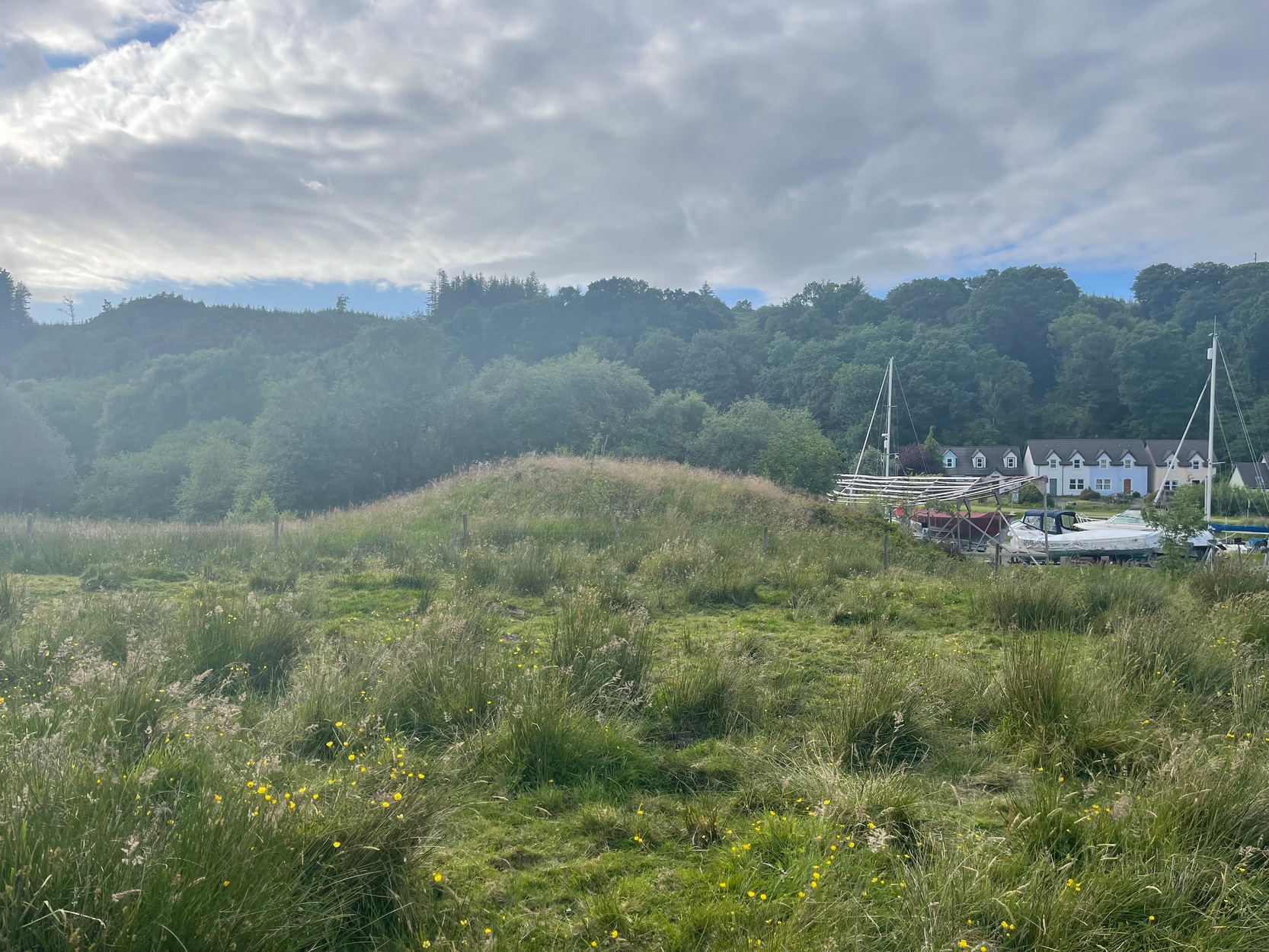
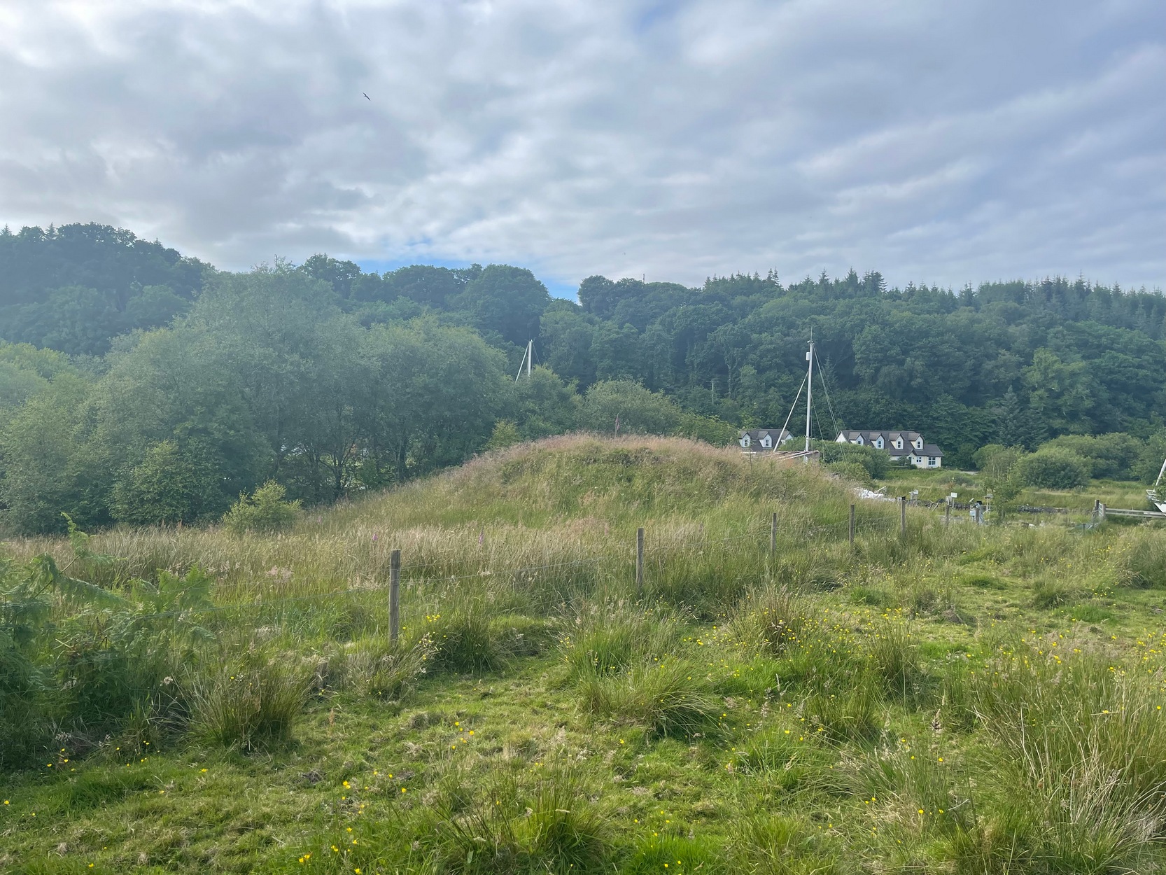
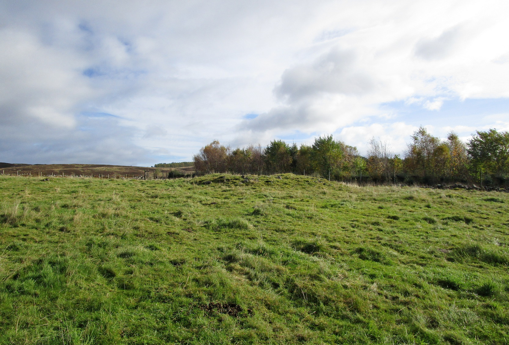
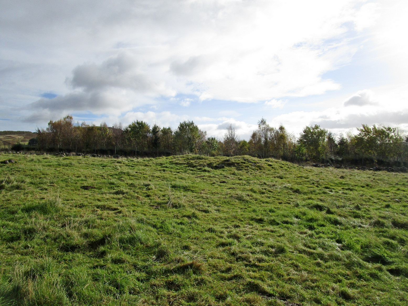
Carn ban, or the White Cairn, from which the hamlet of Cairnbaan gets its name, is a good-sized round cairn, now much overgrown in vegetation, though is still accessible and easy to see. Just above the water-line of the Crinan Canal, the mound is about ten yards across and more than six feet high and is in a good state of preservation. Originally, according to J.H. Craw (1930), the tomb was 12 feet high and 40 feet across!
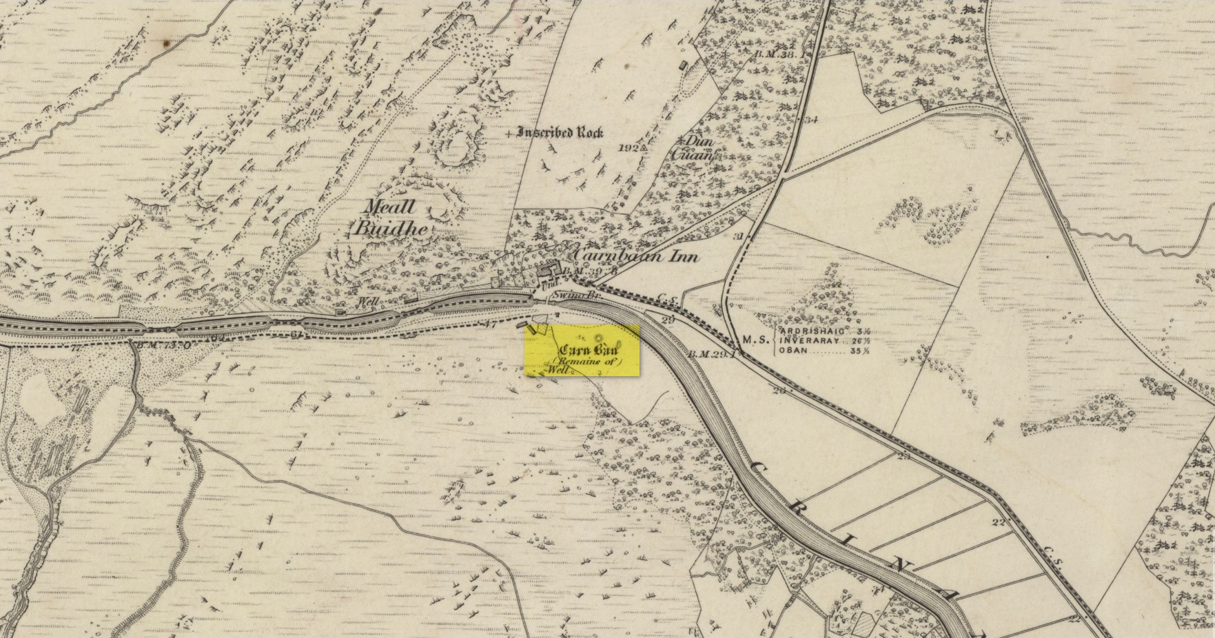
Carn Ban on 1873 mapCarn Ban, looking NE
In the 1850s, the site was examined by a Dr Hunter of Lochgilphead, and Mr Richardson Smith of Achnaba, and a cist that had been built straight on top of the bare rock was uncovered near the centre of the cairn, nearly four feet long and aligned northeast to southwest. Inside it a thin slab of stone—“2 feet long, 17 inches broad, and 2½ inches thick”—had been slid up against the western end of the chamber and on it was a curious petroglyph design comprising “several incised diamond-shaped figures, one within the other”—five altogether, and the commencement of a sixth—similar to ones found at Newgrange in Ireland. This carving was removed and given to the Scottish National Museum where it still resides. Inside the cist, Hunter and Smith found a deposit of some “yellow sand with some black charcoal and several burnt bones lying upon its bottom”, and a subsequent search unearthed some flint fragments.
The Carn Ban is a good site—but if you’re wanting something bigger, something more impressive, I suggest heading just a few miles north…
References:
Beckensall, Stan, The Prehistoric Rock Art of Kilmartin, Kilmartin Trust: Kilmartin 2005.
Simpson, James, Archaic Sculpturings of Cups, Circles, etc., Upon Stones and Rocks in Scotland, England and other Countries, Edmonston & Douglas: Edinburgh 1867.
Acknowledgements:Huge thanks for use of the Ordnance Survey map in this site profile, reproduced with the kind permission of the National Library of Scotland.
From Bainbridge, take the A684 road east to Aysgarth. Just out of the town, 200 yards over the bridge, take the right turn down Blean Lane. Nearly ½-mile along, take the minor road on your left and go along here for 1½ miles where, a few hundred yards before the solitary farm of Carpley Green (lucky buggers!), you can park up. (keep plenty of room for a tractor to get in the fields) Walk down the track past the farm and 250 yards along, where the first field ends, a gate leads you into the hills on your left. Go through here and then the next gate 120 yards on, then walk straight along th elong geological ridge ahead of you, veering to the top-side until it meets the walling. You’ll see the giant Stoney Raise cairn on the other side.
Archaeology & History
Stony Raise from above
The remains we find here are nigh-on immense! If giant cairns get you going (like the Great Skirtful of Stones or the denuded Devil’s Apronful near Pendle, etc), this one will blow you away! Along its widest axis, to this day it’s nearly 40 yards across and nearly 7 feet high! But in earlier times it was even bigger—much bigger! The first known description of the site was made by one Charles Fothergill, a Yorkshire-born politician and ornithologist, who wrote a diary of his walking excursions to various places in North Yorkshire at the beginning of the 19th century. (Romney 1984) His account of it was a good one for that period and thankfully he recorded information that would otherwise have been forgotten. After his visit here in September 1805, he told about this,
“wonderful tumulus called Stone raise which is a great curiosity: it is formed entirely of large stones piled up without earth or gravel, differing in that respect from any I have seen. Notwithstanding that upwards of a thousand, nay ’tis said several thousand, loads of stones have been led away from it to build walls with, it yet remains a stupendous monument of this species of antiquity: we measured the base of it as well as we could by our strides and made it 369 feet in circumference and of such an height as to be seen for a considerable distance. It has been most completely rifled…and it now presents a number of small craters formed by the investigations of the money searchers. It is situated upon a hill about half a mile south of Addlebrough. In addition to the particulars I formerly mentioned, I may say the men who first opened it about 50 years ago worked incessantly for 33 days. It stands on Thornton moor, and tho’ the Thornton men would not assist in the labour, they intended to share in the profit if there was any; but the adventurers who had all the work resolved they should not and they carried a large sword with them every day to defend the treasure in case they found any; the wise man who read ’till the stones shook and rattled was a schoolmaster at Bainbridge: the teeth they found were deposited in a hollow place in the bottom of the tumuli formed long and narrow like a coffin by a walling of stones. Tho’ the tumulus has apparantly been compleatly rifled, I do not believe the whole base has been sufficiently searched, but if it was to commemorate one great individual, which appears to have been the case, perhaps nothing more may be found.”
Fothergill’s description of “upwards of a thousand” cartloads of stone being removed from Stony Raise has been doubted by some archaeologists, but this claim should not be dismissed so lightly without evidence. There are immense tombs from northern Scotland to the unholy South that have remained untouched by the hand of industrialists that easily enter the category of such giants and this may have had equal stature.
A few years after Fothergill’s visit, Thomas Whitaker (1823) briefly described the site in his magnum opus, but added very little, simply telling that on the hills behind Addlebrough,
“there is still on that elevated spot a cairn, called Stone Raise, about 120 yards in circumference at the base, to which the usual tradition of its containing a treasure of gold having been attached, two persons were several years ago induced to make the experiment; but having penetrated to the centre, found, to their great disappointment, what an antiquary would have prepared them to expect, namely, a kist vaen of flag stones, with the remains of a human skeleton, the teeth of which were still pretty perfect.”
To this day the site remains unexcavated, so we don’t know too much about the place. It’s likely to have been constructed in neolithic times and its ancestral nature quite obviously venerated. It may have been re-used during the Bronze Age, but without excavations we may never know. A decent dig into this site is long overdue!
Folklore
This gigantic tomb is, not surprisingly, said to be haunted. Strange sounds and visions have been encountered here in bygone times. But the most well-known tale is that it was the site of a great treasure—perhaps hinted at by Fothergill. There are variations on the theme, but this is overall story:
Structured stonework
The tomb was said to be where a local giant had fallen and with him was buried a great chest of gold which he had dropped before he died. Some say that the ‘giant’ was a Brigantian chief – others a great warrior. The great treasure chest beneath the cairn is said to looked over by a fairy who lived by the giant’s tomb. It was this tale which gave the site its local name, the ‘Golden Chest on Greenber’. Several attempts made to find the treasure have all failed to uncover it.
However, by the time Edmund Bogg came to write of the place in 1908, the giant had by all accounts been found within! He told that,
The giant’s cist cover?
“this Kist-vaen was opened, many years back, and the skeleton of a chieftain of great stature was unearthed; the treasure chest of that or some other primal savage was not, and has not yet been discovered – for, take heed ye matter-of-fact money hunters, it is said the lucky one must first see the wraith of the ancient warrior to whom it belonged, who will then shew under which part of the immense Raise it is hidden! May this help any reader who is imaginative enough to find it – having seen the wraith he must keep silence – he has then but to stretch out his hand, and draw it forth.”
There are variations on this tale that have subsequently been penned by a number of Yorkshire folklorists, but this is the general lore. There was also a short rhyme told of toney Raise, that speaks of its apparent use through history by various races:
Druid, Roman, Scandinavia,
Stone Raise in Addlebro’.
References:
Bogg, Edmund, Wensleydale and the Lower Vale of the Yore, E. Bogg: Leeds 1906.
Bogg, Edmund, Richmondshire, James Miles: Leeds 1908.
Elgee, F. & H.W., The Archaeology of Yorkshire, Methuen: London 1933.
Gutch, Mrs E., Examples of Printed Folklore Concerning the North Riding of Yorkshire, David Nutt: London 1899.
Lofthouse, Jessica, Countrygoer in the Dales, Hale: London 1964.
Parkinson, Thomas, Yorkshire Legends and Traditions – volume 2, Elliot Stock: London 1889.
Pontefract, Ella, Wensleysdale, J.M. Dent: London 1936.
Romney, Paul (ed.), The Diary of Charles Fothergill, 1805, Yorkshire Archaeological Society: Leeds 1984.
Whitaker, Thomas Dunham, An History of Richmondshire – volume 1, Longman Hurst: London 1823.
White, Robert, A Landscape through Time, Great Northern: Ilkley 2002.
Cup-Marked Stone (lost): OS Grid Reference – NU 2299 2989
Archaeology & History
Tait’s 1971 sketch of the carving
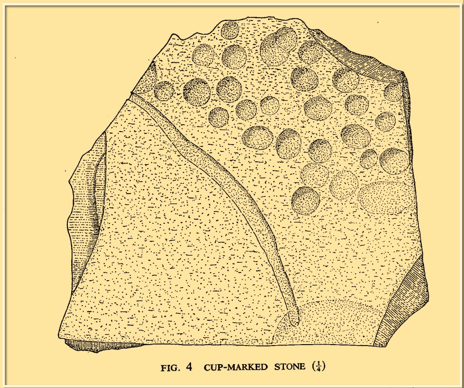
When the Beadnell Caravan Park was being constructed in 1970, in cutting into the Earth the workmen destroyed a couple of prehistoric tombs—but not before one of them (the northernmost one of the two) was thankfully excavated. It was looked at by John Tait (1971), who described the covering cairn as measuring “nineteen feet in diameter and four feet high”. Beneath it, within a cist that had been modified at two very different periods in time, were a large number of human remains that had been deposited over equally extended periods, suggesting it was a place of considerable importance to either one family lineage or the tribal lineage (unless it was just a dumping spot for any old Tom, Dick and Harry!). Outside of the cist itself, but within the rocky mass of the cairn, this cup-marked stone was found (illustrated). It had already been moved by the workmen before Tait came to excavate it, so he was unable to ascertain its precise position in the tomb. Carved into a piece of sandstone were a number of odd-sized cup-marks, smaller than usual. Tait wrote:
“It measures 38cm by 36cm and bears 29 small cup-marks and one slightly sinuous duct leading into what may be part of an earlier and larger cup. It also seems probable that additional cups were added in antiquity, since some are distinctly more shallow than others and, in one instance, two cups impinge upon one another. The stone had been broken in antiquity and may have come from a larger inscribed slab, as is perhaps the case with some other “portable” stones of burials or cairns and other monuments of the second this nature.”
It is thought that the carving was laid back in the ground whence it was found.
References:
Beckensall, Stan, Prehistoric Rock Motifs of Northumberland – volume 1, Abbey Press: Hexham 1991.
Beckensall, Stan, Prehistoric Rock Art in Northumberland, Tempus: Stroud 2001.
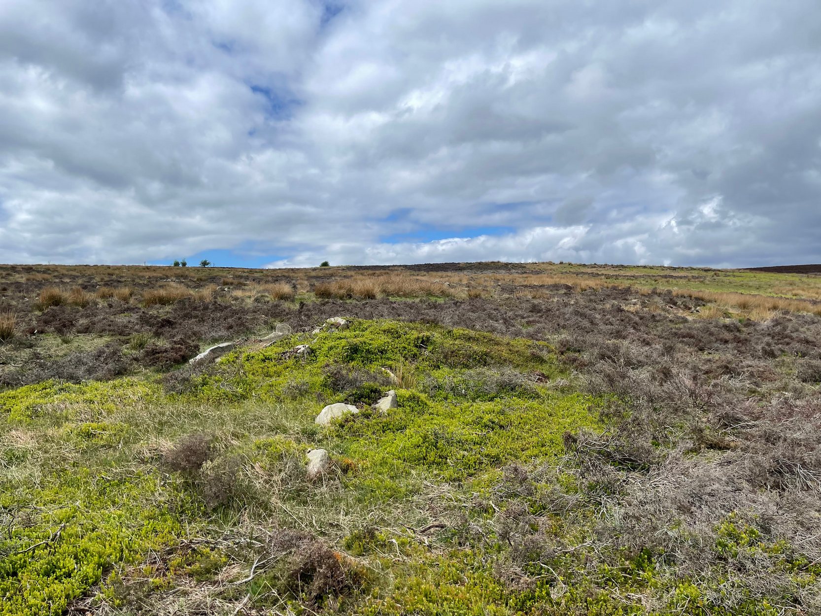
Park up at the singular dusty car-park on the east-side of Askwith Moor Road. If you walk to the sloping eastern edge of the car-park and then go down and over the collapsed fence onto the moorland immediately east, walk in the direction of the Tree of Life Stone to the north-east (be aware that there’s no footpath here and it’s boggy as fuck in places) . Just over halfway towards the carving, nearly 400 yards from where you’ve parked, you’ll begin to see various ruinous piles and scatters of stone. You can’t really miss them!
Archaeology & History
Cairn, looking north
In a region teeming with prehistoric sites, the great Eric Cowling (1937) seems to have been the person who stumbled across this “barrow group”, as he called it, during one of his rock art forays in this neck o’ the woods. Little has been written of them since. Not to be confused with the Snowden Moor cairnfield more than 350 yards to the north, at this place we find at least a dozen quite distinct cairns scattered around the grid-reference cited, most of them much larger in size than the cairns to the north, ranging between five to twelve yards across and up to three feet high. They have all been opened and robbed, with considerable disturbance on the largest of the ‘barrows’. We know not who may have done this, but there’s been a history of quarrying close by and it may have been some of the workmen who did the damage, knowingly or otherwise.
Large scatter of cairn-spoilCairn covered in bilberries!
As far as I’m aware, no burial or funerary remains have been found here—but there’s been negligible archaeological attention given to any of the sites on this moorland, meaning that we can draw no real conclusions about the nature of the cairns. They seem to be far too large to be clearance cairns; and the proximity of large scale prehistoric settlements and rock art all round here would strongly suggest they possessed a funerary nature. Several impressive petroglyphs exist right at the edge of this group, literally yards away from them. Check them all out out the next time you see the Tree of Life stone…
References:
Cowling, Eric T., ‘Cup and Ring Markings to the North of Otley,’ in Yorkshire Archaeological Journal, volume 33 (part 131), 1937.
Cowling, Eric T., Rombald’s Way: A Prehistory of Mid-Wharfedale, William Walker: Otley 1946.
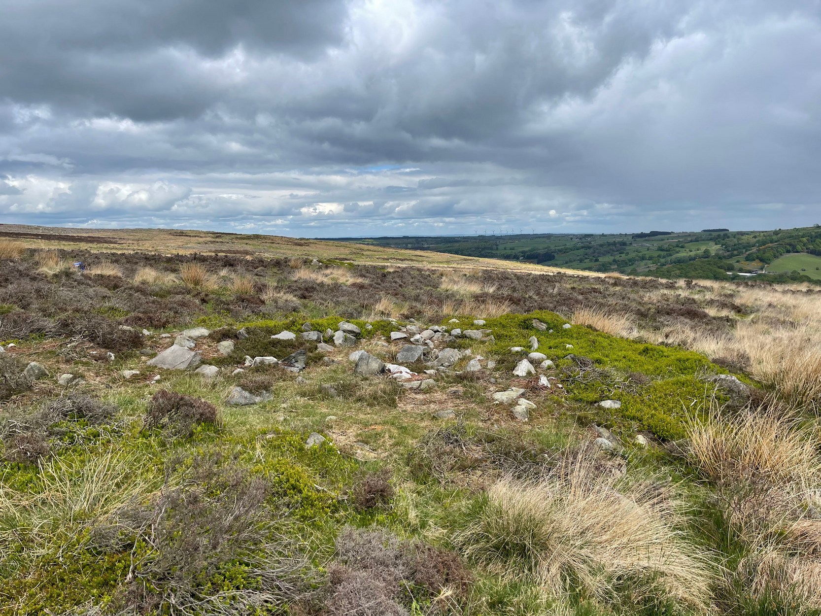
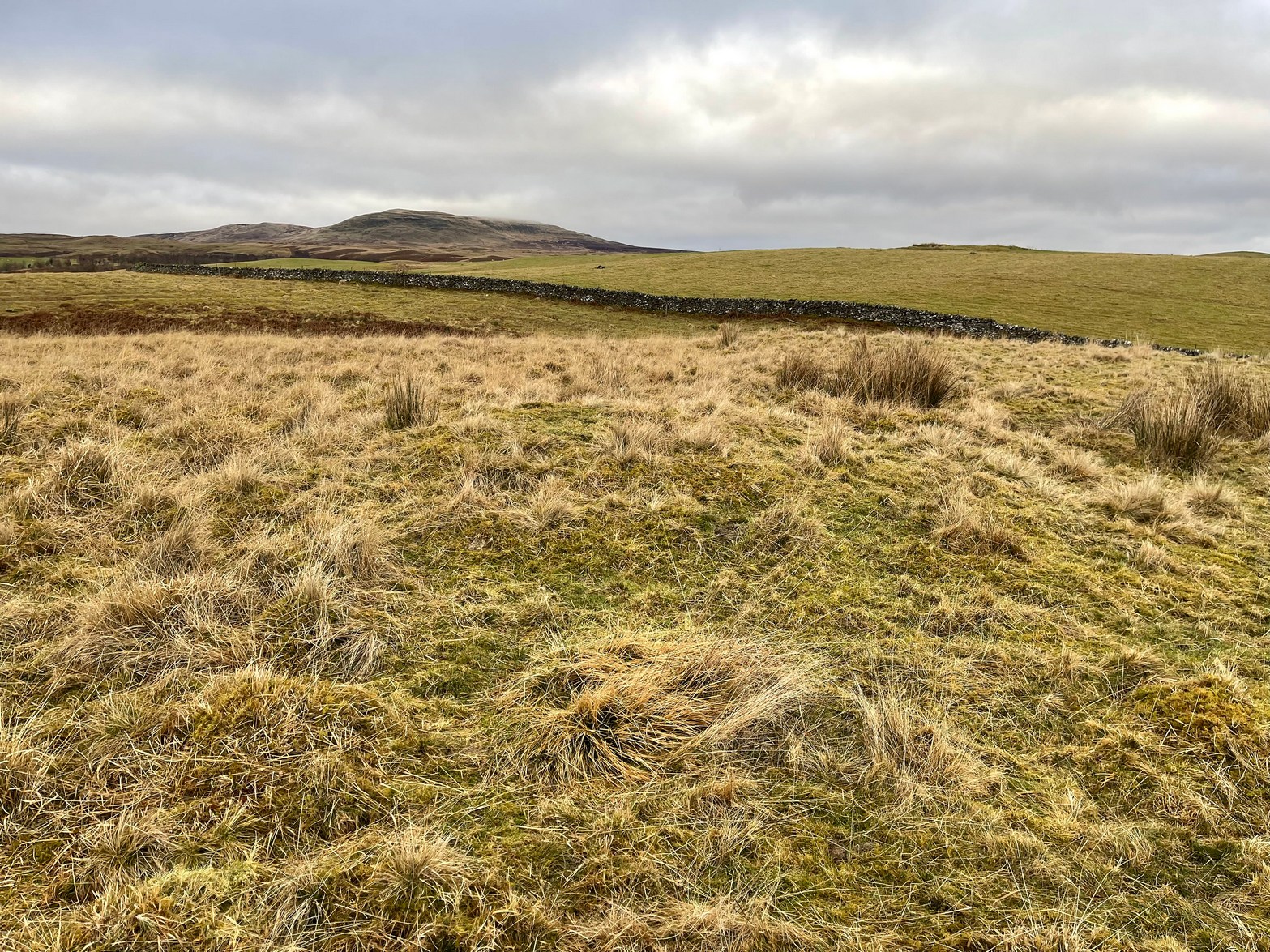
From Kirkmichael village take the A94 road 2 miles south to the Balnabroich standing stone and another 100 yards past it, on the left (east) take the dirt-track uphill, following the directions to reach the Balnabroich hut circles. You’ll see the large prehistoric rock pile of the Grey Cairn on the near skyline just above the huts and roughly on the same level, 50 yards away to the south, you’ll see this scruffy lumpy dump of a cairn, all overgrown.
Archaeology & History
The cairn, looking S
Amidst the veritable scatter of a thousand clearance cairns (yes, that’s the estimate), there are a few up here that had more funerary functions than the rest. This being one of them. When Allan Stewart (1795) wrote about them all in the Statistical Account, he couldn’t have missed this one—and yet he made no mention of it. We had to wait another seventy years before the outside world became aware of its existence. Then, along with “a band of between twenty and thirty workmen,” John Stuart (1865) set out to see what lay beneath the rocky pile. In truth, much more attention was given to the huge Gray Cairn close by (understandably so), but at least some attention was given here. Stuart described this cairn as,
“about 9 yards across, defined by large boulders, with a raised ridge around, and a cup in the centre. The raised ridges and centre were all formed of small stones and earth. A trench was cut through it from the southeast, which showed that in the centre, at a depth of 2 feet, a deposit had been made, of which the remains were charred wood and fragments of charred bone, with traces of blackish matter, which had filtered into the yellow subsoil, as in the case of the graves at Hartlaw.’ Many fragments of white quartz pebbles appeared near the centre, as in other cairns to the east.”
Indeed, at least one of the “cairns to the east” is made entirely of quartz stones! Since Mr Stuart’s dig into the tomb, it has widened out slightly as rummaging cattle and other damage has been inflicted, and the grasses have coloured the tomb with their life. Check it out when you’re up here!
References:
MacLagan, Christian, The Hill Forts, Stone Circles and other Structural Remains of Ancient Scotland, Edmonston & Douglas: Edinburgh 1875.
Ramsay, John S., Highways and Byways of Strathmore and the Northern Glens, Blairgowrie Advertiser 1927.
Royal Commission on the Ancient & Historical Monuments of Scotland, North-East Perth: An Archaeological Landscape, HMSO: Edinburgh 1990.
Stewart, Allan, “Parish of Kirkmichael,” in Statistical Account of Scotland – volume 15, 1795.
Stuart, John, “Account of Excavations in Groups of Cairns, Stone Circles and Hut Circles on Balnabroch, Parish of Kirkmichael, Perthshire,” in Proceedings Society Antiquaries, Scotland, volume 6, 1865.
Acknowledgements:Huge thanks for use of the Ordnance Survey map in this site profile, reproduced with the kind permission of the National Library of Scotland.
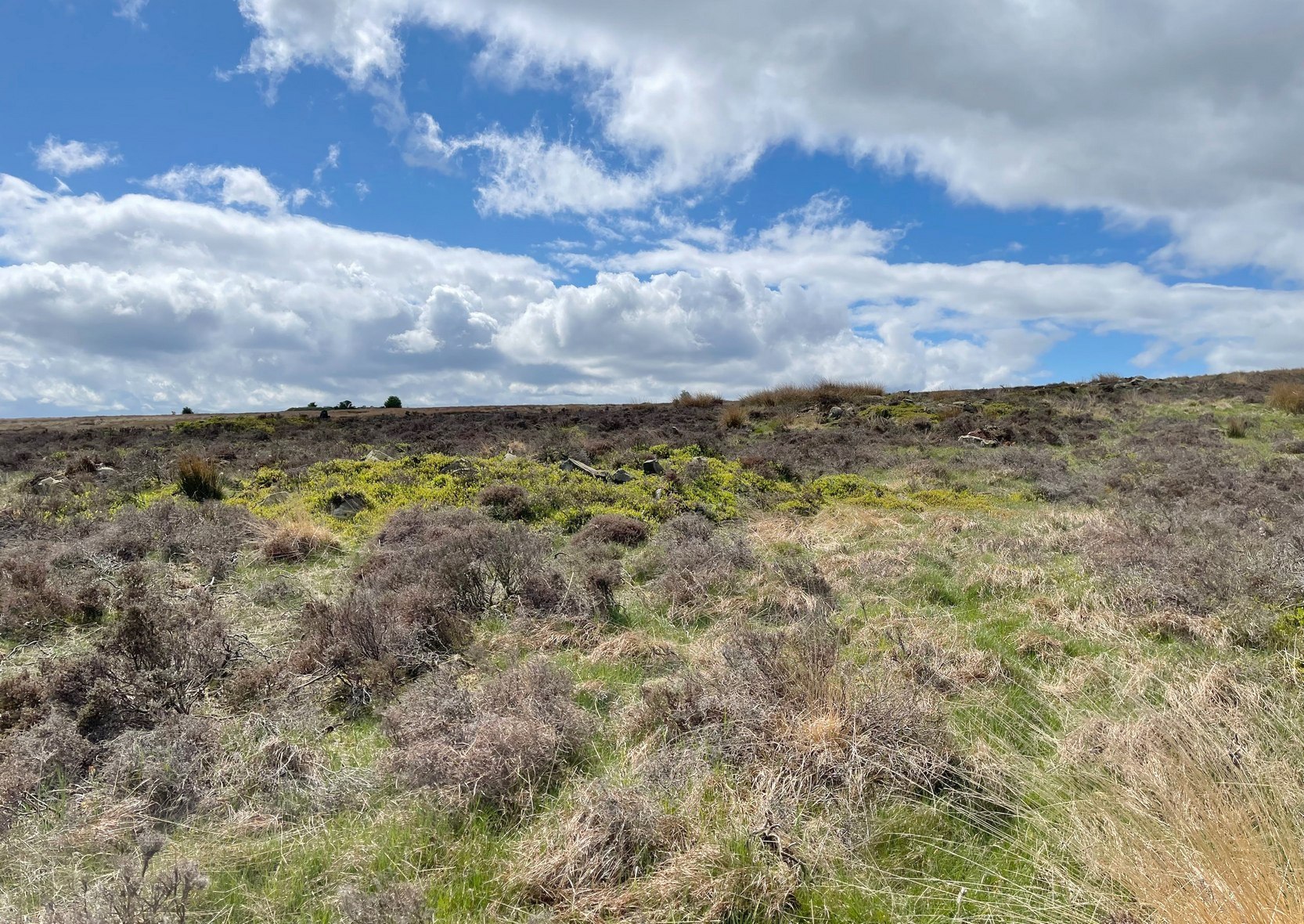
From Callander head east along the main A84 road and nearly 300 yards past the entrance to the Keltie Bridge caravan park, take the tiny road on your left (north) and barely 100 yards along turn right and go up here for exactly 1 mile. Walk up the track from here and follow the directions to find the Black Park (1) cairn; and then the nearby small Black Park (2) cairn. From here you need to walk north-east round the small rounded hillock in front of you, and cross a small burn (stream) up to the next small grassy rise. Altogether this is about 200 yards from the Black Park (2) cairn. On this grassy rise lives the Black Park (3) cairn!
Archaeology & History
As with its compatriot Black Park (2) cairn 200 yards southwest, this can be hard to see. It’s an overgrown small singular cairn (it looks like a tumulus now) of no great note to look at: probably the resting spot of an individual or just a small family. Measuring some 5-6 yards across and less than a yard high at the most, its easily missed unless you’re really mean to find it. More impressive are the ones on the hill immediately above you to the east. Head there next!
References:
Royal Commission Ancient & Historical Monuments, Scotland, Braes of Doune: An Archaeological Survey, RCAHMS: Edinburgh 1994.
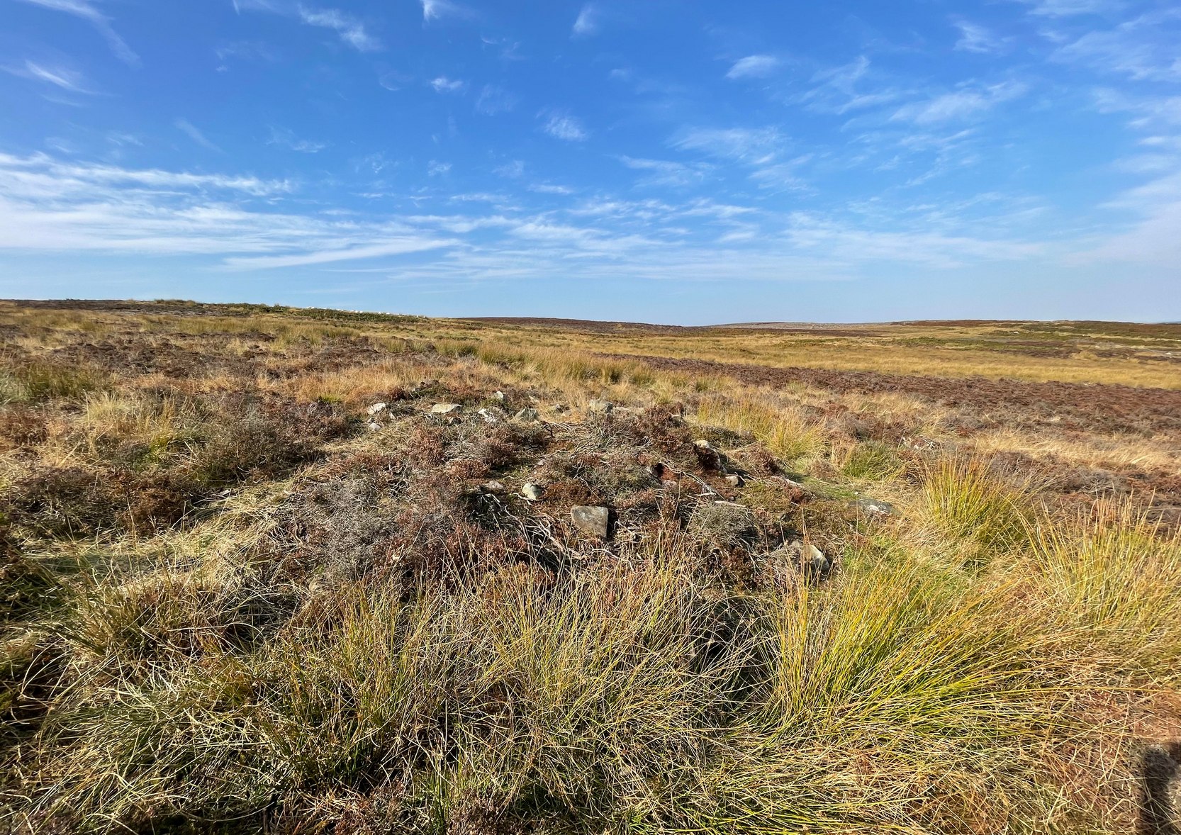
Take the same directions as if you’re going to visit the large Black Park (1) cairn, and from here look down the slight boggy slope to your right (east) and, across the other side of a small burn (stream) you’ll see a slightly raised grassy knoll. A curved dyke is to its left (west) side. You’re there!
Archaeology & History
This small cairn, barely two feet high at the most, and five yards across, is deemed as a possible Bronze Age cairn on Canmore and in the Royal Commission (1994) report of the area. There is certainly a pile of small stones here, but it may be a clearance cairn (I hope I’m wrong). Only an excavation will tell us for sure.
References:
Royal Commission Ancient & Historical Monuments, Scotland, Braes of Doune: An Archaeological Survey, RCAHMS: Edinburgh 1994.
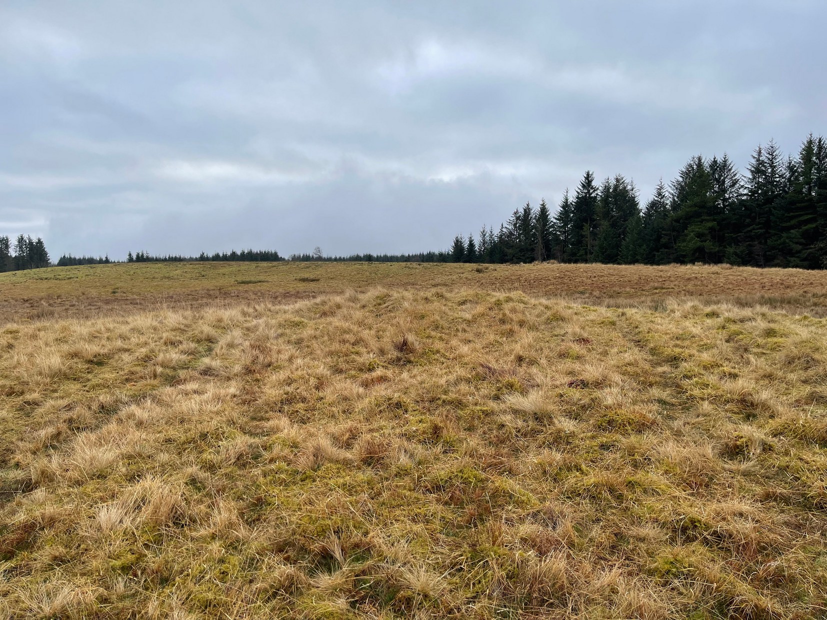
Less than a mile east of Callander on the main A84 road, nearly 300 yards past the entrance to the Keltie Bridge caravan park, take the tiny road on your left (north) and barely 100 yards along turn right and go up here for excatly 1 mile (give or take a few yeards) where track goes into the forest on your left and you can park-up here. Walk up the track into the silence for just under a mile where, as the track splits and you kink to the right, a gate appears. On the other side of the gate, turn immediately left, almost walking back on yourself, just above the curving waters of a burn, through boggy reeds, keeping to the fence-line until, less than 300 yards along, you’ll reach what you’re looking for.
Archaeology & History
Black Park (1), looking W
This reasonably large cairn and its neighbours (Black Park [2], [3], [4] and [5]) would appear to be relatively new discoveries as I can find nothing about it prior to the Royal Commission’s 1994 survey. They are even absent from Moray MacKay’s (1953) excellent work on the area! Hence, descriptions of it are scant and visitors to the place are few indeed (we did meet a local who knew about the old tomb, but said that nothing was known about it); but it is, nonetheless, a fine, albeit denuded and very overgrown cairn, living today amidst a quiet mass of reeds and surrounded by boggy ground—so make sure you’ve got your boots on!
Internal line of stoneworkBlack Park (1), looking SE
At its height, today, it stands less than four feet tall and measures roughly 16 yards across at its widest. Through one section of the tomb there runs a raised line of stonework that almost looks like internal walling, which may have been where a chamber once existed. It’s been hollowed out by someone in the not-too-distant past but, as I said, there are no records of such a thing, so whether or not that was a chamber or merely a fortuituous collapse of stone in a straight line, we can’t really say. Along its more northern edges there seems to be a small raised wall of stone defining its edge, although once again it requires a more discerning examination to work out whether this is part of its original facade, or is a result of some of the stone mass falling to the edges.
Visit the old place and sit with its silence for a while…
References:
Royal Commission Ancient & Historical Monuments, Scotland, Braes of Doune: An Archaeological Survey, RCAHMS: Edinburgh 1994.
Stone Circle (destroyed): OS Grid Reference – NY 549 182
Archaeology & History
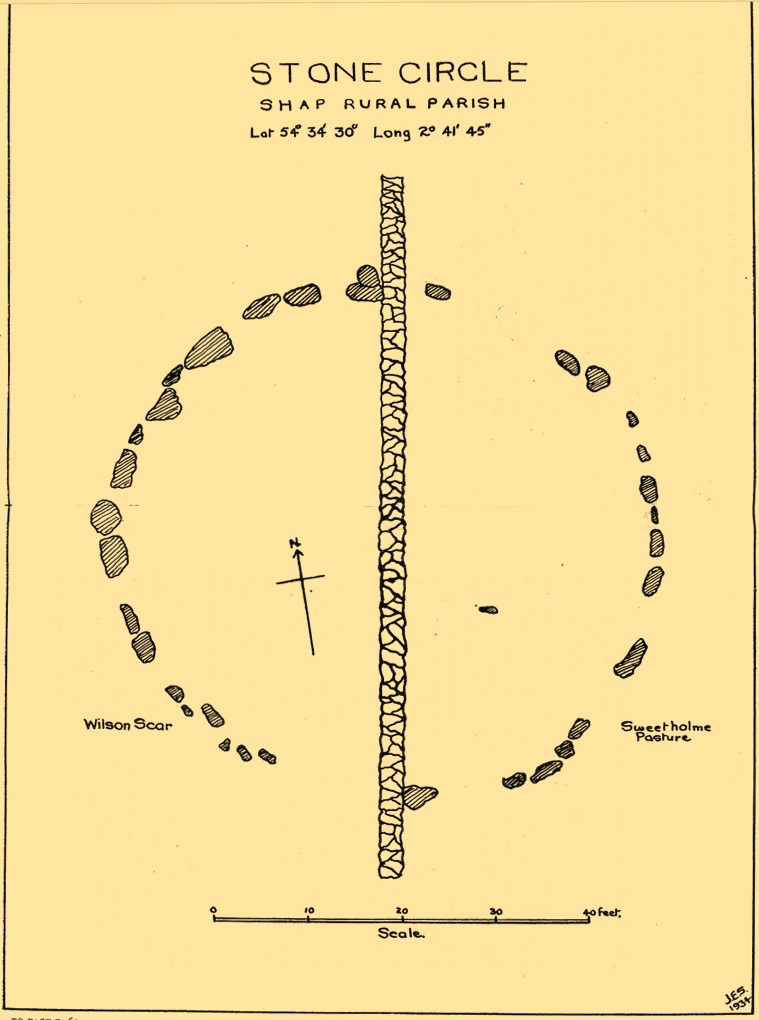
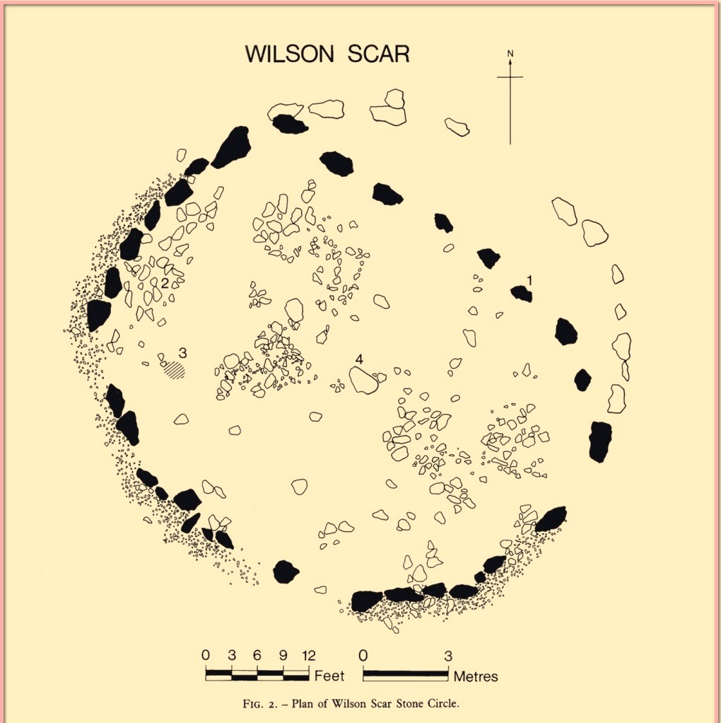
This site has been completely destroyed by the huge eyesore of a quarry that we all see when we’re travelling up the M6 north, above Shap. John Waterhouse (1985) told that “a rescue excavation” was carried out here with help from the kids at Penrith Queen Elizabeth School, shortly before its destruction in 1952, but now there is no trace left of it. When it was first described by J.E. Spence (1935), the circle had already been damaged by a wall that cut right through its centre. He told:
Spence’s 1935 plan
“The circle, which is 6o feet in diameter, is composed of 35 stones, 20 being on the west and 15 on the east side of the boundary wall running through the circle from north to south. The stones of which the circle is composed are Borrowdale erratics, a large number of which are scattered over the adjoining ground on both sides of the wall but more thickly in Sweet Holme Pasture. The stones, which vary up to 5 feet 9 inches by 3 feet, are larger and more numerous in the north-west quadrant where the tallest stands 1 foot 8 inches above the level of the turf. The ground within the circle is level, but to the south and west it slopes gently down from the edge of the circle in such a manner as to suggest that the area within the circle has been levelled.”
1952 plan laid over Spence’s 1935 plan
Spence told that an ancient “sunken trackway” led outwards from the circle to the south-west in the direction of Rosgill, but when the 1952 excavation occurred, no remains of such a track were found; nor was the wall that had cut through it; and the north-easterly section of the circle had been cut into and re-laid, presumably by the quarrymen. It was quite plain, wrote G.G. Sieveking (1984), “that this portion of the monument was encroached upon in the summer of 1952, and hastily reconstructed for the benefit of the archaeologists.”
Their excavation found that some internal sections of this ring had been paved with thin limestone slabs and they also uncovered two small cairns, neither of which possessed anything. However, they did find four funerary deposits within the monument: one at the northeastern section of the circle (no.1); another near the centre (no.4); and remains of a cremation west of centre (no.3); but the most complete find was at the western side of the ring, where a “disarticulated inhumation burial was lying immediately beneath the turf line in a shallow grave 1.35 m long, surrounded by a setting of small boulders.” It was a near complete human skeleton. This place was obviously, at times, used in ceremonies for the dead.
Shortly after the archaeological examination of the site, it was blasted away by quarrying. Gone!
References:
Barnatt, John, Stone Circles of Britain– volume 2, BAR: Oxford 1989.
Burl, Aubrey, The Stone Circles of Britain, Ireland and Brittany, Yale University Press 2000.
Farrah, Robert W.E., A Guide to the Stone Circles of Cumbria, Hayloft: Kirkby Stephen 2008.
Seton, Ray, The Reason for the Stone Circles in Cumbria, privately published: Morecambe 1995
Sieveking, G.G., “Excavation of a Stone Circle at Wilson Scar, Shap North 1952,” in Transactions Cumberland & Westmorland Antiquarian & Archaeological Society, volume 84, 1984.
Spence, J.E., “A Stone Circle in Shap Rural Parish,” in Transactions Cumberland & Westmorland Antiquarian & Archaeological Society, volume 35, 1935.
Waterhouse, John, The Stone Circles of Cumbria, Phillimore: Chichester 1985.
Cup-and-Ring Stone (removed): OS Grid Reference – NT 12364 32627
Also Known as:
Drumelzier Carving
Archaeology & History
Position of stone in cairn
A carving that was located at the edge of a cairn on a knoll on the east-side of the River Tweed, this is an odd design that now lives in Edinburgh’s central museum: odd, inasmuch as the design looks as if it’s a typical cup-and-ring carving, yet none of the cups on this stone were ever hollowed or pecked out, and so the “cups”, so to speak, are actually small rings (if that makes sense!). There are a number of similar unhollowed “cups” on other carvings that are found associated with prehistoric tombs, so perhaps this aspect was something of a burial trend—amongst a very small tribal group, perhaps… It’s an element that was remarked upon in Simpson & Thawley’s (1972) examination of petroglyphs in neolithic tombs that were called “passage grave style” carvings: a sort of dyslexic cup-and-ring design no less! The intriguing thing about this carving is that it’s one in a small cluster of dyslexic cup-and-rings that are found in this part of Scotland—in an area where rock art itself is pretty scarce. Which begs the question: was it a local tribal style? Anyhow…
The carving was first uncovered when J.H. Craw (1930) excavated the aforementioned cairn, finding therein a number of cists. There’s speculation that the petroglyph might originally have been a covering stone for one of the cists, but we don’t know for sure. Craw described the carving as follows:
Craw’s 1930 sketchRon Morris’ 1981 sketch
“The ring-marked slab…measures 3 feet by 2 feet by 6 inches. It lay at the north side of the cairn (highlighted in sketch, PB), outside the encircling ring, but may originally have been the cover of cist No.2. On the upper side are five shallow ring-markings, four being double and one single. The former measure 3 inches to 4 inches in diameter, and the latter 1¾ inch. The figures are thus much smaller than in typical cup-and-ring-marked stones, and the lines are only ¼ inch in width. The only similar markings known to me are on a slab which I found a number of years ago near the site of several former cairns, and forts at Harelawside near Grant’s House, Berwickshire. The stone is now in our Museum.”
The “museum” in question being Edinburgh’s National Museum (I don’t know if it’s in a box somewhere or on public display, which is where it needs to be). If anyone can get a good photo of this carving, please send it to us or add it on on our Facebook group.
Morris, Ronald W.B., “The Cup-and-Ring and Similar Early Sculptures of Scotland; Part 2 – The Rest of Scotland except Kintyre,” in Transactions of the Ancient Monuments Society, volume 16, 1969.
Morris, Ronald W.B., The Prehistoric Rock Art of Southern Scotland, BAR: Oxford 1981.
Ritchie, Graham & Anna, Edinburgh and South-East Scotland, Heinnemann: London 1972.
Royal Commission on the Ancient & Historical Monuments, Scotland, Peeblesshire – volume 1, Aberdeen University Press 1967.
Simpson, D.D.A. & Thawley, J.E., “Single Grave Art in Britain,” in Scottish Archaeological Forum, no.4, 1972.
Acknowledgements:Huge thanks for use of the Ordnance Survey map in this site profile, reproduced with the kind permission of the National Library of Scotland.