Easter Brackland, Callander, Perthshire

Cup-Marked Stone:  OS Grid Reference – NN 65736 07989

Getting Here

The carved stone in situ

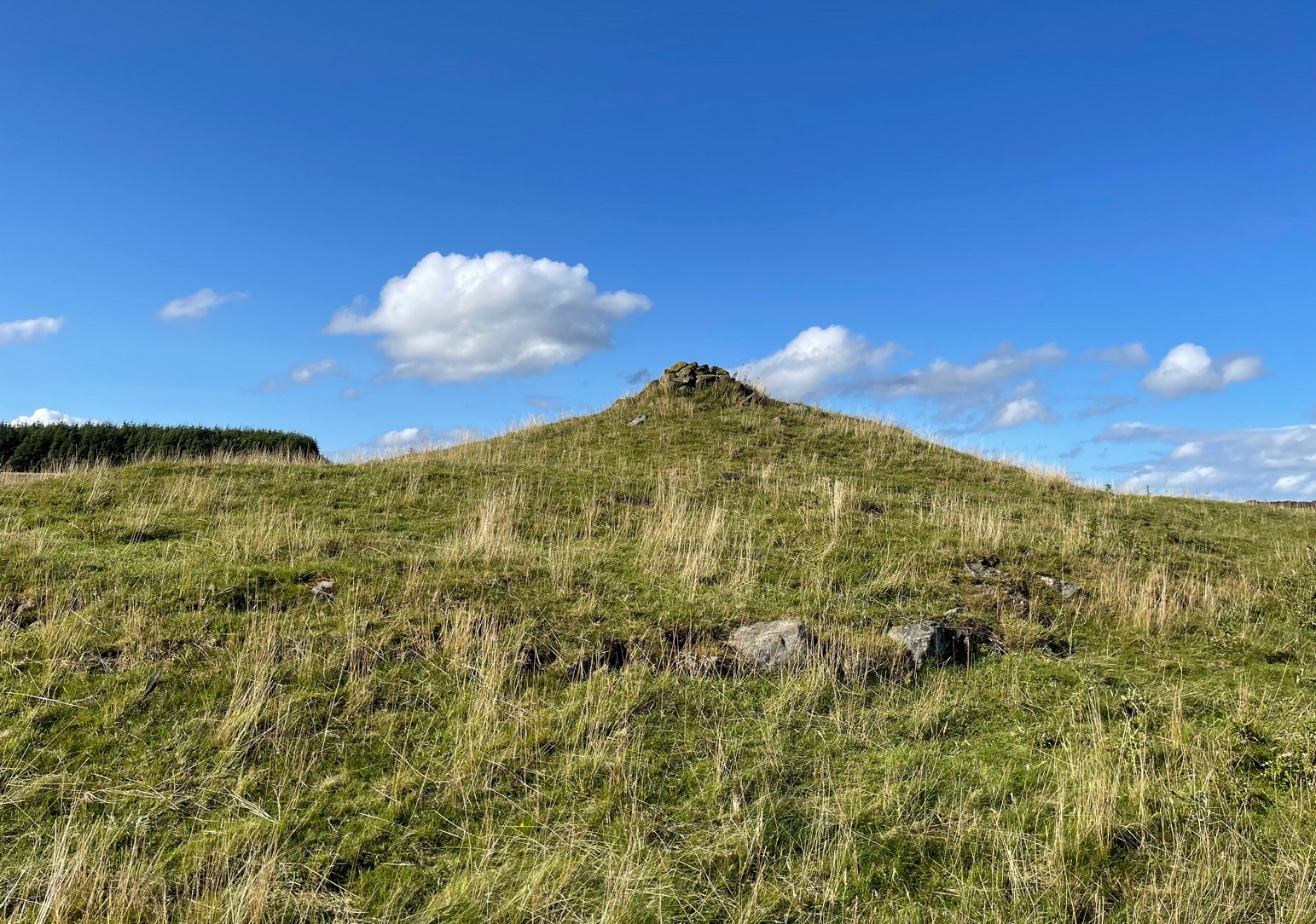
Less than a mile east of Callander on the main A84 road, nearly 300 yards just past the entrance into the Keltie Bridge caravan park, take the tiny road on your left (north) and barely 100 yards along where a small crossroads can be said to exist, go straight forward up the tiny single-track road ahead of you.  Literally 0.62 miles, or 1km up, park on the right-side of the road where a small grassy track runs up the slope.  From here, you need to keep walking up the road itself, bearing right just past the small bridge and, about 350 yards along you’ll see a notable rise in the field on your right less than 100 yards in.  Head straight for it!

Archaeology & History

Despite this being a very basic simplistic design, I’m somewhat disappointed in myself as when we visited here, She was pouring with rain and for some reason or other I didn’t indulge myself in the soaking muddy ground and peel back the dung-infested turf to see the entire surface of this stone—and so, as a result, didn’t see the carving in its entirety.  I’d have got soaked and been covered in shit! 🙂  But later this day we were visiting an antique centre and book-dealer straight afterwards, so for once I couldn’t play in the mud.  Damn those neat and tidy folk!

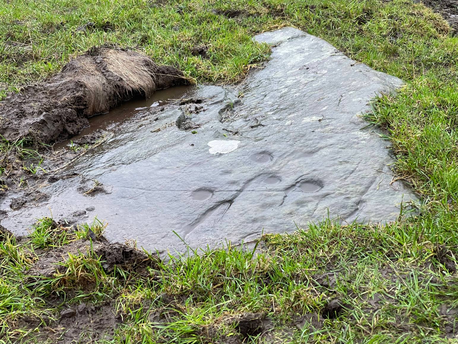
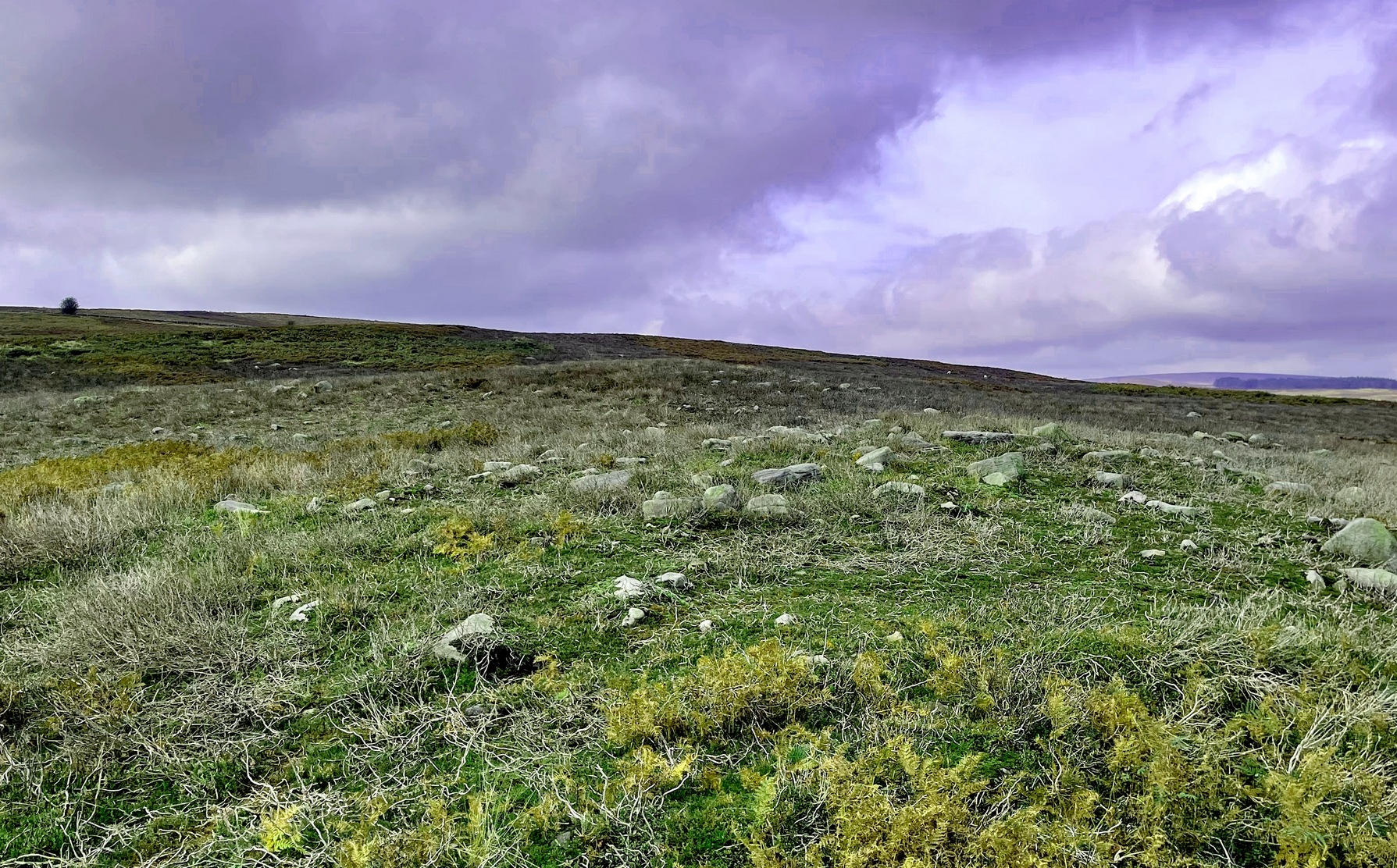
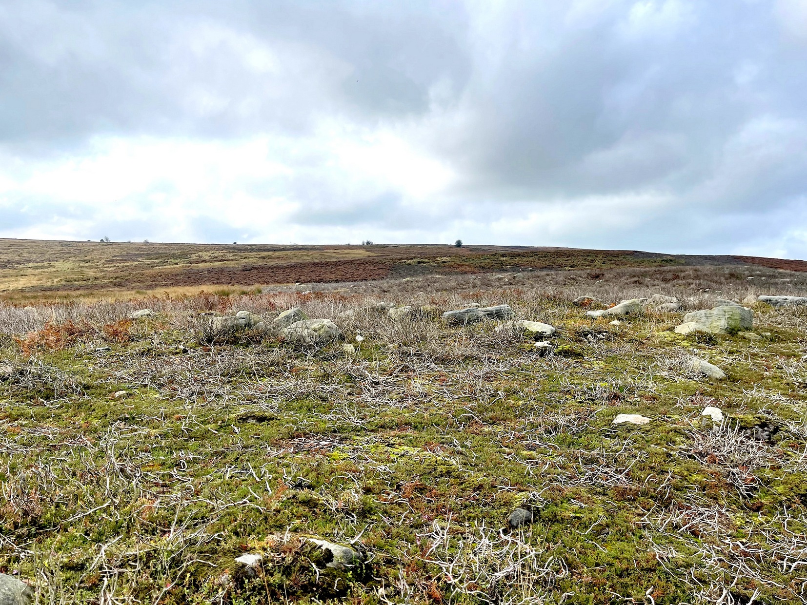
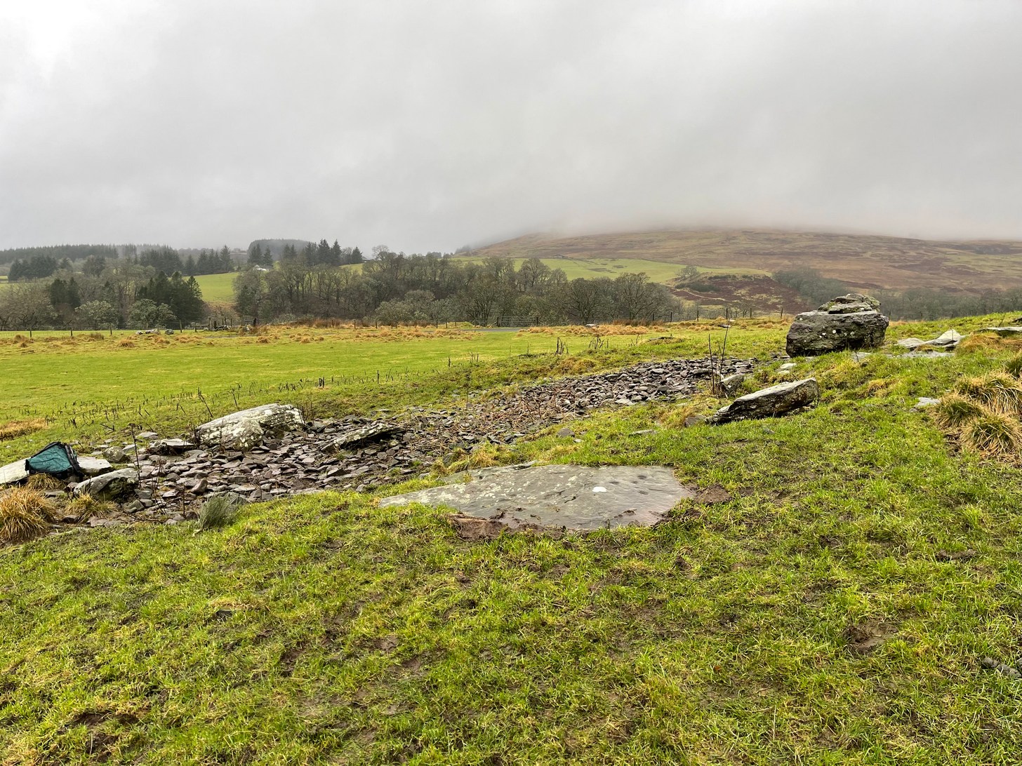
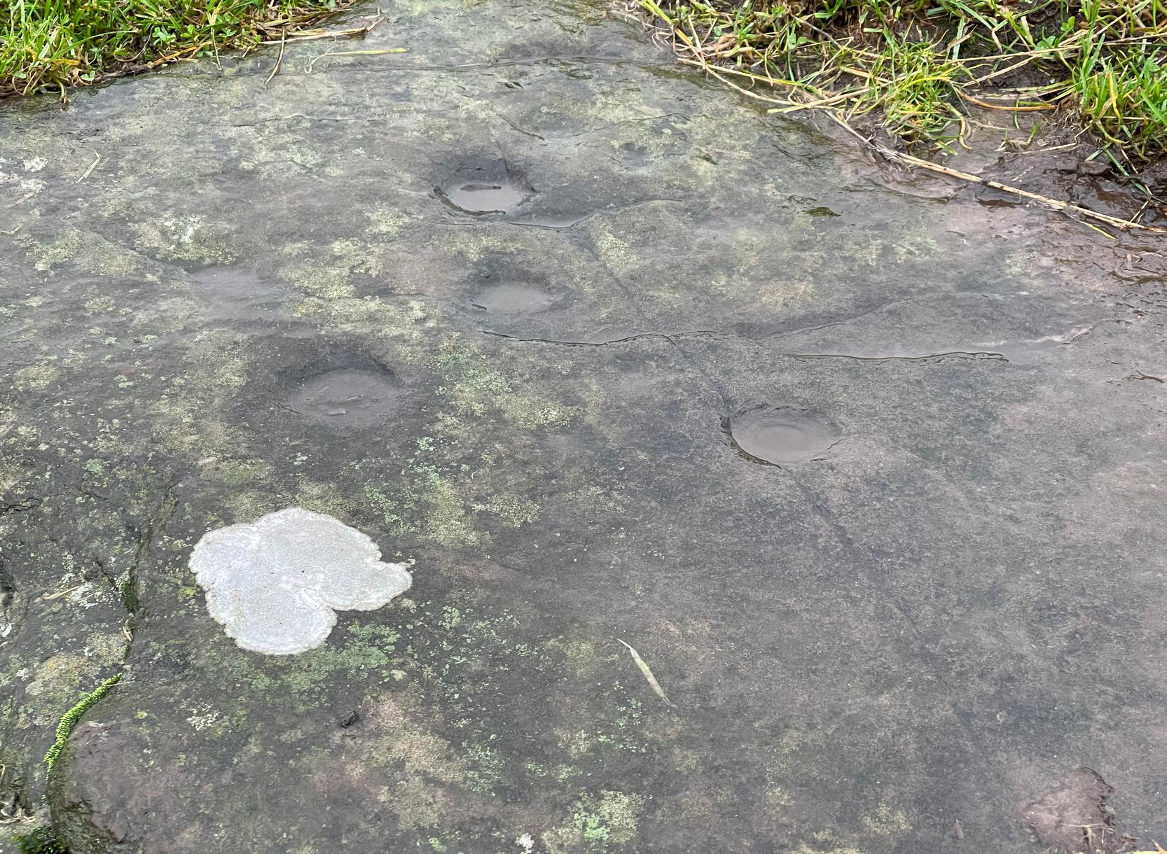
It’s nowt special to look at in all honesty, but it’s in a good state of preservation as it was seemingly uncovered in pretty recent times beneath the curious large mass of loose stones right next to it.  The stone mass gives the impression of it being a ruined cairn, but seems more likely to be a clearance cairn that was piled up, quite fortuitously, next to the cup-marked rock.

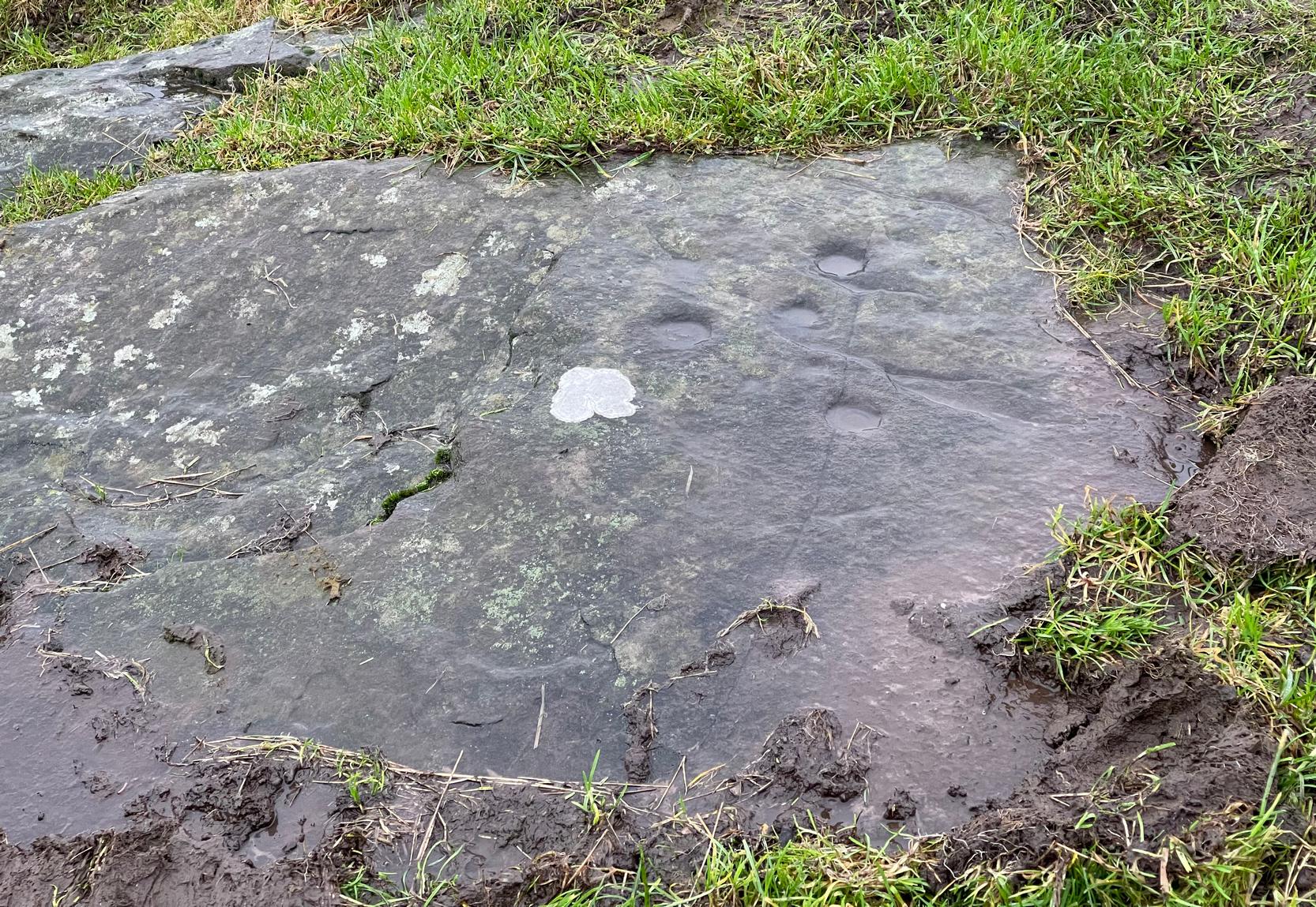
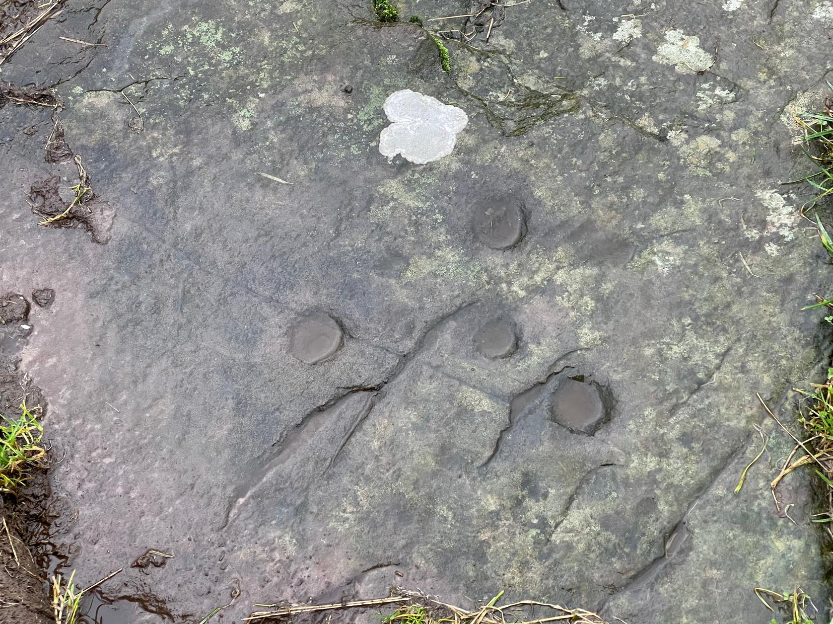
The carving consists of eight cup-marks (not all shown in these photos): five large and prominent, one not so prominent, and two that are small and very shallow.  The more distinct cups would seem to have been worked and re-worked many times, obviously possessing a practical nature of some sort.  As we can see in the photos, four of the larger cups stand out, whilst the small ones can be difficult to see.  If there are any petroglyphic locals who fancy getting up here to clear the rest of the stone to see if there are more cup-marks underneath the soil, please let us know!  Perhaps check it out when you’re looking at the nearby cairns at Ballachraggan and beyond.

References:

  1. Main, Lorna & Page, R., “Easter Brackland, Stirling,” in Discovery & Excavation Scotland, volume 2, 2001.

© Paul BennettThe Northern Antiquarian

Woodend, Mossfennan, Broughton, Peeblesshire

Cup-and-Ring Stone:  OS Grid Reference – NT 12136 31360

Also Known as:

  1. Mossfennan Farm

Archaeology & History

Carving, looking W: courtesy Jim Ness

A little-known multiple ringed carving was discovered a few years ago during the excavation of a prehistoric cairn just immediately east of the A701 roadside, several miles south of Broughton.  The cairn itself had been recognised many years prior to the recent excavation, when one of two cists inside it was noted by R.B.K. Stevenson (1940), and which was subsequently described in slightly more detail in the Royal Commission Inventory (1967).  But when the modern investigation was undertaken by the Biggar Archaeology Group in 2008, a damaged but impressive carving was uncovered that somehow hadn’t been noticed before.  It was described in Tam Ward’s (2008) excavation report where he told that,

Carving in situ (photo courtesy Jim Ness)
Carving looking N: courtesy Jim Ness

“lying almost immediately on the east side of Cist 1 is an angular rock…measuring 1m long and over 0.3m wide on the uppermost face, itself lying at an angle facing SW and away from  the cist.  The rock has fractured due to weathering in post deposition times, as indeed several other surface stones had, but on the widest part of the upper surface are at least seven concentric lines faintly pecked into the smooth flat surface of the stone. The lines are up to 10mm wide and appear to have been intended to form semi ovals on the edge of the rock.  The outer ring forms an arc of c270mm on the long axis by c140mm on the short one (the former measurement being straight between the ends of the lines and the latter being a radius across the design). The terminals of the inner curved line are about 80mm apart. The lines are slightly irregular in distance from one another. Although it is far from certain, it does not appear that the rock has been part of a larger one with a more complete design on it, rather the pecking appears not to have been finished since the surface of the rock is similar in appearance overall while the abrasion of the carving varies.”

Fractured design (photo courtesy Jim Ness)

The carving remains in place with the cist, which was covered back over when the excavation had been finished.

Carvings such as this are uncommon in this neck o’ the woods; although less than a mile downstream from here, on the other side of the river, another petroglyph—known as the Drumelzier carving—accompanied another prehistoric tomb.  Apart from this, there’s a great scarcity of carvings scattering the Lowlands—although it’s likely that there are others hiding away, waiting to be found on these hills…

References:

  1. Royal Commission on the Ancient & Historical Monuments, Scotland, Peeblesshire – volume 1, Aberdeen University Press 1967.
  2. Stevenson, R.B.K., “Cists near Tweedsmuir,” in Proceedings Society Antiquaries, Scotland, volume 74, 1940.
  3. Ward, Tam , “Excavation of a Bronze Age burial cairn at Woodend, Mossfennan Farm, Upper Tweeddale,” Biggar Archaeology 2008.

Acknowledgements:  Huge thanks to Jim Ness and Tam Ward of the Biggar Archaeology Group for use of the photos in this site profile. 

© Paul BennettThe Northern Antiquarian

One Barrow, St. Austell, Cornwall

Tumulus (destroyed):  OS Grid Reference – SX 0309 5227

Archaeology & History

More than two hundred years ago, an impressive prehistoric burial mound lived in an area that used to be known as Gwallon Down, not far from the impressive Long Stone monolith, about half-a-mile west of Charlestown on the southern edges of St. Austell, but it was completely destroyed in 1801.  Thankfully there was a lengthy account made of the site in John Whitaker’s (1804) huge work, but there seems to be little else known of it.  He told us:

“In the middle of that extended waste, the downs of St. Austle, was, what was called One Barrow.  This waste, in 1801, was resolved to be enclosed, and the barrow was obliged to be levelled.  In this operation, the single workman came near the centre, and there found a variety of stones, all slates, ranged erect in an enclosure nearly square.  The stones were about one foot-and-a-half in height, apparently fixed in the ground before the formation of the barrow.  The stones were all undressed, but had little stones carefully placed in the crevices at the joints of the large, in order to preclude all communication between the rubbish without and the contents within.  On the even heads of these stones was laid a square freestone, which had evidently been hewn into this form, which seemed to rest with its extremities on the edges of the others, and was about eighteen or twenty inches in diameter.  The summit of the barrow rose about eight or ten feet above all.  In the enclosure, the leveller found a dust, remarkably fine, and seemingly inclining to clay.  On the surface it was brown, about the middle downwards it took a dark chestnut colour, and at the bottom it approached towards a black.  On stirring it up, a multitude of bones appeared, different in the sizes, but none exceeding six or seven inches in length.  Among them were some pieces about the largeness of a half-crown, which, from their concave form, convinced him they were parts of a skull.  The whole mass of bones and ashes might (he thought) be about one gallon in quantity.  On touching the bones, they instantly crumbled into dust, and took the same colour with the same fineness as the dust in which they were found.  They were exceedingly white when they were first discovered, but remarkably brittle; the effect assuredly of their calcination in a fire, antecedent to their burial.  Much in fineness and in colour with these ashes, appeared several veins of irregular earth on the outside of the enclosure; which, from their position without, yet adjoining, and from the space occupied by them there, he conjectured to have been bodies laid promiscuously upon the funeral pile, but which I conjecture to have been only the ashes adhering to the ground, and not possible to be separated from it, for a burial with the rest within the enclosure.  They had nothing of sand in them, but seemed inclining to clay, and even more so (from the adhering soil probably) than the dust of the enclosure.  And, as the workman was fully convinced of what every one else must acknowledge, that the ashes and the bones of the enclosure had once belonged to a human body, he very properly took up the whole with care, placed the stones nearly in their original posture within an hedge contiguous, then in building, placed also the bones with the ashes within their original enclosure there, and even placed the covering-stone over both.”

One wonders where precisely the hedgerow happened to be where the stones were placed “nearly in their original posture”, and if this reconstruction was ever recovered.

The site was subsequently mentioned in Polwhele’s (1816) massive survey, reiterating Whitaker’s description, simply telling how:

“With respect to the monumental remains in the neighbourhood of St Austel, a very ingenious correspondent says in one of the mounds of earth on our downs which was lately levelled a kind of urn was discovered which evidently contained human ashes many of the bones were entire but appear to have been calcined I am well acquainted with the man who dug this up.”

References:

  1. Borlase, William Copeland, Nænia Cornubiæ, Longmans Green Reader: Truro 1872.
  2. Hammond, Joseph, A Cornish Parish: Being an Account of St. Austell, Skeffington & Sons: London 1897.
  3. Polwhele, Richard, The History of Cornwall – volume 2, Law & Whittaker: Truro 1816.
  4. Whitaker, John, The Ancient Cathedral of Cornwall – volume 2, John Stockdale: London 1804.

© Paul BennettThe Northern Antiquarian

Ossian’s Cairn, Fowlis Wester, Perthshire

Cairn:  OS Grid Reference – NN 88987 30186

Also Known as:

  1. Jock’s Cairn

Getting Here

Cairn on the distant peak

Make a day out for this one!  You could, of course, go barely half-a-mile straight up the hill (southwest) from Ossian’s Stone in the Sma’ Glen below – but it’s steep as fuck and I know that most of you wouldn’t do it.  So, park-up and take the gradual 3 mile walk into the mountains.  Coming via Crieff, along the A85 road east, turn left up the A822 Dunkeld road at Gilmerton.  2½ miles on, you reach the Foulford golf course on the right-hand side of the road, whilst directly across the road a dirt-track leads you into the fields, past the large Foulford cup-and-ring stone.  Keep along this track, bearing right just before Connochan Lodge and follow this dirt-track uphill on and on for another 2 miles where you’ll eventually see the cairn-peak in the distance. Another shallow track leads uphill after about 2 miles: we walked up to where the ground levels out, walked across the dodgy swamp-land and up again to the tomb. It’s well worth it!

Archaeology & History

Visible for many miles round here from the surrounding hills, this somewhat mutilated giant cairn, highlighted on the earliest Ordnance Survey map of the area in 1867, hasn’t fared well in archaeology tomes.  Apart from a passing note in Margaret Stewart’s (1966) summary article on prehistoric remains in central Perthshire—where she erroneously told it to be 400 feet lower down that it actually is—almost nothing has been said of this place.  Most odd.

Cairn spoil, looking SE
New cairn atop of the old

Despite it being ransacked over the centuries, it was obviously of some considerable size in its early days.  Today, surmounting it, is a very large walker’s cairn which, no doubt, has accrued some of its own foundations from the prehistoric tomb on which it sits.  To the side of this recent cairn, another one is growing, thanks to stones brought from near and not-too-far.  But the original creation can still be seen in outline and mass all around.  Indeed, as you walk all round the modern cairn, you’re walking over much of the early collapsed stonework sleeping gently beneath the moorland vegetation, and once you walk away and below the cairn mass itself, looking back up at it you’ll notice the very ancient raised plinth of stone on which our modern one now lives.

Low walling on NW side

Its amorphous shape is somewhat amoeboid, measuring more than 22 yards across east-west, by 15 yards north-south, with a curious arc of low walling, very old indeed, on its northwestern side.  Whether this walling outlines the original edge of the tomb, only an excavation will tell.  The most notable remaining mass of ancient cairn material reaches out on its south-east to eastern edges, where some of it is beginning to fall away down the edge of the mountain slope.

Folklore

Local tradition assigns this cairn to be where the bones of the great hero-figure Ossian was removed to, when they were disturbed by the unruly mob of General Wade and his cohorts in the middle of the 18th century. Notes of the event were written at the time by one of Wade’s mob, a Captain Edward Burt, who told,

“the Highlanders, they assembled from distant parts, and having formed themselves into a body, they carefully gathered up the relics, and marched with them, in solemn procession, to a new place of burial, and there discharged their fire-arms over the grave, as supposing the deceased had been a military officer.”

This was essential, said Burt, as

Site shown on 1867 map
New cairn on old, looking W

“they (the Highlanders) firmly believe that if a dead body should be known to lie above ground, or be disinterred by malice, or the accidents of torrents of water, &c. and care was not immediately taken to perform to it the proper rites, then there would arise such storms and tempests as would destroy their corn, blow away their huts, and all sorts of other mis-fortunes would follow till that duty was performed.  You may here recollect what I told you so long ago, of the great regard the Highlanders have for the remains of their dead…”

Oral tradition tells us that this cairn, high above Ossian’s Stone, is where the rites occurred.  It makes sense too.

References:

  1. Finlayson, Andrew, The Stones of Strathearn, One Tree Island: Comrie 2010.
  2. Stewart, M.E.C., “Strathtay in the Second Millenium BC“, in Proceedings of the Society of Antiquaries, Scotland, volume 92, 1961.

Acknowledgements:  Huge thanks for use of the Ordnance Survey map in this site profile, reproduced with the kind permission of the National Library of Scotland

© Paul BennettThe Northern Antiquarian

Villa Real, Jesmond, Newcastle-upon-Tyne, Northumberland

Cist (destroyed):  OS Grid Reference – NZ 260 656

Archaeology & History

Urn of Villa Real

All remains of this prehistoric burial site have obviously long since fallen into only the vaguest of memory, but its incidence deserves reviving for those who may live nearby and seek for a place where our truly ancient ancestors once faired.  Here, beneath the modern buildings of homo-profanus, less than a mile north-east of Newcastle city centre, a small prehistoric burial chamber, or cist, was uncovered quite accidentally by a Mr Russell Blackbird (1832) in the first-half of the 19th century.  In a letter to the newly-formed (as it was back then) Society of Antiquaries of Newcastle in April of that year he told,

“In trenching some ground for planting, this morning, we discovered a stone vault, 4 feet long by 2 feet wide, and 20 inches deep, deposited in a dry hard marl below the soil, which we were  taking out for making the walks in the garden. It contained the bones of a man, the head, in particular, quite perfect, with all the teeth in it.  Also a small urn (was found)… There was some red-coloured earth in the urn which the labourers threw out.”

Mr Blackbird sent the antiquarian society a sketch of the urn that he and his colleagues discovered, reproduced here.

References:

  1. Blackbird, Russell, “Account of the Discovery of a Stone Vault and Urn, at Villa Real, Jesmond,” in Archaeologia Aeliana, volume 2, 1832.

Acknowledgements:  Huge thanks for use of the Ordnance Survey map in this site profile, reproduced with the kind permission of the National Library of Scotland

© Paul BennettThe Northern Antiquarian

The Spinsters’ Rock, Drewsteignton, Devon

Dolmen:  OS Grid Reference – SX 70092 90783

Also Known as:

  1. Drewsteignton (1)

Archaeology & History

Highlighted on Benjamin Donn’s map of Devon in 1765, this impressive neolithic dolmen consists of three large granite support stones between 5 ft 7 in and 7 ft 7 in tall, surmounted by a large capstone measuring 15 feet by 10 feet.  It collapsed in 1862 but was restored later the same year.


Folklore

In Murray’s (1851) Handbook for Travellers he told the following tale of the site:

This interesting old monument derives its name from a whimsical tradition that three spinsters (who were spinners) erected it one morning before breakfast; but “may we not,”* says Mr. Rowe (Peramb. of Dartmoor), “detect in this legend of the three fabulous spinners the terrible Valkyriur of the dark mythology of our Northern ancesters – the Fatal Sisters, the choosers of the slain, whose dread office was to ‘weave the warp and weave the woof of destiny.'”

Polwhele informs us that the legend varies, in that for the three spinsters some have substituted three young men and their father, who brought the stones from the highest part of Dartmoor; and in this phase of the legend has been traced an obscured tradition of Noah and his three sons.

.. The hill on which it stands commands an excellent view of Cawsand Beacon. About 100 yds. beyond the cromlech on the other (N.) side of the lane, is a pond of water, of about 3 acres, called Bradmere Pool, prettily situated in a wood. It is said to be unfathomable, and to remain full to the brim during the driest seasons, and some regard it as artificially formed and of high antiquity – in short a Druidical pool of lustration connected with the adjacent cromlech..

.. The country-people have a legend of a passage formed of large stones leading underground from Bradmere to the Teign, near the logan stone..

References:

  1. Baring-Gould, Sabine, A Book of Dartmoor, London 1900.
  2. Crossing, William, Gems in a Granite Setting, Western Morning News: Plymouth 1905.
  3. Falcon, T.A., Dartmoor Illustrated, James G. Comin: Exeter 1900.
  4. Murray, John, A Hand-book for Travellers in Devon & Cornwall, John Murray: London 1851.
  5. Ormerod, G. Waring, Notes on Rude Stone Remains Situate on the Easterly Side of Dartmoor, privately printed 1873.
  6. Page, John Lloyd Warden, An Exploration of Dartmoor and its Antiquities, Seeley: London 1892.
  7. Worth, R. Hansford, Worth’s Dartmoor, David & Charles: Newton Abbot 1967.

Acknowledgements:  Huge thanks for use of the Ordnance Survey map in this site profile, reproduced with the kind permission of the National Library of Scotland

© Paul BennettThe Northern Antiquarian

Snowden Carr, Askwith Moor, North Yorkshire

Ring Cairn:  OS Grid Reference – SE 1786 5129

Getting Here

Low remains of cairn mass

From the Askwith Moor car-park (SE 1757 5067), walk along the road north for several hundred yards and go through the gate on your right.  Head northeast through the heather to the Death’s Head carving and keep along the same direction for barely another hundred yards onto the ever-so-slight crown of a small hillock.  This is a hut circle you’re standing in/on.  A few yards away just to the southeast of where you’re standing is the very denuded remains of this ring cairn.

Archaeology & History

Low remains of rubble wall

Not visible when the heather’s in full growth, it’s nonetheless worth visiting if you’re trying to get a picture of the prehistoric landscape hereby.  Less than 10 yards southeast of the notable hut circle on the small crown of a hill, it was first noticed by Sarah Walker on a group visit here recently.  Roughly 12 yards across, the most notable section of the circle is the remains of the rubble bank on its east and southeastern sides, raised a few feet above ground level.  The majority of the monument comprises of a scatter of various rocks and small stones within and round the edges of the circle.  There’s a lot of scattering from other adjacent remains, such as the hut circle and nearby walling, that give the initial impression of it being little more than a spurious mess of stone; but the more you walk around and inside it, the more you come to recognize its structure.

It has that Bronze Age hallmark look about it, but without an excavation this is just educated guesswork.  It might actually be older.  The widespread mass of prehistoric remains all round here shows that it was once a mass of activity in prehistoric times.  It’s a brilliant area, even if you can’t find this particular site!

© Paul BennettThe Northern Antiquarian

Killarow, Kilchenzie, Argyll

Cist:  OS Grid Reference – NR 6625 2818

Archaeology & History

Halfway between the standing stone of Tangy Glen and the cup-marked stone of Allt a’ Ghoirtein, is a rounded hill that has for a long time been turned to farming.  On top of here in the 1950s, the President of the Kintyre Antiquarian Society, a Mr Duncan Colville, came across the remains of an ancient burial cist, roughly 200 yards north of Killarow Farm.  A short account of the find was written by Mr & Mrs Scott (1957) based on Colville’s description. They wrote:

“The cist, 3ft 8in long by 1 ft 11in wide at maximum, and about 2ft deep, had a stone-lined bottom and was covered by a slab originally 5ft 6in by 3ft in size, but now split into two.  The cover slab lay not far below the surface, and there was no sign of a cairn.  The cist had obviously been rifled, for a layer of clay at the bottom contained fragments of coal and modern glass; on the other hand, a few pieces of cremated bone may have been part of the original burial.”

When the Royal Commission (1971) dudes visited the site a few years later, they could find no remains of it.  The cist is believed to have been covered over and remains hidden underground.

References:

  1. Royal Commission Ancient & Historical Monuments of Scotland, Argyll – volume 1: Kintyre, HMSO: Edinburgh 1971.
  2. Scott, Mr & Mrs J.G., “Argyllshire: Killarow, Kintyre” in Discovery & Excavation Scotland, 1957.

© Paul BennettThe Northern Antiquarian

Seat Knowe, Fowlis Wester, Perthshire

Cairn:  OS Grid Reference – NN 93616 24689

Also Known as:

  1. Blairmore
  2. Murray’s Hill Wood

Getting Here

Seat Knowe, looking south

You need to hit the village of Fowlis Wester, which is easiest to approach from both east and west along the A85, between Crieff and Perth: nearly 3 miles east of Gilmerton and about 6½ mile west of Methven. Keep your eyes peeled and take the road up (north) where the large rounded tree-covered tumulus stands and up to the village.  Go through the village and uphill for literally ½ a mile (veering sharp left at a junction) where a gate on your right leads into the fields. (a large parking spot is 300 yards further uphill)  Walk ¼-mile east and through the other side of the small woodland, over the fence, you’ll see the mound of a typical tumulus.  That’s it!

Archaeology & History

If you’re going to visit the megalithic remains of Fowlis Wester ¾-miles to the west, the antiquarians amongst you might as well give this old burial mound your attention too.  It’s not grandiose by any means, but its position in the landscape is quite superb.  It’s built upon a long geological promontory with extensive views that reach from south-east to south to south-west for many miles into the distance with the Ochils framing the majority of the southern horizon, but also with the notable pap of the West Lomond hill 20 miles to the south-east mimicking the shape of the tomb itself.  It was obviously built here with the extended landscape having some ancestral importance. Visit it and see for yourself!

Despite being a notable mound, this tumulus-cum-cairn only seems to have been written about for the first time as recently as 1998, when archaeologist Ian Armit visited the site.  Roughly circular in form, it’s about 12 yards across and more than six feet in height.  A small pile of stones crowns the very top, placed here in much more recent times.  At ground level on its northern side, an arc of low lying stones define the edge of the tomb.  The stones probably continue all the way round the entire structure, but it’s overgrown by centuries of soil and vegetation and we lose sight of it as we walk round.  When Mr Armit (1998) wrote about the site, he and colleague wrote:

Seat Knowe, looking NW

Seat Knowe, looking north

“A grassed-over stony cairn lies on the highest point of Seat Knowe, a ridge commanding extensive views to the south.  The cairn has a diameter of c.10m and is up to 2m high.  A modern cairn occupies it summit.  The low turf foundations of a rectilinear structure, some 6 x 8m, occupy its south flank, and thee are extensive cultivation and field system remains in the vicinity.”

Check it out!  You won’t be disappointed.

Folklore

An interesting piece of relatively recent folklore about Seat Knowe, described in the Perthshire Name Book around 1862, told that,

“One of the Earls of Strathearn, desirous of having a church in the vicinity of his Castle, stood on an eminence, on which he had a summer seat, and resolved to erect it where the sun first shone, which was on the spot where it now stands.”

References:

  1. Armit, Ian & Hall, M., “Seat Knowe (Fowlis Wester parish): Cairn,” in Discovery & Excavation Scotland, 1998.

© Paul BennettThe Northern Antiquarian

The Hagg, Kirkbymoorside, North Yorkshire

Tumulus (destroyed):  OS Grid Reference – SE 6803 8695

Also Known as:

  1. Robin Hood’s Howl

Archaeology & History

Site on the 1856 OS-map

There once stood a very impressive prehistoric burial mound here, a few hundred yards east of the roadside, just above the wooded valley known curiously as Robin Hood’s Howl.  Highlighted on the 1856 Ordnance Survey map as an elongated structure, it was suggested in McDonnell’s (1963) work to have been a long barrow, measuring roughly 70 feet long by 50 feet across and more than six feet in height.  It was seemingly written about for the first time by William Eastmead (1824) in his lengthy history of the area and was, he told,

“a tumulus of considerable dimensions (that) was lately opened at a place called the Hag, about a mile northwest of Kirkby-Moorside, in which was found an urn… Great numbers of human bones were also dug out…; and from the immense size of it, a great number of bodies appear to have been burnt indiscriminately, and the ashes of some particular person deposited in the urn.”

The urn would seem to have been either lost or destroyed—as has the tumulus.  It was apparently still intact, albeit very denuded, twenty years ago, but has since been ploughed out.

References:

  1. Eastmead, William, Historia Rievallensis: containing the history of Kirkby Moorside, R. Peat: Thirsk 1824.
  2. McDonnell, J. (ed.), History of Helmsley, Rievaulx and District, Stonegate: York 1963.

Acknowledgements:  Huge thanks for use of the Ordnance Survey map in this site profile, reproduced with the kind permission of the National Library of Scotland

© Paul BennettThe Northern Antiquarian