Cup-and-Ring Stone (lost): OS Grid Reference – NY 5019 2776
Also Known as:
Archaeology & History
Taylor’s 1883 sketch
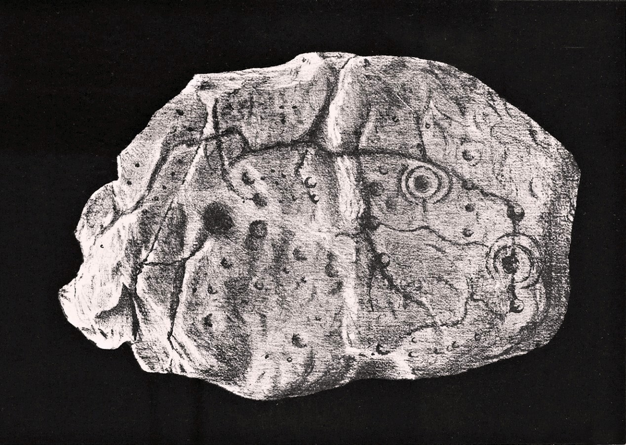
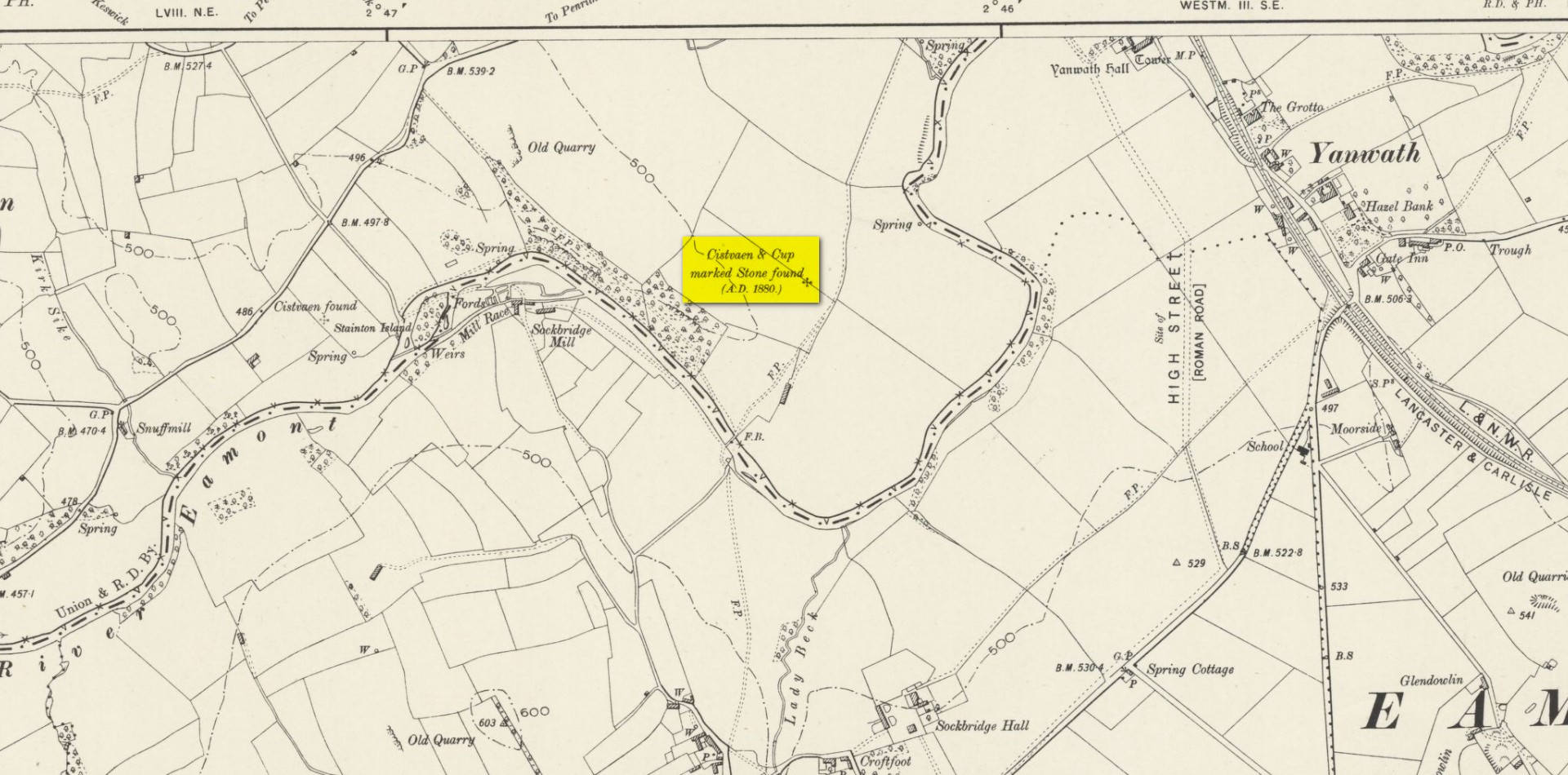
The geographical position of this site was shown on the 1897 Ordnance Survey map, albeit in the past tense as it had been destroyed not long after after being uncovered. Thankfully however, local antiquarian Mick Taylor (1882; 1883) did a damn good job recording what had been found here, and although he had remains of the stone in his possession shortly after it had been found, the carving has subsequently been lost. Thankfully Mr Taylor left us with a good drawing of the design (right).
Located a short distance west of the grand henges of Mayburgh and King Arthur’s Round Table, the carving was found some ten inches below the ground during work that was being done to lay some new fencing. The lads doing the work hit some stone and found it to be covered with a number of standard cup-and-ring motifs facing downwards. This carved stone, wrote Taylor (1882), was in fact “the cover of a kist-vaen”, a.k.a, prehistoric stone burial cist. He then proceeded to give a lengthy account of the site and the carving, telling:
Site shown on 1897 map
“There are traces of ancient occupancy, and vestiges of cairn structure still to be discerned on the hill-side on which it was found, but no barrow nor mound covered this particular grave. A space had been excavated for the interment dipping into the limestone rock to a depth of about 3 feet; the length of the grave was 4 feet, and the breadth about 3 feet 6 inches. Cobble stones had been used partially to line the cavity, but there was no flagging at the sides or bottom. The space was filled with blackish soil, amid which was a quantity of burnt bones, all in a fragmentary state. No implement nor shreds of pottery could be found, but there were several pieces of charcoal. It had evidently been an interment of cremated remains.
“The massive stone which formed the cover of the kistvaen I saw in situ immediately after its discovery.
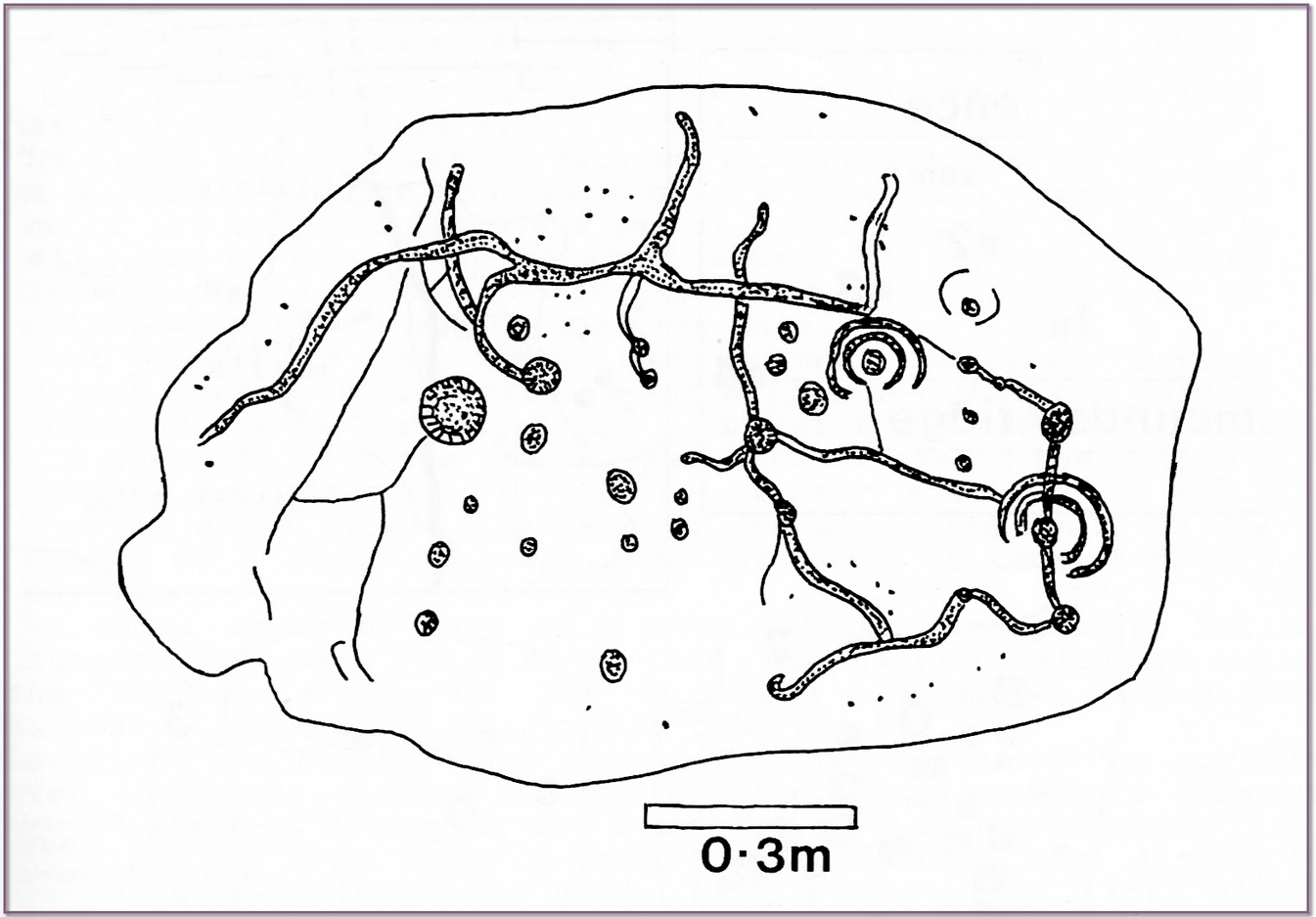
Beckensall’s impression of the design
“This stone is a natural slab of white freestone; it is of a broadish ovoid form, 5 feet 4 inches long, and at the centre 3 feet 6 inches broad, tapering towards each end; and it varies from 8 inches to 13 inches in thickness. The superior surface is rough and irregular, and scored in many places with marks of the ploughshare and harrows, which have passed over it in frequent cultivation. The interior surface, which was presented towards the grave, shows a fairly smooth cleavage, and on it were carved the sculptured markings which I shall describe.
“The slab, which is in my possession, was unfortunately broken in three or four pieces by the hammer of the workman, but I have put it together, and when viewed with a certain light when the shadows are deep, the sculpturings may be well made out, and appear to be arranged as follows: near the bottom there is a central cup deeply carved, about 3 inches in diameter; around this there are two concentric rings, somewhat faintly incised, the outermost of which has a diameter of 6 inches. From this central cup proceed two grooves 6 inches long, which bisect the concentric circles, and traverse in a straight line to join a similar cup on each side of the central one. From this line of cups three gutters meander upwards over the surface of the slab; the main channel takes a direction upwards on the right side of the stone, and receives a number of branches like the tributaries of a river from each side, and terminates on the free margin of the upper part of the stone. On the lowest quarter of the stone to the right there is a large hollow cup 3 inches in diameter, around which also there are two well-executed concentric rings, the largest with a diameter of 6 inches. These rings are cut by a radial groove which joins a gutter in the centre of the stone, and in the opposite direction, at a point in their circumference, they fall into and are subtended by the larger side channel. These are the only two cuttings on the stone which present this annular arrangement; on the other hand, the simple cup markings are numerous, in fact, twenty-four may be counted. One of these cups is greatly larger than any of the rest. It is situated in the centre of the upper half of the slab, and on first view forms the most strikingly characteristic feature of the tablet. This cup is 6 inches in diameter, and is carved out to the depth of 3 inches. The chisel marks are distinct and fresh, as if done yesterday; and there is a smoothness and regularity of execution about it, which evinces that more pains have been taken with it than with some of the other incisions. The other cup-markings vary from 1 inch to 3 inches in measurement. A number of them (about twelve of them may be counted) are associated with the furrowed lines, either forming the beginning of a gutter, or joining or being included in the line of the channel itself. These form the series of the larger cup-markings, and are an inch or more in depth. On the other hand, others of these cups are isolated, and scattered singly, and apparently without regular order over the surface, and unconnected with the branch-like lines; these for the most part are mere shallow depressions, and with less defined margins. Again, there is another class of markings on the stone; they are very numerous, and are dispersed apparently irregularly over all the surface; these are little pits or pick marks, small irregular holes picked into the stone, evidently done with some pointed tool.”
Taylor thought that these “small irregular holes” had been made with a flat-edged chisel whacked with a hammer, and the cup-marks “by a flint or harder stone.” In examples I’ve found in Perthshire where the tools have been left at the site, both a harder stone was found at one (for some reason actually laid within the cup-mark and left there before it had been finished), whilst a flint was laid in the cup-mark of another carving (although that example seemed to be more a deliberate deposit rather than being the tool that made the carving).
Anyhow, considering the poor condition of the carving when Taylor described it—”broken in three or four pieces”—there’s little likelihood of it having survived. But, on the off-chance that someone’s mum or granny has it hiding in the rockery at the back of the garden somewhere, give us a shout….
References:
Beckensall, Stan, Cumbrian Prehistoric Rock Art, Abbey Press: Hexham 1992.
Beckensall, Stan, Prehistoric Rock Art in Cumbria, Tempus: Stroud 2002.
Taylor, Michael W., “On a Sculptured Stone with Cup and Ring-Markings, found at Redhills, near Penrith,” in Proceedings Society of Antiquaries Scotland, volume 16, 1882.
Taylor, Michael W., “On a Cup-marked Stone found at Redhills, near Penrith,” in Transactions Cumberland & Westmorland Antiquarian & Archaeological Society, volume 6, 1883.
Acknowledgements: Huge thanks for use of the Ordnance Survey map in this site profile, reproduced with the kind permission of the National Library of Scotland.
Take the A816 out of Lochgilphead and head north as if you’re going to Kilmartin. Nearly 2 miles along, take the left turn along the B841 Crinan road. A few hundred yards along, go over the canal bridge and about 70 yards along there’s a left turn onto the track into the Knapdale Forest. Go along here (there’s a parking spot) for 200 yards until your reach the grasslands on your left. If you walk into this bit of scrubland, you’ll see the rounded fairy-mound over the fence in the adjacent field, almost overlooking the canal. Y’ can’t really miss it.
Archaeology & History
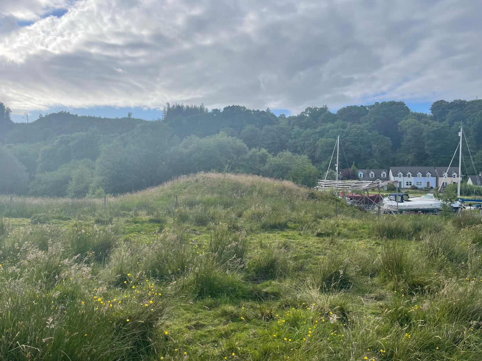
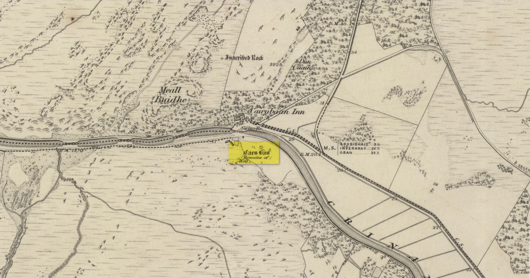
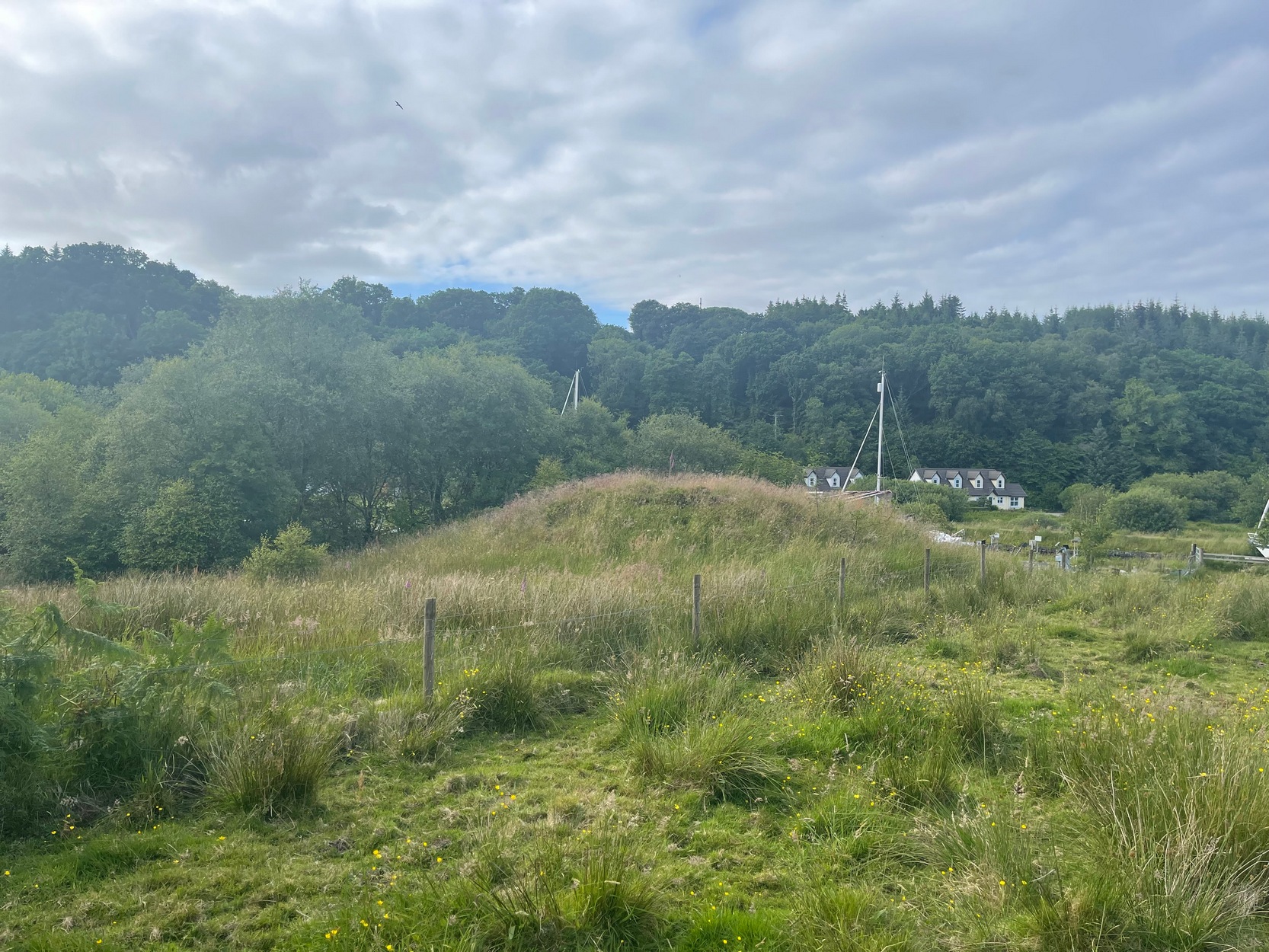
Carn ban, or the White Cairn, from which the hamlet of Cairnbaan gets its name, is a good-sized round cairn, now much overgrown in vegetation, though is still accessible and easy to see. Just above the water-line of the Crinan Canal, the mound is about ten yards across and more than six feet high and is in a good state of preservation. Originally, according to J.H. Craw (1930), the tomb was 12 feet high and 40 feet across!
Carn Ban on 1873 mapCarn Ban, looking NE
In the 1850s, the site was examined by a Dr Hunter of Lochgilphead, and Mr Richardson Smith of Achnaba, and a cist that had been built straight on top of the bare rock was uncovered near the centre of the cairn, nearly four feet long and aligned northeast to southwest. Inside it a thin slab of stone—“2 feet long, 17 inches broad, and 2½ inches thick”—had been slid up against the western end of the chamber and on it was a curious petroglyph design comprising “several incised diamond-shaped figures, one within the other”—five altogether, and the commencement of a sixth—similar to ones found at Newgrange in Ireland. This carving was removed and given to the Scottish National Museum where it still resides. Inside the cist, Hunter and Smith found a deposit of some “yellow sand with some black charcoal and several burnt bones lying upon its bottom”, and a subsequent search unearthed some flint fragments.
The Carn Ban is a good site—but if you’re wanting something bigger, something more impressive, I suggest heading just a few miles north…
References:
Beckensall, Stan, The Prehistoric Rock Art of Kilmartin, Kilmartin Trust: Kilmartin 2005.
Simpson, James, Archaic Sculpturings of Cups, Circles, etc., Upon Stones and Rocks in Scotland, England and other Countries, Edmonston & Douglas: Edinburgh 1867.
Acknowledgements:Huge thanks for use of the Ordnance Survey map in this site profile, reproduced with the kind permission of the National Library of Scotland.
Take the B6362 high road between Lauder and Stow and, regardless of which direction you’re coming from, when you reach the top heights of the moorland road with views all around, you need to keep your eyes peeled for where a dirt-track runs south and, diagonally across the road on its north side, is a dirt-track-cum-parking-spot (if you came from Stow, you should’ve already noticed the cairn on the skyline on your way up). There’s a hut circle in the heather by the parking spot. From here, just walk over the heather nearly 300 yards north. Y’ can’t really miss it.
Archaeology & History
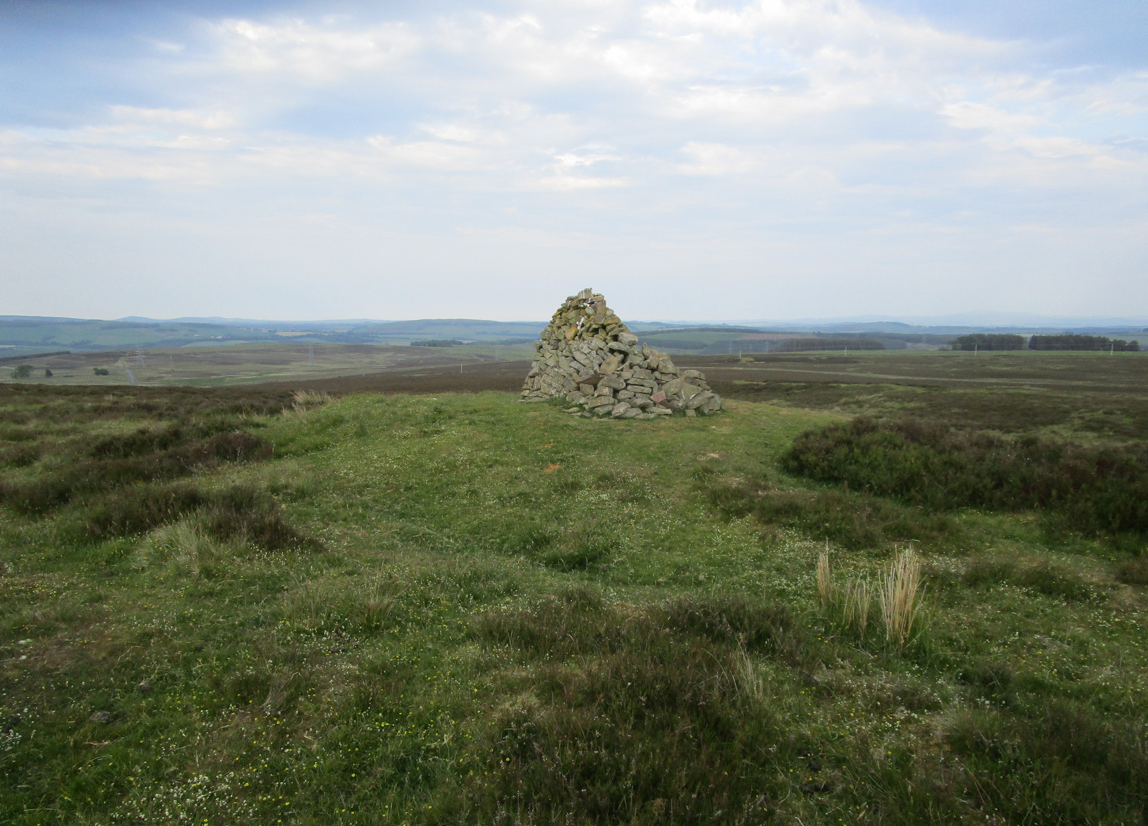
Looking to the southeast
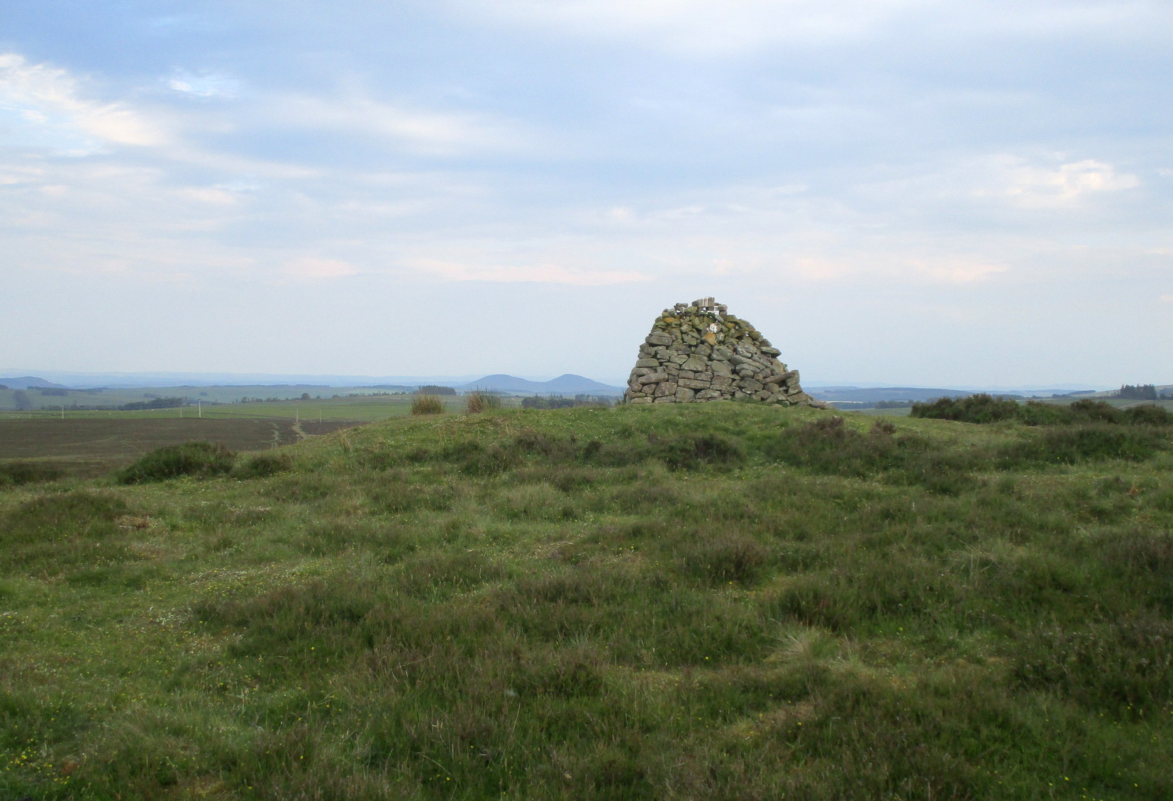
The first thing that you see as you approach here is a modern cairn which is sat upon the more ancient and completely overgrown one. You can’t really see the “ancient” section of it until you walk round to its more northern side, where you’ll then notice how the new cairn has been built on top of a small but artificial rise in the ground, about ten yards across. This is the original ancient cairn. Sections of the ground have come away on its southern side, revealing a scattered mass of loose stones. It doesn’t seem to have been excavated but has all the hallmarks of being typically Bronze Age by the look of it. Of particular note is the superb view from here, not least towards the legendary Fairyland of the Eildon Hills, standing out clearly about 10 miles to the south…
Cup-and-Ring Stone: OS Grid Reference – NZ 0774 7048
Archaeology & History
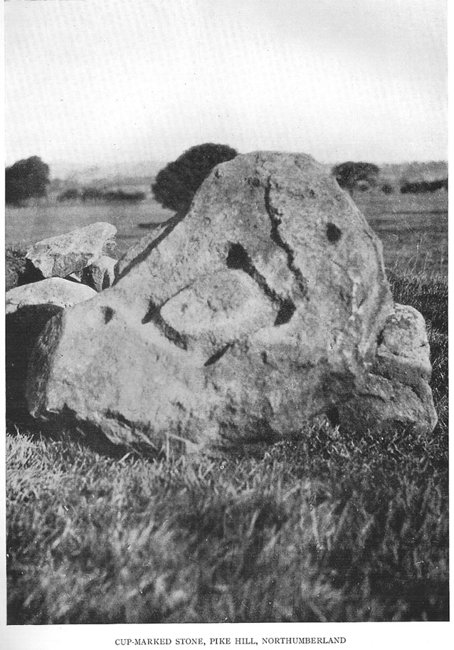
1928 photo of carving
Found inside a prehistoric tomb that was excavated in the late 1920s “by Messrs R.C. and W.P. Hedley at Pike Hill, near Stamfordham,” this fascinating-looking carving was found on a stone that “was overlying the primary burial” cist in the middle of the tumulus, measuring “2 feet 9 inches long by 2 feet wide and 12 inches deep, with an orientation on the longer axis of NE.” As we can see in the old photo that accompanied Mr Hedley’s (1928) short article in Antiquity journal, four single cups are arranged in a rough square and are joined with each other by a single line, running from cup to cup, outlining a clear quadrilateral formation. Two other single cups are outliers on the left and right side of the ‘square.’
A second smaller cist was also found inside the same mound and on the central inner face of this was another, more simplistic carving described as “a very fine cup-mark 1½ inch in diameter and ¾-inch deep.” These carvings are no longer in situ (I think they’re in Newcastle Museum) and apparently this second single cup-marked stone can no longer be located.
References:
Beckensall, Stan, Northumberland’s Prehistoric Rock Carvings, Pendulum: Rothbury 1983.
Beckensall, Stan, Prehistoric Rock Motifs of Northumberland – volume 2: Beanley to the Tyne, Abbey Press: Hexham 1992.
Hedley, R. Cecil, “Ancient British Burials, Northumberland,” in Antiquity Journal, volume 2, December 1928.