Harden Moor (1), Harden, Bingley, West Yorkshire

Cup-and-Ring Stone:  OS Grid Reference – SE 07342 38371

Getting Here
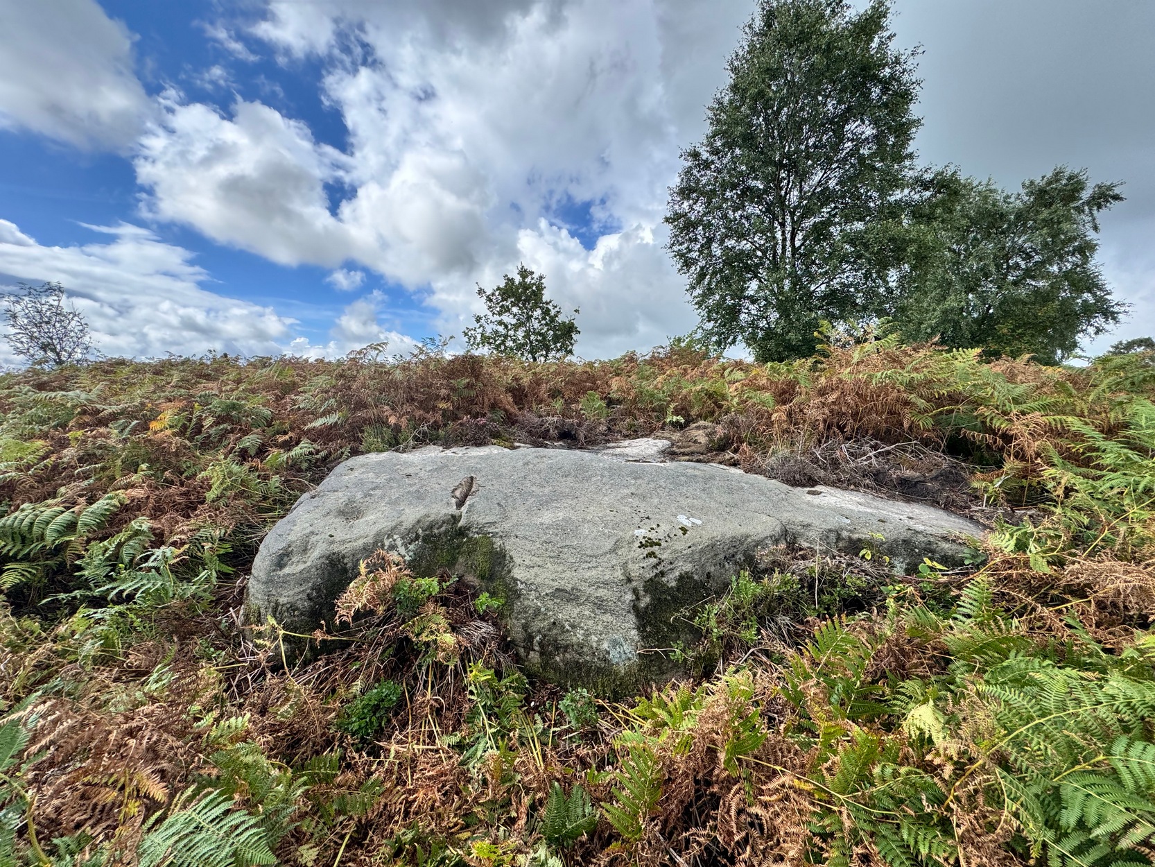
Harden Moor’s cup-&-ring

We took the long road round to get here, but perhaps the easiest route, from Harden village, is to go up Long Lane then turn right up the tiny Ryecroft Road.  Three-quarters of a mile up, past the entrance to the quarry, park up.  Walk back past the entrance to the quarry, and barely 50 yards past it, a wall on your left heads up the slope.  Walk up alongside the wall on the same side as the quarry (not in the field) for 250 yards where you reach the moorland and some fencing that runs to your left.  Walk alongside this for about 40 yards and then head to one of the birch trees on the moorland about 25 yards away.  Hereby is the large earthfast rock.  You’re damn close!

Archaeology & History
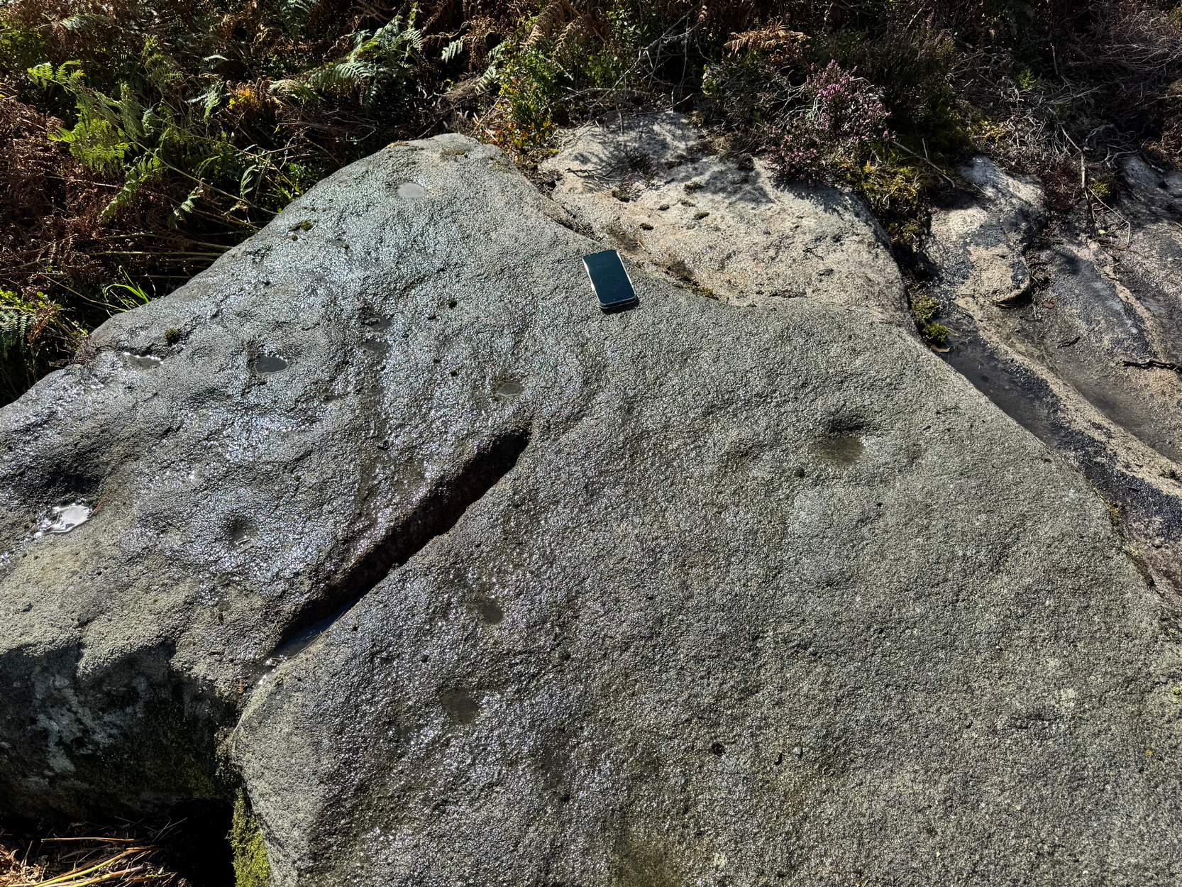
Main section of design

Rediscovered earlier this year by Lee Brotherton, this is—officially at least—the only prehistoric cup-and-ring stone on Harden Moor (a modern one has been carved not far from the Harden Moor circle more than 500 yards to the north-east).  A single cup-marked stone not far from the circle seems to be the only other petroglyph up here…..and for good reason: much of this small moorland area was heavily quarried in the 19th and 20th century and, obviously, traces of the prehistoric sites that were mentioned by earlier antiquarians have been destroyed.  This carving has been damn lucky to survive!

When you stand on top of this large curvaceous earthfast stone, you’ll notice a deep straight industrial cut into the edge of the rock, part of which runs into a section of the carving.  So it seems that the stone was selected for destruction but, for one reason or another, was spared the fate of its neighbours—thankfully!
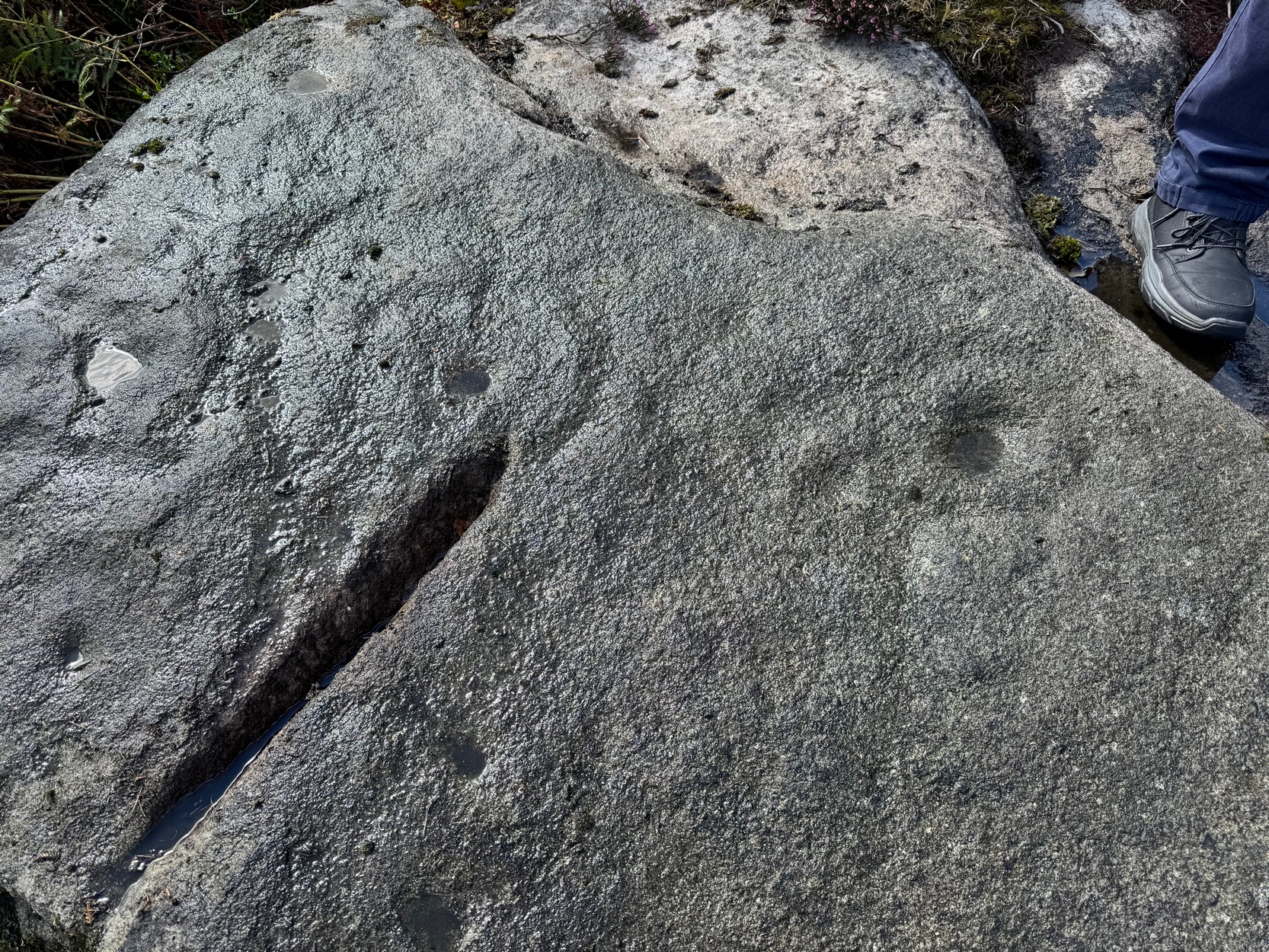
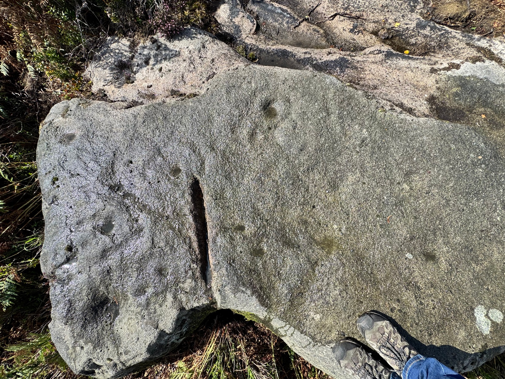
Cups, rings & arcs
Cups, rings & arcs

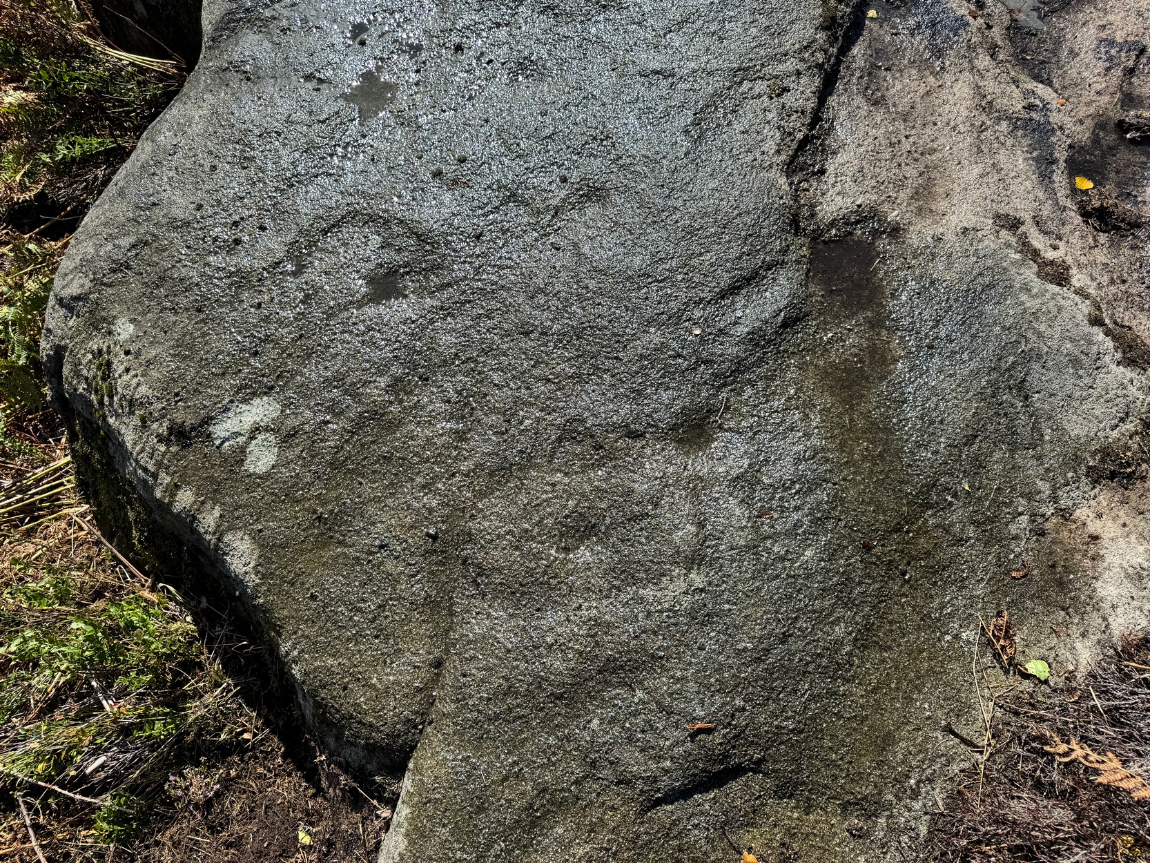
Of the carving: the most notable thing you’ll see when you visit is the large, wide cup-and-ring design near the highest point of the rock, roughly 45° right of the deep cut.  It’s clearly visible even under bright sunlight, but as you can see in the photos, we’ve wet the stone and this element stands out much clearer.  A carved semi-circle with a smaller shallower cup-mark is attached at the side of this large cup-and-ring.  This may originally have been a complete cup-and-ring, but on our visit here, the high sun prevented us getting a clearer perspective.
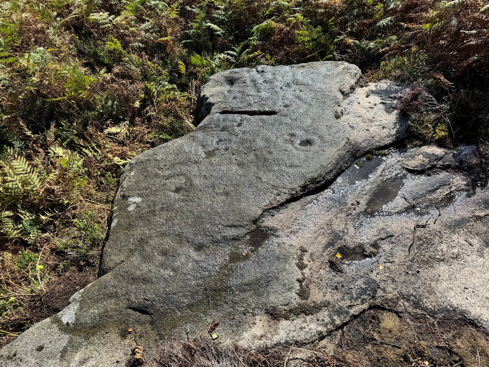
At the top-end (south) of the deep quarry-mark is a single cup with a wide surrounding ring, which may have originally been complete.  What seems to be a carved line emerges from this central cup-mark and moves to the southern side of the stone; and it seems there’s a much wider, incomplete outer ring arching round the south- and eastern section of the inner ring.  These elements are visible in the photos but, once again, they need to be looked at in better light, when the sun is low.  Further down the side of the deep quarry mark, closer to the edge of the stone, is what seems to be another single cup-and-ring.  There are other marks on this part of the rock, but most of them seem to be natural.
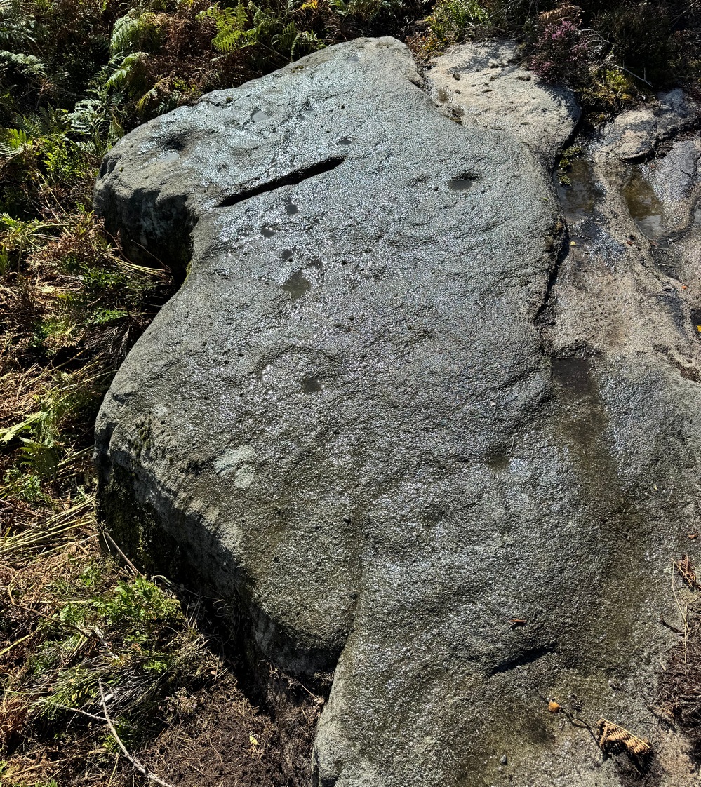
Looking down the stone
Close-up of cup-&-oval

A curious design element on the stone is at the more northern end where a notable large singular cup-mark is found.  When we brushed water across this part of the stone, the isolated cup-mark seemed attached to an elongated, almost rectangular carved ‘enclosure’ design, near the middle of which was another shallow cup.  You can make it out in the photos, but it was difficult (again!) to see this clearly.

One final note to this site entry: despite a high degree of improbability, there might still be other carvings on some of the remaining rocks on this moorland. The general rule is a simple one: where there’s one carving, others tend to be close by.  So keep your eyes peeled if you explore the area…

AcknowledgementsHuge thanks to Martin Ferner for getting us up here.

© Paul BennettThe Northern Antiquarian 

Carn Ban, Cairnbaan, Lochgilphead, Argyll

Cairn:  OS Grid Reference – NR 84009 90709

Also Known as:

  1. Cairnbaan
  2. White Cairn

Getting Here

Misty mound of Carn Ban

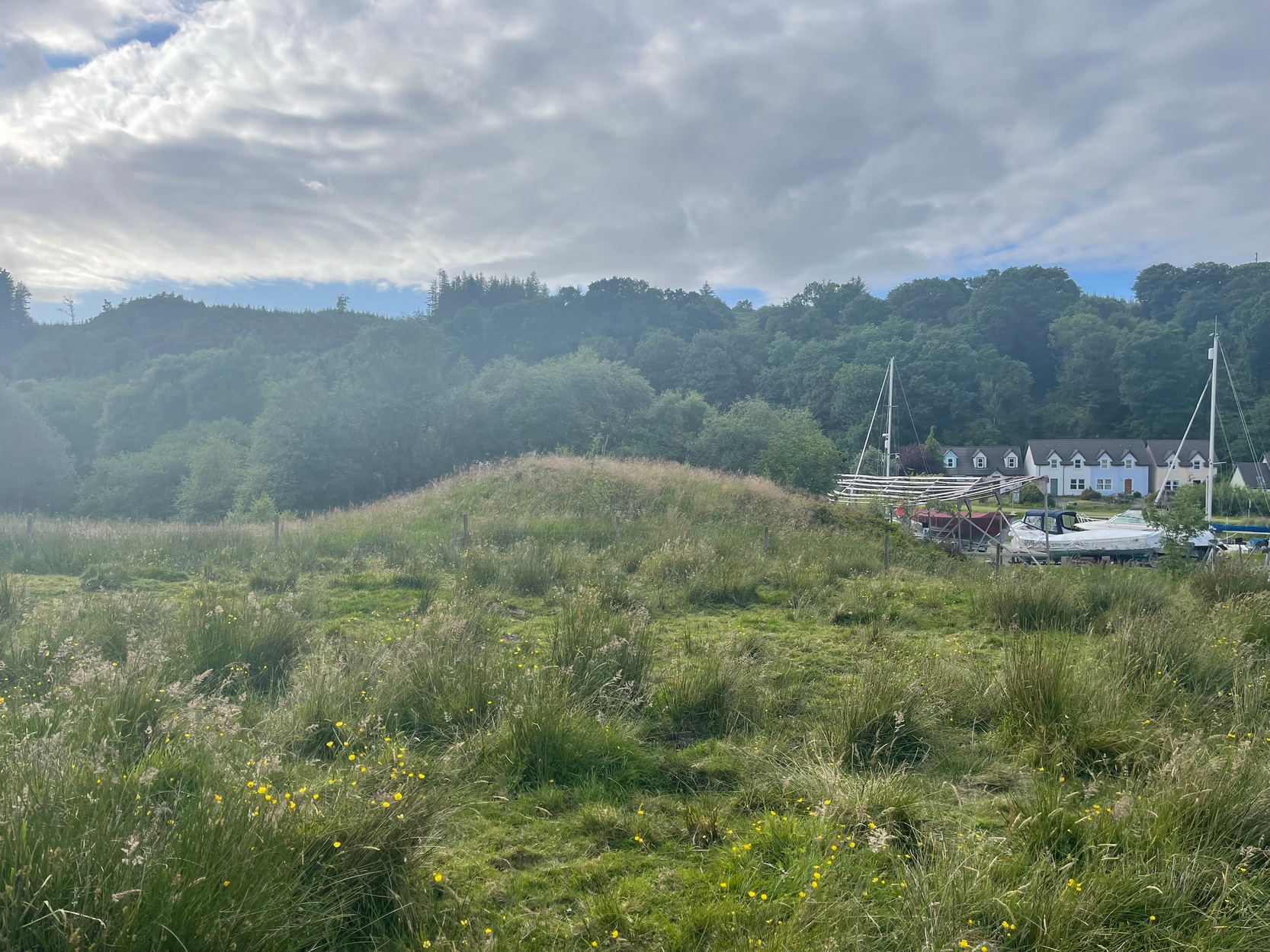
Take the A816 out of Lochgilphead and head north as if you’re going to Kilmartin.  Nearly 2 miles along, take the left turn along the B841 Crinan road.  A few hundred yards along, go over the canal bridge and about 70 yards along there’s a left turn onto the track into the Knapdale Forest.  Go along here (there’s a parking spot) for 200 yards until your reach the grasslands on your left.  If you walk into this bit of scrubland, you’ll see the rounded fairy-mound over the fence in the adjacent field, almost overlooking the canal.  Y’ can’t really miss it.

Archaeology & History

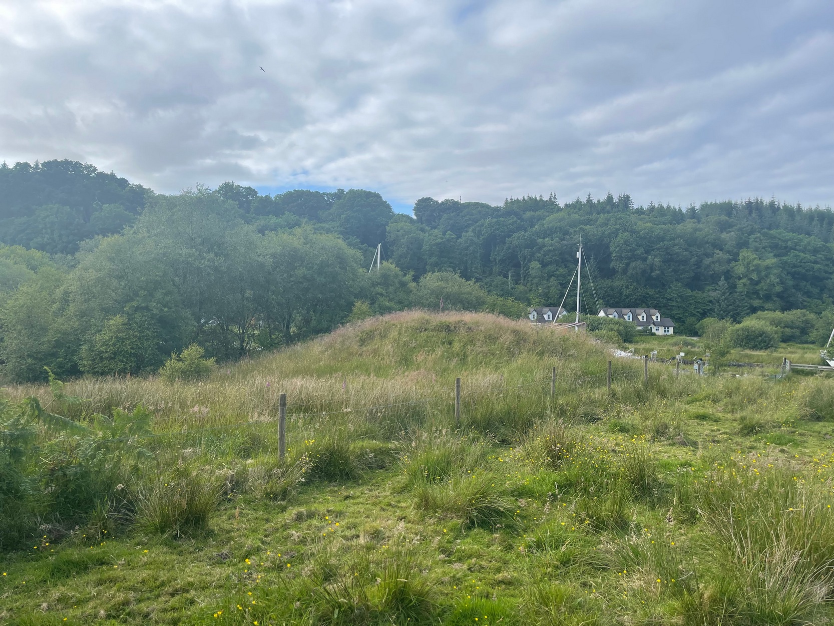
Carn ban, or the White Cairn, from which the hamlet of Cairnbaan gets its name, is a good-sized round cairn, now much overgrown in vegetation, though is still accessible and easy to see.  Just above the water-line of the Crinan Canal, the mound is about ten yards across and more than six feet high and is in a good state of preservation.  Originally, according to J.H. Craw (1930), the tomb was 12 feet high and 40 feet across!

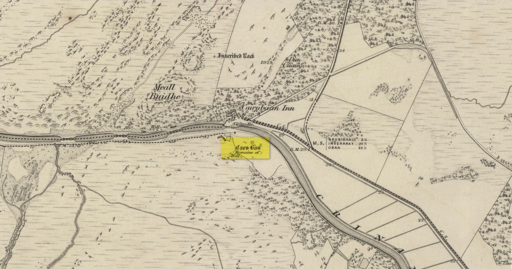
Carn Ban on 1873 map
Carn Ban, looking NE

In the 1850s, the site was examined by a Dr Hunter of Lochgilphead, and Mr Richardson Smith of Achnaba, and a cist that had been built straight on top of the bare rock was uncovered near the centre of the cairn, nearly four feet long and aligned northeast to southwest.  Inside it a thin slab of stone—“2 feet long, 17 inches broad, and 2½ inches thick”—had been slid up against the western end of the chamber and on it was a curious petroglyph design comprising “several incised diamond-shaped figures, one within the other”—five altogether, and the commencement of a sixth—similar to ones found at Newgrange in Ireland.  This carving was removed and given to the Scottish National Museum where it still resides.  Inside the cist, Hunter and Smith found a deposit of some “yellow sand with some black charcoal and several burnt bones lying upon its bottom”, and a subsequent search unearthed some flint fragments.

The Carn Ban is a good site—but if you’re wanting something bigger, something more impressive, I suggest heading just a few miles north…

References:

  1. Beckensall, Stan, The Prehistoric Rock Art of Kilmartin, Kilmartin Trust: Kilmartin 2005.
  2. Campbell, Marion & Sandeman, M.L.S., “Mid-Argyll: A Field Survey of the Historic and Prehistoric Monuments”, in Proceedings of the Society of Antiquaries, Scotland, volume 95, 1964.
  3. Craw, J. Hewat, “Excavations at Dunadd and at other Sites on the Poltalloch Estates, Argyll”, in Proceedings of the Society of Antiquaries, Scotland, volume 64, 1930.
  4. MacBrayne, David, Summer Tours in Scotland, D. MacBrayne: Glasgow 1886.
  5. Royal Commission Ancient & Historical Monuments of Scotland, Argyll – volume 6: Mid-Argyll and Cowal, HMSO: Edinburgh 1971.
  6. Simpson, J.Y., “On Ancient Sculpturings of Cups and Concentric Rings,” in Proceedings of the Society of Antiquaries, Scotland, volume 6, 1866.
  7. Simpson, James, Archaic Sculpturings of Cups, Circles, etc., Upon Stones and Rocks in Scotland, England and other Countries, Edmonston & Douglas: Edinburgh 1867.

Acknowledgements:  Huge thanks for use of the Ordnance Survey map in this site profile, reproduced with the kind permission of the National Library of Scotland

© Paul BennettThe Northern Antiquarian

Traquair Churchyard, Traquair, Peeblesshire

Cup-Marked Stone (lost):  OS Grid Reference – NT 3202 3347

Archaeology & History

In 1974, Ordnance Survey reported the existence of “a large piece of sandstone containing two depressions resembling cup marks” in the churchyard wall which, tradition told, originally came from the ruined 12th century parish church (long gone) more than 300 yards to the southwest (at NT 3185 3328).  However, in recent years the cup-marks seem to have disappeared and may be hiding behind the overgrowth of ivy in the boundary wall.  It needs to be recovered.

Halfway between the location of the original church and the present one, waters from the heathen St Bryde’s Well used to flow, but it had already been drained by 1856.

© Paul BennettThe Northern Antiquarian

Meikle Whitefield, Cargill, Perthshire

Stone Circle (destroyed):  OS Grid Reference – NO 173 342 (approximation)

Archaeology & History

In an archaeological report by Alexander Hutcheson for the Scottish Society of Antiquaries in 1884, he described and illustrated an impressive cup-and-ring stone that was formerly built into the walls of a demolished house ¾-mile from its original position near Meikle Whitefield farm.  Upon destruction of that house, the farmer of West Whitefield—a half-mile from its original position—then moved the stone it into his front garden.  According to tradition, said Hutcheson, this stone

“was originally removed from a circle of stones, which had stood about half-a-mile eastward, but which have now been buried or broken up.”

Despite the local tradition, Hutcheson was some what sceptical of it, thinking that it

“seems very unlikely that such a weighty stone should have been transported for half a mile merely to serve as a foundation stone for a cottage, when the ground around was capable of supplying as many stones as would be required.”

You can see his point; but there are known circumstances where individual stones from megalithic rings have been preserved.  Hence, like John Barnatt (1989) in his magnum opus who preserved the folk memory of such sites, we include it here.  The tradition may well be valid.  Added to this is the fact that in just a few square miles hereby we once had a large cluster of stone circles, a few of which still remain.

Refeences:

  1. Barnatt, John, Stone Circles of Britain (2 volumes), BAR: Oxford 1989.
  2. Hutcheson, Alexander, “Notice of a Cup and Ring-marked Stone, and of Incised Stones Recently Discovered at Cargill, and of an Incised Boulder at Fowlis Wester,” in Proceedings Society Antiquaries Scotland, vol. 18, 1884.

© Paul BennettThe Northern Antiquarian

Monzie Carving, Crieff, Perthshire

Cup-and-Ring Stone:  OS Grid Reference – NN 88161 24176

Getting Here

Andy Finlayson’s original piece

From Gilmerton village, take the A822 Dunkeld road north.  Go for about 200 yards and take the little road to Monzie; watching carefully another 200 yards on for the dirt-track on the left taking you across the fields.  Go along the track, watching out for the small stones in the field on your right less than 200 yards along.  You can’t really miss ’em!  This small ring of stones is the Monzie Cairn Circle.  The carving is just in front of it!

Archaeology & History

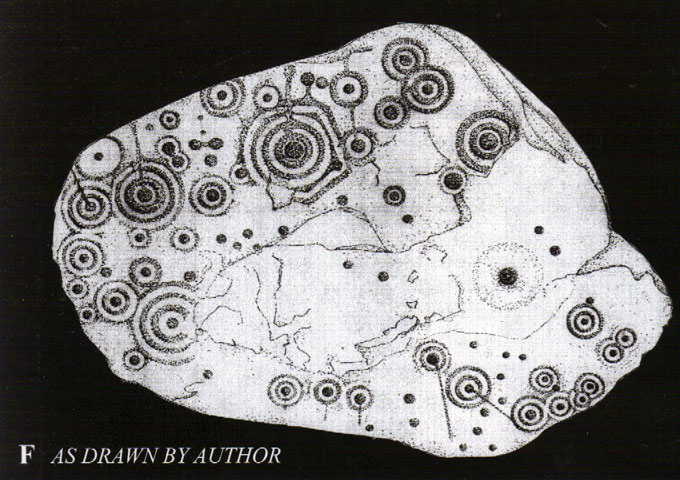
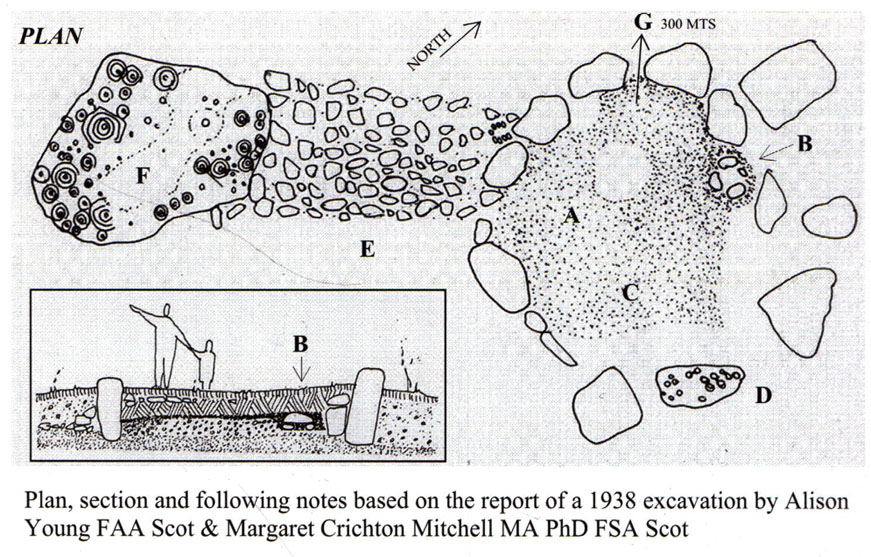
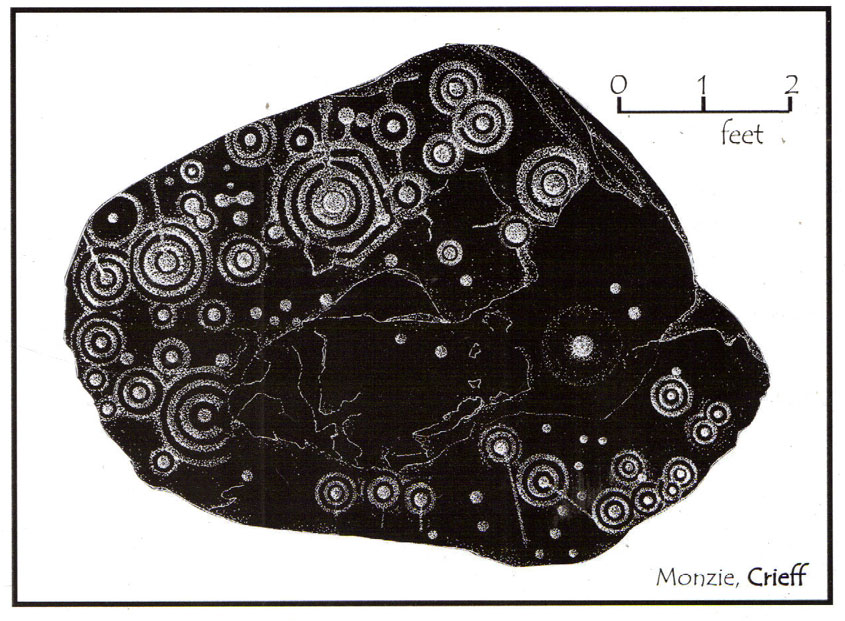
Although we know this brilliant carved stone has some relationship with the Monzie cairn circle only five yards away (it was linked via a man-made stone causeway, running between the circle and the carving), the stone itself is very much deserving of its own entry here — and at the same time I can give Andrew Finlayson’s (2010) excellent book a decent plug aswell! (the superb drawings of the stone, top & bottom, are from Andy’s work)

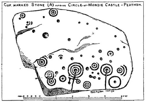
Allen’s 1882 drawing
Carving & proximity of circle

First mentioned (I think) in Simpson’s (1867) early survey, the carving was described soon after by J. Romilly Allen (1882), who gave us an early drawing of the stone.  Thought by some to have originally stood upright, the carving was described by Aubrey Burl (2000) as being, “decorated with forty-six cupmarks, cup-and-rings, nine double, one triple, there are grooves and a pair of joined cups.”  It’s certainly an impressive carving!

Although the carving has been posited by some archaeologists as an outlier to the Monzie circle, it’s probable that the circle emerged from the carving — a concept that some may find difficult to understand.  I’m not aware of any modern excavations here (the last, I think, was in 1938), but my guess would be that the stone causeway laid between the cup-and-ring stone and the circle ran towards the circle from the carving, and not the other way round.  The carving is probably older than the stone ring — though of course, without excavation, my idea could be utter bullshit! (there are also some cup-marked stones in the circle aswell – though none as impressive as this)

The carving in shadow (© Andrew Finlayson)

One of my truly favourite megalith fanatics (despite some of his alignments being out), Alexander Thom, came here and thought this old carving “coincided with a rough stellar alignment from the centre-point of the cairn” (Hadingham 1974); though his notes in Megalithic Rings (1980) tell that,

“from the cupmarked stone beside the circle, the midsummer sun sets above an outlier some 800ft distant.”

The “outlier” that Thom mentions is known as the Witches’ Stone of Monzie, which Simpson (1867) appears to have mistakenly thought was the name of this very carving.

References:

  1. Allen, J. Romilly, “Notes on some Undescribed Stones with Cup Markings in Scotland,” in Proceedings of the Society of Antiquaries Scotland, volume 16, 1882.
  2. Burl, Aubrey, The Stone Circles of Britain, Ireland and Brittany, Yale University Press 2000.
  3. Finlayson, Andrew, The Stones of Strathearn, One Tree Island: Comrie 2010.
  4. Hadingham, Evan, Ancient Carvings in Britain, Garnstone: London 1974.
  5. Simpson, James, Archaic Sculpturings of Cups, Circles, etc., Upon Stones and Rocks in Scotland, England and other Countries, Edmonston & Douglas: Edinburgh 1867.
  6. Thom, Alexander, “Megalithic Astronomy: Indications in Standing Stones,” in Vistas in Astronomy, volume 7, 1966.
  7. Thom, A., Thom, A.S. & Burl, H.A.W., Megalithic Rings, BAR: Oxford 1980.

© Paul Bennett, The Northern Antiquarian