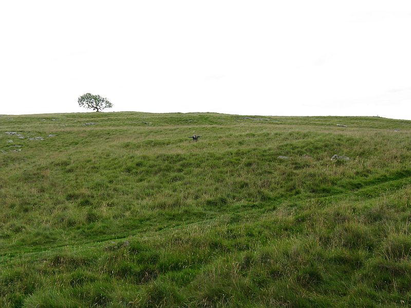
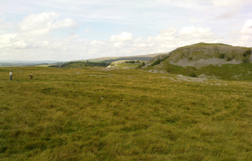
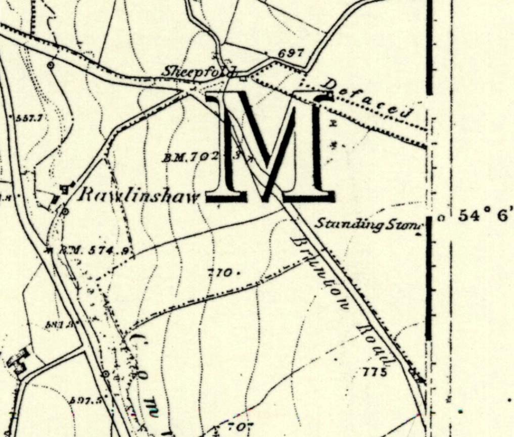
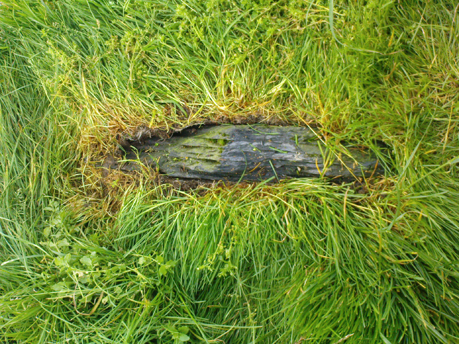
Standing Stone (destroyed?): OS Grid Reference – SE 282 402
Archaeology & History
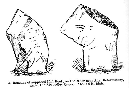
Idol Rock, Adel (Simpson 1879)
Difficult to know what to think about this one. It seems to have been described just once in the latter half of the 19th century by that real Bible-thumping nutcase, Henry Simpson (1879), who gave us the only known picture of the place. Simpson said that it was, “the remains of supposed Idol Rock on the moor near Adel reformatory, under the Alwoodley Crags. About six foot high.” It is believed to have been destroyed, but having not checked the region thoroughly, it could still be there somewhere (the grid reference cited here is an approximation). Does anyone know owt else about it?
References:
Simpson, Henry T., Archaeologia Adelensis, W.H. Allen: London 1879.
Bittova journey this — but well worth it! From Broughton-in-Furness take the A595 road west, past Duddon Bridge for about another 1½ miles, turning right up the small single-track country lane beloved of city-mind drivers, up the fertile scruffy road, past Broadgate and stopping just before Cragg Hall Farm. There’s a dirt-track running up the back of Cragg Hall. Go up here and keep walking for a mile or so until, as you approach Swinside Farm and the fields open up in front of you, the stones begin to appear.
Archaeology & History
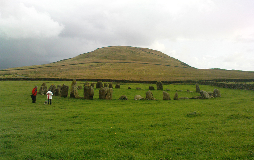
Swinside, looking east
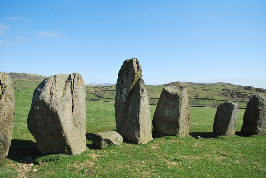
The Swinside stone circle is Aubrey Burl’s favourite. And for good reason! Like other impressive megalithic rings of the region, the stones are large, well set, and the landscape holds the stones finely in the hills. Without the landscape here, Swinside (like Castlerigg and elsewhere) would not have such grandeur. When you sit in the ring, or walk round it, Knott Hill to the south was of obvious mythic relevance to the people who built this stone circle four or five thousand years ago. But this can be said of many of the surrounding crags. A few miles southwest we see the top of the haunted Black Combe rising into clouds, still speaking to some with spirits from animistic realms, long known to our ancestors. Following the skyline west and past the small falls of Whicham stream, whose name speaks of long past trees, we reach the near-west skyline with the cairn-looking pap of the Raven Crag, symptomatic of magickal rites calling to and beyond the circle. To the north is the symbolic ridge of Lath Rigg. Along the craggy eastern ridges from here you get the impression that you’re more in Argyll than Cumbria; and the break in the hills to the southeast reaches to the distant pinnacle of Kirkby Moor, where the midwinter sunrise emerged to tell of solar calendrical motions and the coming of the dark season to our megalithic tribes. But enough of the landscape!
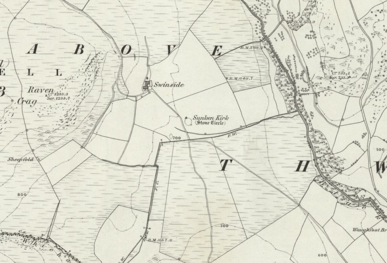
Swinside on 1867 OS-map
Although the name Swinside can be traced back to the 13th century, the local folk-name of the circle—Sunken Kirk—was mentioned for the first time as “the Chapell Suke” in Parish Registers of 1624. No earlier literary source has yet been identified, probably because of the isolation of the site and the lack of people writing about the area. Swinside stone circle is, just about, a perfect circle, give or take a foot here and there, holding the circular dome of the heavens within its domain. Yet despite its almost regal appearance, early references to the site seem scant. It seems to have been first described in William Hutchinson’s huge History of Cumberland (1794), where he told:
“In the neighbourhood of Millum, at a place called Swinside, in the estate of William Lewthwaite Esq., of Whitehaven, is a small but beautiful druidical monument; it is circular, about twenty eight yards in diameter; the stones of which it is composed are from six to eight feet high, all standing and complete. A little to the south, is another of larger dimensions, but not in so perfect a state: the neighbouring people call those places by the emphatical names of Sunken Kirks.”
A few years later, William Camden’s legendary text Britannia was edited and reprinted again, this time by Richard Gough (1806), who told:
“At Swineshead, a very high hill…is a druidical temple, which the country folk call Sunken Kirk, i.e., a church sunk into the Earth. It is nearly a circle of very large stones, pretty entire. No situation could be more agreeable to the Druids than this; mountains almost encircle it, not a tree is to be seen in the neighbourhood, nor a house, except a shepherd’s cot at the foot of a mountain surrounded by a few barren pastures. At the entrance are four large stones, two placed on each side at the distance of six feet. The largest on the left hand side is five feet six inches in height, and ten feet in circumference. Through this you enter into a circular area, 29 yards by 30. This entrance is nearly southeast. On the north or right-hand side is a huge stone of conical form, in height nearly nine feet. Opposite the entrance is another large stone which has once been erect, but is now fallen within the area: its length is eight feet. The left hand or southwest is one, in height seven feet, in circumference 11 feet nine inches. The altar probably stood in the middle, as there are some stones still to be seen, though sunk deep in the earth. The circle is nearly complete, except on the western side some stones are wanting. The largest stones are about thirty one or two in number. The outwards part of the circle upon the sloping ground is surrounded with a buttress or rude pavement of smaller stones raised about half a yard from the surface of the Earth… This monument of antiquity, when viewed within the circle, strikes you with astonishment, how the massy stones could be placed in such regular order either by human strength or mechanical power.”
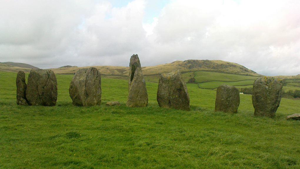
Tall, northernmost stone to centreNortheast section of the ring
It seems he was impressed! Yet despite this, in the 19th century not many folk strayed this far into the western edges of Lakeland to look upon Swinside. There were occasional descriptions from travellers and antiquarians such as J.T. Blight (1843) and Edwin Waugh (1861), each speaking of the site’s visual magnitude, but it wasn’t until archaeologist C.W. Dymond came here, first in 1872 and then again in 1877, that a fuller account of the site came into being. In his essay on a “Group of Cumberland Megaliths,” he said how the stones were still in excellent condition and that,
“few of the stones seem to have been removed — probably because plenty of material for walling and road-making could be collected from the neighbouring hillside.” (Dymond 1881)
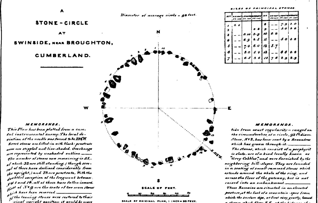
When Mr Dymond first came here he told of the remains of a rowan tree which had split one of the stones, but this has long gone. More than twenty years after the archaeologist’s first visit, he returned with R.G. Collingwood to make a more detailed evaluation of the ring. He measured and planned Swinside like it had never been done before and his ground-plan (below) is still very accurate indeed. Aubrey Burl (1999) takes up the story:
“The ring was partly excavated by Dymond, Collingwood and three men from midday Tuesday, 26 March 1901, until the close of the following evening. They dug two long, intersecting 46cm-wide trenches, NW-SE, NE-SW, across the ring with a curious zigzagging pattern of others between southeast and southwest: an investigation of some 51m² of the central area. Within the circle the trenches represented less than a thirteenth of the 642m² of the interior.
“Below the grass and turf was a thin layer of soil under which yellowish marl or ‘pinnel’ varied from 15cm to 75cm in depth, being deepest at the entrance which had been dug into earlier around 1850. Wherever it was uncovered the gravelly marl was wavily uneven, presumably the result of ploughing. The bases of the circle-stones rested on the pinnel, held firmly in their holes by small cobbles with others heavily packed around the sides. The only finds were a nut-sized lump of charcoal just northeast of the centre with others near the entrance; a minute splinter of decayed bone near the first bit of charcoal and two pieces of red stone. There were also some contemporary glass sherds and a Lancaster halfpenny dated between 1789 and 1794 lying in the uppermost turf layer.”
Dymond’s 1881 plan of Swinside
Since these early archaeological digs, Swinside has given up little else. Much like other stone circles in the British Isles, few real clues as to exactly what went on here have been forthcoming. But in the 1960s, investigations into megalithic sites made a bit of a quantum leap and some old ideas about astronomical ingredients were resurrected.
Alexander Thom’s plan of Swinside
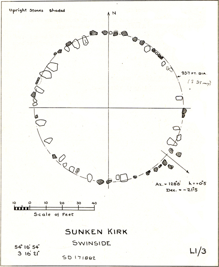
Swinside was one of the places explored by engineer and megalith enthusiast, Alexander Thom. Thom was one of the prime figures instrumental in the resurgence of interest in megalithic sites — and his finds of megalithic astronomy and prehistoric mathematics had a lot to do with it. Although we know today that some of Thom’s work isn’t correct, his explorations and research stand him far ahead of most archaeologists who pretended to represent this area of research. He left us with the most detailed ground-plans of megalithic sites to date and, of course, showed some fascinating alignments.
Thom listed Swinside as site “L1/3” and made the most detailed and accurate ground-plan of this and 18 other megalithic rings in Cumbria. He found it to be 94 feet in diameter, with an internal area measuring 6940 square feet. The one major alignment Thom found at Swinside was of the winter solstice sunrise, lining up just on the edge of the ‘entrance’ to the circle’s southeastern side.
Folklore
Like a number of other stone circles, folklore told that you couldn’t count the stones. Janet and Colin Bord (1997) also told that people once tried to build a church here in early christian days, but once the builders went home in the evening, the Devil pulled down what they’d built during the day. A motif found at Ilkley’s Hanging Stones cup-and-ring carvings and many other prehistoric sacred sites in the country.
References:
Armstrong, A.M. et al., The Place-Names of Cumberland – volume 2, Cambridge University Press 1950.
Bord, Janet & Colin, Prehistoric Britain from the Air, Weidenfeld & Nicolson: London 1999.
Burl, Aubrey, “‘Without Sharp North…’ – Alexander Thom and the Great Stone Circle of Cumbria”, in Ruggles, Clive, Records in Stone, Cambridge University Press, 1988.
Burl, Aubrey, A Guide to the Stone Circles of Britain, Ireland and Brittany, New Haven & London 1995.
Burl, Aubrey, Great Stone Circles, Yale University Press: New York & London 1999.
Burl, Aubrey, The Stone Circles of Britain, Ireland and Brittany, Yale University Press 2000.
Dymond, C.W., “A Group of Cumberland Megaliths,” in Transactions of the Cumberland and Westmorland Antiquarian and Archaeological Society, volume 5, 1881.
Dymond, C.W., “An exploration at the Megalithic Circle called Sunken Kirk at Swinside, in the Parish of Millom, Cumberland,” in Transactions of the Cumberland and Westmorland Antiquarian and Archaeological Society, New Series volume 2, 1902.
Gough, Richard (ed.), Camden’s Britannia, J. Nichols and Son: London 1806.
Hutchinson, William, The History of the County of Cumberland – volume 1, F. Jollie: Carlisle 1794.
Seton, Ray, The Reason for the Stone Circles in Cumbria, R. Seton: Morecambe 1995.
Thom, Alexander, Megalithic Sites in Britain, Oxford University Press 1967.
Thom, A., Thom, A.S. & Burl, H.A.W., Megalithic Rings, BAR: Oxford 1980.
Waterhouse, John, The Stone Circles of Cumbria, Phillimore: Chichester 1985.
Waugh, Edwin, Seaside Lakes and Mountains of Cumberland, Alexander Ireland: Manchester 1861.
ACKNOWLEDGEMENTS:
Huge thanks to Brian Else for his photos. And to Paul and Tricia for taking us here, in awesome downpour weather!
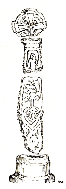
As with many old churches, St. James’ at the northern side of the village has remains of old cross fragments that can be seen inside. They were described at some length in W.S. Calverley’s (1899) excellent work on such monuments. Mr Langham (1972) also gave a good account of the respective cross fragments in his short work on this history of the church, listing the sections as a, b, c, d and e. He wrote:
“a) the greater part of a wheel-head, the reverse side of which has a sunk centre instead of a raised boss, making it a five hole cross. Calverley remarks, “a rarity in the district.”
“b) probably the top of a shaft having on its face a panel with a defaced figure, and conventional ornaments on the side.
“c) probably the lower part of a shaft with figures in two panels, and with incised interlacing designs on the reverse side “of late Scandinavian type, resembling fibulae of the Viking Age.” On the face, the lower panel is Christ risen or rising from the tomb. He is trampling on a serpent and carries a palm of victory in his left hand. The panel above has two figures, suggested by Calverley to be “either John or Mary, or two angels.”
“d) the neck of a cross. Calverley notes that the execution of the wheel-head and the shaft-fragments was by a hacking not a chiselling method, and he makes the comment: “The shafts and head at Burton are similar in workmanship to those at Halton. The Halton crosses and not Norse in style, but are like late pre-Norman work in Yorkshire, where the Danes lived.”
“e) a part of a second shaft with a zigzag pattern. Calverley says that “it is neatly chiselled, and the designs suggests a Norman date, although it seems to belong to a cross of Saxon type.” The Royal Commission volume dates it as the 10th or 11th century.”
St James church cross (by M.D.S. Brown-Smith)
The Royal Commission volume dates the cross shafts as “probably late 10th century.” Sir Nikolaus Pevsner in a recent book, Guide to Cumberland and Westmorland states specifically that, “Christ, the Virgin and St. John are on the Burton-in-Kendale cross.” This is too explicit a statement in view of the deterioration in the detail.
Nearby to the northeast used found to be the remains of a holy well dedicated to St. Helen. Does anyone have further information about it?
References:
Calverley, W.S., Notes on the Early Sculptured Crosses, Shrines and Monuments in the Early in the Present Diocese of Carlisle, T. Wilson: Kendal 1899.
Langham, John G., Parish Church of St. James, Burton-in-Kendal, Mayoh Press: Carnforth 1972.
From Feizor village, take the dirt-track south that cuts up between the two cottages and walk onto the level. From here, the walling bends round and a small cut runs up the slope on your left. Go up here and onto the top, bearing left again when you reach the footpath near the top of the slope. Walk along here until the hills open up before you and less than 100 yards along, just on the right-hand side of the path, you’ll notice the overgrown outline of a ring just by the side. Don’t miss it (like I did!).
Archaeology & History
Danny, Paul and I visited here a few weeks back on a fine sunny day and, my attention caught by some nearby rocks that got mi nose twitching, I just about walked past the place until Danny called me back and said, “Oy – ‘ave y’ not seen this?” Right under my nose no less!
Feizor Thwaite circle, looking northwest
The site’s a little known circular monument east of Feizor village, less than a mile northwest of the cairnfield above Stackhouse (where lives the Apronful of Stones and other prehistoric friends). Marked on modern OS-maps as an ‘enclosure,’ the site here is in fact an overgrown cairn circle, typical in size and form of the ones found at nearby Borrins Top, Burley Moor, Askwith Moor and elsewhere in the Pennines. Measuring (from outer edge to outer edge) 66 feet 6 inches east-west and 59 feet north-south, the remains here consist of a raised embankment of stones, encircling an inner flatter region consisting of many smaller stones beneath the overgrowth of grasses and vegetation. Locals told me that the some of the cairns up here were explored early in the 20th century by a local man called Tot Lord, but I’m unsure whether he looked at this one.
There are a couple of other smaller circular remains on the same grassland plain, clearly visible from aerial imagery, along with other crop-marks of human activity on this part of the Feizor Thwaite landscape. More antiquarian analysis could do with focussing here to see what can be found!
Standing Stone (destroyed): OS Grid Reference – SD 78570 67177
Archaeology & History
Feizor on 1851 map
There have been no previous archaeological reference to this site (until now), which was included in early place-names records (Smith 1961) and was also highlighted on the first Ordnance Survey map of the region around 1851. Probably as a result of the archaeological lacking, the upright stone has finally succumbed to the destructive actions of modern man. When we asked the farmer if he knew owt about any standing stone here, he said he knew “nowt abaat that.”
Feizor stone stumpand from another angle
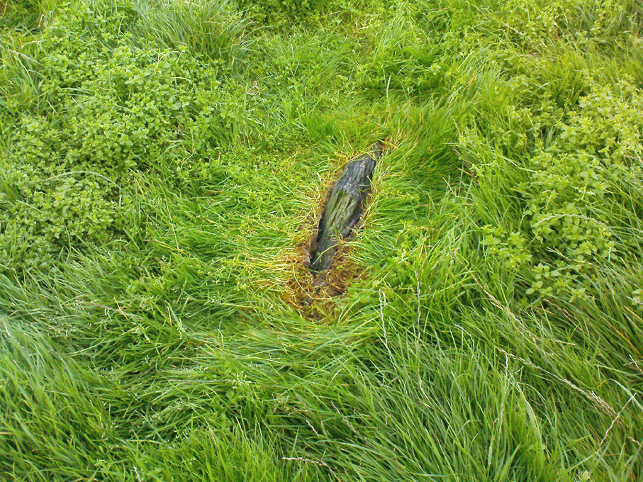
All that can be seen today is the very small stump of stone, just visible above ground level, in the middle of the field. It’s not easy to spot either, as the grasses grow over what’s left. But we found the slim remnant of the stump embedded in exactly the spot marked on old and modern maps, measuring 24 inches in length and just 4 inches across at the widest, with what seemed like worn rounded edges at either end. We were unable to ascertain the depth of the remaining stone in the ground. The stone looks simply as if it’s been snapped at the base. We have no idea how tall this standing stone was.
If any local people know anything more about this stone, or have any old photos, we’d love to hear from you — and would obviously give due credit for any help on this matter.
References:
Smith, A.H., The Place-Names of the West Riding of Yorkshire – volume 6, Cambridge University Press 1961.
Cup-and-Ring Stone (lost): OS Grid Reference – SE 1015 4702
Also Known as:
Panorama Rock 226
Archaeology & History
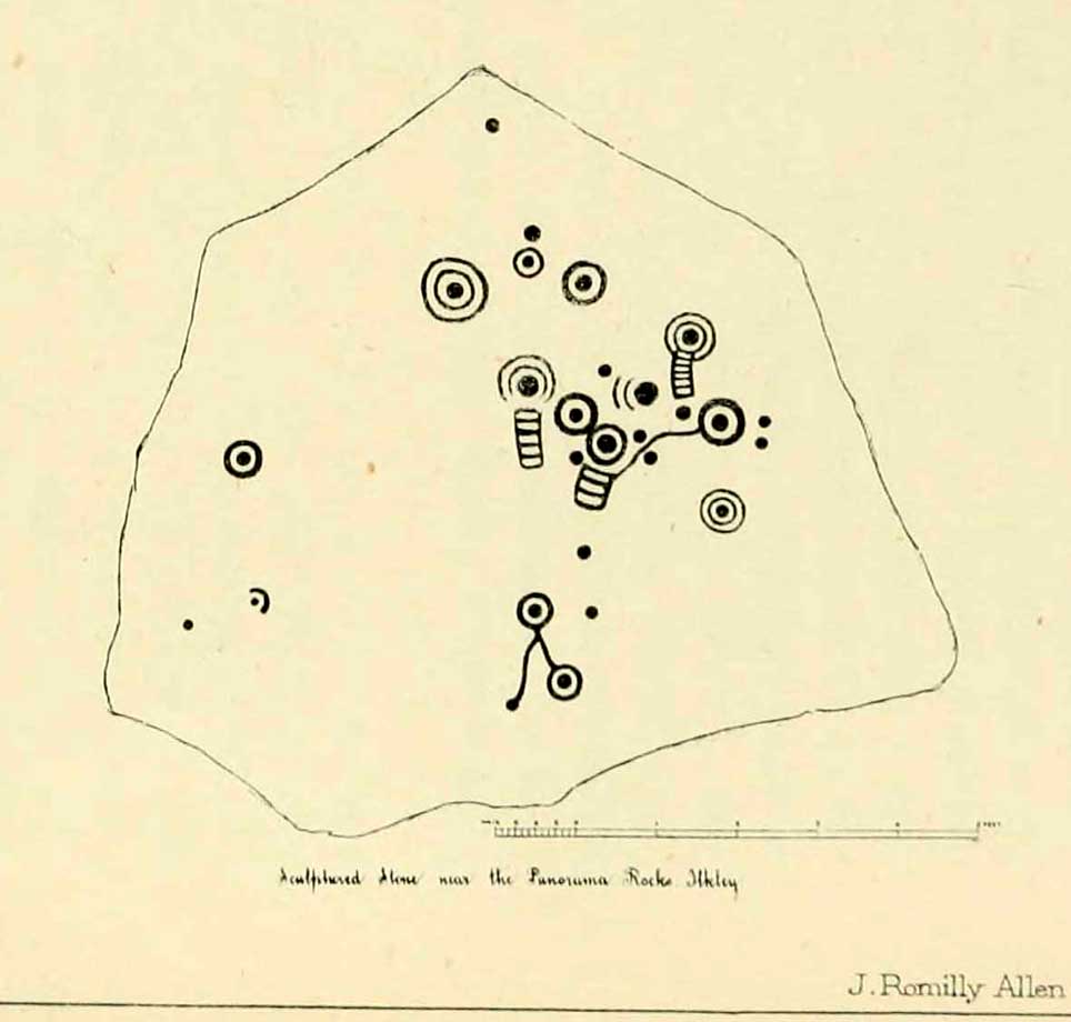
J.R. Allen’s 1879 drawing
It would seem that this excellent looking cup-and-ring stone may have been destroyed sometime around 1890 during the construction of the Panorama Reservoir and the building of the houses on the southwestern edge of Ilkley, right by the moorside. But this isn’t known for certain; and the carving could still exist beneath vegetation in the trees just north of the reservoir. In requesting to explore some National Archives data in which there may be information relating to this carving (and others nearby), I was directed to Bradford Council’s community archaeologist, Gavin Edwards (to whom requests should be made), but he denied access to look at the files, then completely ignored subsequent queries that might enable us to locate this and other important prehistoric carvings. So we did our best and this is what we’ve found so far (forgive any errors).
As there’s a slight ambiguity in the precise location of this lost carving, we cannot say for certain whether or not this site was included in the sale of Property Lots, numbers 7-34, “surrounding the far-famed Panorama Rocks,” which may have led to the site’s destruction and subsequent removal of the protected Panorama Stones to Saint Margaret’s Park on the other side of the road from the church, closer to Ilkley centre. The sale of this “building land” as it was called was advertised in the Leeds Mercury, Saturday September 4, 1880, with a brief description of the respective “lots” near this and the adjacent carvings. But this Panorama Stone 226 may have been left alone and be buried under the surface…
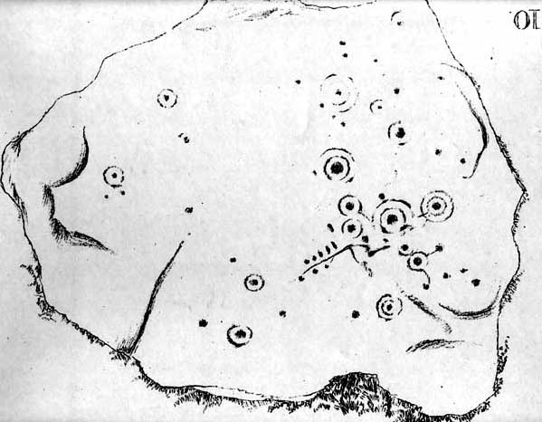
J.T. Dale’s 1880 sketch
Historical notes on this particular stone are scattered and sparse, but digging through old journals and texts has given us a reasonably good vision of the place. It was first described, albeit in passing, in A.W. Morant’s edited third edition of Whitaker’s History of Craven (1878: 289), where it was described in context with the other cup-and-ring east of here on the same ridge. All of them were described as being located within a now-destroyed prehistoric enclosure (precise nature unknown), with carving 226 at the westernmost end. However, the following year J. Romilly Allen (1879) gave more details of this, “the third stone” as he called it and furnished us with a damn good drawing to boot!
As we can see, there are four double-ringed cups and eight or nine archetypal cup-and-rings, with the usual scatter of cups falling across the design. The curious ‘ladder’ markings found on one of the other Panorama Stones, the Barmishaw Stone, Willy Hall’s Wood carving and at least one of the Baildon Moor carvings, were also quite prominent. Although when J. Thornton Dale visited here around the same time and did his own drawings, the ladders weren’t quite as pronounced. This would have been due to the simple factors of cloud cover, poorer sunlight and the time of day the drawings were done (the pseudoscientific proclamation of local archaeologist Gavin Edwards that such artistic difference is due to some Victorian chap adding, or removing sections of the carvings for his own pleasure, negates common sense and is strongly lacking in evidence). Romilly Allen’s own description of the site was as follows:
“The Panorama Rock lies one mile south-west of Ilkley, and from a height of 800 feet… About 100 yards to the west of this spot appears to be some kind of rough inclosure, formed of low walls of loose stones, and within it are the three finest sculptured stones near Ilkley. They lie almost in a straight line East to West… The third and most westerly stone of the group measures 10ft. by 9ft. and lies almost horizontally, having its face slightly inclined. On it are carved twenty-seven cups, fourteen of which have concentric rings round them. Some of the cups have connecting grooves, and three have the ladder-shaped pattern before referred to.”
Notes from a few years later told that this carving was still in situ when the companion carvings were moved and imprisoned behind railings across from St. Margaret’s Church in Ilkley. The carving was shown at the grid reference given above on the 1895 Ordnance Survey map of the region before the reservoir was built, correcting the coordinates given in Boughey & Vickerman’s (2003) otherwise fine survey. They described this very ornate carving thus:
“According to Thornton Dale (1880), this was a large rock with 27 cup, eighteen of which had single rings. Some of the cups had connecting grooves and three had the same ladder motif as the Panorama Stone.”
…to be continued…
References:
Allen, J. Romilly, “The Prehistoric Rock Sculptures of Ilkley,” in Journal of the British Archaeological Association, volume 35, 1879.
Allen, J. Romilly, “Notice of Sculptured Rocks near Ilkley,” in Journal of the British Archaeological Association, volume 38, 1882.
Allen, J. Romilly, “Cup and Ring Sculptures on Ilkley Moor,” in The Reliquary, volume 2, 1896.
Bennett, Paul, The Panorama Stones, Ilkley, TNA: Yorkshire 2012.
Boughey, Keith, “The Panorama Stones,” in Prehistory Research Section Bulletin, no.40, Yorkshire Archaeological Society: Leeds 2003.
Boughey, K.J.S. & Vickerman, E.A., Prehistoric Rock Art of the West Riding, WYAS: Leeds 2003.
Collyer, Robert & Turner, J.H., Ilkley: Ancient and Modern, William Walker: Otley 1885.
Jennings, Hargrove, Archaic Rock Inscriptions, A.Reader: London 1891.
Turner, J. Horsfall, “British or Prehistoric Remains,” in Collyer & Turner, Otley 1885.
Whitaker, Thomas Dunham, The History and Antiquities of the Deanery of Craven in the County of York, (3rd edition) Joseph Dodgson: Leeds 1878.
Walk from Ilkley up the Wells Roads as if you’re going to the White Wells, but keep following the road along, keeping to the moorside (don’t go up Panorama Drive). A few hundred yards up, crossing the small bridge over the gorse-scattered stream, take the footpath to your right and walk along the moor-bottom, parallel to the rich houses. Keep walking, past the reservoir (don’t go up the slope on the newly created path) and cross the small wooden bridge. Once over the other side, head through the gate and walk along the rocky footpath into the woods. Less than 100 yards down where the first seat is, there’s a slow-running blood of water oozing out from the rocks.
Archaeology & History
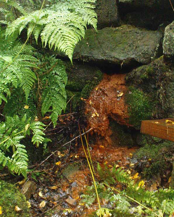
At the top of this bit of old woodland, out of rocks near the top of the trees, emerges another of Yorkshire thousands of chalybeates, or iron-bearing springs of water, on the very edge of Ilkley Moor. Collyer and Turner (1885) mentioned its discovery in 1883, but gave no further details. Searching for this place on one of my countless moorland ambles as a child, I found its waters oozing slowly from betwixt moss-enriched rocks on the west side of the stream. If you look for it in the dry season though, there is little to see. It is best seen later in the year, after heavy rains, although the waters are pretty slow running and have that distinct “off” taste (an attribute well-known of chalybeates —taste ‘em and see!). The only real account of this little-known healing well was told in an early edition of the Leeds Mercury (1883), shortly after its rediscovery, in which we were told:
“Our Ilkley correspondent says the existence of a chalybeate spring has lately been discovered there, and from its valuable medicinal properties will prove a valuable adjunct in the future development of this health resort. The water from the spring (which is situated near to the Panorama Rocks, in what is known as Hebers Gill, or Briery Wood) has been submitted to Mr F.M. Rimmington…of Bradford for analysis and his report is of a most favourable character. The data shows that the water is remarkable for the smallness of the amount of its saline constituents, and (so far as the analyst has been able to discover by reference to published analysis of either English or Continental chalybeate springs), there is not one comparable to it: whilst its ferruginous element is equal to the majority of such waters and, in Mr Remmington’s opinion, as large as is desirable for medicinal effect. The spa that most resembles the one under notice is that of Tunbridge Wells in Kent, which is derived from exactly the same geological formation (millstone grit), the total solid constituents of this water being 13½ grains to the gallon. The report adds that, “The use of this class of waters as medical agents has, from remote periods, been found efficacious in those states of debility denominated anemia,” and “the value of this class of spa water as a safe and natural remedy can scarcely be overestimated.” From the foregoing it will be seen that an important discovery has been made…”
This once important spring of water — that would have been known and used by our prehistoric ancestors living on the moors above — is nowadays but a shadow of its former self. The water tables drop annually as a result of moorland drainage and other poor land management and we only see a small trickle of water emerging from the mossy rocks these days…
…to be continued…
References:
Anonymous, “Important Discovery at Ilkley,” in Leeds Mercury, August 18, 1883.
Bennett, Paul, Healing Wells and Springs of Ilkley Moor, unpublished: Hebden Bridge 1995.
Collyer, Robert & Turner, J.H., Ilkley: Ancient and Modern, William Walker: Otley 1885.
Take the B6246 road northwest out of Whalley, or else east from Hurst Green, until you hit the little village of Great Mitton, with its churchyard in the middle. Go into the churchyard and you’ll find this weird-looking cross!
Archaeology & History
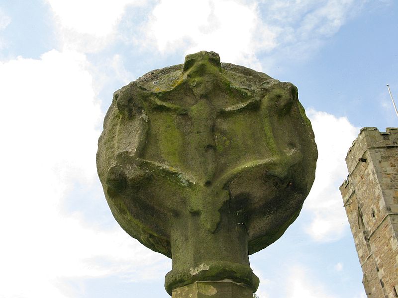
The curious-looking upright in the churchyard here has a mixed history by all accounts. The oldest portion of the cross is universally ascribed to be the top section, rediscovered when it was dug up “shortly before 1801.” (Ackerley 1947) It possesses a carving of the crucifixion on one side, and some curious figures carved on the other, which some ascribe to being Jesus, but could well be the triple female element which would still have been prevalent in peasant culture at the time it’s thought to have been carved. The original shaft carrying the ‘cross’ had long since been destroyed and so, according to Jessica Lofthouse (1946),
“In 1897 it was ‘re-erected to commemorate the 1300th anniversary of the reintroduction of christianity into Britain,’ with the new shaft we see today. This is the oldest relic in Mitton.”
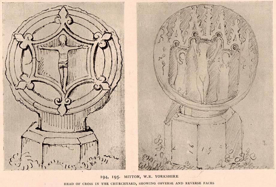
In J. Buckler’s early 1841 drawing of both sides of the carved cross-head we can see in greater detail the nature of the medieval rock art and this was described in Aymer Vallance’s (1920) decorative analysis of carved crosses in England. He told that
“the cross-head at Mitton, Yorkshire…is peculiar inasmuch as the crucifixion is sculptured on both faces, but in totally different fashions. That on the west face has the arms stretched horizontally, within a sexfoil frame, and might well be of the thirteenth century. Whereas the sculpture on the east face, though much more weatherworn, is of a style that could not have been designed before the fourteenth, or perhaps even the fifteenth century. The arms of the Christ in this instance are drawn upwards in an unusually oblique direction. It is impossible that these two representations could have been executed at one and the same date. The circular outline of the head, too, is peculiar, and suggestive rather of a gable-cross than of a standing cross. Possibly the west face only was sculptured in the first instance, for a gable-cross, the sculpture on the east face being added later in order to adapt the stone for the head of a churchyard cross.”
Although I’ve gotta say that the three carved figures with the upright arms strikes me more as three females than any crucified character and may be an early depiction of the three Mary’s.
One of the early ministers at Mitton church was none other than John Webster, who wrote the highly influential work, Displaying of Supposed Witchcraft, which denounced much of the Church’s obsession and murder of countless people under the auspice of some spurious devil and demonological bollocks which, even today, some still suffer to endure. Webster was only at Mitton for a few years, before moving into deeper Yorkshire and setting up at Kildwick.
References:
Ackerley, Frederick George, A History of the Parish of Mitton, Aberdeen University Press 1947.
Lofthouse, Jessica, Three Rivers, Robert Hale: London 1946.
Vallance, Aymer, Old Crosses and Lychgates, Batsford: London 1920.
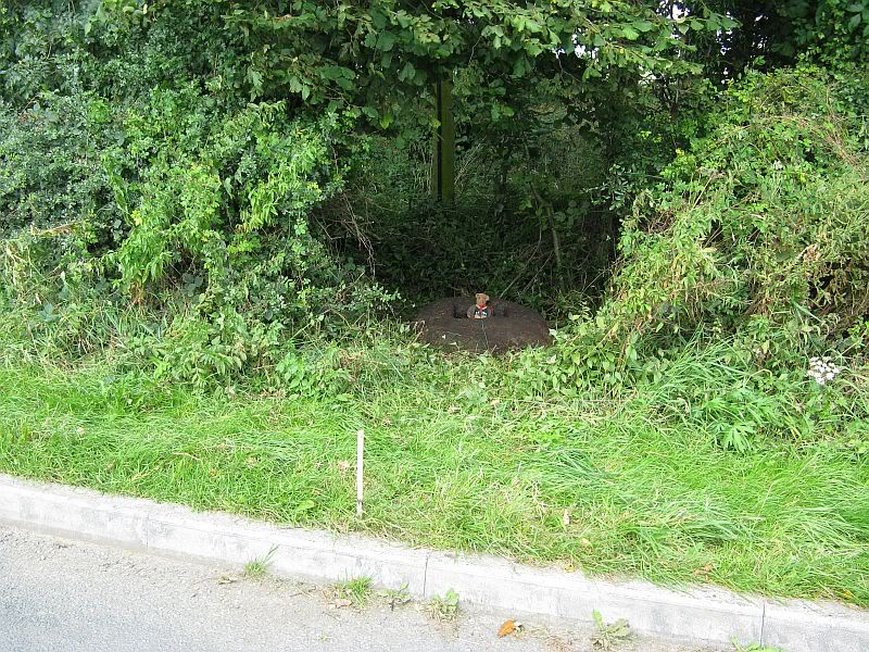
From Great Mitton village, go up (north) the slightly winding B6243 road for a mile, then take the left turn up the minor country lane, for about 300 yards, till you reach a tiny crossroad of tracks, one leading down to Scott House and the other up to Withgill Farm. Stop here! You’re damn close. From what our man ‘QDanT’ says, this is now to be found behind the hedge by the roadside, on the side of the road where the track runs up to Withgill Farm, tucked low and overgrown close to the ground. Good luck!
Archaeology & History
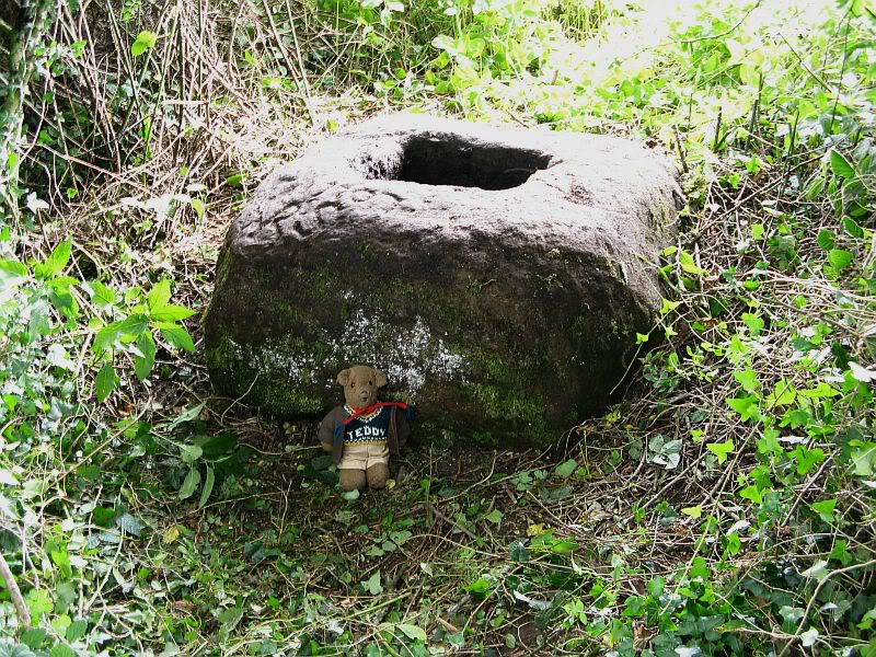
Described by Mr Ackerley (1947) as being found
“in the coppice beside the gate to Withgill is the base of another road-side cross,”
Cross-base (after QDanT)
all but overgrown by ivy and lost to the causal eye. Thankfully our man Danny got on his bike and found the remains of the little fella, all-but invisible beneath the vegetative growth! Beneath the vegetation, John Dixon told there to be “some interesting 17th century graffiti,” but there’s not much that remains of the old cross.
Folklore
There is a curious story about a legendary church that was once supposed to have been up the track on the hill just above here at the farm. The story goes,
“that when Mitton church was built, it ought to have been built on Withgill Knowle: that there was a church somewhere about there, and that the stones from it were carted down to Mitton in one night and used in building the present church.”
This bitta folklore is a motif found commonly at prehistoric sites, where stones from our ancient places were uprooted and moved (destroyed) to give way to the new christian mythos. To my knowledge, no such prehistoric sites are known hereby. Mr Dixon – over to you dear sir!
References:
Ackerley, Frederick George, A History of the Parish of Mitton in the West Riding of Yorkshire, Aberdeen University Press 1947.
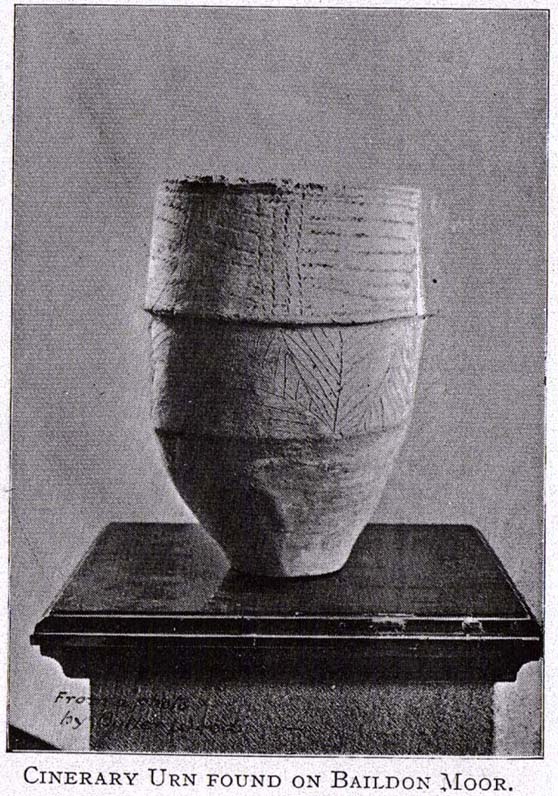
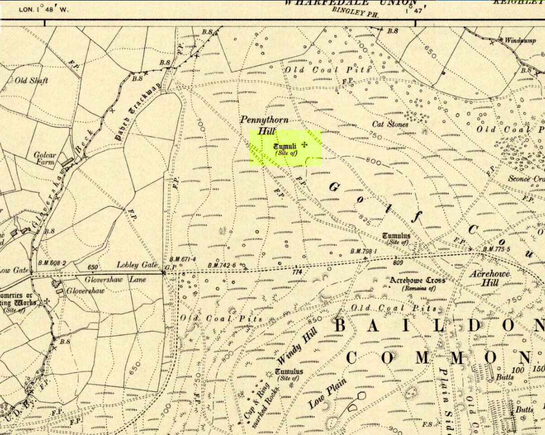
Highlighted on the 1909 OS-map of the area, on the top of the hill a short distance from the roadside, about 250 yards northwest of the Acrehowe Hill site (now at the edge of the golf course) could once be seen another prehistoric burial mound. The rediscovery of this tumulus was first announced briefly in the January 1905 edition of the Bradford Scientific Journal (issue no.3). A few months later the local writer and historian William Preston (1905) wrote a more detailed article on the site, telling the following information:
“A discovery of considerable interest to local archaeologists was made early in December, 1904, on the summit of the spur of moorland on the northwest of Baildon Moor, known as Pennythorn Hill.
“A workman engaged in removing stones from an extension of the golf course, unearthed an ancient cinerary urn containing calcined human bones, a flake of flint which may have served the purpose of an arrow point, a bronze instrument, and a perforated piece of bone, unfortunately broken during calcination. An examination of the site of the discovery revealed the remains of a tumulus, the upper part at some time removed, with a diameter as near as it was possible to tell, of about fifteen feet. In point of construction it differed little from others which are to be found in the locality. The vessel had been placed in an inverted position over the calcined bones, in a hole made in the sandy subsoil. There was no indication of the urn having rested in a cist.
“The earth beneath the urn bore no evidences of fire, and it is likely that the funeral pyre on which the corpse was reduced to ashes was not erected on the spot. It may be assumed from the association of the weapons named that the bones are those of a male person.
“The height of the urn is twelve and a half inches, it is eight and a quarter inches in diameter, and taper in the lowest third of its height to a base of about three inches in diameter. In the course of its excavation it was broken by the workmen, but it has been excellently restored in the laboratory of the Hull Museum…
“The urn belongs to the early British type and its date is, probably, well before the Roman invasion of the island. The general outline of the urn is very similar to that of some urns found by Canon Greenwell in the course of his exploration of the barrows of the north of England… The surface of the urn is divided into three zones. The upper part of the vessel consists of a raised border, about four inches wide, decorated with horizontal and vertical lines alternately arranged, and produced by pressing a twisted thong up0n the clay of which it was composed… Beneath the border and upon the central part of the body, a different form of decoration has been carried out. A zig-zag line scratched in the clay has been carried around the body, forming a number of triangular compartments, which were filled in with diagonal lines, giving he appearance of a herring-bone pattern. The counterpart this design does not appear on any of the urns figured by Canon Greenwell in his records of digging in British barrows.”
References:
Greenwell, William, British Barrows, Clarendon Press: Oxford 1877.
Preston, William E., “The Discovery of a Cinerary Urn on Baildon Moor,” in Bradford Scientific Journal, no.4, April 1905.
Wardell, James, Historical Notes of Ilkley, Rombald’s Moor, Baildon Common, and other Matters of the British and Roman Periods, Joseph Dodgson: Leeds 1869. (2nd edition 1881)