Standing Stone (destroyed): OS Grid Reference – SD 78570 67177
Archaeology & History
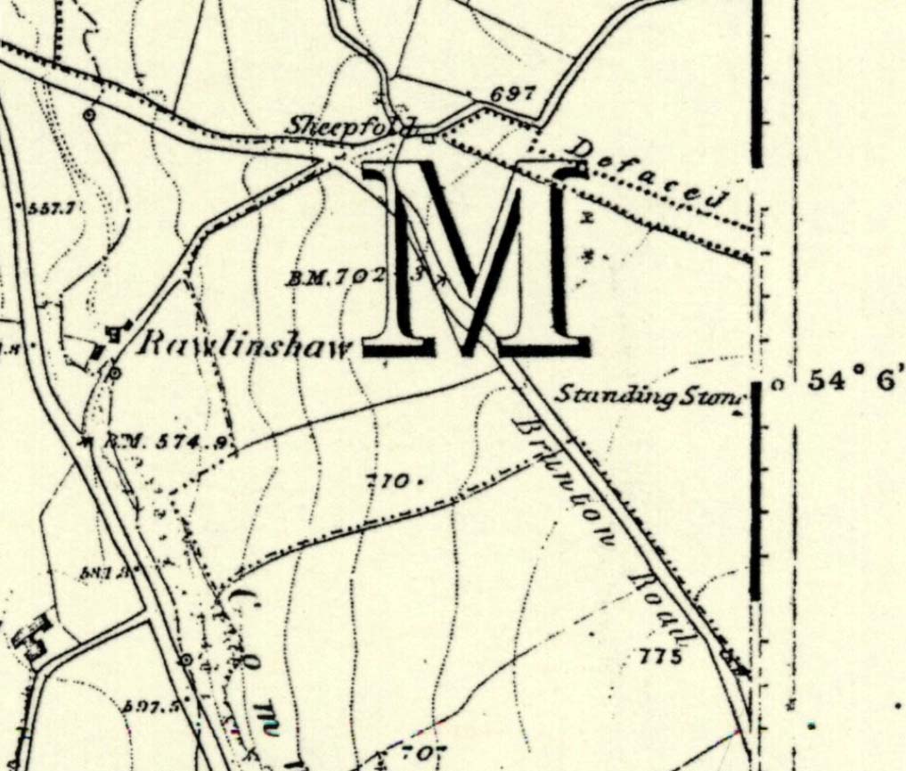
There have been no previous archaeological reference to this site (until now), which was included in early place-names records (Smith 1961) and was also highlighted on the first Ordnance Survey map of the region around 1851. Probably as a result of the archaeological lacking, the upright stone has finally succumbed to the destructive actions of modern man. When we asked the farmer if he knew owt about any standing stone here, he said he knew “nowt abaat that.”


All that can be seen today is the very small stump of stone, just visible above ground level, in the middle of the field. It’s not easy to spot either, as the grasses grow over what’s left. But we found the slim remnant of the stump embedded in exactly the spot marked on old and modern maps, measuring 24 inches in length and just 4 inches across at the widest, with what seemed like worn rounded edges at either end. We were unable to ascertain the depth of the remaining stone in the ground. The stone looks simply as if it’s been snapped at the base. We have no idea how tall this standing stone was.
If any local people know anything more about this stone, or have any old photos, we’d love to hear from you — and would obviously give due credit for any help on this matter.
References:
- Smith, A.H., The Place-Names of the West Riding of Yorkshire – volume 6, Cambridge University Press 1961.
Links:
© Paul Bennett, The Northern Antiquarian