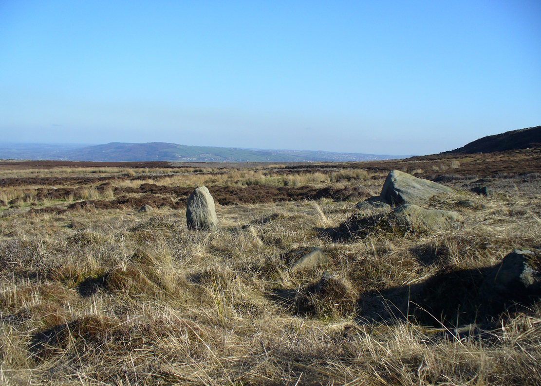
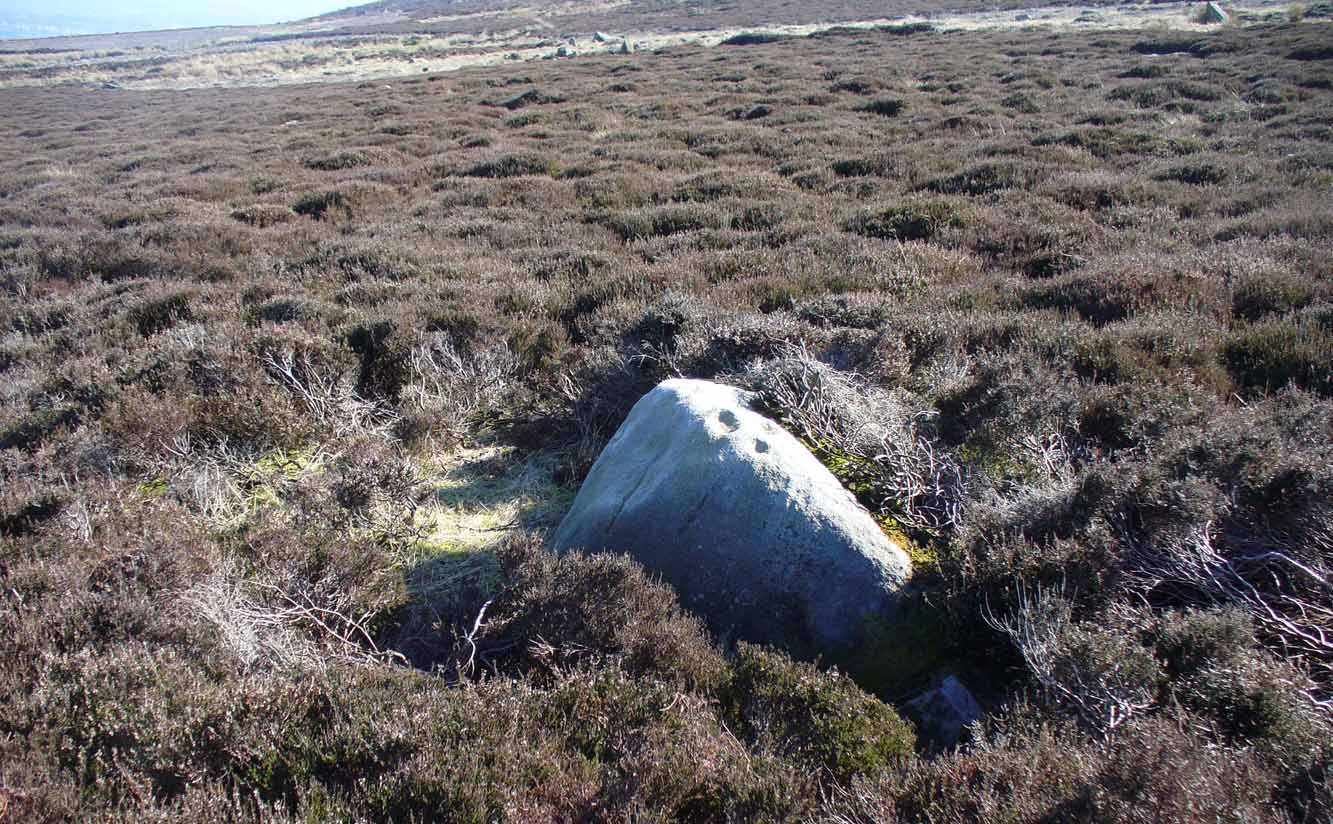
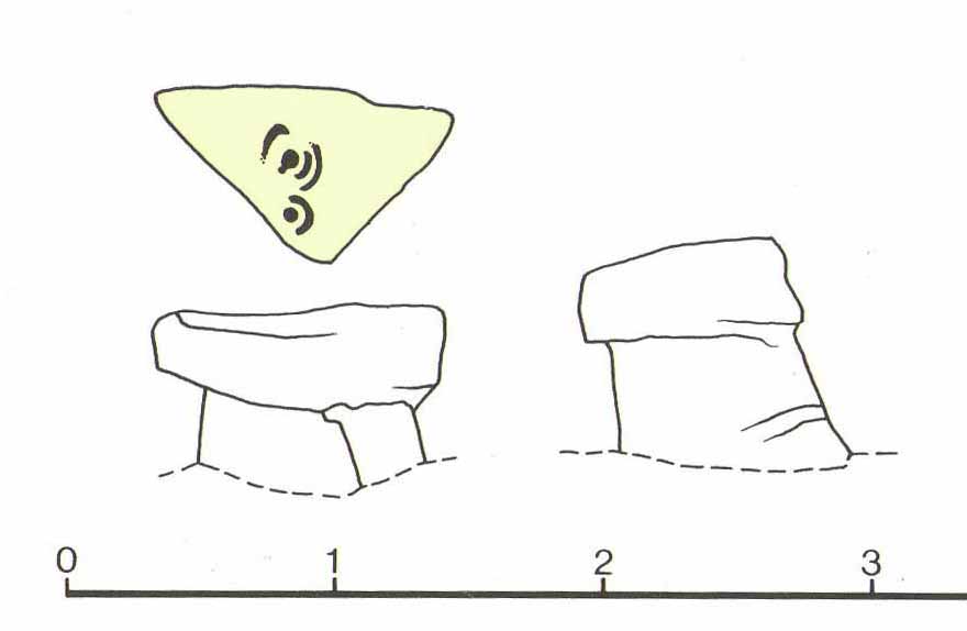
Piper’s Crag Stone, Addingham Moorside, West Yorkshire

Cup-and-Ring Stone:  OS Grid Reference – SE 08497 47097

Also Known as:

  1. Carving no.44 (Hedges)
  2. Carving no.212 (Boughey & Vickerman)
  3. Piper’s Stone

Getting Here

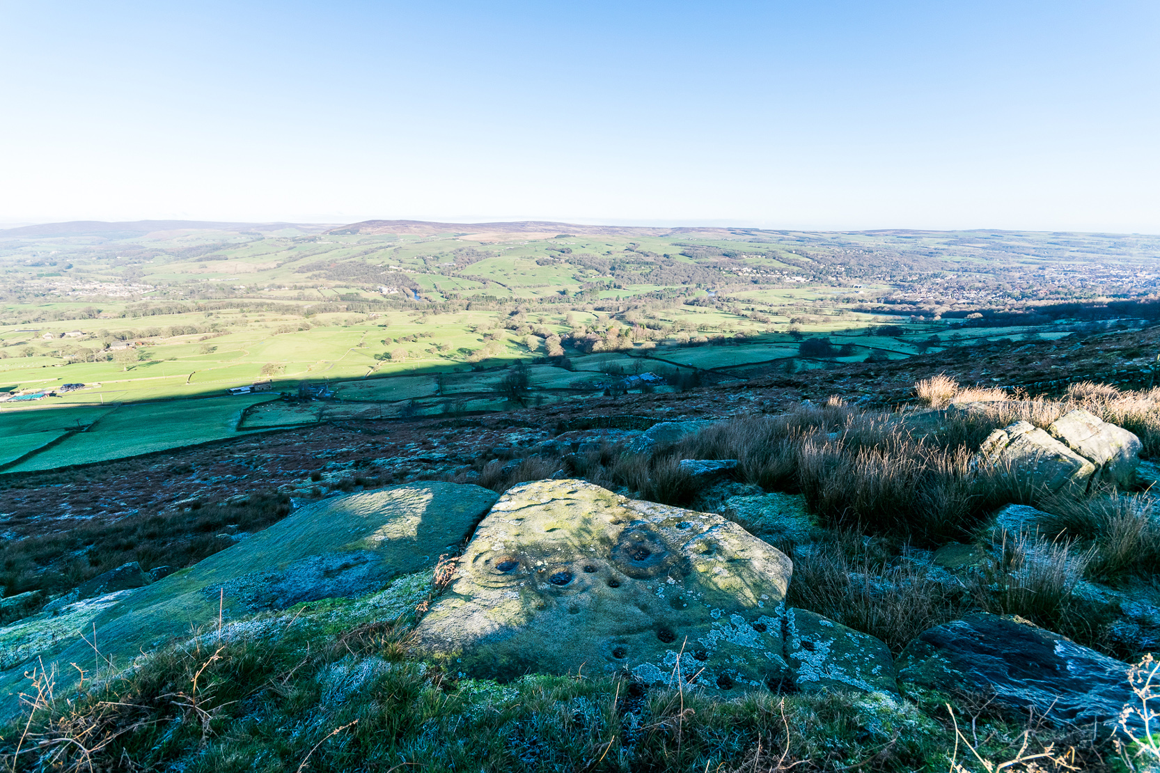
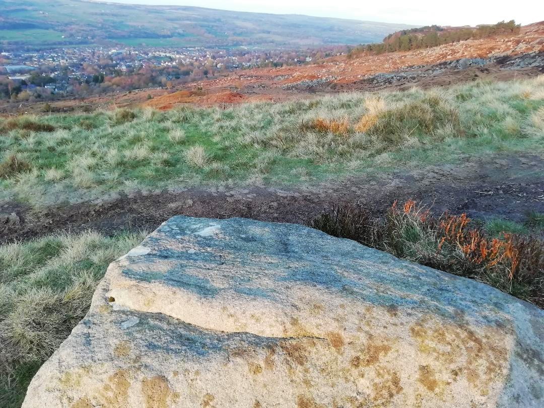
Piper Stone (photo by James Elkington)

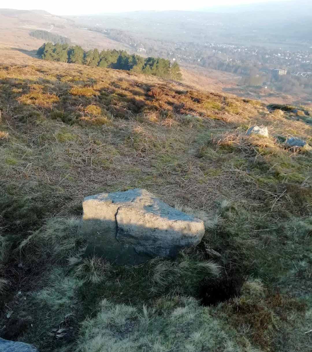
Follow the directions to reach our superb Swastika Stone from Ilkley, visible due to the iron railing that surround and protect the carving on the cliff edge.  From here, keep walking west along the Millenium Way footpath, over the stile of the first wall, then the second wall—six in all—for ⅔-mile (1km), where you’ll see another small crag of rocks on your right, just yards from the footpath.  You’re damn close!

Archaeology & History

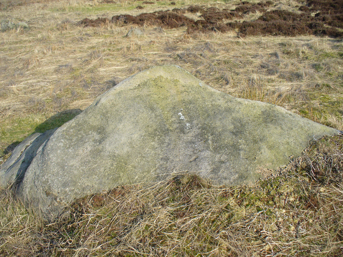
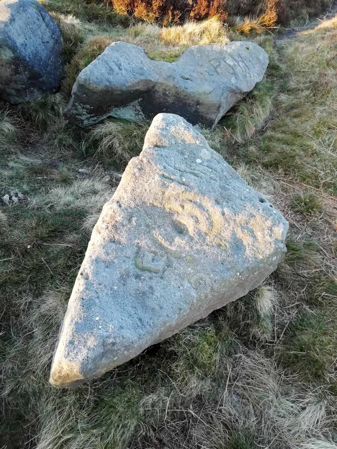
When the great J. Romilly Allen (1882) visited the Ilkley petroglyphs in 1878, the Piper Stone was one that he wandered over to see—and he had this to say of it:

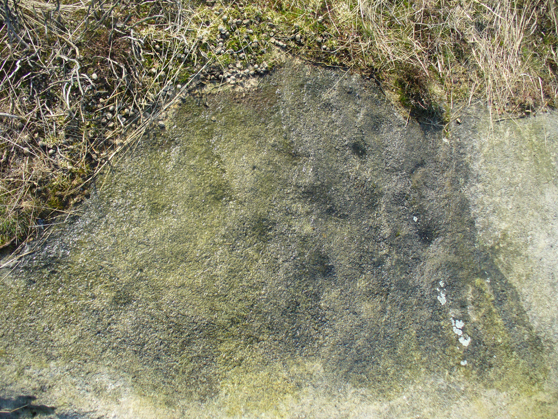
“At the edge of Piper’s Crag is a horizontal rock-surface, and on a portion of it, measuring 5ft by 7ft, are carved a series of fifteen cups varying in diameter from 2 to 3 ins.  Of these, one is surrounded by a single ring, four by a double ring, and one by a triple ring.”
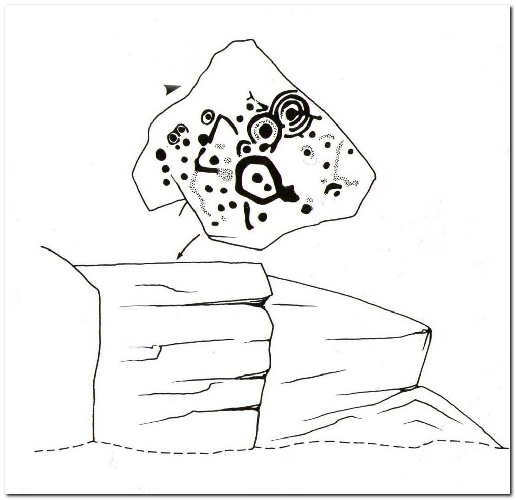
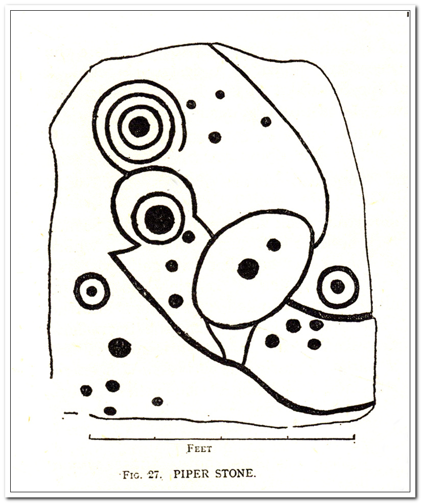
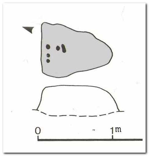
Hedges 1986 sketch
Cowling’s 1940 sketch

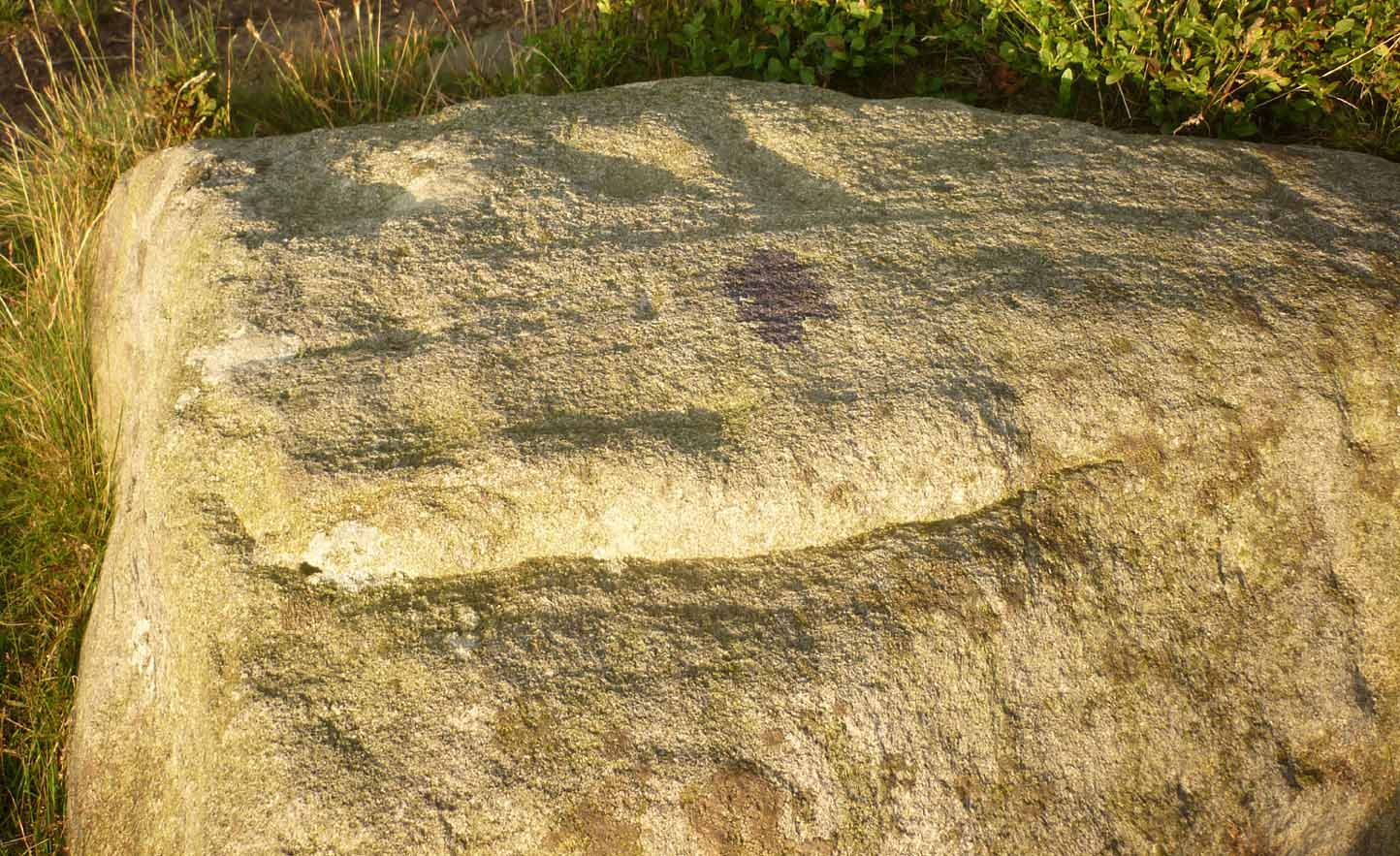
This type of description, whilst accurate on the whole, rarely does justice to the carving.  It was echoed more than 100 years later in John Hedges’ (1986) survey, when he described the large rock jutting out to possess merely, “a complicated design of cups, rings and grooves.”  When Boughey & Vickerman (2003) did their follow-up survey, they added nothing more.

In an attempt to give some sort of meaning to the carving (and many others), the late great Eric Cowling (1940; 1946) placed it within Henri Breuil’s (1934) classification system, which assigns all carvings different degrees of complexity and form, from Classes 1-4.  The Piper Stone entered Breuil’s Class 3A, being one “with deeply cut and smoothed down grooves.” Whilst this may sound good on the surface, in truth such classifications are utterly meaningless outside of the tables and graphs of statisticians and the boring.  They give the appearance of quantitative research, but they have as much bearing on the nature of the carvings as an energy dowser healing the place with crystals.
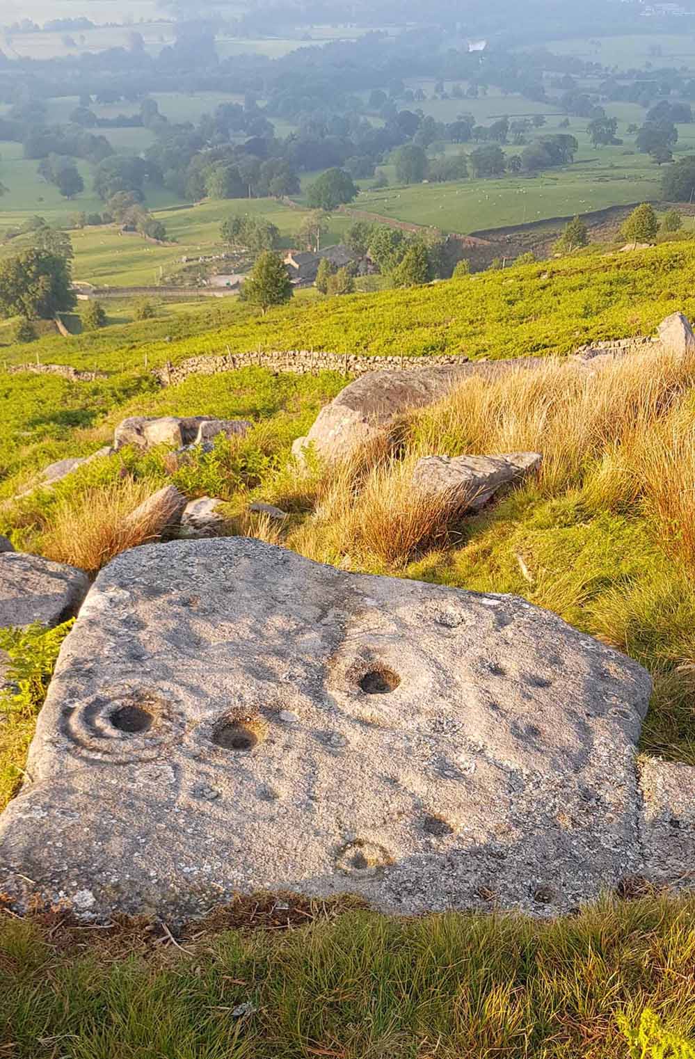
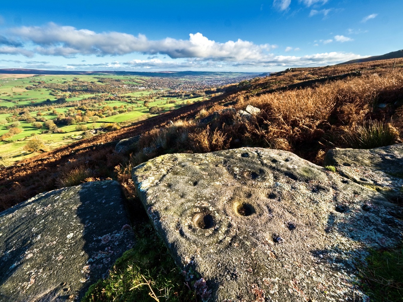
Piper Stone (photo by Josh Millgate)
Close-up of design (photo by James Elkington)

In the flesh, in the real world—so to speak—from the Piper Stone we are looking, not just at the carving, but its place in the landscape: an ingredient that more and more emerging archaeologists are recognizing has a synergistic relationship with some petroglyphs.  And here we have an impressive landscape that reaches out ahead of us for many miles.  We look primarily to the north: the Land of the Dead in many traditional northern cultures.  But our panorama here is 180º, with east and west horizons having the potential for measuring equinoctial periods in the cycle of the year.  But in truth this is sheer speculation.

It’s a worthwhile carving to see, both for its views and its excess of non-linearity.  In its form, Rorscharch impressions of early humans emerge; the usual solar and lunar symbols can be seen; star systems seem apparent; maps or settlement ground-plans could be there.  We know that somewhere within it is the animistic ‘spirit’ of the rock itself, but the forms it exalts are, once again, all but lost on us modern folk…

References:

  1. Allen, J. Romilly, “Notice of Sculptured Rocks near Ilkley,” in Journal of the British Archaeological Association, volume 38, 1882.
  2. Allen, J. Romilly, “Cup and Ring Sculptures on Ilkley Moor,” in The Reliquary and Illustrated Archaeologist, volume 2, 1896.
  3. Anonymous, Walks around Cup and Ring Stones, TIC: Ilkley n.d. (c.1990).
  4. Baildon, W. Paley, “Cup and Ring Carvings: Some Remarks on their Classification and a New Suggestion as to their Origin and Meaning,” in Archaeologia, volume 61, 1909.
  5. Bennett, Paul, “Cup-and-Ring Art”, in Towards 2012, volume 4, 1998.
  6. Bennett, Paul, The Old Stones of Elmet, Capall Bann: Milverton 2001.
  7. Boughey, Keith & Vickerman, E.A., Prehistoric Rock Art of the West Riding, WYAS: Wakefield 2003.
  8. Breuil, Henri, “Presidential Address for 1934,” in Proceedings Prehistoric Society East Anglia, 7:3, 1934.
  9. Collyer, Robert & Turner, J.H., Ilkley: Ancient and Modern, William Walker: Otley 1885.
  10. Cowling, E.T., ‘A Classification of West Yorkshire Cup and Ring Stones,’ in Yorkshire Archaeological Journal 1940.
  11. Cowling, E.T., Rombald’s Way: A Prehistory of Mid-Wharfedale, William Walker: Otley 1946.
  12. Hedges, John (ed.), The Carved Rocks on Rombalds Moor, WYMCC: Wakefield 1986.

Acknowledgements:  Huge thanks to Josh Millgate and James Elkington for use of their photos in this site profile.  Cheers guys. 🙂

© Paul BennettThe Northern Antiquarian
Chellow Heights, Heaton, Bradford, West Yorkshire

Cist (destroyed):  OS Grid Reference – SE 117 353

Archaeology & History

High up in the landscape on the northwestern edges of Bradford, where we now find the Chellow Heights reservoirs, ancient man saw fit to place the remains of their dead.  It’s in a damn good location too, typical of burial sites.  The views to the immediate north are directly at Rombalds Moor where, as we all know, Bronze Age and other prehistoric remains are found in huge numbers.

It was during the construction of the Chellow Heights reservoirs when the site was uncovered.  Twas here, in June 1921, where segments of three urns and,

“an incomplete incense cup, 2 inches high and 3 inches diameter at its base, were found together with partly burnt bones”,

of what were thought to be a young female adult. There are few other details.  The fact that there was no mention of any covering mound, nor mass or stones, strongly implies that neither a tumulus or cairn covered these urns—and neither place-name evidences nor early maps indicate anything to suggest such a monument—so it would be fair to surmise they had been deposited in a stone cist.

References:

  1. Barnes, Bernard, Man and the Changing Landscape, Merseyside County Council 1982.
  2. Longworth, Ian, Collared Urns of the Bronze Age in Great Britain and Ireland, Cambridge University Press 1984.
  3. Rowe, J.H., “An Ancient Burial at Chellow, near Heaton,” in Heaton Review, volume 2, 1928.

© Paul BennettThe Northern Antiquarian
Dowley Gap, Bingley, West Yorkshire

Cist (destroyed):  OS Grid Reference – SE 1196 3824

Archaeology & History

The remains of a prehistoric tomb existed near the foot-bridge on the south-side of the canal at Dowley Gap, but was destroyed during the building of the sewage works there in 1951.  It was reported by a Mr Duncanson to Bradford’s Cartwright Hall archaeology group, who told how they accidentally uncovered it during construction work.  He told that the

“stone cist (was) about 3½ feet long and 1½ feet deep and was found on rising ground at the western end of the works where the storm water tanks are now situated.”

We obviously don’t know the age of the cist, but such grave monuments are most commonly Bronze Age.  The existence of the Crosley Wood Iron Age enclosure 4-500 yards NNW and the prehistoric circle 800 yards east are the nearest other known early period monuments.

References:

  1. Jackson, Sidney, “Stone Cist at Bingley,” in Cartwright Hall Archaeology Group Bulletin, 3:6, 1958.

© Paul BennettThe Northern Antiquarian
Two Eggs, Morton Moor, West Yorkshire

Legendary Rocks:  OS Grid Reference – SE 1058 4490

Getting Here

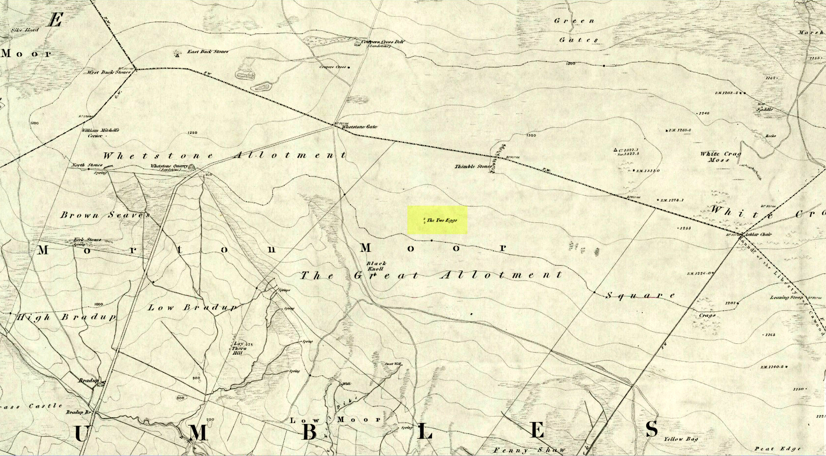
Two Eggs on 1851 map

By whichever route you wanna take, get y’self to the prominent cup-and-ring marked rocks known as the Thimble Stones near the very top of these moors. From here, walk roughly 400 yards southwest onto the bare open moors (there are no footpaths here) and you’ll see these two isolated prominent boulders living quietly on their own.  You can’t really miss ’em!  You’re there.

Archaeology & History

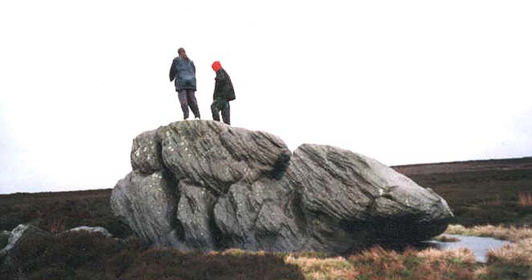
Of the two giant boulders here, both are included in the petroglyph surveys of Hedges (1986) and Boughey & Vickerman’s (2003) as possessing “all natural” cup-marks on their top and vertical surfaces.  Those on top of the rocks certainly seem to be Nature’s handiwork, whilst many of the seeming ‘cups’ on the vertical face of one (not the one pictured here) are due to gunshots.  I’m not quite sure when they were done, but they certainly didn’t exist during the many visits I made here in the in the 1970s and ’80s.

They stones included in most of the standard antiquarian surveys of the 19th century, with the earliest being Forrest & Grainge (1869) who described them as,

“two detached masses of rock, standing alone upon the moor.  The first is 14ft in length by 8ft in height, tapering to the ground; a set of cups and channels occupy the highest point.  The other, distant 13 yards, is of an irregular square form, 45 yards in circumference and 7ft high.  This stone appears to be tilted on its edge, presenting its cleavage upwards, and has hollows containing water, but is so much wasted above that if it has ever borne the cups and channels, they are now obliterated.”

On top of an Egg, c.1986

Collyer & Turner (1885) described “a number of cups” on the edge of the northern rock; and Romilly Allen (1896) likewise.  Even that historical literary giant, Harry Speight (1900), added his own tuppence here, telling folks how both Eggs “are channelled and bear cups.”

It’s very possible that these isolated stones did have some sort of significance to our prehistoric ancestors.  There are innumerable examples worldwide of rocks like this possessing ritual and mythic lore—and many in the British Isles too.  And the cupmarks on the stones may have been enhanced by those same prehistoric ancestors.  But we’ll never know for sure…

Folklore

The creation myth behind the Two Eggs is one echoed in traditions across the world.  Folklore tells that the Eggs were said to have been laid here by a great dragon who lived within a hill some distance to the south.  All other aspects of the tale have sadly long since been forgotten…

References:

  1. Allen, J. Romilly, “Cup and Ring Sculptures on Ilkley Moor,” in The Reliquary, volume 2, 1896.
  2. Bennett, Paul, The Old Stones of Elmet, Capall Bann: Milverton 2001.
  3. Boughey, Keith & Vickerman, E.A., Prehistoric Rock Art of the West Riding, WYAS: Wakefield 2003.
  4. Collyer, Robert & Turner, J.H., Ilkley: Ancient and Modern, William Walker: Otley 1885.
  5. Forrest, Charles & Grainge, William, A Ramble on Rombald’s Moor, Northern Antiquarian: Bradford 2012 (1st published 1867-69).
  6. Hedges, John (ed.), The Carved Rocks on Rombalds Moor, WYMCC: Wakefield 1986.
  7. Speight, Harry, Upper Wharfedale, Elliott Stock: London 1900.

© Paul BennettThe Northern Antiquarian


East Wall Stone, Burley Moor, West Yorkshire

Cup-Marked Stone:  OS Grid Reference – SE 13924 45493

Getting Here

East wall stone on the right

Follow the directions to reach the impressive Woofa Bank prehistoric enclosure.  You need to find the walling that constitutes the enclosure itself and walk along to its eastern side where you’ll reach an ‘opening’, as if it may once have been an entrance at that side of the enclosure.  A reasonably large sloping rock is on one side of this ‘entrance’.  You can’t really miss it!

Archaeology & History

Unlike many of the other petroglyphs found within the Woofa Bank enclosure, the design on this one is faint — very faint indeed (much like the recently uncovered triple-ring petroglyph by the Thimble Stones).  Comprising simply of a small cluster of cup-marks, you’ll struggle to see this one — unlike its compatriot on the western wall of the enclosure.

Looking down on the rock
Some very faint cupmarks

It consists of a single cup-mark on the northern edge of the stone, whilst on the sloping southern part of the rock are a number of very faint cups, eroded by them there millenia of Nature’s wind and weathering.  One or two of the cups are just visible in good lighting, but what are almost certainly a few more can be seen when the rock is wet and in low daylight hours.  It’s a design that’s probably only of interest to the hardcore petroglyph fanatics, but without doubt this is yet another carving within this obviously important prehistoric enclosure.

© Paul BennettThe Northern Antiquarian

Deer Track Stone, Ilkley Moor, West Yorkshire

Cup-Marked Stone:  OS Grid Reference – SE 13858 45562

Also Known as:

  1. Carving no.190 (Hedges)
  2. Carving no.367 (Boughey & Vickerman)
Carving with Woofa Bank enclosure to rear

Getting Here

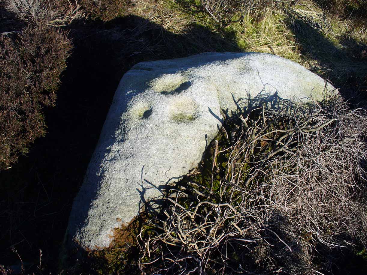
The easiest way to find this is to take the same directions to reach the Woofa Bank settlement.  Get your compass out and make sure that you’re at the northern edge of the settlement walling.  From here, walk about 60 yards northwest and keep your eyes peeled for a rock about 2 feet high, curved and elongated with its top surface above the heather.  You’ll find it.

Archaeology & History 

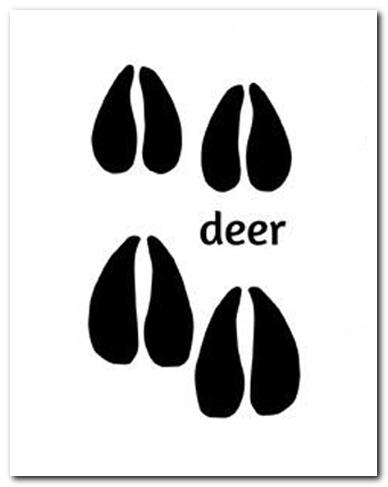
The name I’ve given to this stone is a conjectural one based entirely on comparative petroglyph designs elsewhere in the world.  Or to put it more simply: elsewhere in the world we find examples of prehistoric rock art showing animal tracks and rituals relating to hunting animals, and in the design of this petroglyph on Ilkley Moor I wondered if we might be looking at something similar.  Internationally respected anthropologists, archaeologists, geologists and rock art specialists such as Lawrence Loendorf (2008), Polly Schaafsma (1980), Dennis Slifer (1998) and many others show examples of animal tracks in the US and Mexico (examples exist throughout the world), and it’s not unlikely that some of the petroglyphs in the UK represent such things.  But, like I say, this particular carving may have nowt to do with such a thing and the idea is entirely conjectural on my part and is probably way off the mark.

Deer-print motif & cup

Located less than 60 yards (54m) northwest of the impressive Woof Bank enclosure, it’s possible that the first literary note of this was by Stuart Feather (1968) when he made note of five cup-and-ring marked rocks (which) have been revealed by erosion in 1968,” telling us that some of the motifs on the rocks included cups with and without rings, channels and eye-shaped marks (occuli)— the latter of which may relate to this stone.

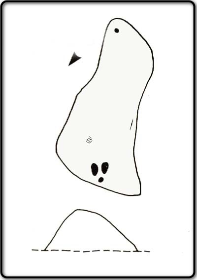
A more definite description of the stone was made in John Hedges (1986) survey where he described it in that usual simplistic form, telling us: “Long rock, its surface on two levels, sloping N to S in heather.  Two large oval cups and one cup at N end.  One clear cup at S end.”

Hedges’ 1986 sketch

It is these two elongated cups that have the distinct appearance of deer tracks. (another animal with a similar footprint is the goat)  The cup-mark in front of them and the one at the back of the rock may be something relative to the animal.  But more important than this is to recognise that, in lots of cultures, animal tracks are represented in some petroglyphs.  That’s more important to think about when you look at British rock art, than the improbability of this design being such a thing…

References:

  1. Boughey, Keith & Vickerman, E.A., Prehistoric Rock Art of the West Riding, WYAS: Wakefield 2003.
  2. Feather, Stuart, “West Yorkshire Archaeological Register – Ilkley (WR) Green Crag Slack,” in Yorkshire Archaeology Journal, volume 42, 1968.
  3. Hedges, John, The Carved Rocks on Rombalds Moor, WYMCC: Wakefield 1986.
  4. Loendorf, Lawrence L., Thunder and Herds – Rock Art of the High Plains, Left Coast: Walnut Creek 2008.
  5. Schaafsma, Polly, Indian Rock Art of the Southwest, University of New Mexico Press 1980.
  6. Slifer, Dennis, Signs of Life – Rock Art of the Upper Rio Grande, Ancient City: New Mexico 1998.

© Paul BennettThe Northern Antiquarian

Low Well, Bradford, West Yorkshire

Sacred Well (destroyed):  OS Grid Reference – SE 1589 3132

Archaeology & History

Low Well on 1852 map

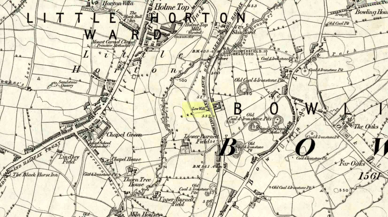
Along the now-lost Low Well Road between Little Horton and West Bowling, could once be found this innocuous-sounding water source.   Shown on the 1st OS-map of the area in 1852, the site was deemed to be little other than a ‘public well’.  At the end of the 19th century, a small well-house was built over the waters; and the years following that saw its complete demise.  Its name you would think relates to a position in the land, but the dialect word low, or lowe can mean “a flame, blaze, light, glow”, it can also refer to a prehistoric tomb.  However in this case it most likely derives from “a pond or standing pool”.

…And if some of you wonder why I have given this so-called Public Well the provenance of being a “sacred well”, please keep reading…

Folklore

Although it was deemed a simple ‘public well’ by historians and the public water authority, local folk knew there was much more to it than that!  In the Bradford area, this innocuously-named Well is the most promiscuously supernatural of all water sources, with a hidden history of magickians, ghosts and black dogs haunting its once ancient flow.  It was a site remembered as having oracular powers, where local people used it in scrying the future.  For such powers to work here, one had to gaze into the waters as they stilled at 6 o’ clock in the morning – a common time used by ritual magickians for the invocations of spirits.

The Bradford historian William Scrotum (1889) told us that in the 1860s, local people reported that the phantom black dog—or Bharguest as it was known—with its glowing red eyes, was seen coming out of the well after dark and scaring people half out of their wits.  Very soon people would not even venture out after dark for fear of encountering this great harbinger of Death.  Several years passed before local people called upon the abilities of a ritual magickian in the hope that he could lay the ghostly hound and bring peace and stability back to the hearts and minds of those living hereabouts.  Eventually, after much work, the magickian exorcised the waters and cast the black dog back into the depths of the Earth from whence it had come and, to this day, sightings of the spectral hound have stopped.

Water sources that possess ingredients of hauntings, magic and oracular properties are universally ascribed as ‘sacred’ in one way or the other.  In pre-industrial times I have little doubt that, amongst the animistic pantheon of local Bradfordians, this was no exception.

References:

  1. Scruton, William, Pen and Pencil Pictures of Old Bradford, Thomas Brear: Bradford 1889.
  2. Wright, Joseph, The English Dialect Dictionary – volume 3, Henry Frowde: London 1902.

© Paul BennettThe Northern Antiquarian


Watcher Stone, Ilkley Moor, West Yorkshire

Cup-Marked Stone:  OS Grid Reference – SE 11816 46563

Also Known as:

  1. Carving no.109 (Hedges)
  2. Carving no.263 (Boughey & Vickerman)
  3. White Wells 05

Getting Here

Watcher Stone by the path

From Ilkley, go up to White Wells (ask a local if y’ get stuck) and walk round the back of the building. Walk to the trees and then follow the footpath up onto the moors; but after 70 yards a small footpath on your right goes up the slope.  Take this and after about 90 yards it veers round to your left, following the contours up towards the copse of trees.  Another 100 yards up it meets with another path and once here, just yards in front of you, right by the side of the footpath, is the stone in question.

Archaeology & History

First described in John Hedges (1986) survey, this simple cup-marked stone typifies many petroglyphs on these moors: a barely visible design much eroded by centuries of wind and water, with markings perhaps only of interest to the devoted student and explorer.  But at least it’s a good place to sit, rest and watch the valley below.

Looking down at the cups
Hedges 1986 sketch

This old fella looks to have only five cupmarks on its supper surface, one of which is elongated, as shown in Hedge’s drawing.  However, when he saw this, he thought the elongated ‘cup’ consisted of three of them in a line, all linked up.  He saw a “medium sized smooth grit rock standing in grass, its surface triangular in shape, with flat top sloping slightly N to S.  Three cups connected by a groove, c. four other cups, all shallow and worn.”

This description was echoed in Boughey & Vickerman’s survey (2003), where they thought that the “triangular top surface has about seven worn cups, three connected by a short groove.”  But if the light isn’t quite right, this can be very difficult to see.

References:

  1. Boughey, Keith & Vickerman, E.A., Prehistoric Rock Art of the West Riding, WYAS: Wakefield 2003.
  2. Hedges, John (ed.), The Carved Rocks on Rombalds Moor, WYMCC: Wakefield 1986.

Links

  1. The Watcher Stone on The Megalithic Portal


Table Stone, Ilkley Moor, West Yorkshire

Cup-and-Ring Stone:  OS Grid Reference – SE 12233 46342

Also Known as:

  1. Carving no.114 (Hedges)
  2. Carving no.267 (Boughey & Vickerman)

Getting Here

Table Stone carving (photo by Jonathan Warrenberg)

From Ilkley walk up to the White Wells and follow the footpath behind it up to the cliffs, up the stone steps and onto the moor itself.  Once you’ve climbed the steps, walk uphill onto the moor for 100 yards, then turn right up a small path for another 80 yards until you reach the large Coronation Cairn with its faint cup-and-ring stone.  From here there are two paths heading west: take the higher of the two for just 30 yards where a small group of rocks are by the path-side on your right.  The curiously-shaped ‘upright’ one is the stone in question.  You’ll see it.

Archaeology & History

Found high up on top of an oddly-shaped stone, somewhat like an anvil or small table (hence the name, courtesy of Jonathan Warrenberg), is carved a slightly worn, incomplete cup-and-double-ring.  This aspect of the design is the one that stands out the most; but you’ll also see a cup-and-half-ring there too.

The carving seems to have been described for the first time in John Hedges (1986) survey (though I may be wrong), who described an additional feature to the design, saying:

“Small grit rock in possible cairn material, cut all round as if one pedestal, top surface triangular, sloping slightly SW to NE, overlooking Wharfe Valley, in grass and crowberry.  Large cup with two vestigial rings, second large cup with vestigial ring.  Possible third ring of corner edge (hewn off).  Recent carving of initials spoils original carving.”

John Hedges 1986 sketch
Looking from above (photo – Jonathan Warrenberg)

His description of the stone being “in possible cairn material” doesn’t seem true – although a number of petroglyphs are associated with cairns of varying sizes.  Several other carvings can be found close to this one.

In Boughey & Vickerman’s (2003) later survey, they copy Mr Hedges earlier description, but with less detail.

The view from this stone is quite impressive.  Even with the minor tree cover that would have existed when this carving was done, you’d still have clear views up and down the winding wooded valley that was carved by the River Wharfe.  The moors to the north at Denton and Middleton with their own petroglyphic abundance could be chanted at with ease from here when the winds sleep.  Tis a good spot to sit… if you’re lucky enough to get some silence…

References:

  1. Boughey, Keith & Vickerman, E.A., Prehistoric Rock Art of the West Riding, WYAS: Wakefield 2003.
  2. Hedges, John (ed.), The Carved Rocks on Rombalds Moor, WYMCC: Wakefield 1986.

LinksThe Table Stone carving on The Megalithic Portal

Acknowledgments:  Huge thanks to Jonathan Warrenberg for the use of his photos in this site profile – and also due credit for giving the stone its modern title. 🙂

© Paul BennettThe Northern Antiquarian


Wood Well, Shipley Glen, Gilstead, West Yorkshire

Healing Well:  OS Grid Reference – SE 12797 39277

Getting Here

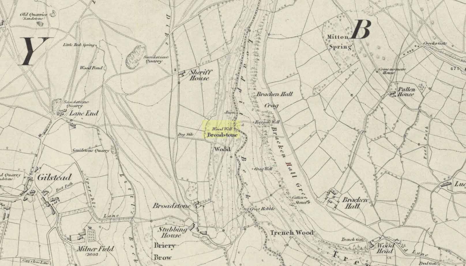
Wood Well on 1852 map

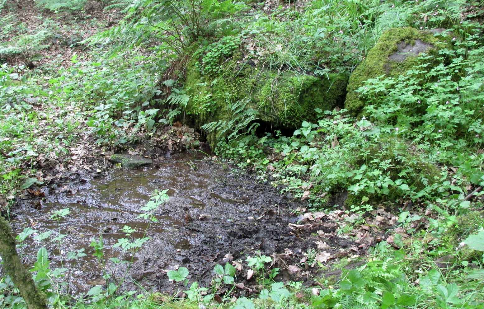
Best reached by going up Shipley Glen, to the Brackenhall Circle enclosure; keep going for a couple of hundred yards and then drop down into the trees, taking the directions directly to the Cloven Hoof Well.  Just past the well, a small footpath leads you downhill towards the large stream at the bottom, where there’s a rocky crossing (an old ford).  Go over here and, barely 50 yards upstream to your right, a large singular moss-covered boulder is set back, just a few yards above the stream with a small pool in front of it.  That’s it!

Archaeology & History

The ‘directions’ to find this might seem a little confusing to locals at first.  This is because the whereabouts of the Wood Well is on the eastern boundary edge of Gilstead – which is down at the bottom of Shipley Glen.  The steep muddy hill above it is almost always slippy and wet through, so it’s easiest to approach from the Baildon side.

The shallow muddy waters in a hot summer

The site is shown on the 1852 map of the area, but I can find no written material telling of its qualities.  If it ever had any medicinal virtues, they have long since been forgotten.  Whilst the water here is fresh and drinkable, in times of drought and low rainfall the water subsides and leaves only a muddy pool – just as it was when I last visited, making it quite undrinkable.  But to me, the main aspect of this site is its natural spirit, its locale, as it’s surrounded by unerring hues of rich greens, cast out by the landscape of mosses prevalent in a region almost bereft of such voices.  If you like y’ wells – check it out!

© Paul Bennett, The Northern Antiquarian