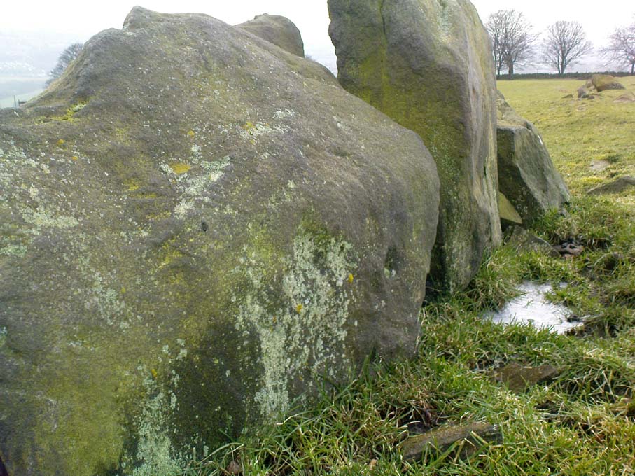
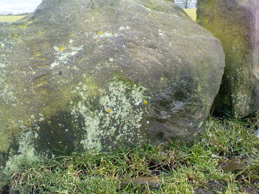
East Wall Stone, Burley Moor, West Yorkshire

Cup-Marked Stone:  OS Grid Reference – SE 13924 45493

Getting Here

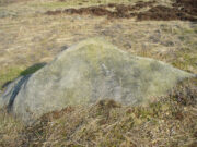
East wall stone on the right

Follow the directions to reach the impressive Woofa Bank prehistoric enclosure.  You need to find the walling that constitutes the enclosure itself and walk along to its eastern side where you’ll reach an ‘opening’, as if it may once have been an entrance at that side of the enclosure.  A reasonably large sloping rock is on one side of this ‘entrance’.  You can’t really miss it!

Archaeology & History

Unlike many of the other petroglyphs found within the Woofa Bank enclosure, the design on this one is faint — very faint indeed (much like the recently uncovered triple-ring petroglyph by the Thimble Stones).  Comprising simply of a small cluster of cup-marks, you’ll struggle to see this one — unlike its compatriot on the western wall of the enclosure.

Looking down on the rock
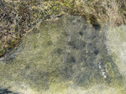
Some very faint cupmarks

It consists of a single cup-mark on the northern edge of the stone, whilst on the sloping southern part of the rock are a number of very faint cups, eroded by them there millenia of Nature’s wind and weathering.  One or two of the cups are just visible in good lighting, but what are almost certainly a few more can be seen when the rock is wet and in low daylight hours.  It’s a design that’s probably only of interest to the hardcore petroglyph fanatics, but without doubt this is yet another carving within this obviously important prehistoric enclosure.

© Paul BennettThe Northern Antiquarian

Conichan East, Glen Almond, Perthshire

Settlement:  OS Grid Reference – NN 84645 32074  —  NEW FIND

Getting Here
The setting of the remains

The setting of the remains

Park up and walk the long estate track up Glen Almond for nearly three miles until, on your left, you’ll see a small pond.  From here, walk up the slope and, about 100 yards above you, note the large solitary boulder ahead, above the dyke of a small walled stream, where the land levels out.  Just past the rock itself is the first of several remains.

Archaeology & History

First things first: the grid-reference cited here is centred upon the largest of several rings of stone found on this small grassy plateau, 150 yards north above the River Almond, just past the huge boulder.  It’s an impressive site – and a previously unrecorded one.
The raised ring of Conichan
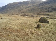
The raised ring of Conichan

Looking southeast

Looking southeast

At least three large hut circles can be clearly seen on this small ridge, amidst a sea of prehistoric sites scattered all down this lonely Scottish glen.  When Paul Hornby, Lara Domleo and I meandered up here the other day (to visit the Clach na Tiompan megaliths), extensive prehistoric walling called my nose up the slopes to see if anything was hiding away—and a large prehistoric ring, more reminiscent of the Derbyshire stone circles and ring cairns than any hut circle, appeared before me.

The first and largest that I came across is the one immediately north of the huge boulder (which may have slight traces of ancient walling running up to it).  The large ring is clearly raised onto a flat level platform, with an entrance on its southern edge.  The ring itself measures, from outer-wall to outer-wall some 12 yards wide (E-W) and 11 yards N-S.  The northernmost section of the walling or stone embanked structure is built into the sloping hill to the rear, with the east and western walls constructed simply onto the flat land.  The walling itself is typical of prehistoric structures, comprising the usual mass of small stones packed within a number of larger upright stones; although much of it is very overgrown with centuries of vegetation.  The walling that constitutes the ring itself is between 1-2 yards across and about two-feet high above the present ground-level.
Second circular remains
Second circular remains

...and from another angle

…and from another angle

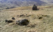
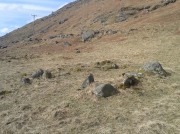
To the east of this is a smaller, roughly circular construction of similar form.  The rocks that make up this site are much more visible and may have been robbed and used in the more extensive walling above and the dykes below.  It is unclear whether the nature of this site is the same as that of the more defined circular enclosure we have just described.

The remains of a third structure was clearly evident a short distance to the east of this, but I didn’t have much time here and another visit is needed to make further assessments.  Iron Age walling and other undocumented prehistoric remains were also found close by.

Acknowledgements:  Many thanks to the noses of little Lara Domleo and Prof. Paul Hornby for their bimbling aid to relocate this site – and one or two others that have been off the radar for many-a-century.

© Paul BennettThe Northern Antiquarian


Baildon Moor Carving (150), West Yorkshire

Cup-and-Ring Stone:  OS Grid Reference – SE 13724 40096

Also Known as:

  1. Carving no.22 (Hedges)

Getting Here

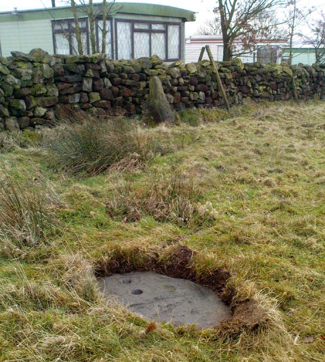
Carving 150, with Dobrudden Stone to rear

Whether you come via Shipley Glen or Baildon, head for the Dobrudden caravan park on the western edge of Baildon Hill.  As you get to the entrance of the caravan site, turn right and walk along the outer walling of the caravan site, up and around for less than 100 yards.  Keep your eyes peeled for the upright stone against the outer walling (the famous Dobrudden Cup-and-Ring Stone), and just 10 yards away, laid flat in the grasses, you’ll see this small cup-and-ring stone!

Archaeology & History

Found just a few yards from the well-known Dobrudden Carving that stands up against the wall, this small flat level stone, slowly again being encroached by Earth’s skin, is found on the edge of the High Plain, whereon the usual conjunction of prehistoric tombs and cup-and-rings is found once again.  Whether this carving ever had its own cairn or funerary monument is now hard to say for sure; and the excessive erosion of modern humans is slowly eradicating the landscape all round here.

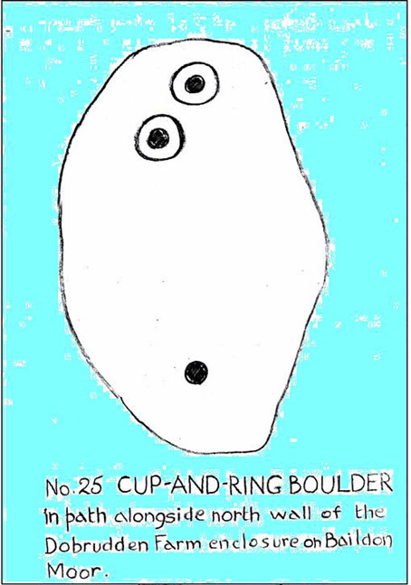
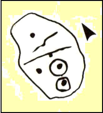
Jackson’s 1956 drawing
Hedges 1986 drawing

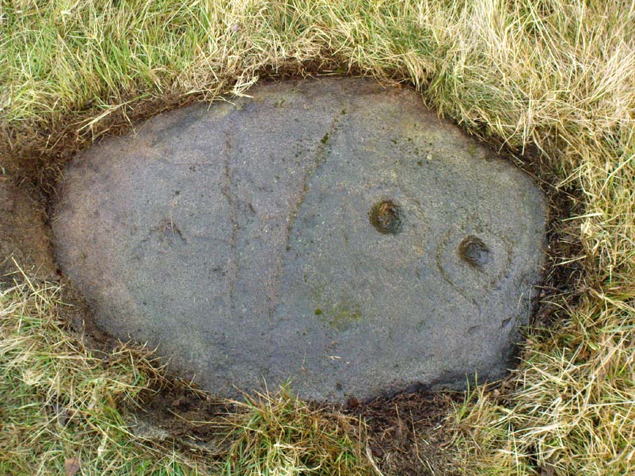
Consisting of two cup-and-rings (with very deep cupmarks in the centres), there are also what seem like artificially carved lines or grooves running across the stone.  It was first described in a short article in the Cartwright Hall Archaeology Group Bulletin (Jackson 1956)*, found lying “in the path alongside the north wall of the Dobrudden Farm enclosure.”  It seems like stone may have been covered over until some local work on Dobrudden unearthed it in the latter half of the 20th century.  There’s also an intriguing note told by a local man called Jack Taylor, which Jackson narrated, saying how he,

“always held the opinion that the rings were not contemporary with the cups, and went so far as to suggest that they had been carved within living memory by someone anxious to ‘improve’ the boulder.”

This might be the case, as there is another carving not far away near the top of Baildon Hill that certainly seems to have been done in the 20th century.  And one of the two surrounding rings on this stone does appear to have a more recent look to it than the other.  However, we must consider that the covering soil has kept the carved rings in such good condition. (There are examples of petroglyphs throughout the world where certain carved elements were added at later times by countless aboriginal tribes.)

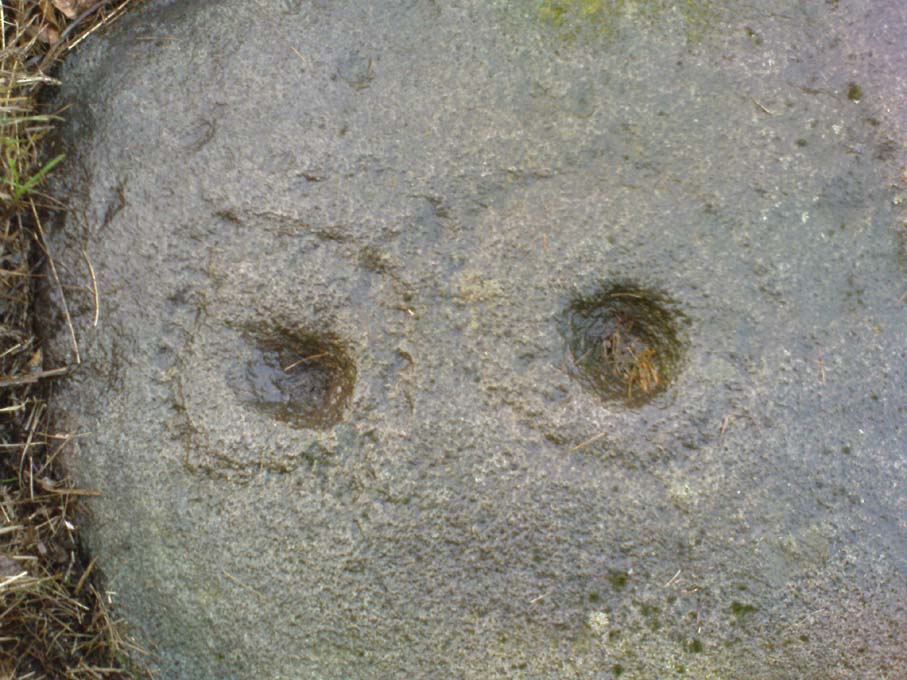
Close-up of cup-and-rings
Dobrudden carving 150

Like all of these carvings, to get an accurate picture of the true original we must visit them in all weathers all through the year, to see how differing seasons express the petroglyph. For we can see on some images we have of this carving a number of features that aren’t on the drawings of either Jackson (1956) or Hedges (1986): whether the rings surrounding the cups are ancient or not, there is a definite carved line nearly linking them together; and at least one faint line stretches down from one of the rings.  We need to visit the carving again to see if such features show up with greater clarity when lighting conditions are better.

References:

  1. Baildon, W. Paley, Baildon and the Baildons – parts 1-15, Adelphi: London 1913-1926.
  2. Bennett, Paul, Megalithic Ramblings between Ilkley and Baildon, unpublished: Shipley 1982.
  3. Boughey, Keith & Vickerman, E.A., Prehistoric Rock Art of the West Riding, WYAS: Leeds 2003.
  4. Hedges, John, The Carved Rocks on Rombald’s Moor, WYMCC: Wakefield 1986.
  5. Jackson, Sidney, “Another Cup-and-Ring Boulder,” in Bradford Cartwright Hall Archaeology Group Bulletin, 1:13, 1956.

* Boughey & Vickerman (2003) cited W. P. Baildon’s magnum opus (1913) as the first to describe this stone, but this is untrue (there’s certainly no mention nor illustration of it in my editions of the Baildon volumes).

© Paul Bennett, The Northern Antiquarian

Hope Farm Field, Baildon Moor, West Yorkshire

Cup-Marked Stone:  OS Grid Reference – SE 13856 39599

Getting Here

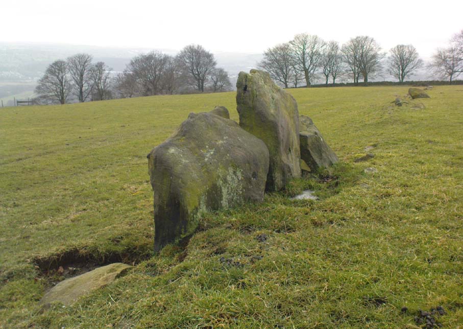
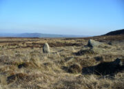
Cup-marked line of old walling

Whether you come via Shipley Glen or Baildon, head for the Dobrudden caravan park on the western edge of Baildon Hill.  As you get to the entrance of the caravan site, walk down (left) the footpath outside the park itself, looking across the grasslands, left, to the tree-lined wall a coupla hundred yards away.  Head for that.  Then go through the gate into the field where you’ll see a denuded line of walling, with what looks like some standing stones along it.  That’s where you need to be!

Archaeology & History

First noticed on February 12, 2012, this simple cup-marked stone is another one that’s probably only of interest to the purists amongst you.  Found below the southern end of Baildon Hill, due west of the lost Hope Farm cup-and-ring stone, the cup-markings here are on the north-face of an upright stone in an old wall.  It’s obvious that this stone was once earthfast, when the carving faced the zenith or night sky, and has been cut in half and turned 90° making the cups more difficult to notice; and very obviously the rock was originally close to its present position in the walling.

Primary cupmark, right-side of stone
Close-up of cup/s

Found in an area rich in cup-and-ring stones, there’s just one singular cupmark that’s obvious on this stone; but as we looked back and forth, feeling the stone with our fingers, it seemed there may be a couple of others on the rock.  We need to come back here again in better lighting conditions, as opposed to the old grey day She gave us yesterday, and see if the others are real or simple geological marks.

© Paul Bennett, The Northern Antiquarian