Get up to the Swastika Stone, then head west along the footpath towards the Piper Stone. Shortly before there, you’ll see the small cup-marked Piper’s Crag (3) carving, just by the walling. From this carving, just step a few yards down the slope and on the smooth sloping rock face is this faded carving. You’ll see it.
Archaeology & History
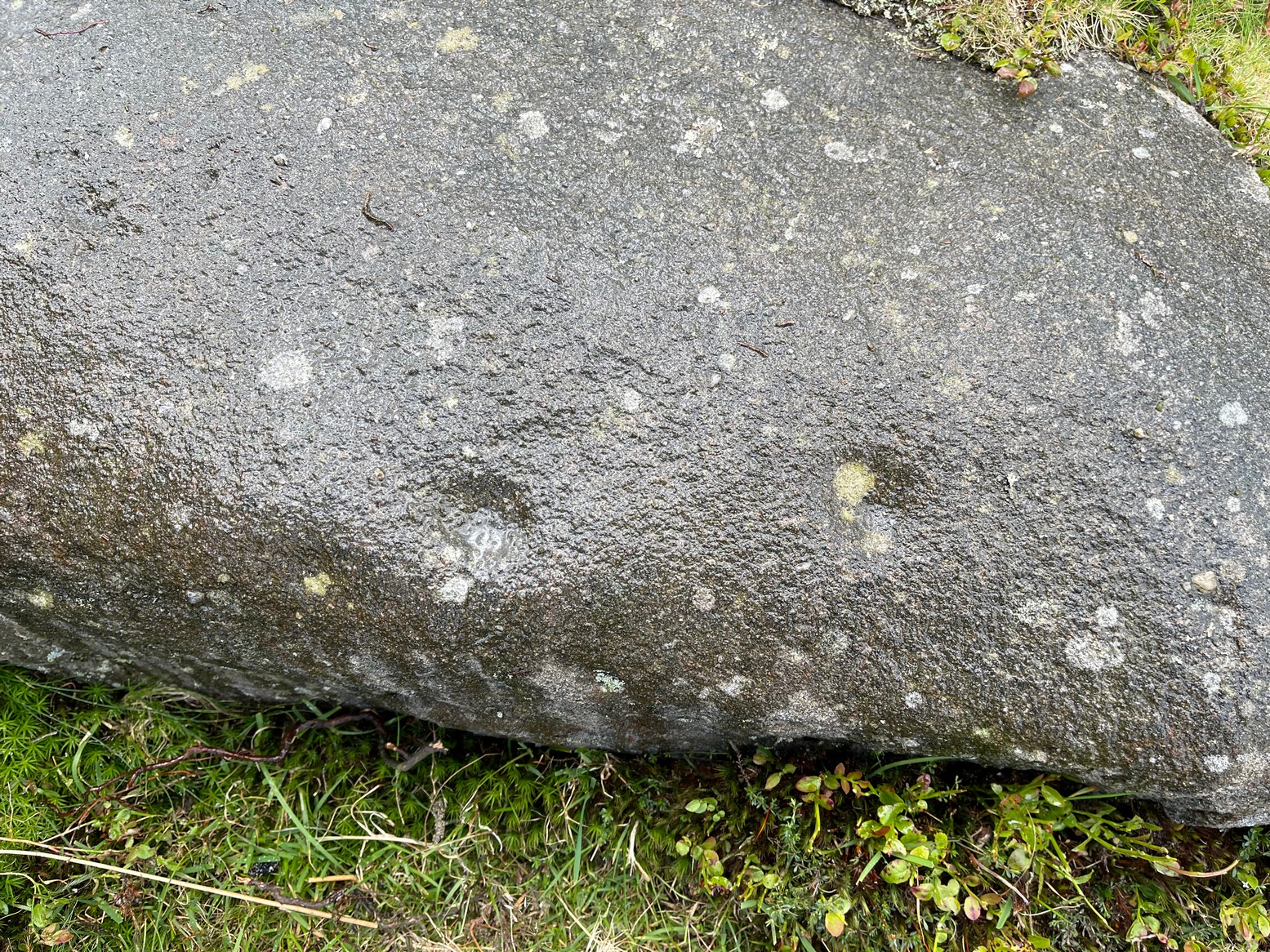
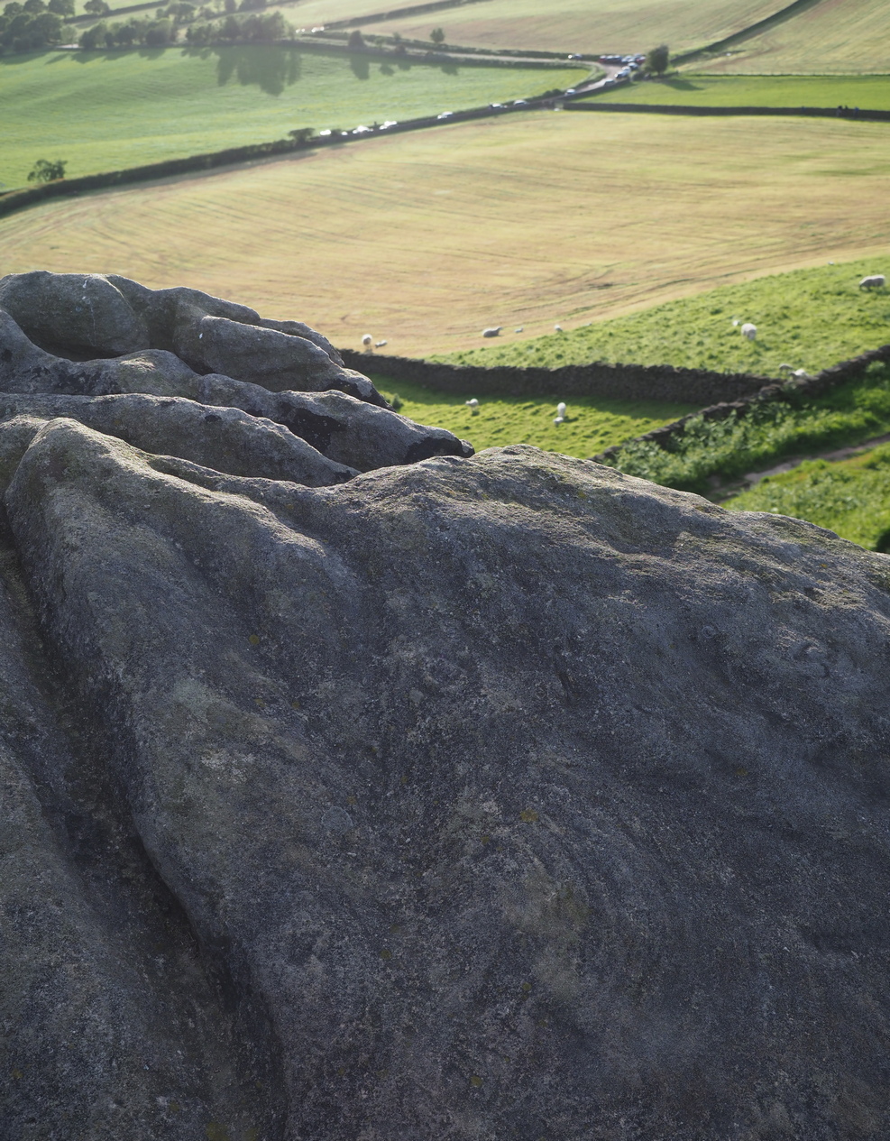
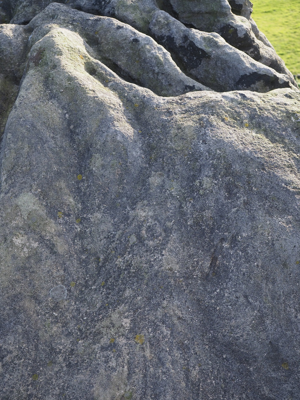
A larger than normal single cup-mark near the bottom slope of this rock has an incomplete ring around its east and southern edges, possibly with another broken element of it on its northern edge. It’s difficult to work out whether or not this is one of Nature’s curious markings and so needs looking at in different lights to work it out, one way or the other. It’s included in Boughey & Vickerman’s (2018) updated rock art survey, but there are a number quite natural cup-marks in that tome, so we need to exercise a little bit of caution here. However, it does seem to have a greater degree of authenticity than some of the other dubious single cup-marked stones in their book. Check it out on your way to the Piper’s Stone.
References:
Boughey, Keith & Vickerman, E.A., Prehistoric Rock Art of the West Riding Supplement, 2018.
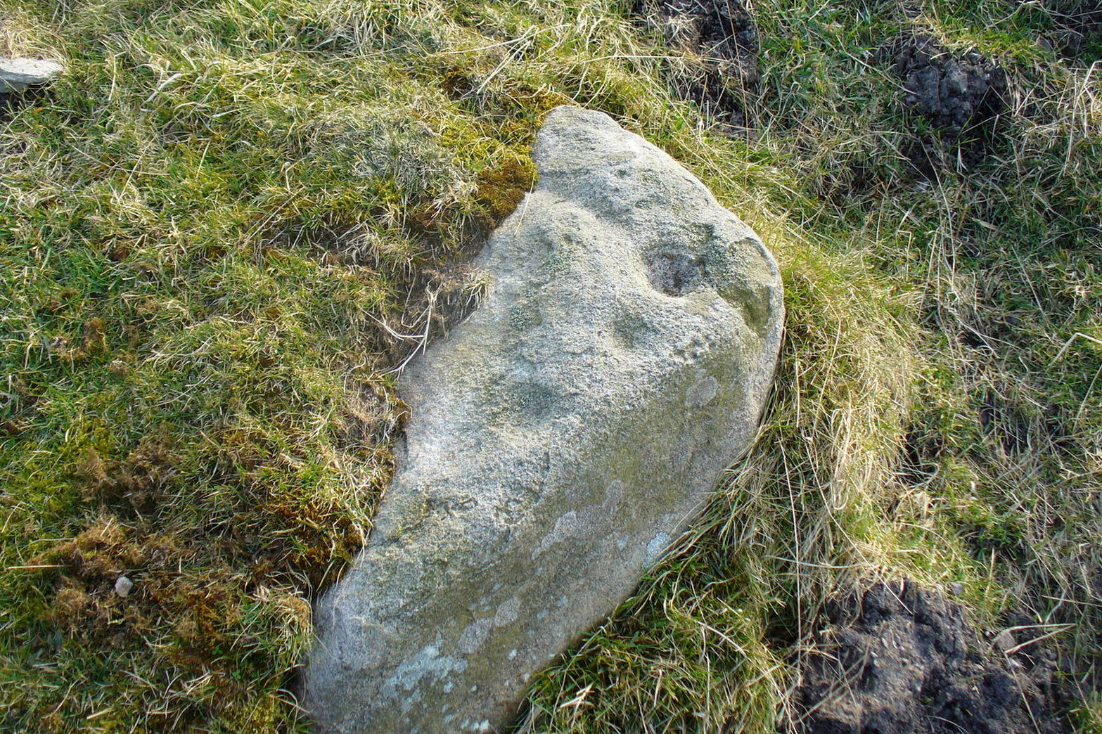
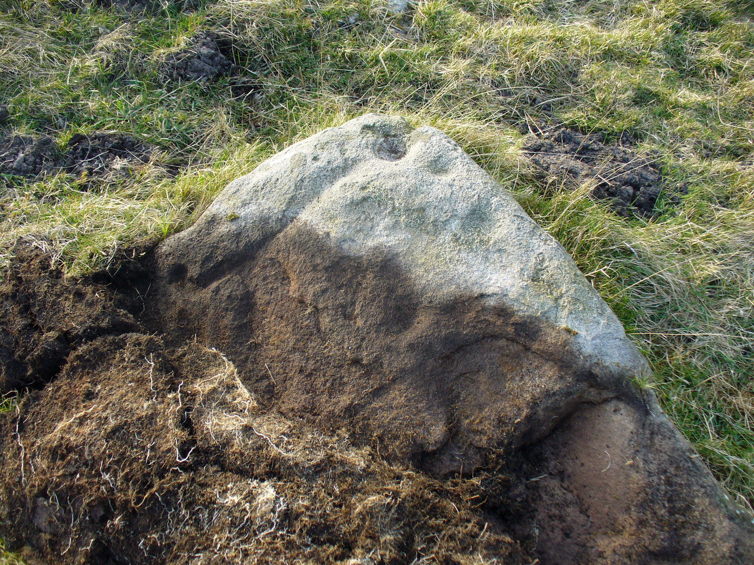
Heading up from Ilkley, follow the directions to reach the Swastika Stone, then keep walking (west) along the footpath to the small clump of trees, and keep walking past them too and keep going along the same path as if you’re heading toward the Piper’s Stone. About 200 yards before reaching it, just where the gate and boundary stone is in the old walling, there’s a small line of crags to the right of your feet and there, at the edge of the path, is the stone in question. You’ll see it (unless it’s a cloudy gray day, in which case you might struggle).
Archaeology & History
The two cup-marks
This is one of a number of cup-marked stones that you’ll find scattering this part of the moor, almost all of which are Nature’s handiwork (a few of these natural carvings have somehow found their way into Keith Boughey’s [2018] updated West Riding rock art book). I’m not 110% certain that this doesn’t have Nature’s name on it either, but it’s got a greater degree of probability to it than some of the others. It’s a simple little thing, as y’ can see, consisting of just the two cup-marks, smaller than usual, living next to each other. If it’s the real deal, we can surmise that it may have been carved by a young person back-in-the-days. In the walling just above this stone you can see the medieval boundary stone, which might—just might—have a prehistoric pedigree to it….
References:
Boughey, Keith & Vickerman, E.A., Prehistoric Rock Art of the West Riding Supplement, 2018.
This is an outstanding site visible for miles around in just about every direction – so getting here is easy! If you’re coming from Harrogate, south down the A658, turn right and go thru North Rigton. Ask a local. If you’re coming north up the A658 from the Leeds or Bradford area, do exactly the same! (either way, you’ll see the crags rising up from some distance away) As you walk to the main crags, instead of going to the huge central mass, you need to follow the line of walling down (south) to the extended cluster of much lower sloping rocks. Look around and you’ll find it!
Archaeology & History
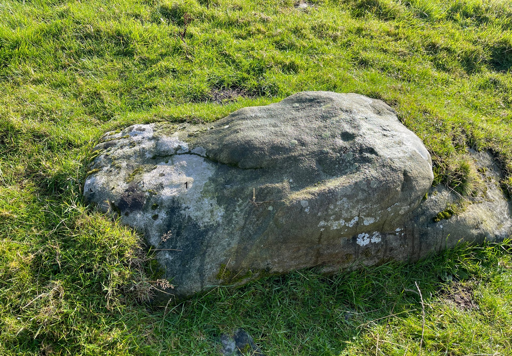
On the evening of May 27, 2024, I received a phone call from a Mr James Elkington of Otley. He was up Almscliffe Crags and the wind was howling away in the background, taking his words away half the time, breaking the sentences into piecemeal fragments. But through it all came a simple clarity: as the sun was setting and the low light cut across the rocky surface, a previously unrecorded cup-and-ring design emerged from the stone and was brought to the attention of he and his compatriot Mackenzie Erichs. All previous explorations for rock art here over the last 150 years had proved fruitless—until now!
Looking northwestCentral cup-&-ring
On the east-facing slope of the stone, just below the curvaceous wind-and-rain hewn shapes at the very top of the boulder, is a singular archetypal cup-and-ring. It’s faint, as the photos show, but it’s definitely there. What might be another cup-and-ring is visible slightly higher up the sloping face, but the site needs looking at again when lighting conditions are just right! (you can just about make it out in one of the photos) But, at long last, this giant legend-infested mass of Almscliffe has its prehistoric animistic fingerprint, bearing fruit and giving watch to the countless heathen activities going back centuries. Rombald’s wife Herself might have been the mythic artist of this very carving! (if you want to read about the many legends attached to the major Almscliffe rock outcrop, check out the main entry for Almscliffe Crags)
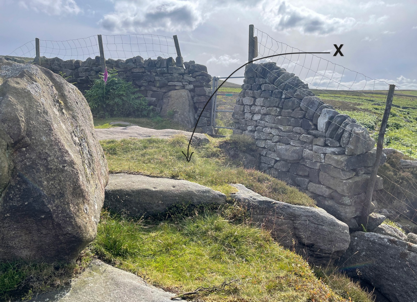
On the moorland road from Dick Hudson’s pub, head east along the Otley Road for more than 1½ miles, past the T-junction right-turn at Intake Gate (to Hawksworth) and just a quarter-mile further on park-up at the roadside (opposite Reva Reservoir). Walk (north) thru the gate into the field and after 300 yards through another gate into the next field. From this gate, walk straight north to the Fraggle Rock cup-and-ring stone, then go down the slope NNW for nearly 50 yards and just above the old track you’ll see the edge of this stone peeking out!
Archaeology & History
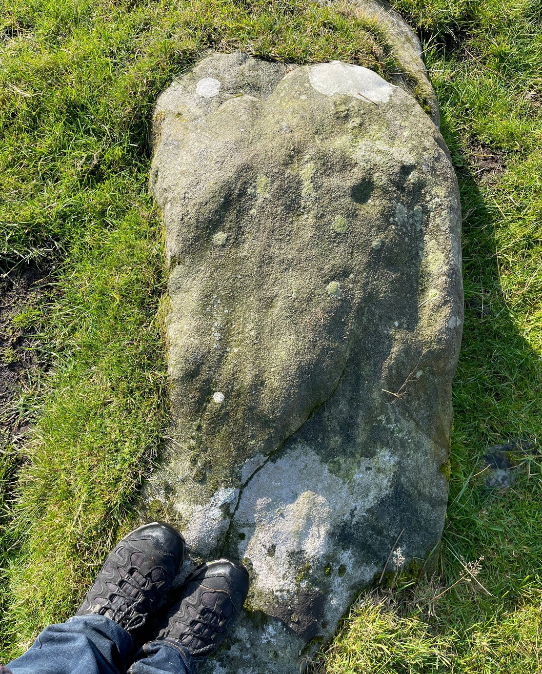
One of a number of previously unrecorded carvings in these fields, this is a pretty simplistic but unique design. The first thing you’ll notice is at the top-corner of the stone where, like many rocks on these moors, a nicely-worn cup stands out. Erosion obviously…. or so it first seems. This cup-mark has another two by its side, along the top edge of the stone which, again, initially suggested them to be little more than natural. But in rolling back the turf this assumption turns out to be wrong; for, along the west-side of the rock you’ll see a notable pecked groove running down to another cup-mark about twelve inches below, kinking slightly just before it reaches that cup. You can see this in the photo. Now, if we return to the prominent cup-mark at the top corner of the stone, in certain light there seems to be a very faint incomplete ring around it – but we can’t say for certain and it needs to be looked at again in better light.
Cups & line clearly visibleMain carved section
The name given to this carving (thanks to Collette Walsh) comes from the wavy lines that go into the middle of the stone from the long pecked line. These wavy lines are natural, although one portion of them might have been artificially enhanced. It’s difficult to tell one way or the other and we’ll have to wait for the computer boys to assess this particular ingredient. Just above these “waves” is a single eroded cup-mark nearly 2-inch across. And that’s that!
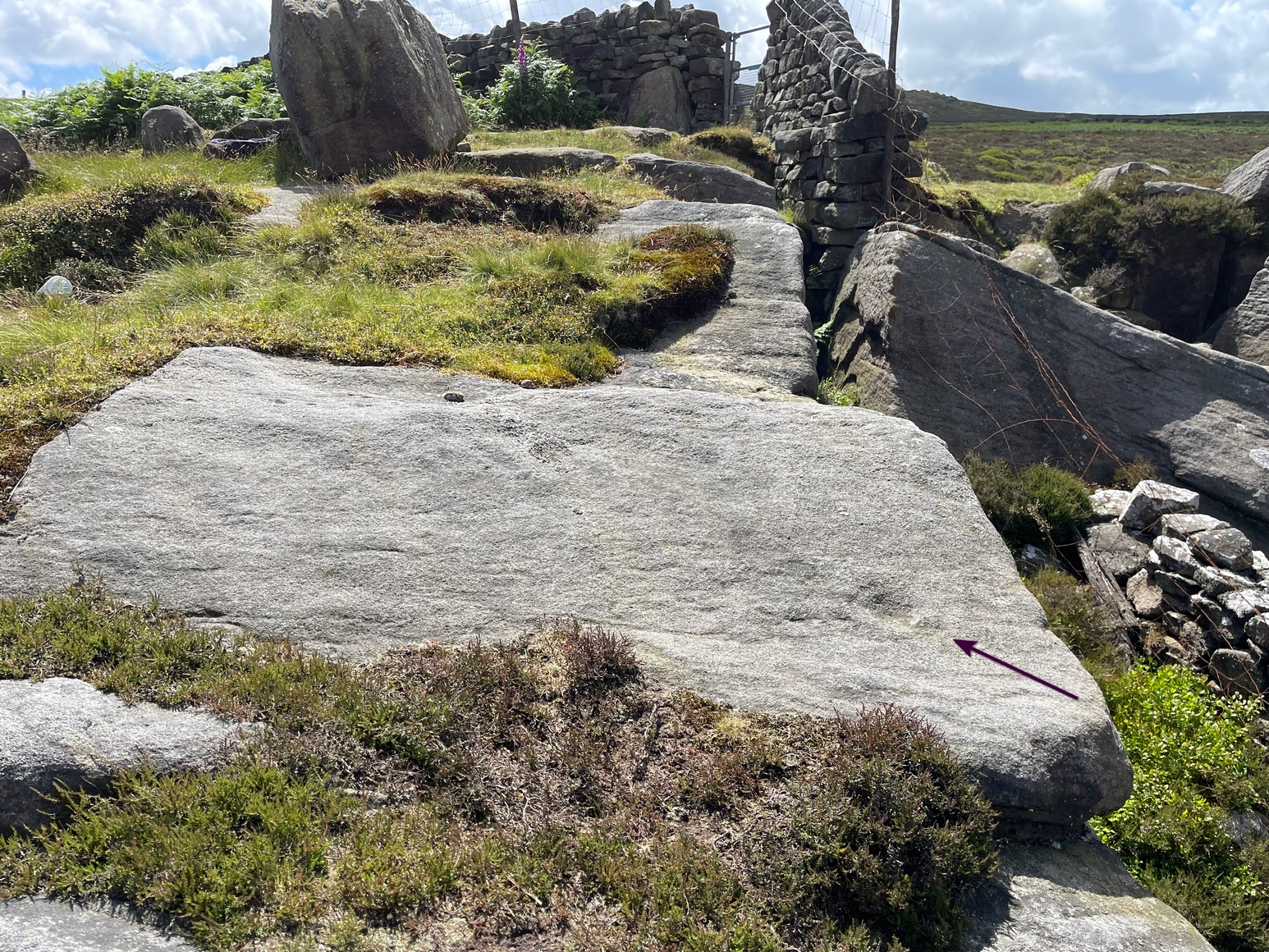
Numerous ways to get here, it’s probably the easiest (direction wise) to reach here starting from Dick Hudson’s public house on the southern road surrounding Rombalds Moor. From the pub, head left (east) along Otley Road (passing Weecher reservoir) for 1.9 miles (3.1km) until you reach Reva reservoir where a track leads you to the waters. A small parking spot is on the left-side of the road. From here, go through the gate and up the footpath (north) for about 200 yards then turn right and go up the field towards the wall where, about 20 yards before it, you’ll see find the stone in question.
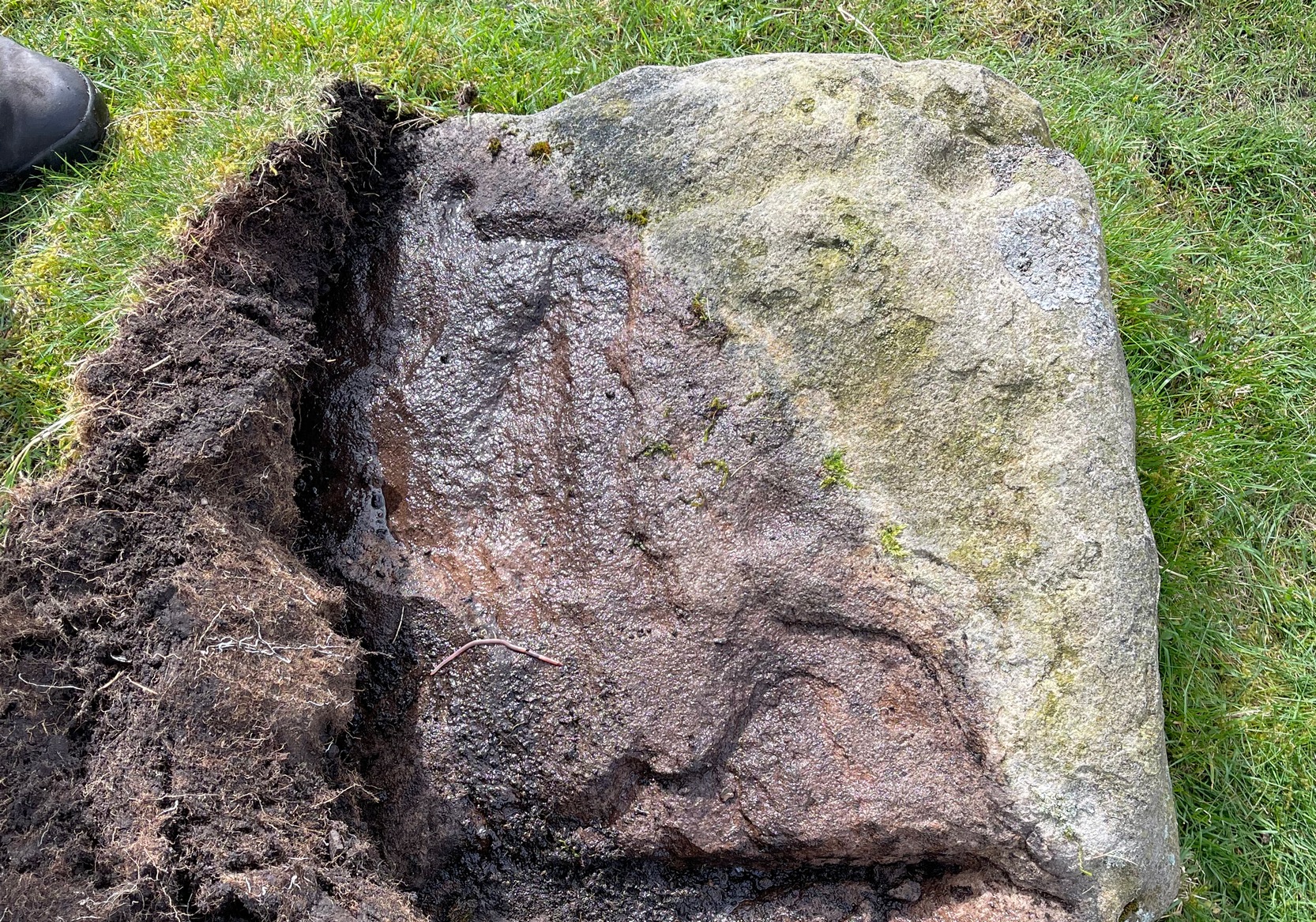
Archaeology & History
This long earthfast stone has two distinct cup-markings: one near its northern upper end, and the other near the lower southern end, as highlighted on the above photo. (forgive the poor image, but we took it when the sun was pretty high in the sky) It seems as if there are two or three other very faint cup-marks on the upper end of the stone, close to the most distinct one, but none of our photos show them with any clarity.
Acknowledgements: Huge thanks to Sarah Walker and Thomas Cleland for help with location and imagery for this stone.
Cup-and-Ring Stone (lost): OS Grid Reference – SE 0965 4797
Archaeology & History
In Ronald Morris’ (1989) gazetteer of British petroglyphs, he included this curious entry but gave no real details regarding its appearance or history. Listed by the Royal Commission lads, it would seem to have been located immediately south of the dismantled railway where it used to cross the Addingham-Ilkley road, but no one seems to have seen it either before or since Morris’ description. Any help regarding its whereabouts would be appreciated.
References:
Boughey, Keith & Vickerman, E.A., Prehistoric Rock Art of the West Riding, WYAS: Wakefield 2003.
Morris, Ronald W.B., “The Prehistoric Rock Art of Great Britain: A Survey of All Sites Bearing Motifs more Complex than Simple Cup-marks,” in Proceedings of the Prehistoric Society, volume 55, 1989.
Coming from Harrogate, take the B6162 and B6161 road to Beckwithshaw, through the village and, 4-500 yards on, turn right onto Norwood Lane. 2 miles along, keep your eyes peeled on your left for a gravelled parking spot and you’ll see the large rock outcrop 200 yards south of the road. …Otherwise, from Otley: go over the river bridge and turn right up Farnley Lane and follow the B6451 for a few miles, thru Farnley village up the Washburn valley, past Norwood and at Bland Hill, turn right along Broad Dubb Road for 1¾ miles where you’ll reach that same gravelled parking spot.
Archaeology & History
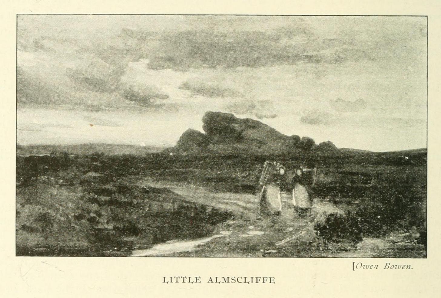
Very much the ‘little brother’ of Great Almscliffe, 3 miles (4.83km) to the southeast, this site would be more of interest to the travelling geologist, perhaps, than to antiquarians. But that depends what tickles y’ fancy I s’ppose.
In 1702 when the northern antiquarian Ralph Thoresby mentioned this and its big brother to the southeast, he described the “two famous crags of Almes Cliff—in some old writings called Aylmoys ut dicitur—but have seen nothing memorial of it, saving its remarkable lofty situation.” He missed the cup-and-ring carving on the east-side of the crags, obviously, which indicates that it had some form of animistic sanctity in ancient times.
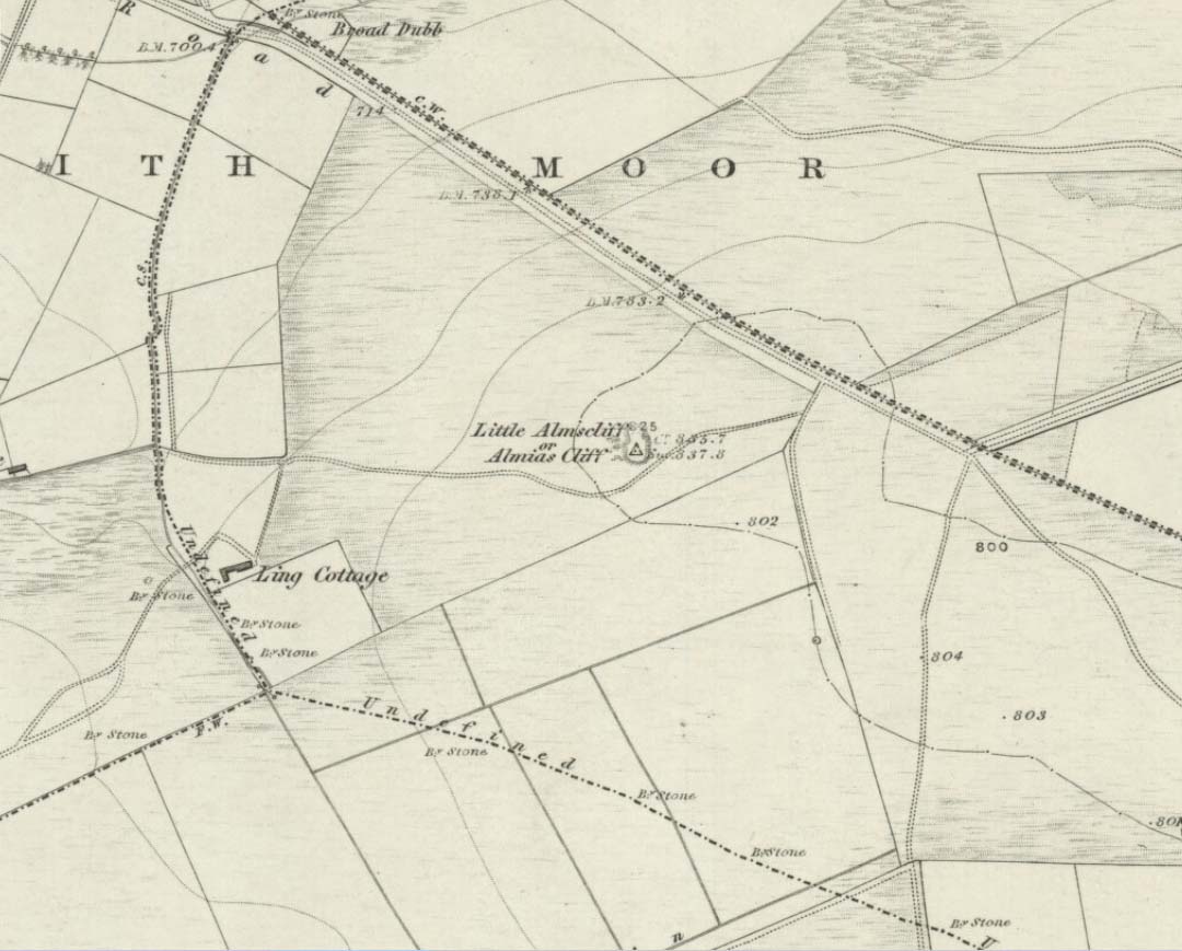
The location on 1851 mapLittle Almscliffe c.1900
Little Almscliffe was one of many impressive places located within the ancient Forest of Knaresborough; and although it wasn’t on the original boundary line, a perambulation (i.e., annual ritual walking to the old stones, trees and wells defining the region) of the area written in 1770, in what Mr Grainge called “the Copyhold Forest”, was undertaken by the Enclosure Commissioners. It differed from the more ancient perambulation rite, in that the newer one included a mention of,
“five bounder stones also marked F to an earth-fast stone, lying northeast of Little Almes Cliffe, marked also with an F; (and) from thence by other four bounder stones marked F to Sandwith Wath…”
The letter ‘F’ here signifying the word ‘forest’, as in the Forest of Knareborough.
William Grainge (1871) also believed these crags to have been a place of druidic worship. He wasn’t the only one. Many other writers of the time thought the same thing; and although we have no concrete evidence to prove this, it is highly likely that these rocks would have served some ritual purpose in pre-christian days. Certainly in more recent times (during the 1980s and ’90s) we know that ritual magickians used this site for their workings. On a more mundane level, the crags were previously used as a site for for beacon fires. One was erected here in 1803 when the first Bonaparte threatened to invade England; but I can find no written accounts of earlier beacons here.
References:
Bennett, Paul, The Old Stones of Elmet, Capall Bann: Milverton 2001.
Bogg, Edmund, From Eden Vale to the Plains of York, James Miles: Leeds 1895.
Bogg, Edmund, Higher Wharfeland, James Miles: Leeds 1904
Cowling, E.T., Rombald’s Way, William Walker: Otley 1946.
Grainge, William, History & Topography of Harrogate and the Forest of Knaresborough, J.R. Smith: London 1871.
Parkinson, Thomas, Lays and Leaves of the Forest, Kent & Co.: London 1882.
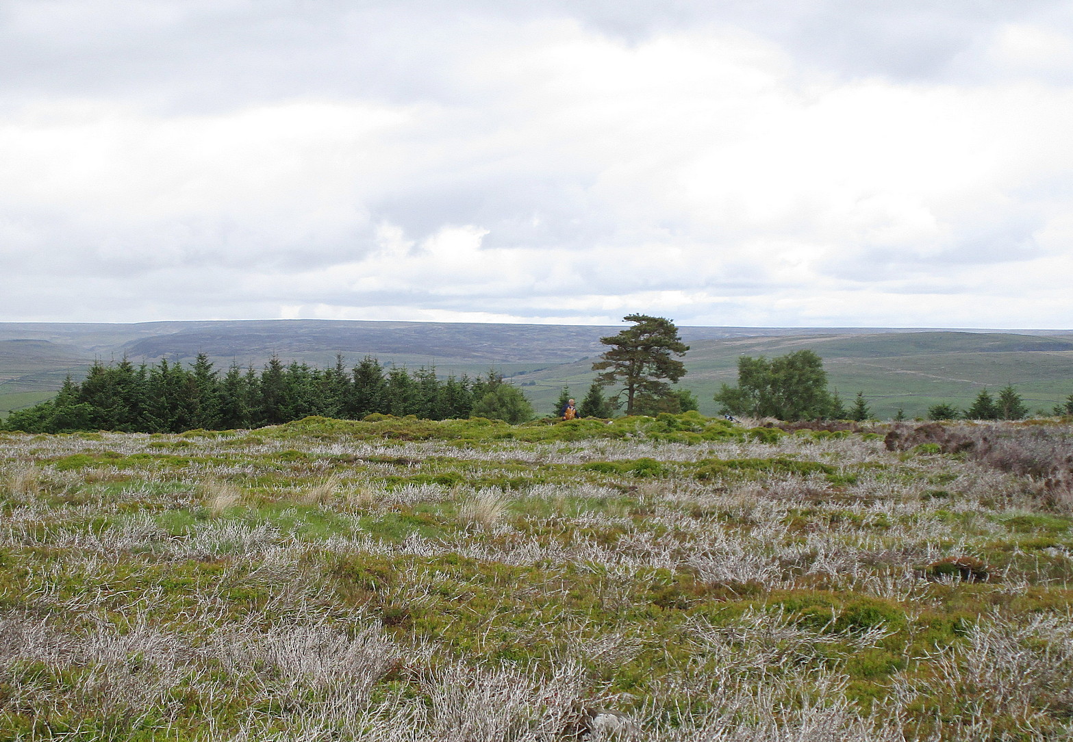
It’s easier to explain how to get here if you’re coming from the Burnsall-side of the B6160 road that leads to Bolton Abbey. A half-mile out of Burnsall village you a small woodland with a small parking spot. From here, a footpath runs up the steep hill above the parking spot. It zigzags a little and you eventually come out on the south-side of the trees where it meets some tall walling. Follow this walling further uphill for more than 600 yards (past more woodland) until the land starts to level out. Hereby, go thru an opening in the wall and less than 100 yards away (west) amidst the overgrown heather, you’ll see what you’re looking for.
Archaeology & History
A large but peculiar site resting on a moorland plateau on the eastern edges of the mighty Barden Moor. Peculiar inasmuch as it’s completely isolated from any other monument of the same age and type anywhere on these huge moors. A few miles east, on the moors around Appletreewick, Thruscross and Beamsley we have a plethora of prehistoric sites—but up here on Barden Moor there’s apparently nowt else! I find that hard to believe….
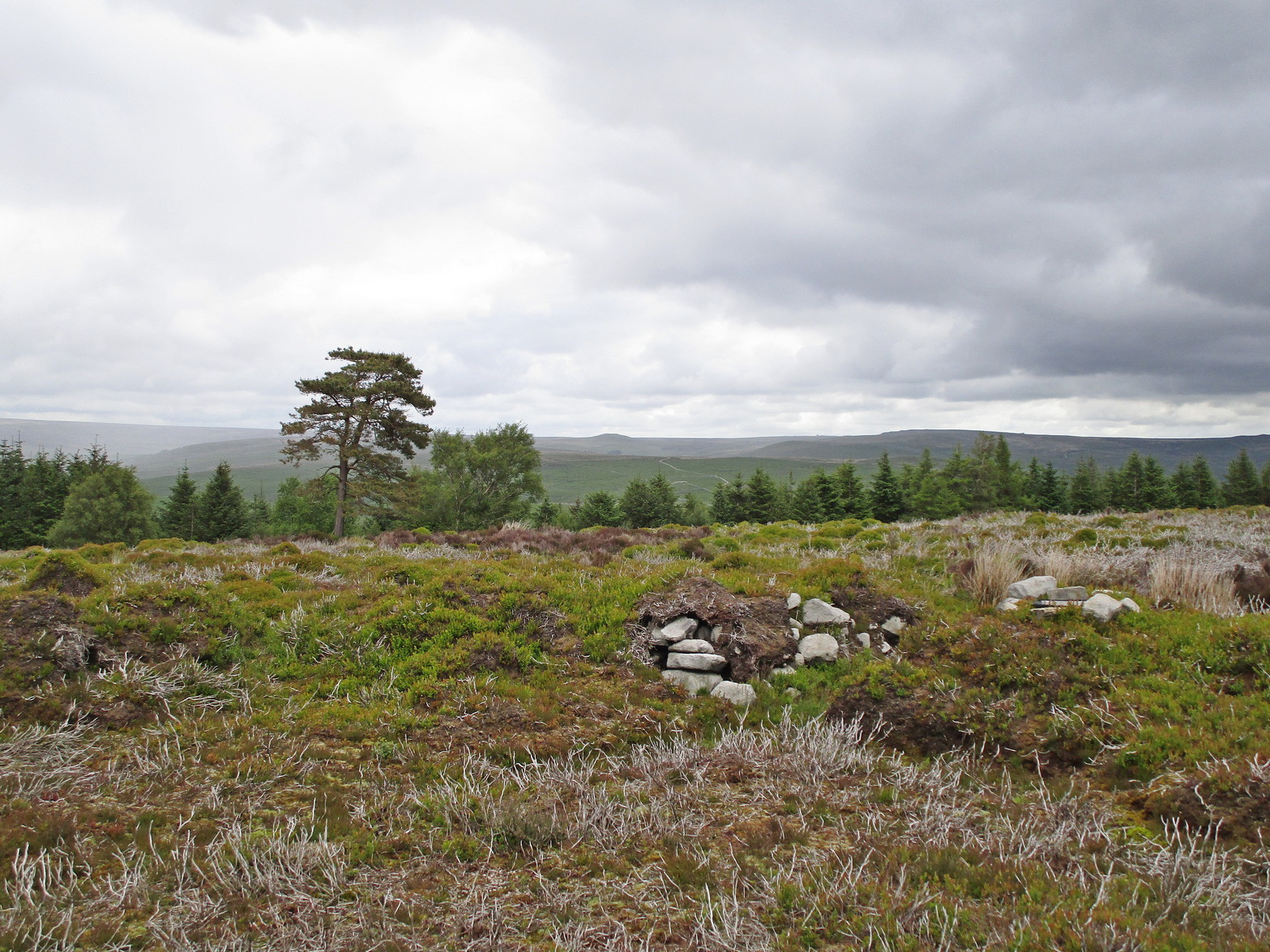
Inner rubble wallingRubble walling, looking N
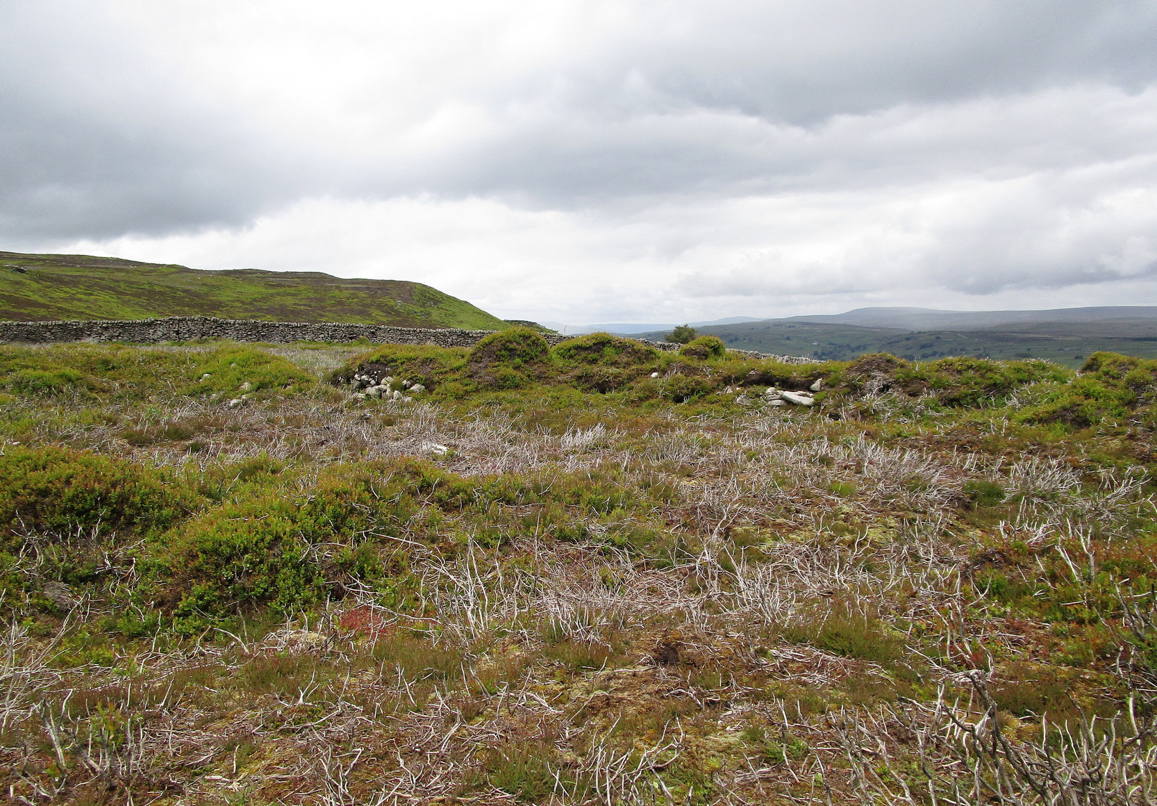
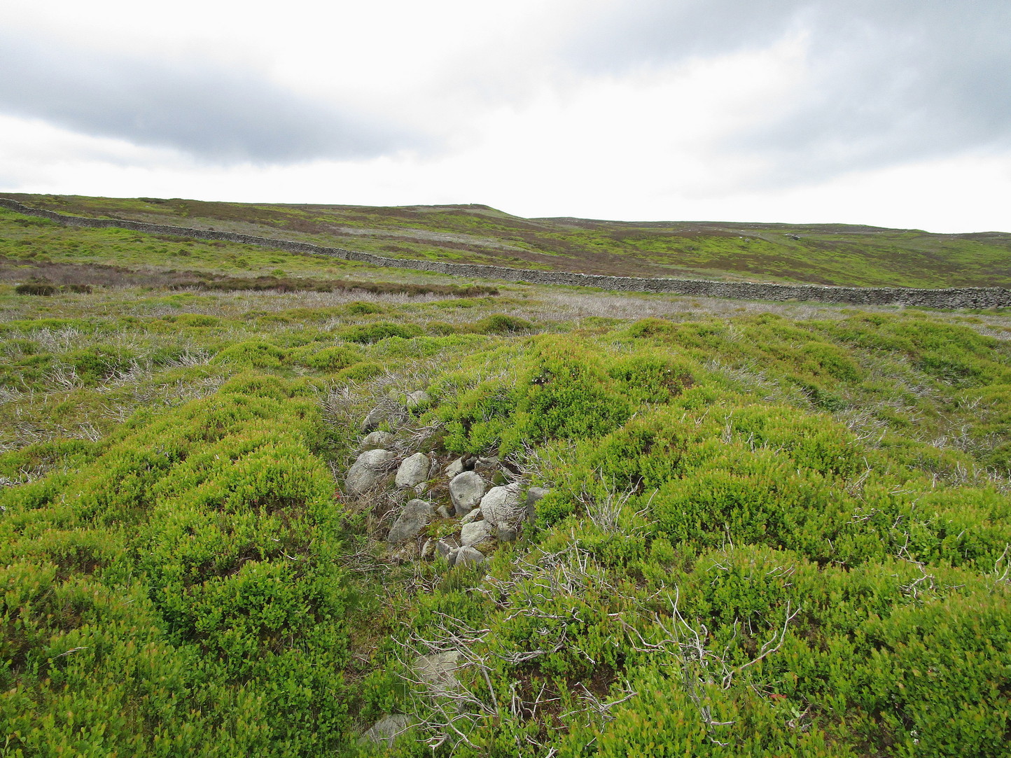
Listed on official websites as being a ring cairn, it’s difficult without a detailed excavation of the site (there hasn’t been one) so say that’s what it is. But we’ll stick with it for the time being. My initial impression of the site was that it was a crude form of a collapsed Scottish dun: impressive large circular monuments—buildings if you like—with very well-built large stone walls, usually several yards thick, a little bit like the Scottish brochs (mighty things indeed!). This thing at Folly Top isn’t quite as impressive, but it’s like a collapsed version of a dun.
Arc of western walling
The site consists of large ring of raised collapsed rubble walling, more than a yard high in places, and about three yards thick all the way round, measuring roughly 21 yards (N-S) by 19 yards (E-W) from outer wall to outer wall. There are “entrances” on the east and west sides; but there seemed to be little of any note in the middle of the ring, although the site was somewhat overgrown on our visit here. Outside of the ring there was also nothing of any note. It’s a pretty isolated monument which seems to have more of an Iron Age look about it than the Bronze Age—but until there’s an excavation, we’ll not know for sure.
It’s well worth checking out—and from here, walk onto the huge moorland above you to the west….
Acknowledgements: Huge thanks to the Crazy-gang of Sarah, Helen and James for their awesome assistance on our venture up here. A damn good day indeed! Cheers doods. 🙂
Cross (destroyed): OS Grid-Reference – SE 3224 4498
Archaeology & History
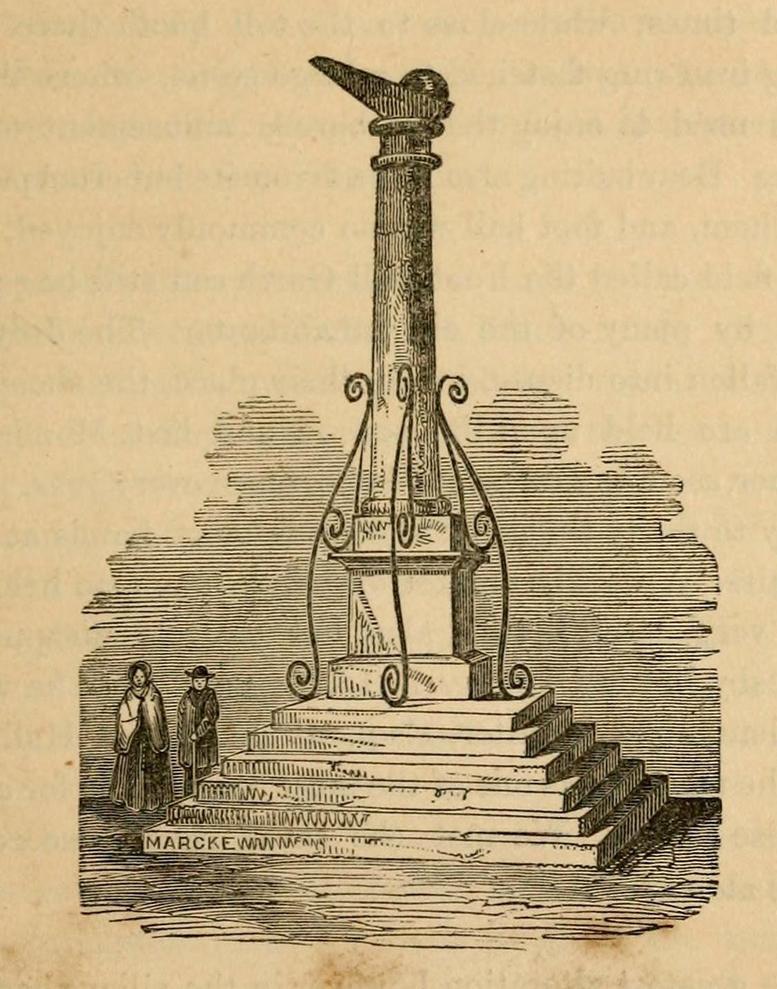
A Charter in the time of King John allowed for markets to be held in Harewood from 1209 CE onwards, “on the first day of July and the two following days, and also to hold one market there every week on the Monday.” But whether or not a market cross was erected that far back, we don’t quite know. Certainly, the edifice illustrated by John Jones (1859) in his standard work on Harewood didn’t date from such an early period! It stood close to the old road junction to Wetherby in old Harewood village, “a little below the intersection of the roads, and about fifty yards higher up than the market house.” Jones told us:
Harewood Cross (Jones 1859)
“It stood upon a large stone pedestal, and was approached by a quadrangular flight of seven steps, very broad, where the neighbouring farmers used to stand, and dispose of their butter, fowls, eggs, &c. It was re-erected, AD 1703, by John Boulter, Esq., and in the year 1804, when the road was lowered, it was taken down and destroyed. This is to be regretted, it might have been re-erected in another situation, if that was inconvenient, and would have been in the present day, not only an ornament to the village but a relic of the past, of which the villagers might have been justly proud. On the top of this cross there was a knur and spell, a game for which the village was celebrated in old times, while close to the toll booth there was a strong iron ring fastened to a large stone, where the villagers used to enjoy the barbarous amusement of bull baiting.”
References:
Bogg, Edmund, Lower Wharfeland, J. Sampson: York 1904.
Jones, John, The History and Antiquities of Harewood, Simpkin Marshall: London 1859.
Speight, Harry, Lower Wharfedale, Elliott Stock: London 1902.
Coming up from Otley, make your way up to the Askwith Moor road (the only one that goes across the moors) and park up on the rough parking spot on the right-side (east) of the road. You can’t really miss it. From here walk up the road for less than 500 yards until your reach the rickety gate and the path onto the moors. From here I walked 600 yards east, thru the heather until I reached the wall (close to the Tree of Life Stone) and then followed the wall up for 150 yards, then back up (west) onto the moor again and, about 50 yards along at the foot of the slope, keep your eyes peeled for the earthworky undulations beneath your tiny feet!
Archaeology & History
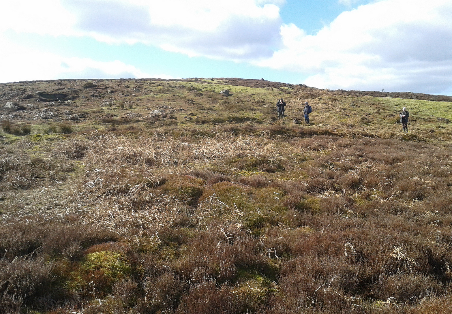
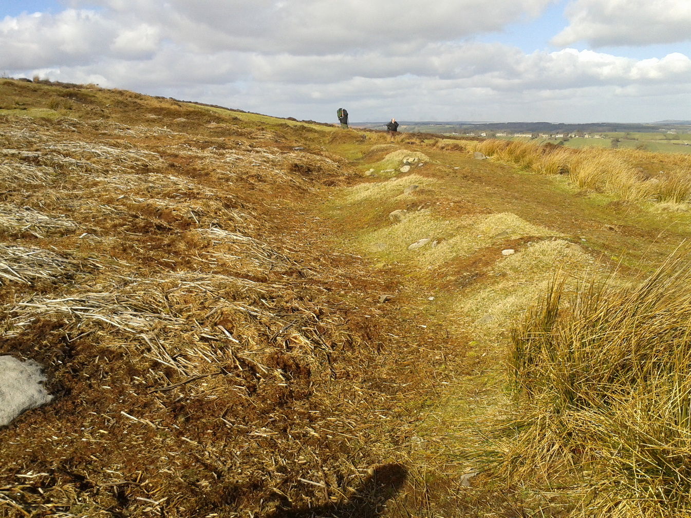
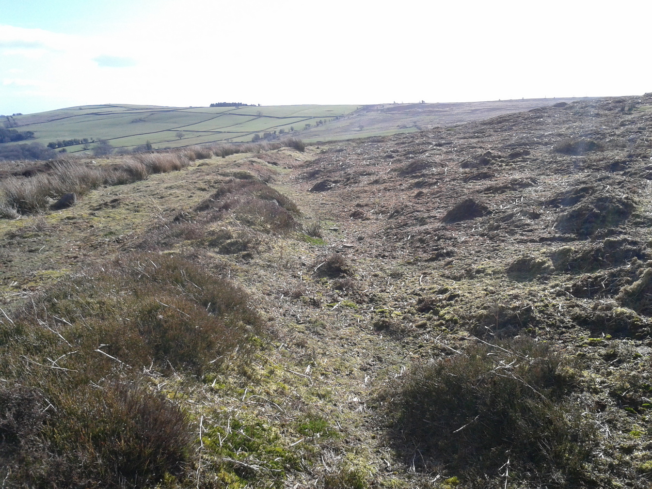
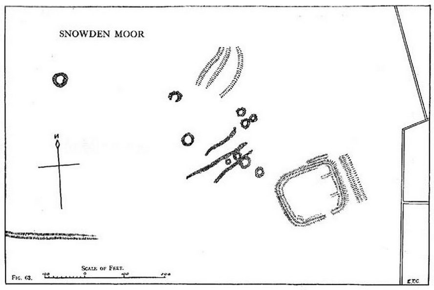
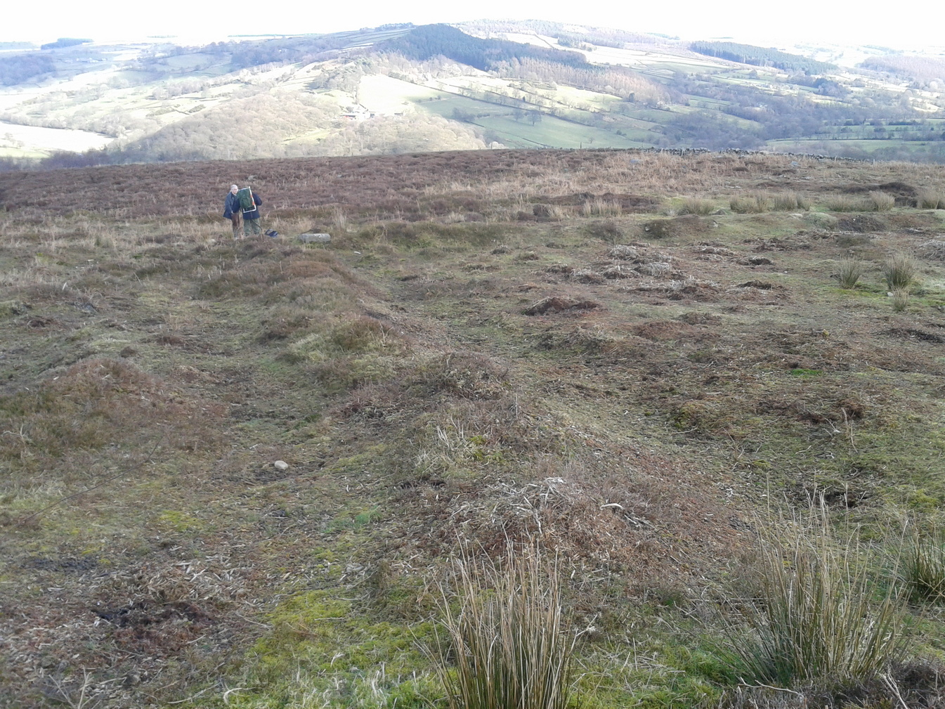
Just below the scattered Snowden Moor settlement we find this curious large structure, first described 75 years ago by the northern antiquarian Eric T. Cowling (1946). Since then, apart from a cursory overview, archaeologists haven’t really paid it much attention.
Eastern ditch, looking NEastern ditch, looking S
It’s a large site – and one which Cowling thought was constructed in the Iron Age. He may have been right, but there’s such a profusion of ancient sites on this small moorland area—dating from Neolithic times onwards—that it could be earlier than he thought. It’s an odd site too! Unlike the prehistoric D-shaped enclosure and settlement on the top of the slope less than 100 yards away, and an equivalent D-shaped enclosure to the south, the area inside Cowling’s enclosure ostensibly is on quite sloping ground, with barely a flat level area anywhere inside it. As a result of this, we can safely conclude that it wasn’t where people lived; and the complete lack of any inner hut circles (which you’d expect in a standard enclosure of this size) encourages this view. It’s a bit of a puzzle! Cowling opted for the idea that it was built to enclose cattle – which may be right; but again, even this must be questioned, as there is ample space on more level ground where this could have been done. His description of the site is as follows:
“The most prominent feature (on these moors) is a D-shaped enclosure which covers the nose of the spur; the area is eighty feet from north to south and seventy feet from east to west. The enclosing bank is of piled boulders, three feet high and eight feet wide. Cuttings across the north side revealed no evidence of dry walling, but rather a bank to carry a heavy stockade. A shallow trench runs inside the bank, which is doubled where it is overlooked by higher ground at the northeast corner. A second outer bank at the eastern side has an outer trench. Along the ridge to the east are circles of varying size, probably a hut group. A larger circle (?) of heavy material, some thirty feet in diameter, is isolated on the shelf above Snowden Crags to the west. Strips of wall and remains of enclosures of circular shape abound.”
Cowling’s plan of the siteNorthern bank, looking E
Cowling’s initial measurements of the site underestimated its real size, as the bank and ditch that runs roughly north-south is close to 52 yards—nearly twice as long! The same was found along its east-west size: being 56 yards, which is more than twice what Cowling measured. Altogether, the enclosure measures approximately 225 yards around its outer edges. In fairness, Cowling’s error was probably due to it being covered in vegetation when he came to do his measurements here. …So, if you’re gonna check this place out, make sure you do it in the winter or early spring months, before the bracken encroaches.
There’s a real abundance of prehistoric sites all over this part of the moor, from more settlement remains, cairns, ring cairns and petroglyphs. Make a day out of it.
References:
Cowling, Eric T., Rombald’s Way, William Walker: Otley 1946.