Acrehowe Circle, Baildon Moor, West Yorkshire

Ring Cairn:  OS Grid Reference – SE 14245 40686

Also Known as:

  1. Coll’s Burial Mound
  2. Rerehowe

Getting Here

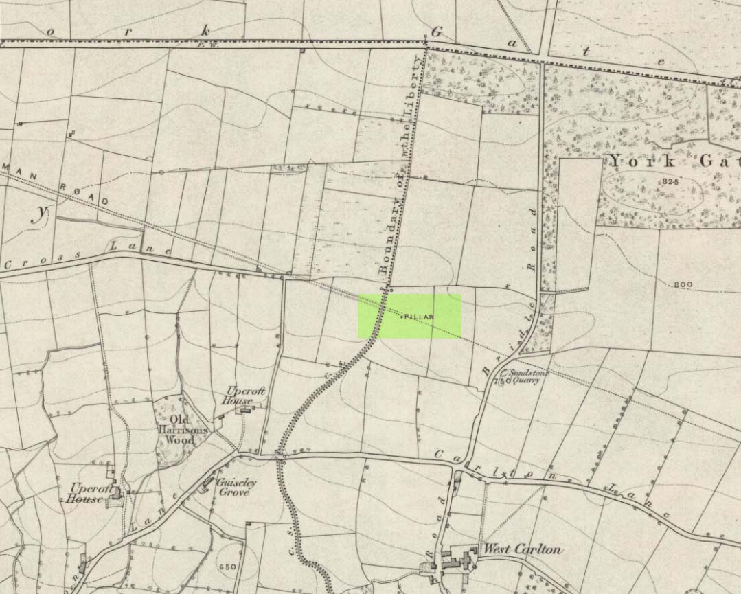
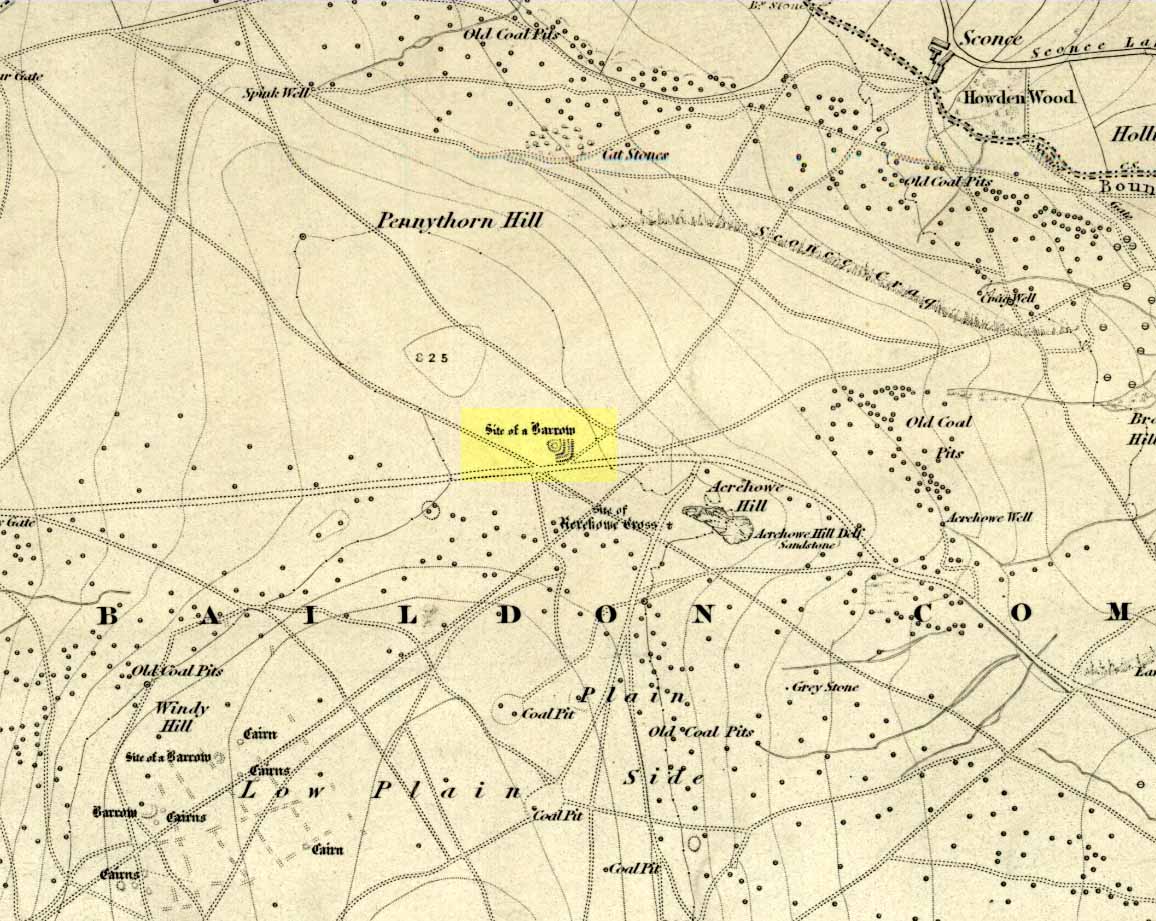
Acrehowe site on 1852 map

Go up through Baildon centre and head onto the moors. Crossing the cattle-grid, a coupla hundred yards further up, turn left. Past the small reservoirs on your left, another 100 yards or so and you reach the brow of the hill.  As you begin going down the road, there’s a small car-park right by the roadside.  The curious remains of the earthworks at the side of the old circle are discernible in the grassland right to its side.

Archaeology & History

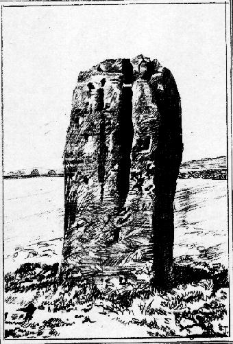
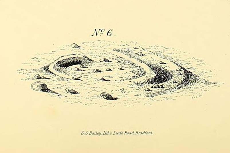
Illustrated on the 6-inch OS-map of 1852 as “Site of a Barrow” (similar to how it appears in the image drawn here by Mr. C.N.M. Colls) a short distance below Pennythorn Hill top, there are still considerable traces of the earthworks surrounding the east and southern sides of what was once some form of ring cairn or tumulus that was once at this prominent place in the landscape.

Aerial view of siteThe site was first explored by Mr Colls in 1843 (his results were reported a few years later), who found a loose double-ring of stones, fifty feet across, surrounded by a shallow trench which was most notable on the south and east sides. Two urns were also uncovered near the centre of the ring, nearly two feet down, containing the cremated remains of people.  A few years later, the Leeds historian James Wardell (1869) told a most fascinating note about what happened during their excavation, saying:

“This…examination was attended by a circumstance not soon to be forgotten by the persons engaged therein (on the excavation). They had almost reached the place where the broken urn and bones were deposited when, at once, such a fearful storm of thunder, lightning and rain came on, that they were not only considerably alarmed, but driven from the Common to seek shelter in the village.”

Colls’ 1846 sketch

We hear this sorta thing at many of our ancient places!

Colls 1846 plan

One anonymous writer in 1955 described the site as a ‘stone circle’, and a number of subsequent archaeologists copied this without question; but in all probability this site was more typical of an old cairn circle or ring-cairn, similar in size and design to the Roms Law circle two miles north of here.  However, the earthworks at its side give the impression of some sort of exaggerated hengiform enclosure.

The place-name element howe strongly indicates a burial site and is a suffix found at many prehistoric tombs across northern England.  The prefix ‘acre’ may relate to “a plot of arable or cultivated land, a measure of land (an acre) which a yoke of oxen could plough in a day” (Smith 1956), or may be a corrupted form of the Old English word, ‘acen’, relating to oak trees.  Early literary examples of the place-name would enable a clearer understanding of the prefix element here.

References:

  1. Anonymous, Colls’ Burial Mound Stone Circle, Baildon Moor, Museum Leaflets: Bradford 1955.
  2. Baildon, W. Paley, Baildon and the Baildons (parts 1-15), St. Catherines: Adelphi 1913-26.
  3. Barnes, Bernard, Man and the Changing Landscape, Eaton: Merseyside 1982.
  4. Bennett, Paul, The Old Stones of Elmet, Capall Bann: Milverton 2001.
  5. Colls, J.N.M., ‘Letter upon some Early Remains Discovered in Yorkshire,’ in Archaeologia, 31, 1846.
  6. Collyer, Robert & Turner, J.H., Ilkley: Ancient and Modern, William Walker: Otley 1885.
  7. Smith, A.H., English Place-Name Elements – volume 1, Cambridge University Press 1956.
  8. Wardell, James, Historical Notes of Ilkley, Rombald’s Moor, Baildon Common, and other Matters of the British and Roman Periods, Joseph Dodgson: Leeds 1869. (2nd edition 1881)

© Paul Bennett, The Northern Antiquarian

Nine Stones Monolith, Harthill, Derbyshire

Standing Stone:  OS Grid Reference – SK 2253 6256

Getting Here

Taking the roughly north-south road betwixt the village of Elton and the town of Youlgrave, rising up to see the great rock outcrop of Robin Hood’s Stride, park-up by the roadside and walk down the path across the fields to the Nine Stone Close stone circle. Once at the circle, look at the wall immediately south of here (looking towards the great Robin Hood’s Stride rock towers) about 100 yards away and you’ll see a large, nicely-worn ‘standing stone’ in the walling, with another a few yards to its side.

Archaeology & History

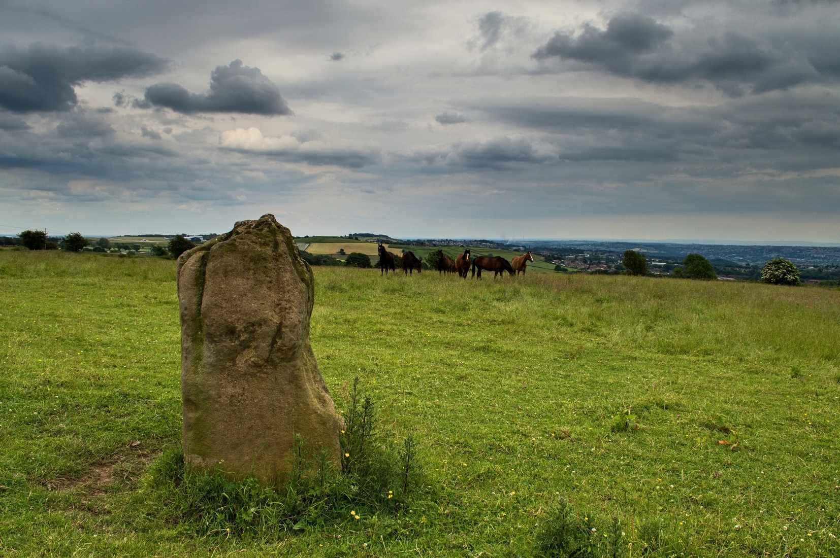
Nine Stones monolith, with stone circle behind

It seems like there’s been quite a lot written of this particular stone — much of it deeming, or speculating, that it once had summat to do with the stone circle of Nine Stones Close (which you can see in the background on one of the photos). The local archaeologist and writer, J. Percy Heathcote (1947) told us that around 1819, a Mr Glover said that this stone and a companion stood next to each other, but Mr Heathcote thought that,

“Judging from its size alone, only one of these is large enough to be compared to the stones in the circle.”

Standing Stone and Robin Hood’s Stride in background

Heathcote continued:

“Dr Phillips apparently assumes this stone to be connected with the circle in the same way as the similarly placed King Stone was connected with the Nine Ladies (Stanton Moor).  However, it seems more reasonable to suppose that the stone was brought by a farmer into the wall and not that he built the wall up to the standing stone.”

In more modern times however, John Barnatt (1978) thought that this stone was originally in the circle, but “has been moved across the field to the south to act as a gatepost.”

It’d be hugely improbable that it didn’t have summat to do with the stone circle, but exactly what, we can only speculate.

References:

  1. Barnatt, John, Stone Circles of the Peak, Turnstone: London 1978.
  2. Heathcote, J. Percy, Birchover – Its Prehistoric and Druidical Remains, Wilfrid Edwards: Chesterfield 1947.

© Paul Bennett, The Northern Antiquarian

New Hagg Standing Stone, Hallam Moors, South Yorkshire

Standing Stone:  OS Grid Reference – SK 25815 87058

Getting Here

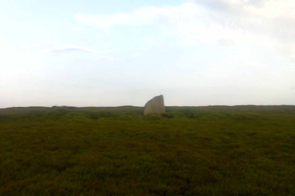
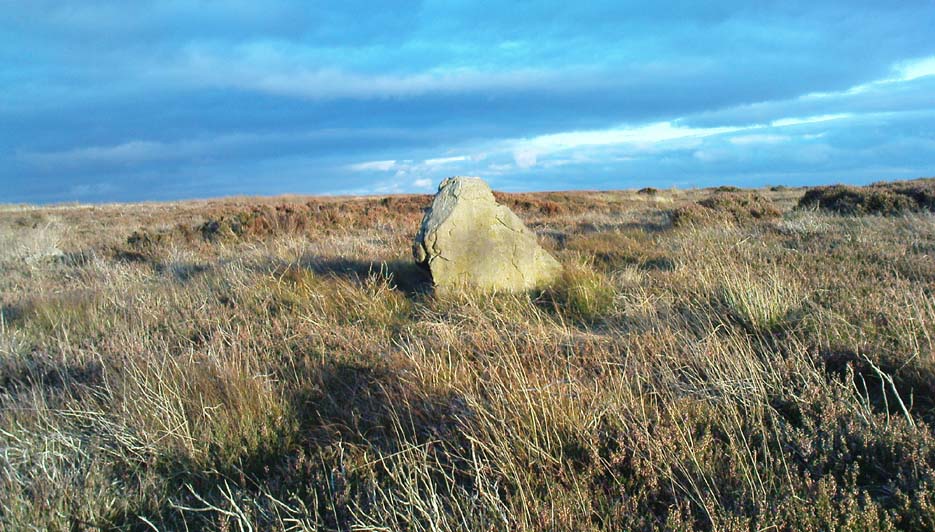
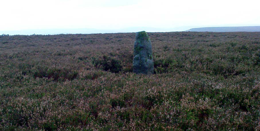
New Hagg Stone
New Hagg Stone

From Redmires Road, follow the path on the opposite side of the road from the reservoirs that follows the “conduit”: a man-made dyke marked on the map at SK 2601 8578.  You’ll need to follow this for about 1km till you come to a junction with a path crossing a small bridge on your left, and a path to your right onto the moor.  You need to take the latter for about 200 metres downhill.  The standing stone is roughly 100 metres onto the moor in a NNE direction.

Archaeology and History

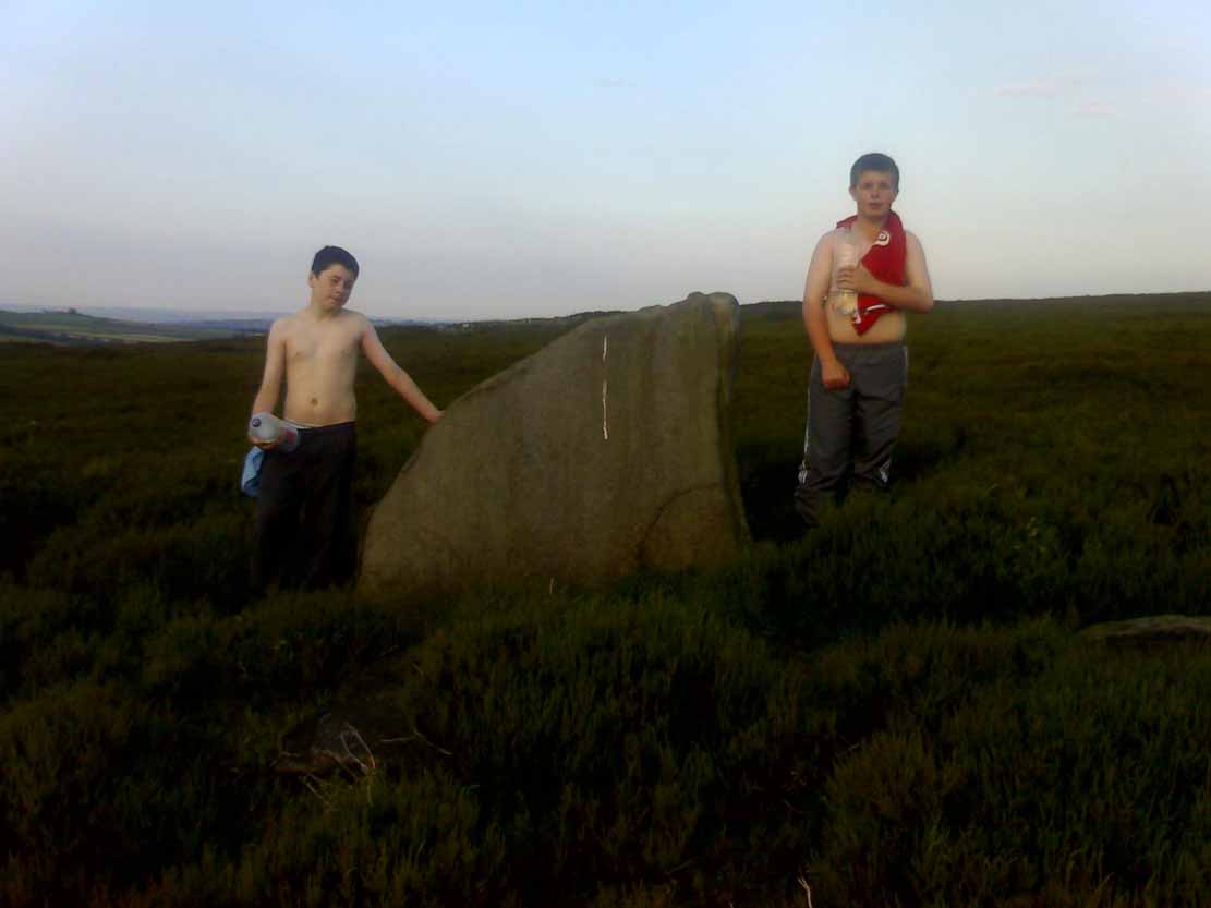
New Hagg, with kids for scale

None that I know of!  I didn’t know of its existence until I found it whilst wandering the moor one day.  Though I can find no record of it anywhere, the weathering on its top in comparison with other authentic standing stones suggest that it’s been stood for a very long time and probably since prehistory.

Four feet tall, the stone stands roughly half a kilometre SSE from the Headstone which can be seen from here – and roughly half a kilometre from the Reddicar Clough Long Cist, ESE of here.

© Geoff Watson, The Northern Antiquarian


Carra Bhroin, Lochboisdale, South Uist

Standing Stone:  OS Grid Reference – NF 8117 2248

Also Known as:

  • Carragh broin

Archaeology & History

The nature of this site seems a little disputed.  Shown on modern OS-maps and cited as being visited and seen in April 1967,the Canmore website also describes it in the present tense — but when I.A. Crawford (1965) wrote of this site he told that, “this standing stone…has been destroyed in fencing operations” — i.e., building a fence or wall, not some doods having a fencing fight!

Equally curious would be the stature of the site; as in the Royal Commission report (1928), the stone was told to be only 2-feet tall — which would mean that if this site is included as an authentic archaeological site, then we’re gonna have to double or treble the number of standing stone sites nationally!  There are masses of ‘monoliths’ two-feet tall and above which are in the ‘natural’ category.  But this stone, for whatever reason (the folklore probably), has been granted the providence as an authentic standing stone.

Folklore

Tradition told that this old stone was “alleged to mark a battle site” in ancient days.  The variation on this theme tells that the stone marked the grave of a man who was slewn in battle here.  Seems likely that there will be prehistoric tombs nearby…

References:

Crawford, I.A., ‘Carra Bhroin, S.Uist,’ in Discovery & Excavation in Scotland, 1965, SRG & CBA 1965.
Royal Commission on the Ancient & Historical Monuments & Constructions of Scotland, Inventory of Monuments and Constructions in the Outer Hebrides, Skye and the Small Isles, HMSO: Edinburgh 1928.

Frensham Common necropolis, Frensham, Surrey

Tumuli:  OS Grid Reference – SU 853 406

Archaeology & History

There are several tumuli near the top of the hill here, but only one of them really stands out.  Nick Thomas (1976) told it to be one “of the best preserved bowl barrows in Surrey.”  A brief description of the relevant tombs, running north to south:

“the first is 75ft across and 6ft high; the second, which has a surrounding ditch 9ft wide, is also 75ft across, but is 8ft high.  The third has a diameter of 42ft and a height of 4ft.  The last is 54ft wide and 5½ft high.  It has a surrounding ditch 8ft wide. ” (Thomas 1976)

None of the tombs had been excavated up to the early 1980s, but I’m not sure if anything has been found since then.  There was also a potential “great stone” up here that was mentioned by John Aubrey in the late 17th century, but nothing has been seen of it since.  In all probability this was a standing stone or the remains of some prehistoric tomb.

Folklore

Several hundred years ago the King’s antiquary, John Aubrey, told the curious tale of the great cauldron that was said to have been found here:

“In the vestry (of Frensham church, in Surrey), on the north side of the chancel, is an extraordinary great kettle or caldron, which the inhabitants say, by tradition, was brought hither by the fairies, time out of mind, from Borough-Hill, about a mile hence. To this place, if anyone went to borrow a yoke of oxen, money, etc., he might have it for a year or longer, so he kept his word to return it. There is a cave where some have fancied to hear music.  On this Borough hill…is a great stone lying along, of the length of about six feet. They went to this stone and knocked at it, and declared what they could borrow, and when they would repay, and a voice would answer when they should come, and that they should find what they desired to borrow at that stone. This caldron, with the trivet, was borrowed here after the manner aforesaid, and not return’d according to promise; and though the caldron was afterwards carried to the stone, it could not be received, and ever since that time no borrowing there.”

In relation to the folklore that is generally attached to the tumulus on top of the hill here from which modern lore ascribes the cauldron to have originated, when A.G. Wade (1928) came to investigate the nature of the site and the folktale he found that,

“there are several folk-tales other than those given by Aubrey.  One relates that it was dug up on Kettlebury Hill, south of Hankley Common, by the monks of Waverley Abbey, and that it was taken by them to Frensham for brewing ale.  Another tale says that it was a loan from the fairies of Thursley — there are tumuli in this parish, south of Ockley Common — and that Mother Ludlam, a medieval witch who lived, according to tradition, in Ludlam’s Cave in Moor Park, was the owner and lender.  The cave was dug by a monk of Waverley Abbey who, when the water supply of the Abbey failed, found that three springs joined here, and by enlarging their outlets and bringing them together he obtained a good supply of fresh drinking water…”

Mr Wade was also unable to satisfactorily show that the Borough Hill named in Aubrey’s survey and Frensham Common hilltop were one and the same.

References:

  1. Aubrey, John, The Natural History and Antiquities of Surrey, E. Curll: London 1719.
  2. Thomas, Nicholas, Guide to Prehistoric England, Batsford: London 1976.
  3. Wade, A.G., “The Great Cauldron of Frensham,” in Antiquity, 2:6, June 1928.

© Paul Bennett, The Northern Antiquarian

Mullans, Ballyshannon, County Donegal

Standing Stones (destroyed):  Grid Reference – G 915 605

Archaeology & History

Field-notes collected by Oliver Davies described there being “two standing stones, side by side,” at the coordinate given here.  In Lacy’s Archaeological Survey (1983), he told that the larger and southernmost of the monoliths stood 5’10” high, with its companion being just 3 feet tall.  All remains of these stones have apparently vanished.

References:

  1. Lacy, Brian, Archaeological Survey of County Donegal, DCC: Lifford 1983.

© Paul Bennett, The Northern Antiquarian

Todmor Stone, Bingley Moor, West Yorkshire

‘Standing Stone’:  OS Grid Reference – SE 1096 4261

Getting Here

From East Morton village, take the moorland road, east, and up the steep hill.  Where the road levels out there’s a right turn, plus (more importantly!) a trackway on your left which leads onto the moor.  Go up here, past the top of the tree-line; on for another 100 yards or so, then turn left into the heather.  You’ll notice the upright stone from the path, even if the heather’s deep.  Check it out!

Archaeology & History

Todmoor Stone - looking east
Todmoor Stone – looking east
Todmoor Stone, looking south
Todmoor Stone – looking south

Nowt’s been said of this stone elsewhere — probably cos it’s in that halfway height between being classed as an authentic monolith, and that other of ‘dubious status’ (hence the reason I’ve highlighted this in inverted commas!).  But an additional reason that this three-foot-tall stone needs describing is the close association it has with cup-and-ring stones very close by; along with some previously unrecognised prehistoric walling and at least one Bronze Age cairn some twenty yards to the north.  We even find two distinctly archetypal ‘standing stone’ characters laid down in the heather 10 yards to the north, more than 4-feet long.  It’s a good looking stone and has a chunkier upright bedfellow in the heather some twenty yards to the west.  Along with the adjacent prehistoric remains here, the stone’s worth checking out!

The word Todmor was earlier spelt as ‘Todmerstones’ (1849) and is thought to relate to it being, in some form or another, ‘the boundary stones of the fox/es’.  The nearest boundary line is about 100 yards west of here.

References:

  1. Smith, A.H., The Place-Names of ther West Riding of Yorkshire – volume 4, Cambridge University Press 1961.

© Paul Bennett, The Northern Antiquarian

Greenwood ‘B’ Stone, Midgley Moor, West Yorkshire

Standing Stone:  OS Grid Reference – SE 01659 28449

Also Known as:

  1. Midgley Moor Standing Stone

Getting Here

Midgley Moor Standing Stone

Takes a bitta finding – especially if some dood’s knocked it down again (as happens up here).  Best thing to do is get to the Miller’s Grave prehistoric cairn, which is only a few hundred yards away.  From Miller’s Grave, walk due west for 200 yards till you hit once a ditched footpaths, where you should turn right.  A short distance along you’ll hit a 5-foot-tall boundary stone called the Greenwood Stone with ‘1775’ carved on one side.  From here, walk due south into the heather for 75 yards.  You’re very close!

Archaeology & History

We resurrected this old standing stone in 1996, several years after first discovering it laid amidst the heather in the early 1990s. It appeared to mark an old boundary line (no longer used) betwixt Wadsworth Moor and Midgley Moor, but its nature is distinctly prehistoric. The remains of a small hut circle (seemingly Bronze Age, though excavation is needed) can be found a short distance to the west, though this is hard to find when the heather has grown. Other seemingly prehistoric remains scatter the ground nearby, none of which have received the attention of archaeologists.

Greenwood ‘B’ on a grey day

As you can see from these grey, rain-swept images, this upright stone is well-weathered (though we need to visit here again soon and get some better photos). It stands some 4-feet tall and may have accompanied one or two other monoliths close by.  The suggestion by one Peter Evans that the Greenwood B stone stood “possibly at the centre of a stone circle” is sadly untrue (soz Peter); though it probably had some relationship with the Millers Grave cairn site, a few hundred yards equinox east.

References:

  1. Bennett, Paul, The Old Stones of Elmet, Capall Bann: Milverton 2001.

© Paul Bennett, The Northern Antiquarian

Na Clachan Bhreige, Kirkibost, Strathaird, Skye

Stone Circle:  OS Grid Reference –  NG 5432 1768

Also known as:

  1. The False Stones
  2. Na Clachan Breitheach
  3. Strathaird Circle

Getting Here

Way off from seemingly anywhere this one – on the southern foothills of the great Cuillins, by the western edge of a seemingly unnamed loch. (most unusual) Take the Elgol road (A881) south from Broadford, nearly to its end, keeping an eye out for Kirkibost a few miles from the very end of the road. Just past here, stop and walk the track west to Camasunary a half-mile along, through the small forestry-bit, then follow the line of the trees north and keep going a bit more till y’ reach the nice stream that feeds that unnamed loch. Cross the stream!

Archaeology & History

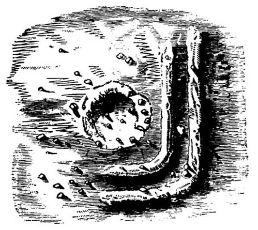
Alexander Thom's 1967 drawing
Alexander Thom’s 1967 drawing

A fascinating little site this one! Perhaps consisting of as many as eight stones at one time, only three stand visible today.  Alexander Thom (1967) reported finding other stones in this circle “being buried in the peat, but prodding revealed their position roughly” — as shown on his drawing here.  There may at one time have been as many as eight stones here, but the site itself is quite small, making a ring of stones only 21-feet across (or 8 megalithic yards as Thom had it).  The ruinous state of the site was put down to the stupidity of the Church of Scotland issuing “instructions that all stones in Skye were to be thrown down” a few centuries back.

Aubrey Burl's later 'four-poster' summary
Aubrey Burl’s later ‘four-poster’ summary

Aubrey Burl reported that “there were once at least 4 stones here, the tallest being of 6ft 6ins (2m) high,” and wondered whether this was one of the many ‘four-poster’ stone circles that scatter Scotland and elsewhere.  An issue he seemed comfortable to proclaim a few years later in his survey of such sites. (Burl 1988) Of those stones still standing, the tallest is just 5 feet high; but there’s the impressive 11½-foot long monolith laying on the southeast edge of the ring!  Mr Burl also pointed out that some

“casual digging  inside the ring around 1860 uncovered a blackpolished stone about 1½ ins (4cm) long, ‘somewhat resembling a small pestle.'”

I found the proximity of the Cille Mhaire burial ground a mile west of here more than a bit intriguing (though didn’t have time to assess its geomantic relationship further).  And the reported presence of prehistoric cairns nearby imply that the Na Clachan Bhreige ‘circle’ had some relationship with death and burial.

Folklore

The folkname of ‘The False Stones’ comes from that well-known tale of the site “supposedly being the remains of three men turned into stone for deserting their wives.”  Something which Otta Swire (1964) thought was likely told by christian converts.  It would have probably replaced an earlier tale of the stones being the site where some ancestral spirits lived.  Swire also told that,

“these were once, if tradition is to be believed, Stones of Wisdom who could both foretell the future and show justice as between man and man.”

Burl (1988) also points out how,

“The name, Na Clachan Bhreige, has been variously pointed translated as ‘the judicial stones’, a place where medieval law courts were held, as in several other Scottish rings.  It has also been interpreted as ‘the stone of lies, or falsehood.'”

References:

  1. Burl, Aubrey, Four Posters: Bronze Age Stone Circles of Western Europe, BAR: Oxford 1988.
  2. Grinsell, L.V., Folklore of Prehistoric Sites in Britain, Hale: Newton Abbot 1976.
  3. Swire, Otta F., Skye: The Island and its Legends, Blackie & Sons: Glasgow 1961.
  4. Thom, Alexander, Megalithic Sites in Britain, Oxford University Press 1967.
  5. Thom, A., Thom, A.S. & Burl, Aubrey, Megalithic Rings, BAR: Oxford 1980.

© Paul Bennett, The Northern Antiquarian
Linton Church, Grassington, North Yorkshire

‘Standing Stone’:  OS Grid Reference – SE 00426 63176

Getting Here

Pretty easy really. Get to the ancient St. Michael’s Church on the dead-end road just outside of Linton village.  As you approach it, look into the field on your right.  Y’ can’t miss it!

Archaeology & History

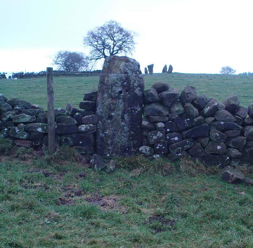
Linton 'Standing Stone'
Linton ‘Standing Stone’

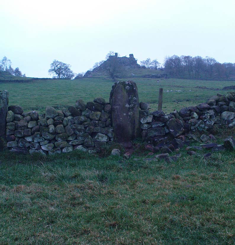
This is an oddity.  It could perhaps be little more than one of the Norber erratics found a few miles further north — but it looks more like a smaller version of one of the Avebury sarsens!  Just under six-feet tall, it was shown to me by Adrian Lord yesterday (when the heavens subsequently opened and an outstanding downpour-and-half followed), who’d come across it only a week or two earlier themselves when they visited the ancient church next door.  The stone certainly aint in any archaeology registers (no surprise there); and as one local man we spoke to yesterday told us, “there used to be several other standing stones in the same field, cos I remember ’em when I was a kid. ” The gent we spoke to seemed to know just about everything about the local archaeology and history of the area (one of those “damn good locals” you’re sometimes lucky to find!).  He told us that the other stones which used to be there had been moved by the local farmer over the years, for use in his walls.  So it seems that this is the last one standing.  What looks like several other fallen stones can be seen further down the field, just next to the church.  But this one’s pretty impressive.

Close-up of gnarled rock
Looking south-ish!
Looking south-ish!

The church of St. Michael next door was, tells the information inside, built upon some old pagan site — which gives added thought to this upright stone perhaps being the ruin of an old circle, or summat along those lines.  The church, incidentally, is built right next to the River Wharfe.

Not far from here we find an almost inexhaustible supply of prehistoric remains at Grassington and district (less than a mile north).  A huge excess of Bronze- and Iron Age remains scatter the fields all round the town.  And aswell as the Yarnbury henge close by, there is — our local man told us,  “another one which no-one knows abaat, not far away”!

Folklore

The folklore of this area is prodigious!  There is faerie-lore, underworld tales, healing wells, black-dogs, ghosts, earthlights – tons of the damn stuff.  But with such a mass of prehistoric remains, that aint too surprising.  And although there appears no direct reference to this particular stone (cos I can’t find a damn reference about it), the old Yorkshire history magus, Harry Speight (1900), wrote of something a short distance away along the lane from the church.  He told that,

“In the field-wall beside the road may be seen some huge glacial boulders, and there is one very large one standing alone in the adjoining field, which from one point of view bears a striking resemblance to a human visage; and a notion prevails among the young folk of the neighbourhood that this stone will fall on its face when it hears the cock crow.”

Just the sort of lore we find attached to some other standing stones in certain parts of the country.  And in fact, from some angles, this ‘ere stone has the simulacrum of a face upon it; so this could be the one Speight mentions (though his directions would be, unusually, a little out).

There are heathen oddities about the church aswell: distinctly pre-christian ones.  An old “posset-pot” was used for local families to drink from after the celebration of a birth, wedding or funeral here.  And at Hallowtide – the old heathen New Year’s Day,

“certain herbs possessed the power of enabling those who were inclined to see their future husbands or wives, or even recognizing who was to die in the near future.”

And in an invocation of the great heathen god (the Church called it the devil), Speight also went on to tell that:

“The practice at Linton was to walk seven times round the church when the doomed one would appear.”

In a watered down version of this, local people found guilty of minor transgressions in and around Linton (thieves, fighters, piss-heads, etc),

“was compelled to seek expiation by walking three time around Linton Church.”

Linton stone05This would allegedly cure them of their ‘sins’!  Rush-bearing ceremonies were also enacted here.  On the hill above, the faerie-folk lived.  And until recently, time itself was still being measured by the three stages of the day: sunrise, midday and sunset; avoiding the modern contrivances of the clock, and maintaining the old pre-christian tradition of time-keeping.  Much more remains hidden…

References:

  1. Speight, Harry, Upper Wharfedale, Elliott Stock: London 1900.

© Paul Bennett, The Northern Antiquarian