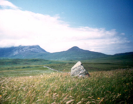
Go up Jura’s only road until it becomes a dirt-track and head along the track to the east to the natural hillock on the coast. You’ll pass the three standing stones of Knockrome before you get to this one, right by the end house.
Archaeology & History
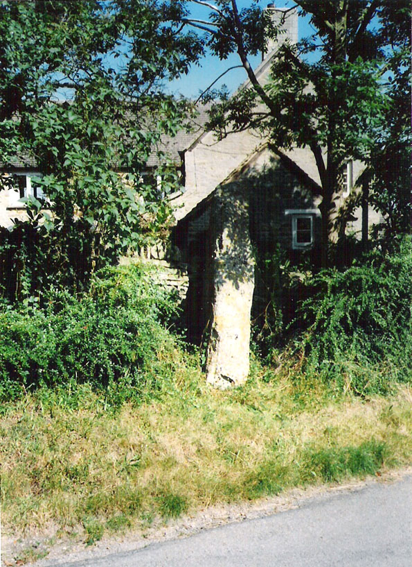
Found in a beautiful setting, this is a thick little stone but is less than four feet tall and it may have had some shapely relationship with one of the hills (Corra Bheinn) on Jura. The Royal Commission (1984) described it merely as, “an erratic boulder measuring 3.1m in girth at the base, and 1.2m in height with its longer axis aligned roughly east and west.” Several other stones can be found nearby.
References:
Royal Commission on the Ancient & Historical Monuments of Scotland, Argyll – volume 5: Islay, Jura, Colonsay and Oronsay, HMSO: Edinburgh 1984.
This site hasn’t been located. However, if it hasn’t been destroyed by the quarrying on the SW side of the moor, remains of it should still be found amidst the heather and would be a good discovery for any enthusiast.
Archaeology & History
The first notes I found about this place were those by archaeologist Sydney Jackson in 1956, who wrote:
“It would be interesting to know what Dr Richard Richardson, of Bierley Hall, Bradford meant when, writing about 1709, he said that Mr Benjamin Ferrand show him a ‘skirt of stones’ on Harden Moor, near to a row of stones placed in a line nigh two hundred paces in length some two feet above the heath, others hidden beneath it.” (my italics)
The undoubted man-made nature of this row of stones was emphasized by Dr Richardson when he wrote,
“That these stones were placed here by design, no person can doubt; but for what I end cannot conjecture, having never seen anything of this kind before.”
The great Yorkshire historian Harry Speight (1898) also came across the same antiquarian notes many years before and speculated how,
“it may be inferred from this that it had been a double row of stones, like the avenue of Maiden Castle in Swaledale.”
The ‘skirt of stones’ that were described here may be the well-preserved Harden Moor Circle. However in recently finding the short essay of Peter Craik (1907) of Keighley, this idea may need re-assessing, as Craik clearly shows in his survey of the the nearby Catstones Ring earthwork, what he described as the “remains of a cairn” on the northern edge of that ring, giving us a different location for this lost stone row.
However, another potential position for our lost stone row that needs exploring is the one described by Butler Wood following an exploratory visit here with the Bradford historian, William E. Preston, at the beginning of the 20th century. Mr Wood (1905) told of them both coming across some sort of earth-and-stone line “half-a-mile north of” the Catstones Ring, telling:
“Mr W.E. Preston and myself traced a short time ago on Harden Moor, remains of an entrenchment for a distance of 80 or 90 yards. It faces south, and lies near Spring Head Heights. The wall consisting of boulder and earth rising three feet above the soil, but there is no trace of a ditch.”
This is obviously half the length described by Richardson and Ferrand in 1709, but nearly two centuries separate the two accounts (the position of Mr Woods’ line is roughly SE 072 387; whilst that nearer to the Catstones Ring would be nearer SE 069 383).
I’ve searched the tops of this moorland a number of times hoping to locate this seemingly important megalithic stone row, obviously without success. Further searches on the moor are needed after the heather’s been burnt back.
Best visited out of season before the corn’s been planted. It makes it easier to find and doesn’t annoy the land-owner here, who tends to be a decent dood. From Chipping Norton go southeast along the B2046 road to Charlbury. After about 1½ miles take the second right turning down the small country lane. Go slowly down here for less than half a mile, watching the fields on your right. You’re damn close!
Archaeology & History
The Hawk Stone
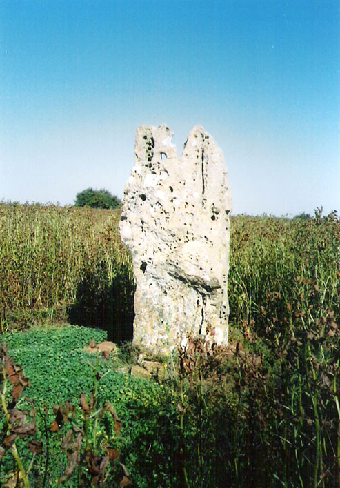
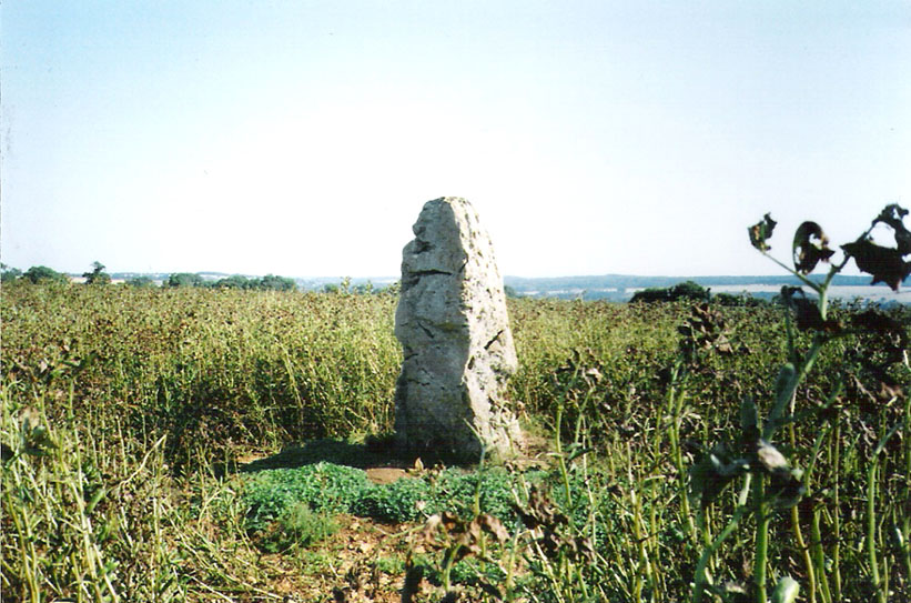
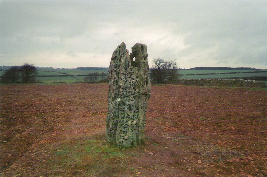
This impressive, weather-worn, eight-foot tall standing stone stands aloft in the middle of a field due west of the road between Chalford Green and Dean. It’s an excellent monolith and one which, I think, has a lot more occult history known of it than described here. Thought by O.G.S. Crawford (1925) and others in the past to have been “formerly part of a chambered structure,” or prehistoric chambered tomb like that of the Hoar Stone at nearby Enstone, no remains of such a structure unfortunately remain today. It is first illustrated and named on a local map of the region in 1743 CE, and the stone at least has fortunately managed to escape the intense agricultural ravages endemic to this part of the country.
The name “Hawk” stone has been fancied by some to relate to some obscure resemblence to a Hawk, or because there very often are hawks hovering over those upland fields – but these are unlikely. It’s thought by place-name authorities more likely to derive from a corruption of ‘Hoar’ meaning a grey or boundary stone; and as it stands just yards east of the present township boundary line, this derivation seems more probable.
To all lovers of megalithic sites, we highly recommend a visit here!
Folklore
In local folklore and in the opinion of some earlier historians, the Hawk Stone formed an integral part of a stone circle here, but there is little known evidence to substantiate this.
Hawk Stone in summerHawk Stone in winter
A creation legend attached to this site tells that the stone was thrown, or dragged across the land, by a old witch or hag — though we are not told from where. This is a motif found at megalithic sites all across the country (see Bord & Bord 1977; Grinsell 1976, etc). In Corbett’s History of Spelsbury (1962) the author told of the folklore spoken of by one Mr Caleb Lainchbury who
“said the cleft at the top of the Hawk Stone at Dean was supposed to of been made by the chains of the witches who were tied to it and burnt. As witches seem to have been extremely rare in Oxfordshire it cannot have been a very common practise to burn them at Dean; but there may indeed have been some kind of fire ceremonies near the stone.”
Grinsell (1976) also tells how the Hawk Stone has that animistic property, bestowed upon other old monoliths, of coming to life and going “down to the water to drink when it hears the clock strike 12.”
This evidently important and visually impressive monolith also plays an important part in an incredibly precise alignment (ley) running roughly east-west across the landscape. At first, Tom Wilson (1999) thought the alignment had previously gone unnoticed, but later we later found a reference to the same line in an early copy of The Ley Hunter (Cooper 1979). It links up with other important megalithic sites, such as the Hoar Stones at Enstone, Buswell’s thicket, and the ancient Sarsden Cross.
Similarly, when Tom Graves’ (1980) was doing some dowsing experiments at the Rollright stone circle a few miles west, he found what he described as an ‘overground’ (or ley) linking the ring of stones to the Hawk Stone, but no other connecting sites are known along this line.
References:
Bennett, Paul & Wilson, Tom, The Old Stones of Rollright and District, Cockley: London 1999.
Bord, Janet & Colin, The Secret Country, BCA: London 1977.
Cooper, Roy, “Some Oxfordshire Leys,” in The Ley Hunter, 86, 1979.
Corbett, Elsie, A History of Spelsbury, Cheney & Sons: Banbury 1962.
Crawford, O.G.S., The Long Barrows of the Cotswolds, John Bellows: Gloucester 1925.
Gelling, Margaret, The Place-Names of Oxfordshire – volume 2, Cambridge University Press 1954.
Graves, Tom, Needles of Stone, Granada: London 1980.
Grinsell, L.V., Folklore of Prehistoric Sites in Britain, David & Charles: Newton Abbot 1976.
Thor Stone, Taston, hiding in shadows on bright sunny day
Very easy! From which ever direction you approach the gorgeous little village of Taston, get to the Cross in the middle of the road and look up the slight hill and at the old walling on the right-hand side. You can’t really miss it!
Archaeology & History
An impressive seven-foot tall standing stone resting up against the walling of Martin and Martha’s Thorstone Cottage, and which appears to have been recorded as far back as the late thirteenth century in the survey of the Chadlington hundred. Indeed, according to the respective place-name authorities, the village of Taston itself appears to get its name from the Thor Stone, as it’s recorded as Thorstan in 1278 CE. (Gelling 1954)
Less than 100 yards away is a large old stone cross, the top of it now fallen, which may once have had some earlier pre-christian relationship with the Thor Stone; perhaps originating from other standing stones close by our now solitary Thor Stone (see Folklore, below). No other monoliths or prehistoric tombs are presently associated with this site, but its folklore tells of earlier companions…
More than a hundred miles north of here we find an etymological sister in the old village of Thurstaston and where, not surprisingly, we have another Thor’s Stone — but in this instance the name applies to a huge rock outcrop with old pagan legends attached.
Folklore
Elsie Corbett (1962) tells that the creation myth for this stone was that it originated after the great god Thor cast a thunderbolt down from the heavens and this stone appeared as a result. But more intriguing from an archaeological perspective is what Mike Howard (he of The Cauldron magazine) told us in a short article for the Gloucester Earth Mysteries magazine in 1994, which said that our grand old Thor Stone was once part of a stone circle. He wrote:
“At Taston…are the rather battered remains of a megalithic circle known locally as the Thor Stones. It seems the original circle was dug up many years ago and the stones now reside in a neat pile at the crossroads in the centre of the village. The whole edifice resembles nothing less than an eccentric market cross, topped by a phallic stone.”
Although he doesn’t cite any sources for this bit of info (where’d you gerrit from Mike?), we need to take a more careful look at the old cross nearby. And we find another piece of folklore relating to the Taston cross which said that it was placed there to abate the evil influences that were supposed to come from the Thor Stone. This piece of folklore is simply one laid down by the Church which portrayed most things it did not understand, or sought to repress, as being the work of their own demonic power, Satan.
Between these two old monuments was once a huge old elm tree which, says Caroline Pumphrey (1990), was a meeting place of the local villagers in times gone by. Whether this implies the Thor Stone to have been a moot spot is difficult to tell, although the erection of the cross would seem to add weight to this.
More recent screwy notions comes from one woman who reckoned, curiously, that the Thorstone got its name from some completely invented made-up goddess, saying:
“I believe its more likely to be a corruption of the name of ‘Hoar’, the great Goddess. Indeed the Hawk Stone, and various Hoar stones stand widely hereabouts and probably derived their names from the same deity.”
Utter drivel of course (there’s no such goddess as Hoar)! But — like the christians and others before them — people believe what they want to believe and this sorta nonsense is increasingly found all over the internet. As is well known, the word hoar derives from ‘har’, being ‘grey’ or ‘a boundary’ (Gelling, 1954; Smith 1956); and numerous studies show this quite clearly.
References:
Bennett, Paul & Wilson, Tom, The Old Stones of Rollright and District, Cockley: London 1999.
Corbett, Elsie, A History of Spelsbury, Cheney & Sons: Banbury 1962.
Gelling, Margaret, The Place-Names of Oxfordshire – volume 2, Cambridge University Press 1954.
Grigson, Geoffrey, The Shell Country Book, George Rainbird: London 1962.
Howard, Mike, ‘From Thor to Rollright,’ in Gloucestershire Earth Mysteries 18, 1994.
Pumphrey, Caroline, Charlbury of our Childhood, Sessions Book: York 1984.
Smith, A.H., English Place-Name Elements – volume 1, Cambridge University Press 1956.
Standing Stone (destroyed): OS Grid Reference – NG 520 144
Folklore
This once-famous standing stone appears to have gone. It was described in Otta Swire’s (1961:230) superb book on the folklore of Skye, where she wrote:
“Overlooking Elgol is Bidein an Fhithich. Near here once stood the famous Raven’s Stone, about which the Brahn Seer prophesied. It is believed that this prophecy, however, can never be fulfilled, as seventy or eighty years ago the stone was broken up and the main portion of it is now incorporated in one wall of the Glendale church, according to the Rev. A. R. Forbes’ Place Names of Skye. The stone was believed to have had some connexion with old pagan religious ceremonies.”
The Brahn Seer (more commonly known as the Brahan Seer) was Coinneach Odhar, a 16th century prophet who is said to have foretold the Battle of Culloden and other events.
References:
Swire, Otta F., Skye: The Island and its Legends, Blackie & Sons: Glasgow 1961.
Standing Stone (destroyed?): OS Grid Reference – NS 805 958
Archaeology & History
Nearly a hundred years ago Christina Buchan told the local writer Donald Morris (1935) about this seemingly forgotten and lost megalithic site. The narrative she gave told:
“I remember a stone which was known among the Causewayhead people as the Bel Stane. (The name is significant) It originally stood in the Doocot Park on Spittal Farm. This park overlooks the high road from Causewayhead to Bridge of Allan and adjoins the steading of Spittal… When the road leading up through the village of Causewayhead was formed (about 1820), the garden of William Robb’s cottage near the foot of the Broad Loan was somewhat altered in shape. He put up a new gate and, requiring a gatepost, he lifted the Bel Stane from Doocot Park and set it up at the front of his own house to support the gate. It was a stone of pillar-shape and stood four or five feet above the ground, and I do not remember whether they were any markings on it. The cottage became ruinous many years ago and the garden ran waste. A new house is now built on the site, but the Bel Stane has been lost.”
There is a possible contender for the lost Bel Stane, used again as another gatepost, on the south-side of the road some 450 yards to the east (at NS 80922 95931). The stone in question is somewhat fatter than usual gateposts, about four-feet tall, and has the eroded appearance of considerably greater age than many others. The monolith isn’t mentioned in the Royal Commission’s Stirlingshire inventory. Further information would be very welcome.
References:
Morris, David, B., ‘Causewayhead a Hundred Years Ago’, in Transactions of the Stirling Natural History and Archaeological Society, 1935.
Not too troublesome to locate really… It’s at the top-end of the University, just above the side of the small Hermitage Road, about 100 yards along. Keep your eyes peeled to your left!
Archaeology & History
Pathfoot Stone
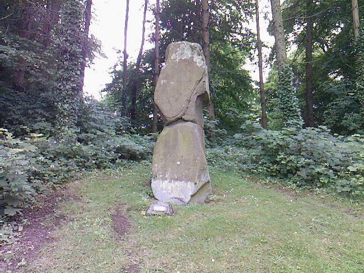
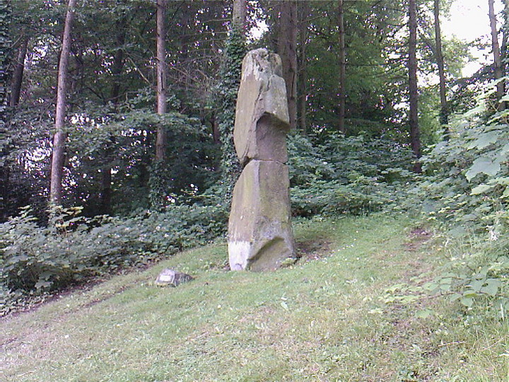
Today standing proud and upright, this ruinous standing stone has been knocked about in the last couple of hundred years. Although we can clearly see that it’s been “fixed” in its present condition, standing more than 10 feet high, when the Royal Commission lads came here in August 1952 (as they reported in their utterly spiffing Stirlingshire (1963) inventory), it wasn’t quite as healthy back. They reported:
“Many years ago the stone, which is of dark grey dolerite, fell down and was broken, and the basal portion, now re-erected, is only 3ft 10in high; two large fragments however, still lie beside the base, and the original stone is said to have stood to a height of 9ft 4in. Of a more or less oblong section throughout, the re-erected stones measures 2ft 10in by 1ft 10in at ground level, swells to its greatest dimensions (3ft 2 in by 1ft 9in) at a height of 1ft 4in, and diminishes at the top…”
…and again!
But the scenario got even worse, cos after the Royal Commission boys had measured it up and did their report, it was completely removed! Thankfully, following pressure from themselves and the help of the usual locals, the stone was stood back upright in the position we can see it today. And — fingers crossed — long may it stay here!
Folklore
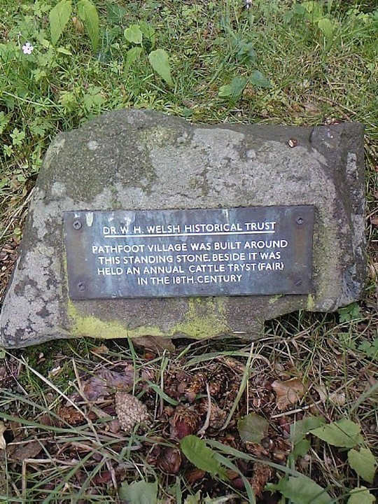
Commemorative plaque!
A plaque that accompanies the monolith tells that the old village of Pathfoot itself was actually “built around this standing stone” — which sounds more like it was the ‘centre’ or focus of the old place. An omphalos perhaps? The additional piece of lore described in Menzies (1905) work, that an annual cattle fair was held here, indicates it as an ancient site of trade, as well as a possible gathering stone: folklore that we find is attributed to another standing stone nearby.
Hutchinson, A.F., “The Standing Stones of Stirling District,” in The Stirling Antiquary, volume 1, 1893.
Hutchinson, A.F., “The Standing Stones and other Rude Monuments of Stirling District,” in Transactions of the Stirling Natural History and Antiquarian Society, 1893.
Royal Commission on the Ancient and Historical Monuments of Scotland, Stirlingshire – volume 1, HMSO: Edinburgh 1963.
‘Standing Stone’: OS Grid Reference – SS 8896 3355
Getting Here
You can’t really miss this. Take the road south from Winsford, up the steep hill onto the moors and before you reach the crossroads, look up across the slope on your left where you’ll see a small building on its own. Go there!
Archaeology & History
A curious upright monolith more than five feet long (though some of this is embedded in the ground) with the words ‘CARAACI NEPVS’ carved on one side, is strangely closetted in a silly ‘house’ of its own on the moortops! But the origins and history of the stone are contentious. Some proclaim it as prehistoric, others Romano-British, and others as being from the Dark Ages. In the 1960s and ’70s, archaeological tradition had its origins in the Romano-British period, and certainly the carved lettering on the sides of the stone seem to indicate a Roman provenance; but as the great Exmoor historian S.H. Burton (1974) told,
“It is possible that the stone was erected hundreds of years before it was inscribed, and the existence of an ancient trackway alongside, leading to the Barle, strengthens this possibility. But, like most things about the Caratacus Stone, this is guesswork.”
We know it stood here in the 13th century as it was described in perambulation records of 1219 and 1279 AD; but it’s more than likely to be a monolith erected in the Dark Ages. Grinsell (1970) however is a little more cautious, telling:
“The likelihood of the person in whose memeory this stone was raised claiming kinship with the Caratacus who was the arch-enemy of Rome, c. AD 45-50, has on more than one occasion been questioned. It is, however, too tempting to be abandoned by the present writer.”
The carving on the stone was deciphered by the legendary Prof. John Rhys at the end of the 1800s, telling it to have been Carataci Nepos, the Kinsman of Caratacus (and variants thereof), who held out against the Romans in south Wales until AD 50. The old Celtic writer, R.A.S. Macalister, thought the stone to have been dedicated to a local christian hero, St. Carantoc, but this notion has been generally dismissed.
Folklore
The old stone is said to be a site where buried treasure exists — though none has ever been found. There is also an old tradition that “ghostly horses and waggons rumble towards the stone at midnight” — but this as likely relates to its proximity with the old crossroads a short distance away.
References:
Burton, S.H., Exmoor, Hale: London 1974.
Grinsell, L.V., The Archaeology of Exmoor, David & Charles: Newton Abbot 1970.
Page, John Lloyd Warden, An Exploration of Exmoor and the Hill Country of West Somerset, Seeley 1890.
Vowles, Alfred, History of the Caratacus Stone, privately printed 1939.
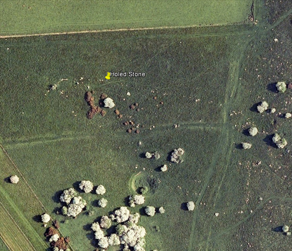
Follow the same directions as if you’re visiting the Polisher Stone at the top-end of Overton Down where it meets Fyfield Down. From here, walk down the slope for a hundred yards or so where you’ll notice, just above the long grassy level, a line of ancient walling running nearly east to west. It’s very close to the yellow marker in the attached aerial image shot to the right. If you walk along this line of walling you’ll find what you’re looking for.
Archaeology & History
Overton’s Holed Stone
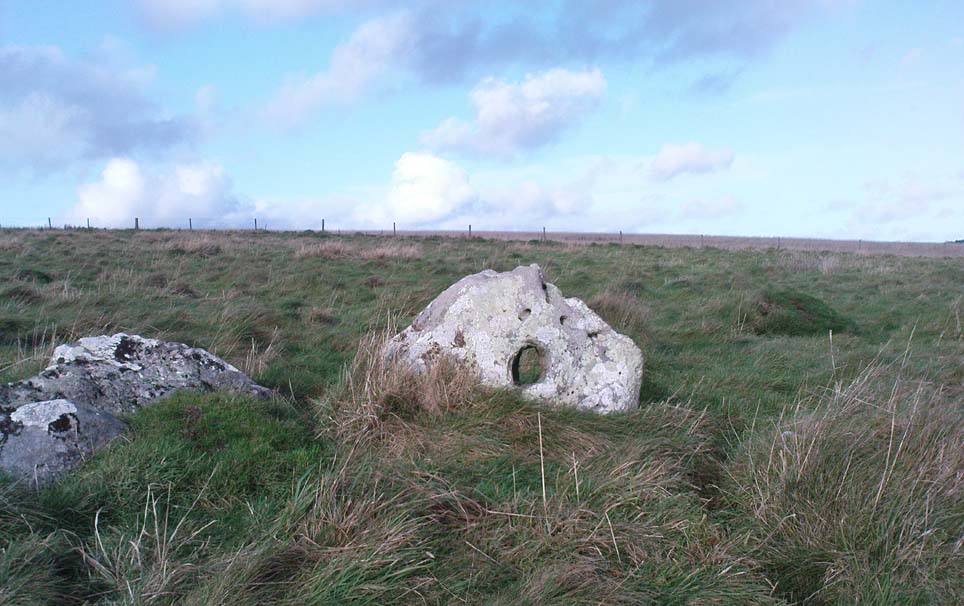
As I’ve only been here once, and briefly — under the guidance of the Avebury expert Pete Glastonbury — my bearings on this site may need revising. There are two distinct sections of walling here: one has been excavated by Peter Fowler and his team; the other hasn’t. (correct me if I’m wrong Pete) And in Fowler’s (2000) fine survey of this area he does not describe this very distinct holed-stone in the line of walling, or adjacent “linear ditch F4”, as it was called. But then, many archaeologists don’t tend to find items such as these of any interest (unless their education stretches to other arenas, which isn’t usually the case). But the stone seems to be in a section of walling that isn’t in their survey; standing out in aerial imagery as a less well-defined, but still obvious line of walling that is closer to the fence, 70-80 yards north, with a decidedly Iron-Age look about it!
But, precision aside! — as you can see in the photos, the holed stone here isn’t very tall — less than 2 feet high; though we don’t know how deep the stone is set into the ground. This spot is on my “must visit again” list for the next time we’re down here!
There’s nowt specific to this stone, nor line of walling, nor settlement (as far as I know), but it seems right to mention the fact that in British and European folklore and peasant traditions, that holed stones just like the one found here have always been imbued with aspects of fertility — for obvious reasons. Others like this have also acquired portentous abilities; whilst others have become places where deeds and bonds were struck, with the stone playing ‘witness’ to promises made.
References:
Fowler, Peter, Landscape Plotted and Pierced: Landscape History and Local Archaeology in Fyfield and Overton, Wiltshire, Society of Antiquaries: London 2000.
Stone Circle (destroyed): OS Grid Reference – NY 37 50
Archaeology & History
Listed in Burl’s (2000) magnum opus, this is another long-lost megalithic ring, whose exact location seems to have been forgotten. An early description of the site by William Whellan (1860) told us that,
“There was formerly a circle of rude stones, ten yards in diameter, near the village, supposed to have been the remains of a Druidical temple; and a little distance from it, was a tumulus, three yards high and eight in diameter.”
More than a hundred years later in Waterhouse’s (1985) fine survey, he described the circle, saying:
“It lay near the village of Dalton…near the River Caldew… An 18th century account describes it as consisting of ‘rude’ stones…set in a circle of diameter about 27m. East of the the centre of the circle were four large stones lying on top of each other. They may have been the remains of a cist, or possibly a tumbled cove, like that inside the circle-henge of Arbor Low in Derbyshire. A tumulus may have stood nearby.”
There are however some discrepancies in the descriptions between Whellan and Waterhouse. In the former, the site of Chapel Flat is talked of separately as being the abode of a hermit in the lost chapel of St. Wynemius, “in a deep and romantic part of the vale of Caldew.” The description of the stone circle immediately follows this, but is spoken of as merely being “near the village.”
Does anyone know anything further about this once important site? Did the lost hermitage on Chapel Flat actually have anything to do with the stone circle?
References:
Burl, Aubrey, The Stone Circles of Britain, Ireland and Brittany, Yale University Press 2000.
Waterhouse, John, The Stone Circles of Cumbria, Phillimore: Chichester 1985.
Whellan, William, The History and Topography of the Counties of Cumberland and Westmoreland, Comprising their Ancient and Modern History, W.Whellan: Pontefract 1860.