Standing Stone (lost): OS Grid Reference – SE 2522 5010
Archaeology & History
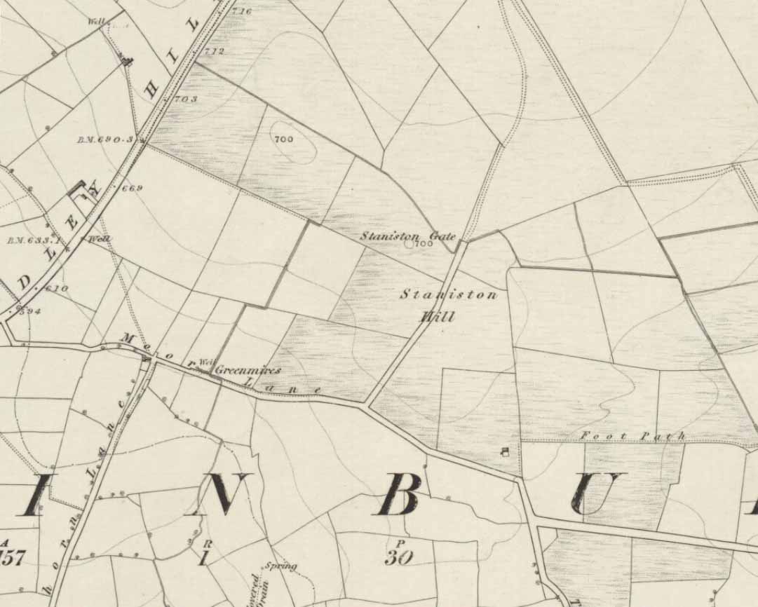
Staniston Hill on 1851 map
This long-lost standing stone gave its name to the small hill between the geological giants of Little Almscliffe and Almscliffe Crags, ‘Staniston Hill.’ Described as early as the 13th century in the Cartulary of Fountains Abbey as ‘Standandestan’, its precise whereabouts is unknown—but it’s damn close to the grid-reference cited here. As the early OS-map shows, a small rounded hill occurs a short distance northwest of the small copse of trees now growing. The monolith may have been felled by some grumpy christian, or it could be standing in some nearby walling. Local antiquarians, dowsers or archaeologists may or may not find a search for it worthwhile…
Its position between the two Almscliffe Crags makes it very close to marking the midway point of a natural solstice marker: the Winter sunrise from Little Almscliffe and summer sunset from the greater Almscliffe.
References:
Bennett, Paul, The Old Stones of Elmet, Capall Bann: Milverton 2001.
Smith, A.H., The Place-Names of the West Riding of Yorkshire – volume 5, Cambridge University Press 1961.
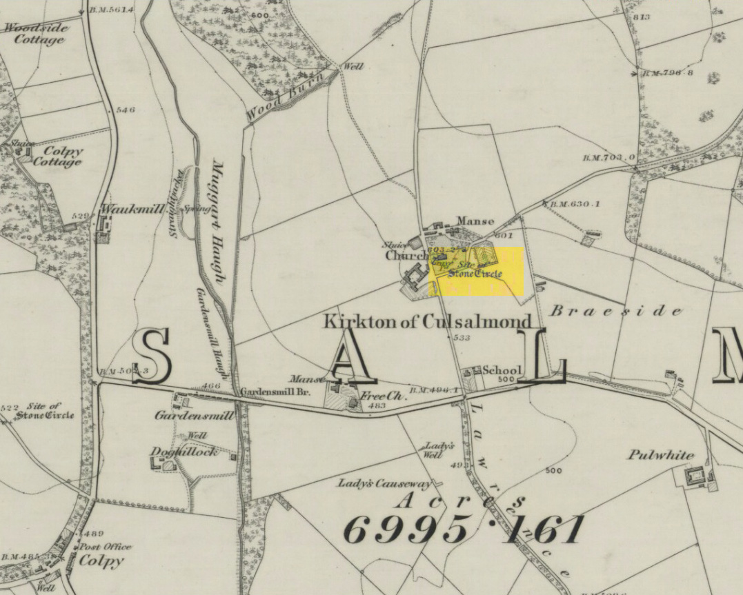
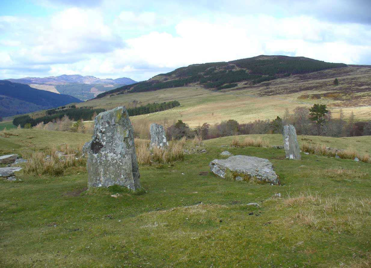
After standing at the same spot for 3000 years or more, near the beginning of the 19th century this stone circle was destroyed by the self-righteous christian cult that was rampaging its way through cultures far and wide. After all, they needed to rid the area of local traditions and “improve” the locals, whether they liked it or not! Thankfully however, one of their creed—a reverend Ferdinand Ellis: minister of the parish for forty years—recorded its destruction in the New Statistical Account between 1834-45. Amongst a variety of important traditional monuments that once existed hereby,
“A Druidical place of worship anciently stood about the middle of the churchyard or burying ground. It consisted of a circle of twelve upright large granite stones from Benochee, which were overturned when the first Christian temple was erected. One of these was taken up in 1821 and now remains above ground, near the spot where it was taken up. The other eleven are still underground. This is proof that the first christian missionaries, in this country, erected their places of worship as near as possible to the holy hills of the heathens, that the people might be more easily persuaded to assemble there.”
‘Persuaded‘ being a very broad term indeed when it came to the land confiscation of indigenous folk…
The stone that Ellis said “was taken up in 1821 and now remains above ground” was gone when Fred Coles (1902) surveyed the site, but he told how an earlier antiquarian and writer for the Scottish Society of Antiquaries, J.G. Callander, lived nearby, and who was
“told by the aged sexton, Florance, that he many a time came across a great stone, when preparing graves, and that he had himself blasted these more than once.”
It seems that all trace of this single stone, and the rest of them, either still lay in the ground or were used for local building material.
When John Barnatt (1989) came to add this circle in his corpus, for some reason he postulated that
“the number of stones suggest it was a recumbent stone circle”,
…that is: a stone circle possessing one large stone in the ring that’s laid down with two standing stones either side. However, there seems no real evidence to show that this was the case.
References:
Barnatt, John, Stone Circles of Britain – volume 2, BAR: Oxford 1989.
Browne, G.F., On Some Antiquities in the Neighbourhood of Dunecht House, Aberdeenshire, Cambridge University Press 1921.
From Lochgilphead, take the A816 road north for several miles (towards the megalithic paradise of Kilmartin), keeping your eyes peeled for the road-signs saying “Dunadd.” Turn left and park-up. Instead of walking up the craggy fortress, follow the road-track to the house and, alongside the River Add, you’ll see the standing stone in the well-mown garden on your right.
Archaeology & History
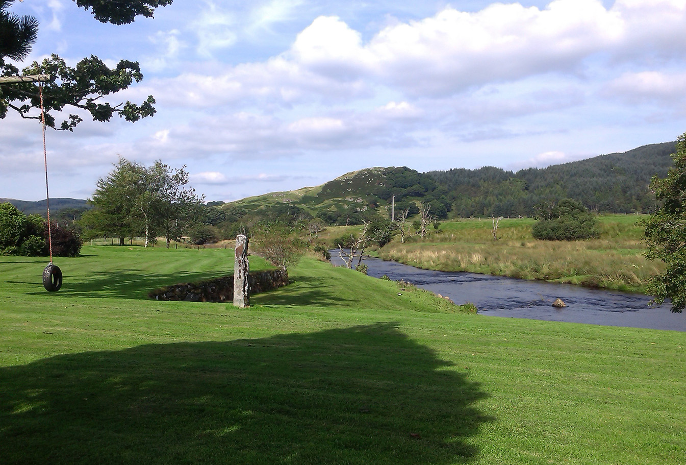
As a monolith within the Kilmartin Valley complex, this is a slight, almost gentle standing stone, missed by most when they visit the other larger sites in Argyll’s Valley of the Kings. Set upright close to the gentle winding River Add and only a few yards from the ancient ford that bridged the waters beneath the shadow of Dunadd’s regal fortress, the late great Alexander Thom (1971) wrote about it in his exploration of lunar alignments found at other nearby standing stones. This one however, was 3° out to have any astronomical validity.
Described only in passing by a number of writers, the greatest literary attention it has previously been afforded was by the Royal Commission lads (1988), whose notes on it were short:
“An irregularly-shaped block of stone, 1.35m high and 1.35m in girth at the base, is situated 25m S of Dunadd farmhouse, it is aligned NNW and SSE, and the top the SSE edge appear to have been broken off.”
…My first visit here was when I lived north of Kilmartin and each time I found the same ‘gentle’ feeling, in all different weathers: a most unusual phenomenon, as there tends to be changes in psychological states between rain, sunshine, frosts, dark night and mists. But there was a consistency of subtlety; a regularity in genius loci—probably due to its proximity to the River Add, the lowland tranquility below the crags. It’s a wonderful little place. Well worth visiting if you go to Dunadd.
References:
Campbell, Marion, Mid-Argyll: An Archaeological Guide, Dolphin Press: Glenrothes 1984.
Lane, Alan & Campbell, Ewan, Dunadd: An Early Dalriadic Capital, Oxbow: Oxford 2000.
Royal Commission on the Ancient & Historical Monuments of Scotland, Argyll – Volume 6: Mid-Argyll and Cowal, HMSO: Edinburgh 1988.
Ruggles, Clive L.N., “A critical examination of the megalithic lunar observatories,” in Ruggles & Whittle, Astronomy and Society in Britain, BAR: Oxford 1981.
Ruggles, Clive L.N., Megalithic Astronomy, BAR: Oxford 1984.
Follow the same directions as if you’re visiting the Dissenter’s Well. The cross stands right next to it!
Archaeology & History
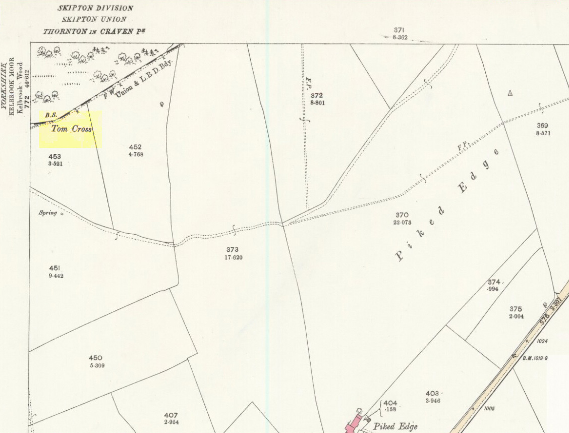
This is one of two old stone crosses with the same name within a mile of each other (the other could be found in the walling along Warley Wise Lane). Included in Taylor’s (1906) stunning magnum opus on the wells and crosses of Lancashire, the site was mentioned in a boundary dispute in the year 1592. He told how a local man called Mr Carr said,
“John Parkinson, ‘of the age of ffour score and thirtiene year or thereabouts’ stated that Tom Cross and the Graystone were by credible report the boundaries, as well of Lancashire and Yorkshire, as of the manors of Colne and Cowling.”
Years later when Clifford Byrne (1974) surveyed the crosses of East Lancashire, he gave us more details about the site, saying:
Photo by Phil WaterworthTom Cross, looking N
“Tom Cross is built into the wall hard by Copy House Farm… At the foot of the Copy House Cross is a well, carved out of a solid block of stone. The water apparently trickles into the well from a spring at the back of the wall , and the overflow spills into the field. The top section of the cross is missing, probably it was vandalized at the time of the Reformation or some time afterwards. It appears that the well was used and probably laid down by the Congregational Church dissenters from the late 17th century. At that time, a law was passed, soon to be repealed, which decreed that every man should attend his Parish Church. This meant that those who wished freedom to practise religion in their own form had to firstly attend the Parish Church and then hold a meeting privately afterwards. At that time, and under those circumstances, it was obviously sensible to meet far away from the Parish Church, and apparently Tom Cross was chosen to meet this need. The children of the Dissenters would be privately baptised in this well at the foot of the monolith into which, a cross was deeply incised.
Tom Cross is mentioned in a lawsuit in the year 1592 and a map exists dated slightly earlier which shows another cross in the area on Greystone Moor near Blacko…”
Tom Cross stone
Byrne suggested that the name ‘Tom Cross’ relates to a boundary cross, but this is not substantiated in local dialect or place-name surveys (who say nothing!). Instead, Joseph Wright (1905) gives us the possibility of Tom being simply, “a kind of rock”; although a variety of other associations relate it children’s games, customs and goblins. The word may derive from the Gaelic ‘tom’, relating to a mound, or clump, or knoll in the landscape (Watson 1926). I’d go for one of these misself. Makes sense.
References:
Byrne, Clifford H., “A Survey of the Ancient Wayside Crosses in North East Lancashire,” unpublished manuscript, 1974.
Taylor, Henry, The Ancient Crosses and Holy Wells of Lancashire, Sherratt & Hughes: Manchester 1906.
Watson, W.J., The Celtic Placenames of Scotland, Edinburgh 1926.
Wright, Joseph (ed.), English Dialect Dictionary – volume 6, Henry Frowde: Oxford 1905.
Acknowledegments: Big thanks to Chris Swales for guiding me to the site; and to the old Teddy Man, DannyTiernan.
Turn off the A91 road at Gateside and go down Station Road, crossing the old railway line at the bottom. From here, cross the fields to your left and the site of the circle will be found in the field to the north east of Easter Nether Urquhart Farm.
Archaeology & History
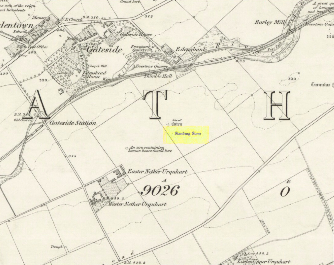
Marked on the 1856 6″ Ordnance Survey map as a “standing stone,” earlier references record this as being the survivor of a stone circle. Not listed in Aubrey Burl’s (2000) magnum opus, this circle was on the edge of the site of a major battle between the Romans and the native defenders, and large amounts of human remains have been found in the vicinity. Referring to an adjacent cairn, Lieutenant-Colonel Miller wrote in 1829:
“A very fine Druid’s Temple stood on the south side of it, consisting of seven very large stones. All these were blasted with powder and removed, except half the one of them, which still marks the spot.”
Of the same cairn, the Reverend Andrew Small wrote in 1823:
“This cairn stood a little north of an ancient Druids’ temple, only one stone now remaining, out of ten of which it formerly consisted.”
The Ordnance Survey Name Book for 1853-55 imparts the following:
“This standing Stone is about 13 chains on the South side of the River Eden opposite Edensbank but whether it is the remains of a druid’s temple or set up to mark something relative to the battle contested between the Romans and Caledonians according to Messrs. Miller & Small, it is difficult to determine. It stands about 4 feet 10 inches high and its sides are about 2 feet broad…many of the inhabitants consider it to have been a druid’s temple…”
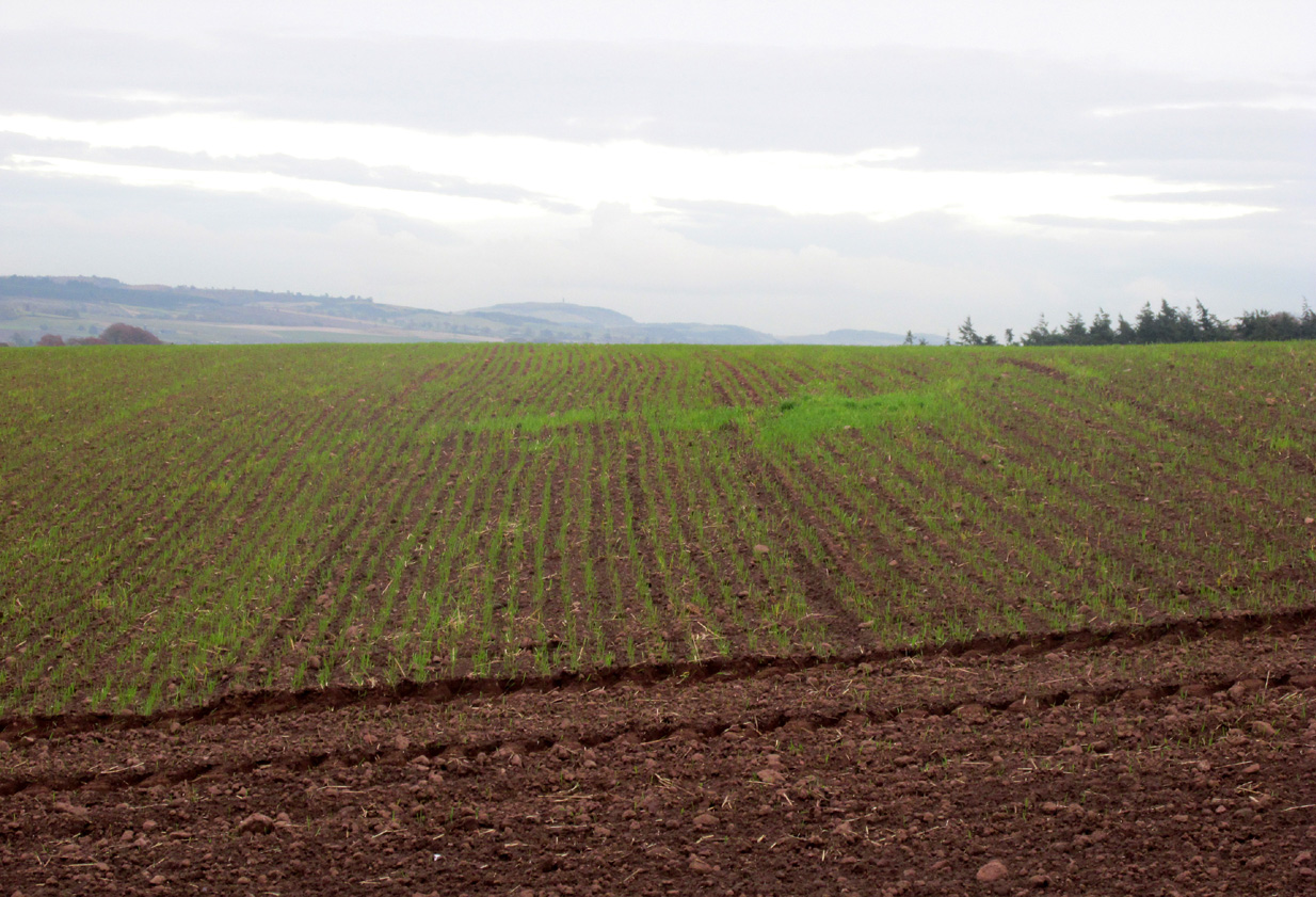
A close-up of the sitePosition of the circle, evident in crop-growth
J.S. Baird of Nether Urquhart informed an Ordnance Survey officer in 1956 that the remaining stone was broken up and removed around 1952, and measured 5 feet high with a girth of 9 feet at the base. Near the top of the stone, on the south-side were two slight cracks weathered to suggest a simple incised cross.
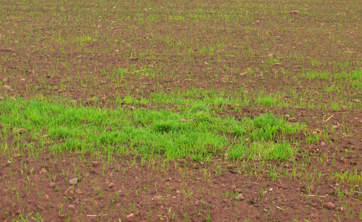
On the day of my November field-visit the winter barley was sprouting and it was interesting to see how much better it was growing at the place where the remaining stone had stood.
Burl, Aubrey, The Stone Circles of Britain, Ireland and Brittany, Yale University Press 2000.
Miller, Lieutenant-Colonel, “An Inquiry respecting the site of the battle of Mons Grampius (Read 27th April 1829 and 25th January 1830),” in Proceedings of the Society of Antiquaries of Scotland, Volume IV, 1857.
Small, Reverend Andrew, Interesting Roman Antiquities Recently Discovered in Fife Ascertaining the site of the Great Battle fought betwixt Agricola and Galgacus, John Anderson & Co: Edinburgh 1823.
Take the directions to the hugely impressive Dunruchan A standing stone. Walk directly south, over the gate and follow the fence straight down the fields, crossing the burn at the very bottom. Walk over the boggy grassland and start veering uphill, southeast. You’ll notice the land goes up in geological ‘steps’ and, a few hundred yards up, a small standing stone pokes up on the near skyline ahead of you. Head straight for it!
Archaeology & History
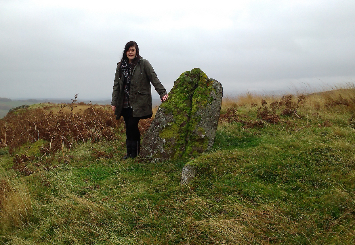
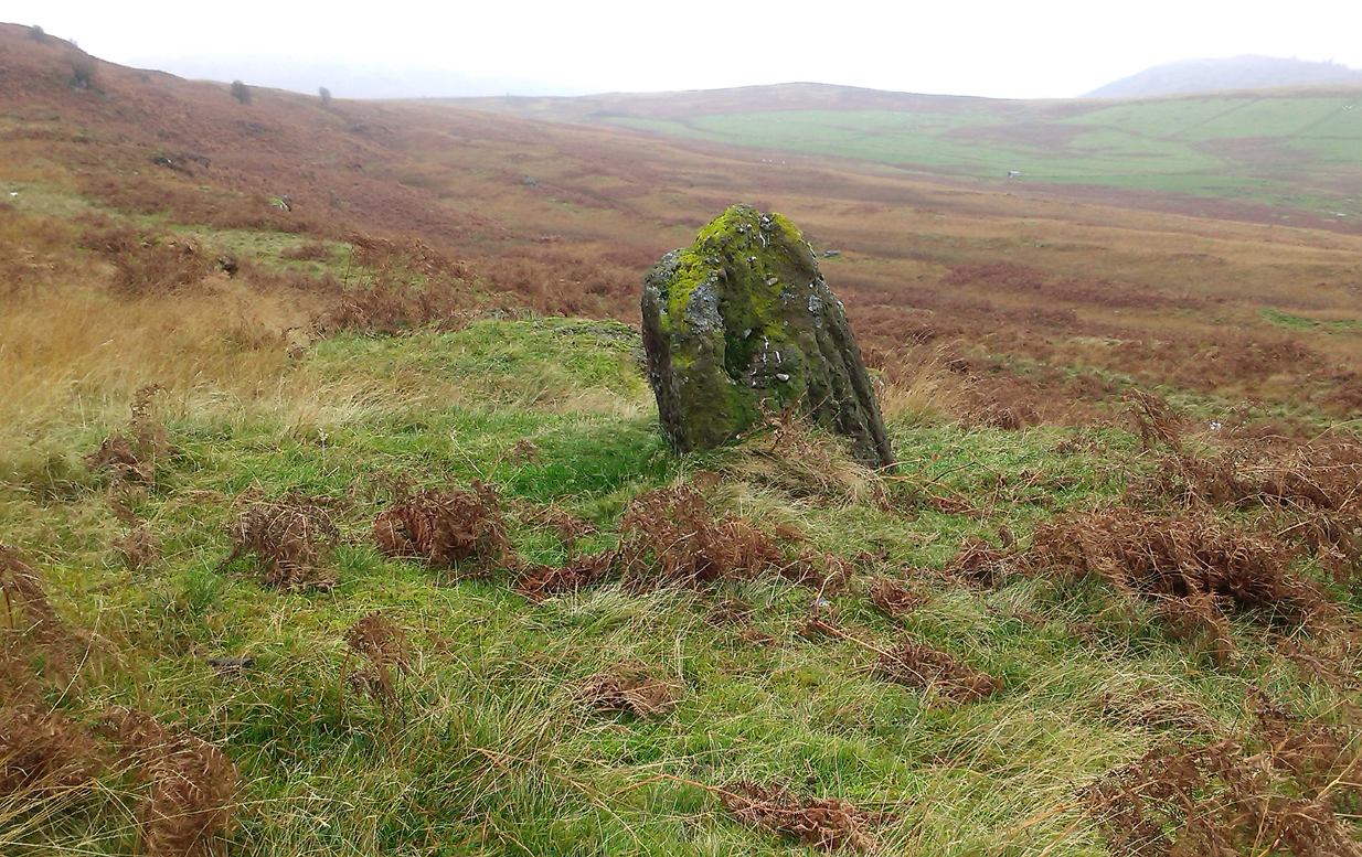
This small standing stone was first noted after a quick visit to the major Dunruchan megalithic complex in the summer of 2016. Photographer James Elkington was taking images of the landscape and the standing stones when he noticed a stone on the horizon a half-mile away. As we were in a rush, he took a couple of photos from different angles on the way back to the car—both of which looked promising. And so, several months later, we revisited the site again. Lisa, Paul and Mr Fukner and I meandered up the geological steps of the hillside until we reached the site in question.
Looking northwestLooking northeast
Standing just over four-feet tall, this solitary stone overlooks the megalithic Dunruchan complex a half-mile or so to the north and northwest. Like the Dunruchan C monolith, this smaller upright is conglomerate stone. Paul Hornby noted what may be a single cup-marked stone roughly 100 yards east along the same ridge. (Please note that the grid-ref may be slightly out by perhaps 50 yards or so at the most. If anyone visits and can rectify my ineptitude on this matter, please let me know.)
From Colne or Laneshaw Bridge, head up the Skipton Old Road which heads up towards Bleara Moor (with its prehistoric cairns). Way before that though, about 100 yards before you reach the Black Lane Ends pub, turn left up the track to Jerusalem Farm. Go past it, through the gates and keep on the track until, another coupla hundred further uphill, you’ll see it on the skyline ahead of you…
Archaeology & History
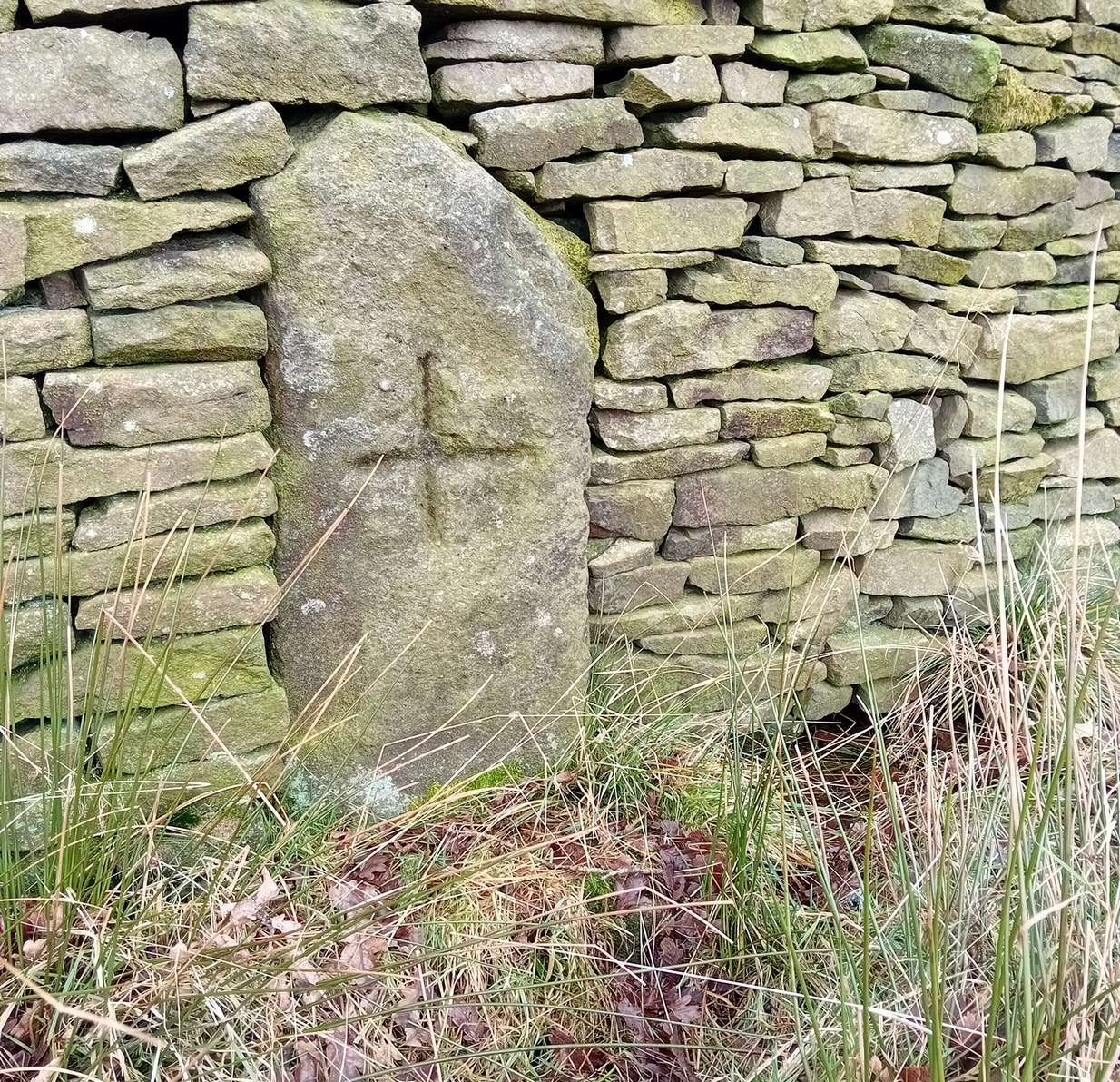
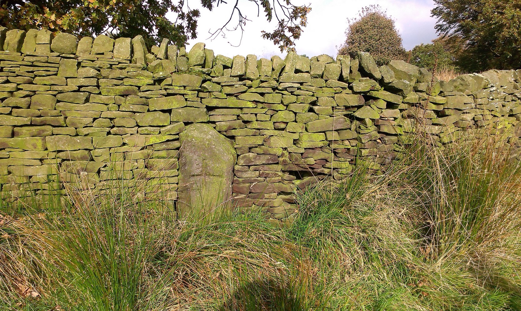
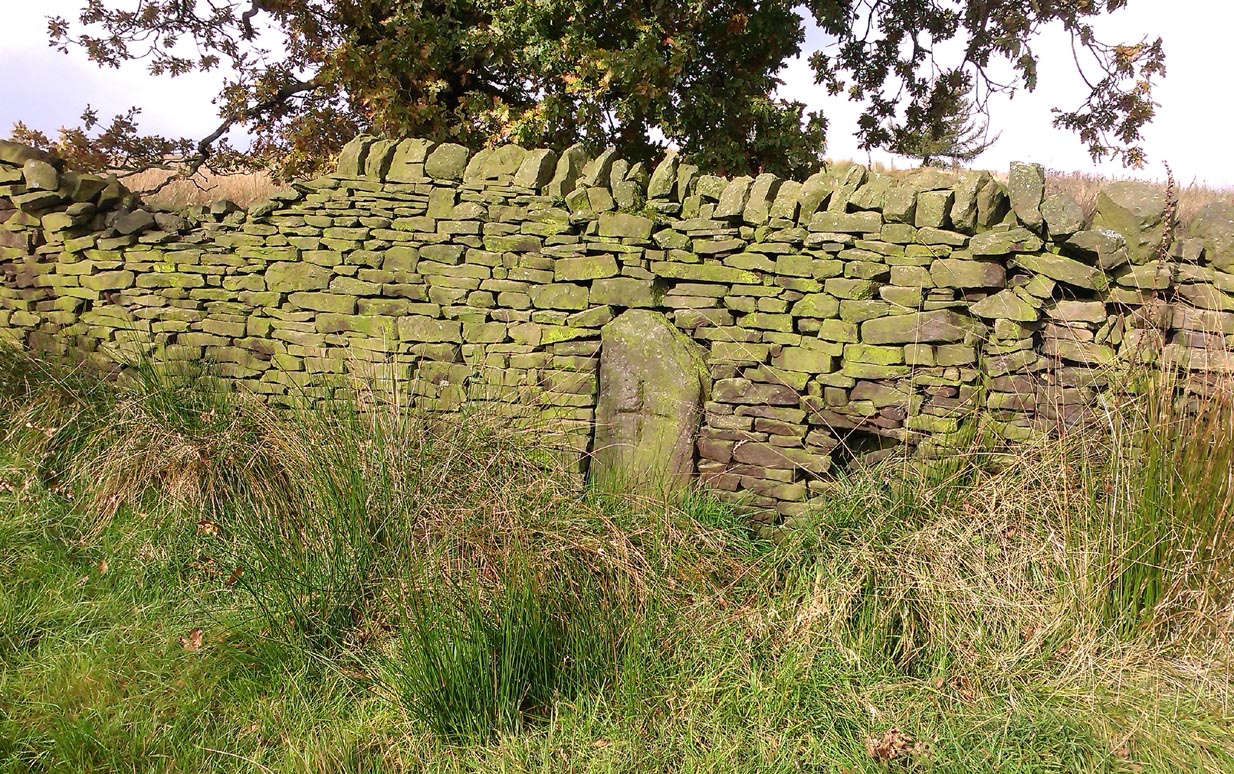
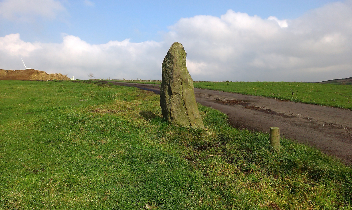
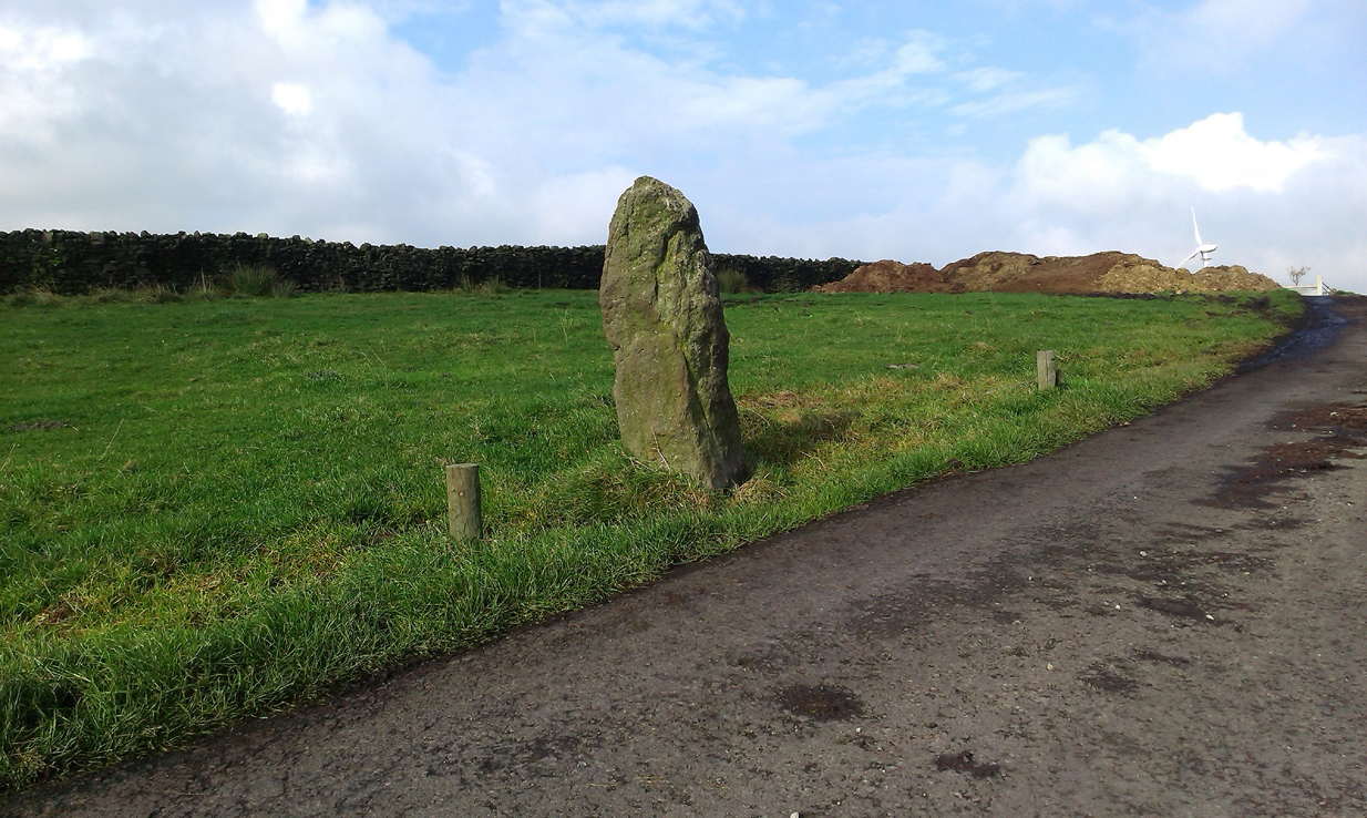
There appears to be no previous reference to this standing stone, found high upon the lonely ridge beside the old track that runs between Laneshaw Bridge and Kelbrooke and Earby. Well eroded on all sides, it isn’t shown on the early or recent maps and has evaded the archaeological registers of the area (but this is Lancashire, where archaeology has been damn lazy on the county’s prehistoric relics until very recently). It may have been laid down for an age, only recently resurrected—we simply do not know. Standing nearly five-feet tall, on its top western face is what looks like a very faded cup-marking, but this may be a fortuitous Rorscharch. There are no marks or holes in the stone to indicate it has ever been used as a gatepost.
Looking far into the eastLooking northwest
I was guided here by the northern antiquarian and stonemason Chris Swales a few weeks ago and was quite taken aback by its position in the landscape—which is outstanding! Apart from being blocked to the west by the rise of the Great Edge, the views to the north through east and south and superb. On the far eastern skyline rises the legendary Hitching Stone, between which is the seemingly cairn-less Knarrs Hill.
Further north along the track we reach the old Dissenter’s Well and its moving companion, the Tom Cross (which has marked different parts of the Lancashire and Yorkshire boundary). Other than this, we know nothing more. An intriguing spot and well worth visiting!
From Kenmore, take the minor road on the south-side of Loch Tay for 1½ miles (2.4km) until you reach the hamlet of Acharn. From here take the track uphill for ½-mile past the Acharn waterfalls and follow the same route to the Acharn Burn tumulus. Walk past here along the track and, just before you reach the wooded burn, bear right and walk uphill for nearly another half-mile, roughly parallel to the Allt Mhucaidh (Remony Burn). As you reach the proper moorland, you’ll see the stones rising up!
Archaeology & History
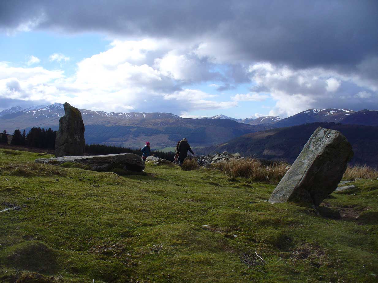
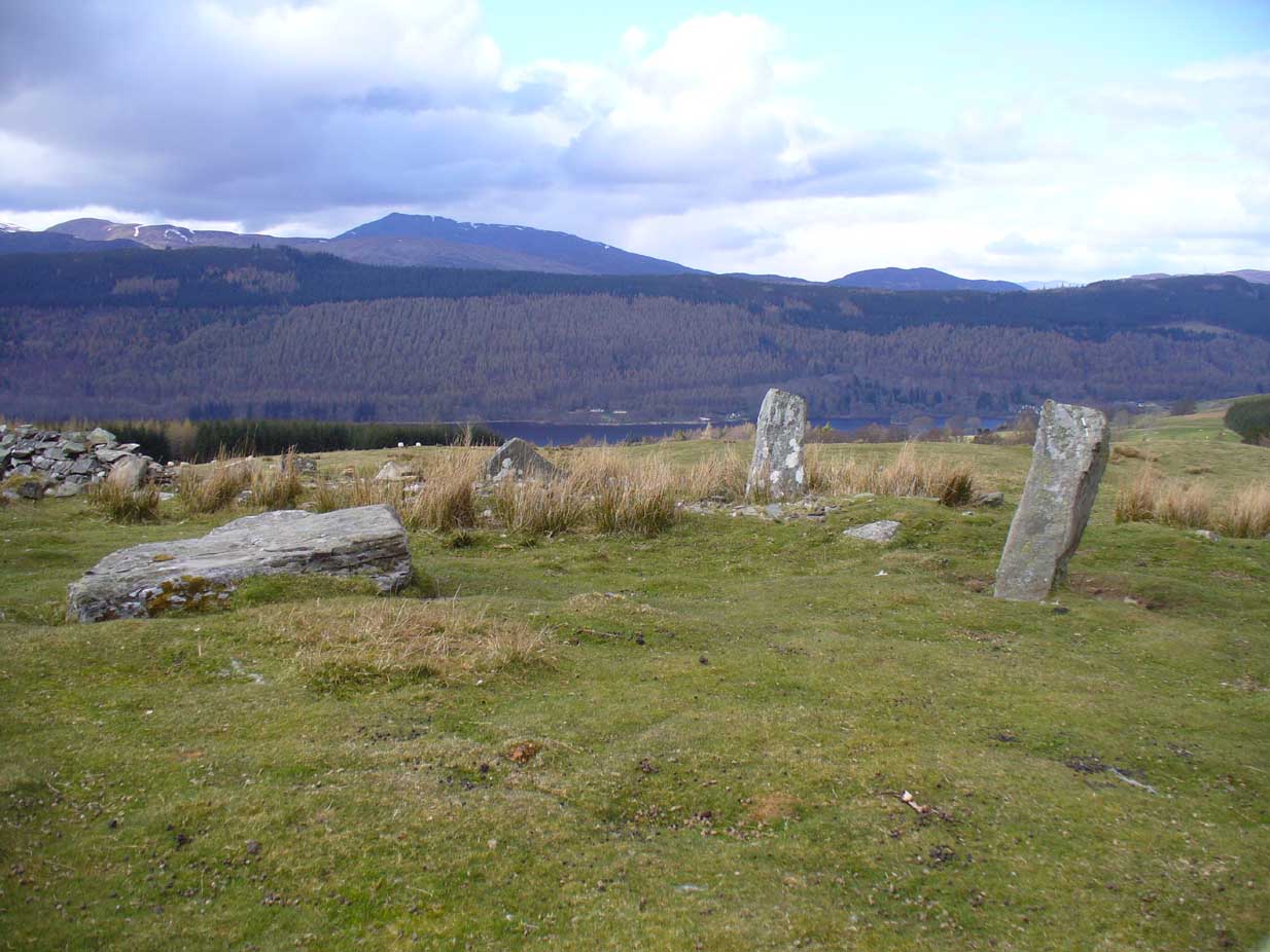
This is quite a spectacular site! Not for the size of the stones or the arrangement of the megaliths, but for the setting! It’s outstanding! When a bunch of us wandered up here a few months ago, snow was still on the peaks and Nature was giving us a real mix of Her colours and breath in a very changeable part of Her season. Twas gorgeous. Perhaps the setting was the thing which has kept the circle pretty quiet until recent years. It’s high up – and out of season the freezing winds and driving rains would keep all but the healthiest of crazy-folk away. We all only wished we’d have had more time here. But that aside…
Lara between the old stonesJ.D. MacLeod’s 1909 groundplan
Along with the changeable weather She gives up here, the literary-types have given this circle changeable names too. Nowadays known as the Acharn Falls stone circle, in truth that’s a mile away and lacks in both visual and geographical accuracy. ‘Greenland’ was the name cited when J.B. MacKenzie (1909) wrote about it more than a hundred years back, and it’s the name we find in Mr Burl’s (2000) magnum opus, despite him telling how “a local name for it is Auchliacha, ‘the field of stones'” (Burl 1995), so perhaps we should adhere to what the locals say (my preference generally).
The atmospheric ring, looking WGreenland Circle, looking N
The ring is in quite a mess, having had a drystone wall built through it in the last 100 years. No walling is shown on the early Ordnance Survey maps, so some local land-owners (an english incomer?) was probably responsible. The stones used to stand in parts of the ancient forest, which must have looked and felt quite something before they ripped the trees away. It was hiding away in the woods when J.B. MacKenzie (1909) came here, shortly after the “modern wall” as he called it, had been constructed through the circle. He wrote:
“Six stones remain on the site, of which four are still erect and in position, and two are prostrate, one of which has apparently fallen inwards and the other outwards of the line of the circle, the diameter of which, touching the inner sides of the stones still standing, is 27 feet 9 inches. Mr MacLeod has supplied the following dimensions of the several stones:
A — 6 feet 9 inches x 3 feet 6 inches, lying flat
B — 8 feet 4 inches, in circumference at ground level
——1 foot 7 inches, high above the ground level
C — 6 feet 10 inches, in circumference at ground level
——4 feet 0 inches, high above ground level
D — 6 feet 0 inches, in circumference at ground level
——4 feet 3 inches, high above ground level
E — 7 feet 8 inches x 4 feet 6 inches, lying flat
F — 9 feet 0 inches, in circumference at ground level
——5 feet 8 inches, high above ground level.”
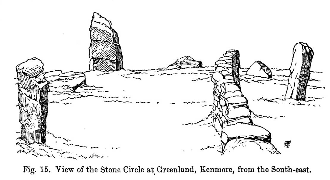
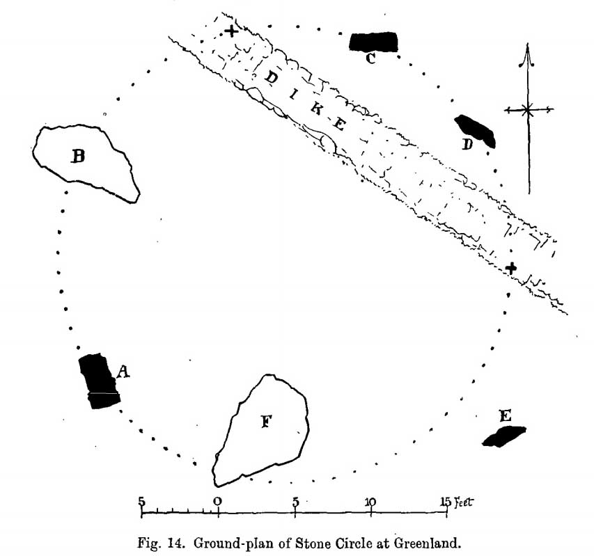
Coles’ 1910 sketch of the siteColes’ 1910 ground-plan
The year after MacKenzie’s notes, the great Fred Coles (1910) paid a visit here. Noting how high it was in the landscape compared to other megalithic rings in the region (it’s the highest known circle, at 1240 feet up), he went on to give his usual detailed appraisal, telling:
“In a little clearing amid these woods on Craggan Odhar, but disfigured by a dike which separates some of the Stones from the others, stands this Greenland Circle of which the ground-plan is given…. The Stones are six in number, of which four are erect, and they all appear to be of the quartzitic schist. Some disturbance has occurred, and it seems probable that there were at least two more Stones originally, one between B and C at the spot marked with a cross, and the other similarly marked midway between D and E. There is, however, no vestige of any Standing Stone in the sides of the dike itself.
“On the south-west is Stone A, the tallest, with pointed top, 5 feet 7 inches in height, oblong in contour, and measuring at the base 9 feet 5 inches. Having several deep horizontal fissures, this Stone…bears an odd resemblance to masonry. The next Stone, B, lies prostrate, measuring 7 feet 9 inches by 4 feet, and about 1 foot in thickness above ground. The little oblong Stone, C, on the other side of the dike, stands only 1 foot 10 inches above ground, and probably is a mere fragment—the stump of a much larger block. At D the Stone is 4 feet 3 inches in height, and is a very narrow slab-like piece; Stone E, which has a decided lean over towards the interior of the Circle, is 4 feet 2 inches high, and is in basal girth 6 feet 6 inches. Like the others, it is angular and thinnish in proportion to its breadth. Stone F measures 8 feet 2 inches by 5 feet 2 inches, and its position, with the narrow end resting almost on the circumference, suggests, as in other cases, the probability that it was this narrow end which was buried when the Stone was erected. These blocks were most likely brought from the low cliffy ledges near, for, as the name ‘Craggan Odhar’ implies, the place was, before being planted, conspicuous for its Grey Crags.”
Although no modern excavation has taken place, when the brilliant local historian William Gillies (1925) first got round to exploring the circle, he remedied that situation. In probing the ground beneath the surface when the weather conditions allowed, Mr Gillies found that there seemed to have been more standing stones in the circle than presently meets the eye. He wrote:
“I paid several visits last summer to this lonely and elevated spot, and examined the ground for stones, where the wide spaces between those indicated on the plan (see Coles’ 1910 drawing, above) suggested that others might be concealed beneath the turf. There would appear to be three stones missing, which would make the circle to consist of nine in all when it was entire. With little trouble, at a depth of only 3 inches, I located a large flat stone measuring 5 feet 6 inches by 4 feet 8 inches. It had stood on the north-western arc of the circle half-way between the fallen stone on the west and the broken standing stone on the north-north-west. It had fallen outwards. The foundation of the wall, built probably some seventy years ago to enclose the plantation, rested on the edge of the stone. The ground along the circumference of the circle between the three stones on the eastern side was carefully probed, but the rod touched only small loose stones.
“I next turned up the centre of the circle, and at a depth of 5 inches below the surface came upon a dark deposit. It extended over a space of 2 feet square and was about 5 inches in depth. It was mixed with a white limy substance consisting of calcined bones, bits of which along with a sample of the dark substance I brought to the Museum. A bit of charcoal from the deposit revealed the lines of cleavage in the wood. There is no peat at the spot, although the elevation, which is at least 1200 feet, might suggest it. The surrounding soil is of a reddish colour, and quite unlike the deposit which must have been placed there, and which was probably a burial after cremation.”
Greenland circle, looking NE
Gillies was exemplary in his exploration of sites that were on the verge of disappearing from tongue and text and we remain incredibly grateful for his later exposition on the antiquarian remains and legends of this truly stunning landscape. In Aubrey Burl’s (1995; 2000) respective summaries of this stone circle, as well as that of John Barnatt (1989), they ascribe the situation of it originally having 9 stones, as Gillies suggested.
Visit this site! If you’re into megaliths, you’ll bloody love it!
References:
Barnatt, John, Stone Circles of Britain – volume 2, BAR: Oxford 1989.
Burl, Aubrey, A Guide to the Stone Circles of Britain, Ireland and Brittany, Yale University Press 1995.
Burl, Aubrey, The Stone Circles of Britain, Ireland and Brittany, Yale University Press 2000.
Money, Bob, Scottish Rambles – Corners of Perthshire, Perth 1990.
Acknowledgements: Many thanks to the unholy bunch who helped travel, locate, photograph and take notes on the day of our visit here, including Aisha, Lara & Leo Domleo; Lisa & Fraser; Nina and Paul. Let’s do it again and check out the unrecorded stuff up there next time!
Take the A822 road south out of Crieff and less than half a mile down, in a field on the east side of the road is the giant solitary standing stone of Dargill. On the opposite side of the road from here (roughly) is a small country lane. Go along here and past the third field on your left, park up. Look down the fields for a coupla hundred yards and you’ll see the standing stone. Make your way there by following the field-edges.
Archaeology & History
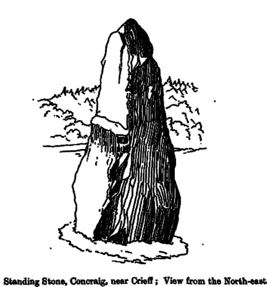
Concraig stone, near Crieff
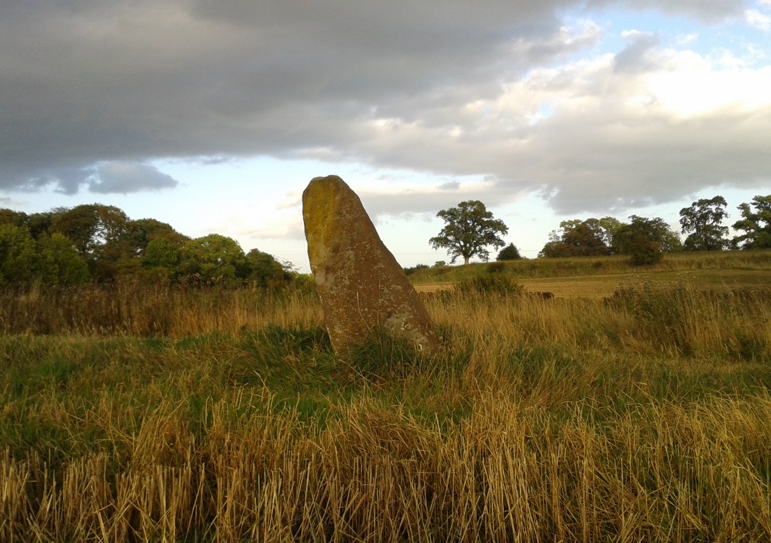
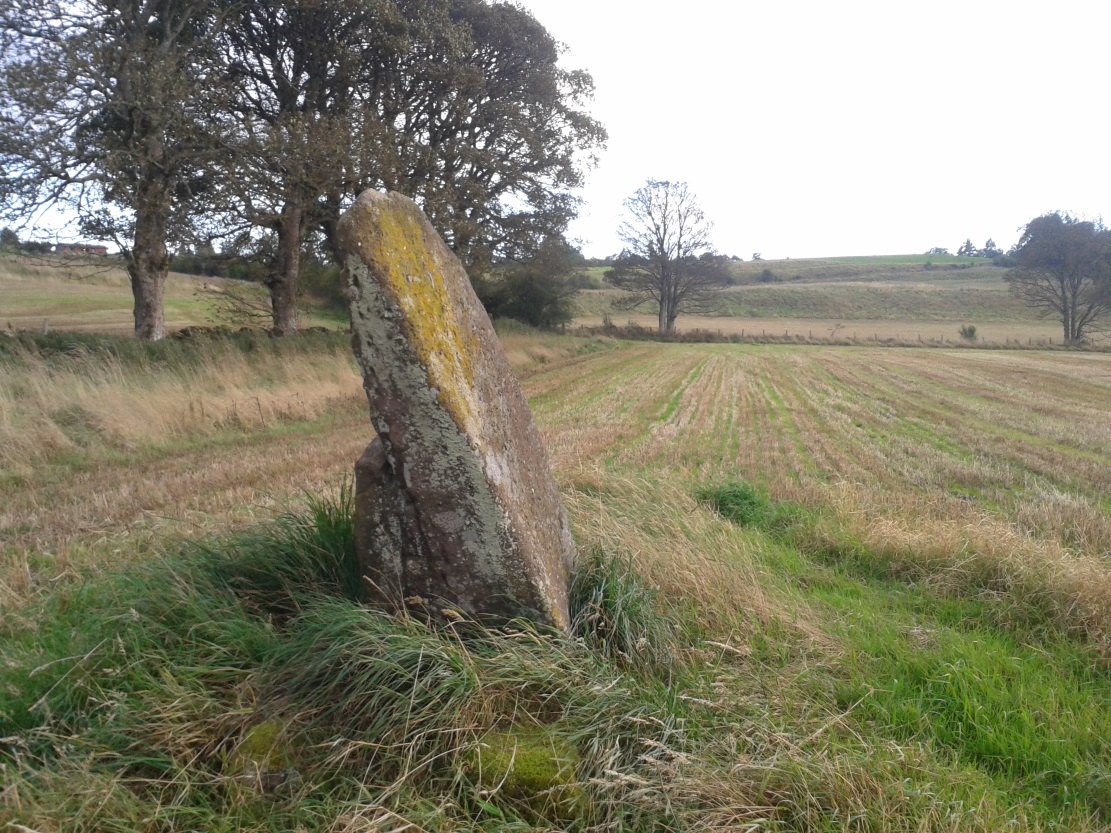
Closer to the larger town of Crieff than it is to the village of Muthill, this seven-foot tall standing stone, leaning at an angle to the north and with a small scatter of stones around its base, stands alone near the side of the field, feeling as if others once lived close by. It’s set within a distinctly nurturing landscape, enclosed all round instead of shouting out to the hills, with that nourishing female quality, less commonly found than those stones on the high open moors. The only real ‘opening’ into a wider landscape here was mentioned by the local writer Andrew Finlayson (2010), “to the distant east.” Whether this possessed any astronomical-calendrical importance hasn’t yet been explored.
Concraig, looking southFred Coles 1911 sketch
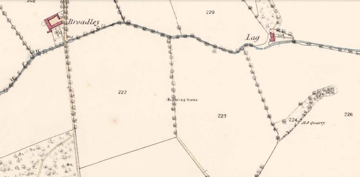
The stone was first highlighted on the 1863 Ordnance Survey map—and described in their Name Book as “a large upright Stone adjacent to and South-east of Broadley about 8 feet high and traditionally said to be either the remains of a Druidical Temple or in some way associated with the Druidical period”—but since then it hasn’t fared very well in antiquarian tomes. Fred Coles (1911), as usual, noted it in one of his Perthshire surveys, but could find very little information from local people about the place, simply telling us that,
“in an open field about 300 yards to the north-west of Concraig, there stands this irregularly four-sided block of conglomerate schist… The stone measures 9 feet 3 inches round the base and stands 7 feet 3 inches in height. About halfway up its eastern face it has been broken so as to leave a very distinct ledge.”
What appears to be cup-markings on the southern-face of the stone are just Nature’s handiwork.
Take the same directions as if you’re visiting any of the upper Ballochraggan petroglyphs, but 100 yards before the carvings, out in the open on the grasslands, below the reach of the forest, you’ll see the leaning stone if you wander about. You can’t really miss it!
Archaeology & History
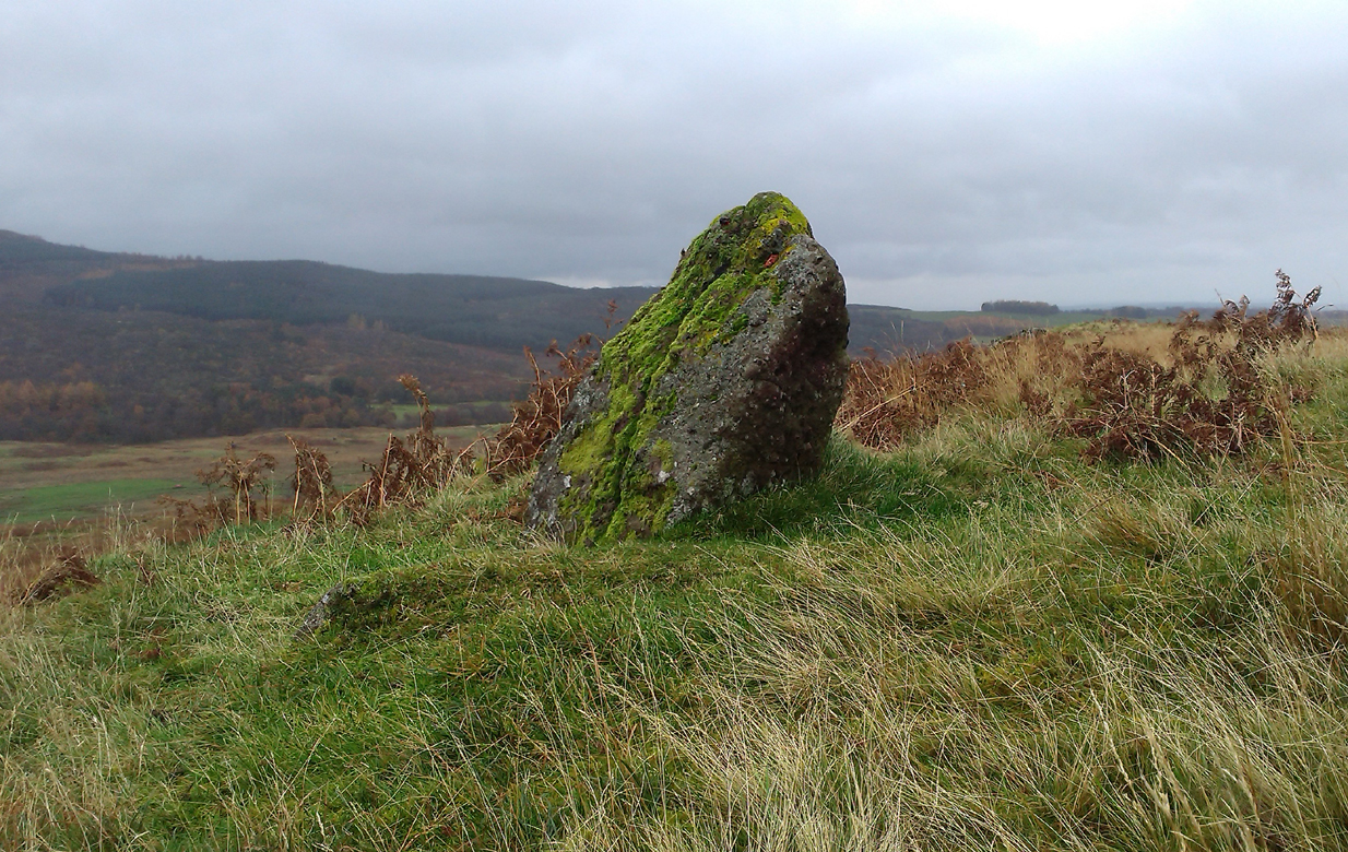
Not included in any of the Canmore, Royal Commission or Ordnance Survey records, this standing stone appears to have eluded official records until now. Found close to the petroglyph-rich arena of the Ballochraggan complex, with attendant tombs to the east, there is the possibility that this large leaning stone was itself, once, a part of a long-gone cairn, as Paul Hornby suggested. The small cluster of stones around its base certainly adds to that idea (similar to the incredible Dunruchan cluster, more than 17 miles (28km) northeast).
The stone leans at a considerable angle from a previously upright position. When standing it would have been nearly five-feet tall and measures nearly as wide. The stone is roughly triangular in shape, above ground. What appear to be two faint cup marks on its topmost surface are very probably due to conglomerate rock erosion and not the handiwork of humans.