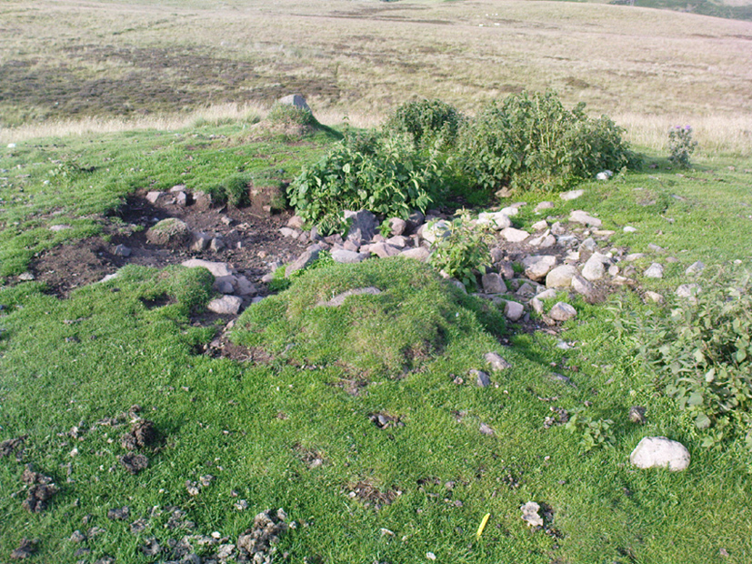
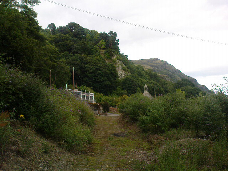
From Brodick, walk up the Glencloy dirt-track towards the friendly Kilmichael Hotel but turn off on the left shortly before hand, up another footpath, crossing the stream until you eventually reach the derelict house which was built into the edges of this old tomb. Upon the small rise above here, at the edge of the forestry commission trees, you’ll notice the overgrown ruins of the old tomb.
Archaeology & History
The remains here are somewhat overgrown and ramshackled, but I still like this place and in my younger days used to spend a lot of time here. It can get quite eerie in some conditions and seems to validate some of the folklore said of it. The site was described in Balfour’s (1910) magnum opus as:
“Situated in Glen Cloy, on the moor above Kilmichael House, close to a cottage called Glenrickard. There are no traces of a cairn or of a frontal semicircle. The chamber is formed of rather light flags, with their upper edges nearly on the same level, so that the monument is more like a series of cists than a chamber. The roof and end stone have gone; there are two portal stones, but the gap between them is only 7 inches. The chamber is directed N and S, with the portal to the south. There have been three compartments, but they are rather smaller than usual, the third from the portal being only 3 feet 10 inches long by 2 feet 2 inches broad. Two feet 6 inches from this compartment is another cist, which is possibly a short cist representing a secondary interment, and 10 feet farther north is a second ruined cist placed at a different angle. This last has the appearance of a short cist, but it is not carefully constructed and differs little from the component compartments of the chamber. The structure is anomalous, and may perhaps be regarded as representing a phase of degeneration in the transitional period.”
Glenrickard ground-plan (after Henshall 1972)Glenrickard on 1868 map
Audrey Henshall (1972) later descried the site in greater details in her own magnum opus and told that “two rude clay urns of the primitive flower-pot pattern (were) found in the chamber”, along with “calcined bones, said to have been in the two vessels.”
Folklore
Said by local people to be haunted, the spirit of the tomb was said to have been disturbed upon the building of the derelict house below it. Ghosts of a middle-aged couple and young child have been seen in the house; whilst the spirit of the site can generate considerable fear to those who visit the place when it is ‘awake.’ To those who may visit this out-of-the-way tomb, treat the site with the utmost respect (and DON’T come here and hang a loada bloody crystals around the place in a screwy attempt to “clean” the psychic atmosphere of the place. If you’re that sort of person, don’t even go here! The spirit of the place certainly wouldn’t want you there).
References:
Balfour, J.A., The Book of Arran: Archaeology, Arran Society: Glasgow 1910.
Henshall, Audrey Shore, The Chambered Tombs of Scotland – volume 2, Edinburgh University Press 1972.
From Dunkeld travel southeast on the A984 road to Caputh and after about 1½ miles, set back a few yards from the road amidst the trees below the Newtyle Quarries (whose mass of slate and loose rocks cover the slopes), you’ll see these two large monoliths. There’s nowhere to park here, but there’s a small road a coupla hundred yards before the stones aswell as a space to park on the verge by the side of the road a few hundred yards after them. Take your pick!
Archaeology & History
When we visited these two tall standing stones a few weeks ago, guerilla archaeologist Hornby and I were a little perplexed at the state of these stones, wondering whether they were a product of the fella’s who dug the quarries above here, or whether they were truly ancient. It seems the latter is the consensus opinion!
They were described by the great Fred Coles (1908) in one of his lengthy essays on the megaliths of Perthshire, where he thought the two stones here were all that remained of a stone circle that once stood on the flat, above the River Tay, but whose other stones “were destroyed in the making of the road” which runs right past here. Not so sure misself! He told that,
“An old cart-track runs up between the stones, leading from the main road…up to the quarry. The mean axis of the two stones runs N 13° W and S 13° E (true), and although their broader faces do not point towards the centre of a circle on the west, it is certainly much more probable that the other stones were on this side, the lower and flatter ground, than on the east, where the ground slopes and is more broken and rough.
“Both stones are of the common quartzose schist, but they differ considerably in shape. A is 6 feet 7 inches high at the north corner, but only 4 feet 10 inches at the south, and its vertical height at the east is only 3 feet. The basal girth is 13 feet 3 inches, and in the middle 15 feet 9 inches. The broad east face measures 5 feet. Stone B is level-topped and 5 feet in height; it has a basal girth of 12 feet 4 inches, and at the middle of 11 feet 8 inches. Its two broad faces are of the same breadth.”
Little else was said of the two stones for many years and, to my knowledge, no real excavation has been undertaken here. But when Alexander Thom (1990) visited the site he found that,
“This two stone alignment showed the midsummer setting sun. The south stone may possibly, by itself, have shown the setting Moon at major standstill.”
Aubrey Burl’s description of the stones was succinct and echoed much of what Coles had said decades earlier, telling:
“Two very large stones stand only 9 feet (2.7m) apart in an unusually closed-in environment for a Perthshire pair. The ground rises very steeply to the east. To the west the stones overlook the valley of the River Tay.
“Both are of local quartzoze schist and are ‘playing-card’ in shape. As usual it is the westernmost stone that is taller, 7ft 2in (2.2m) in height. Its peak tapers almost to a point. Conversely, its partner is flat-topped and only 4ft 9in (1.5m) high. The pairing of such dissimilarly shaped stones has led to the interpretation of them as male and female personifications.”
Alex Thom’s groundplanBack of the smaller stone
Burl’s latter remark thoughtfully recognises that such animistic qualities are found in many other cultures in the world and this ingredient was also an integral part of early peasant notions in Britain; therefore such ingredients are necessities to help us understand the nature and function of megalithic sites. We must be cautious however, not to fall into the increasingly flawed modern pagan notion of such male and female ‘polarizations’, nor the politically-correct sexist school of goddess ‘worship’ and impose such delusions upon our ancestors, whose worldviews had little relationship with the modern pagan goddess fallacies, beloved of modern Press, TV shows and pantomime festival displays.
Folklore
In Elizabeth Stewart’s history of Dunkeld, she narrates the tale told by an earlier historian who told that,
“these two upright stones at the Doo’s Nest, but says they are supposed to mark the graves of two Danish warriors returning from the invasion of Dunkeld.”
References:
Burl, Aubrey, From Carnac to Callanish, Yale University Press 1993.
Coles, Fred, “Report on Stone Circles Surveyed in Perthshire – Northeastern Section,” in Proceedings of the Society of Antiquaries, Scotland, volume 42, 1908.
Stewart, Elizabeth, Dunkeld – An Ancient City, Munro Press: Perth 1926.
Thom, A., Thom, A.S. & Burl, Aubrey, Stone Rows and Standing Stones – 2 volumes, BAR: Oxford 1990.
Pretty easy to find. At the eastern end of Loch Tay, go through the old village of Kenmore along the A827, towards Aberfeldy, for about a mile. At least a mile past Kenmore, keep your eyes peeled for a small left turn which takes you back into the grounds of Taymouth Castle. Go on this small road, pass the ornate walling, and you’ll see these two standing stones in front of you, before the trees, on the left. If you reach the Croftmoraig Stone Circle, you’ve gone a few hundred yards past the turning.
Archaeology & History
Fred Coles’ drawing & lay-out
These fine-looking standing stones a mile northeast of Kenmore village, on the edge of the grounds of the superb Taymouth Castle, are worthy old monoliths, encrusted by the lichens of many centuries, resting within the long grass beside the track that runs to the castle. But they have received little attention in archaeological terms. When Fred Coles (1910) described them, he thought them to be the remains of a stone circle — an impression echoed by Margaret Stewart (1966) many years later (I got the same impression aswell), but no other stones have been found to substantiate this (although Mr Gillies’ folklore remnant is intriguing). There is a notable rounded hillock immediately behind the two stones which may, or may not, have had other uprights surrounding it; though I can find no further data anywhere to substantiate such a thing.
In William Gillies’ (1938) historical survey of the area he related Mr Coles’ earlier findings of the two stones, telling us:
“There are two great standing stones just within the Principal Gate leading to Taymouth Castle. The stone A (see plan) stands at a distance of 54 feet to the NNW of B — a somewhat greater diameter than is common among the Perthshire Circles. These stones are almost equal in height — A is 4ft 9in, B is 4ft 7in — and they are both rugged blocks of a rough species of diorite. Stone A measures round the base 10ft 8in, and stone B 14ft.”
The western stoneThe eastern stone
But it seems that little else has been found about the place. It’s in a gorgeous setting (but, round here, everything’s in a gorgeous setting!) and must have related to other sites in the area, but it’s hard to contextualize the place on a single visit. If you stand behind the two stones, the shape of their ‘heads’ fits very nicely onto the rounded hillock on the northwestern skyline — which seems to have later been used as a hillfort. Whether this has any astronomical potential, I aint checked. (though Thom says nothing about them)
In geomantic terms both of these stones possess a distinct female flavour to them; the easternmost thinner of the two, particularly so. But then I could just be talking bullshit! I’d have loved to have spent more time with these two stones — bimbling, sitting, focussing, dreaming — as people of olde naturally did; but we were on the move and had other places to see. Tis a delightful spot indeed…
(NOTE – This site was first given a grid reference of NN 801 477 in Margaret Stewart’s (1967) fine essay on the standing stones at nearby Lundin; and the grid-ref has since been reproduced in texts by Burl (1993), Thom (1990) and others. Please note that this grid-ref is incorrect and is nearly a mile away from the actual position of the stones.)
Easternmost stone from another angle
Folklore
There is the possibility that this site once played a part in an important megalithic stone row. Mr Gillies (1938) once again notes an old tradition told by local people which “says that at one time there was a paved way connecting the circle, of which these stones are the remains, with the great Croftmoraig circle.” Very intriguing indeed…
References:
Burl, Aubrey, From Carnac to Callanish, Yale University Press 1993.
From Gilmerton village, take the A822 Dunkeld road north. Go for about 200 yards and take the little road to Monzie; watching carefully another 200 yards on for the dirt-track on the left taking you across the fields. Go along the track, watching out for the small stones in the field on your right less than 200 yards along. You can’t really miss ’em! This small ring of stones is the Monzie Cairn Circle. The carving is just in front of it!
Archaeology & History
Although we know this brilliant carved stone has some relationship with the Monzie cairn circle only five yards away (it was linked via a man-made stone causeway, running between the circle and the carving), the stone itself is very much deserving of its own entry here — and at the same time I can give Andrew Finlayson’s (2010) excellent book a decent plug aswell! (the superb drawings of the stone, top & bottom, are from Andy’s work)
Allen’s 1882 drawingCarving & proximity of circle
First mentioned (I think) in Simpson’s (1867) early survey, the carving was described soon after by J. Romilly Allen (1882), who gave us an early drawing of the stone. Thought by some to have originally stood upright, the carving was described by Aubrey Burl (2000) as being, “decorated with forty-six cupmarks, cup-and-rings, nine double, one triple, there are grooves and a pair of joined cups.” It’s certainly an impressive carving!
Although the carving has been posited by some archaeologists as an outlier to the Monzie circle, it’s probable that the circle emerged from the carving — a concept that some may find difficult to understand. I’m not aware of any modern excavations here (the last, I think, was in 1938), but my guess would be that the stone causeway laid between the cup-and-ring stone and the circle ran towards the circle from the carving, and not the other way round. The carving is probably older than the stone ring — though of course, without excavation, my idea could be utter bullshit! (there are also some cup-marked stones in the circle aswell – though none as impressive as this)
One of my truly favourite megalith fanatics (despite some of his alignments being out), Alexander Thom, came here and thought this old carving “coincided with a rough stellar alignment from the centre-point of the cairn” (Hadingham 1974); though his notes in Megalithic Rings (1980) tell that,
“from the cupmarked stone beside the circle, the midsummer sun sets above an outlier some 800ft distant.”
The “outlier” that Thom mentions is known as the Witches’ Stone of Monzie, which Simpson (1867) appears to have mistakenly thought was the name of this very carving.
References:
Allen, J. Romilly, “Notes on some Undescribed Stones with Cup Markings in Scotland,” in Proceedings of the Society of Antiquaries Scotland, volume 16, 1882.
Burl, Aubrey, The Stone Circles of Britain, Ireland and Brittany, Yale University Press 2000.
Finlayson, Andrew, The Stones of Strathearn, One Tree Island: Comrie 2010.
Hadingham, Evan, Ancient Carvings in Britain, Garnstone: London 1974.
Simpson, James, Archaic Sculpturings of Cups, Circles, etc., Upon Stones and Rocks in Scotland, England and other Countries, Edmonston & Douglas: Edinburgh 1867.
Thom, Alexander, “Megalithic Astronomy: Indications in Standing Stones,” in Vistas in Astronomy, volume 7, 1966.
Thom, A., Thom, A.S. & Burl, H.A.W., Megalithic Rings, BAR: Oxford 1980.
Various ways to get here. Probably the easiest is via the golf course itself, walking up towards the top where the trees reach the hills, but keeping your eyes peeled for the large archetypal tumulus or fairy mound near the top of the slope. Alternatively, come up through the wooded slopes from Bridge of Allan and onto the golf course, keeping your eyes ready for the self same mound sat in the corner by the walls. You can’t really miss it to be honest!
Archaeology & History
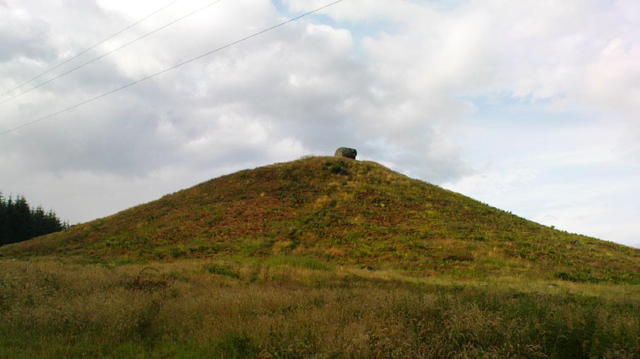
This is an impressive-looking burial mound sat, intact, on the edge of those painful golf courses that keep growing over our landscape — and you can see for miles from here! It would seem to have been placed with quite deliberate views across the landscape, reaching for countless miles into the Grampian mountains north and west across the moors of Gargunnock and Flanders towards Lomond and beyond…
Fairy Knowe, facing westSir Armstrong’s old drawing
The Fairy Knowe was first excavated in 1868 by Sir J.E. Alexander and his team, when their measurements found it to be some 80 yards in circumference, 78 feet across and 21 feet high — compared to less than 60 feet across and only 8 feet tall today. The findings were recorded in one of the early PSAS reports, and more recently a synopsis of the account was made of it by the Royal Commission (1963) lads who summarized his early findings and told:
“The excavation revealed a cist in the centre of the cairn, laid on the original surface of the ground and measuring 2ft 6in in length, 1ft 6in in breadth and 3ft in depth. Its walls were formed partly of upright slabs and partly of small stones laid horizontally, while the floor and the roof each consisted of a single slab. Within it there was a deposit, 6in in depth, of black earth, charcoal and fragments of human bone among which pieces of a skull were conspicuous. The cist was covered by a heap of large stones, 8ft in diameter and 13ft in height, and this in turn was covered with earth, in which there were charcoal, blackened stones, fragments of human and animal bones and unctuous black earth. Among these remains were found six flint arrowheads, a fragment of what was once thought to be a stone spear-head, and a piece of pine which, it was suggested, might have formed part of a spear-shaft.”
Also, near the top of the cairn in the fairy mound, Sir Alexander’s team located a prehistoric beaker vessel and fragments of what they thought were other beakers pots. Archaeologist Richard Feachem (1977) also mentioned this site in his gazetteer, simply copying the words of previous researchers.
Other prehistoric cairns can be found nearby: one in Cuparlaw Woods less a mile north; plus the Pendreich cairns on the edge of the moors just over 1 mile to the northeast.
Folklore
Obviously an abode of the faerie folk in bygone times, the tales of the place are sadly fading from local memory… Mr Alexander (1868) thought this place may have been an important site for the Pictish folk, and he may well have been correct, as the legendary hill of Dumyat (correctly known as Dun Myat) 2 miles east of here has long been regarded as an outpost of one Pictish tribe.
The main piece of folklore attached to this place relates to its very name and how it came about. In R.M. Menzies (1912) rare work on the folklore of the Ochils, he narrates the local tale that used to be spoken, which describes a procession here from the Fairy Well, just over a mile to the east. Whether this folktale relates to some long lost actual procession between the two sites, we don’t know for sure. Mr Menzies told:
“Once upon a time, when people took life more leisurely, and when the wee folk frequented the glens and hills of Scotland, there was one little fairy whose duty it was to look after certain wells renowned for their curative properties. This fairy was called Blue Jacket, and his favourite haunt was the Fairy Well on the Sheriffmuir Road, where the water was so pure and cool that nobody could pass along without taking a drink of the magic spring. A draught of this water would have such a refreshing effect that the drinker could go on his journey without feeling either thirsty or hungry. Many travellers who had refreshed themselves at the Fairy Well would bless the good little man who kept guard over its purity, and proceed upon their way dreaming of pleasant things all the day long.
“One warm day in June, a Highland drover from the Braes of Rannoch came along with a drove of Highland cattle, which he was taking to Falkirk Tryst, and feeling tired and thirsty he stopped at the Fairy Well, took a good drink of its limpid water, and sat down beside it to rest, while his cattle browsed nearby. The heat was very overpowering, and he fell into a dreamy sleep.
“As he lay enjoying his noonday siesta, Blue Jacket stepped out from among the brackens and approaching the wearied drover, asked him whence he came. The drover said:
“‘I come from the Highland hills beside the Moor of Rannoch; but I have never seen such a wee man as you before. Wha’ may you be?’
“‘Oh,’ said the fairy, ‘I am Blue Jacket, one of the wee folk!’
“‘Ay, ay man, ye have got a blue jacket, right enough; but I’ve never met ony o’ your kind before. Do ye bide here?’
“‘Sometimes; but I am the guardian of the spring from which you have just been drinking.’
“‘Weel, a’ I can say is that it is grand water; there is no’ the likes o’t frae this to Rannoch.’
“‘What’s your name?’ asked the fairy.
“‘They ca’ me Sandy Sinclair, the Piper o’ Rannoch,’ was the reply.
“‘Have you got your pipes?’ asked Blue Jacket.
“‘Aye, my mannie, here they are. Wad ye like a tune? Ye see there’s no’ a piper like me in a’ Perthshire.’
“‘Play away then,’ said Blue Jacket.
“Sandy Sinclair took up his pipes and, blowing up the bag, played a merry Highland reel. When he finished, he was greatly surprised to see above the well a crowd of little folk, like Blue Jacket, dancing to the music he had been playing. As he stopped they clapped their little hands and exclaimed, ‘Well done Sandy! You’re the piper we need.’
“Thereupon Blue Jacket blew a silver whistle, which he took from his belt, and all the wee folk formed themselves into a double row. Blue Jacket then took the Highland piper by the hand, led him to the front of the procession, and told him to play a march. Sandy felt himself unable to resist the command of the fairy, and, putting the chanter into his mouth, blew his hardest and played his best, marching at the head of the long line of little people, who tripped along, keeping time to the strains of the bagpipes. Blue Jacket walked in front of the piper, leading the way in the direction of the Fairy Knowe.
“Sandy Sinclair never marched so proudly as he did that day, and the road, though fairly long, seemed to be no distance at all; the music of the pibroch fired his blood and made him feel as if he was leading his clansmen to battle. When the Fairy Knowe was reached, the wee folk formed themselves into a circle round the little hill, and sang a song the sweetest that ever fell upon the ears of the Highlandman. Blue Jacket once more took his whistle and, blowing three times upon it, held up his hand, and immediately the side of the knoll opened. Bidding the piper to play on, Blue Jacket led the procession into the interior; and when all were inside, the fairies formed themselves into sets, and the piper playing a strathspey, they began dancing with might and main.
“One dance succeeded another, and still Sandy played on, the wee folk tripping it as merrily as ever. All thoughts of Sandy’s drove had gone quite out of his head, and all he thought of now was how best to keep the fairies dancing: he had never seen such nimble dancers, and every motion was so graceful and becoming as made him play his very best to keep the fun going. Sandy Sinclair was in Fairyland, and every other consideration was forgotten.
“Meanwhile his cattle and sheep were following their own sweet will, the only guardian left to take care of them being his collie dog. This faithful animal kept watch as well as he could, and wondered what had become of his master. Towards evening another drover came along with his cattle for the same tryst. He knew the dog at once, and began to pet the animal, saying at the same time, ‘Where’s your master, Oscar? What’s become o’ Sandy?’
“All the dog would do was to wag his bushy tail, and look up with a pleading air, as if to say, ‘I don’t know; will you not find him?’
“‘My puir wee doggie, I wonder what’s come over Sandy? It’s no like him to leave his cattle stravaiging by the roadside. Ay ay man; and at the Fairy Well too! Indeed, this looks unco bad.’
“The newcomer, who was also a Highlander, made up his mind to spend the night with his own drove and that of Sandy Sinclair, thinking that the missing man would turn up in the morning. But when the morning came there was no sign of Sandy.
“Taking Sandy’s collie and leaving his own dog in charge of the combined droves, he said, ‘Find master, Oscar!’ The wise beast sniffed around for a little and then trotted off in the direction taken the day before by Sandy Sinclair and the fairies. By and by they reached the Fairy Knowe; but there was nobody there as far as the drover could see. The dog ran round and round the knoll, barking vigorously all the time, and looking up into the face of the drover as if to say, ‘This is where he is; this is where he is.’ The drover examined every bit of the Fairy Knowe, but there was no trace of Sandy Sinclair. As the drover sat upon the top of the Fairy Knowe, wondering what he should do next, he seemed to hear the sound of distant music. Telling the faithful dog to keep quiet, he listened attentively, and by-and-by made out the sound of the pibroch; but whether it was at a long distance or not, he could not be certain. In the meantime, the dog began to scrape at the side of the mound and whimper in a plaintive manner. Noticing this, the drover put his ear to the ground and listened. There could be no mistake this time: the music of the pibroch came from the centre of the Fairy Knowe.
“‘Bless my soul!’ exclaimed Sandy’s friend. ‘He’s been enticed by the fairies to pipe at their dances. We’ll ne’er see Sandy Sinclair again.’
“It was as true as he said. The Piper of Rannoch never returned to the friends he knew, and the lads and lasses had to get another piper to play their dance music when they wished to spend a happy evening by the shore of the loch. Long, long afterwards, the passers-by often heard the sound of pipe music, muffled and far away, coming from the Fairy Knowe; but the hidden piper was never seen. When long absent friends returned to Rannoch and enquired about Sandy Sinclair, they were told that he had gone to be piper to the wee folk and had never come home again.”
There is some confusion as to whether this mound of earth, barely four feet high but some 50 feet across, is actually prehistoric. But the folklore has that common ring to it, found at olde sites from Cornwall to northern Scotland, speaking of old tombs and ancient ways…
Folklore
In modern times apparently, earthlights have been reported flitting about around this earthen ridge, but the old mound has older, more familiar tales spoken of it. In Rev. Williams’ (1901) article on the folklore of Stirlingshire, he made a considerable detour to tell of some old faerie-lore he’d heard when he was younger, from the prehistoric tomb on the northern side of Elphillock, a few miles south of Kildrummy. In talking with some of the local people about old beliefs, one local man told him:
“The fairies of my native parish made their abode in a round knoll, known as Elfhillock. My friend, James Smith, now no more, was ploughman at Cairncoullie, in the neighbourhood. Passing the hillock one evening, he heard the sound of music and dancing. James drew near to the spot and saw the revels. He waited and enjoyed himself for a short space and then returned to Cairncoullie and went to bed. He found to his amazement that he had been away a year and a day! Every field on the farm and the new ploughmen bore evidence to the fact; and Jamie believed till his dying day that he was a year older than he was aware of, and all because he had given heed to matters he had no business with.”
Not only were the little people said to live within this small tomb, but the hillock must also be cared for and never damaged. Rev. Williams also narrated that the grandfather of the same local man told him that he had,
“pulled some heather from this elf hillock. He was compelled by the women to replace it, otherwise he would have to encounter the wrath of the fairies.”
Thankfully the old hillock is still here, just off the roadside. Not far from here are a number of other prehistoric sites with faerie and ghost-lore and mythological place-names, long since fallen into memories old…soon to be lost perhaps…
References:
Williams, George, “Local Superstitions,” in Transactions of the Stirling Natural History and Archaeological Society, 1901.
Settlement (destroyed): OS Grid Reference – NS 086 635
Archaeology & History
Pottery remnants
Somewhere beneath the modern cemetery and adjacent factory close to St. Mary’s church on the southern outskirts of Rothesay, right by the roadside, was once an important prehistoric settlement. All remains of the site however, have long since been destroyed. An axe that was found here was held in the local museum. There are several scattered accounts of the place, one of which was written by J.G. Scott (1968), who reported that,
“between 1914 and 1929, a series of finds — pottery, a polished stone axehead, a saddle quern, hearths and remains of shallow trenches — was made at Townhead…at a now disused gravel pit. Excavations in 1929 revealed several slots in the original gravel surface, which suggested the remains of sleeper beams for wooden buildings. All the pottery recovered was neolithic… Amongst it were sherds of two vessels of Rinyo-Clacton ware. Most of the rest of the pottery…showed well-developed rims, often thickened and bevelled externally and sometimes everted. This pottery recalls the Abingdon style of southern Britain, and has been termed Rothesay ware by the writer.
“Sherd from one of these Rothesay vessels were associated with charcoal, possibly from a hearth, with hazel-nut shells and small fragments of bone.”
Scott told that radiocarbon analysis dated the finds at around 2120 BC. A couple of hundred yards away are the enclosed remains of St. Mary’s Holy Well, whose waters may well have been of magickal repute all those centuries ago…
References:
Scott, J.G., “A Radiocarbon Date for a West Scottish Neolithic Settlement,” in Antiquity journal, volume 42, no.168, December 1968.
Go thru Killin and, just past the Bridge of Lochay hotel, take the tiny road on your left. Go down here for 3 miles till you pass the gorgeous Stag Cottage (with its superb cup-and-rings in the field across the road) for another 300 yards, past Duncroisk Farmhouse set back on your right, then over the small river bridge. Just over the bridge there’s a gate on your left. Go thru this and up the track until you get to another large gate. Go thru this, then walk immediately left where you’ll notice a large-ish boulder sat on the nearby slope ahead of you in a part of some very old walling. That’s your target!
Archaeology & History
The title of this carving is slightly misleading, as the stone concerned is about 50 yards west of the fast-running burn. But it’s pretty easy to locate. When we visited the stone recently, as the photos show, the rock was all-but covered in a beautiful patchwork of lichen and moss, inhibiting the visibility of a quite impressive carving. But we have to let this be.
The carving’s on the big rock by tree, in the wallingLine of walling clearly evident
The carved rock plays an important part in a line of ancient prehistoric walling, which looks Iron Age in nature, but without an excavation we’ll not know for certain. The walling is quite extensive and is an integral part of the extended derelict village of Tirai, with its standing stones and other monuments. This begs the questions: was the carving executed before or after the walling was created? Was the stone carved in traditional neolithic/Bronze Age periods and later accommodated into the walling?
Even in the grey overcast light of a winter’s day when we first visited here, many cups were clearly visible on the rock’s surface, but they were difficult to contextualize in terms of artificial and natural aspects of the stone. Later visits here at the end of Spring enabled a much better assessment — though capturing the surrounding “rings” proved difficult. The carving is shown highlighted on Ron Morris’ (1981) map of the cluster of Duncroisk carvings, and described as a:
“domed schist boulder, 2½m by 2m, 1¼m high (8ft x 6ft x 4ft). On its top, mostly where sloping…are: 2, and possibly 3, cups-and-one-ring, much weathered and only visible when wet in very low sun, probably un-gapped, and at least 32 cups. Diameters up to 17cm (6½in) and depths up to 1cm.”
But this is only half the story. Despite what Mr Morris and the more recent Canmore records tell us about this carving, there are in fact at least 52 cups on the surface of the rock, at least two of which have definite ring-like forms around them. The largest of the cups has linear features around a large section of it, but to ascribe these elements as ‘rings’ is also stretching it a bit — as one of the photos here clearly shows. The ‘ring’ consists more of two separate straight lines with curvaceous ends: more like a right-angled carving with a swerve than any traditional ring. It’s a quite unique feature by the look of things.
Faint cup-and-ring and cups…and…Cups & right-angled lines
The majority of the carved cups and lines occur on the eastern side of the boulder, with only a few singular cups almost fading their way onto its western sloping sides. And of primary visual interest are the swirl of cups that surround two small cups at the ESE corner of the rock. These give the impression of running into another swirl of cups that hedge their ways around the edges of the largest cup-and-right-angled-lines, until bending back up and along the southern-side of the stone. This possibly deliberate sequence of cups then continues in roughly the same form back upwards to near the top-middle of the rock and onto a complete cup-and-ring. Just above the top of this runs a short pecked line just detached from the cup-and-ring, but of obvious mythic relevance in the story which this carving once told.
RWB Morris’ sketch of the design
It’s an absolutely fascinating carving which gives the distinct impression of narrating a myth of journeying, by either a person, tribes or ancestral beings. Of course we’ll probably never know for sure what story it once told; but its tale may have been known by the people of the once proud village of Tirai which was only destroyed a couple of centuries ago, along whose fallen walls this great stone still rests within…
And finally, for those students exploring the potential relationship that cup-and-rings may have with water: please note that in wet conditions, a spring of water emerges right underneath the very base of this large rock.
…to be continued…
References:
Morris, Ronald W.B., The Prehistoric Rock Art of Southern Scotland, BAR 86: Oxford 1981.
Royal Commission on the Ancient & Historical Monuments of Scotland, Archaeological Sites and Monuments of Stirling District, Central Region, Society of Antiquaries of Scotland 1979.
Go west outta Stirling along the Cambusbarron road and along the Main Street until it meets up with Touch Road. Go along here for a couple of miles, past Touch House and Seton Lodge until you reach the small West Lodge cottage where the road bends. From here go left up the footpath onto the fields immediately south. About 200 yards on, where the field rises to the crest of the hill, you’ll note the small mound right next to the track. If you start walking back down the slope again, you’ve walked past it!
Archaeology & History
Possible peristalith ruins
There’s not too much to see here as the site is very much overgrown, but it’s in a lovely spot looking across to the Ochil Hills eastwards. And if records are anything to go by, it’s a pretty isolated prehistoric site with no companions close by — though a prehistoric food vessel was located a short distance to the east on the Touch House Estate grounds many years ago. It’s quite a large, roughly circular mound. Several long stones are visible, laid down, on top of its western side, which archaeologists believe may represent the remains of an encircling stone ring that was built to define the cairn. As far as I’m aware the site remains unexcavated and its condition is still much as it was when the Scottish Royal Commission fellas visited the place in 1956. Following their brief excursion, they later (1963) wrote the following notes:
“It is circular on plan, measures 65ft in diameter at the base and stands to a height of 2ft 6in. Now covered with fine pasture, it appears to have been formerly under cultivation, and the flat top measures 50ft in diameter. The mound may represent a denuded cairn and three earthfast boulders which protrude through the turf near the W edge may be the remains of a peristalith. The largest stone has a bench-mark carved on it (125.9).”
A later brief report by the Royal Commission (1979) commented that the site was a cairn measuring 20m across and 0.7m high.
References:
Royal Commission on the Ancient & Historical Monuments Scotland, Stirling – volume 1, HMSO: Edinburgh 1963.
Royal Commission on the Ancient & Historical Monuments of Scotland, Archaeological Sites and Monuments of Stirling District, Central Region, Society of Antiquaries of Scotland 1979.
To be found on the wooded hill about 160 yards north of Wallstale Farm, on the Polmaise Road on the western side of the M9, a mile or so south of Cambusbarron, below the hugely impressive Murrayshall Quarries. Walk up the steep slope into the woodland and when you reach the level you’ll find the stonework remains. It’s on the edge of the slope in the trees.
Archaeology & History
This old fortified walled structure is best seen in the winter months when all the vegetation has fallen back to Earth. If you come here in the summer, the woods are nice but the monument can’t be seen as clearly. Found at the top of the slope above the roadside, it was described in the Stirlingshire Royal Commission (1963) account as follows:
Ground-plan of Wallstale Dun (after RCAHMS 1963)Wallstale Dun, up there somewhere!
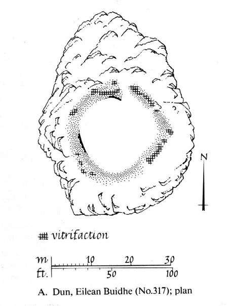
“It is almost circular in plan…measuring about 45ft in diameter within a ruined stone wall some 11ft in thickness. Except on the ESE side, where the entrance was probably situated, the wall can be traced continuously by patches of rubble core, and round the east half outer facing-stones are visible up to a maximum height of four courses. In contrast, the inner face is only exposed for a short distance on the ENE. The interior of the dun is featureless. On the NW side the dun is protected by a rock-cut ditch of substantial proportions which traverses the spur; it measures 26ft in width at the top and the scarp is 5ft 6in in depth.”
References:
Royal Commission on the Ancient & Historical Monuments Scotland, Stirling – volume 1, HMSO: Edinburgh 1963.