Cuparlaw Wood, Bridge of Allan, Stirlingshire

Cairn:  OS Grid Reference – NS 8046 9916

Also Known as:

  1. Canmore ID 47128
  2. Pendreich

Getting Here

The rise of Cuparlaw cairn

From Bridge of Allan go down the main A9 road towards the University, but turn left up the Sheriffmuir road, 100 yards up turning right to keep you on track up the steep narrow dark lane, turning left at the next split in the road. Follow this for a mile or two all the way to the very end where the tell-tale signs of the unwelcoming english incomers of ‘Private’ now adorns the Pendreich farm buildings.  There’s a dirt-track veering uphill diagonally right from here. Go up here and as it bends slightly left, look into the open copse of trees to the highest point here less than 100 yards to you right. That’s it!

Archaeology & History

Lisa gives an idea of scale

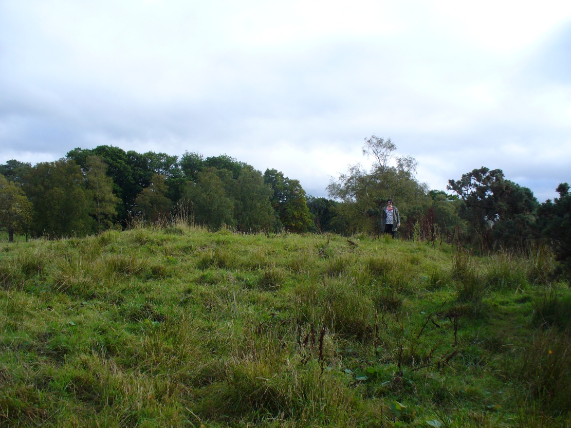
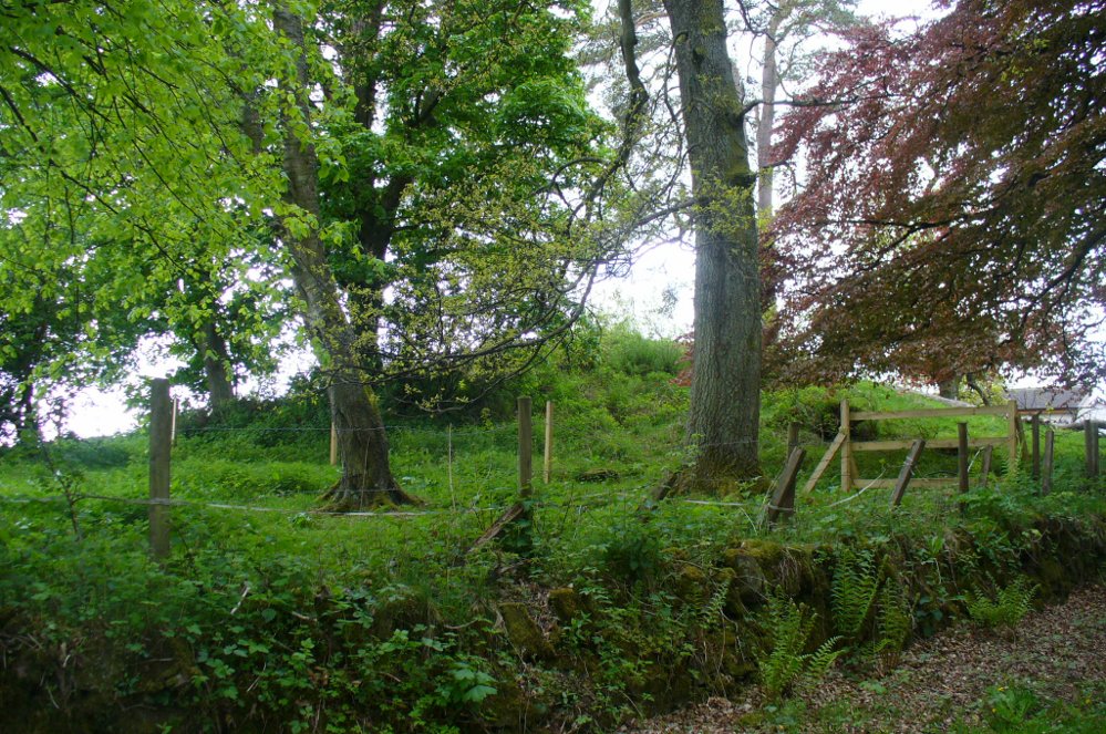
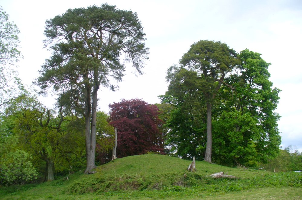
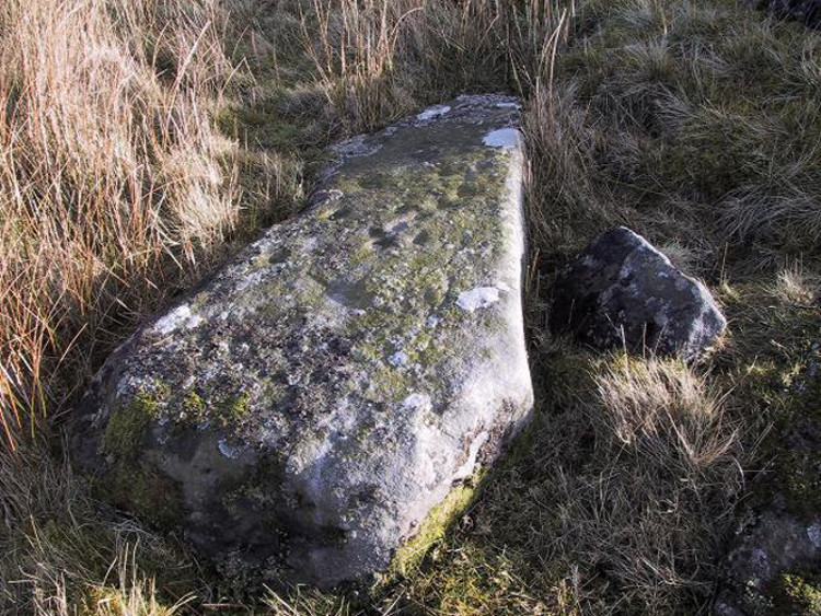
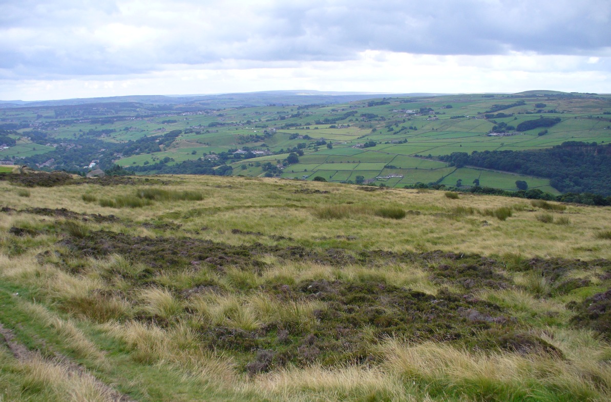
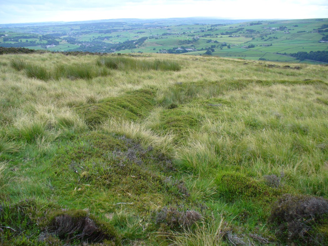
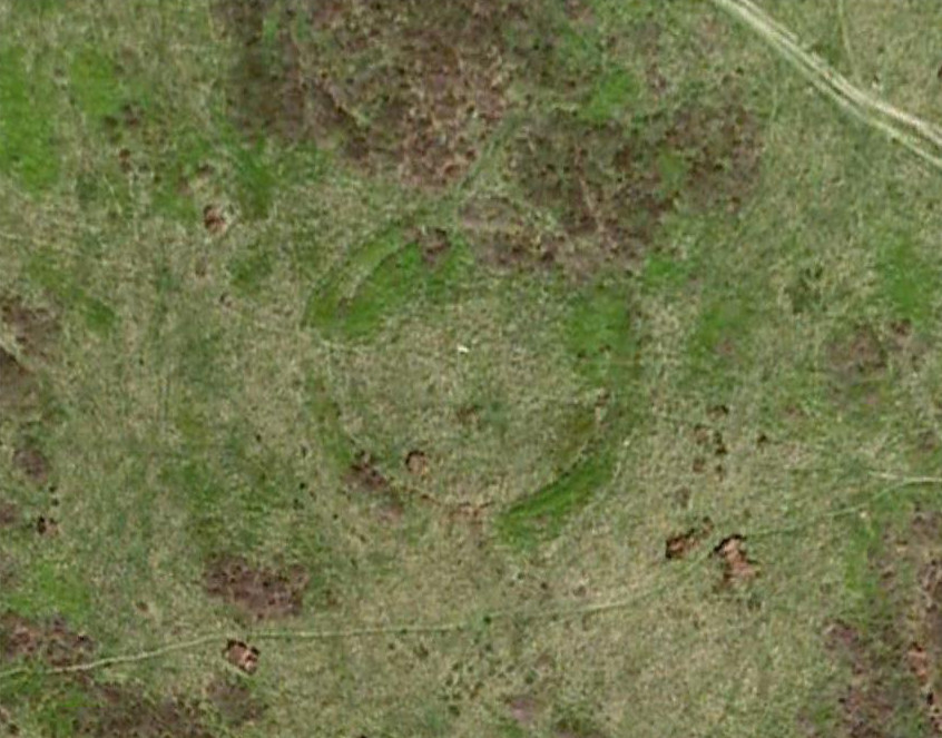
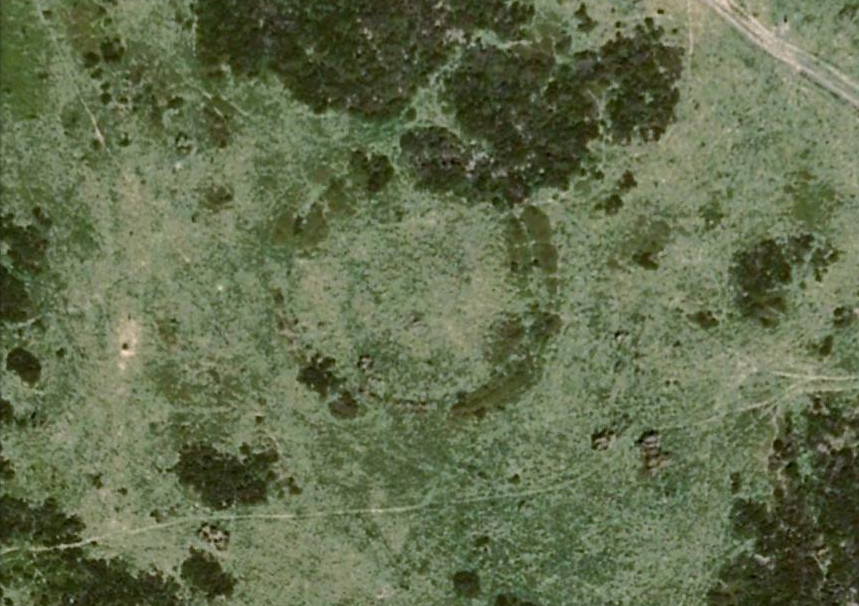
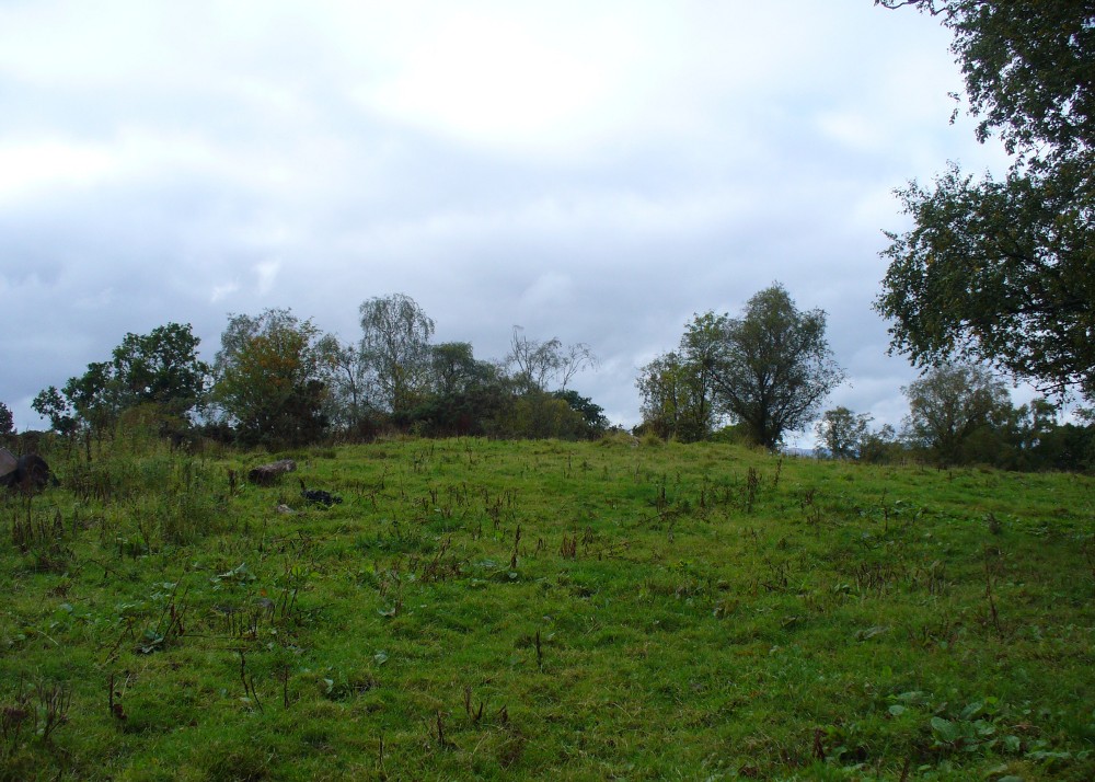
The remains of this prehistoric tomb sits right on the very crown of the hill round the back of Pendreich, covered on its western edges by old gorse bushes.  Its eye speaks with the nearby sites of the Fairy Knowe to the south, the fallen standing stone of Pendreich Muir to the northeast, the associated cairns to the east, and the Pictish fortress of Dumyat behind them.  When I came up here for the first time last week with local archaeologist Lisa Samson, we found that the land upon which the cairn now lives is fertile with a variety of edible (Boletus, Amanita, etc) and sacred mushrooms (Panaeolina, Psilocybes, etc).  And, despite being told by locals and the archaeology record as a place where very little can be seen, I have to beg to differ.

Fallen stone at the cairn edge

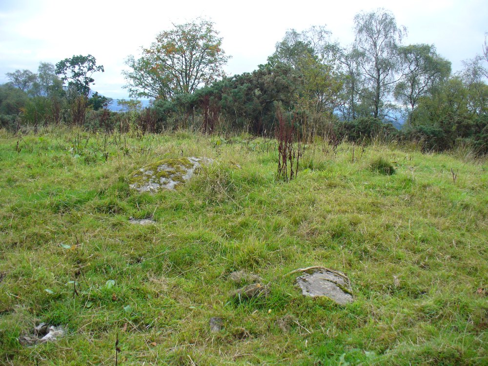
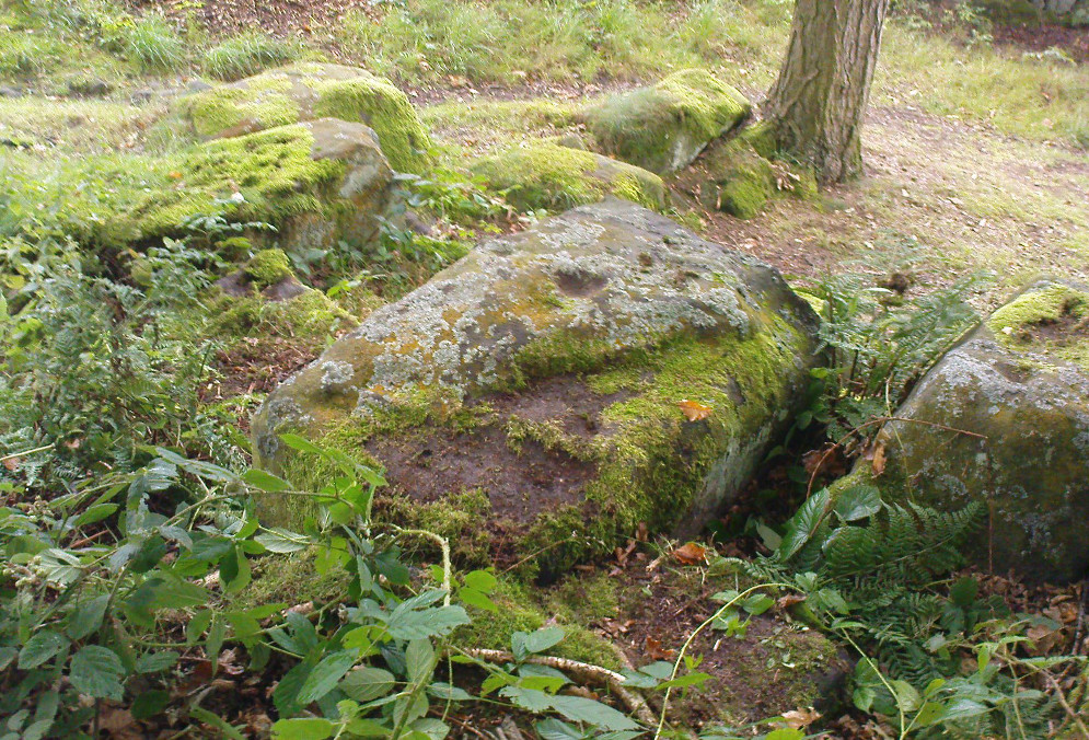
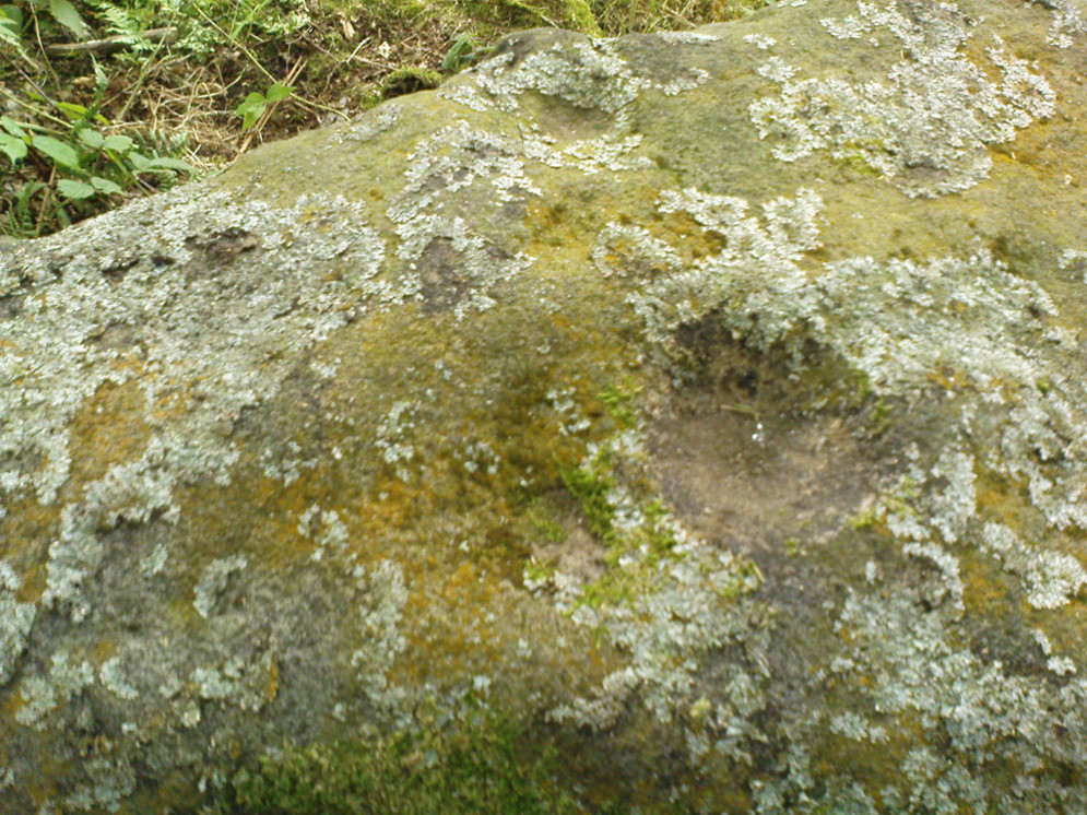
The crowning cairn is of course much overgrown and has been dug into in earlier years, but just beneath the grassy surface you can feel and see much of the stone that constitutes this buried site.  The cairn itself rises a couple of feet beneath the grass and is clearly visible as you walk towards it.  At its edges there seems to be the fallen remains of a surrounding ring of stones.  Inside of this ring we can see and feel the overgrown rocky mass and open cists sleeping quietly, awaiting a more modern analysis to tell us of its ancient past.  When the site was visited by the Royal Commission lads in the 1960s, they went on to tell us the following about the place:

“This cairn is situated on the summit of a low knoll within a felled wood, 170 yards ENE of Pendreich farmhouse at a height of 600ft OD. It consists of a low, grass-covered mound which measures 40ft in diameter and stands to a maximum height of 1ft 6in.  The surface is disfigured by pits caused in 1926 when the cairn was opened and three cists were uncovered. Two of these contained no relics; in the third there were fragments of bones and a broken beaker, some sherds of which are preserved in the Smith Institute, Stirling.”

Although we find the scattered remains of old farm equipment lying round the edge of this tomb, it’s still a good site to visit and, I’d say, worthy of further archaeological attention.

References:

  1. Royal Commission on the Ancient & Historical Monuments Scotland, Stirling – 2 volumes, HMSO: Edinburgh 1963.
  2. Royal Commission on the Ancient & Historical Monuments of Scotland, Archaeological Sites and Monuments of Stirling District, Central Region, Society of Antiquaries of Scotland 1979.
  3. Watson, Angus, The Ochils – Placenames, History, Tradition, Perth & Kinross District Libraries 1995.

© Paul Bennett, The Northern Antiquarian


Rudston ‘D’ Cursus, East Yorkshire

Cursus: OS Grid Reference – TA 099 717 to TA 096 679

Archaeology & History

Plan of Rudston D Cursus & associated monuments (after I.M. Stead 1976)

To the north of Rudston village and its giant standing stone, running roughly parallel with the divinatory waters of the Gypsey Race river and passing a mass of prehistoric remains en route, we find one the biggest prehistoric cursus monuments in the British Isles: the Rudston D cursus.  More than twice as long as any of the three other cursus monuments nearby, its northern end or ‘terminal’ is flattened in nature (others are rounded) and is due east of the village of Burton Fleming starting at the intriguingly-named Maidens Grave field, just as the land begins to rise at TA 099 717.  From here it begins its almost southern trajectory and runs almost dead straight for several hundred yards until edging, ever so slightly in direction, to a slightly more secure southern alignment.  Past the site of the Rudston henge, the cursus broadens out slightly and, as it reaches the farmlands of Littlethorpe, edges slightly further to a more decisive direct southern route.  The cursus then maintains a dead straight course for another mile, heading straight for, and stopping just short of the Rudston monolith in its modern churchyard.  A short distance before we reach its southern end, archaeologists found that a section of the Cursus C monument cut right across it.  Altogether, the Rudston D Cursus is more than 4km (2.3 miles) long!  At its narrowest width, this monument is a mere 160 feet (50m) across, and at its widest is 280 feet (90m).  A giant by anyone’s standard!

Along the entire length of this continuous ditch and inner bank there were just 3 small cuttings on the western side and three on the east, but two of the eastern openings were quite large.  Some of these openings were affected by natural elements and others by modern agriculture. Today, much of this gigantic ritual monument (as the archaeologists call them) is not visible at ground level.

In visiting this area, make yourself aware of the other monuments in this class: the Rudston A cursus and Rudston B cursus, southeast and southwest of here respectively. A full multidisciplinary analysis of the antiquities in this region is long overdue.  To our ancestors, the mythic terrain and emergent monuments hereby related to each other symbiotically, as both primary aspects (natural) and epiphenomena (man-made) of terra mater: a phenomenon long known to comparative religious students and anthropologists exploring the animistic natural relationship of landscape, tribal groups and monuments.

References:

  1. Burl, Aubrey, Rites of the Gods, J.M. Dent: London 1981.
  2. Harding, Jan, ‘Pathways to New Realms: Cursus Monuments and Symbolic Territories,’ in Barclay & Harding, Pathways and Ceremonies: The Cursus Monuments of Britain and Ireland, Oxbow: Oxford 1999.
  3. Loveday, Roy, Inscribed Across the Landscape: The Cursus Enigma, Tempus: Stroud 2006.
  4. Pennick, Nigel & Devereux, Paul, Lines on the Landscape, Hale: London 1989.
  5. Stead, I.M., ‘La Tene Burials between Burton Fleming and Rudston,’ in Antiquaries Journal, volume LVI Part II, 1976.

Links:

  1. ADS: Archaeology of Rudston D – Brief archaeological notes on the longest of the four known cursuses in the region.

© Paul Bennett, The Northern Antiquarian


Rudston ‘C’ Cursus, East Yorkshire

Cursus:  OS Grid Reference – TA 0914 6809 – TA 1014 6803

Archaeology & History

D.P. Dymond's 1966 sketch of Rudston 'C' cursus
D.P. Dymond’s 1966 sketch of Rudston ‘C’ cursus

Of the four giant linear cursus monuments that were laid out around the landscape that holds Britain’s largest standing stone—the Rudston monolith—this one, the Rudston ‘C’ cursus, is the one we know the least about. This is mainly due to it receiving the minimum of archaeological attention, which can be forgiven round here as there is so much material to explore!  Traces of the cursus at ground level are also quite negligible.  Thankfully however, like the other cursus monuments nearby, some of the site can be made out on GoogleEarth.  

The alignment of this cursus runs east-to-west, cutting across the Cursus D monument and then running above the northern course of Nature’s curious river known as the Gypsey Race, which local folklore ascribes as being used in animistic divinatory practices.  Cursus C was first noticed in aerial photographs taken by Prof. J.K. St. Joseph in 1961 and first described by D.P. Dymond (1966) a few years later, who told us:

“Immediately north of the village (Rudston), two parallel ditches, about 60 yards apart, are visible as crop-marks running east-west for 1000 yards… As they are too far apart to be considered as road-ditches and are similar to the linear ditches (of Rudston A and B), they are best interpreted as a fragment of a third cursus, C. The western end fades out near the York road as it climbs onto high ground, while at the east the ditches disappear into Bridlington Gate Plantation.  Like Cursus A, this also crossed the Gypsey Race. Approximately 1½ miles northwest of the last westward point of these ditches is the presumed site of two lost long barrows, joined together at one end. There may, therefore, have been an original connection between Cursus C and these long barrows.”

First faint photo of Cursus C

His final remark is quite a good one! And since Dymond’s initial description (according to the PastScape lads anyhow), Cursus C has been found to be much longer than the initial 1000 yards, growing another 500 yards at least!  The final point or ‘terminal’ on the eastern end still remains hidden, as it was intruded upon by the later Argham Dyke and the trees.  The start or western terminal also remains unfound, so we don’t know for sure the exact length of this giant neolithic ‘line on the landscape’, as Pennick and Devereux (1989) call them.

References:

  1. Dymond, D.P., “Ritual Monuments at Rudston, E. Yorkshire, England,” in Proceedings of the Prehistoric Society, volume 32, 1966.
  2. Harding, Jan, ‘Pathways to New Realms: Cursus Monuments and Symbolic Territories,’ in Barclay & Harding, Pathways and Ceremonies: The Cursus Monuments of Britain and Ireland, Oxbow: Oxford 1999.
  3. Loveday, Roy, Inscribed Across the Landscape: The Cursus Enigma, Tempus: Stroud 2006.
  4. Manby, T.G., “The Neolithic in Eastern Yorkshire,” in Archaeology in Eastern Yorkshire, University of Sheffield 1988.
  5. Pennick, Nigel & Devereux, Paul, Lines on the Landscape, Hale: London 1989.
  6. Stead, I.M., ‘La Tene Burials between Burton Fleming and Rudston,’ in Antiquaries Journal, volume LVI Part II, 1976.

© Paul Bennett, The Northern Antiquarian


Tulloch, Doune, Perthshire

Tumulus:  OS Grid Reference – NN 71782 01194

Also Known as:

  1. Canmore ID 24771

Getting Here

Tulloch Knowe from the road

Head out of Doune village and take the A84 to Stirling. Just a few hundred yards along, over the old river bridge, take the first right along the B8032 (don’t head into Deanston).  Barely 500 yards along on the left-hand side, between the farmhouse and a small group of houses, note the large tree-lined mound in the middle, just over the fence.  It’s quite a big fella – you can’t really miss it.

Archaeology & History

The mound and its trees

This is an almost archetypal fairy mound of a monument—and a mighty one at that!—living quietly in the field with its olde trees for company.  Despite its size, it has brought little by way of archaeological attention and has, to my knowledge, never been excavated.  Probably a Bronze Age burial mound, the tomb stands more than 15 feet high and is some 30 yards across east-west and 35 yards north-south.  The Royal Commission (1979) listing of the mound says simply that “this large cairn measures 34m in diameter and up to 5m high.”

References:

  1. Royal Commission on the Ancient & Historical Monuments of Scotland, Archaeological Sites and Monuments of Stirling District, Central Region, Society of Antiquaries of Scotland 1979.

© Paul Bennett, The Northern Antiquarian


Deil’s Cradle, Dollar, Clackmannanshire

Legendary Rock:  OS Grid Reference – NS 9686 9906

Also Known as:

  1. Devil’s Cradle

  2. Devil’s Rock

Folklore

The Deil’s Cradle stone

A few hundred yards below the legendary old Wizard’s Stone, we find there’s a real cluster of witch-lore in the small area to the north of Dollar which, to be honest, is deserving of wider analysis from competent researchers and historians.  Not only is there the legendary Lochy Launds of the Black Goddess hereby, but we also find this curious rock, described by one ‘J.C.’  in an early edition of the Scottish Journal (1848), which told:

“On the confines of the parish of Dollar, not far from Hillfoot, the seat of John McArthur Moir, Esq., lies a glen, called Burngrens, watered by a small stream and planted with numerous large trees.  A great number of these, however, have fallen, during the last few years, beneath the unsparing axe; but strong, healthy saplings are rising rapidly to supply their place.

“In this glen there is a large stone, of peculiar formation, in every way like a cradle. It is currently believed by the superstitious in the vicinity, that the stone, every Hallowe’en night, is raised from its place, and suspended in the air by some unseen agency, while “Old Sandy,” snugly seated upon it, is swung backwards and forwards by his adherents, the witches, until daylight warns them to decamp.

The following rather curious affair is told in connection with the “Cradle:”

“One Hallowe’en night a young man, who had partaken somewhat freely of the intoxicating cup, boasted before a few of his companions that he would, unaccompanied, visit the stone. Providing himself with a bottle, to keep his courage up, he accordingly set out.  The distance not being great, he soon reached his destination.  After a lusty pull at the bottle, he sat down upon the “Cradle,” boldly determined to dispute the right of possession, should his Satanic majesty appear to claim his seat. Every rustle of a leaf, as the wind moaned through the glen, seemed to our hero as announcing the approach of the enemy, and occasioned another application to fortifying “bauld John Barleycorn.” Overpowered at last by repeated potations, our hero, dreaming of “Auld Nick,” and his cohort of “rigwuddie hags,” fell sound asleep upon the stone.

“His companions, who had followed him, now came forward. With much shouting and noise, they laid hold of him, one by the head and another by the feet, and carrying him, half-awake, to the burn, dipped him repeatedly, accompanying each immersion with terrific yells. The poor fellow, thinking a whole legion of devils were about him, was almost frightened to death, and roared for mercy so piteously that his tormentors thought proper to desist. No sooner had our hero gained his feet than he rushed up the glen, and ran home, resolving never to drink more, or attempt such a feat again. For many a long day he was ignorant who his tormentors really were.

“We stood upon the stone about a week ago. Ivy and moss are slowly mantling over it, a proof that it is some considerable time since the Devil has been rocked on it.”

Historian Angus Watson (1995) told the place to be “south of Wizard’s Stone…near Kelty Burn,” and also that,

“it is said to be where witches rock Satan to sleep on Halloween.”

Above here, the tree-topped rounded hill to the north was one of the meeting places of the witches of Fife, Perthshire and Clackmannan.  Something of sincere pre-christian ritual importance was undoubtedly enacted in this region, as we also find sites of the Maiden a short distance due north.  Does anyone know more about this fascinating sounding place?

References:

  1. ‘J.C.,’ “The Deil’s Cradle”, in The Scottish Journal, February 5, T.G. Stevenson: Edinburgh 1848.
  2. Simpkins, John Ewart, County Folklore – volume VII: Examples of Printed Folk-Lore Concerning Fife, with some Notes on Clackmannan and Kinross-Shires, Folk-Lore Society: London 1914.
  3. Watson, Angus, The Ochils: Placenames, History, Tradition, PKDC: Perth 1995.

© Paul Bennett, The Northern Antiquarian


Raven Stones (559), Thruscross, North Yorkshire

Cup-Marked Stone:  OS Grid Reference – SE 11835 58006

Getting Here

Heavily cup-marked Raven Stone (after QDanT)

Take the A59 road from Harrogate and Skipton and at the very top of the moors near the Gill Head Enclosures, take the small Kex Ghyll road up past the disused quarry works north for a mile or so. At the junction go left, past the Outdoor Centre, thru West End up Whit Moor Road, then go left down to Brays Cross Farm and over the ford. Note the clump of trees on the moors to the west and take the path there. Once here, a large outcrop of rocks will be seen about 150 yards on the moor to the west. That’s the spot! Otherwise, follow the directions of the legendary wandering Teddy!

Archaeology & History

This dramatic looking outcrop of rocks rising out of the ground a half-mile due west of Bray farmhouse has long been known as the rocks of the ravens: oracular birds of ill-omen in all peasant traditions, yet carrier birds of shamans in their Underworld ventures, from accounts in Russia and Scandinavia, through the Scottish highlands and into Yorkshire’s northern hills, as folklore records show.  Whether such mythical figures used the Raven Stones here for such magick, we have no firm accounts; but the existence of the many cup-markings on this particular rock (and others in the outcrop) show that animistic traditions of some form or another occurred here in prehistoric times at the very least.

Looking across the stone
Looking down on the cups (after QDanT)

Records of this place as an archaeological spot are scant indeed.  It is passed with barely a mention by those Victorian antiquarian giants, Bogg, Grainge and Speight.  The rock art students Boughey & Vickerman (2003) give the wrong grid reference here, but added the site to their inventory, saying only that it is “long, low, exposed bedrock. 22-25 cups; some very weathered and smooth.”  A series of channels runs down the slope of the stone, but there are probably natural.  However, a cup-and-line does occur on the eastern side of the carving.

References:

  1. Armstrong, Edward A., The Folklore of Birds, Collins: London 1958.
  2. Boughey, Keith & Vickerman, E.A., Prehistoric Rock Art of the West Riding, WYAS: Wakefield 2003.

Links:  

  1. Teddy Tour Teas

Acknowledgements:  Huge thanks for QDanT & Teddy for the fine photos of the Raven Stone carving!

© Paul Bennett, The Northern Antiquarian 


High Green (407), Skyreholme, North Yorkshire

Cup-Marked Stone:  OS Grid Reference – SE 07508 62599

Getting Here

Skyreholme Cup-marked rock 407

Take the B6265 east out of Grassington, thru Hebden, for another 2 miles till you pass the tiny road down to Skyreholme on the right.  Another few hundred yards on, past Nussey Farm and Dry Gill house, park up and look for the track going south into the moors. Go down the track called Black Hill Road for a few hundred yards till y’ reach the gate on the right. A track bends downhill to the psilocybin-rich pastures of Nussey Green. Several hundred yards on, to the right-hand side of the track, we find this and its companions. Look around!

Archaeology & History

Quick sketch of design

This medium-sized, recumbent standing-stone-shaped boulder has perhaps fifteen cup-markings on it.  It’s a plain carving with others of a similar ilk in the area.  First described by Stuart Feather in 1970 as one of “two cup-marked rocks” he found when ambling around; in Boughey & Vickerman’s (2003) survey they give it the wrong grid reference, though describe it correctly as a “long flat rock of irregular outline (with) fourteen to sixteen cups.” A cluster of other carvings are nearby, though some have been destroyed through mining operations.

References:

  1. Boughey, Keith & Vickerman, E.A., Prehistoric Rock Art of the West Riding, WYAS: Wakefield 2003.
  2. Feather, Stuart, “Appletreewick, W.R.,” in Yorkshire Archaeological Register, 1969, Yorkshire Archaeological Journal, part 168, 1970.

© Paul Bennett, The Northern Antiquarian


Foster Clough Delph, Midgley Moor, West Yorkshire

Enclosure:  OS Grid Reference – SE 0234 2708

Getting Here

Near the centre of this photo, the large 'ring' can be seen
Near the centre of this photo, the large ‘ring’ can be seen

From Midgley go west along Height Road and take the track up on your right, at the tree-lined bend, up Foster Clough and onto the moor as if you’re gonna go to Churn Milk Joan.  As you reach the footpath at the quarries up the hill, go to the top of them and take the small footpath where the land levels-out and head east towards the walling.  Just a hundred yards or so before the walling, keep your eyes peeled, cos you’re damn close!

Archaeology & History

Best seen when looking down from the slopes above, this is a fascinating site that is lucky to still be here!  For just a few yards to the west are extensive quarry works that could easily have destroyed the place had they continued.  But thankfully we have here a near-perfect circular enclosure: measuring roughly 27 yards in diameter east-west, and about 25 yards north-south, the circumference around the outer-edge is approximately 82 yards (75m).  It has all the appearance of an overgrown henge monument, with an outer bank and inner ditch, then a central flat arena—and it may indeed be such a monument—but until we have a decent excavation of the site, we’ll stick to calling it a simple enclosure—which it is!

Eastern arc of bank & ditch

The outer bank is very much overgrown, but as it runs round and defines this site, it measures 1-2 feet high most of the way, except on the westernmost spot, where it seems there may be an ‘entrance’.  The inner ditch is only a couple of feet deep, again all the way round the monument.  The internal level of the site is pretty flat, like most henges; but there seems to be a small central ‘cairn’ of some sort in the middle.  Again, this is very overgrown by our traditional moorland vegetation.

Aerial image, 2009
Aerial image, 2009
Aerial image, 2006
Aerial image, 2006

So what is it exactly?  An enclosure, a settlement, or even (as local research student John Billingsley once suggested) a henge?  Tis difficult to say for sure without further and more detailed archaeological excavation.  My estimate is that the site is either Bronze- or Iron-Age in nature, and is definitely an ‘enclosure’ of some sort.  We have located other prehistoric sites on the slopes just above here to the north, like the Crow Hill cairn circle and accompanying tumulus, remains of a neolithic settlement and a number of other small single cairns that are only visible when the heather has been burnt back.  If you intend to explore any of the ancient sites sites on this moor, check this one out!

References:

  1. Bennett, Paul, The Old Stones of Elmet, Capall Bann: Milverton 2001.

© Paul Bennett, The Northern Antiquarian


Craigton, Cleish, Kinross, Kinross-shire

Tumulus (destroyed):  OS Grid Reference – NT 090 993

Also Known as:

  1. Canmore ID 49622

Archaeology & History

A prehistoric tomb of unknown size was opened and robbed of its contents shortly before its total destruction sometime in the middle of the 19th century.  There were no remains seen of the site when Ordnance Survey came here in 1854, and it is unlikely to have been confused with the large Thorn Knowe tumulus a half-mile to the northwest.  A certain Prof. Duns (1876) described in an early article that the only remaining artefact from this tomb was an elaborate early Bronze Age spear-head, found in 1855, which he described at some length in the PSAS journal of the time.  Neither he nor any other colleagues told us anything further about the tumulus.

References:

  1. Duns, J., “Notes on some articles exhibited to the meeting: A bronze spear-head, a small unlooped socketed celt, a sword-shaped stone from Shetland, and a tripod bronze pot,” in Proceedings of the Society of Antiquaries, Scotland, volume 11, 1876.
  2. Royal Commission on the Ancient & Historical Monuments, Scotland, Inventory of Monuments and Constructions in the Counties of Fife, Kinross and Clackmannan, HMSO: Edinburgh 1933.

© Paul Bennett, The Northern Antiquarian


Panorama Woods (230), Ilkley, West Yorkshire

Cup-Marked Stone:  OS Grid Reference – SE 10377 47027

Also Known as:

  1. Carving no.63 (Hedges)
Panorama Woods stone 230

Getting Here

From Ilkley, take the directions up to the Panorama Woods 232 carving.  From here you can step from this rock over the stride onto the cup-marked carving 231b, and then go onto the next adjoining rock surface a little lower down. From here, you’ll see another mossy rock surface in front of you by a yard or two. That’s the one!

Archaeology & History

The three cup-markings

Here’s another simple cup-marked stone, probably only for the purists amongst you—although in visiting here please take into account the primary carving’s association with other more prominent designs that once existed only a few yards to the west where the houses now stand.  There is also the cluster of other carvings right next to this stone.  A prehistoric settlement was also in evidence adjacent to this carving which was destroyed in the latter half of the 19th century.

Close-up of the cups
John Hedges 1986 drawing

Described simply in John Hedge’s (1986) fine survey as a small “piece of rock with three clear cups and one depression.”  Boughey & Vickerman’s (2003) survey added nothing more and merely copied the same words.  For some reason or other (mebbe cos I’m simple!) I really like this otherwise innocuous design and its close simplistic relatives. It’s probably due to the trees amidst which the stones are found and the bright mosses on the rocks, giving the site a slightly extra sense of more living genius loci than others on the top of these moors, where the winds move the subtle spirits with greater ease.

19th century addition

If you step down and look at the vertical side of this stone, you’ll notice a more modern stylistic carving etched onto the surface.  Not as deep as the prehistoric cups on the top, it seems probable that a local artist by the name of Ambrose Collins carved this on here (and other similar designs on other rocks nearby) in the late 19th century.

References:

  1. Bennett, Paul, The Panorama Stones, Ilkley, TNA: Yorkshire 2012.
  2. Boughey, Keith & Vickerman, E.A., Prehistoric Rock Art of the West Riding, WYAS: Wakefield 2003.
  3. Hedges, John (ed.), The Carved Rocks on Rombalds Moor, WYMCC: Wakefield 1986.

© Paul Bennett, The Northern Antiquarian