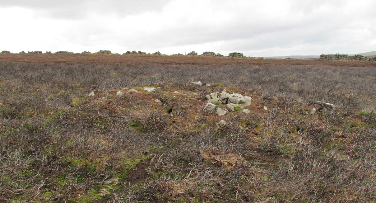
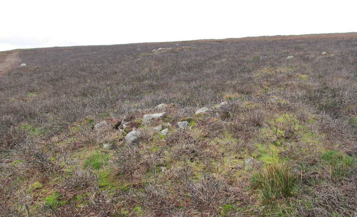
Takes some finding this one! We parked up by the entrance to Ballochraggan on the A81 between Aberfoyle and Port of Mentieth. Walk up the track, then up the burnside past the house. Keep to its right-side and head uphill towards the very top of the forestry edge, staying in the grasslands. As you near the very top NE corner of the grassland boscage (NOT into the forest), about 100 yards before it, zigzag about through the gorse and keep your eyes peeled. It’s there!
Archaeology & History
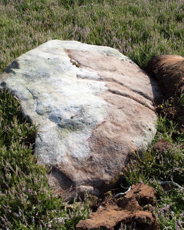
This is a small, flat, smooth piece of stone with a simple carving clearly visible, in a region replete with highly impressive multiple-ringed petroglyphs. Very little has been said of this design and even the Canmore lads tell us only that the carving “includes one cup and ring marking and two cups within an oval ring.” And that’s that! However, other faint lines are evident on the surface of the stone, with the single cup-and-ring appearing to have another partial second-ring encircling a section of it. Outlying this are very shallow worn lines that seem to bear the hallmarks of human interference, but they were difficult to see with any certainty and our camera didn’t pick up additional elements with any real clarity. What seemed to be another cup-and-half-ring (not visible in the photos) was just beneath the edge of the grass where the rock fell back into the Earth.
Ballochraggan12, under cloud
The most catching element of the design is the very obvious ‘eye’ symbol peering up at us as we look down. Whether this symbol was deliberate or not, we can be sure that the old archaeologist O.G.S. Crawford (1957) would have loved it and added it to his old dreams of eye goddesses!
Other carvings nearby will blow your head off! The recently discovered Mask Stone, right next to this Ballochraggan 12 carving, being just a taster of the things to come.
Crawford, O.G.S., The Eye Goddess, Phoenix House: London 1957.
Naddair, Kaledon, et al, ‘Menteith (Port of Menteith Parish): Rock Ccarvings’, in Discovery & Excavation Scotland, 19, 1992.
Royal Commission on the Ancient and Historical Monuments of Scotland, The archaeological sites and monuments of Stirling District, Central Region, HMSO: Edinburgh 1979.
Acknowledgements: Huge appreciation to Paul Hornby for use of his photos. Cheers mate!
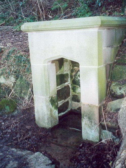
The genuine St. Bertram’s well is not easy to find and I recommend using the OS map carefully. It is reached by taking the footpath that leads off at the left passing the cross out of the village. Follow this until the end of the dry stone walling on the right and then divert from the footpath to the right where the well can be seen. The second well is easily found in the field between the church and the Hall.
Archaeology and History
Bertram is an interesting local saint, dating from around the 7th-8th century. Briefly, he is said to be of Royal Irish lineage but after making a princess pregnant, escaped to England where he sheltered in the woods around Ilam. The story is told by Alexander, a monk, in the 13th century who notes:
“They were in hiding in a dense forest when lo ! the time of her childbirth came upon them suddenly ; born of pain and river of sorrow! A pitiful child bed indeed! While Bertellinus went out to get the necessary help of a midwife the woman and her child breathed their last amid the fangs of wolves. Bertellinus on his return imagined that this calamity had befallen because of his own sin, and spent three days in mourning rites”.
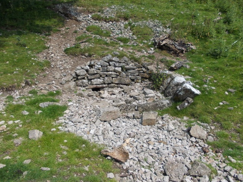
As a result he became a hermit living in a cave in the valley near Ilam. Despite the earliest mention being Plot, the local geography is suggestive that this is the site of an early Christian hermitage site, although no mention of a well is noted in his legends it can be noted. Currently, the well is surrounded on four sides by varying low stone walling, about two feet or so at its highest (although it appears to have been built up and down over the time I have visited the well). The spring flows from a small, less than a foot square chamber, enclosed in stone and set into the bank through a channel in the rubble flow and out along the path towards it.
Since the 1990s, on the first Saturday in August, the Orthodox Church makes a pilgrimage to the site and blesses the well. Interestingly, literature available from the National Trust shop fails to mention this well, but notes a more substantial second St Bertram’s Well close by the church and surrounded by a rectangular stone wall with steps down, the water arises here at greater speed and flows into the nearby River Manifold. Visually it is more impressive and more accessible but whether there is any long tradition of this second well is unclear, but authors such as the Thompsons’s (2004) The Water of Life: Springs and Wells of Mainland Britain and Bord (2008) Holy Wells of Britain appear to have fostered its reputation.
Incidentally, the church boasts the remains of St Bertram’s shrine with foramina and the church yard has two Saxon crosses, making a visit to the village a must for those interested in early medieval history.
Folklore
“St Bertram’s Ash… grows over a spring which bears the name of the same Saint… The common people superstitiously believe, that tis very dangerous to break a bough from it: so great a care has St Bertram of his Ash to this very day. And yet they have not so much as a Legend amongst them, either of this Saint’s miracles, or what he was; onely that he was Founder of their Church”
Such notes Plot (1686) The Natural History of Stafford-Shire, the earliest reference of this fascinating site. By Browne (1888) in his An Account of the Three Ancient Cross Shafts, the Font, and St Bertram’s Shrine, at Ilam, noted that the ash had gone, but the water was still being used. He states that:
“The late Mrs Watts Russell always had her drinking water from it.”
Extracted and amended from the forthcoming Holy wells and healing springs of Staffordshire by R. B. Parish (2008)
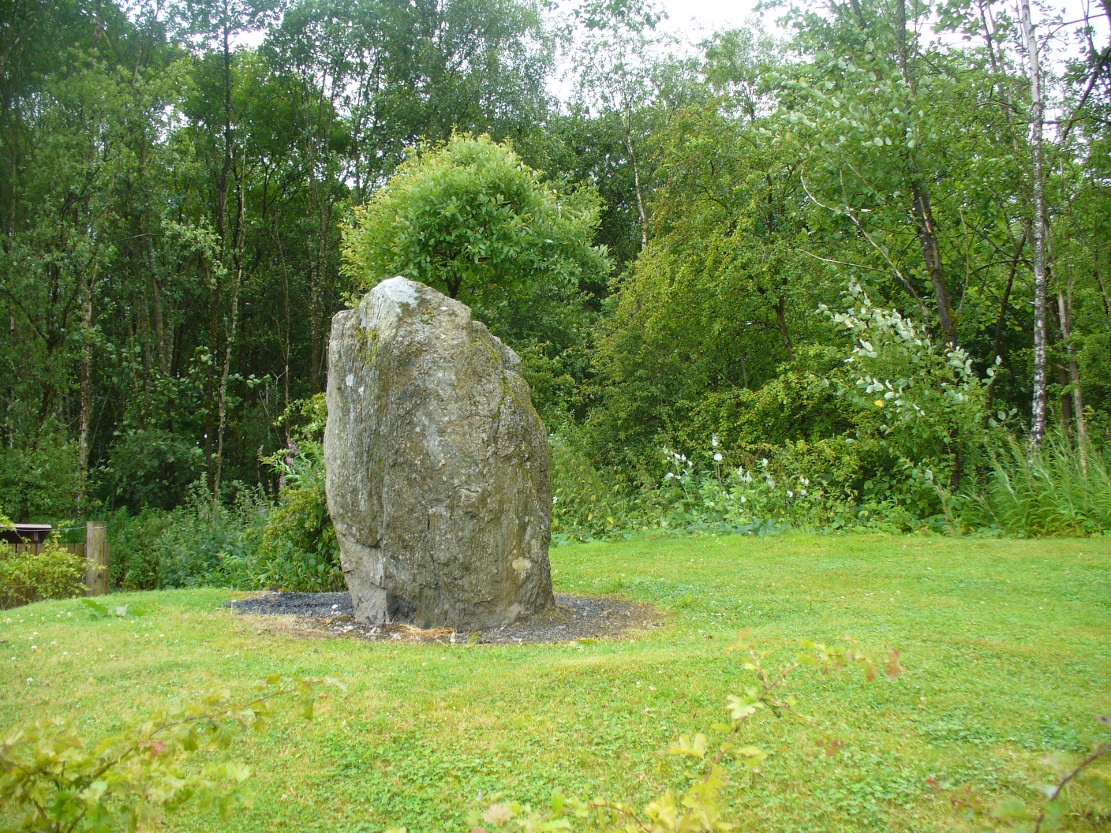
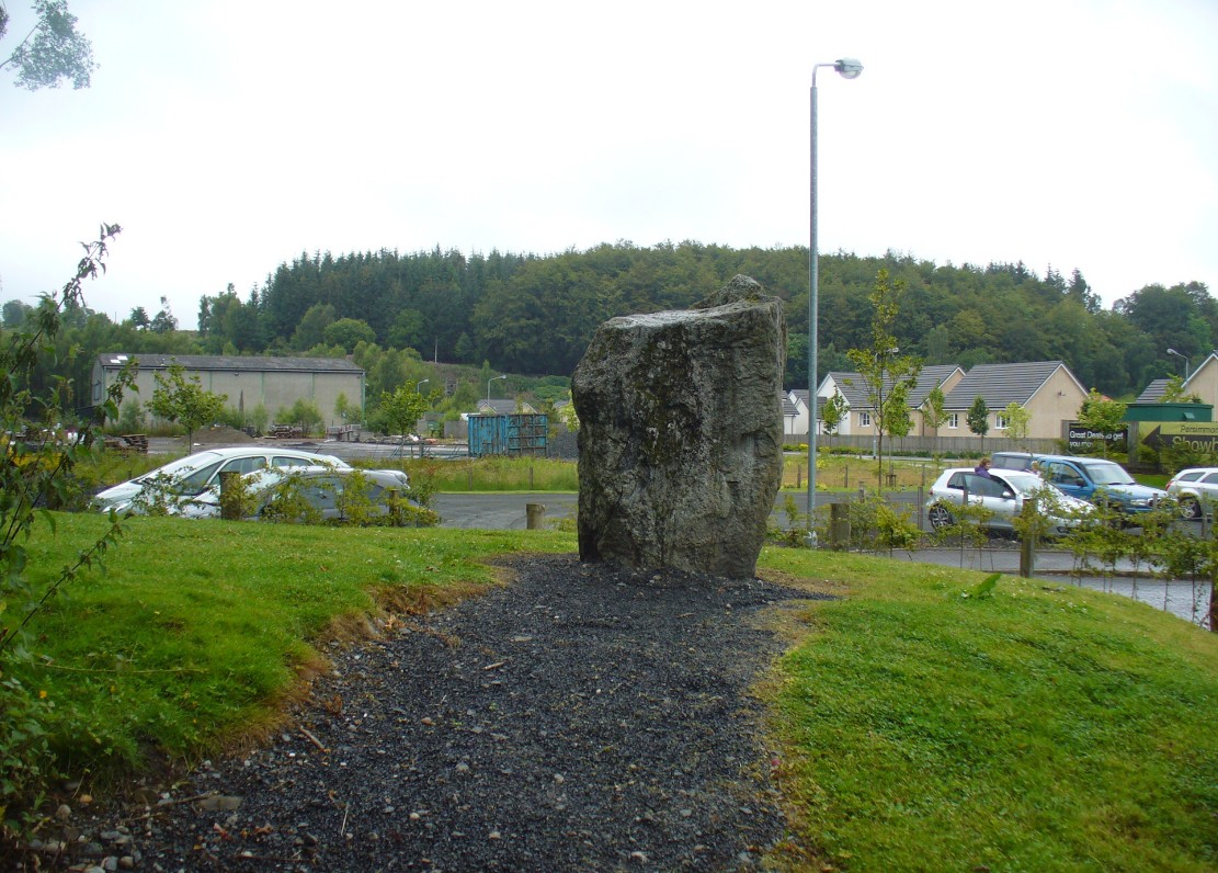
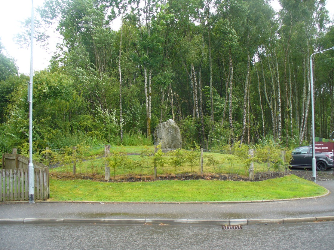
From the old cross in the middle of the village, walk along the A820 Balkerach Street main road (NOT down George Street) until you reach Station Wynd on your right. Walk up here for 100 yards towards the new housing estate (don’t buy these places – they’re dreadful quality beneath the veneers) and there, on a small grassy rise on the left just before the car park, stands our stone!
Archaeology & History
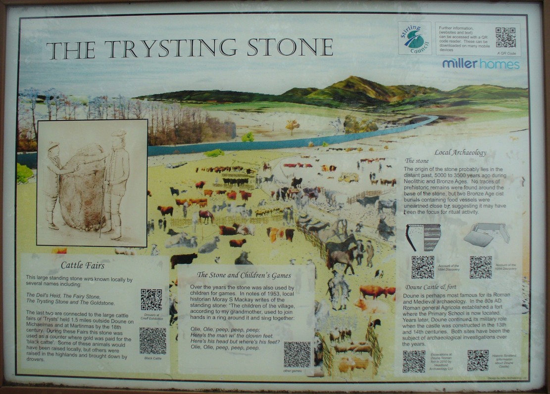
This little-known monolith on the northern edge of little Doune village, was recently moved a short distance from its original position thanks to another one of those sad Barratt housing estates being built here; but at least it has received protection with the surrounding fence and notice board telling its brief history and folklore (better than being destroyed I s’ppose).
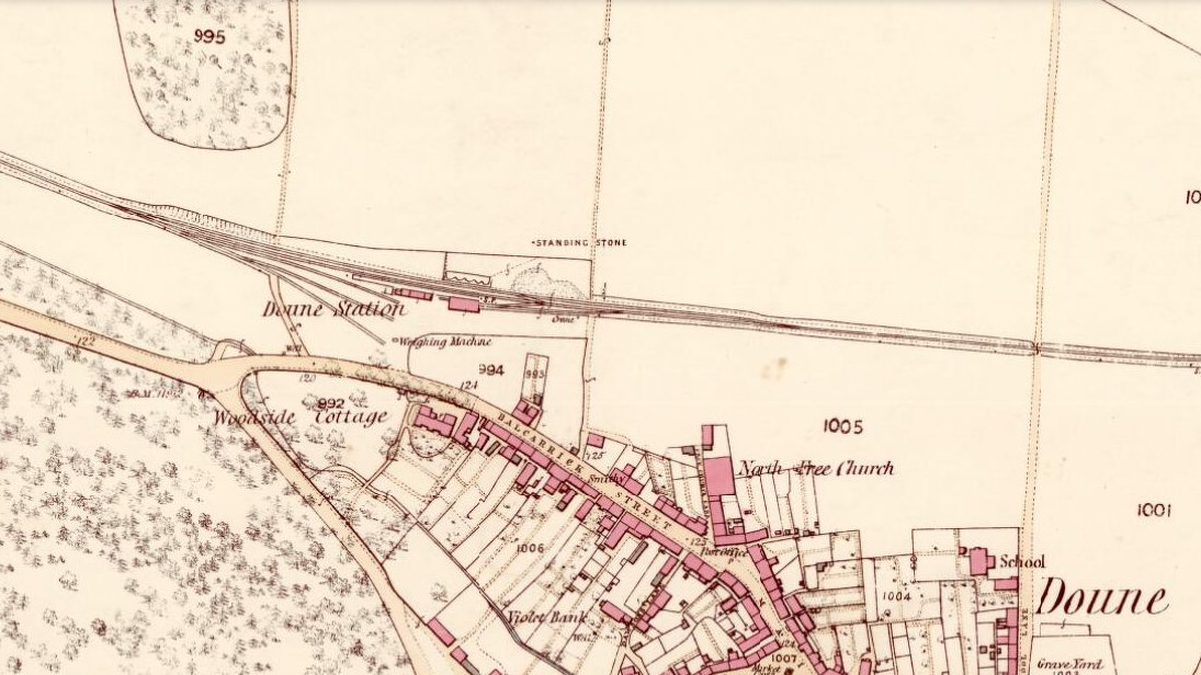
Stone on 1866 OS map
Standing less than five feet tall, local lore tells that it has been moved around close to this spot several times in the last couple of centuries. Although not mentioned in Hutchinson’s (1893) essay on local megaliths, the stone was highlighted on the 1866 Ordnance Survey of Doune, where the non-antiquated lettering showed how it was thought to be Roman in origin, not prehistoric.
Folklore
Trysting Stane, looking NE
The name of the stone comes from it being used as a place where deeds were sworn, with the stone as witness to the words proclaimed by both parties (implying a living presence, or animistic formula of great age). This activity was continued in the local ‘trysts’ or cattle fairs held a mile away, where buyers swore the sale of cattle at this stone—again with the stone being ‘witness’ to the spoken deals. It was also used as a counter where gold was exchanged for cattle bought and sold during the Michaelmas and Martinmas Fairs. Sue Harvey (2006) told that this standing stone,
“was called the Devil’s Head and was used during past Doune fairs to count gold on when cattle were being bought and sold.”
In local newspaper accounts from the 1950s, local historian Moray S. Mackay (1984) told how the children of the village used to gather round the stone, holding hands, and sing,
Olie Olie, peep, peep, peep,
Here’s the man with the cloven feet,
Here’s his head, but where’s his feet?
Olie Olie, peep, peep, peep.
Notice board telling its tale…Looking at the stone on its rise
This implies the stone once possessed a myth relating to a petrified ancestral deity of animistic (pre-christian) origin, but as yet we have found no additional information allowing us a confirmation of this probability. A correlate of this theme—i.e., of the stone being the head of a deity—is found in West Yorkshire (amongst many other places), where one of the little known Cuckoo Stones was once known to be a local giant until a hero-figure appeared and cut off his head, leaving only his body which was then turned to stone. Mircea Eliade (1958; 1963) cites examples of animistic religious rites and events explaining this early petrification formula via creation myths, etc. (we find very clear evidences of animistic worldviews and practices still prevailing in the mountains just a few miles north and west, still enacted by local people)
Folklore also alleged that the stone was Roman in nature, but neither archaeology nor the architectural form of the stone implies this. Roman stones were cut and dressed—unlike the traditional looking Bronze Age, rough, uncut fella standing here.
References:
Eliade, Mircea, Patterns in Comparative Religion, Sheed & Ward: London 1958.
Eliade, Mircea, Myth and Reality, Harper & Row: San Francisco 1963.
Harvey, Sue, Doune and Deanston, Kilmadock Development Centre 2006.
Hutchinson, A.F., “The Standing Stones of Stirling District,” in The Stirling Antiquary, volume 1, 1893.
From Marske village, take the road west and uphill to the villages of Fremington and Reeth. At the top of the hill where the fields open up, several hundred yards along on your right, past the field with the track, a footpath sign points you up onto the moor. Go up the field till you hit the wall that goes right to the top of the moor. Where the four walls meet, go straight across and then walk northwards along the line of walling for 2-300 yards, keeping your eyes peeled for a solitary stone on its own, 100 yards west. You’ll find it.
Archaeology & History
Deep carved line features
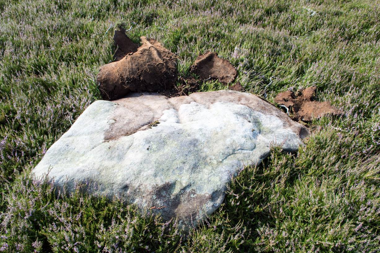
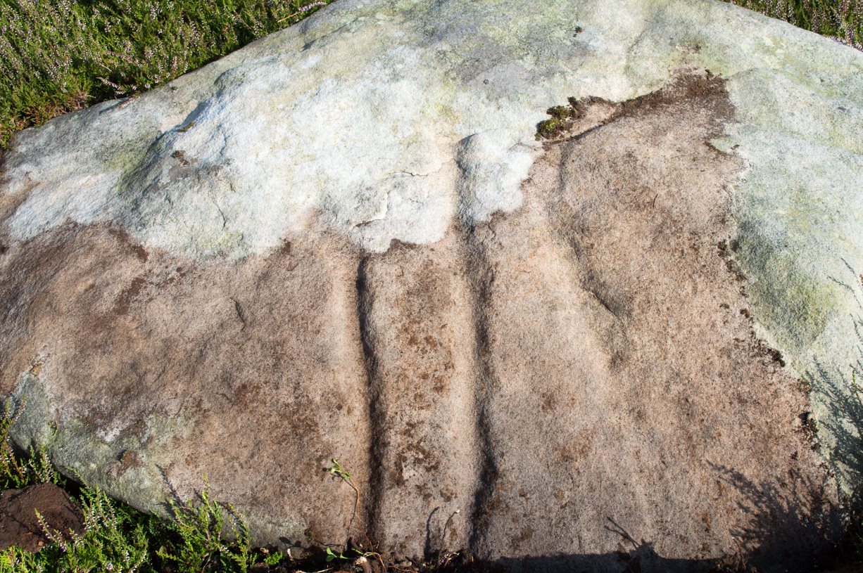
A pretty basic petroglyph located within a massive arena of prehistoric sites dating from the neolithic and continuing through the Bronze Age period and beyond. Found a few hundred yards northwest of the once giant cairn of Cock Howe, this design is characterized mainly by the two large deep channels deliberately cut into the stone that run from the middle of the upper surface down to ground level. One of them emerges from a single cup-marking, at an angle; whilst the other comes from the edge of a natural crack in the rock. The channels are wide and flattened. Other faint lines can be discerned too, which may have originally been carved. We need to explore this design in different lighting conditions to see if there are additional features here.
Looking east-ish
An archetypal cup-marking can seen on the vertical edge of the stone and three other faint ones scatter the top. Another small ‘cup’ is along the southern vertical face of the rock which, when we found it, thought was natural; but a photograph of the stone by James Elkington seems to show a ring surrounding much of the cup-mark. We need to go back and take another look at the place.
A number of other carvings described in Paul and Barbara Brown’s (2008) survey can be found in the region.
References:
Brown, Paul & Barbara, Prehistoric Rock Art in the Northern Dales, Tempus: Stroud 2008.
Go up the B6160 road, heading for Kilnsey Crag. A few hundred yards past here, take the road to Arncliffe and, several hundred yards along, keep yer eyes peeled for the (usually) decent craggy dry stream bed on your left (west). Follow this upstream till you hit the large cave, continuing uphill above the crags, following the steep walling upwards to the next set of crags. Above these, another long straight line of walling continues in the same direction you’ve been walking. Follow this along until it meets up with another large line of walling, heading NE. Walk along here till this wall changes direction NE, but here you need to walk across the grasses westwards, past the large cave for another 100 yards. You’ll find it!
Archaeology & History
This is a simple but well-preserved circular monument, probably constructed in the Iron Age, just 100 yards past the incredible Douky Bottom cave (in which various prehistoric remains have been found). No excavations appear to have been made here, yet the near-perfect ring is in very good condition indeed. The monument consists of thousands of small stones – taken from the huge scree immediately behind the structure – whose uppermost visible mass overlays a much older and larger pile of stones, all of roughly the same size.
Douky Bottom ring, looking NE
The ring is less than 10 yards across and gives the impression of it being a large hut circle—which it may or may not be. Without an excavation we cannot know its function with any certainty. Other, much larger prehistoric enclosures and settlements are close by, mainly to the northeast; and you have the truly bizarre rock piles on the ghostly horizon crags, whose histories are quiet indeed…. For any antiquarians amongst you who’d like a good day out, give this region a try! It’s a truly intriguing arena with much much more hiding away than any of the archaeology records can tell you about.
Acknowledgements: Many many thanks to James Elkington for guiding us to the sites in this region.
Take the minor high road between the hamlets of Marske and Fremington (up Hard Stiles from Marske side), turning up Stelling Road at the crossroads, and ⅔-mile (1.1km) along, turn right up Helwith Road. ¾-mile (1.2km) along, on the right, walk thru the gate onto the moor following the walling. Nearly 400 yards on you meet a junction of walling: walk past this until you reach the next line of walling and then follow it northeast for just over 500 yards. Once there, look for the mounds in the heather immediately south, less than 50 yards away.
Archaeology & History
This is one of the “isolated cairns of fair size” mentioned in passing by Tim Laurie (1985) in his survey of the massive settlement and field systems scattering this gorgeous moorland arena. It is one amongst a scatter of several in and around the eastern height of Cock Howe hill on the south side of Skelton Moor. The area has sadly been scarred by an excess of old lime mines—many of which are visible close by—damaging with some severity the excess of prehistoric remains on these moors, none of which have yet been excavated in any detail. This cairn included.
More cairns to the rear
Even though much of the heather here had been burnt back when James Elkington and I visited the place recently, the pile of stones was still very embedded into the peat. The moorland rabbits had dislodged some of the stones, highlighting the mass of rocks much better. It stands nearly a metre high and is roughly 7 yards by 8 yards in diameter from edge to edge, structurally similar to the many Bronze Age cairns scattering Rombalds Moor, Askwith Moor and other Yorkshire clusters. A second cairn of similar size and stature exists some 30 yards to the southeast (visible on one of the photos).
For anyone who might visit this site, the most impressive features hereby are the huge settlement remains scattering the moors just north of the wall a few yards away. When the heather has been burnt back, a veritable prehistoric city unfolds before your eyes, with extensive lengths of walling, hut circles and what can only be described as huge halls, in which tribal meetings probably occurred – much of it in superb condition! Well worth visiting.
References:
Laurie, T.C., “Early Land Division and Settlement in Swaledale,” in Upland Settlement in Britain: the Second Millennium B.C. and After, ed. Don Spratt and Colin Burgess, BAR British Series 143, 1985.
Martlew, R.D., Prehistory in the Yorkshire Dales, YDLRT: York 2011.
Cup-Marked Stone (missing): OS Grid Reference – SE 16940 87301
Archaeology & History
A prehistoric carving that is missing and possibly destroyed since being rediscovered in 2001 by Barbara Brown (2008) and subsequently described in her book on North Yorkshire petroglyphs. She told it to be in “Thornton Steward field hedge bottom” and was a simple glyph, being a
“rectangular slab (with) single cup-mark located in hedge bottom part of old walling.”
When she revisited the site with her husband in 2006, the old hedge and wall had been removed, with “new hedging in place.” The carved stone may be buried within a pile of clearance stones adjacent to the hedgerow, but it has yet to be relocated. If anyone finds it, please let us know! It was one of several cup-marked stones that exist in the wider neighbourhood.
References:
Brown, Paul & Barbara, Prehistoric Rock Art in the Northern Dales, Tempus: Stroud 2008.
Along the B880 glen road that cuts Arran roughly in half, known as The String, could once be seen a stone circle that one early writer told was quite impressive. Today It seems that all trace of the circle has gone. The earliest mention of it seems to be in James Headrick’s (1807) work, where, in discussing what he thought were “Druidical” remains of obelisks and cairns in the area,
“A more entire circle of this sort is seen on the rising ground at the mouth of Glen Shirreg, towards the west.”
But he tells us no more. Shortly afterwards—according to reverend Allan McNaughton in the New Statistical Account of the 1830s—it was destroyed. He said that,
“about twenty-four years ago, a very complete circle at the mouth of Glensheraig was removed, in clearing the field in which it stood for the operations of the plough.”
Despite this short remark, eighty years later we had J.A. Balfour (1910) inform us that,
“On the right of the String Road going west in Glen Sherraig is a small ruined monument of which three small standing stones alone remain, so disposed as to suggest that the original structure was a double circle.”
However, Balfour’s site may be an altogether different one to that mentioned by Headrick and McNaughton.
Aubrey Burl (2000) lists it in his major work; but its ancient life was, once again, brought to end in these recent years by those of less sound minds than our ancestors.
References:
Balfour, J.A., The Book of Arran – volume 1, Arran Society of Glasgow 1910.
Burl, Aubrey, The Stone Circles of Britain, Ireland and Brittany, Yale University Press 2000.
Headrick, James, View of the Mineralogy, Agriculture, Manufactures and Fisheries of the Islland of Arran, with Notices of Antiquities, D. Willison: Edinburgh 1807.
The stone circle of Fingal’s Cauldron Seat, Machrie Moor, Arran (photo by Aisha Domleo)
By whichever way you come (be it from Brodick on the east, Lochranza to the north) ask any local the way to Machrie and they’ll point you the road onto the west side of the island, roughly halfway. You’re after the hamlets of Blackwaterfoot or Auchagallon. From either of these spots, take the road to Tormore. From here, the dirt-track east close to the Machrie Water is where you need to walk. About a mile along this well-defined track you’ll see the large barn ahead of you. Hereabouts you’ll begin to notice some very tall standing stones. Keep walking on the track, and the first double-ring of smaller stones to your right is the place yer after!
Archaeology & History
Approaching the ring (photo by Aisha Domleo)
This is one well-preserved stone circle in a superb setting with other large megalithic rings all close by—at least 12 of them!—set upon the flat open moorlands on the west side of Arran, with views in all directions sending the enquiring nose tasting for more wherever the eyes gaze…. It has been written about by many many writers over the last few centuries—which aint surprising! But it was in recent times that the place was said by Aubrey Burl (1981) to be “holy ground,” because although there are many prehistoric settlement sites and other remains scattered across this landscape,
“it is noticeable that the dozens of huts whose ruins litter the moor were built well away to the west, none of them near these powerful and lonely stones.”
1832 sketch of Fingal’s Cauldron by James Skene
It’s a fair point.
Fingal’s Cauldron was first defined in an archaeological context by James Bryce in 1863, who named it the ‘Machrie Moor 5’ stone circle (MM5)—and it was he and several others who dug into the ring, to see what it might be hiding!
“Excavating at the centre we found a small cist at less than a foot in depth, and lying about north-east. It was covered by a small lid, and the dimensions were 2 feet 2 inches in length, 10½ inches in depth, and 11 inches in width. Inside there were several bone fragments and black earth. A flint implement was found in the stony soil above, and three other flint fragments, but nothing of this kind in the cist itself. This was of much ruder structure than any we had seen before (Ed. – i.e., in the other Machrie circles); it was cut out of the sold sandstone rock, but with little care or exactness; the sides however, were nearly perpendicular. The difficulty of excavating without iron tools may account for the smaller size and ruder form of this cist. No other cist was found, nor remains of any kind, though a trial was made at several points around the centre. A deep opening was also made on both sides of the upright stone, but nothing was met with worthy of being recorded.”
A.E. Roy’s 1967 site-plan
Described thereafter a number of times by different historians and antiquarians, Fingal’s Cauldron (and its associates) was then recounted in the Machrie Moor survey of Mr Balfour (1910) in his magnum opus on the Isle of Arran. Although he gave more attention to the other stone circles in this multiple megalithic complex, he did thankfully make note that,
“upon higher ground free of peat, and immediately to the south of the farmhouse, is the celebrated double circle of granite blocks known popularly as Fingal’s Cauldron Seat. The inner ring consists of eight and the outer of fourteen blocks. The diameter of the inner circle is 36 feet and of the outer 57 feet. The largest stones are in the inner series; they are more or less round-topped blocks, about 4 feet high. One of the stones of the outer ring has a ledge which is perforated by a round hole, with the edges worn smooth.
“In the centre of the inner ring, only a foot from the surface, a ruined cist was laid bare. It had been previously disturbed, and was represented by two stones only, lying parallel to one another. There was no capstone, and no relics were discovered.”
More recently in the 1960s, another survey of Fingal’s Cauldron was undertaken by A.E. Roy and other archaeologists. They found nothing new of any value, but gave us the ground-plan we see here (sadly it seems that Alexander Thom didn’t bless this site with his theodolite and survey). Aubrey Burl re-examined the site again during his own survey in the 1980s.
An elemental called Lara sat seated on one of the uprights! (photo by Aisha Domleo)Small section of inner & outer rings (photo by Aisha Domleo)
There are other curious features to this ring that aint generally talked about amongst the archaeo-fraternity, out of fear of sounding inspiring perhaps… In the 1980s, a chap called Paul Devereux and a number of physicists organized volunteers from across the country to monitor electromagnetic anomalies at many megalithic rings, in order to explore the validity, or otherwise, of the idea that there were ‘energies’ at stone circles. The study was called The Dragon Project and went on for many years. The Machrie Moor complex was one of the places where examinations of electromagnetic fields were undertaken—Fingal’s Cauldron being one of them. Devereux (1990) tells us a small part of the story:
“In May 1983 Dave and Lynn Patrick monitored several of the Machrie Moor circles, including MM5, with a geiger counter for the Gaia Programme. They also took background control readings and monitored a non-megalithic ‘dummy site’ for comparisons.
“Five of the circles…gave average site readings 2 to 13 per cent higher than background, but MM5 gave a site average of 33 per cent above background. A non-megalithic ‘dummy site’ was 5 per cent above background. The Patricks had taken 20 readings within MM5—one hour of monitoring time—plotted onto the ground-plan. There was no mystery about why the site gave a higher average than anywhere else, and a third higher than background—the stones are radioactive granite, and there are 23 of them. But one stone, the tallest, and the most westerly of the upright stones in the inner ring, is particularly energetic, giving readings 16 per cent above the next most radioactive stone in the double ring, and more than that for the other 58 stones monitored in the Patrick’s study on Machrie Moor.
“I took measurements at the site myself in April 1988, using new equipment, and confirmed that the MM5 stone did indeed give a moderately high naturally radiation count (about 33 per cent above normal).”
This rather hot “Cauldron of Finn” certainly does throw off more heat than its compatriots nearby, as scientific analysis has shown! It turned out to be the type of stone which our ancestors used in constructing the site. Fascinating…
Folklore
1861 drawing of the site
Although this is one of the smallest of the megalithic rings on the moor, it’s the one that has the main legend. In line with its folk-title, twas said to have been the place where the Irish giant and hero-figure, Finn, “assigning to the encircling stones the purpose of supporting the cauldron of the giant,” with the inner ring being where it was placed and he cooked. Finn also used another part of the circle, as James Bryce (1863) said:
“A block on the southeast side of the outer circle has a ledge perforated by a round hole, which is well worn on the edges, and said to have been formed for the purpose of fastening the favourite dog Bran.”
Shortly after this, John McArthur (1873) wrote his work on the ancient remains of the island, giving additional elements to the myths of this ring; firstly telling that the perforated hole which Bran was tied to,
“was probably associated with some old superstition or religious ceremony, now forgotten. The hole is sufficiently large to admit the two fingers, and runs perpendicularly through the side of the column…
“The perforated column of “Fiongal’s Cauldron Seat,” on the Mauchrie Moor, was believed to contain a fairy or brownie, who could only be propitiated by the pouring of milk through the hole bored in the side of the stone.”
The animistic tradition of pouring milk into stones is more usually found at bullauns and some cup-and-ring carvings, so we need to look closely in good weather conditions at the uprights in the circle just to make sure we aint missed anything here… Carvings are found on some of the other Machrie stones.
Regarding the small hole through the stone which Bran was tied to, Gareth Weston (2007), in his otherwise terrible book, tells that,
“The middle of the perforated stone and the geometric centre (of the ring) are in line with the sharp summit of Goat Fell, Arran’s loftiest peak and the highest point in southeast Scotland.”
Geomancy anyone…?
Forteana
Over the years I have slept at many prehistoric sites in Britain—stone circles, chambered tombs and cup-and-ring stones all—hundreds of times, in all weathers. Sadly in recent years I’ve been neglecting this duty. However, during the winter of 1986 I spent a few nights in the snow on the Machrie plain, between this circle and the taller uprights a short distance away. On one dark freezing February night, shortly before we hit the sack,
“a bright orange glow was seen on the summit of the mountain (Ard Bheinn), three miles away. A second or two later a ball of light rose up from the snow-clad hills and into the clouds, a hundred feet above. A few minutes later we saw the same ball of light again; on both occasions the ball of light was visible for two seconds at the most.”
Several times when sleeping rough at Machrie I got talking with an old farmer who had grown up round here. He told that he’d “seen strange lights around the moors a few times” down the years. With the moorland scent and feel of the place round here, that surprises me not one bit!
McArthur, John, The Antiquities of Arran, Adam & Charles Black: Edinburgh 1873 (2nd edition).
MacLellan, Robert, The Ancient Monuments of Arran, HMSO: Edinburgh 1989.
Roy, A.E., “A New Survey of the Tormore Circles,” in Transactions of the Glasgow Archaeological Society, 51, 1963.
Weston, Garth, Monuments and Mountains, Ashridge Press: Bakewell 2007.
Acknowledgements: HUGE thanks to Aisha Domleo—and Her brilliant clan!—not only for kicking my arse to write this up, but for the photos of the site too! More to come.
The well depicted in Hope’s (1893) Legendary lore of holy wells, sadly he says nothing about it!
The Holy Well is signposted off the road to Castle Donington on the left hand side as you near a small brook, past new bridge and it will be seen down the track. It can be muddy, so bring some boots!
Archaeology & History
It is first noted in 1366 as ‘Halywalsiche.’ The purchase of the lands of St Catherine’s Chantry, lately dissolved, in 1564, refers to lands here at ‘Holy well hedge’ and ‘Hollywell siche.’ A carved inscription over the well read:
“Fons sacer hic strvitvr Roberto Nominus Hardinge 16xx“
translating as:
“this Holy well was built by Robert named Hardinge 16xx“.
Briggs suggested the date of 1660, which is quite likely, as it coincides with the Restoration of Charles II as the family at the nearby hall. The aforementioned Hardinge, were staunch Royalists, and of course puritans disliked holy wells as many other so called ‘popish’ things. However, its restoration may have been for little more than to maintain a good water supply. Later depictions such as pre-war postcards show the date to be quite clearly 1662.
The restored holy well today, original stonework to rear with newer stone at the front
The present condition of the well is tribute to its local community. The arch survived for nearly 300 years but a combination of vandals and the roots of the nearby ash tree caused the arch fall down and it lay in pieces in the 1950s. Sadly the original inscription appears to have been stolen or entirely broken to pieces. However, unlike many similar sites, this was not the final fate of the well. In the 1980s it was restored using as many of the old stones as possible. The landowner was happy to sell the land and Melbourne Civic Society donated money for its restoration. No artifacts were found, apart from 17th century Ticknall ware pottery, later tiles, and drainpipes fragments. Most of the original stones were recovered, but the job of reconstructing them appeared to be a large task and new stone was required. The arch over the well was left blank as it was thought misleading to re-inscribe it. Usher (1985) notes that on the first Sunday after Ascension Day, May 19th 1985, over a hundred people gathered for the opening ceremony when the plaque was unveiled by the Society’s President, the Marquees of Lothian, of Melbourne Hall. It is delightful to see it restored and celebrated by the community.
Folklore
There appears to be no records regarding its properties baring its ‘superior excellence of its waters‘, and being noted as a mineral spring. Interestingly, its waters are said to flow towards the rising sun.