Take the A59 road from Harrogate and Skipton and at the very top of the moors near the Gill Head Enclosures, take the small Kex Ghyll road up past the disused quarry works north for a mile or so. At the junction go left, past the Outdoor Centre, thru West End up Whit Moor Road, then go left down to Brays Cross Farm and over the ford. Note the clump of trees on the moors to the west and take the path there. Once here, a large outcrop of rocks will be seen about 150 yards on the moor to the west. That’s the spot! Otherwise, follow the directions of the legendary wandering Teddy!
Archaeology & History
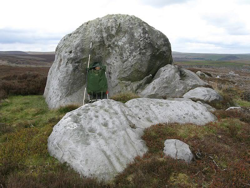
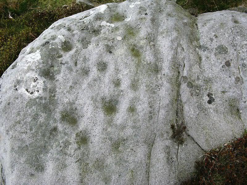
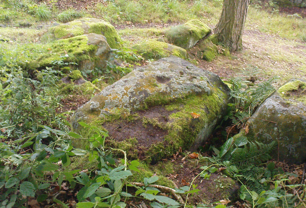
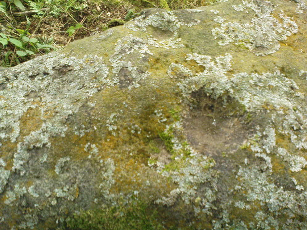
This dramatic looking outcrop of rocks rising out of the ground a half-mile due west of Bray farmhouse has long been known as the rocks of the ravens: oracular birds of ill-omen in all peasant traditions, yet carrier birds of shamans in their Underworld ventures, from accounts in Russia and Scandinavia, through the Scottish highlands and into Yorkshire’s northern hills, as folklore records show. Whether such mythical figures used the Raven Stones here for such magick, we have no firm accounts; but the existence of the many cup-markings on this particular rock (and others in the outcrop) show that animistic traditions of some form or another occurred here in prehistoric times at the very least.
Looking across the stoneLooking down on the cups (after QDanT)
Records of this place as an archaeological spot are scant indeed. It is passed with barely a mention by those Victorian antiquarian giants, Bogg, Grainge and Speight. The rock art students Boughey & Vickerman (2003) give the wrong grid reference here, but added the site to their inventory, saying only that it is “long, low, exposed bedrock. 22-25 cups; some very weathered and smooth.” A series of channels runs down the slope of the stone, but there are probably natural. However, a cup-and-line does occur on the eastern side of the carving.
References:
Armstrong, Edward A., The Folklore of Birds, Collins: London 1958.
Boughey, Keith & Vickerman, E.A., Prehistoric Rock Art of the West Riding, WYAS: Wakefield 2003.
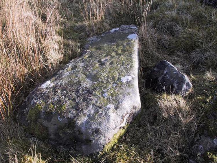
Take the B6265 east out of Grassington, thru Hebden, for another 2 miles till you pass the tiny road down to Skyreholme on the right. Another few hundred yards on, past Nussey Farm and Dry Gill house, park up and look for the track going south into the moors. Go down the track called Black Hill Road for a few hundred yards till y’ reach the gate on the right. A track bends downhill to the psilocybin-rich pastures of Nussey Green. Several hundred yards on, to the right-hand side of the track, we find this and its companions. Look around!
Archaeology & History
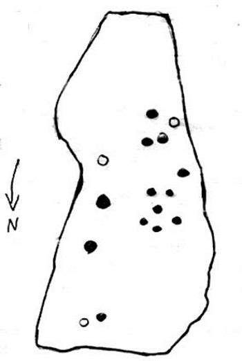
Quick sketch of design
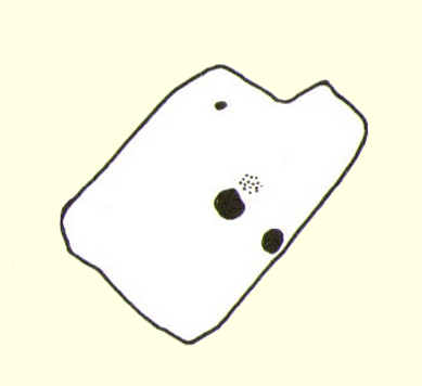
This medium-sized, recumbent standing-stone-shaped boulder has perhaps fifteen cup-markings on it. It’s a plain carving with others of a similar ilk in the area. First described by Stuart Feather in 1970 as one of “two cup-marked rocks” he found when ambling around; in Boughey & Vickerman’s (2003) survey they give it the wrong grid reference, though describe it correctly as a “long flat rock of irregular outline (with) fourteen to sixteen cups.” A cluster of other carvings are nearby, though some have been destroyed through mining operations.
References:
Boughey, Keith & Vickerman, E.A., Prehistoric Rock Art of the West Riding, WYAS: Wakefield 2003.
Feather, Stuart, “Appletreewick, W.R.,” in Yorkshire Archaeological Register, 1969, Yorkshire Archaeological Journal, part 168, 1970.
Near the centre of this photo, the large ‘ring’ can be seen
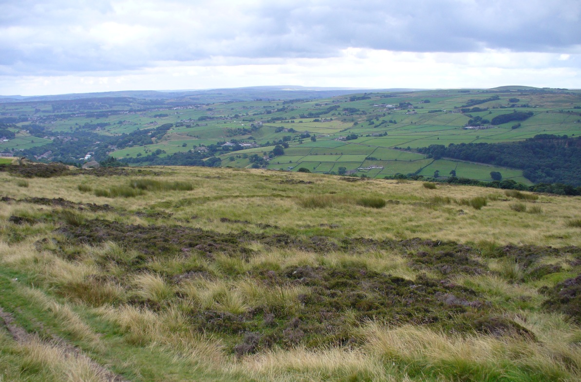
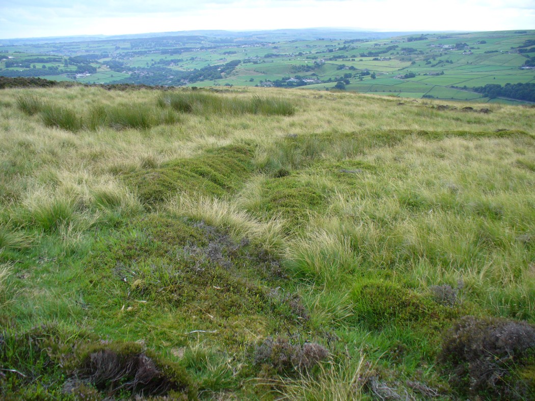
From Midgley go west along Height Road and take the track up on your right, at the tree-lined bend, up Foster Clough and onto the moor as if you’re gonna go to Churn Milk Joan. As you reach the footpath at the quarries up the hill, go to the top of them and take the small footpath where the land levels-out and head east towards the walling. Just a hundred yards or so before the walling, keep your eyes peeled, cos you’re damn close!
Archaeology & History
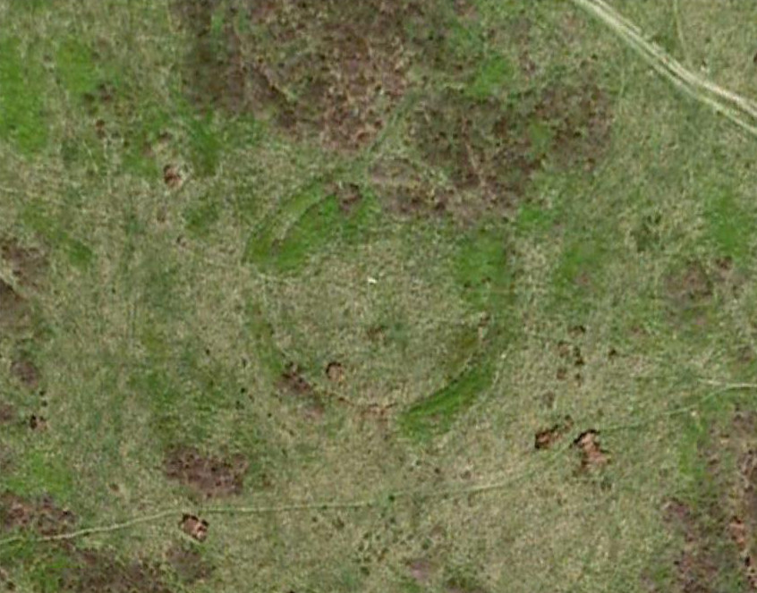
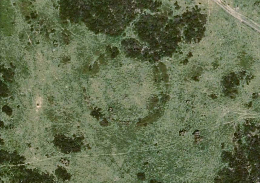
Best seen when looking down from the slopes above, this is a fascinating site that is lucky to still be here! For just a few yards to the west are extensive quarry works that could easily have destroyed the place had they continued. But thankfully we have here a near-perfect circular enclosure: measuring roughly 27 yards in diameter east-west, and about 25 yards north-south, the circumference around the outer-edge is approximately 82 yards (75m). It has all the appearance of an overgrown henge monument, with an outer bank and inner ditch, then a central flat arena—and it may indeed be such a monument—but until we have a decent excavation of the site, we’ll stick to calling it a simple enclosure—which it is!
Eastern arc of bank & ditch
The outer bank is very much overgrown, but as it runs round and defines this site, it measures 1-2 feet high most of the way, except on the westernmost spot, where it seems there may be an ‘entrance’. The inner ditch is only a couple of feet deep, again all the way round the monument. The internal level of the site is pretty flat, like most henges; but there seems to be a small central ‘cairn’ of some sort in the middle. Again, this is very overgrown by our traditional moorland vegetation.
Aerial image, 2009Aerial image, 2006
So what is it exactly? An enclosure, a settlement, or even (as local research student John Billingsley once suggested) a henge? Tis difficult to say for sure without further and more detailed archaeological excavation. My estimate is that the site is either Bronze- or Iron-Age in nature, and is definitely an ‘enclosure’ of some sort. We have located other prehistoric sites on the slopes just above here to the north, like the Crow Hill cairn circle and accompanying tumulus, remains of a neolithic settlement and a number of other small single cairns that are only visible when the heather has been burnt back. If you intend to explore any of the ancient sites sites on this moor, check this one out!
References:
Bennett, Paul, The Old Stones of Elmet, Capall Bann: Milverton 2001.
A prehistoric tomb of unknown size was opened and robbed of its contents shortly before its total destruction sometime in the middle of the 19th century. There were no remains seen of the site when Ordnance Survey came here in 1854, and it is unlikely to have been confused with the large Thorn Knowe tumulus a half-mile to the northwest. A certain Prof. Duns (1876) described in an early article that the only remaining artefact from this tomb was an elaborate early Bronze Age spear-head, found in 1855, which he described at some length in the PSAS journal of the time. Neither he nor any other colleagues told us anything further about the tumulus.
Royal Commission on the Ancient & Historical Monuments, Scotland, Inventory of Monuments and Constructions in the Counties of Fife, Kinross and Clackmannan, HMSO: Edinburgh 1933.
From Ilkley, take the directions up to the Panorama Woods 232 carving. From here you can step from this rock over the stride onto the cup-marked carving 231b, and then go onto the next adjoining rock surface a little lower down. From here, you’ll see another mossy rock surface in front of you by a yard or two. That’s the one!
Archaeology & History
The three cup-markings
Here’s another simple cup-marked stone, probably only for the purists amongst you—although in visiting here please take into account the primary carving’s association with other more prominent designs that once existed only a few yards to the west where the houses now stand. There is also the cluster of other carvings right next to this stone. A prehistoric settlement was also in evidence adjacent to this carving which was destroyed in the latter half of the 19th century.
Close-up of the cupsJohn Hedges 1986 drawing
Described simply in John Hedge’s (1986) fine survey as a small “piece of rock with three clear cups and one depression.” Boughey & Vickerman’s (2003) survey added nothing more and merely copied the same words. For some reason or other (mebbe cos I’m simple!) I really like this otherwise innocuous design and its close simplistic relatives. It’s probably due to the trees amidst which the stones are found and the bright mosses on the rocks, giving the site a slightly extra sense of more living genius loci than others on the top of these moors, where the winds move the subtle spirits with greater ease.
19th century addition
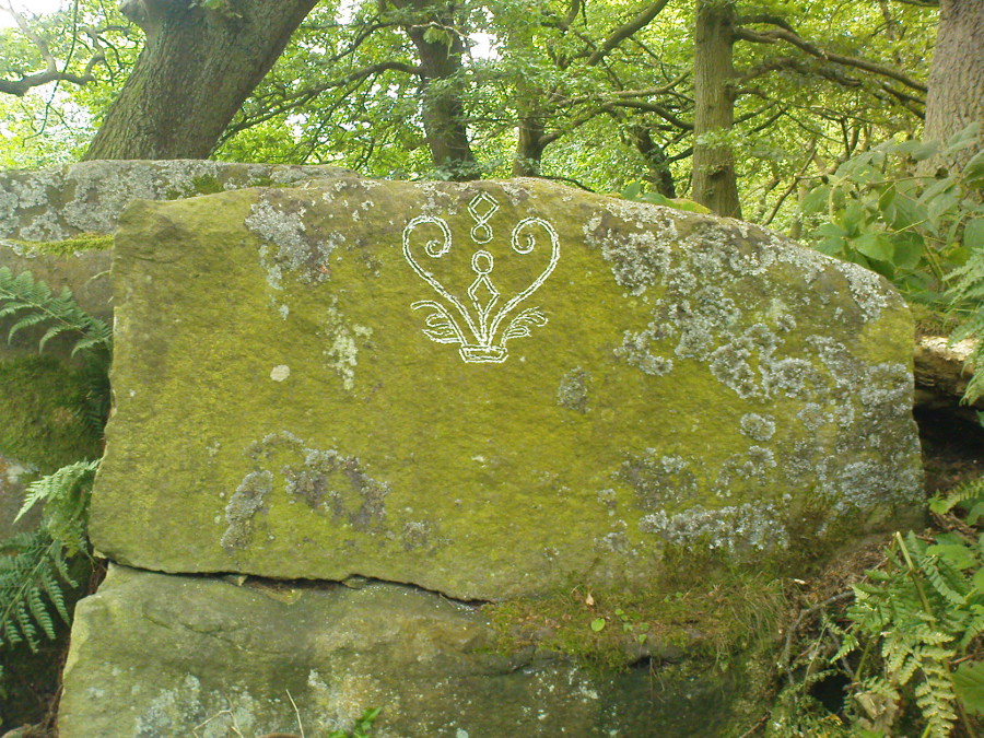
If you step down and look at the vertical side of this stone, you’ll notice a more modern stylistic carving etched onto the surface. Not as deep as the prehistoric cups on the top, it seems probable that a local artist by the name of Ambrose Collins carved this on here (and other similar designs on other rocks nearby) in the late 19th century.
References:
Bennett, Paul, The Panorama Stones, Ilkley, TNA: Yorkshire 2012.
Boughey, Keith & Vickerman, E.A., Prehistoric Rock Art of the West Riding, WYAS: Wakefield 2003.
Hedges, John (ed.), The Carved Rocks on Rombalds Moor, WYMCC: Wakefield 1986.
Although now seemingly lost, it’s location is damn close to this: Along the A657 between Greengates and Bradford, where the New Line meets Carr Road, the dirt-track takes you into Calverley Woods, down Eleanor Drive. About 250 yards along (just before you get to the field on the left), take the footpath down the embankment towards the stream where it bends to the left and where the land levels out (don’t cross the stream). It’s somewhere round there!
Archaeology & History
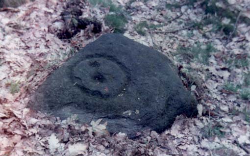
This was one of two previously unrecognised carvings we came across sometime in 1985 (see West Woods 1 stone), when we were seeking out another missing carving in the same woods. It was clear and well-defined as the faded photo here shows; but having been back to try find it twice in the last two years in the hope of getting better photos, I’ve been unable to locate it. The carving was described in an article I did in an old earth mysteries magazine. It comprises simply of a large ring surrounding and enclosing two deep cups, which were linked to each other by a connecting carved line. Parts of the stone had been chipped in parts—including a section of the large ring— due to some industrial workings that had happened here in the past. Thankfully I managed to find the old photo and hopefully, perhaps, some local explorer could try and seek out where it’s hiding beneath the trees and other vegetation.
References:
Bennett, Paul, “The Undiscovered Old Stones of Calverley Woods,” in Earth no.2, 1986.
Take the A822 straight road south out of Crieff and as you pass the garden centre on your right and the fields and trees begin either side of the road, you need to watch out in the field on your left-hand side. Just a couple of hundred yards after passing beyond the garden centre, stop. Look in the field there and you’ll see the object in question. You can’t really miss him!
Archaeology & History
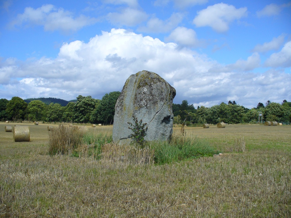
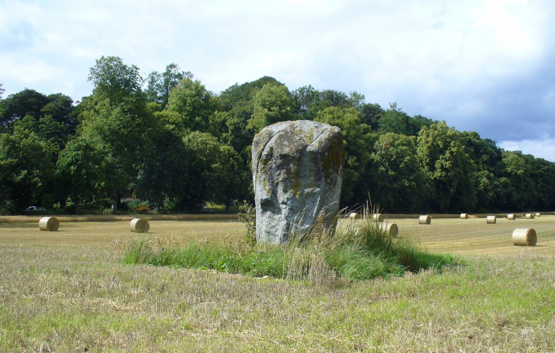
As you approach or leave Crieff along the A822 you can easily pass this stone by. Which would be a pity, as it’s quite a giant standing alone just above the slight ridge in the field. And in times gone by, not only were there other standing stones here as companions, but a cluster of other prehistoric pits, enclosures and linear markings were all around this very spot. Some of them are visible as faint crop-marks even today, but they remain unexcavated and we are left (presently) in the dark as to their nature.
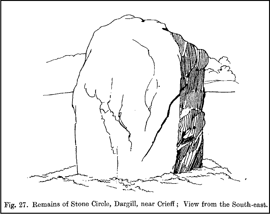
Dargill stone, looking NWOld drawing by Fred Coles
The standing stone itself is a real beauty! A huge fat fella, standing nearly eight feet tall, looking proudly across the field in all directions and gazing into the northern hills, where the wanderer’s eye naturally falls… In earlier years, the great megalithic explorer Fred Coles told of two other stones standing hereby—although they are not noted on the earliest OS-map of the area. Nevertheless he wrote the following:
“This place-name deserves brief notice. It is pronounced by persons in the locality as if it were spelt like the Irish name Dargle, having the stress on the first syllable. The site is in a field between the main road from Crieff to Auchterarder and Dargill Island on the river Earn, at the height of 121 feet above sea-level… There is here an indistinct mound, not now easily traceable, nor of any considerable height; but it is significant to have to report that up to 1909, when a new tenant entered the farm, two other great Stones were standing. These were removed by the newcomer, much to the surprise and indignation (I was told) of the neighbours. The remaining monolith is an unusually square and massive oblong block of schist, girthing over 16 feet, and standing clear of the ground 7 feet 8 inches in height. Its eastern edge is rough and riven into long vertical hollows; but the other sides are, on the whole, smooth. I append a view from the south-east.”
More recently the Dargill stone was described in Andy Finlayson’s (2010) excellent photo-history guide to the megaliths of the region.
Folklore
In recent years this great stone has received the attention of local ley hunter David Cowan, who dowsed here and found ‘earth energies.’ These are in fact water-lines: the primary dowsing response and not related to leys.
From the hamlet of Eskdalemuir, take the B709 road over the river bridge and keep going for about a mile, past the Hartmanor Hotel. Keep your eyes peeled for the small parking spot on the left-hand side of the road soon after the hotel. Once here, cross the road and walk down the footpath towards the river, following the line of the fence, pass the superb apple trees. You’ll walk straight to it!
Archaeology & History
The Loupin Stanes, looking SW
A long distance from anywhere out here in the hills, my short foray here with fellow antiquarian Paul Hornby told that there was once much more here than presently meets the eye. Aubrey Burl (1979) hinted at the same, as did our mathematical megalithic magus Alexander Thom. (1980) There are curious stones near and not-so-near the circle you’re about to meet, many of them speaking of relationships just hiding beneath their historical surface. Sadly we only spent a short time here at the Loupin Stanes. A full day or two would have been much better!
Despite this circle (and its nearby companion the Girdle Stanes) hiding miles away from anywhere out here, the legendary compilers of the 18th century Statistical Account of Scotland still managed to find it, telling us simply,
“On the farm of Coatt there are two circles of erect stones, the one entire measuring about 90 feet (i.e., in girth), and the other, having a part of it worn away by the Esk, measuring about 340 feet.”
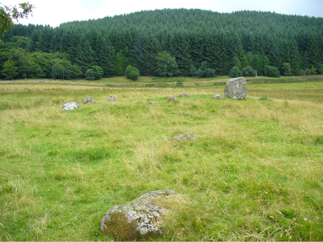
The ‘entrance stones’Loupin Stanes, looking WNW
Another century was to pass by before anyone else came and wrote about these hidden stones, sitting upon a level man-made platform built by neolithic or Bronze Age ancestors. In Dave Christison’s (1897) lengthy article for the Scottish Society of Antiquaries, he gave a pretty lengthy description of the Loupin Stanes, which is still as accurate today as when he wrote it 120 years ago. He told:
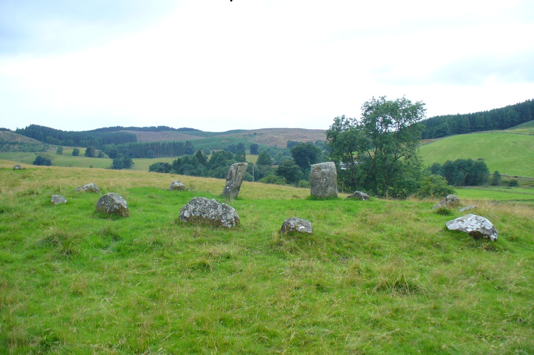
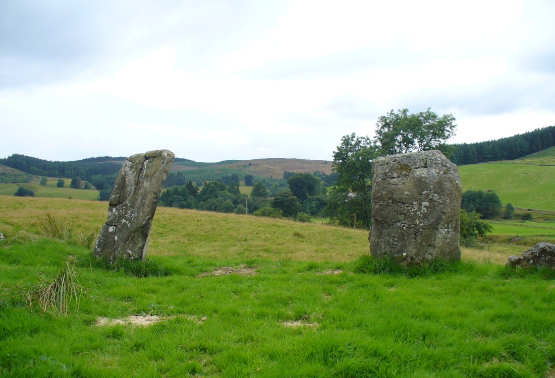
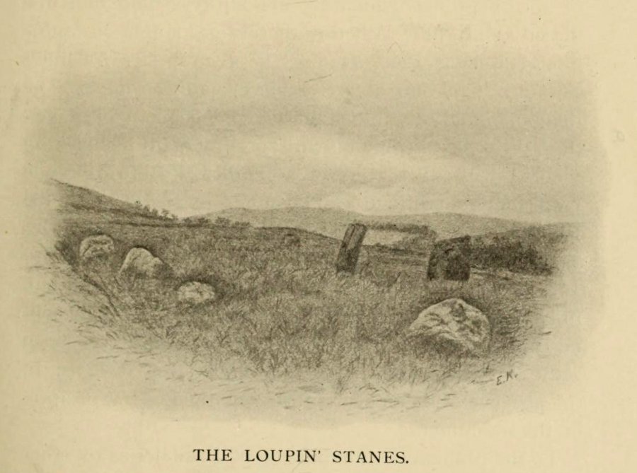
“The site of the smaller circle is at Hartmanor, retired about 80 yards from the river, in a gently undulating field, and it has been banked up nearly all round from a foot to 18 inches, perhaps with the object of making the interior level. The circle consists of thirteen stones…not reckoning one which seems too small to be included, but from the inequality of the intervals it is likely that a number have been carried off, and this seems proved by one hollow…left in all probability by the removal of a stone, and – by another within the circle opposite a blank in it, probably caused by digging to uproot a second stone. The developed view…shows this irregularity of the spacing. But it also shows that two neighbouring stones greatly exceed the others in size, and alone can be considered truly standing, as they are pillar-like and set on end, whereas the smaller ones are so shaped that it does not much matter on which end they are placed. The two large stones are about 5 feet 4 inches high, and are flat-topped. One is a massive rectangular block, about twice the bulk of the other. Few of the smaller stones stand a foot above ground, and the two highest do not exceed a couple of feet. The large stones (in this ring) are known as ‘the loupin’ stanes…
“…In its present state the ‘circle’ is slightly oval, the cross diameters, measured from the inner faces of the stones, being about 35 and 31 feet. The entrance, if we may call it so, between the two pillar-stones, looks out about E.S.E.”
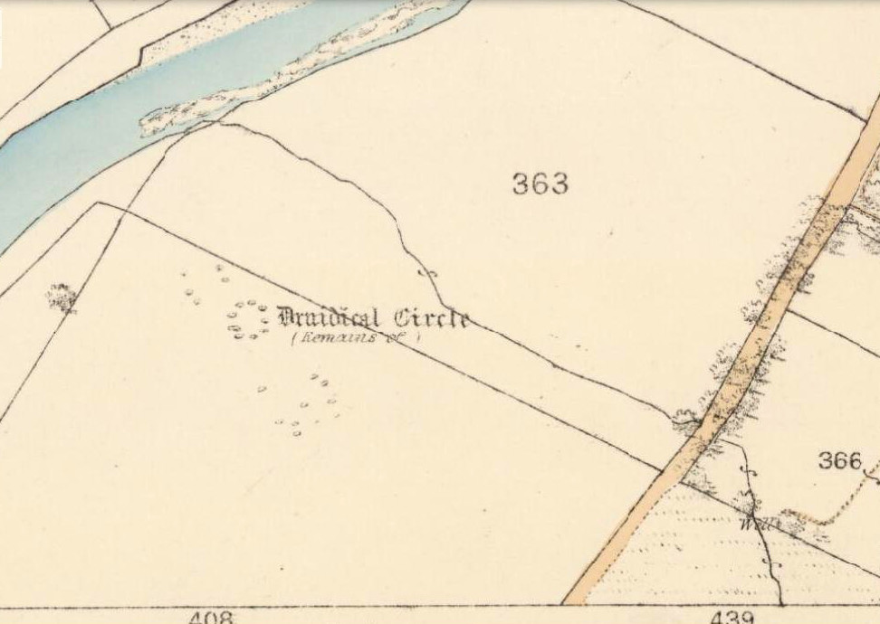
Of course, Christison meant WSW, not ESE. Probably the best description of the Loupin Stanes (and the nearby Girdle Stanes) was done, not surprisingly, by a local historian. In the superb work on the Langholm district, the brothers Hyslop (1912) gave commendable descriptions—including ingredients which, I’m pleased to say, the likes of Mr Hornby and myself wondered over in our short visit here. Burl and Thom thankfully noted the very same elements.
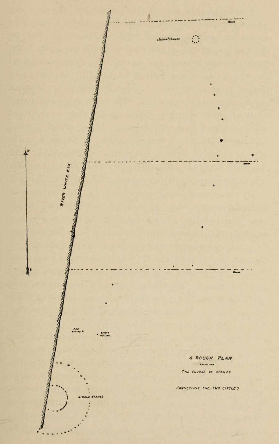
Loupin Stanes & stone avenue to the Girdle Stanes
The casual visitor here cannot fail to note the curious scatter of other stones close to this megalithic ring. Before you actually reach the circle there is a scatter of small stones which have more of a ‘feel’ to them being related to the actual circle than proof has yet afforded. Both Thom and Burl postulate this scatter of stones as the remains of another damaged stone circle. One of these stones has three cup-marks upon it. But there are other stones reaching away up the slope of the field to the south. Our impression here was that these had some relevance to the circle when it was first built, probably 4000 years ago. Paul suggested the idea of an ‘avenue’ perhaps linking it with the Girdle Stanes circle about 600 yards away. He wasn’t the first to do so. John and Robert Hyslop (1912) talk of the likely relationship these two stone circles had with each, and much more:
“Though now forming separate circles 600 yards apart, that they were at one time, though possibly not originally, parts of one scheme is clearly indicated by their relative positions and especially by the irregular line of large stones stretching from one to the other. Only two of the stones of the first Circle are now standing. One stands 4 feet 9 inches above ground and measures 19 feet 5 inches in girth. The other is also 4 feet 9 inches high but is only 7 feet 8 inches in girth. It is quite possible that some of the other stones composing the Circle are in their original positions, though they are now greatly weathered and broken… This…Circle when built appears to have consisted of nine* large stones, and was nearly 36 feet in diameter, or some 113 feet in circumference by inside measurement.
“A little to the south-east of the Loupin’ Stanes there is what, to the casual observer, appears to have been, and probably was, another Circle also of nine stones, with a centre stone. Some of these stones have been displaced, and the contour of the Circle is consequently broken. Nearer the Esk, and almost touching the Loupin’ Stanes, are four single stones whose relation to the other members of the group it is very difficult even to guess. Fancy or guesswork might weave a simple theory which could neither be proved nor absolutely refuted — but it is wiser not to guess in questions like this! Reference has already been made to the “avenue,” or line of single stones stretching from the Loupin’ Stanes to the Girdle Stanes. Though the line is not a straight one, and is broken, it seems to afford fairly conclusive proof that all these stones at the Cote are parts of what must once have been a prehistoric monument of considerable importance, and, needless to add, of great antiquity.”
The ‘avenue’ between the two circles was later described with a bit more detail and the suggestion of an astronomical function arose. Again, the Hyslop’s (1912) told that the avenue was,
“a course of 11 stones placed at intervals between the two Circles, rudely joining them, but not in a straight line. The last four of these (nearest the Loupin’ Stanes) form very nearly a straight line in a direction S. 16 34′ E., but no satisfactory significance has been found for this line.
“…Whether there was a single or double line of stones in the “avenue” between these two Circles cannot be said until a careful survey has been made. The theodolite and the link-chain have a curious habit of settling these disputed points and spoiling many a charming theory — without regrets or apologies! But this much may safely be said: if an “avenue” existed between the Loupin’ Stanes and the Girdle Stanes, as appearances suggest, it was probably for ceremonial rather than for astronomical purposes.”
Remains of possible avenue, from the Esk to the StanesHyslop’s old drawing of the Loupin Stanes
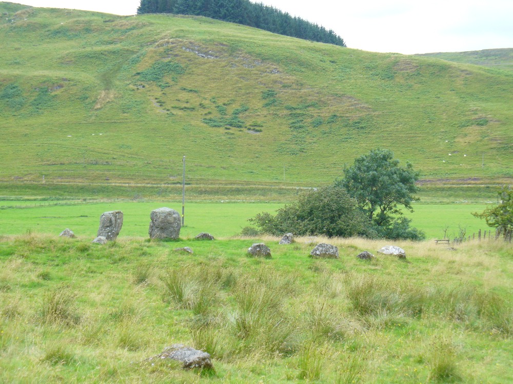
Very true indeed. But whether this alignment of weaving stones has actual relevance to the megalithic arena, only detailed excavations will tell for sure. Yet on the western side of the Loupin Stanes, we see at least four stones (possibly six) which run down to the River Esk. This also may be remains of an old avenue, taking us to an important water source.
No ‘avenues’ were mentioned in the survey by the Royal Commission (1920) lads, written several years after their visit here in July 1912. They described the site as follows:
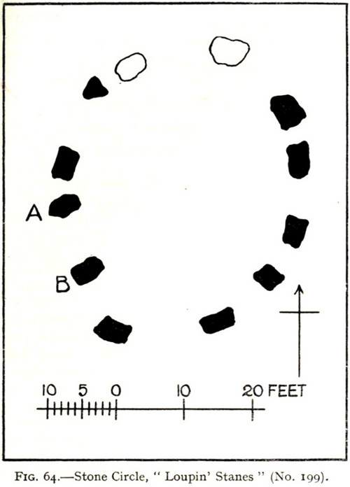
“The stone circle known as the Loupin Stanes…is situated at an elevation of 600 feet above sea-level, on an undulating meadow some 80 yards from the left bank of the White Esk and 600 yards north-east “of the Girdle Stanescircle…. It consists of twelve stones placed at irregular intervals, of which, on the west side, only two, standing 8 feet apart (A and B on plan, fig. 64), are true pillars, all the others being simply boulders.
“The setting does not form a true circle but is flattened on the western arc; it measures some 38 feet in diameter from north to south and 31 feet from east to west. The pillar stones, which are flat-topped, measure about 5 feet 4 inches in height, and the two highest of the smaller stones do not exceed 2 feet, while few of them reach 1 foot. The site has been banked up nearly all round from 1 foot to 1 foot 6 inches, perhaps with the object of making the interior level. There are numerous large stones adjacent, some of which may be the remains of other circles, but others are probably merely boulders naturally deposited or outcrop of rock. The field was in a hay crop at the date of visit, and the fallen stones were not easily seen.”
1920 Loupin Stanes plan (after RCAHMS )
When Alexander Thom (1980) came here and measured the site, he thought there was a ‘possible’ midsummer sunrise from the stones—but even he didn’t seem convinced. Described as a Type A Flattened Circle, he did find units of his ‘megalithic yard’ in the construction of the site.
Folklore
In David Christison’s essay (1897) on this and its companion site—the Girdle Stanes—he told:
“The large stones are known as ‘the loupin’ stanes,’ because it is said that lads, and even a lass, were in the habit of jumping from the top of one to the other; but as the distance is 8 feet, the people of the district must be uncommonly good ‘loupers’ to accomplish the feat without breaking their legs. However it may be with their limbs, so little are the powers of observation of the natives cultivated that, although all know ‘the loupin’ stanes,’ they generally deny the existence of a circle.”
This narrative was repeated in the Hyslop’s (1912) work. Though it should be noted here that Mr Christison’s final remark about the local people denying the existence of any such circle is something I’ve encountered a few times, despite them knowing otherwise. But for good reason, it has to be said.
…to be continued…
References:
Burl, Aubrey, Rings of Stone, Frances Lincoln: London 1979.
Burl, Aubrey, A Guide to the Stone Circles of Britain, Ireland and Brittany, New Haven & London 1995.
Burl, Aubrey, The Stone Circles of Britain, Ireland and Brittany, Yale University Press 2000.
Christison, David, “‘The Girdlestanes’ and a neighbouring stone circle, in the parish of Eskdalemuir, Dumfriesshire”, in Proceedings of the Society of Antiquaries, Scotland, volume 31, 1897.
Hyslop, John & Robert, Langholm As it Was, Hills & Company: Sunderland 1912.
Macauley, Anne, Megalithic Measures and Rhythms, Floris: Edinburgh 2006.
Royal Commission on the Ancient & Historical Monuments, Scotland, Inventory of Monuments and Constructions in the County of Dumfries, HMSO: Edinburgh 1920.
Thom, Alexander, Megalithic Sites in Britain, Oxford University Press 1967.
Thom, A., Thom, A.S. & Burl, H.A.W., Megalithic Rings, BAR: Oxford 1980.
The best way to get here (when we went anyway, quite a few years back now), was via the old church . At the entrance to the church there was a signpost to the tumuli. Take the footpath to the left of the building and walk about 200 yards. Once you go under the railway bridge and into the trees, walk left and the overgrown mounds appear in front of you!
Archaeology & History
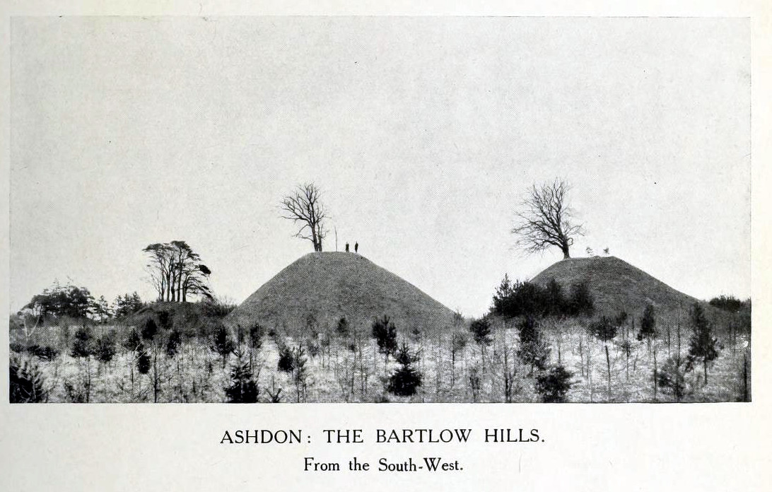
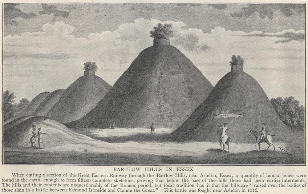
Thought to the largest Romano-British barrows in England, this was an incredible clump of giant burial mounds which, in more recent years, have been allowed to fall into neglect. Although a railway was built through this clump, it bypassed the main tumuli—and in doing so uncovered another cemetery! Four large barrows still remain and access, though alleged by some of those southern-types to be on private land, didn’t stop our foray here. The usual “private” signs showing just how unwelcoming some of them are, just made us Northerners more determined to find ’em! But that aside…
18th century drawing of the hills1916 map & plan
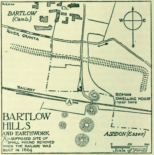
Although nowadays classed as being in Cambridgeshire, when the Royal Commission lads visited the site and described it in their Inventory (1916), the mounds were in the parish of Ashdon on the northern edge of Essex. But now it comes under the parish of Bartlow in Cambridgeshire—which seem sensible, as the word ‘bartlow’ itself stems from these very monuments. As the regional place-name expert P.H. Reaney (1943) told, Bartlow means,
“‘(At) the mounds of the birch trees,’ OE (æt) beorca-hlãwum, (from the verb) beorc, hlaw, i.e., the great Bartlow Hills tumuli which dominate the church and village.”
Described as early as 1232 CE as Berkelawe, these hills were opened in the middle of the 19th century and found to possess a mass of Roman remains. A number of articles in the journals of the period gave extensive descriptions of what was uncovered, but they are summed up nicely in the Essex Royal Commission (1916) report, which told:
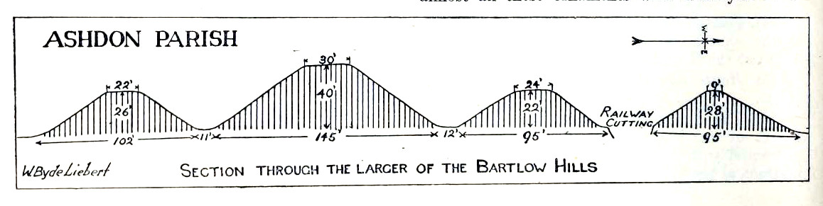
“The principal monuments are the Bartlow Hills, which lie…at the extreme N.E. of the parish. They form (or formed) two parallel rows, running nearly N. and S. The eastern row consists of four large steep-sided mounds, in shape truncated cones, the largest 40 ft. high and 145 ft. in diameter; since 1760 three of the mounds have been planted with trees. The western row is now less clear: originally, it consisted of at least three small mounds, as was proved by digging in 1832; only two can now be faintly traced. Excavations, chiefly in 1832-40, have shown that all seven mounds contained at the centre regularly walled graves, within which was very costly grave-furniture of glass, decorated bronze, and enamel; almost all these ornaments were destroyed in a fire at Easton Lodge in 1847. The graves seem to belong to the end of the first and beginning of the second century and were doubtless built for Romanized British nobles of the district. The particular method of burial occurs especially in eastern England and in Belgium, and is native, not Roman, by origin.
“…Other burials have been noticed near the Hills — one with a flint axe and knife, presumably prehistoric. A small dwelling-house was found in 1852 about 100 yards E. of the Hills — mainly, if not wholly, within the Cambridgeshire border — but nothing of it is now visible on the surface.”
Section & sizes of the tumuli, 1916
The sites are very impressive indeed, though as we can see from the old images, when they were clear of trees they stood out much clearer.
Folklore
Old fairs used to be held at the Bartlow Hills, whose origin goes way back. There is also a curious custom which probably originated in some way from traditional beating of the bounds of the local township boundaries, narrated by folklorist Enid Porter. (1969) Throughout the region she reported how “skipping was performed on Good Friday”. It commenced at 10am and would continue into the evening. Porter wrote:
“An eighty year old woman of Linton recalled in the 1930s that in her youth the villagers of Linton and Hadstock used to skip on Good Friday to Bartlow Hills to join in the fun of the fair held there.”
An early legend uncovered from archives by Leslie Grinsell told that here could be found a “treasure chest said to have been concealed by Oliver Cromwell in the barrows known as the Three Hills, or in pits near them.”
…to be continued…
References:
Porter, Enid, Cambridgeshire Customs and Folklore, RKP: London 1969.
Reaney, P.H., The Place-Names of Cambridgeshire and the Isle of Ely, Cambridge University Press 1943.
Royal Commission on Historical Monuments, England, An Inventory into the Historical Monuments in Essex – volume 1, HMSO: London 1916.
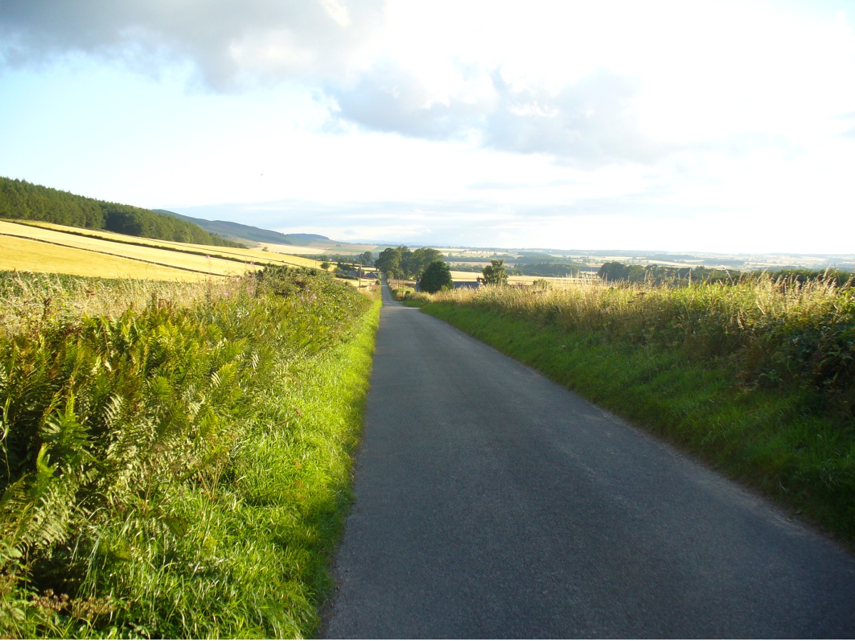
Looking dead straight from the Hill of Ballunie to Leys.
There seems to be nothing left of the stone circle described in Andrew Jervise’s (1879) immense work which, sadly, only described this stone circle in passing. He told us simply that hereby, “are also the remains of stone circles upon the hill of Ballunie,” which is just a few hundred yards along the road from the magnificent Keillor Pictish symbol stone. When we visited the place not long ago, no trace of any stones were visible hereby. The site is not listed in Burl’s (2000) magnum opus.
However, ley-hunters will love this place. Not only was this lost circle located at the edge of a dead straight road, running from the Keillor standing stone a short distant east, but as it runs downhill it reaches, a couple of miles below, the hamlet called Leys.
References:
Jervise, Andrew, Epitaphs and Inscriptions from Burial Grounds and Old Buildings in the North-East of Scotland – volume 2, Edmonston & Douglas: Edinburgh 1875.