St. David’s Well, Weem, Aberfeldy, Perthshire

Holy Well:  OS Grid Reference – NN 8445 5002

Also Known as:

  1. Canmore ID 25672
  2. Chapel Rock Spring
  3. Fuaran Creig a’ Chaibeul
  4. St. Cuthbert’s Well

Getting Here

In the dark, dark wood... hides St. David's Well
In the dark, dark wood… hides St. David’s Well

The best way to find this site, in the middle of the large woods up the slopes, is to follow the circular mile-long tourist path that runs through it. Take the B846 road out of Aberfeldy over the bridge towards Dull and Weem.  As you go through Weem, watch closely for the signpost directing you into the trees of Weem Rock and Woods on the right. Follow this tiny road up until you reach the parking circle in the edge of the trees.  Follow the directed footpath up into the woods & keep to the winding track, up, zigzagging, and up again, until it levels out a bit and runs below the large long crags. Tis beneath here you need to be!

Archaeology & History

The pool of St David's Well
The pool of St David’s Well

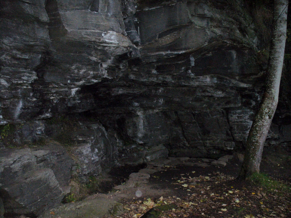
Not far from the curious Weem Wood carvings, hidden beneath one section of the long high crags in remains of the ancient forest, is this trickle of fresh water which collects into a small stone-lined pool. (a small round plaque which reads ‘St. David’s Well’ on the cliff-face above the waters is helpful) It’s in a truly lovely setting, with a small ‘cave’ about 50 yards west along the same footpath and a modern carved ‘cross’ in front of it.

The well was formerly known as St. Cuthbert’s Well (date: 20 March) who, so legend tells, lived nearby—probably at the christian-druid college at Dull, a mile west of here. It was he who collected the waters from the rock face into the small pool we see today.  This used to be known as St. Cuthbert’s Bath.  But several centuries after the saint’s death, the local laird, Sir David Menzies, came and restored the well and gained a reputation for spending much time living hereby, sometimes in the small cave along the edge of the cliffs.  It was to him that the New Statistical Account wrongly dedicated the waters to in the 19th century—but the title has stuck!

Described in several old local history works, the site was included in the giant folklore tome on Scottish waters by MacKinlay (1893), who wrote the following:

“In the wood clothing the steep hill of Weem, in Perthshire, is St. David’s Well, said to be named after a former laird who turned hermit.  The spring has a considerable local fame, and many have been the wishes silently breathed over its water.  Part of an ancient stone cross lies at its margin, and on it the visitor kneels while framing his or her wish.”

Nothing of this ‘cross’ can now be seen, but it is said that its remnants are housed at Weem church in the village below.  Also in the 19th century, occasional christian gatherings were held here and as many as fifty people came “for religious services.” Thomas Hunter (1886) reported that “a collection of human bones” were found near the well in front of the crags. There is also what looks like a newly cut large cup-marking with two carved lines reaching out from it, heading towards the well, on a small ledge of stone close to the pool.

Folklore

Folklore tells that once, long ago, dragons lived in these old woods—overcome no doubt by the incoming christians who stole and denigrated the olde peasant ways of our ancestors.  In bygone times, locals used the waters here for their health-giving properties.  As Ruth and Frank Morris (1982) told,

“it was an ancient wishing well which was still visited in 1954, when such objects as pins and buttons and an occasional penny was thrown in.”

References:

  1. Ferguson, Malcolm, Rambles in Breadalbane, Thomas Murray: Glasgow 1891.
  2. Hunter, Thomas, Illustrated Guide to Perthshire, Robertson & Hunter: Perth 1886.
  3. MacKinlay, James M., Folklore of Scottish Lochs and Springs, William Hodge: Glasgow 1893.
  4. Morris, Ruth & Frank, Scottish Healing Wells, Alethea: Sandy 1982.

© Paul Bennett, The Northern Antiquarian

Minspit Well, Preston, Lancashire

Healing Well (destroyed):  OS Grid Reference – SD 540 293

Archaeology & History

Here we have another example of one of the many healing wells destroyed thanks to those industrialists who tend to do that sort of thing.  Found in close proximity to several other water sources — including the Syke, Preston’s main watercourse in bygone times — very little has been written of the place. However, in Dave Hunt’s (2005) recent work on Preston, he told us the following:

“The Minspit Well in Mainsprit Weind at the foot of the Church Street ridge is close to the line of the Syke, has a good claim to be one of Preston’s earliest wells, and remained one of the principle water sources well into the 18th century.  The ‘spit’ or ‘sprit’ element in the name perhaps indicates the original strongly flowing spring or fountain. The site is now covered over, but Kuerden, writing in the 1680s, describes the picturesque early morning scene as the town’s housemaids collected water in what was accordingly referred to as Pettycoat Alley.”

References:

  1. Hunt, David, The Wharncliffe Companion to Preston: An A to Z of Local History, Wharncliffe: Barnsley 2005.

© Paul BennettThe Northern Antiquarian


St. Mary’s Well, Callander, Perthshire

Holy Well:  OS Grid Reference – NN 6507 0556

Also Known as:

  1. Canmore ID 24322

Getting Here

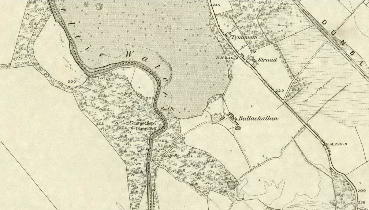
St Marys Well on 1862 OS-map

You’ll need wellies or no shoes for this excursion! From the lovely town of Callander, take the A84 road southeast out towards Doune and Stirling for a mile or so. Keep your eyes peeled for Straid by the roadside on your left and the turning right down to Ballochallan quarries. About 200 yards down, notice the industrial works on your left. Walk about 50 paces past this, then turn right into the trees.  Less than 100 yards in, you’ll hit a shallow bend in the River Teith. Walk across and into the trees opposite…and if you amble just yards above the edge of the river, along the tree-line, you’ll find St. Mary’s Well…

Archaeology & History

Fresh waters of the quartz-lined spring

Highlighted on the 1862 Ordnance Survey map of Callander and cited in the Object Name Book of the same year, oddly there is no mention of this mythic site in the Scottish surveys on holy wells (MacKinlay 1894; Morris 1981) — which seems rather unusual considering the importance this legendary entity (St. Mary) possessed in the christian pantheon.

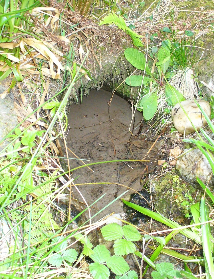
There is also some doubt about the precise position of this holy well.  According to the Royal Commission account, the well “is stone lined; it measures 0.9m in diameter, and is choked with fallen leaves.”  However, this appears to be the remains of a latrine (or “a bog,” as my northern tongue so eloquently exclaimed soon after finding it), now used more by frogs to lay their spawn in which their tadpoles thankfully emerge (as we found when visiting it last week).  The holy well itself is about 10 yards further along the edge of the river and has a most curious architectural feature to it.

Stone-lined "well" 10 yards west of the real one
Stone-lined “well” 10 yards west of the real one

When we found the place, much of it was very overgrown indeed and it took a while to recover its status.  But in doing so, we found that on all sides where the stone-lining marked the emergence of the waters, rocks large and small consisting almost entirely of quartz constituted the opening as it came out of the ground.  This was a very deliberate construction feature no less!  Also, the fine sandy silt which clogged up the waters were also found to have small pieces of quartz laying beneath it, seemingly as offerings that had been made here many years ago.  But on the whole there seemed little evidence that the well had been used ritually for many years.  So, once we’d cleaned up the debris and made the site more notable, I drank its waters and found them very fine and refreshing indeed!

In the trees behind the well you will find the overgrown remains of the old chapel, also dedicated to St. Mary.  The tranquility and spirit of this place would have been truly superb. Even today, it is an ideal retreat for meditation and spiritual practice.  It just seems such a curious mystery that nothing seems to be known of the place…

Folklore

The 1862 “Object Name Book” told that the waters here were renowned for having great healing properties.  St. Mary’s feast day was August 15 and great were the country fairs and rituals surrounding this period across Scotland and beyond — many of which may have supplanted the more arcane festival of Lammas.  However, local records are silent about any such events performed at Callander’s St. Mary’s Well.  Do any old locals know more about it…?

References:

  1. MacKinlay, James M., Folklore of Scottish Lochs and Springs, William Hodge: Glasgow 1893.
  2. Morris, Ruth & Frank, Scottish Healing Wells, Alethea: Sandy 1982.

© Paul BennettThe Northern Antiquarian


Garchel Burn, Glendevon, Perthshire

Hut Circles:  OS Grid Reference – NN 9696 0182

Also Known as:

  1. Canmore ID 25942

Getting Here

Line of walling to hut circle on ridge

Along the A823 road from the Pool of Muckhart up to Glendevon, watch out for the small left turning opposite the car-parking spot by the Castlehill Reservoir a couple of miles up the road.  Walk up this small road a mile or so to the Glenquey reservoir, taking the footpath on your right and making sure you walk along the north-side of the waters.  You’ll eventually reach a small set of beautiful mossy green waterfalls (with the rounded fairy hill of Maiden Castle ahead of you).  This is the Garchel Burn. Take steep the path up the side until it levels out a bit, heading for the small clump of stones on the near skyline a couple of hundred yards ahead. That’s it!

Archaeology & History

This is a curious little cluster of seemingly multi-period remains sitting on the edges above the gorgeous waters of the Garchel Burn.  The Royal Commission Canmore report ascribes the scattered rocky cluster below the deer-fencing as the main hut circle – and the line of walling running slightly down the slope does have that traditional Iron Age look about it.  But it’s yet to be excavated.  The larger ring of stones constituting the main ‘circle’ is very much bogged-down, literally, amidst tussock and marshland, with an arc of stones running away from the circle and it’s obviously been made use of it by people in more recent times.

Small 'hut circle' to centre
Small ‘hut circle’ to centre

Below the larger rock cluster is a lovely oval structure, built upon a slight rise overlooking the burn, with all the rocks in the structure overgrown with age and grasses.  Tis a beautiful spot to sit and hear the silence of the waters around you.  Aerial images show the outlines of other roughly circular remains in the same area, but none are yet excavated – and some are distinctly much later in period, medieval by the look of things and very probably used by farmers in more recent centuries.  In all probability, there are more things to be found up here, hiding within the forests…

© Paul Bennett, The Northern Antiquarian

Mount Cross, Cornholme, Todmorden, West Yorkshire

Cross:  OS Grid Reference – SD 91460 27280

Also Known as:

  1. Idol Cross

Getting Here

Mount Cross, near Cornholme

The site can be approached by going up the almost hidden long steep winding lane off the A646 in Cornholme; but if you don’t know the area it’s probably best approached from the well known Bride Stones, above Todmorden.  From here, go west along the road running 100 yards or so above the Bride Stones, past the old pub, past Hawk Stones farm, and turning left downhill about a quarter-mile on.  A coupla 100 yards down, there’s a track to your left.  As you start walking along you’ll see a standing stone on the grassy rise in front of you on your left.  That’s it!

Archaeology & History

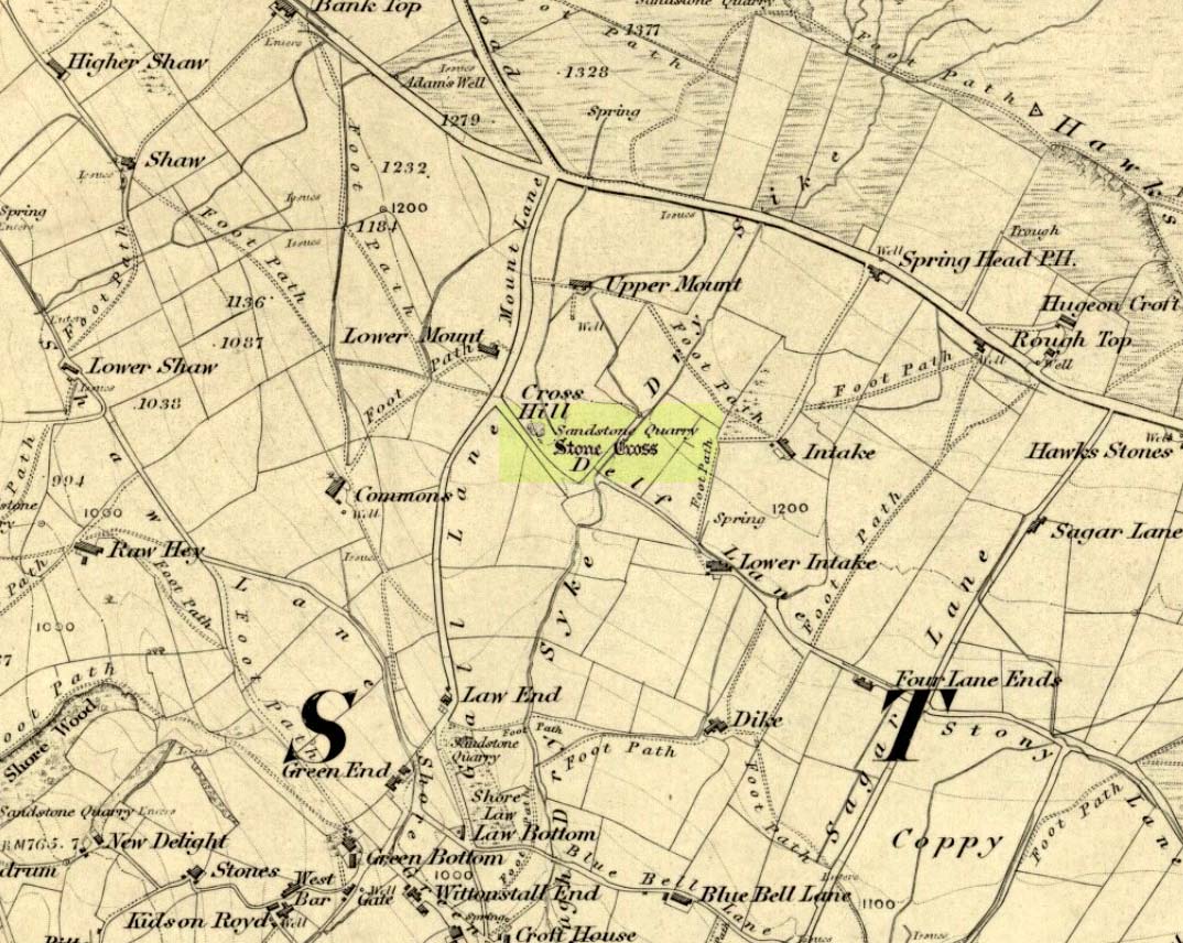
Mount Cross on 1848 map

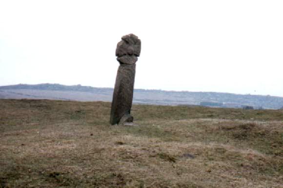
Said by local writer Geoff Boswell (1986) to be “the oldest religious memorial in Todmorden,” this old stone, more than 4-feet tall, is still in good condition and can be found beside the Old Causeway: a prehistoric trackway running between Lancashire and Yorkshire which is said by archaeologists to have been an old, but established trade route.  It was suggested by some to have been erected as a cross as early as the 7th century.  Generally known as the Mount Cross, it is also known as the Idol Cross, as legend reputes it to have been the site of pagan practices; hence its repute as being haunted. Its alleged heathen history is probably true (history records describe an old “rude stone” that was once found beneath the legendary Bride Stones nearby, which was moved many centuries back).

The Calderdale Council website tells that,

“Towards the bottom of the shaft on the NE side are what appears to be extremely faint traces of vine-scroll decoration which would suggest a fairly early date for the cross, possibly tenth or eleventh century. The irregularity of the carving overall tends to indicate that the cross is no earlier.”

Folklore

Said to have stood upon or beside a small tumulus until the 20th century. Jessica Lofthouse (1976) reported that a local farmer said of this stone. “Queer things happened here long since. They worshipped idols here.” Locally attributed to be haunted, the old stone was said to have a history of “uncanny happenings.”

References:

  1. Bennett, P., The Old Stone Crosses of West Yorkshire, unpublished MS, 1995.
  2. Boswell, Geoff, On the Tops around Todmorden, Delta G: Todmorden 1986.
  3. Lofthouse, Jessica, North Country Folklore, Hale: London 1976.

© Paul Bennett, The Northern Antiquarian

Hermit’s Well, Dale Abbey, Derbyshire

Holy Well:  OS Grid Reference – SK 4378 3861

Getting Here

Dale Abbey is a small and interesting village not far from Ilkeston. It can be found by taking the A6096 from Ilkeston and after passing through Kirk Hallam, take the first turning on the left called Arbour Hill. At the Carpenter’s Arms in the village turn right and park near the church. The well lies within the private garden of Church house, although it can be easily seen in the winter from the field in which the footpath below the church passes through, as well from the church yard.

Archaeology & History

R.C. Hope (1893) gives two versions of the story of how the hermit found the well and cave, taken from the Chronicle of Thomas de Musca quoted in Glover’s History of Derbyshire:

“A hermit once going through Deep Dale being very thirsty, and for a time not able to find any water, at last came upon a stream, which he followed up to the place where it rose; here he dug a well, returned thanks to the Almighty, and blessed it, saying it, should be holy for evermore, and be a cure for all ills. Another version is that the famous Hermit of Deep Dale, who lived in the Hermitage which is close by the well, discovered this spring and dug the well, which never dries up, nor does the water diminish in quantity, however dry the season and blessed it.”

In another version of the story, Hope (1893) notes:

“There was a baker in Derby, in the street which is called after the name of St. Mary. At that period the church of the Blessed Virgin at Derby was at the head of a large parish, and had under its authority a church de onere and a chapel. And this baker, otherwise called Cornelius, was a religious man, fearing God, and, moreover, so wholly occupied in good works and the bestowing of alms, that whatsoever remained to him on every seventh day beyond what had been required for the food and clothing of himself and his, and the needful things of his house, he would on the Sabbath day take to the church of St. Mary, and give to the poor for the love of God, and of the Holy Virgin. It happened on a certain day in autumn, when he had resigned himself to repose at the hour of noon, the Blessed Virgin appeared to him in his sleep, saying, ” Acceptable in the eyes of my Son, and of me are the alms thou hast bestowed. But now, if thou art willing to be made perfect, leave all that thou hast, and go to Depedale where thou shalt serve my Son and me in solitude; and when thou shalt happily have terminated thy course thou shalt inherit the kingdom of love, joy, and eternal bliss which God has prepared for them who love Him. The man, awakening, perceived the divine goodness which had been done for his sake; and, giving thanks to God and the Blessed Virgin, his encourager, he straightway went forth without speaking a word to anyone. Having turned his steps towards the east, it befel him, as he was passing through the middle of the village of Stanley, he heard a woman say to a girl, ”Take our calves with you, drive them as far as Depedale, and make haste back.” Having heard this, the man, admiring the favour of God, and believing that this word had been spoken in grace, a, it were, to bin’, was astonished, and approached near, and said, “Good woman, tell me, where is Depedale?” She replied, “Go with this maiden, and she, if you desire it, will show you the place. When he arrived there, he found that the place was marshy, and of fearful aspect, far distant from any habitation of man. Then directing his steps to the south-east of the place, he cut for himself, in the side of the mountain, in the rock, a very small dwelling, and an altar towards the south, which hath been preserved to this day; and there he served God, day and night, in hunger and thirst, in cold and in meditation.

And it came to pass that the old designing enemy of mankind, beholding this disciple of Christ flourishing with the different flowers of the virtues, began to envy him, as he envies other holy men, sending frequently amidst his cogitations the vanities of the world, the bitterness of his existence, the solitariness of his situation, and the various troubles of the desert. But the aforesaid man of God, conscious of the venom of the crooked serpent, did, by continual prayer, repeated fastings, and holy meditations, cast forth, through the grace of God, all his temptations. Whereupon the enemy rose upon him in all his might, both secretly and openly waging with him a visible conflict. And while the assaults of his foe became day by day more grievous, he had to sustain a very great want of water. Wandering about the neighbouring places, he discovered a spring in a valley not far from his dwelling, towards the west, and near unto it he made for himself a cottage, and built an oratory in honour of God and the Blessed Virgin. There, wearing away the sufferings of his life, laudably, in the service of God, he departed happily to God, from out of the prison-house of the body.”

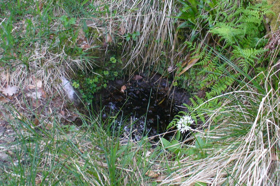
The well is a delightfully rustic one and certainly contains old stonework if not from the hermit’s time than the period of the Abbey. It is an oval structure with eight stones around the mouth, a three foot rectangular stone covers half of the well and has a semi-circular cut placed in the middle. Mossy steps lead from the higher end of the garden into the little dell where the well arises. The well has been dressed in the early 2000s but has now disappeared into obscurity. Indeed, some believe that it is does not exist in the first place…

 Folklore

First noted in 1350 in association with the legend of the foundation of the Abbey, Hope (1893) notes it was curative and was a wishing well; being visited on Good Friday, between twelve and three o’clock, water being drunk three times.

OLYMPUS DIGITAL CAMERAOLYMPUS DIGITAL CAMERA

References:

  1. Hope, Robert Charles (1893), Legendary Lore of the Holy Wells of England, Elliott Stock: London.
  2. Parish, R.B. (2008), Holy wells and healing springs of Derbyshire.

Copyright © Ross Parish


Market Cross, Kincardine, Fife

Cross:  OS Grid Reference – NS 93120 87515

Also Known as:

  1. Canmore ID 48126
  2. Mercat Cross

Getting Here

Old Market Cross, Kincardine

Dead easy to find. Get into the centre of the lovely little town centre of Kincardine, down High Street, and there upon its steps at the roadside, you can’t miss the it!

Archaeology & History

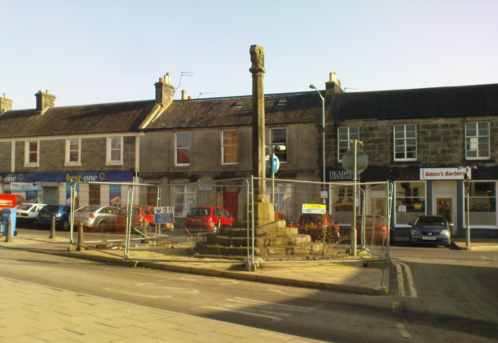
A few days ago when I came to have a look at this old cross (17th century according to the Royal Commission) it was surrounded by protective railings while some work was being done in the town centre.  Thankfully it was a glorious bright day and allowed for some good photos!

It is a typical mercat cross, as Mair (1988) called them: a stone pillar, mounted on steps, with some sort of crowning edifice on top.  The monument was described in the Royal Commission (1933) report of the region, where they wrote:

“The market cross stands at the southern end of High Street and consists of an octagonal shaft with moulded base and capital, placed on a rise of six octagonal steps, having a spread of 14½ feet.  Above the square abacus is a stone sculptured with the arms of the Earls of Kincardine on the one side and a thistle ornament on the other.  The arms are: Quarterly, 1st and 4th, a lion rampart; 2nd and 3rd, a saltire and chief.  The shield is flanked by two men in armour as supporters, is surmounted by a coronet and helm, mantled and wreathed, and has for crest a naked arm, flexed, issuing out of a cloud and holding a man’s heart.  The cross must be later than 26 December, 1647, when the Earldom was created.”

References:

  1. Beveridge, David, Culross and Tulliallan: Its History and Antiquities – 2 volumes, William Blackwood: Edinburgh 1885.
  2. Mair, Craig, Mercat Cross and Tolbooth, John Donald: Edinburgh 1988.
  3. Royal Commission on the Ancient & Historical Monuments, Scotland, Inventory of Monuments and Constructions in the Counties of Fife, Kinross and Clackmannan, HMSO: Edinburgh 1933.
  4. Small, John W., Scottish Market Crosses, Eneas Mackay: Stirling 1900.

© Paul Bennett, The Northern Antiquarian 

High Cross, Shrewsbury, Shropshire

Cross (destroyed):  OS Grid Reference – SJ 492 126

Also Known as:

  1. Butter Cross
  2. The Cross

Archaeology & History

This long-lost medieval ornamented cross, found not far from the legendary Grope Cunt Lane (I kid you not) was located close to the middle of old Shrewsbury town, “at the junction of Pride Hill, Castle St and St. Mary’s St,” according to the 1902 OS-map of the region.

Although Shrewsbury’s High Cross is believed to have been built in the 12th or 13th century, we don’t know for sure when it was first erected — and indeed, written records of the place don’t appear to begin until the year 1557, where it was described as the ‘Hye Crosse.’  A few years later in the Parish Registers for the Lichfield diocese, dated 1590, the monument was mentioned again as ‘the Highe Crosse’; and subsequent accounts of it are found in various local history accounts from 1695 to 1799.

The site was named as the Butter Cross in street-name listings of 1804, telling it as a site where this food was sold and we know that the High Cross was the centre of a local market and social gathering place in previous centuries.  Gelling (2004) told that “the medieval cross was taken down in 1705, but the name continued to be applied to structures which replaced it, and which were used as a market place for dairy produce.”

In earlier times, the High Cross is said in legend to have been where executions were enacted.  Alfred Rimmer (1875) narrates the oft-told tale of those who died here, saying:

“The High Cross of Shrewsbury has long been destroyed, but its place is pointed out in old documents.  Unhappily, it is not connected with pleasant associations, for before it the last of the British princes, David, a brother of Llewellyn, was cruelly put to death by Edward I; and at a later period many of the nobility who were taken at the battle of Shrewsbury were there executed, the High Cross being considered the most appropriate place for such a spectacle.”

The prince that Rimmer mentions was Dafydd III, the last prince of Wales, executed in the year 1283.

References:

  1. Gelling, Margaret, The Place-Names of Shropshire – volume 4, EPNS: Nottingham 2004.
  2. Hobbs, J.L., Shrewsbury Street Names, Wilding & Son: Shrewsbury 1954.
  3. Rimmer, Alfred, Ancient Stone Crosses of England, Virtue: London 1875.

© Paul Bennett, The Northern Antiquarian


St. Fillan’s Well, Comrie, Perthshire

Holy Well: OS Grid Reference – NN 7080 2327

Also Known as:

  1. Well of St. Fillans

Archaeology & History

Found by the legendary hill of Dundurn, east of Loch Earn, this legendary healing site has been written about by many historians, both local and national. An early account of it was given by the local priest, Rev. Mr McDiarmid, minister of the parish of Comrie at the end of the 18th century, who informed those compiling the Old Statistical Account of the area, the following information:

“This spring, tradition reports, reared its head on the top of Dun Fholain (Fillan’s Hill) for a long time, doing much good, but in disgust (probably at the Reformation) it removed suddenly to the foot of a rock, a quarter of a mile to the southward, where it still remains, humbled, but not forsaken. It is still visited by valetudinary people, especially on the 1st of May and the 1st of August. No fewer than seventy persons visited it in May and August, 1791. The invalids, whether men, women, or children, walk or are carried round the well three times in a direction Deishal—that is from east to west, according to the course of the sun. They also drink of the water and bathe in it. These operations are accounted a certain remedy for various diseases. They are particularly efficacious for curing barrenness, on which account it is frequently visited by those who are very desirous of offspring. All the invalids throw a white stone on the Saint’s cairn, and leave behind them as tokens of their gratitude and confidence some rags of linen or woollen cloth. The rock on the summit of the hill formed of itself a chair for the Saint, which still remains. Those who complain of rheumatism in the back must ascend the hill, sit in this chair, then lie down on their back, and be pulled down by the legs to the bottom of the hill. This operation is still performed, and reckoned very efficacious. At the foot of the hill there is a basin made by the Saint on the top of a large stone, which seldom wants water even in the greatest drought, and all who are distressed with sore eyes must wash them three times with this water.”

We see from this early account that there’s a discrepancy regarding the location of St. Fillan’s Well, as the modern accounts indicate it to be at the top of the craggy hill. In some upland regions this occurred so as to maintain a sense of secrecy about the location of local sites, so ensuring they were not affected or disturbed by outsiders or incomers, who not only disrespected local customs and rites, but tried changing or altering them to their new ways. It also kept the local gods and spirits of the sites protected from tourism and the profane. This may explain the difference in locations described by Rev. McDiarmid.

About one hundred years after McDiarmid’s account, another priest called Tom Armstrong (1896) wrote a piece in the Chronicles of Strathearn (1896) all about this holy well, saying:

“People are prone to believe that the dirty pool of stagnant water which still remains in the driest summer on the top of St. Fillan’s Hill is the famous spring to which pilgrims at one time resorted. Any one who examines it will not fail to observe that it has all the appearance of an artificially built well, and must have been kept in order and preservation for a purpose. Tradition confirms the belief that this was at one time the well, but not always.”

The hill on which it is found was an ancient dun or fort, built in prehistoric times, making you wonder how far back in time its magickal abilities were known about.

References:

  1. Armstrong, Thomas, “By the Well of St. Fillan,” in Chronicles of Strathearn (David Phillips: Crieff 1896).
  2. Gordon, Seton, Highways and Byways in the Central Highlands, MacMillan: London 1948.
  3. Hunter, John, et al, Chronicles of Strathearn, David Phillips: Crieff 1896.
  4. Morris, Ruth & Frank, Scottish Healing Wells, Alethea: Sandy 1982.

© Paul BennettThe Northern Antiquarian


East Riddlesden Cross, Keighley, West Yorkshire

Cross:  OS Grid Reference – SE 079 421

Archaeology & History

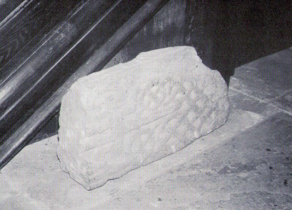
A little-known early christian relic found in the driveway to East Riddlesden Hall was saved and propped up in the stable floor at the back.  In 1984 however, the National Trust got round to moving it and bringing the relic to greater public attention by putting it on display in the great hall of the building. (I think you’ve gotta pay to go in and see the stone these days – which is a bittova pain if you just want to examine the carving)

Old photo of the carved stone (after Margaret Faull)

Measuring just 1 foot across and 2 feet high and carved on all sides, the design is all too familiar to those of you exploring early christian or late-Celtic art forms.  Executed sometime between the 5th-10th century, on the main face of the cross we have the traditional ‘Celtic’ interlacing, with a bird-figure emerging on or around an early ‘cross’ symbol.  There are a variety of interpretations of this, but none relate to any modern christian mythic structures.  Indeed, we should cautiously reflect on the more pre-christian nature of this design: carved as it was at a time when the spirit of the natural world (animism) was endemic amongst all people.  This carving would in some way reflect such implicit subjectivity, though perhaps have had emergent ideals relevant to the christian cult within it.  However, we should be cautious about this christian idea, despite it being much in vogue by prevailing groups of consensus trance historians.

References:

  1. Faull, Margaret L., “The Display of the Anglo-Saxon Crosses of the Keighley Area,” in Transactions of the Ancient Monuments Society, New Series no.30, 1986.

© Paul Bennett, The Northern Antiquarian