High Cross, Tottenham, Greater London

Wayside Cross: OS Grid Reference – TQ 33781 89561

Also known as:

  1. Historic England Grade II Listed Building Number 1188856

Getting Here

The Cross is on the east side of the A10 Tottenham High Road, on the traffic island at the Monument Way Junction.

Archaeology & History
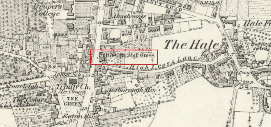
Cross shown on 1873 map

One of the earliest records of what was called the “hie crosse” is contained in a court-roll of 1456.  It was at that time a wooden wayside cross, but there are hints that its origins may go back to Roman times.  The Cross is next to what was the southern end of Ermine Street, built by the Romans where there was no pre-existing roadway and described as the most important thoroughfare in Britain: built to give direct communication to the main centres of the military occupation at Lincoln and York.  Writing of Roman land survey marks, the now discredited early 20th century Middlesex historian Sir Montagu Sharpe (1932) thought Tottenham Cross possibly marked an earlier (i.e. Roman) stone, although no archaeological evidence has been found to support this.  As it was next to Ermine Street it could equally have been a milestone or ceremonial pillar. After the Romans left it may have become a local heathen shrine which, with the coming of Christianity, was ultimately replaced by a wooden cross—but this is speculation, and we will probably never know why and when the original cross was placed where it was.

Originally in the historic County of Middlesex, the settlement of Tottenham surrounding the Cross was known from mediaeval times to the 19th century as ‘Tottenham High Cross’.  Local historian William Robinson writing prior to 1840 thus describes the Cross:

“About the year 1580, a column of wood was standing, with a square sheet of lead on the top to throw off the water, supported by four spurs: these, being decayed and rotten, were taken down, about the year 1600, by Dean Wood, Dean of Armagh, who at that time resided in a house on the east side of it, and who erected on its site an octangular brick column, pointed at the top and crowned with a weathercock, and the initials of the four cardinal points, and under the neckings, small crosses, which were called tau-crosses, according to the true cross or Greek letter T.

“Tottenham High Cross, as it appeared in 1788, was an octangular brick pillar, divided into four stories, viz.: a double plinth, first portion of the pillar; second portion, of the same; and a pinnacle; each plinth and story rendered distinct one from the other by certain appropriate mouldings ; and the whole design appeared without any kind of ornament, pointed at the top and crowned with a weathercock. The Cross having fallen into decay, several of the inhabitants of the parish entered into a subscription, in the year 1809, for the purpose of putting it into a proper state of repair, and about the sum of £300. was raised. It was accordingly repaired, and covered with Parker’s cement. The octangular plan, and the proportions of the Cross in its four stories, have not been departed from ; but in other respects it is a new work ; some of the decorations seem to be formed from the exterior and interior of the chapel of Henry VIII; the double plinths or pedestals are as plain as before, but the intermediate mouldings are new; the first portion of the pillar consists of angular pilasters at each cant done with a pointed head; compartment of five turns, connecting itself with another compartment; above it diamonded, with a shield containing an imitation of the black letter. As there are eight faces to the upright, of course there are as many shields, each bearing a letter of the same cutting, beginning at the west face, TOTENHAM: in consequence of there being but eight shields, one of the T’s in the spelling has been necessarily dispensed with. The mouldings between this story and the second are worked into an entablature, with modern fancy heads and small pieces of ornaments alternately set at each angle.

“Second story—small buttresses at the angles of the octagon, with breaks and pinnacles, but no bases. The face of each cant has a compartment embellished with an ogee head, backed with narrow pointed compartments. The mouldings between this story and the pinnacle, making out a fourth story, give, at each angle, crockets, and its termination is with a double finial, but not set out in geometrical rule to the crockets below : there is at the top a vane, with N. E. W. S. The base is surrounded with a neat iron railing on Portland stone curb. The date at which these alterations were made is not placed in any conspicuous part of the structure.”
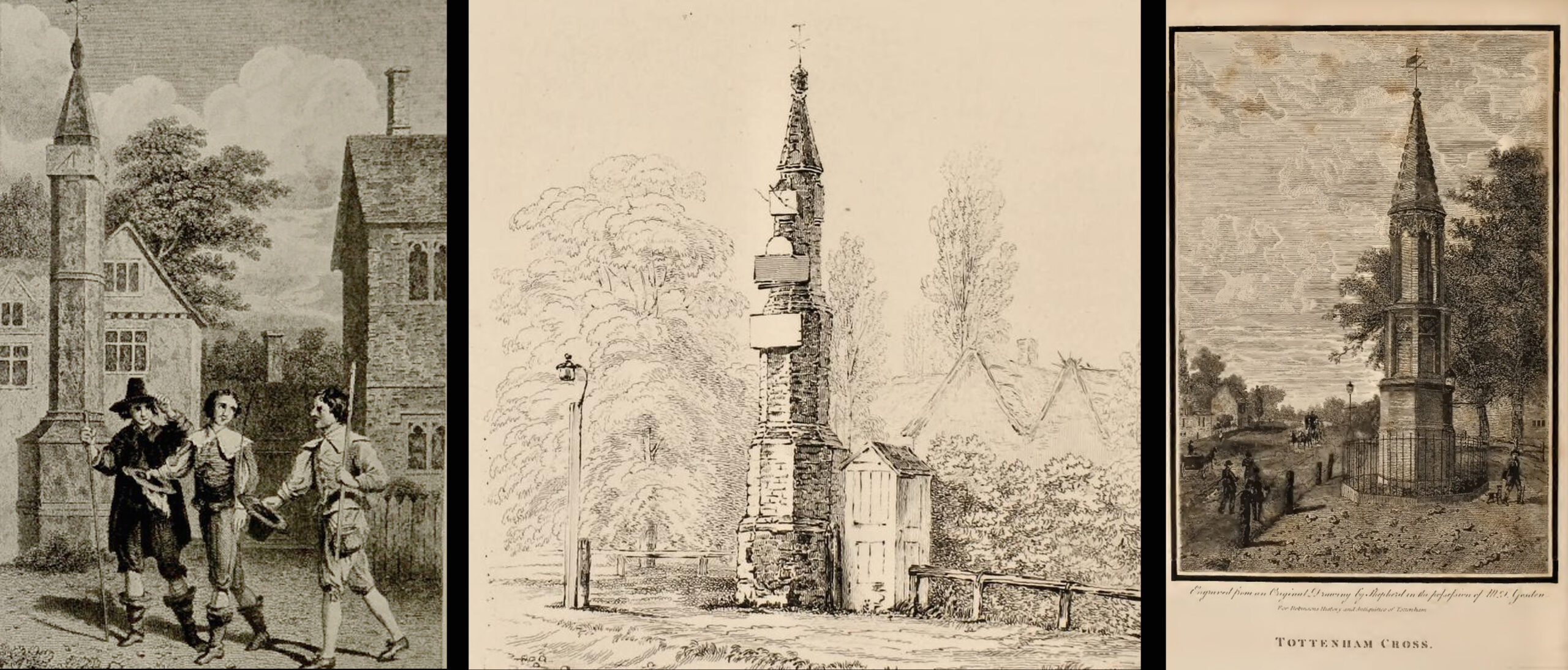
(left) engraving based on Samuel Wale’s 1759 illustration to Compleat Angler; (centre & right) 19th C views pre- and post-renovation

The craftsman who carried out the modernisation was a Mr. Bernasconia, working to the designs of a Mr. Shaw. Not everyone was pleased by the transformation. A regular contributor identified only as ‘An Architect’ made these caustic comments in the November 1809 edition of the Gentleman’s Magazine:

“Tottenham High Cross has this summer been covered over with Compo: it previously bore a simple appearance, but is now rendered of a very rich and elaborate cast, doing away in the first instance the Architectural history of the erection; and allowing it possible that there might once have been on the spot an Eleanora Cross, holding in contempt, by a want of due imitation, the characteristic style of decoration prevailed at at the time of the Queen’s demise.  But according to the system of our Professional innovators, to destroy a sacred relick of antiquity, and to restore it as it is called, upon a model quite in a different style and nature, is one and the same thing. “Any thing is Gothick.”

“….Surveyed November 1809. Entirely covered with the proclaimed everlasting stuff, Compo; a stuff now the rage for trowelling over our new buildings, either on the whole surface, or in partial daubings and patchings; it is used in common with stone work, for instance, on an arcade, half one material, half the other; “ making good,” as it is called (abominable expedient) the mutilated parts of Antient Structures, there sticking on until it reverts (after exposure to the air for three or four years, more or less) to its first quality, dirt and rubbish, and then is seen no more….

“Provided this Compo effort had been advanced on any other occasion, and on any other piece of ground, where no piece of Antiquity was to become the spoil, such as an object to mark the centrical point of three or four counties, a general standard of miles or any other common document for the information or amusement of travellers, all would have been well, and some praise might have been bestowed, for its tolerable adherence to the above style, if not for the material wherewith it is made up. But as nothing of this sort will come in aid of the innovators, and only the barefaced presumption, “ alter or destroy, what was,” is to be encountered, let the detail of parts, put this matter to issue….”

Folklore
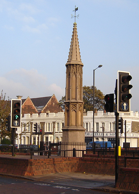
A modern view (Wikipedia Creative Commons)

The Cross stood in front of the Swan Inn, a place frequented by fishing writer Izaak Walton in the 1640s when he would go to fish in the nearby River Lea.  In 1653 he published The Compleat Angler describing his fishing activities in the classical form of a philosophical dialogue between him as ‘Piscator’ and ‘Venator’ (hunter) and other passing characters, starting and ending his adventures at the High Cross.  The 1759 edition of Compleat Angler contains the earliest illustrations of the Cross, with some slight artistic licence, by Samuel Wale.

Afterword

As the Cross now stands in the maelstrom of North London’s traffic, it is worth recalling American traveller Nathaniel Carter’s 1825 observation when travelling north from London:

“Passing Tottenham Cross, we entered a rich agricultural country, possessing the usual charms of English landscape.”

References

  1. An Architect (pseud.) – Architectural Innovation No. CXXXIX – The Gentleman’s Magazine, November 1809
  2. Anonymous – Tottenham High Cross, The Gentleman’s Magazine, April 1820
  3. Blair, John, The Church in Anglo Saxon Society, Oxford University Press 2005
  4. Carter, Nathaniel Hazeltine, Letters From Europe..in 1825 ’26 & ’27, G & C & H Carvill, New York, 1829
  5. Margary, Ivan D., Roman Roads in Britain, 3rd Ed., John Baker: London 1973.
  6. Robinson, William, The History & Antiquities of the Parish of Tottenham, 2nd Ed., Nicholls & Son, W. Pickering, W.B. Hunnings: London 1840.
  7. Sharpe, Montagu, Middlesex in British, Roman & Saxon Times, 2nd Ed., Methuen: London 1932.
  8. Walton, Izaak, The Compleat Angler, Facsimile of the 1st Ed., containing illustrations from the 2nd US edition by John Major, No imprimatur, 1907.

© Paul T Hornby 2020
Kendal Maypole, Kendal, Westmorland

Maypole (destroyed):  OS Grid reference – SD 5161 9212

Archaeology & History

Long since gone, it’s existence was recorded by, amongst others, the Kendal historian Cornelius Nicholson. (1861)  He described it in relation to one of the town crosses, that was removed due to it being “an obstruction in the street.”  The maypole too, he said,

“was another incumbrance, but indispensable, according to the custom of our forefathers.  It stood in Kirkland, opposite the house of the late Thomas Reveley, Esq., and was suffered to remain till within eighty years ago.  In the time of our good Queen Katherine, who may fairly be supposed to have partaken of the amusements, countenanced by her royal consort, the original festivity of maying and morris-dancing would be here celebrated, by the annual ceremony of “maying” when, immediately after sunrise, on the 1st of May, processions, entering the town at various inlets, streamed through the streets, with music of horns and flutes; boys with their May-gads (willow-wands twined with cowslips), and girls with their “brats” full of flowers — young and old alike joining in merry laughter, and song, and the customary chorus, “We have brought the summer home.”  When the above-named ceremonies became less fashionable, the May Pole was made the rendezvous of all the milkmaids in the neighbourhood, who came and paraded round it on Easter Mondays.  On other occasions of rejoicing, afterwards, such for instance, as terminating an apprenticeship, and the like, it became customary for young men to go and dance around it.”

The author then told that this annual village ceremony was still being performed at the beginning of the 19th century, “in the assemblage of young people in the Vicar’s Fields, on Easter Tuesday.  After spending the afternoon there, they returned in procession through the streets, threading grandy needles.”

References:

  1. Nicholson, Cornelius, The Annals of Kendal, Whitaker & Co.: London 1861.

© Paul BennettThe Northern Antiquarian

Horley Green Spa, Halifax, West Yorkshire

Healing Well:  OS Grid Reference – SE 10263 26561

Also Known as:

  1. Horley Green Well
  2. Spa Well

Archaeology & History

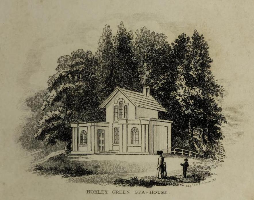
William Alexander’s 1840 sketch of the Spa house

The historian William Addison (1951), in his history on the subject, told how “the spas began as holy wells”; and although no direct accounts are left of early dedications here, the remnants of Mayday traditions tell us there were more archaic goings-on before the waters were taken by the aristocrats.  Once it had been designated as a spa, the waters were covered and a typical Spa House constructed over them.  From hereon, for more than a century, the waters were accessible only to those with money who wished their ailments to be treated.

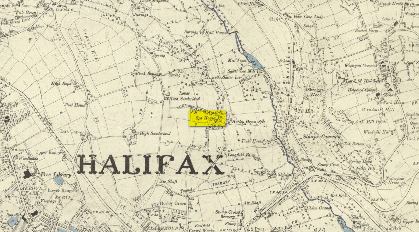
Between the end of the 18th to the end of the 19th century, the Horley Green Spa was a very prominent ingredient in the history of Calderdale.  A chalybeate or iron-bearing spring, its waters were directed into a large underground cistern covered by metal.  Thomas Garnett (1790) was the first to write about it, telling us:

“The Horley Green water is quite pellucid—sparkles when poured out of one glass into another—and has a sharp, aluminous, styptic taste, not unlike ink. The taste is not unpleasant when the water is taken from the springhead and drank immediately.”

He went on to espouse the waters to be good in healing bone and rheumatic diseases, giving many first-hand accounts from people in Yorkshire and beyond who used the waters here with apparent success, including one case of curing diabetes!  Its reputation was later reinforced in a book by William Alexander (1840), who told us how,

“I unhesitatingly affirm that the Horley Green Spa possesses a very strong claim to be regarded as a powerful tonic and chalybeate.”

By the time those words were written, it had already gained a considerable reputation and many were those who’d received treatment.

Spa House on 1894 map

A years after Alexander, the roving doctor A.B. Granville (1841) visited Horley Green—who described it as “a renowned steel-water Spa”.  But at the same time he reported how its popularity had started to decline.  But, via one Mr West, he did leave us with a greater chemical analysis of the Horley Green waters in an attempt, once more, to certify and prove its curative properties.  Their results found the waters to possess, in varying quantities, lime, magnesia, silica, iron oxide, sulphur and silica—all of which further attributed the science of its medicinal actions.   A number of case histories of the people cured here can be found in the works of Granville, Garnett and Alexander.

The well-house that stood here eventually fell into disuse.  When it was eventually restored as someone’s home in the the late 20th century, the disused spring was found beneath the foundations, filled with stones.

Folklore

Horley Green’s spa well came about as a result of local people visiting the site around Beltane, probably for centuries before the aristocrats and early pharmacists took their hand to the place.  But once the spa became renowned, people could only gather here “on the first Sundays in the month of May,” with Sunday being that legendary ‘day of the lord’ crap, to which the people would abide to save them from prosecution.  It is obvious though that it had been used as a place of magick thanks to the snippets of lore which have found their way into local history books.  We read how, at 6am, people gathered here, to such an extent that the roads were completely crowded.  Those who arrived first were given bags of nuts: an archaic traditional motif found at many pre-christian wells in Britain.  Occultists and ritual magickians amongst you will note the time when folk frequented the well, at 6am: the time when many nature-spirits are invoked for full effects.  We find this time echoed in the ritual gatherings at Lady or St. Anne’s Well in Morley, just a few miles to the east.

References:

  1. Addison, William, English Spas, Batsford: London 1951.
  2. Alderson, Frederick, The Inland Resorts and Spas of Britain, David & Charles: Newton Abbot 1973.
  3. Alexander, William, The Horley Green Mineral Water, Leyland & Son: Halifax 1840.
  4. Alexander, William, “On the Mineral Springs of the Parish of Halifax,” in Proceedings Geological & Polytechnic Society, West Riding, Yorkshire, volume 1, Edward Baines: Leeds 1849.
  5. Crabtree, John, Concise History of the Parish and Vicarage of Halifax, Hartley & Walker: Halifax 1836.
  6. Garnett, Thomas, Experiments and Observations on the Horley-Green Spaw, near Halifax, George Nicholson: Bradford 1790.
  7. Granville, A.B., Spas of England, Henry Colburn: London 1841.
  8. Hembry, Phyllis, The English Spa 1560-1815, Athlone Press: London 1990.
  9. Short, Thomas, The Natural, Experimental and Medicinal History of the Mineral Waters of Derbyshire, Lincolnshire and Yorkshire, privately printed: London 1724.
  10. Short, Thomas, A General Treatise on Various Cold Mineral Waters in England, privately printed: London 1765.

© Paul BennettThe Northern Antiquarian


St. Bennet’s Well, Cromarty, Ross & Cromarty

Holy Well:  OS Grid Reference – NH 7923 6502

Archaeology & History

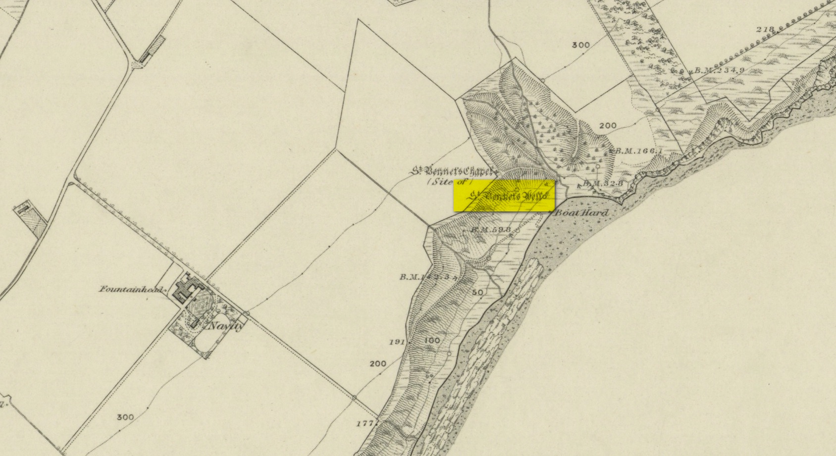
St Bennets Well 1880 map

An old church dedicated to St Bennet once existed on the hill above where this spring of water emerges, but little is now left of the building.  Thankfully the holy well hasn’t quite followed in the footsteps of the church.  Miss Riley (1935) told us that it can be found “near the high-water mark…situated at the foot of a beautiful little glen which runs inland from the coast” – and from all accounts it is still there.

Shown on the 1880 OS-map of the region, the dedication to St Bennet is obscure.  Mr Pullan (1927) suggested it derived from the 6th century St Benedict of Nursia, but this is improbable.  The Royal Commission lads thought it more likely derived from “a Celtic foundation.”

Folklore

The earliest description I’ve found regarding the traditions surrounding this well are by Hugh Miller (1835).  He wrote:

“It is not yet twenty years since a thorn-bush, which formed a little canopy over the spring of St. Bennet, used to be covered anew every season with little pieces of rag, left on it as offerings to the saint, by sick people who came to drink of the water.”

But the tradition didn’t die out, as evidenced by a short article by Miss M.D. Riley (1935) in Antiquity journal where she gave us further valuable information about its folk history, saying:

“In order to insure the fulfilment of the wish it is essential that the wisher should drink the water and leave something of his personal attire.  When the writer visited the spot there was a heterogeneous collection of ‘rags’ hanging on the branches.

“Mr Francis Scott tells me that the site is locally supposed to be the place of judgement.  It is close to the ruins of St Bennet’s Chapel and the ground is said to be cursed as it was stoeln by the Church. Even at the present day the owner has to provide each year at Christmas-tide 8 cwt of oatmeal free for the poor of the parish.  This has been operative since 1630 and though the owner has tested the matter in the highest court of law in Scotland, his appeal was not allowed.”

The tradition of giving offerings to the spirit of this well was still recorded in 1966.

References:

  1. Hiley, M.D., “Rag-Wells,” in Antiquity, volume 9:4, December 1935.
  2. Innies, Cosmo, Origines Parochiales – volume 2:2, W.H. Lizars: Edinburgh 1855.
  3. Miller, Hugh, Scenes and Legends of the North of Scotland; the Traditional History of Cromarty, William Nimmo: Edinburgh 1835.
  4. Morris, Ruth & Frank, Scottish Healing Wells, Alethea: Sandy 1982.
  5. Pullan, L., The Banner of St Boniface, London 1927.

© Paul BennettThe Northern Antiquarian

St. Serf’s Water, Crieff, Perthshire

Cist:  OS Grid Reference – NN 8488 2344

Also Known as:

  1. Canmore ID 25503

Archaeology & History

Were it not for the valuable records in the Scottish Statistical Accounts, we’d have lost all knowledge of this site.  It was described in notes by by Colin Baxter (1793), where he told us:

“About 200 yards west from the church of Monivaird, a barrow was opened some years ago, in which two urns were found, each containing a stone of a bluish colour, very hard about four inches long, and of a triangular shape, somewhat resembling the head of an axe.”

The site was subsequently mentioned in the Ordnance Survey Name Book of the parish, with some additional bits of information:

“In the year 17–, there was found, about one hundred yards to the westward of the old church of Monzievaird, a barrow containing a stone-coffin, in which were inclosed two coarse earthen urns, the one filled with burnt bones, the other containing the bones of the head.  Of these, the under jawbone and the teeth were very entire.  In the stone coffin was also found a stone hatchet, bluish-coloured, very hard, about four inches long, and of a triangular shape, a remain which proves the barrow of very remote antiquity – prior to the use of iron. The stone hatchet is preserved at Ochtertyre.”

No traces remain of the site; and although the stone axes came to be in the possession of Sir William Murray of Ochtertyre, the urns and other remains have long since been lost.

Folklore

The name of ‘St Serf’s Water’ derives from it this area being dedicated to St Servanus in early times; the holy well of St Serf could be found a short distance south from where this tomb was built.

References:

  1. Baxter, Colin, “United Parishes of Monivaird and Strowan,” in Statistical Account of Scotland – volume 8, William Creech: Edinburgh 1793.
  2. Porteous, A., “Extracts from a History of the Parishes of Monivaird and Strowan“, in Archaeologia Scotica, volume 2, 1822.

© Paul BennettThe Northern Antiquarian

St. Serf’s Well, Crieff, Perthshire

Holy Well (lost):  OS Grid Reference – NN 8457 2323

Archaeology & History

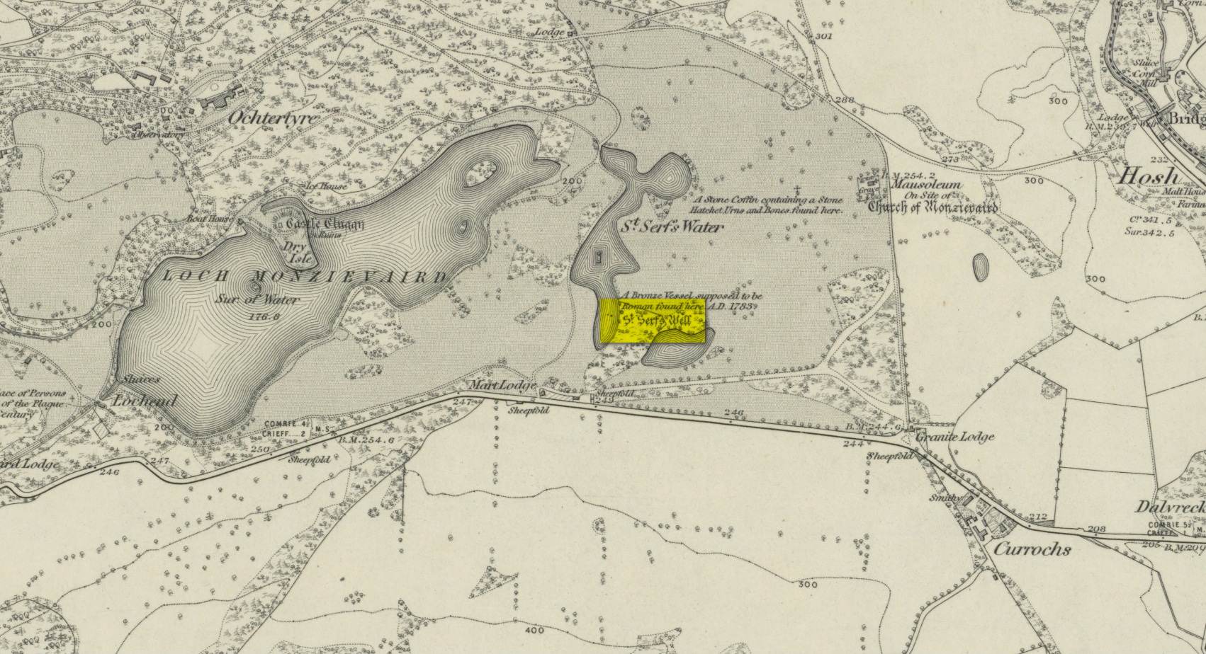
St Serfs Well on 1866 map

A mile to the west side of Crieff, in the grounds of the 18th century mansion known as Ochtertyre House, could once be seen the little-known sacred well of St Serf.  Sadly its waters seem to have disappeared beneath the rising waters of the loch known as St Serf’s Waters—which is a pity, as the place was of importance in the annual traditions of the local people, who left offerings to the spirit of the place, as was common in days of olde.  It was described in Mr Porteous’ (1822) account of Monzievaird parish, in which he told that,

“Nigh to this place is St Serf’s Well, and the moor whereon St Serf’s market is held.  He was the tutelary saint of the parish of Monivaird.  This well is a plentiful spring of water.  About sixty years ago, our people were wont, on Lammas day, to go and drink it, leaving white stones, spoons, or rags, which they brought with them; but nothing except the white stones now appear, this superstitious practice being quite in oblivion.  It has been useful in a strangury, as any other very cold water would be; for a patient, taking a tub full of it immediately from the well, plunging his arms into it, which were bare to the elbows, was cured.

“St Serf’s fair is still kept on the 11th of July, where Highland horses, linen cloth, etc., both from the south and north, are sold.”

Although the well is deemed to be ‘lost’, it is possible that its waters might be seen after a good drought.  Please let us know if that happens.

Folklore

St. Serf was said to have been a hermit and tutor of the more renowned St. Mungo.

References:

  1. Morris, Ruth & Frank, Scottish Healing Wells, Alethea: Sandy 1982.
  2. Porteous, A., “Extracts from a History of the Parishes of Monivaird and Strowan“, in Archaeologia Scotica, volume 2, 1822.

Acknowledgements:  Big thanks for use of the 1st edition OS-map in this site profile, Reproduced with the kind permission of the National Library of Scotland

© Paul BennettThe Northern Antiquarian


Stob Cross, Markinch, Fife

Wayside Cross: OS Grid Reference – NO 29607 02202

Also Known as;

  1. Stobb Cross
  2. Canmore ID 29950

Getting Here

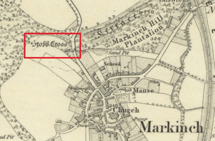
Shown on 1856 OS map

The cross is located on a bluff of land overlooking the west side of Stob Cross Road on the northern edge of Markinch.

Archaeology & History

In 1933, following a visit in 1925, the county archaeological inventory described it thus:-

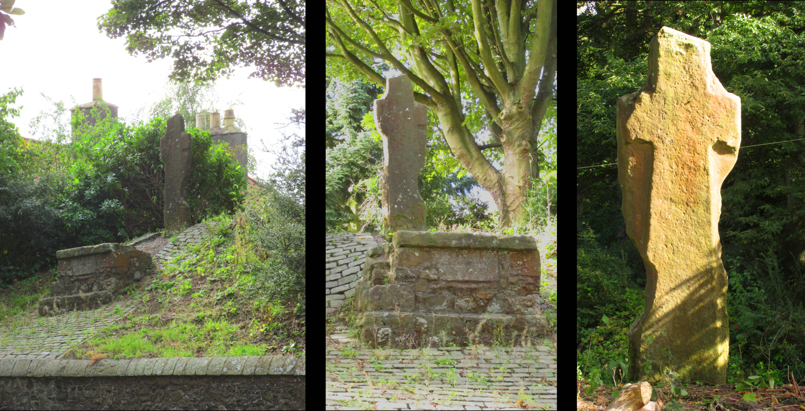
Close beside the East Lodge of Balbirnie House, on a knoll 200 feet above sea-level, stands a stone known, from the nature of its sculpturings, as the “Stob Cross.” It is a somewhat mutilated rectangular slab, 7 feet 5 ½ inches in height, 2 feet broad at the base and 6 inches thick, having a plain cross carved in relief on the east and on the west face. The cross on the east is now very much damaged but sufficient remains to indicate that the arms have been 1 foot wide and that the shaft has measured 1 foot 5 inches across at the intersection. On the west face the design stands out in relief from 1 to 1 ¼ inches. The arms of the cross measure 11 ½ inches in width, and the upper limb, which tapers slightly to its extremity, is 12 ½ inches across at the point of intersection. The shaft measures 1 foot 2 inches across below the arms and widens gradually downwards to 1 foot 8 inches at the base. In 1790, when the cross was in danger of falling, the Earl of Leven had the position faced up with masonry, and the monument now stands, with its major axis north and south, on a two-stepped base of modern construction.

Roadside views l. & centre – Rear view r.

It’s certainly had a hard life, and its official designation as ‘early medieval’ leads us to suspect that it may have been a decorated Pictish cross that has had its ornamentation obliterated by Reformation iconoclasts. Those same iconoclasts may have concocted the ‘history’ recounted by Rev  John Thomson (1794) in the Old Statistical Account of 1794 of what he describes as a ‘very coarse piece of work’:-

‘Vulgar tradition says, that it was erected to the memory of a gentleman, who fell on this spot, in a mortal encounter with one of his neighbours.’

Writing of Markinch, nineteenth century historian Aeneas Mackay (1896) has this to say:-

‘A cell of the Culdees was established there by one of the last Celtic bishops, and the ancient cross near Balgonie [sic] may mark its site.’

Modern place-name research ascribes Markinch as a place where horses were grazed while their owners were attending the early mediaeval courts and assemblies at Dalginch a quarter of a mile to the east, so the cross may at that time have been a waymarker. A roadside plaque describes the Cross as possibly marking the limit of an ancient sanctuary enclosure related to the church of St Drostan (known locally as St. Modrustus) in the centre of Markinch.  Additionally, it was on the ancient (and recently revived) Fife Pilgrim Way from Culross to St Andrews, so would have been a wayside station for the pilgrims. which if it was a Pictish cross would have made it a target for desecration by iconoclasts. We are lucky that it has survived at all, and with the revival of the Pilgrim Way as a long distance path it will attract many new admirers.

References:

  1. Forbes, A.P., Kalendars of Scottish Saints, Edmonston & Douglas: Edinburgh 1872.
  2. Mackay, Aeneas J.G., A History of Fife and Kinross, Blackwood: Edinburgh 1896.
  3. Markinch Heritage Group, – http://www.markinchheritage.org.uk/Index.asp?MainID=5250
  4. Royal Commission, Inventory of Fife, Kinross & Clackmannan, HMSO: Edinburgh 1933.
  5. Taylor, Simon & Márkus, Gilbert, The Place Names of Fife – volume 2, Shaun Tyas: Donnington 2013.
  6. Thomson, Rev John. The Statistical Account of Scotland – volume 12, Creech: Edinburgh 1794.

© Paul T. Hornby, The Northern Antiquarian, 2020


St. Dunstan’s Well, York, North Yorkshire

Holy Well (lost):  OS Grid Reference – SE 607 511

Archaeology & History

An entry in George Benson’s huge work on the history (mainly) of York, describes the holy well of St Dunstan “near the Glass Works”, which used to be at the south-side of the city on Fishergate.  I can find no other reference to this site and it’s not on the early OS-maps, so we must presume it is long gone.

Other wells in his name can be found in Kent, Somerset, Sussex and Tottenham.

Folklore

The fable relating Dunstan to wells was his ability to make springs miraculously appear.  Tradition relates him to have been born in Wessex in the 10th century.  His festival date is May 19.

References:

  1. Benson, George, An Account of the City and County of York – volume 3, Cooper & Swans: Micklegate 1925.

© Paul BennettThe Northern Antiquarian

Cross Gates Cross, Slaidburn, Lancashire

Wayside Cross (base): OS Grid Reference – SD 70039 53609

Also Known as :

  1. Historic England ID 1163860
  2. Pastscape ID 44742

Getting Here

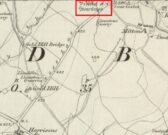
The Cross shown on the 1850 6″ OS Map

Take the Town End Road out of Slaidburn, and turn right along Wood House Lane at the Gold Hill junction, continue past the entrance to Myttons Farm on the right, and the cross base will be seen on the right next to the gateway just before the sharp left hand bend.

Archaeology & History

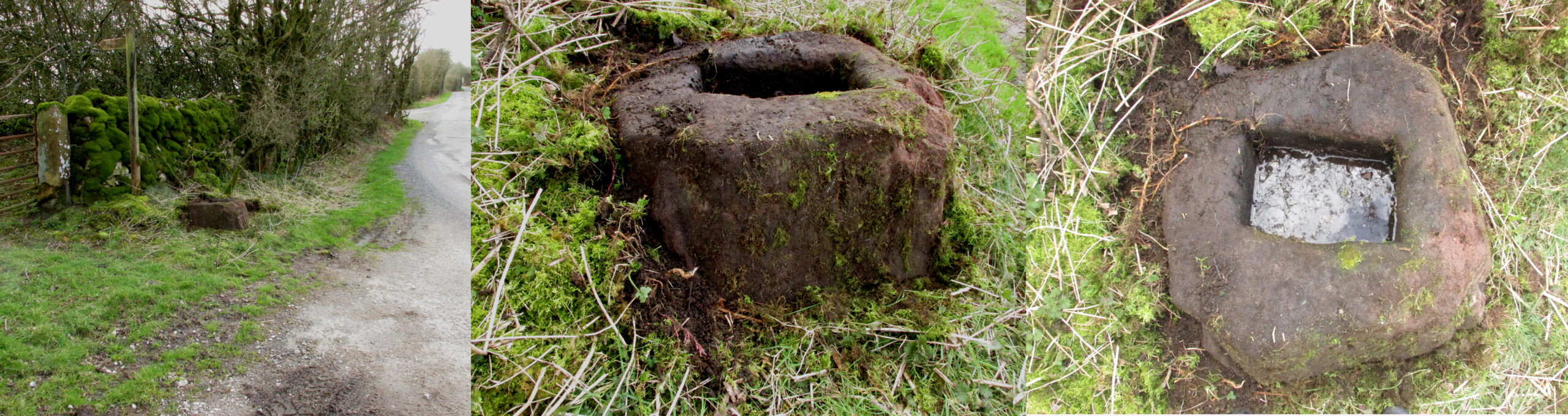
Only the socketed red sandstone base of this mediaeval wayside cross survives. It is unusual in that it has carved decorative fluted corners. It has an OS bench mark carved on its north face and has suffered recent damage to one of the corners, probably from a grass  cutter.  It is beside the old salt road over Salter Fell from Bowland into Lancashire and the Lune Valley.

There is one surviving complete cross and a cross base at the other end of the salt road, south of Hornby.  Wood House Lane was known as Cross Lane when the 1850 6″ OS map was printed. It is a Grade II listed building and is described in the citation as:

“Base of cross, probably medieval, sandstone. Of irregular shape with a rectangular socket in the top.”

Three views of the Cross base

Folklore

The farmer of the adjoining land told me that a local elder had told him that the smashed remains of the Cross had been built into an adjoining dry stone wall, which, if this is correct, may indicate
destruction of the Cross at a comparatively late date.

Note:  the monument is in the historic county of the West Riding of Yorkshire.

© Paul T. Hornby 2020


St James’ Cross, Barton-upon-Humber, Lincolnshire

Cross (destroyed):  OS Grid reference – TA 0424 2064

Archaeology & History

This long lost wayside cross was described in various local records from 1621 upwards.  In the definitive place-name survey of this area, Kenneth Cameron (1991) told us that this was,

“A medieval cross dedicated to St James, situated at the point where the Thornton and Burnham roads meet… Mr R. Newton comments, “said to have replaced a wayside shrine.  The foundations of the shrine were exposed when the Home Guard dug a defensive trench there at the beginning of the last war.  Foundations destroyed by a bomb.””

References:

  1. Cameron, Kenneth, The Place-Names of Lincolnshire – volume 2, EPNS: Nottingham 1991.

© Paul BennettThe Northern Antiquarian